Narrow Results By
- Vaux family (Philadelphia USA) 2730
- Mary M. Vaux (Philadelphia USA) 23
- Dr. Sharples (Philadelphia USA) 9
- Mary Schaffer (Philadelphia, USA) - attributed to 6
- William S. Vaux Jr. (Philadelphia, USA) 6
- Dr. Sharples (United States) 4
- Vaux, William 3
- Vaux, George 2
- Vaux, Mary 2
- William S. Vaux Jr. (Philadelphia USA) 2
- Mary M Vaux (Philadelphia USA) 1
- Mary M. Vaux (Philadelphia, USA) 1
- Part Of
- Vaux family fonds
- Scope & Content
- Map; Department of mines and resources: Mines and Geology Branch: Bureau of Geology and Topography. Map of Cowley West of Fifth Meridian, Alberta. 58 x 31 cm ca. 1940.
- Date Range
- 1940
- Reference Code
- M107 / III / D - 54 / O.S. / "F"
- Description Level
- 6 / Item
- Part Of
- Vaux family fonds
- Description Level
- 6 / Item
- Series
- Publication Series: Maps
- Reference Code
- M107 / III / D - 54 / O.S. / "F"
- Date Range
- 1940
- Physical Description
- 1 cartographic record. -- oversize.
- Scope & Content
- Map; Department of mines and resources: Mines and Geology Branch: Bureau of Geology and Topography. Map of Cowley West of Fifth Meridian, Alberta. 58 x 31 cm ca. 1940.
- Title Source
- Title based on contents
This material is presented as originally created; it may contain outdated cultural descriptions and
potentially offensive content.
Read more.
- Part Of
- Vaux family fonds
- Scope & Content
- Map; Department of mines and resources: Mines and Geology Branch: Bureau of Geology and Topography. Map of Cowley West of Fifth Meridian, Alberta. 58 x 31 cm ca. 1940.
- Date Range
- 1940
- Reference Code
- M107 / III / D - 54 / O.S. / "F"
- Description Level
- 6 / Item
- Part Of
- Vaux family fonds
- Description Level
- 6 / Item
- Series
- Publication Series: Maps
- Reference Code
- M107 / III / D - 54 / O.S. / "F"
- Date Range
- 1940
- Physical Description
- 1 cartographic record. -- oversize.
- Scope & Content
- Map; Department of mines and resources: Mines and Geology Branch: Bureau of Geology and Topography. Map of Cowley West of Fifth Meridian, Alberta. 58 x 31 cm ca. 1940.
- Title Source
- Title based on contents
This material is presented as originally created; it may contain outdated cultural descriptions and
potentially offensive content.
Read more.
- Part Of
- Vaux family fonds
- Scope & Content
- Map; Department of mines and resources: Mines and Geology Branch: Bureau of Geology and Topography. Map of Callum Creek West of Fifth Meridian, Alberta. ca. 1940. 58 x 31 cm.
- Date Range
- 1940
- Reference Code
- M107 / III / D - 55 / O.S. / "F"
- Description Level
- 6 / Item
- Part Of
- Vaux family fonds
- Description Level
- 6 / Item
- Series
- Publication Series: Maps
- Reference Code
- M107 / III / D - 55 / O.S. / "F"
- Date Range
- 1940
- Physical Description
- 1 cartographic record. -- oversize.
- Scope & Content
- Map; Department of mines and resources: Mines and Geology Branch: Bureau of Geology and Topography. Map of Callum Creek West of Fifth Meridian, Alberta. ca. 1940. 58 x 31 cm.
- Title Source
- Title based on contents
This material is presented as originally created; it may contain outdated cultural descriptions and
potentially offensive content.
Read more.
- Part Of
- Vaux family fonds
- Scope & Content
- Map; Department of mines and resources: Mines and Geology Branch: Bureau of Geology and Topography. Map of Beaver mines West of Fifth Meridian, Alberta. ca. 1940. 58 x 31 cm.
- Date Range
- 1940
- Reference Code
- M107 / III / D - 56 / O.S. / "F"
- Description Level
- 6 / Item
- Part Of
- Vaux family fonds
- Description Level
- 6 / Item
- Series
- Publication Series: Maps
- Reference Code
- M107 / III / D - 56 / O.S. / "F"
- Date Range
- 1940
- Physical Description
- 1 cartographic record. -- oversize.
- Scope & Content
- Map; Department of mines and resources: Mines and Geology Branch: Bureau of Geology and Topography. Map of Beaver mines West of Fifth Meridian, Alberta. ca. 1940. 58 x 31 cm.
- Title Source
- Title based on contents
This material is presented as originally created; it may contain outdated cultural descriptions and
potentially offensive content.
Read more.
Indian Reservation map
https://archives.whyte.org/en/permalink/descriptions24848
- Part Of
- Vaux family fonds
- Scope & Content
- Map; Indian Reservations: West of the Mississippi River 1920. 71 x 105 cm
- Date Range
- 1920
- Reference Code
- M107 / VI / A - 1 / O.S. / "F"
- Description Level
- 6 / Item
- Part Of
- Vaux family fonds
- Description Level
- 6 / Item
- Series
- Publication Series: Other Series (O.S.)
- Reference Code
- M107 / VI / A - 1 / O.S. / "F"
- Date Range
- 1920
- Physical Description
- 1 cartographic record. -- oversize.
- Scope & Content
- Map; Indian Reservations: West of the Mississippi River 1920. 71 x 105 cm
- Title Source
- Title based on contents
This material is presented as originally created; it may contain outdated cultural descriptions and
potentially offensive content.
Read more.
- Part Of
- Vaux family fonds
- Scope & Content
- Map; Map of Lethbridge west of fourth Meridian. ca. 1915. 60 x 82 cm.
- Date Range
- 1915
- Reference Code
- M107 / III / D - 57 / O.S. / "F"
- Description Level
- 6 / Item
- Part Of
- Vaux family fonds
- Description Level
- 6 / Item
- Series
- Publication Series: Maps
- Reference Code
- M107 / III / D - 57 / O.S. / "F"
- Date Range
- 1915
- Physical Description
- 1 cartographic record. -- oversize.
- Scope & Content
- Map; Map of Lethbridge west of fourth Meridian. ca. 1915. 60 x 82 cm.
- Title Source
- Title based on contents
This material is presented as originally created; it may contain outdated cultural descriptions and
potentially offensive content.
Read more.
- Part Of
- Vaux family fonds
- Scope & Content
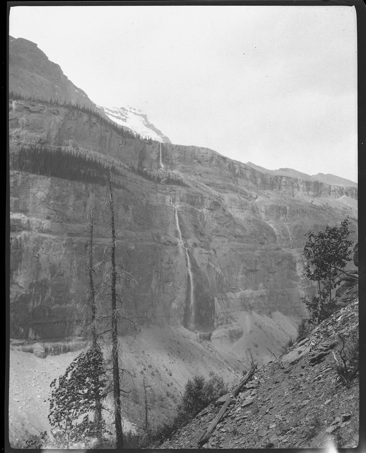
- Takakkaw Falls, Rocky Mountains?
- Date Range
- 1913
- Reference Code
- V653 / NA - 847
- Description Level
- 6 / Item
- GMD
- Photograph
- Negative
1 image
- Part Of
- Vaux family fonds
- Description Level
- 6 / Item
- Fonds Number
- M107 / V653
- Series
- I. Photography
- Sub-Series
- S. Travel 1913
- Reference Code
- V653 / NA - 847
- GMD
- Photograph
- Negative
- Date Range
- 1913
- Physical Description
- 1 negative : film
- Scope & Content
- Takakkaw Falls, Rocky Mountains?
- Subject Access
- Discovery and Exploration
- Geographic Access
- British Columbia
- Creator
- Vaux family (Philadelphia USA)
Images
This material is presented as originally created; it may contain outdated cultural descriptions and
potentially offensive content.
Read more.
- Part Of
- Vaux family fonds
- Scope & Content
- Map; Department of the Interior: Canada. Topographical Map of the Northern part of The Crowsnest Forest Reserve Alberta. From Photographic surveys by M.P. Bridgeland D.L.S. assisted by A.E. Hyatt, 1913. 41 x 39 cm
- Date Range
- 1913
- Reference Code
- M107 / III / D - 52 / O.S. / "F"
- Description Level
- 6 / Item
- Part Of
- Vaux family fonds
- Description Level
- 6 / Item
- Series
- Publication Series: Maps
- Reference Code
- M107 / III / D - 52 / O.S. / "F"
- Date Range
- 1913
- Physical Description
- 1 cartographic record. -- oversize.
- Scope & Content
- Map; Department of the Interior: Canada. Topographical Map of the Northern part of The Crowsnest Forest Reserve Alberta. From Photographic surveys by M.P. Bridgeland D.L.S. assisted by A.E. Hyatt, 1913. 41 x 39 cm
- Title Source
- Title based on contents
This material is presented as originally created; it may contain outdated cultural descriptions and
potentially offensive content.
Read more.
- Part Of
- Vaux family fonds
- Scope & Content
- Map; section of map; Department of the Interior, Canada. Topographical Map of the Northern part of The Crowsnest Forest Reserve Alberta. From Photographic surveys by M.P. Bridgeland DLS assisted by A.E. Hyatt 1913. 41 x 39 cm
- Date Range
- 1913
- Reference Code
- M107 / III / D - 53 / O.S. / "F"
- Description Level
- 6 / Item
- Part Of
- Vaux family fonds
- Description Level
- 6 / Item
- Series
- Publication Series: Maps
- Reference Code
- M107 / III / D - 53 / O.S. / "F"
- Date Range
- 1913
- Physical Description
- 1 cartographic record. -- oversize.
- Scope & Content
- Map; section of map; Department of the Interior, Canada. Topographical Map of the Northern part of The Crowsnest Forest Reserve Alberta. From Photographic surveys by M.P. Bridgeland DLS assisted by A.E. Hyatt 1913. 41 x 39 cm
- Title Source
- Title based on contents
This material is presented as originally created; it may contain outdated cultural descriptions and
potentially offensive content.
Read more.
- Part Of
- Vaux family fonds
- Scope & Content
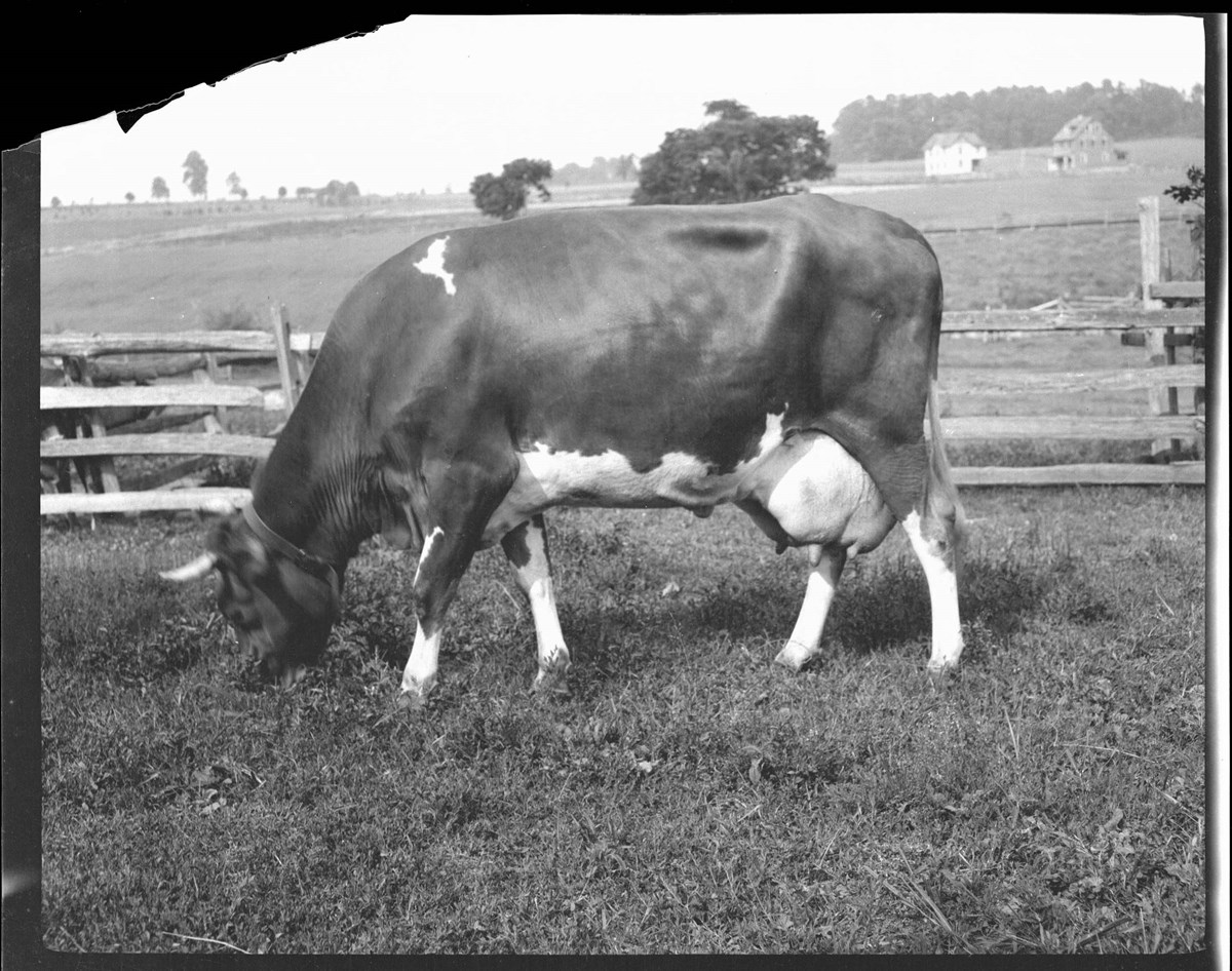
- Selkirk Mountains
- Date Range
- 1912
- Reference Code
- V653 / NA - 757
- Description Level
- 6 / Item
- GMD
- Photograph
- Negative
1 image
- Part Of
- Vaux family fonds
- Description Level
- 6 / Item
- Fonds Number
- M107 / V653
- Series
- I. Photography
- Sub-Series
- R. Travel 1912
- Reference Code
- V653 / NA - 757
- GMD
- Photograph
- Negative
- Date Range
- 1912
- Physical Description
- 1 negative : film
- Scope & Content
- Selkirk Mountains
- Subject Access
- Discovery and Exploration
- Geographic Access
- British Columbia
- Creator
- Vaux family (Philadelphia USA)
Images
This material is presented as originally created; it may contain outdated cultural descriptions and
potentially offensive content.
Read more.