Narrow Results By
- Peter and Catharine Whyte fonds 105
- Bruno Engler fonds 76
- Lillian Gest fonds 21
- Whyte Museum Oral History Programme collection 20
- Alpine Club of Canada fonds 15
- Ron Duke fonds 14
- Nicholas Morant fonds 12
- Bob Smith fonds 8
- Luxton family fonds 7
- Murray Hay fonds
- Trail Riders of the Canadian Rockies fonds
- Bill Goodrich fonds 3
Banff National Park and Lake Louise maps
https://archives.whyte.org/en/permalink/descriptions54945
- Scope & Content
- File consists of two folded maps and a small clipping [possibly top or bottom portion from a different map or one of maps in file]. One map is of Banff National Park and one is of Lake Louise [1959]. Banff National Park map has black pencil tracings over trail section near the bottom of the map and…
- Date Range
- 1959
- [1960-1970]
- Reference Code
- M545 / V / 53
- Description Level
- 5 / File
- GMD
- Textual record
- Published record
- Map
- Description Level
- 5 / File
- Fonds Number
- M545 / V635
- Series
- M545 / V : Administrative records
- Sous-Fonds
- M545
- Accession Number
- 8235
- Reference Code
- M545 / V / 53
- Date Range
- 1959
- [1960-1970]
- Physical Description
- 0.5 cm of textual records (2 maps ; 60.5 x 57.5 and 60 x 56.5 cm)
- Scope & Content
- File consists of two folded maps and a small clipping [possibly top or bottom portion from a different map or one of maps in file]. One map is of Banff National Park and one is of Lake Louise [1959]. Banff National Park map has black pencil tracings over trail section near the bottom of the map and annotation in bottom right corner which reads "Natural Bridge". Lake Louise map produced by the Government of Canada.
- Subject Access
- Banff National Park
- Environment
- Geography
- Map
- Lake Louise
- Travel
- Government
- National parks and reserves
- Trails
- Geographic Access
- Canada
- Alberta
- Banff National Park
- Lake Louise
- Language
- English
- Conservation
- Clipping stored in mylar due to significant staining and residue from tape
- Items kept folded [not placed in mylar] due to mass production of content and minimal/no annotations
- Title Source
- Title based on contents of file
- Processing Status
- Processed
This material is presented as originally created; it may contain outdated cultural descriptions and
potentially offensive content.
Read more.
Banff National Park (general)
https://archives.whyte.org/en/permalink/descriptions55338
- Part Of
- Murray Hay fonds
- Scope & Content
- File consists of 4 prings : col. 35.1 x 24.8 cm or smaller and 4 maps (2 paper, 2 overlays) : col., on mylar ; 60.4 x 30. cm or smaller. File pertains to aerial views of Banff National Park, showing the towns of Banff and Lake Louise, ski hills (Norqay Ski Hill, Sunshine Village, and Lake Louise Sk…
- Date Range
- ca.1976-ca.2000
- Reference Code
- V795 / II / B / v / 1-2
- Description Level
- 5 / File
- GMD
- Map
- Private record
- Part Of
- Murray Hay fonds
- Description Level
- 5 / File
- Fonds Number
- M570 / V795
- Series
- V795 / II : Unpublished Material
- Sous-Fonds
- V795
- Sub-Series
- V795 / II / B : Alberta / v : Banff National Park
- Accession Number
- 2019.41
- Reference Code
- V795 / II / B / v / 1-2
- GMD
- Map
- Private record
- Date Range
- ca.1976-ca.2000
- Physical Description
- 4 prints : col. 35.1 x 24.8 cm or smaller
- 4 maps (2 paper, 2 overlays) : col., annotations, on mylar ; 60.4 x 30. cm or smaller
- Scope & Content
- File consists of 4 prings : col. 35.1 x 24.8 cm or smaller and 4 maps (2 paper, 2 overlays) : col., on mylar ; 60.4 x 30. cm or smaller. File pertains to aerial views of Banff National Park, showing the towns of Banff and Lake Louise, ski hills (Norqay Ski Hill, Sunshine Village, and Lake Louise Ski Resort), as well as other georgraphic features. The mylar overlays contain various amounts of detail and annotations - one consists of a dark red sheet overlayed with place names in negative.
- Notes
- Items not in oversize stored in downstairs vault.
- Name Access
- Hay, Murray
- Subject Access
- Advertising
- Artist
- Ski Maps
- Map
- Cartography
- Sports and recreation
- Tourism
- Tourist information
- Winter
- Winter sports
- Ski area
- Sunshine Village
- Norquay Ski Hill
- Lake Louise Ski Area
- Geographic Access
- Banff
- Lake Louise
- Banff National Park
- Alberta
- Canada
- Canadian Rocky Mountains
- Language
- English
- Creator
- Hay, Murray
- Title Source
- Title based on contents of file
- Processing Status
- Processed
This material is presented as originally created; it may contain outdated cultural descriptions and
potentially offensive content.
Read more.
Canadian Rockies
https://archives.whyte.org/en/permalink/descriptions54817
- Part Of
- Murray Hay fonds
- Scope & Content
- File consists of 1 cm of textual records, 10 x 22 cm. File pertains to tourist maps of the Canadian Rocky Mountains created by Murray Hay. File includes a brochure of titled "Canadian Rockies Access Maps" that, when unfolded, includes several maps of the various areas that make up the Canadian Rock…
- Date Range
- ca. 1990 - 1999
- 1999
- Reference Code
- M570 / III / D / i / 2
- Description Level
- 5 / File
- GMD
- Published record
- Map
- Textual record
- Part Of
- Murray Hay fonds
- Description Level
- 5 / File
- Fonds Number
- M570 / V795
- Series
- M570 / III : Murray Hay portfolio (published material)
- Sous-Fonds
- M570
- Sub-Series
- M570 / III / D : Miscellaneous / i : Canada (general)
- Accession Number
- 2019.41
- Reference Code
- M570 / III / D / i / 2
- Date Range
- ca. 1990 - 1999
- 1999
- Physical Description
- 1 cm of textual records (10 x 22 cm)
- Scope & Content
- File consists of 1 cm of textual records, 10 x 22 cm. File pertains to tourist maps of the Canadian Rocky Mountains created by Murray Hay. File includes a brochure of titled "Canadian Rockies Access Maps" that, when unfolded, includes several maps of the various areas that make up the Canadian Rocky Mountains, like Kananaskis Country, Canmore, Banff National Park, Jasper National Park, Yoho National Park, etc.
- Name Access
- Hay, Murray
- Subject Access
- Advertising
- Artist
- Banff
- Banff National Park
- Cartography
- Communications
- Lake Louise
- Kananaskis Country
- Map
- Mountains
- Tourism
- Tourist information
- Travel
- Geographic Access
- Canada
- Canadian Rocky Mountains
- Alberta
- British Columbia
- Yoho National Park
- Jasper National Park
- Banff National Park
- Glacier National Park
- Canmore
- Banff
- Jasper
- Lake Louise
- Kananaskis
- Kananaskis Country
- Kootenay National Park
- Language
- English
- Title Source
- Title based on contents of file
- Processing Status
- Processed
This material is presented as originally created; it may contain outdated cultural descriptions and
potentially offensive content.
Read more.
- Part Of
- Murray Hay fonds
- Scope & Content
- File consists of 1.5 cm of textual records, 53 x 80.5 cm and 10 x 23.5 cm. File pertains to ski trail maps of Lake Louise ski area created by Murray Hay. File includes two published reproductions of three original trail maps in a fold-out brochure (1992/1993) and in poster format. The three maps de…
- Date Range
- ca.1980 - ca. 1995
- 1992-1993
- Reference Code
- M570 / III / B / ii / 1-2
- Description Level
- 5 / File
- GMD
- Textual record
- Published record
- Map
- Poster
- Part Of
- Murray Hay fonds
- Description Level
- 5 / File
- Fonds Number
- M570 / V795
- Series
- M570 / III : Murray Hay portfolio (published material)
- Sous-Fonds
- M570
- Sub-Series
- M570 / III / B : Alberta / ii : Lake Louise
- Accession Number
- 2019.41
- Reference Code
- M570 / III / B / ii / 1-2
- Date Range
- ca.1980 - ca. 1995
- 1992-1993
- Physical Description
- 1.5 cm of textual records (53 x 80.5 cm and 10 x 23.5 cm)
- Scope & Content
- File consists of 1.5 cm of textual records, 53 x 80.5 cm and 10 x 23.5 cm. File pertains to ski trail maps of Lake Louise ski area created by Murray Hay. File includes two published reproductions of three original trail maps in a fold-out brochure (1992/1993) and in poster format. The three maps depict South Face, Back Bowls, and Larch Area.
- Name Access
- Hay, Murray
- Subject Access
- Ski area
- Ski Maps
- Skiing
- Tourism
- Cartography
- Map
- Winter
- Winter sports
- Sports and recreation
- Travel
- Lake Louise Ski Area
- Lake Louise
- Artist
- Advertising
- Geographic Access
- Lake Louise
- Alberta
- Canada
- Canadian Rocky Mountains
- Language
- English
- Related Material
- V795 / II / B / ii / 1
- Title Source
- Title based on contents of file
- Processing Status
- Processed
This material is presented as originally created; it may contain outdated cultural descriptions and
potentially offensive content.
Read more.
Lake Louise Area
https://archives.whyte.org/en/permalink/descriptions54925
- Part Of
- Murray Hay fonds
- Scope & Content
- File consists of 6 prints : col. ; 25.5 x 20 cm or smaller. File pertains to Murray Hay's renderings of the Lake Louise ski area. File includes six reproduced draft prints of original paintings of the Lake Louise ski area created by Murray Hay (different iterations).
- Date Range
- ca.1976-ca.2000
- Reference Code
- V795 / II / B / ii / 1
- Description Level
- 5 / File
- GMD
- Map
- Private record
- Part Of
- Murray Hay fonds
- Description Level
- 5 / File
- Fonds Number
- M570 / V795
- Series
- V795 / I : Unpublished Material
- Sous-Fonds
- V795
- Sub-Series
- V795 / I / B : Alberta / ii : Lake Louise
- Accession Number
- 2019.41
- Reference Code
- V795 / II / B / ii / 1
- GMD
- Map
- Private record
- Date Range
- ca.1976-ca.2000
- Physical Description
- 6 prints : col. ; 25.5 x 20 cm or smaller
- Scope & Content
- File consists of 6 prints : col. ; 25.5 x 20 cm or smaller. File pertains to Murray Hay's renderings of the Lake Louise ski area. File includes six reproduced draft prints of original paintings of the Lake Louise ski area created by Murray Hay (different iterations).
- Name Access
- Hay, Murray
- Subject Access
- Advertising
- Artist
- Ski Maps
- Map
- Cartography
- Sports and recreation
- Tourism
- Tourist information
- Winter
- Winter sports
- Ski area
- Lake Louise Ski Area
- Geographic Access
- Lake Louise
- Alberta
- Canada
- Canadian Rocky Mountains
- Language
- English
- Related Material
- M570 / III / B / ii / 1-2
- Creator
- Hay, Murray
- Title Source
- Title based on contents of file
- Processing Status
- Processed
This material is presented as originally created; it may contain outdated cultural descriptions and
potentially offensive content.
Read more.
Mount Assiniboine Trail Ride Album (1943)
https://archives.whyte.org/en/permalink/descriptions14150
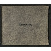
- Scope & Content
- One photograph album containing 111 b&w photographs. Content pertains to a July-August 1943 trip with Trail Riders of the Canadian Rockies which included multiple locations: Banff, Canmore, Spray Lakes, Wonder Pass, Mount Assiniboine, Simpson Summit, Larix Lake, Citadel Pass and Healy Creek. Second…
- Date Range
- 1943
- Reference Code
- V635 / I / PD - 2
- Description Level
- 5 / File
- GMD
- Album
- Photograph
- Photograph print
- Textual record
1 image
1 Electronic Resource
- Description Level
- 5 / File
- Fonds Number
- M545 / V635
- Series
- V635 / I : Events and Activities
- Sous-Fonds
- V635
- Accession Number
- 5757
- Reference Code
- V635 / I / PD - 2
- Responsibility
- Created by Jeanne Nelson of Calgary (?)
- Date Range
- 1943
- Physical Description
- 1 photograph album (111 prints)
- Scope & Content
- One photograph album containing 111 b&w photographs. Content pertains to a July-August 1943 trip with Trail Riders of the Canadian Rockies which included multiple locations: Banff, Canmore, Spray Lakes, Wonder Pass, Mount Assiniboine, Simpson Summit, Larix Lake, Citadel Pass and Healy Creek. Second half of album pertains to Sky Line Hike Camp trip through Goat Creek and Spray River in August, 1943. Photographs depict group shots of riders on horseback and individuals hiking, swimming, scenic views of mountains, lakes, etc., portraits/individual shots of trip attendees, and views of teepees and campsites. Album also contains 3 newspaper clippings with articles related to trips, Trail Riders ticket for Miss Jeanne Nelson (July 30th - August 3rd, 1943) and 2 small booklets (one pertaining to each of two trips depicted in album). Pamphlet for Trail Riders packing trip is covered in signatures of trip attendees. Photos depict individuals including Carl Rungius, Jeanne Nelson, Wilf Bennett, Jean Stewart, and Peggy Robinson.
- Notes
- Possibly related to photographs in file V635 / I / PA - 155 to 178
- Name Access
- Nelson, Jeanne
- Subject Access
- Camping
- Hiking
- Travel
- Mountain
- Lake
- Horses
- Swimming
- Trail Riders of the Canadian Rockies
- Geographic Access
- Canada
- Alberta
- Banff
- Canmore
- Canadian Rocky Mountains
- Language
- English
- Conservation
- Interleave pages with acid-free tissue paper to prevent further deterioration of photographs. Consider replacing metal spiral binding in the future if rusting becomes a risk to rest of album.
- Creator
- Jeanne Nelson (?)
- Title Source
- Title based on contents of file
- Processing Status
- Processed
Electronic Resources
Images

This material is presented as originally created; it may contain outdated cultural descriptions and
potentially offensive content.
Read more.
Newspaper Clippings
https://archives.whyte.org/en/permalink/descriptions54745
- Part Of
- Murray Hay fonds
- Scope & Content
- File consists of 1 cm of textual material in the form of newspaper clippings, 32 x 60 cm or smaller. File pertains to the career of Murray Hay as a ski map artist. File documents Hay's wide-ranging success creating trail maps for ski resorts, particularly in Alberta and British Columbia, Canada (al…
- Date Range
- 1991
- 1993
- 1996
- 1998
- Reference Code
- M570 / I / 1
- Description Level
- 5 / File
- GMD
- Published record
- Textual record
- Newspaper clipping
- Part Of
- Murray Hay fonds
- Description Level
- 5 / File
- Fonds Number
- M570 / V795
- Series
- M570 / I : Newspaper Clippings
- Sous-Fonds
- M570
- Accession Number
- 2019.41
- Reference Code
- M570 / I / 1
- Date Range
- 1991
- 1993
- 1996
- 1998
- Physical Description
- 1 cm of textual records (32 x 60 cm or smaller)
- Scope & Content
- File consists of 1 cm of textual material in the form of newspaper clippings, 32 x 60 cm or smaller. File pertains to the career of Murray Hay as a ski map artist. File documents Hay's wide-ranging success creating trail maps for ski resorts, particularly in Alberta and British Columbia, Canada (although he made maps for ski resorts and other organizations internationally, particularly in the United States). File also includes interviews with Hay about his mapmaking process and style, successes, challenges (including the impact of technology on his work).
- 2020-02-14
- Notes
- Includes articles that were published in the Calgary Sun (January 17, 1991) and the Calgary Herald (March 11, 1993; March 2, 1996; April 16, 1998).
- Name Access
- Hay, Murray
- Subject Access
- Ski areas
- Skiing
- Sports and recreation
- Art
- Artist
- Map
- Ski Maps
- Activities
- Banff National Park
- Cartography
- Lake Louise Ski Area
- Landscapes
- Professional and Personal Life
- Winter
- Winter sports
- Whistler Blackcomb
- Newspaper
- Calgary Herald
- Calgary Sun
- Geographic Access
- Canada
- Canadian Rocky Mountains
- Alberta
- Banff National Park
- Jasper National Park
- British Columbia
- Calgary
- Language
- English
- Title Source
- Title based on contents of file
- Processing Status
- Processed
This material is presented as originally created; it may contain outdated cultural descriptions and
potentially offensive content.
Read more.
Trail ride album
https://archives.whyte.org/en/permalink/descriptions14151
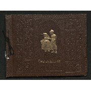
- Scope & Content
- Photograph album contains 182 black and white prints pertaining to trail rides in July/August, 1945 through Baker Creek, Ptarmigan Lake, Skoki and Lake Louise; and Lake O'Hara, Lake McArthur and Odaray Trail. Images depict riders on horseback, scenic views of mountains, waterfalls, forests and land…
- Date Range
- 1945
- Reference Code
- V635 / I / PD - 3
- Description Level
- 5 / File
- GMD
- Album
- Photograph
- Photograph print
- Textual record
1 image
1 Electronic Resource
- Description Level
- 5 / File
- Fonds Number
- M545 / V635
- Series
- V635 / I : Events and Activities
- Sous-Fonds
- V635
- Accession Number
- 5757
- Reference Code
- V635 / I / PD - 3
- Responsibility
- Trail Riders of the Canadian Rockies
- Date Range
- 1945
- Physical Description
- 1 photograph album (182 prints)
- Scope & Content
- Photograph album contains 182 black and white prints pertaining to trail rides in July/August, 1945 through Baker Creek, Ptarmigan Lake, Skoki and Lake Louise; and Lake O'Hara, Lake McArthur and Odaray Trail. Images depict riders on horseback, scenic views of mountains, waterfalls, forests and landscapes, individual and group photographs of riders, and campsites. Most photographs not annotated and people in photographs not named. Album also contains three pamphlets pertaining to 1945 trail rides with lists of locations and attendees.
- Subject Access
- Travel
- Hiking
- Packing
- Horses
- Mountain
- Waterfall
- Landscapes
- Trail
- Lake
- Trail Riders of the Canadian Rockies
- Geographic Access
- Canada
- Alberta
- Canadian Rocky Mountains
- Language
- English
- Creator
- Unknown
- Title Source
- Title based on contents of file
- Processing Status
- Processed
Electronic Resources
Images

This material is presented as originally created; it may contain outdated cultural descriptions and
potentially offensive content.
Read more.
Trail ride negatives
https://archives.whyte.org/en/permalink/descriptions54362
- Scope & Content
- File consists of 53 negative photographs [32 colour, 21 b&w] pertaining to Trail Riders excursions and camp scenes. Includes photos from "Teepee Town", Bow Valley and surrounding areas, and depicts riders on horseback, group photos, swimming and mountain views.
- Date Range
- [ca. 1940 - ca. 1945]
- Reference Code
- V635 / I / NA - 79 to 131
- Description Level
- 5 / File
- GMD
- Photograph
- Negative
- Description Level
- 5 / File
- Fonds Number
- M545 / V635
- Series
- V635 / I : Events and Activities
- Sous-Fonds
- V635
- Accession Number
- 5757
- Reference Code
- V635 / I / NA - 79 to 131
- GMD
- Photograph
- Negative
- Date Range
- [ca. 1940 - ca. 1945]
- Physical Description
- 53 photographs : b&w and col. negatives ; 3 x 4.5 cm or smaller
- Scope & Content
- File consists of 53 negative photographs [32 colour, 21 b&w] pertaining to Trail Riders excursions and camp scenes. Includes photos from "Teepee Town", Bow Valley and surrounding areas, and depicts riders on horseback, group photos, swimming and mountain views.
- Notes
- Some photographs may be attributed to Canadian Pacific.
- Geographic Access
- Canada
- Alberta
- Bow Valley
- Reproduction Restrictions
- Reference use only, no reproduction
- Language
- English
- Category
- Sports, recreation and leisure
- Title Source
- Title based on contents of file
- Processing Status
- Processed
This material is presented as originally created; it may contain outdated cultural descriptions and
potentially offensive content.
Read more.
Trail Riders transparency photographs for publication
https://archives.whyte.org/en/permalink/descriptions54347
- Scope & Content
- File consists of 151 colour transparencies pertaining to Trail Riders of the Canadian Rockies. Includes photographs pertaining to trail rides, guides and outfitters, camp staff, camps, and scenic views of Banff National Park regions including Banff, Red Deer Lake, and the Bow Valley. Some photogra…
- Date Range
- [ca. 1950 - ca. 1960]
- 1956
- 1970
- [ca. 1970 - ca. 1975]
- 1971
- Reference Code
- V635 / III / NS - 1 to 151
- Description Level
- 5 / File
- GMD
- Photograph
- Transparency
- Description Level
- 5 / File
- Fonds Number
- M545 / V635
- Series
- V635 / III : Published records
- Sous-Fonds
- V635
- Accession Number
- 2014.8277
- Reference Code
- V635 / III / NS - 1 to 151
- Date Range
- [ca. 1950 - ca. 1960]
- 1956
- 1970
- [ca. 1970 - ca. 1975]
- 1971
- Physical Description
- 151 photographs : col. slides ; 55 mm and 35 mm
- Scope & Content
- File consists of 151 colour transparencies pertaining to Trail Riders of the Canadian Rockies. Includes photographs pertaining to trail rides, guides and outfitters, camp staff, camps, and scenic views of Banff National Park regions including Banff, Red Deer Lake, and the Bow Valley. Some photographs appear in Trail Riders of the Canadian Rockies Bulletins. Also includes entries for Townsend Trophy photograph competition [1971 and possibly other years].
- Notes
- Many photographs labelled with the names of [possibly] their respective photographers - individual names included in "Name Access" Most photos not dated Not specified which of transparencies, or how many, were published in Trail Riders bulletins
- Name Access
- Riley, Robert
- Ely, Anne
- Read, Linda
- Humfrey, Dorothy
- Reine, Laverne
- Thomas, K.C.
- Lanigan, Jim
- Amram, Dr. J.
- Pinder, Mrs. George
- Barr, Kathy
- Rosa, Irene
- Marx, D.J.
- Fraser, R.L.
- Squires, Gerald
- Subject Access
- Trail ride
- Banff Springs Hotel
- Landscapes
- Packing
- Horses
- Mountain
- Lake
- Trail Riders of the Canadian Rockies
- Geographic Access
- Canada
- Alberta
- Banff
- Bow Valley
- Red Deer Lake
- Access Restrictions
- Some restrictions may apply
- Reproduction Restrictions
- Some restrictions may apply
- Language
- English
- Category
- Sports, recreation and leisure
- Title Source
- Title based on contents of file
- Processing Status
- Processed
This material is presented as originally created; it may contain outdated cultural descriptions and
potentially offensive content.
Read more.