Narrow Results By
- Alpine Club of Canada 172
- Edward Burtynsky (1955 – , Canadian) 16
- George Weber (1907 – 2002, Canadian) 9
- Clifford Foard Robinson (1916 – 1992, Canadian) 6
- Peter Whyte (1905 – 1966, Canadian)
- Alberta Society of Artists 3
- Alberta and British Columbia Boundary Commission 3
- Campbell, Carolyn 3
- Fitch, Lorne 3
- MacEwan, Grant 3
- Martel, Lynn 3
- Petterson, Nissa 3
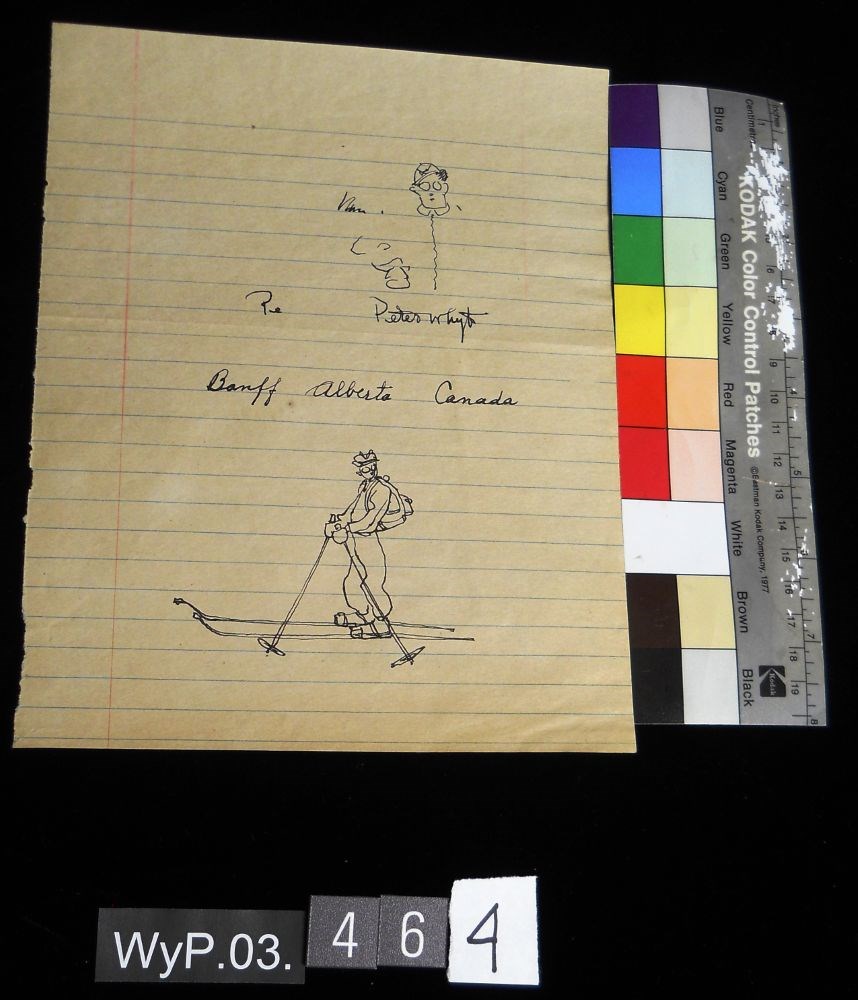
Banff, Alberta, Canada
https://archives.whyte.org/en/permalink/artifactwyp.03.464
- Date
- 1929 – 1966
- Medium
- ink on lined note paper
- Catalogue Number
- WyP.03.464
- Description
- A doodle of a skier on notepad paper with the tile, in cursive: Banff, Alberta, Canada.
1 image
- Title
- Banff, Alberta, Canada
- Date
- 1929 – 1966
- Medium
- ink on lined note paper
- Dimensions
- 21.3 x 16.9 cm
- Description
- A doodle of a skier on notepad paper with the tile, in cursive: Banff, Alberta, Canada.
- Credit
- Gift of Catharine Robb Whyte, O. C., Banff, 1975
- Catalogue Number
- WyP.03.464
Images
This material is presented as originally created; it may contain outdated cultural descriptions and
potentially offensive content.
Read more.
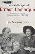
The landscape of Ernest Lamarque : surveyor, artist and Renaissance man, 1879-1970
https://archives.whyte.org/en/permalink/catalogue15204
- Medium
- Library - Book (including soft-cover and pamphlets)
- Published Date
- 2016
- Author
- Sherwood, Jay
- Publisher
- Halfmoon Bay, BC : Caitlin Press
- Call Number
- 08.2 L16l
- Author
- Sherwood, Jay
- Publisher
- Halfmoon Bay, BC : Caitlin Press
- Published Date
- 2016
- Physical Description
- 256 pages, illustrations [some colour plates], maps
- Subjects
- Lamarque, Ernest C.
- Surveyors
- Photography
- Alaska highway
- British Columbia
- Alberta
- Northwest Territories
- Yukon
- ISBN
- 9781987915013
- Accession Number
- 2017.8638
- Call Number
- 08.2 L16l
- Collection
- Archives Library
This material is presented as originally created; it may contain outdated cultural descriptions and
potentially offensive content.
Read more.
Surveying the 120th meridian and the great divide : the Alberta/BC boundary survey, 1918-1924
https://archives.whyte.org/en/permalink/catalogue24952
- Medium
- Library - Book (including soft-cover and pamphlets)
- Published Date
- 2019
- Author
- Sherwood, Jay
- Publisher
- Halfmoon Bay, BC : Caitlin Press
- Call Number
- 08.3 Sh5s Volume 2
1 website
- Author
- Sherwood, Jay
- Responsibility
- Jay Sherwood
- Publisher
- Halfmoon Bay, BC : Caitlin Press
- Published Date
- 2019
- Physical Description
- 192 p. ; illus.
- Series
- Volume 2
- Subjects
- Surveyors
- Surveys and Mapping
- Surveys
- Great Divide Trail
- Alberta
- British Columbia
- British Columbia - Boundaries
- British Columbia - Surveys and Mapping
- Alberta - B.C. Boundary
- Alberta - Boundaries
- Wheeler, Arthur Oliver
- Cautley, Richard William
- History
- History of Alberta
- Abstract
- "Surveying the 120th Meridian and the Great Divide is the second book of a two-part series describing the initial Alberta/BC boundary survey undertaken between 1913-1924. Surveying the 120th Meridian focuses on the years 1918–1924, when the Alberta crew continued the survey of the 120th meridian while the BC crew split off to continue mapping the Great (Continental) Divide. The Alberta/BC boundary survey was a unique Canadian project that combined talented surveyors, high-tech surveying equipment, rugged crew members and Canadian wilderness. This is a story of adventure and danger: the crew climbed mountains and surveyed from the peaks of the Canadian Rockies; slogged through the muskeg north of the Peace River; occasionally crossed rivers at high water; and often worked in the rain, snow or cold. The boundary survey produced the first detailed maps of the terrain along the divide and the first pictures of the northern Canadian Rockies taken from an airplane. But the most important legacy of this project is the collection of approximately 5,000 photographs developed from high-quality glass plate negatives. These photographs provide full panoramas of the Rocky Mountain landscape as it looked over a century ago. Surveying the 120th Meridian and the Great Divide combines the best of these photographs, diary entries and government documents to recount the astonishing journey of the surveyors and their crew members as they explored Canada’s most dramatic landscape."-- Provided by publisher.
- Contents
- Maps
- Acknowledgements
- Introduction
- The Surveyors
- Surveying Methods 1918-1924
- Completion of the Boundary Survey, 1950-1953
- Conclusion
- Geographical Names
- Survey Crews, 1918-1924
- Sources Consulted
- Index
- Notes
- Features visual and textual material from the A.O. Wheeler fonds M546 / V771
- ISBN
- 9780773860091
- Accession Number
- 2019.90
- Call Number
- 08.3 Sh5s Volume 2
- Collection
- Archives Library
- URL Notes
- Publisher's website
Websites
This material is presented as originally created; it may contain outdated cultural descriptions and
potentially offensive content.
Read more.

- Date
- 1917 – 1929
- Medium
- graphite; ink on paper
- Catalogue Number
- WyP.03.561
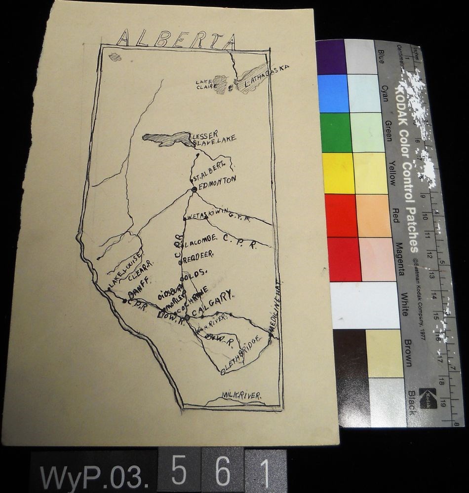
- Description
- Ink and pencil drawing of a map of Alberta with lakes, rivers, CPR lines and urban centres labeled. the border is delineated by a double line. ALBERTA is written above the northern border in narrow block letters.
1 image
- Title
- Untitled
- Date
- 1917 – 1929
- Medium
- graphite; ink on paper
- Dimensions
- 22.5 x 15.1 cm
- Description
- Ink and pencil drawing of a map of Alberta with lakes, rivers, CPR lines and urban centres labeled. the border is delineated by a double line. ALBERTA is written above the northern border in narrow block letters.
- Credit
- Gift of Catharine Robb Whyte, O. C., Banff, 1979
- Catalogue Number
- WyP.03.561
Images
This material is presented as originally created; it may contain outdated cultural descriptions and
potentially offensive content.
Read more.
- Date
- 1925 – 1966
- Medium
- ink; graphite; watercolour on paper
- Catalogue Number
- WyP.03.750
- Description
- On the top half of the page there is a quick sketch in pencil done of a tradesman hammering a piece of wood on what appears to be an anvil. The drawing is then detailed in ink and filled in with watercolour in some places. On the lower half of the page there is practice signatures and practiced way…
1 image
- Title
- Untitled
- Date
- 1925 – 1966
- Medium
- ink; graphite; watercolour on paper
- Dimensions
- 25.2 x 16.2 cm
- Description
- On the top half of the page there is a quick sketch in pencil done of a tradesman hammering a piece of wood on what appears to be an anvil. The drawing is then detailed in ink and filled in with watercolour in some places. On the lower half of the page there is practice signatures and practiced ways to write “Banff,” “Alberta,” and “Canada.” There is also scribbles of ink around some of the words too.
- Credit
- Gift of Catharine Robb Whyte, O. C., Banff, 1979
- Catalogue Number
- WyP.03.750
Images

This material is presented as originally created; it may contain outdated cultural descriptions and
potentially offensive content.
Read more.
- Date
- 1925 – 1966
- Medium
- graphite on paper
- Catalogue Number
- WyP.03.756
- Description
- A very detailed drawing of Banff United Church in the foreground, with a simple sketch of Rundle Mountain in the background. The image is drawn on stationery paper with “BANFF, ALBERTA CANADA” printed on the right side of the page, near the edge. verso: random lines sketched throughout the page
1 image
- Title
- Untitled
- Date
- 1925 – 1966
- Medium
- graphite on paper
- Dimensions
- 21.0 x 28.0 cm
- Description
- A very detailed drawing of Banff United Church in the foreground, with a simple sketch of Rundle Mountain in the background. The image is drawn on stationery paper with “BANFF, ALBERTA CANADA” printed on the right side of the page, near the edge. verso: random lines sketched throughout the page
- Credit
- Gift of Catharine Robb Whyte, O. C., Banff, 1979
- Catalogue Number
- WyP.03.756
Images

This material is presented as originally created; it may contain outdated cultural descriptions and
potentially offensive content.
Read more.