Narrow Results By
[Banff - Sketch plan of Banff townsite]
https://archives.whyte.org/en/permalink/catalogue23259
- Medium
- Library - Maps and blueprints (unannotated; published)
- Map
- Published Date
- 1940
- Publisher
- Department of Mines and Resources
- Call Number
- C4-1.5
- Publisher
- Department of Mines and Resources
- Published Date
- 1940
- Physical Description
- 1 map : black and white
- Scale
- Scale: 400' = 1"
- Subjects
- Banff townsite
- Notes
- Duplicate - Map Room - Accn. 1038, 2933
- Accession Number
- 1161
- 1038
- 2933
- Call Number
- C4-1.5
- Collection
- Archives Library
This material is presented as originally created; it may contain outdated cultural descriptions and
potentially offensive content.
Read more.
[Banff - Townsite]
https://archives.whyte.org/en/permalink/catalogue21316
- Medium
- Library - Maps and blueprints (unannotated; published)
- Map
- Published Date
- 1912
- Call Number
- C4-1.13
- Published Date
- 1912
- Subjects
- Banff townsite
- Notes
- Black and white
- DAMAGED
- Accession Number
- 1113
- Call Number
- C4-1.13
- Collection
- Archives Library
This material is presented as originally created; it may contain outdated cultural descriptions and
potentially offensive content.
Read more.
[Banff: Bow River to Moose Street]
https://archives.whyte.org/en/permalink/catalogue23258
- Medium
- Library - Maps and blueprints (unannotated; published)
- Map
- Published Date
- 1913
- Author
- Walker, C.M.
- Publisher
- Ottawa: Dept. of the Interior
- Call Number
- C4-1.4
- Author
- Walker, C.M.
- Publisher
- Ottawa: Dept. of the Interior
- Published Date
- 1913
- Physical Description
- 1 map : black and white
- Scale
- Scale indeterminable
- Subjects
- Banff - Townsite development
- Walker, C.M.
- Notes
- Compiled from official surveys, December 17, 1912, by C.M. Walker
- Accession Number
- 5670
- Call Number
- C4-1.4
- Collection
- Archives Library
This material is presented as originally created; it may contain outdated cultural descriptions and
potentially offensive content.
Read more.
Banff land use bylaw
https://archives.whyte.org/en/permalink/catalogue23276
- Medium
- Library - Maps and blueprints (unannotated; published)
- Map
- Published Date
- November 13, 1989
- Call Number
- C4-1.19
- Responsibility
- sgd. Barlow et al.
- Published Date
- November 13, 1989
- Physical Description
- 1 map
- Scale
- Scale: 1 : 5,000
- Subjects
- Banff townsite
- Call Number
- C4-1.19
- Collection
- Archives Library
This material is presented as originally created; it may contain outdated cultural descriptions and
potentially offensive content.
Read more.
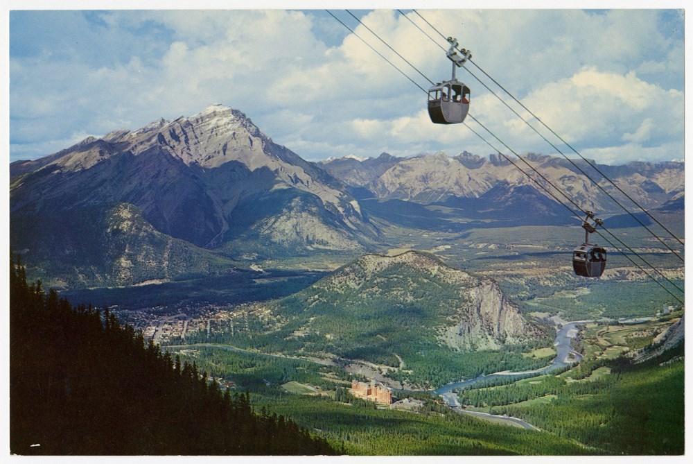
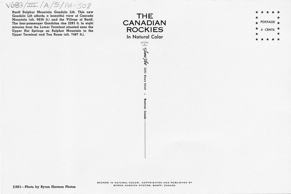
Banff Sulphur Mountain Gondola Lift
https://archives.whyte.org/en/permalink/descriptions51669
- Part Of
- Peter and Catharine Whyte fonds
- Scope & Content
- Image of the Sulphur Mountain gondola with the townsite, Tunnel Mountain, and Cascade Mountain in the background - title and details on the back
- Date Range
- [ca. 1940-1960]
- Reference Code
- V683 / III / A / 5 / PA - 308
- Description Level
- 6 / Image
- GMD
- Postcard
2 images
- Part Of
- Peter and Catharine Whyte fonds
- Description Level
- 6 / Image
- Fonds Number
- M36 / V683 / S37
- Series
- V683 / III / A / 5 : Peter and Catharine Whyte: Landscapes
- Sous-Fonds
- V683
- Accession Number
- .
- Reference Code
- V683 / III / A / 5 / PA - 308
- GMD
- Postcard
- Date Range
- [ca. 1940-1960]
- Physical Description
- Photograph: 1 print (front and back) ; b&w.
- Scope & Content
- Image of the Sulphur Mountain gondola with the townsite, Tunnel Mountain, and Cascade Mountain in the background - title and details on the back
- Subject Access
- Banff townsite
- Banff Springs Hotel
- Gondolas
- Mountains
- Geographic Access
- Banff
- Language
- English
- Title Source
- Title based on item
- Processing Status
- Processed
Images
This material is presented as originally created; it may contain outdated cultural descriptions and
potentially offensive content.
Read more.
[Banff Townsite]
https://archives.whyte.org/en/permalink/catalogue23269
- Medium
- Library - Maps and blueprints (unannotated; published)
- Map
- Published Date
- November, 1955
- Publisher
- Winnipeg: Western Canada Insurance Underwriters Ass'n
- Call Number
- C4-1.14(a), 1955
- Publisher
- Winnipeg: Western Canada Insurance Underwriters Ass'n
- Published Date
- November, 1955
- Scale
- Scale: 1"-800'
- Subjects
- Banff townsite
- Notes
- 4 sheets of maps showing Business Lots, Recreation Areas, Population, Schools of Banff townsite in 1955.
- See also: C4-1.14
- Fire insurance map
- Accession Number
- 2678
- Call Number
- C4-1.14(a), 1955
- Collection
- Archives Library
This material is presented as originally created; it may contain outdated cultural descriptions and
potentially offensive content.
Read more.
[Banff Townsite]
https://archives.whyte.org/en/permalink/catalogue23270
- Medium
- Library - Maps and blueprints (unannotated; published)
- Map
- Published Date
- June, 1930
- Publisher
- Winnipeg: Western Canada Insurance Underwriters Ass'n
- Call Number
- C4-1.14, 1930
- Publisher
- Winnipeg: Western Canada Insurance Underwriters Ass'n
- Published Date
- June, 1930
- Scale
- Scale: 1"-400'
- Subjects
- Banff townsite
- Notes
- 10 sheets of maps showing Business Lots, Recreation Areas, Population, Schools of Banff townsite in 1930
- See also: C4-1.14(a)
- Fire insurance map
- Accession Number
- 400
- Call Number
- C4-1.14, 1930
- Collection
- Archives Library
This material is presented as originally created; it may contain outdated cultural descriptions and
potentially offensive content.
Read more.
Banff Townsite base map : [south side, Bow River]
https://archives.whyte.org/en/permalink/catalogue23272
- Medium
- Library - Maps and blueprints (unannotated; published)
- Map
- Published Date
- 197?
- Author
- Webster, L.
- Publisher
- Ottawa, Dept. of Indian and Northern Affairs
- Call Number
- C4-1.15
- Author
- Webster, L.
- Publisher
- Ottawa, Dept. of Indian and Northern Affairs
- Published Date
- 197?
- Physical Description
- 1 map
- Scale
- Scale: 1 inch = 200 feet
- Subjects
- Banff townsite
- Accession Number
- 6741
- Call Number
- C4-1.15
- Collection
- Archives Library
This material is presented as originally created; it may contain outdated cultural descriptions and
potentially offensive content.
Read more.
- Part Of
- Peter and Catharine Whyte fonds
- Scope & Content
- Image of four unidentified boys wearing Boy Scout[?] uniforms posed on Banff Avenue
- Date Range
- [ca. 1940-1964]
- Reference Code
- V683 / III / A / 15 / PA - 241
- Description Level
- 6 / Item
- GMD
- Photograph
- Postcard
2 images
- Part Of
- Peter and Catharine Whyte fonds
- Description Level
- 6 / Item
- Fonds Number
- M36 / V683 / S37
- Series
- V683 / III / A / 15 : Peter and Catharine Whyte: Collected Photographs
- Sous-Fonds
- V683
- Accession Number
- .
- Reference Code
- V683 / III / A / 15 / PA - 241
- GMD
- Photograph
- Postcard
- Date Range
- [ca. 1940-1964]
- Physical Description
- Photograph: 1 print (front and back) ; b&w.
- Scope & Content
- Image of four unidentified boys wearing Boy Scout[?] uniforms posed on Banff Avenue
- Subject Access
- Banff townsite
- Buildings
- Businesses
- Churches
- Children
- Portrait
- Geographic Access
- Banff
- Banff National Park
- Language
- English
- Title Source
- Title based on item
- Processing Status
- Processed
Images


This material is presented as originally created; it may contain outdated cultural descriptions and
potentially offensive content.
Read more.
Insurance plan of the Town of Banff Alberta : November 1955 Population 2,850
https://archives.whyte.org/en/permalink/catalogue24233
- Medium
- Library - Maps and blueprints (unannotated; published)
- Map
- Published Date
- November, 1955
- Publisher
- Winnipeg: Western Canada Insurance Underwriters Ass'n
- Call Number
- C4-1.14(c), 1955
- Publisher
- Winnipeg: Western Canada Insurance Underwriters Ass'n
- Published Date
- November, 1955
- Scale
- Scale: 1"-800'
- Subjects
- Banff townsite
- Notes
- Maps of lots and blocks of Town of Banff non-personal buildings detailing construction materials used and other information recorded for fire insurance maps. The buildings include hotels, restaurants, garages, tour companies and other businesses, schools, churches and other non-residential lots in 1955.
- This plan consists of the following sheets: Master Title, Key of Signs and Detail Sheets 1 to 6
- See also: C4-1.14
- Fire insurance map
- Accession Number
- 7561
- Call Number
- C4-1.14(c), 1955
- Collection
- Archives Library
This material is presented as originally created; it may contain outdated cultural descriptions and
potentially offensive content.
Read more.