Narrow Results By
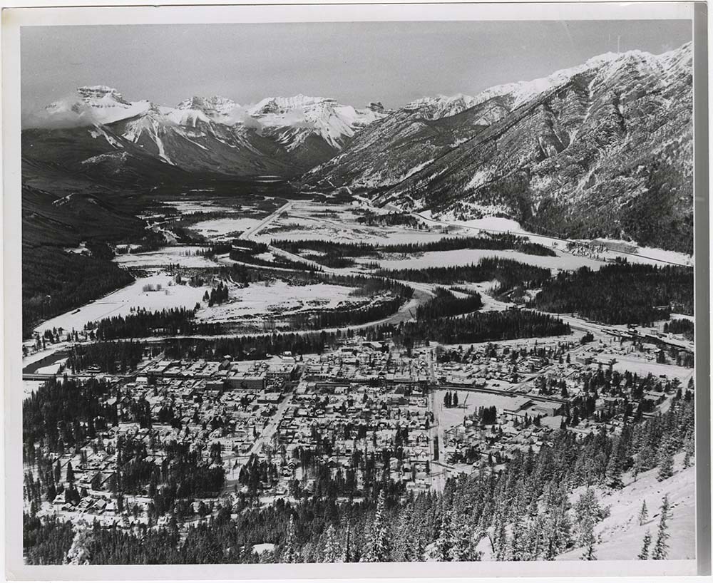
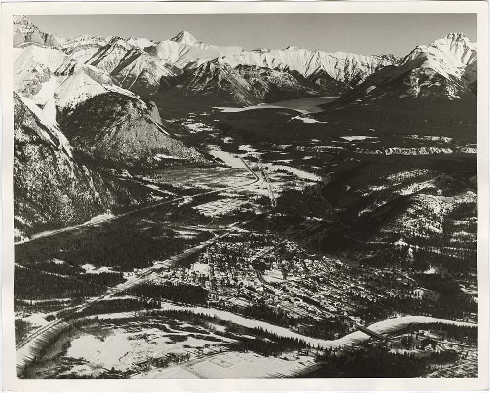
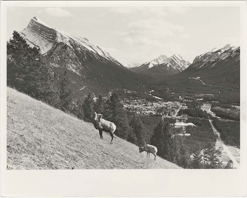
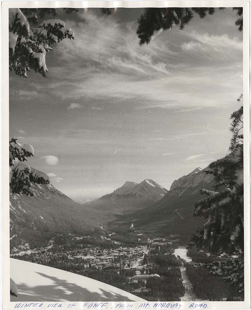
Banff Townsite
https://archives.whyte.org/en/permalink/descriptions57483
- Part Of
- Bruno Engler fonds
- Scope & Content
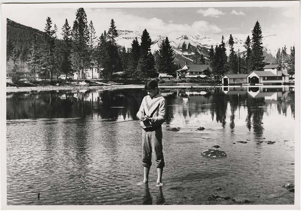
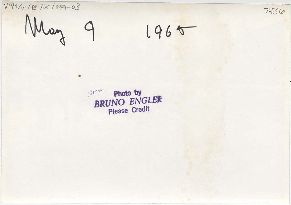
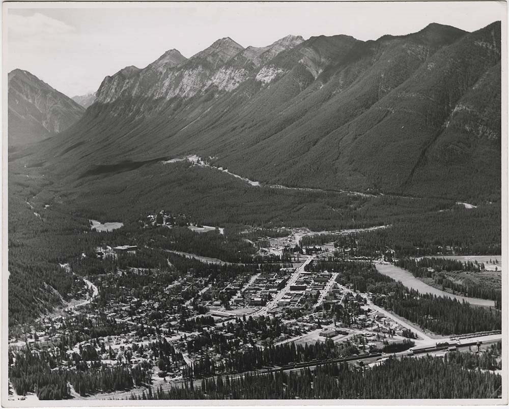
- File pertains to 30 b&w & colour prints of the Banff townsite from various angles, usually from Mount Norquay and Tunnel Mountain. Also includes shots of people at the opening of the Banff Upper Hot Springs, fishing in the river, and painting at Vermillion Lakes.
- Date Range
- 1959-1983
- Reference Code
- V190 / VI / B / ix / PA - 01 to PA - 30
- Description Level
- 5 / File
- GMD
- Photograph
11 images
- Part Of
- Bruno Engler fonds
- Description Level
- 5 / File
- Fonds Number
- M323 / S40 / V190
- Series
- VI : Retained file, B : Alphabetical order
- Sous-Fonds
- V190
- Sub-Series
- ix : Banff Townsite
- Accession Number
- 7436
- Reference Code
- V190 / VI / B / ix / PA - 01 to PA - 30
- GMD
- Photograph
- Date Range
- 1959-1983
- Physical Description
- 30 photographs : b&w & col. ; 25.2 x 20.2 cm or smaller
- History / Biographical
- See fonds level description
- Scope & Content
- File pertains to 30 b&w & colour prints of the Banff townsite from various angles, usually from Mount Norquay and Tunnel Mountain. Also includes shots of people at the opening of the Banff Upper Hot Springs, fishing in the river, and painting at Vermillion Lakes.
- Subject Access
- Activities
- Animals
- Aerial photography
- Artist
- Banff townsite
- Banff Upper Hot Springs
- Big Horn Sheep
- Bow River
- Bow River Boat House
- Buildings
- Fishing
- Mountains
- scenic
- Winter
- Geographic Access
- Banff
- Banff National Park
- Alberta
- Language
- English
- Creator
- Engler, Bruno
- Title Source
- Original title kept
- Processing Status
- Processed
Images


This material is presented as originally created; it may contain outdated cultural descriptions and
potentially offensive content.
Read more.
Key Map of Bow River basin above Calgary
https://archives.whyte.org/en/permalink/catalogue24298
- Medium
- Library - Maps and blueprints (unannotated; published)
- Map
- Published Date
- n.d.
- Publisher
- Water Power Branch
- Call Number
- C5-6.0a
- Publisher
- Water Power Branch
- Published Date
- n.d.
- Scale
- 4 miles to the inch
- Notes
- (accompanies Bow River Power and Storage Investigations by M.C. Hendry 03.6)
- Accession Number
- 576
- Call Number
- C5-6.0a
- Collection
- Archives Library
This material is presented as originally created; it may contain outdated cultural descriptions and
potentially offensive content.
Read more.
[Bow River Basin above Calgary]
https://archives.whyte.org/en/permalink/catalogue24417
- Medium
- Library - Maps and blueprints (unannotated; published)
- Map
- Published Date
- 1912
- Publisher
- Dept. of the Interior Water Power Branch
- Call Number
- C9-3.2
- Publisher
- Dept. of the Interior Water Power Branch
- Published Date
- 1912
- Scale
- Scale: 4 miles: 1 inch
- Relief: Contour interval 500 ft.
- Subjects
- Bow River Basin
- Notes
- 2 duplicates in map room - Accn. 400
- Accession Number
- 400
- Call Number
- C9-3.2
- Collection
- Archives Library
This material is presented as originally created; it may contain outdated cultural descriptions and
potentially offensive content.
Read more.
Map showing power developments on the Bow River above Calgary
https://archives.whyte.org/en/permalink/catalogue24433
- Medium
- Library - Maps and blueprints (unannotated; published)
- Map
- Published Date
- 1963
- Call Number
- C9-5.4
- Published Date
- 1963
- Scale
- Scale: 1 inch: 2 miles
- Subjects
- Power Plants
- Bow River
- Accession Number
- 673
- Call Number
- C9-5.4
- Collection
- Archives Library
This material is presented as originally created; it may contain outdated cultural descriptions and
potentially offensive content.
Read more.
[Bow River Forest Reserve]
https://archives.whyte.org/en/permalink/catalogue23240
- Medium
- Library - Maps and blueprints (unannotated; published)
- Map
- Published Date
- 1965
- Publisher
- Dept. of Lands, Forests
- Call Number
- C2-11.2a
- Publisher
- Dept. of Lands, Forests
- Published Date
- 1965
- Physical Description
- 1 map : col
- Scale
- Scale: 1 inch : 3 miles
- Altitude tints
- Subjects
- Bow River Forest Reserve
- Notes
- C2-11.2b - 1970 reprint - Accn. 3000
- Accession Number
- 718
- Call Number
- C2-11.2a
- Collection
- Archives Library
This material is presented as originally created; it may contain outdated cultural descriptions and
potentially offensive content.
Read more.
Contour Map of Bow River Basin above Calgary
https://archives.whyte.org/en/permalink/catalogue23319
- Medium
- Library - Maps and blueprints (unannotated; published)
- Map
- Published Date
- May, 1912
- Publisher
- Water Power Branch
- Call Number
- C5-6.0
- Publisher
- Water Power Branch
- Published Date
- May, 1912
- Scale
- 4 miles to the inch
- Notes
- (accompanies Bow River Power and Storage Investigations by M.C. Hendry 03.6)
- Accession Number
- 576
- Call Number
- C5-6.0
- Collection
- Archives Library
This material is presented as originally created; it may contain outdated cultural descriptions and
potentially offensive content.
Read more.
Key Map of Bow River basin above Calgary
https://archives.whyte.org/en/permalink/catalogue23320
- Medium
- Library - Maps and blueprints (unannotated; published)
- Map
- Published Date
- n.d.
- Publisher
- Water Power Branch
- Call Number
- C5-6.0a
- Publisher
- Water Power Branch
- Published Date
- n.d.
- Scale
- 4 miles to the inch
- Notes
- (accompanies Bow River Power and Storage Investigations by M.C. Hendry 03.6)
- Accession Number
- 576
- Call Number
- C5-6.0a
- Collection
- Archives Library
This material is presented as originally created; it may contain outdated cultural descriptions and
potentially offensive content.
Read more.
Moose Mountain District of the Disturbed Belt, Southern Alberta
https://archives.whyte.org/en/permalink/catalogue23321
- Medium
- Library - Maps and blueprints (unannotated; published)
- Map
- Published Date
- 1914
- Publisher
- G.S.C.
- Call Number
- C5-6.0b
- Publisher
- G.S.C.
- Published Date
- 1914
- Scale
- 2 miles to the inch
- Notes
- (accompanies Bow River Pwer and Storage Investigations by M.C. Hendry 03.6)
- Accession Number
- 576
- Call Number
- C5-6.0b
- Collection
- Archives Library
This material is presented as originally created; it may contain outdated cultural descriptions and
potentially offensive content.
Read more.
Route map between Calgary and Banff
https://archives.whyte.org/en/permalink/catalogue23322
- Medium
- Library - Maps and blueprints (unannotated; published)
- Map
- Published Date
- n.d.
- Publisher
- G.S.C.
- Call Number
- C5-6.0c
- Publisher
- G.S.C.
- Published Date
- n.d.
- Scale
- 15 miles to the inch
- Notes
- (accompanies the Bow River Power and Storage Investigations by M.C. Hendry 03.6)
- Accession Number
- 576
- Call Number
- C5-6.0c
- Collection
- Archives Library
This material is presented as originally created; it may contain outdated cultural descriptions and
potentially offensive content.
Read more.
Structure Section across the Rocky Mountains near the Main Line of the Canadian Pacific Railway between the Cascade Trough and the Columbia Valley
https://archives.whyte.org/en/permalink/catalogue23323
- Medium
- Library - Maps and blueprints (unannotated; published)
- Map
- Published Date
- n.d.
- Publisher
- G.S.C.
- Call Number
- C5-6.0d
- Publisher
- G.S.C.
- Published Date
- n.d.
- Scale
- 2 miles to the inch
- Notes
- (accompanies the Bow River Power and Storage Investigations by M.C. Hendry 03.6)
- Accession Number
- 576
- Call Number
- C5-6.0d
- Collection
- Archives Library
This material is presented as originally created; it may contain outdated cultural descriptions and
potentially offensive content.
Read more.