Narrow Results By
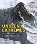
Mountains : mapping the earth's extremes
https://archives.whyte.org/en/permalink/catalogue19921
- Medium
- Library - Book (including soft-cover and pamphlets)
- Published Date
- 2016
- Author
- Dech, Stefan
- Messner, Reinhold
- Sparwasser, Nils
- Publisher
- London, England : Thames and Hudson
- Call Number
- GA D43 M68
1 website
- Responsibility
- Stefan Dech, Reinhold Messner, Nils Sparwasser
- Publisher
- London, England : Thames and Hudson
- Published Date
- 2016
- Physical Description
- 240 p. illus. (colour)
- Subjects
- Mountains
- Maps
- Cartography
- Photography, Aerial
- Abstract
- Mountains marks a new milestone in Earth observation and Alpine exploration. For the first time, a special recording process and a technique developed at the German Aerospace Center (DLR) allow the satellite recording of three-dimensional views from 300 miles above with a resolution in the range of a few meters. Photorealistic images are created in this manner from perspectives denied even to mountaineers and helicopter pilots. In addition to highly accurate detailed models of individual regions, the DLR generates a global three-dimensional elevation model of Earth in unprecedented quality. For this purpose, two German satellites are currently circling the earth at a speed of more than 15,000 miles per hour—separated by a mere 500 feet. Taken together, both techniques offer a detailed view of a world that still pushes human beings to their limits—the mountainous regions of our planet. For this book Reinhold Messner has selected thirteen peaks and routes to feature, as they’ve never been seen before. (from publisher's website)
- Contents
- Trailblazers
- Mountains: the fourth dimension
- Of scientists and mountaineers : the making of this book
- Kailash
- Mont Blanc
- Matterhorn
- Ushba
- Denali
- Aconcagua
- Nanda Devi
- Mount Everest
- K2
- Dhaulagiri
- Annapurna
- Masherbrum
- Histories
- Profiles
- From data to images
- Editors, authors and project partners
- Index
- ISBN
- 9780500518892
- Accession Number
- AC635
- Call Number
- GA D43 M68
- Collection
- Alpine Club of Canada Library
- URL Notes
- Publisher's website
Websites
This material is presented as originally created; it may contain outdated cultural descriptions and
potentially offensive content.
Read more.
The last of his kind : the life and adventures of Bradford Washburn, America's boldest mountaineer
https://archives.whyte.org/en/permalink/catalogue13923
- Medium
- Library - Book (including soft-cover and pamphlets)
- Published Date
- 2009
- Author
- Roberts, David
- Publisher
- New York, N.Y. : William Morrow
- Edition
- 1st ed.
- Call Number
- 01 R54l
- Author
- Roberts, David
- Responsibility
- David Roberts
- Edition
- 1st ed.
- Publisher
- New York, N.Y. : William Morrow
- Published Date
- 2009
- Physical Description
- 334 p., [16] p of plates : ill.
- ISBN
- 0061560944
- Accession Number
- 60, 500 2011-01-13
- Call Number
- 01 R54l
- Collection
- Archives Library
This material is presented as originally created; it may contain outdated cultural descriptions and
potentially offensive content.
Read more.

Sometimes only horses to eat : David Thompson : the Saleesh House period 1807-1812
https://archives.whyte.org/en/permalink/catalogue13946
- Medium
- Library - Book (including soft-cover and pamphlets)
- Published Date
- 2008
- Author
- Haywood, Carl W.
- Publisher
- Thompson Falls, Mont. : Rockman's Trading Post
- Call Number
- 02.5 T37h
- Author
- Haywood, Carl W.
- Responsibility
- Carl W. Haywood; illustrated by Cricket Johnston
- Publisher
- Thompson Falls, Mont. : Rockman's Trading Post
- Published Date
- 2008
- Physical Description
- 392 p. : ill., map
- ISBN
- 9780980227901
- Accession Number
- 60,000 2010-12-17
- Call Number
- 02.5 T37h
- Collection
- Archives Library
This material is presented as originally created; it may contain outdated cultural descriptions and
potentially offensive content.
Read more.

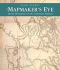
The mapmaker's eye : David Thompson on the Columbia Plateau
https://archives.whyte.org/en/permalink/catalogue13536
- Medium
- Library - Book (including soft-cover and pamphlets)
- Published Date
- 2005
- Author
- Nisbet, Jack
- Publisher
- Pullman : Washington State University Press
- Call Number
- 02.5 T37ni
- Author
- Nisbet, Jack
- Publisher
- Pullman : Washington State University Press
- Published Date
- 2005
- Physical Description
- xii, 180 p. : ill. (some col.), maps (some col.)
- Subjects
- Biography
- Cartography
- Columbia River
- Exploration
- Indians
- Notes
- Bibliography and index
- ISBN
- 0874222850 (pbk. : alk. paper)
- Accession Number
- 40000 07-11-09
- Call Number
- 02.5 T37ni
- Collection
- Archives Library
This material is presented as originally created; it may contain outdated cultural descriptions and
potentially offensive content.
Read more.
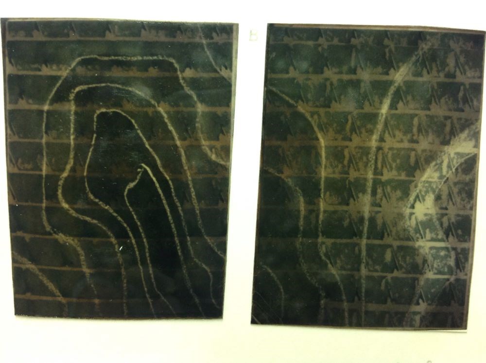
Tunnel Contour in Four Parts
https://archives.whyte.org/en/permalink/artifactans.12.01%20a-d
- Date
- 1977
- Medium
- acrylic; wax on paper
- Catalogue Number
- AnS.12.01 a-d
- Description
- General colour: green. Superimposed on horizontal lines placed at regular intervals up the picture, are curved lines indicating topographic or contour symbols. When all four are hung together the lines meet to form one autonomous image.
1 image
- Title
- Tunnel Contour in Four Parts
- Date
- 1977
- Medium
- acrylic; wax on paper
- Dimensions
- 76.0 x 55.7 cm
- Description
- General colour: green. Superimposed on horizontal lines placed at regular intervals up the picture, are curved lines indicating topographic or contour symbols. When all four are hung together the lines meet to form one autonomous image.
- Credit
- Purchased from Stephen Andrews, Banff, 1977
- Catalogue Number
- AnS.12.01 a-d
Images
This material is presented as originally created; it may contain outdated cultural descriptions and
potentially offensive content.
Read more.
An atlas of the world
https://archives.whyte.org/en/permalink/catalogue25563
- Medium
- Library - Book (including soft-cover and pamphlets)
- Published Date
- 1925
- Author
- Philip, George
- Publisher
- London : Robert Riviére & Son
- Edition
- 15
- Call Number
- 03.1 P53a
- Author
- Philip, George
- Responsibility
- Ravenstein, E. G.
- Edition
- 15
- Publisher
- London : Robert Riviére & Son
- Published Date
- 1925
- Physical Description
- 94 pages
- Series
- The Reference Library
- Subjects
- Cartography
- Maps
- Atlases
- World
- World War I
- Contents
- Section I: Maps ; Section II: Descriptive and Statistical Notes and Index
- Notes
- The HANDY VOLUME ATLAS OF THE WORLD has long enjoyed a large measure of popularity as the most complete and accurate Compendium of Geographical Information of its size published. The evidence of this continued popularity lies in the fact that, since it was first produced under the Editorship of the eminent Geographer, the late Dr. E. G. Ravenstein, no fewer than fourteen large editions have been issued. In this, the FIFTEENTH EDITION, the present Editor has endeavoured to deserve a continuance of that popularity, by making the new issue of the Atlas a complete SURVEY of POST-WAR GEOGRAPHY, exhibiting, in their natural order, the territorial changes and political changes throughout the World effected by the Peace Treaties and Agreements following the Great War. -- Excerpt from Preface, p. v
- Accession Number
- 3069A
- Call Number
- 03.1 P53a
- Collection
- Archives Library
This material is presented as originally created; it may contain outdated cultural descriptions and
potentially offensive content.
Read more.
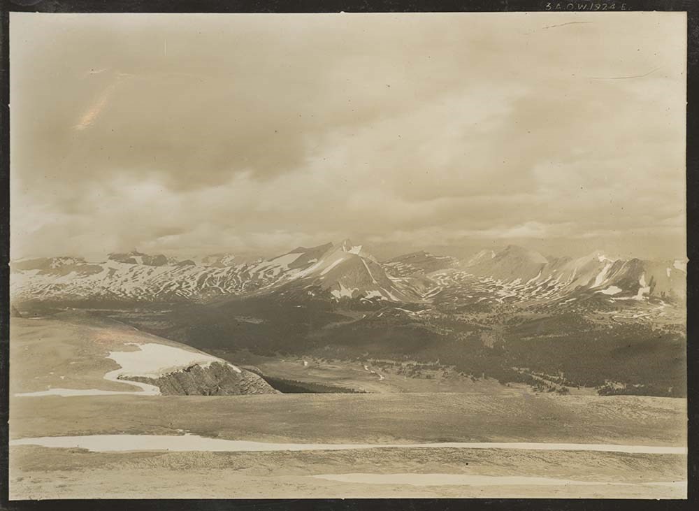
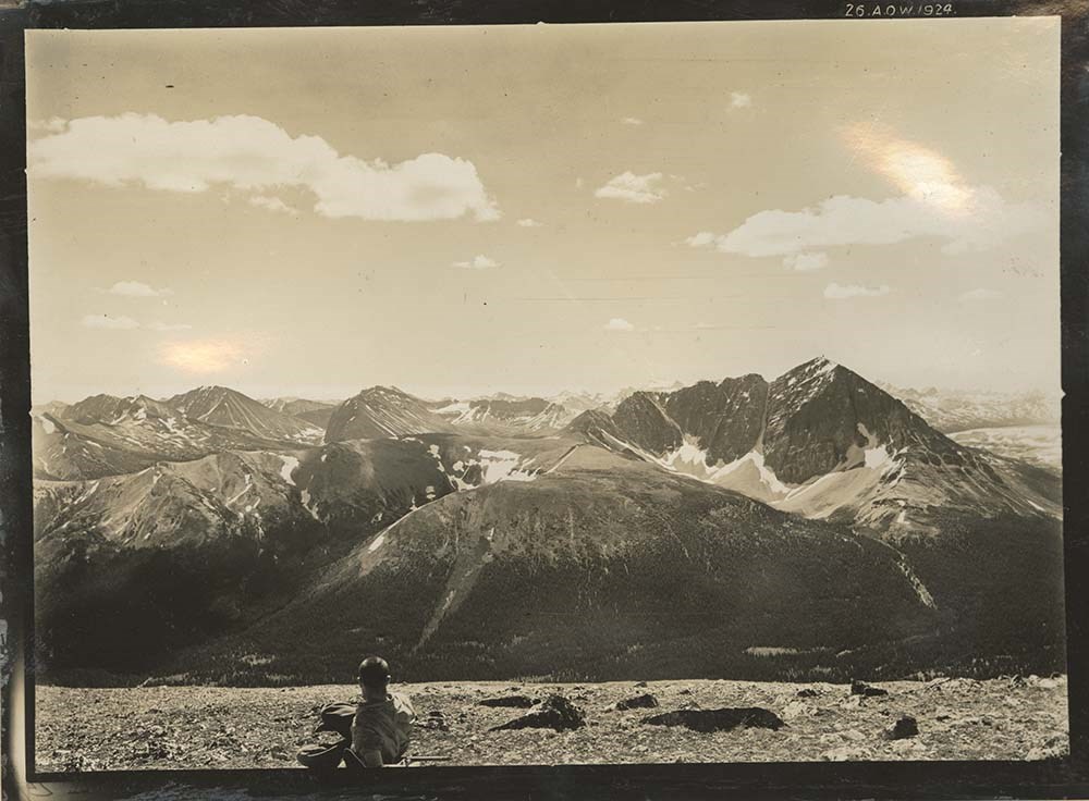
Alberta- British Columbia Boundary Survey, 1924. Volume 1 ( 10 volumes), Stations 289-294
https://archives.whyte.org/en/permalink/descriptions22843
- Part Of
- Arthur Oliver Wheeler fonds
- Scope & Content
- Includes list of stations with bearings and coordinates for each related photograph.
- Date Range
- 1924
- Reference Code
- V771 / PD -57
- Description Level
- 5 / File
2 images
- Part Of
- Arthur Oliver Wheeler fonds
- Description Level
- 5 / File
- Fonds Number
- V771
- Sous-Fonds
- V771
- Accession Number
- 8144
- Reference Code
- V771 / PD -57
- Date Range
- 1924
- Physical Description
- 1 photograph album: 27 pages
- Scope & Content
- Includes list of stations with bearings and coordinates for each related photograph.
- Subject Access
- Surveying/ Cartography
- Mountains
- Title Source
- Title taken from source.
- Processing Status
- Processed
Images
This material is presented as originally created; it may contain outdated cultural descriptions and
potentially offensive content.
Read more.
Alberta- British Columbia Boundary Survey, 1924. Volume 2 ( 10 volumes), Stations 294-Sub Station 1
https://archives.whyte.org/en/permalink/descriptions22844
- Part Of
- Arthur Oliver Wheeler fonds
- Scope & Content
- Includes list of stations with bearings and coordinates for each related photograph.
- Date Range
- 1924
- Reference Code
- V771 / PD -58
- Description Level
- 5 / File
- Part Of
- Arthur Oliver Wheeler fonds
- Description Level
- 5 / File
- Accession Number
- 8144
- Reference Code
- V771 / PD -58
- Date Range
- 1924
- Physical Description
- 1 photograph album: 28 pages
- Scope & Content
- Includes list of stations with bearings and coordinates for each related photograph.
- Subject Access
- Surveying/ Cartography
- Mountains
- Title Source
- Title taken from source.
- Processing Status
- Processed
This material is presented as originally created; it may contain outdated cultural descriptions and
potentially offensive content.
Read more.
Alberta- British Columbia Boundary Survey, 1924. Volume 3 ( 10 volumes), Stations 301-306
https://archives.whyte.org/en/permalink/descriptions22845
- Part Of
- Arthur Oliver Wheeler fonds
- Scope & Content
- Includes list of stations with bearings and coordinates for each related photograph.
- Date Range
- 1924
- Reference Code
- V771 / PD -59
- Description Level
- 5 / File
1 image
- Part Of
- Arthur Oliver Wheeler fonds
- Description Level
- 5 / File
- Fonds Number
- V771
- Sous-Fonds
- V771
- Accession Number
- 8144
- Reference Code
- V771 / PD -59
- Date Range
- 1924
- Physical Description
- 1 photograph album: 28 pages
- Scope & Content
- Includes list of stations with bearings and coordinates for each related photograph.
- Subject Access
- Surveying/ Cartography
- Mountains
- Title Source
- Title taken from source.
- Processing Status
- Processed
Images

This material is presented as originally created; it may contain outdated cultural descriptions and
potentially offensive content.
Read more.
Alberta- British Columbia Boundary Survey, 1924. Volume 4 ( 10 volumes), Stations 306-311
https://archives.whyte.org/en/permalink/descriptions22846
- Part Of
- Arthur Oliver Wheeler fonds
- Scope & Content
- Includes list of stations with bearings and coordinates for each related photograph.
- Date Range
- 1924
- Reference Code
- V771 / PD -60
- Description Level
- 5 / File
- Part Of
- Arthur Oliver Wheeler fonds
- Description Level
- 5 / File
- Accession Number
- 8144
- Reference Code
- V771 / PD -60
- Date Range
- 1924
- Physical Description
- 1 photograph album: 28 pages
- Scope & Content
- Includes list of stations with bearings and coordinates for each related photograph.
- Subject Access
- Surveying/ Cartography
- Mountains
- Title Source
- Title taken from source.
- Processing Status
- Processed
This material is presented as originally created; it may contain outdated cultural descriptions and
potentially offensive content.
Read more.