Narrow Results By
- Part Of
- Peter and Catharine Whyte fonds
- Scope & Content
- Image of structures along a railway line - railway cars on track in foreground
- Date Range
- [ca. 1889-1920]
- Reference Code
- V683 / III / A / 3 / PA - 259
- Description Level
- 6 / Item
- GMD
- Photograph
1 image
- Part Of
- Peter and Catharine Whyte fonds
- Description Level
- 6 / Item
- Fonds Number
- M36 / V683 / S37
- Series
- V683 / III / A / 3 : Peter and Catharine Whyte: Various Views of Banff and Area
- Sous-Fonds
- V683
- Accession Number
- .
- Reference Code
- V683 / III / A / 3 / PA - 259
- GMD
- Photograph
- Date Range
- [ca. 1889-1920]
- Physical Description
- Photograph: 1 print ; b&w.
- Scope & Content
- Image of structures along a railway line - railway cars on track in foreground
- Subject Access
- Buildings
- Coal and coal mines
- Trains
- Geographic Access
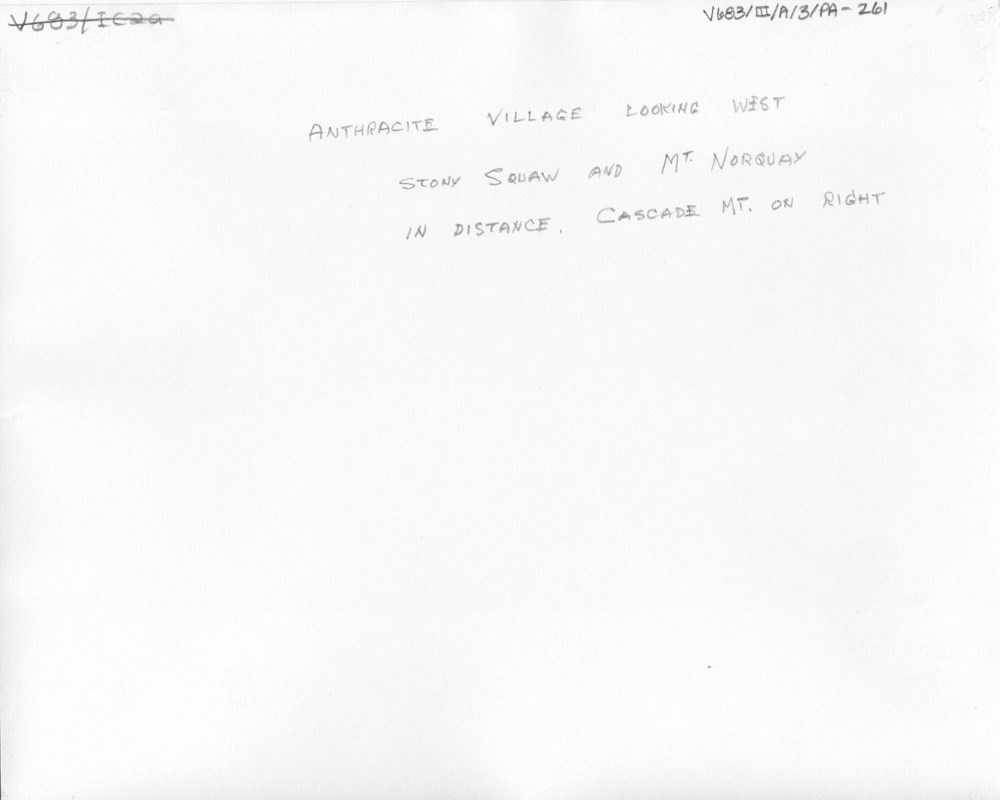
- Anthracite
- Bankhead
- Language
- English
- Title Source
- Title based on item
- Processing Status
- Processed
Images
This material is presented as originally created; it may contain outdated cultural descriptions and
potentially offensive content.
Read more.
- Part Of
- Peter and Catharine Whyte fonds
- Scope & Content
- Image of structures along a railway line - railway cars on track in foreground
- Date Range
- [ca. 1889-1920]
- Reference Code
- V683 / III / A / 3 / PA - 260
- Description Level
- 6 / Item
- GMD
- Photograph
1 image
- Part Of
- Peter and Catharine Whyte fonds
- Description Level
- 6 / Item
- Fonds Number
- M36 / V683 / S37
- Series
- V683 / III / A / 3 : Peter and Catharine Whyte: Various Views of Banff and Area
- Sous-Fonds
- V683
- Accession Number
- .
- Reference Code
- V683 / III / A / 3 / PA - 260
- GMD
- Photograph
- Date Range
- [ca. 1889-1920]
- Physical Description
- Photograph: 1 print ; b&w.
- Scope & Content
- Image of structures along a railway line - railway cars on track in foreground
- Subject Access
- Buildings
- Coal and coal mines
- Trains
- Geographic Access
- Anthracite
- Bankhead
- Language
- English
- Title Source
- Title based on item
- Processing Status
- Processed
Images
This material is presented as originally created; it may contain outdated cultural descriptions and
potentially offensive content.
Read more.
- Part Of
- Peter and Catharine Whyte fonds
- Scope & Content
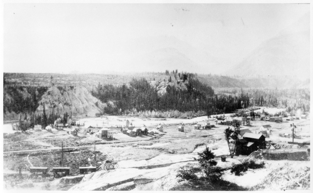
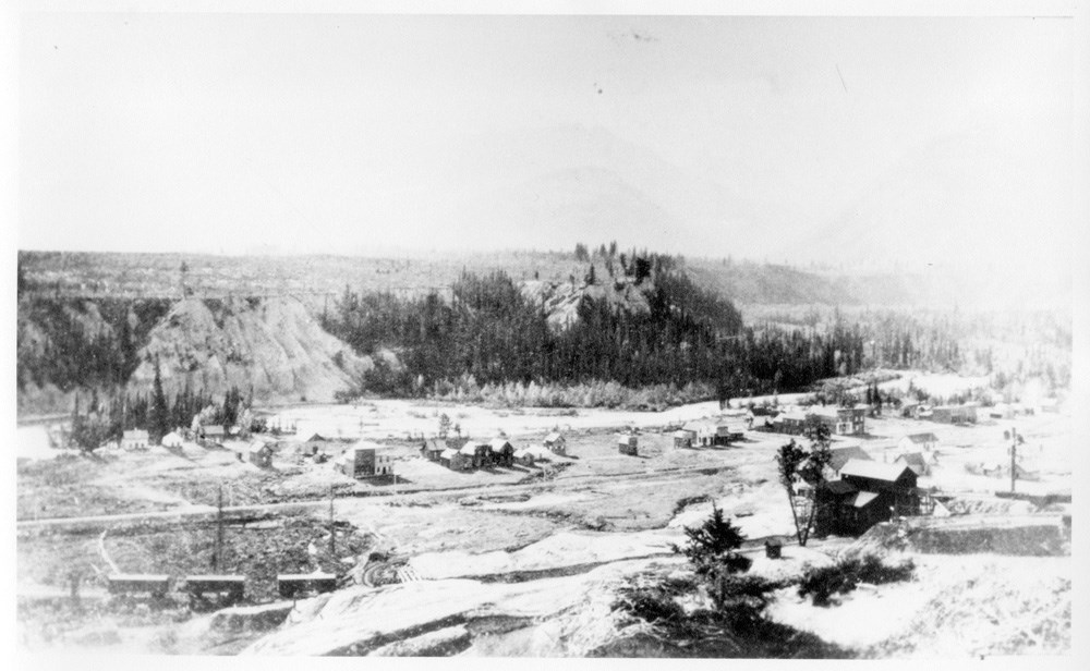
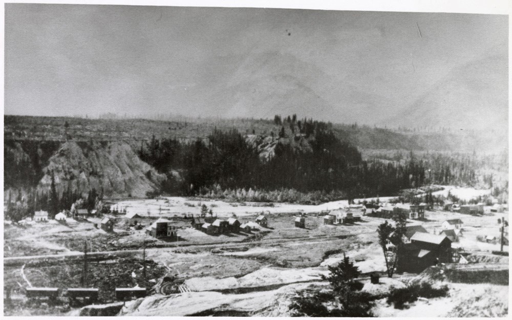
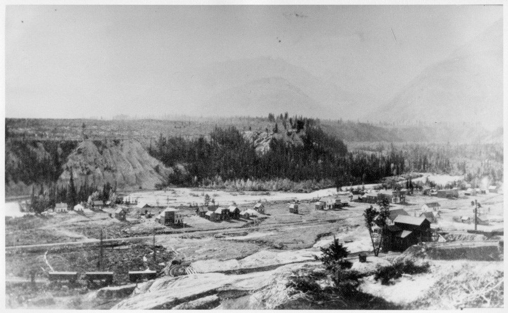
- Image of the town of Anthracite
- Date Range
- [ca. 1885-1945]
- Reference Code
- V683 / III / A / 15 / PA - 676
- Description Level
- 6 / Item
- GMD
- Photograph
2 images
- Part Of
- Peter and Catharine Whyte fonds
- Description Level
- 6 / Item
- Fonds Number
- M36 / V683 / S37
- Series
- V683 / III / A / 15 : Peter and Catharine Whyte: Collected Photographs
- Sous-Fonds
- V683
- Accession Number
- .
- Reference Code
- V683 / III / A / 15 / PA - 676
- GMD
- Photograph
- Date Range
- [ca. 1885-1945]
- Physical Description
- Photograph: 1 print ; b&w.
- Scope & Content
- Image of the town of Anthracite
- Subject Access
- Buildings
- Coal and coal mines
- Geographic Access
- Banff National Park
- Language
- English
- Title Source
- Title based on item
- Processing Status
- Processed
Images
This material is presented as originally created; it may contain outdated cultural descriptions and
potentially offensive content.
Read more.
Anthracite Village looking west
https://archives.whyte.org/en/permalink/descriptions52041
- Part Of
- Peter and Catharine Whyte fonds
- Scope & Content
- Image of structures along a railway line - railway cars on track in foreground
- Date Range
- [ca. 1889-1920]
- Reference Code
- V683 / III / A / 3 / PA - 261
- Description Level
- 6 / Item
- GMD
- Photograph
2 images
- Part Of
- Peter and Catharine Whyte fonds
- Description Level
- 6 / Item
- Fonds Number
- M36 / V683 / S37
- Series
- V683 / III / A / 3 : Peter and Catharine Whyte: Various Views of Banff and Area
- Sous-Fonds
- V683
- Accession Number
- .
- Reference Code
- V683 / III / A / 3 / PA - 261
- GMD
- Photograph
- Date Range
- [ca. 1889-1920]
- Physical Description
- Photograph: 1 print (front and back); b&w.
- Scope & Content
- Image of structures along a railway line - railway cars on track in foreground
- Subject Access
- Buildings
- Coal and coal mines
- Trains
- Geographic Access
- Anthracite
- Bankhead
- Language
- English
- Title Source
- Title based on item
- Processing Status
- Processed
Images
This material is presented as originally created; it may contain outdated cultural descriptions and
potentially offensive content.
Read more.
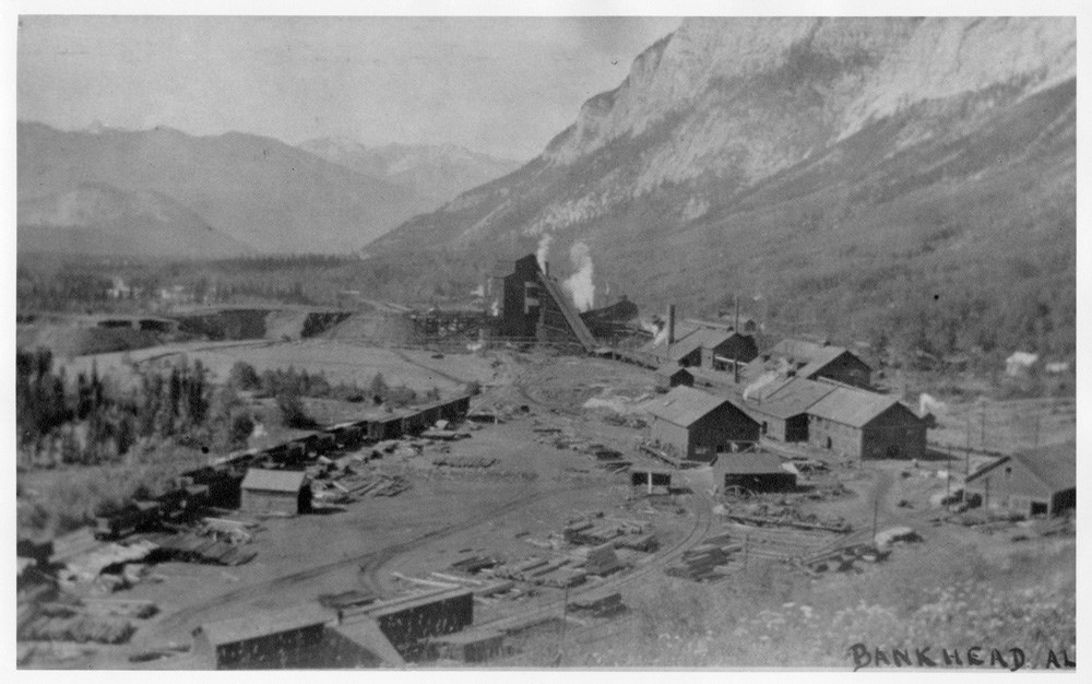
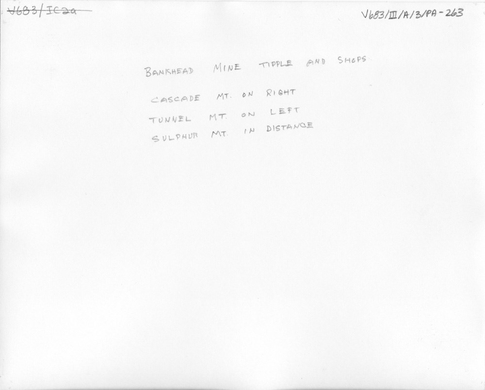
Bankhead Mine Tipple and Shops
https://archives.whyte.org/en/permalink/descriptions52042
- Part Of
- Peter and Catharine Whyte fonds
- Scope & Content
- Image of structures and mine infrastructure built along a railway - written along bottom in black ink "Bankhead, AL." Written on the back is "Bankhead Mine Tipple and Shops - Cascade Mt. on right, Tunnel Mt. on left, Sulphur Mt. in distance" in pencil
- Date Range
- [ca. 1889-1920]
- Reference Code
- V683 / III / A / 3 / PA - 263
- Description Level
- 6 / Item
- GMD
- Photograph
2 images
- Part Of
- Peter and Catharine Whyte fonds
- Description Level
- 6 / Item
- Fonds Number
- M36 / V683 / S37
- Series
- V683 / III / A / 3 : Peter and Catharine Whyte: Various Views of Banff and Area
- Sous-Fonds
- V683
- Accession Number
- .
- Reference Code
- V683 / III / A / 3 / PA - 263
- GMD
- Photograph
- Date Range
- [ca. 1889-1920]
- Physical Description
- Photograph: 1 print (front and back); b&w.
- Scope & Content
- Image of structures and mine infrastructure built along a railway - written along bottom in black ink "Bankhead, AL." Written on the back is "Bankhead Mine Tipple and Shops - Cascade Mt. on right, Tunnel Mt. on left, Sulphur Mt. in distance" in pencil
- Subject Access
- Buildings
- Coal and coal mines
- Mountains
- Trains
- Geographic Access
- Bankhead
- Language
- English
- Title Source
- Title based on item
- Processing Status
- Processed
Images
This material is presented as originally created; it may contain outdated cultural descriptions and
potentially offensive content.
Read more.
Geological map of part of the Cascade Coal Basin, Rocky Mountains
https://archives.whyte.org/en/permalink/catalogue21453
- Medium
- Library - Book (including soft-cover and pamphlets)
- Map
- Published Date
- 1886
- Author
- White, J.
- Call Number
- C7-1.1
- Author
- White, J.
- Published Date
- 1886
- Subjects
- Cascade Coal Basin
- Alberta
- Notes
- To illustrate report by George M. Dawson D.S. F.G.S.
- Topography chiefly from sketches and Surveys by J. White C.E. with additions by R.G. McConnell, B.A.
- Accession Number
- 400
- Call Number
- C7-1.1
- Collection
- Archives Library
This material is presented as originally created; it may contain outdated cultural descriptions and
potentially offensive content.
Read more.
Geological map of the Cascade Coal Basin
https://archives.whyte.org/en/permalink/catalogue24678
- Medium
- Library - Book (including soft-cover and pamphlets)
- Map
- Published Date
- Topo survey: 1889-90
- Call Number
- C7-1.1(b)
- Published Date
- Topo survey: 1889-90
- Scale
- 1 mile - 1 inch
- Subjects
- Cascade Coal Basin
- Alberta
- Notes
- Sheet #2. Cascade River No. 931
- To illustrate Report by D.B. Dowling
- Accession Number
- 3120 (Copy 2)
- Call Number
- C7-1.1(b)
- Collection
- Archives Library
This material is presented as originally created; it may contain outdated cultural descriptions and
potentially offensive content.
Read more.
On the Canadian Rocky Mountains with special reference to that part of the range between the forty-ninth parallel and the headwaters of the Red Deer River
https://archives.whyte.org/en/permalink/catalogue5444
- Medium
- Library - Book (including soft-cover and pamphlets)
- Published Date
- 1886?
- Author
- Dawson, George Mercer
- Call Number
- 03.2 D32o
- Author
- Dawson, George Mercer
- Responsibility
- read before Section C, British Association, Birmingham Meeting, 1886
- Published Date
- 1886?
- Physical Description
- 16p
- Subjects
- Coal
- Columbia Valley
- Gold
- Mining
- Stoney Indians
- Notes
- Reprinted from the "Canadian Record of Science"
- Accession Number
- 668
- Call Number
- 03.2 D32o
- Collection
- Archives Library
This material is presented as originally created; it may contain outdated cultural descriptions and
potentially offensive content.
Read more.
Plan shewing the C.A.C. Coy's coal land, Bow River Valley
https://archives.whyte.org/en/permalink/catalogue24880
- Medium
- Library - Maps and blueprints (unannotated; published)
- Map
- Published Date
- 1889
- Publisher
- [Anthracite? Th. C. Watts?]
- Call Number
- C14-3.3
- Responsibility
- Watts, Th. C. [?]
- Publisher
- [Anthracite? Th. C. Watts?]
- Published Date
- 1889
- Physical Description
- 1 map
- Scale
- 1 inch = 40 chains
- Subjects
- Anthracite
- Coal and coal mines
- Notes
- Sgd. Anthracite, Aug. 9th, 1889, Th.[?] C. Watts
- Call Number
- C14-3.3
- Collection
- Archives Library
This material is presented as originally created; it may contain outdated cultural descriptions and
potentially offensive content.
Read more.