Narrow Results By
- Vaux family fonds 2785
- Byron Harmon fonds 1436
- Mary Schaffer fonds 708
- Moore family fonds 401
- Elliott Barnes fonds 205
- Hans Gmoser fonds
- Charles Macmunn fonds 144
- Professional photographers collection 109
- Boorne and May fonds 104
- Alpine Club of Canada fonds
- Mary (Molly) Wright Adams fonds 25
- Edward Feuz fonds 13
A. W. Drinnan photographs
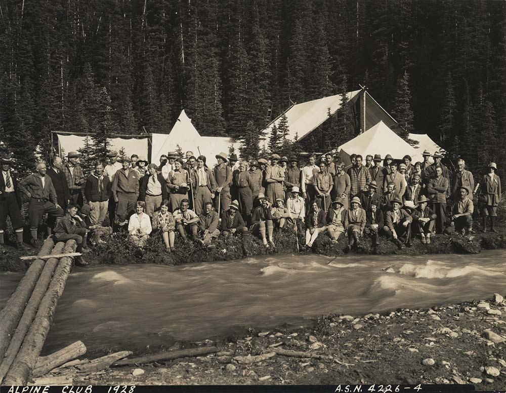
https://archives.whyte.org/en/permalink/descriptions7237
- Part Of
- Alpine Club of Canada fonds
- Scope & Content
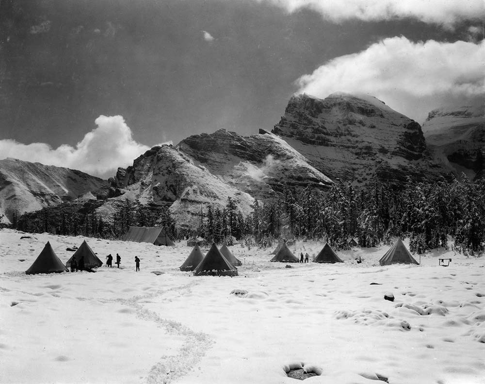
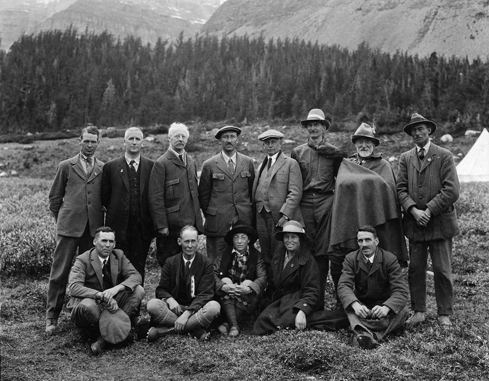
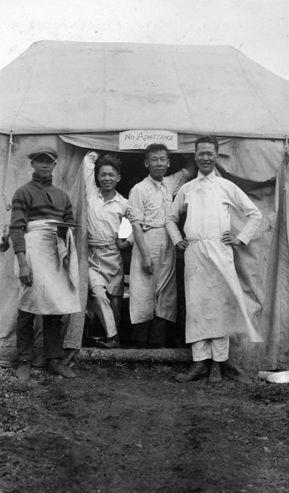
- Album and loose accompanying prints pertain to alpine club camps and activities.
- Date Range
- [ca. 1917-1928]
- Reference Code
- V14 / AC 192P / 01-10
- Description Level
- 5 / File
- GMD
- Photograph
- Photograph print
21 images
- Part Of
- Alpine Club of Canada fonds
- Description Level
- 5 / File
- Fonds Number
- M200 / S6 / V14
- Series
- III. Personal papers and photographs
- Sous-Fonds
- V14
- Accession Number
- 5200
- Reference Code
- V14 / AC 192P / 01-10
- Responsibility
- Album was assembled by A.W. Drinnan; includes many views by H. Pollard.
- Date Range
- [ca. 1917-1928]
- Physical Description
- 1 photograph album (ca.180 prints). -- 9 photographs : prints
- Scope & Content
- Album and loose accompanying prints pertain to alpine club camps and activities.
- Name Access
- Alpine Club of Canada
- Drinnan, A. W.
- Subject Access
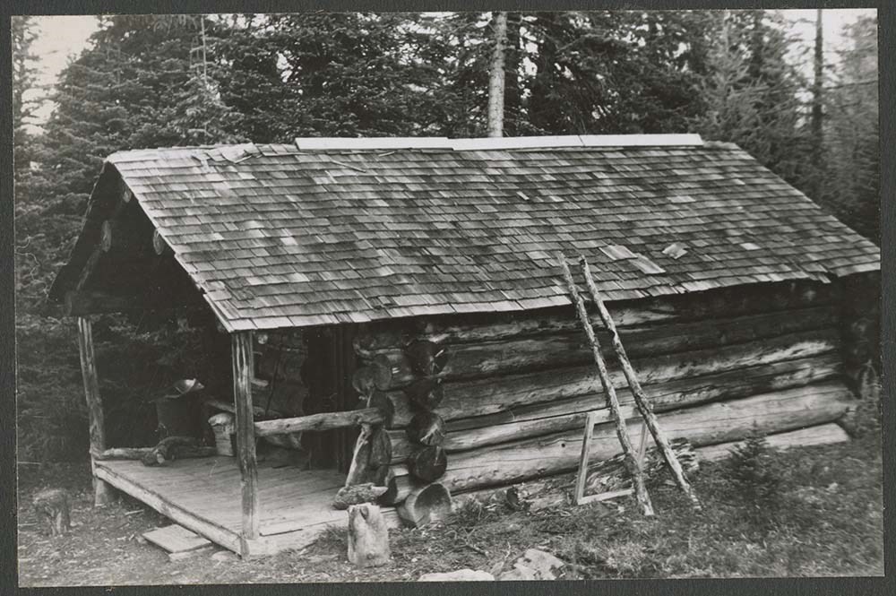
- Abbot Pass Hut
- Activities
- Administration
- Advertising
- Alpine Club of Canada
- Alpine Club House
- Cabins
- Cabins and shelters
- Camps
- Club
- Competition
- Discovery and exploration
- Environment
- Environment and Nature
- Exploration
- Guide
- Guides
- Hiking
- Huts
- Mountain
- Mountain guides
- Mountaineering
- Mountaineers
- Mountains
- National parks and reserves
- Organizations
- Photography
- Scenery
- Sports and recreation
- Summit
- Geographic Access
- Banff National Park
- Jasper National Park
- Yoho National Park
- Alberta
- British Columbia
- Canada
- Language
- English
- Title Source
- Title based on album
- Processing Status
- Processed
Images


This material is presented as originally created; it may contain outdated cultural descriptions and
potentially offensive content.
Read more.
A.L. Harkness photograph album
https://archives.whyte.org/en/permalink/descriptions7229
- Part Of
- Alpine Club of Canada fonds
- Scope & Content
- Album contains miscellaneous views.
- Date Range
- 1917
- Reference Code
- V14 / AC 055P / 30
- Description Level
- 5 / File
- GMD
- Photograph
- Photograph print
1 image
- Part Of
- Alpine Club of Canada fonds
- Description Level
- 5 / File
- Fonds Number
- M200 / S6 / V14
- Series
- III. Personal papers and photographs
- Sous-Fonds
- V14
- Accession Number
- 5200
- Reference Code
- V14 / AC 055P / 30
- Date Range
- 1917
- Physical Description
- 1 photograph album (27 prints)
- Scope & Content
- Album contains miscellaneous views.
- Name Access
- Alpine Club of Canada
- Harkness, A.L.
- Subject Access
- Abbot Pass Hut
- Activities
- Administration
- Advertising
- Alpine Club of Canada
- Alpine Club House
- Cabins
- Cabins and shelters
- Camps
- Club
- Competition
- Discovery and exploration
- Environment
- Environment and Nature
- Exploration
- Guide
- Guides
- Hiking
- Huts
- Mountain
- Mountain guides
- Mountaineering
- Mountaineers
- Mountains
- National parks and reserves
- Organizations
- Photography
- Scenery
- Sports and recreation
- Summit
- Geographic Access
- Banff National Park
- Jasper National Park
- Yoho National Park
- Alberta
- British Columbia
- Canada
- Language
- English
- Title Source
- Title based on preliminary inventory
- Processing Status
- Processed
Images

This material is presented as originally created; it may contain outdated cultural descriptions and
potentially offensive content.
Read more.
- Part Of
- Hans Gmoser fonds
- Scope & Content
- Album dates to 1947- 1951. Album measures as 35.5 x 28.5 cm, it is blue with “Photographs” embossed in gold, red stains on front. Images relate to skiing, possibly family, mountains, some postcards with writing on back, bike trips.
- Date Range
- 1947- 1951
- Reference Code
- V68 / PD- 1
- Description Level
- 5 / File
- Part Of
- Hans Gmoser fonds
- Description Level
- 5 / File
- Series
- VI. Photograph Albums and Scrapbooks
- Accession Number
- 7361
- Reference Code
- V68 / PD- 1
- Date Range
- 1947- 1951
- Physical Description
- 1 photograph album: b&w.
- Scope & Content
- Album dates to 1947- 1951. Album measures as 35.5 x 28.5 cm, it is blue with “Photographs” embossed in gold, red stains on front. Images relate to skiing, possibly family, mountains, some postcards with writing on back, bike trips.
- Subject Access
- Discovery and Exploration
- Environment and Nature
- Family and personal life
- Sports and Recreation
- Title Source
- Supplied title.
- Content Details
- The pictures are tipped in, mounted on black construction paper, some images missing, several pages have captions and dates written in German, images of varying sizes, many 9.5 x 7 cm.
- Processing Status
- Processed
This material is presented as originally created; it may contain outdated cultural descriptions and
potentially offensive content.
Read more.
- Part Of
- Hans Gmoser fonds
- Scope & Content
- Album measures as 35.5 x 28 cm and is brown with “Photographs” embossed in gold on the front .Images of Gmoser on hiking trips, annotated images of mountains with routes, postcards, skiing images, one long panorama shot of mountains taped together.
- Reference Code
- V68 / PD- 3
- Description Level
- 5 / File
- Part Of
- Hans Gmoser fonds
- Description Level
- 5 / File
- Series
- VI. Photograph Albums and Scrapbooks
- Accession Number
- 7361
- Reference Code
- V68 / PD- 3
- Physical Description
- 1 photograph album: b&w.
- Scope & Content
- Album measures as 35.5 x 28 cm and is brown with “Photographs” embossed in gold on the front .Images of Gmoser on hiking trips, annotated images of mountains with routes, postcards, skiing images, one long panorama shot of mountains taped together.
- Subject Access
- Discovery and Exploration
- Environment and Nature
- Family and personal life
- Sports and Recreation
- Title Source
- Supplied title.
- Content Details
- Pictures tipped in with black or plastic tips, mounted on black construction paper, some images missing, images of varying sizes. No captions, no dates, all images black and white.
- Processing Status
- Processed
This material is presented as originally created; it may contain outdated cultural descriptions and
potentially offensive content.
Read more.
- Part Of
- Hans Gmoser fonds
- Scope & Content
- Album measures as 20.25 x 13.5 cm, it is brown and the cover is attached with string. Pictures of children at home, children at groups, at parties.
- Reference Code
- V68 / PD- 4
- Description Level
- 5 / File
- Part Of
- Hans Gmoser fonds
- Description Level
- 5 / File
- Series
- VI. Photograph Albums and Scrapbooks
- Accession Number
- 8111
- Reference Code
- V68 / PD- 4
- Physical Description
- 1 photograph album: b&w.
- Scope & Content
- Album measures as 20.25 x 13.5 cm, it is brown and the cover is attached with string. Pictures of children at home, children at groups, at parties.
- Subject Access
- Discovery and Exploration
- Environment and Nature
- Family and personal life
- Sports and Recreation
- Content Details
- 10 pages of photographs glued on black construction paper, 19 black and white photographs, small, of varying sizes, some with textured edges, no captions, 9 photographs missing.
- Processing Status
- Processed
This material is presented as originally created; it may contain outdated cultural descriptions and
potentially offensive content.
Read more.
- Part Of
- Hans Gmoser fonds
- Scope & Content
- White album with gold embossing titled “The Bobby Burns 1981”. Album with dedication on front cover from Dec 1981. 39 photographs in chronological order documenting the construction of the Bobbie Burns. Aug 1981-Dec 1981, some with captions, pictures measure 10 x 7.75 cm.
- Date Range
- 1981
- Reference Code
- V68 / PD- 5
- Description Level
- 5 / File
- Part Of
- Hans Gmoser fonds
- Description Level
- 5 / File
- Series
- VI. Photograph Albums and Scrapbooks
- Accession Number
- 8111
- Reference Code
- V68 / PD- 5
- Date Range
- 1981
- Physical Description
- 1 photograph album: col.
- Scope & Content
- White album with gold embossing titled “The Bobby Burns 1981”. Album with dedication on front cover from Dec 1981. 39 photographs in chronological order documenting the construction of the Bobbie Burns. Aug 1981-Dec 1981, some with captions, pictures measure 10 x 7.75 cm.
- Subject Access
- Discovery and Exploration
- Environment and Nature
- Family and personal life
- Sports and Recreation
- Title Source
- Supplied title.
- Processing Status
- Processed
This material is presented as originally created; it may contain outdated cultural descriptions and
potentially offensive content.
Read more.
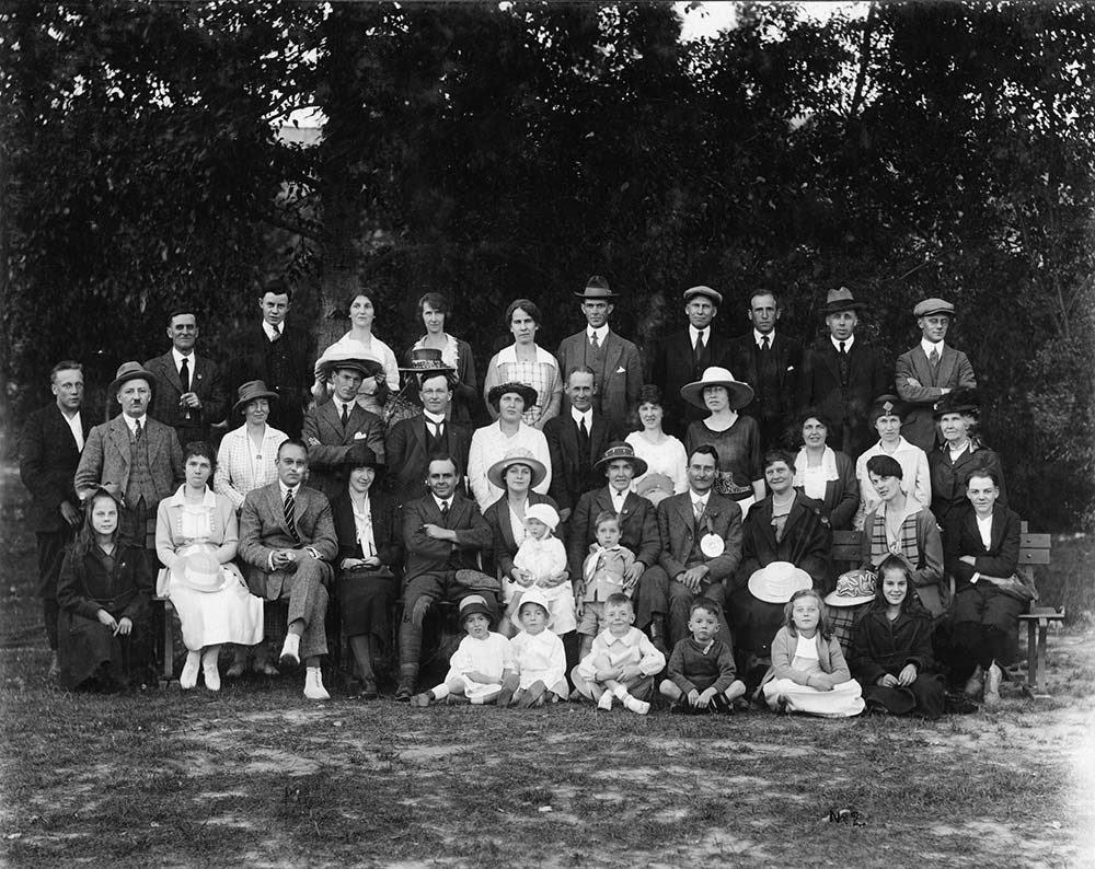
Annual meeting of Alpine Club of Canada, secretary (Elizabeth Parker) reading her report [Lake O'Hara, Yoho Park, B.C.]
https://archives.whyte.org/en/permalink/descriptions49267
- Part Of
- Alpine Club of Canada fonds
- Scope & Content
- Image of a woman identified as Elizabeth Parker reading her report to the Alpine Club of Canada memebers at Lake O'Hara
- Date Range
- 1909
- Reference Code
- v14 / ac55 / 5 / 984 / na66 - 2131
- Description Level
- 6 / Item
- GMD
- Photograph
- Negative, copy
1 image
- Part Of
- Alpine Club of Canada fonds
- Description Level
- 6 / Item
- Fonds Number
- V14
- Sous-Fonds
- .
- Reference Code
- v14 / ac55 / 5 / 984 / na66 - 2131
- Date Range
- 1909
- Physical Description
- 1 photograph : negative : copy negative
- Scope & Content
- Image of a woman identified as Elizabeth Parker reading her report to the Alpine Club of Canada memebers at Lake O'Hara
- Subject Access
- Women
- Discovery and Exploration
- Environment and Nature
- Organizations
- Sports and Recreation
- Geographic Access
- Alberta
- British Columbia
- Creator
- Frank W. Freeborn
- Title Source
- copy negative envelope
- Processing Status
- Processed
Images

This material is presented as originally created; it may contain outdated cultural descriptions and
potentially offensive content.
Read more.
Cartographic Materials
https://archives.whyte.org/en/permalink/descriptions23065
- Part Of
- Hans Gmoser fonds
- Scope & Content
- Cartographic materials in these four oversized files consist of the following:
- Date Range
- 1914-1973
- Reference Code
- M224 / O.S. Cartographic
- Description Level
- 5 / File
- Part Of
- Hans Gmoser fonds
- Description Level
- 5 / File
- Series
- IV.C. Textual records: Cartographic records
- Accession Number
- 7361, 7877, 8111
- Reference Code
- M224 / O.S. Cartographic
- Date Range
- 1914-1973
- Physical Description
- 48 cartographic records.
- Scope & Content
- Cartographic materials in these four oversized files consist of the following:
- Subject Access
- Discovery and Exploration
- Environment and Nature
- Family and personal life
- Sports and Recreation
- Title Source
- Title based on contents.
- Content Details
- Folder 1 Map on heavy paper, wrapped in plastic. “A Reconnaissance Topographic Map Suveyed and edited by Bradford Washburn” printed in Bern, Switzerland. Centred on Mt. McKinley.- From 7361. Palliser- Kananaskis Area British Columbia and Alberta- Publication No. 1962- Reprinted by the Surveys and Mapping Branch, Department of Mines and Technical Surveys, Ottawa. Mistaya British Columbia and Alberta- Compiled, drawn and printed at the office of the Surveyor General, Ottawa, 1931. Reprinted with corrections at the Surveys and Mapping Branch, Ottawa, 1950. National Topographic Series. Yoho British Columbia and Alberta- Compiled, drawn and printed at the office of the Surveyor General, Ottawa, 1932. Reprinted with corrections at the Surveys and Mapping Branch, Ottawa, 1952. National Topographic Series. Price 25 cents. Invermere British Columbia Kootenay Land District- National Topographic System- First Status Edition compiled and produced by the Geographic Division, Surveys, and Mapping Branch, Dept. of Lands, Forests and Water Resources, Victoria, BC 1964-65- annotated Beaton British Columbia Kootenay Land District- National Topographic System- First Status Edition compiled and produced by the Geographic Division, Surveys, and Mapping Branch, Dept. of Lands, Forests and Water Resources, Victoria, BC 1964-66- annotated Lardeau British Columbia Kootenay Land District- National Topographic System- First Status Edition compiled and produced by the Geographic Division, Surveys, and Mapping Branch, Dept. of Lands, Forests and Water Resources, Victoria, BC 1963- annotated Mount McKinley Alaska, Published by the Museum of Science, Boston, Mass, USA and the Swiss Foundation for Alpine Research, Zurich. 1960. Centennial Range Yukon Territory- M.C.R. 7 Edition 1- Produced and printed 1967 by the Surveys and Mapping Branch, Department of Energy, Mines and Resources- maps printed in 1961-62- annotated British Columbia Land Recording Dists.- Land Commissioner’s Offices- Department of Lands and Forests- first published 1957- Updated Nov. 1, 1960. Master Site Plan Bugaboo Creek Lodge Project number 6844- June 18, 1973- Cohos Delesalle & Evamy. Folder 2 Boundary Between Alberta and BC- Athabasca Pass- Sheet No. 27A – annotated- centered on Jasper Park Boundary Between Alberta and BC-All below Wheeler Maps (by hand) used for the Great Divide as per Chic-no topographical maps used for both Hans and similar maps were used by Chic bottom rip taped- Sheet No. 20- Drawn and printed by the Topographical Survey of Canada, Ottawa - centered on Clearwater forest and Lyell Icefield at bottom right Boundary Between Alberta and BC- Sheet No. 15- Drawn and printed at the Surveyor General’s Office, Ottawa, Canada- centered on Rocky Mountains Park Boundary Between Alberta and BC - Sheet No. 19- Drawn and printed at the Surveyor General’s Office, Ottawa, Canada- centered on centered on Clearwater Forest with Mt. Alan Campbell at bottom Boundary Between Alberta and BC- Sheet No. 25- annotated- Drawn and printed by the Topographical Survey of Canada, Ottawa - centered on Jasper Park with Chisel Peak at bottom Boundary Between Alberta and BC- Sheet No. 19- dirt and annotated- revised 1925- drawn and printed by the Topographical Survey of Canada, Ottawa- centered on Clearwater and Push Pass W. Boundary Between Alberta and BC- annotated- Sheet 16- revised 1925- drawn and printed by the Topographical Survey of Canada, Ottawa- centered on Yoho Park and Rocky Mountains Park Steele Glacier- Topographical Survey 1967 Arial Photography 1951 Mount St. Elias Canada- United State of America- Produced and Printed by the Surveys and Mapping Branch, Department of Mines and Technical Surveys 1962 from air photographs taken in 1951 and 1956- annotated Woolsey Glacier- Revelstoke National Park British Columbia – Printed by the Surveys and Mapping Branch Department of Energy, Mines and Resources- 1967 Windermere Kootenay District- Map 165A Issued 1918- Reprinted by the Surveys and Mapping Branch, Department of Mines and Technical Surveys, Ottawa. Folder 3 Boundary Between Alberta and BC- Sheet No. 20- heavily annotated- revised 1925- drawn and printed by the Topographical Survey of Canada, Ottawa- centered on Clearwater Forest, Saskatchewan Glacier at top left Boundary Between Alberta and BC- Sheet No. 18- heavily ripped- annotated - notes on back- revised 1925- drawn and printed by the Topographical Survey of Canada, Ottawa- centered on Clearwater Forest, Mt Mummery at bottom Boundary Between Alberta and BC- Sheet No. 17 (in pencil “A and B”)- annotated - heavily ripped- drawn and printed at the Surveyor Generals’ Office- centered on Clearwater Forest and Yoho Park Boundary Between Alberta and BC- Sheet No. 26- annotated- revised 1925- drawn and printed by the Topographical Survey of Canada, Ottawa- centered on Jasper Park and Icefields Boundary Between Alberta and BC- Sheet No. 17- revised 1925- drawn and printed by the Topographical Survey of Canada, Ottawa- centered on Clearwater Forest and Yoho Park Boundary Between Alberta and BC- Sheet No. 28- stained- centered on Jasper Park Boundary Between Alberta and BC- Sheet No. 24- annotated- revised edition, 1925- drawn and printed by the Topographical Survey of Canada, Ottawa- centered on Jasper Park Boundary Between Alberta and BC- Sheet No. 16- annotated- revised 1925- drawn and printed by the Topographical Survey of Canada, Ottawa- centered on Yoho and Rocky Mountains Park Interprovincial Boundary Commission Boundary Between Alberta and British Columbia. Revised edition 1925 drawn and printed by the Topographical Survey of Canada, Ottawa. Sheet No. 27. Following maps are from accession 7877. Interprovincial Boundary Commission Boundary Between Alberta and British Columbia. Surveyed 1920. Drawn and printed by the Topographical Survey of Canada, Ottawa. Sheet No. 26. Interprovincial Boundary Commission Boundary Between Alberta and British Columbia. Surveyed 1920, 1921. Drawn and printed by the Topographical Survey of Canada, Ottawa. Sheet No. 25. Interprovincial Boundary Commission Boundary Between Alberta and British Columbia. Surveyed 1919, 1921. Drawn and printed by the Topographical Survey of Canada, Ottawa. Sheet No. 24. Interprovincial Boundary Commission Boundary Between Alberta and British Columbia. Revised edition 1925 drawn and printed by the Topographical Survey of Canada, Ottawa. Sheet No. 21. Interprovincial Boundary Commission Boundary Between Alberta and British Columbia. Revised edition 1925 drawn and printed by the Topographical Survey of Canada, Ottawa. Sheet No. 18. Interprovincial Boundary Commission Boundary Between Alberta and British Columbia. Surveyed 1913. Drawn and printed by the Topographical Survey of Canada, Ottawa. Sheet No. 13 A. Interprovincial Boundary Commission Boundary Between Alberta and British Columbia. Surveyed 1916. Drawn and printed by the Topographical Survey of Canada, Ottawa. Sheet No. 12 A. Interprovincial Boundary Commission Boundary Between Alberta and British Columbia. Surveyed 1916. Drawn and printed by the Topographical Survey of Canada, Ottawa. Sheet No. 11. Interprovincial Boundary Commission Boundary Between Alberta and British Columbia. Surveyed 1916. Drawn and printed by the Topographical Survey of Canada, Ottawa. Sheet No. 10. Interprovincial Boundary Commission Boundary Between Alberta and British Columbia. Surveyed 1916. Drawn and printed by the Topographical Survey of Canada, Ottawa. Sheet No. 9. Interprovincial Boundary Commission Boundary Between Alberta and British Columbia. Surveyed 1916. Drawn and printed by the Topographical Survey of Canada, Ottawa. Sheet No. 8. Interprovincial Boundary Commission Boundary Between Alberta and British Columbia. Surveyed 1916. Drawn and printed by the Topographical Survey of Canada, Ottawa. Sheet No. 6. Interprovincial Boundary Commission Boundary Between Alberta and British Columbia. Surveyed 1915. Drawn and printed by the Topographical Survey of Canada, Ottawa. Sheet No. 5. Interprovincial Boundary Commission Boundary Between Alberta and British Columbia. Surveyed 1914. Drawn and printed by the Topographical Survey of Canada, Ottawa. Sheet No. 4. Interprovincial Boundary Commission Boundary Between Alberta and British Columbia. Surveyed 1922. Drawn and printed by the Topographical Survey of Canada, Ottawa. Sheet No. 31. Interprovincial Boundary Commission Boundary Between Alberta and British Columbia. Surveyed 1922, 1924. Drawn and printed by the Topographical Survey of Canada, Ottawa. Sheet No. 30. Interprovincial Boundary Commission Boundary Between Alberta and British Columbia. Surveyed 1917. Drawn and printed by the Topographical Survey of Canada, Ottawa. Sheet No. 29.
- Processing Status
- Processed
This material is presented as originally created; it may contain outdated cultural descriptions and
potentially offensive content.
Read more.
- Part Of
- Hans Gmoser fonds
- Scope & Content
- National Ski Team Certificat of Bronze Associate Membership Certificate.
- Date Range
- 1965, 1966
- Reference Code
- M224 / O.S. Category "B"
- Description Level
- 6 / Item
- Part Of
- Hans Gmoser fonds
- Description Level
- 6 / Item
- Series
- IV.C. Textual records
- Accession Number
- 7877
- Reference Code
- M224 / O.S. Category "B"
- Date Range
- 1965, 1966
- Physical Description
- 0.1 cm of textual records.
- Scope & Content
- National Ski Team Certificat of Bronze Associate Membership Certificate.
- Subject Access
- Discovery and Exploration
- Environment and Nature
- Family and personal life
- Sports and Recreation
- Title Source
- Title based on contents.
- Processing Status
- Processed
This material is presented as originally created; it may contain outdated cultural descriptions and
potentially offensive content.
Read more.
Club photographs
https://archives.whyte.org/en/permalink/descriptions7214
- Part Of
- Alpine Club of Canada fonds
- Scope & Content
- Includes photographs of ACC property at Mount Assiniboine (accompanied by 2 maps - AC 018P); clubhouse view; move of library to Vancouver Public Library; Board meeting; closing party at the old clubhouse (AC 421P / 09-37); office staff.
- Date Range
- 1953-1983
- Reference Code
- V14 / AC 018P / 1-7
- V14 / AC 041P / 1
- V14 / AC 345P / 1-3
- V14 / AC 363P / 1
- V14 / AC 421P / 09-37
- V14 / AC 421P / 52-53
- Description Level
- 5 / File
- GMD
- Photograph
- Photograph print
5 images
- Part Of
- Alpine Club of Canada fonds
- Description Level
- 5 / File
- Fonds Number
- M200 / S6 / V14
- Series
- I.A.2.i. Administration: photography and photographs
- Sous-Fonds
- V14
- Accession Number
- 5200
- Reference Code
- V14 / AC 018P / 1-7
- V14 / AC 041P / 1
- V14 / AC 345P / 1-3
- V14 / AC 363P / 1
- V14 / AC 421P / 09-37
- V14 / AC 421P / 52-53
- Date Range
- 1953-1983
- Physical Description
- ca.44 photographs : prints
- Scope & Content
- Includes photographs of ACC property at Mount Assiniboine (accompanied by 2 maps - AC 018P); clubhouse view; move of library to Vancouver Public Library; Board meeting; closing party at the old clubhouse (AC 421P / 09-37); office staff.
- Name Access
- Alpine Club of Canada
- Subject Access
- Abbot Pass Hut
- Activities
- Administration
- Advertising
- Alpine Club of Canada
- Alpine Club House
- Cabins
- Cabins and shelters
- Camps
- Club
- Competition
- Discovery and exploration
- Environment
- Environment and Nature
- Exploration
- Guide
- Guides
- Hiking
- Huts
- Mountain
- Mountain guides
- Mountaineering
- Mountaineers
- Mountains
- Mount Assiniboine
- National parks and reserves
- Organizations
- Photography
- Scenery
- Sports and recreation
- Summit
- Geographic Access
- Banff National Park
- Jasper National Park
- Yoho National Park
- Alberta
- British Columbia
- Canada
- Language
- English
- Title Source
- Title based on material
- Processing Status
- Processed
Images


This material is presented as originally created; it may contain outdated cultural descriptions and
potentially offensive content.
Read more.