Narrow Results By
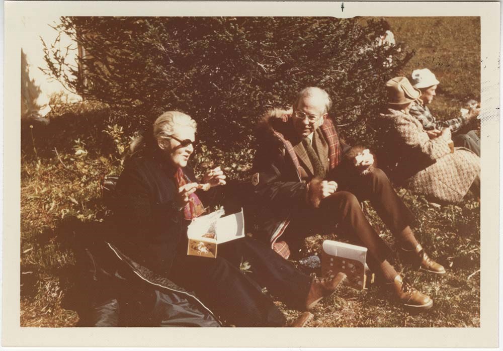
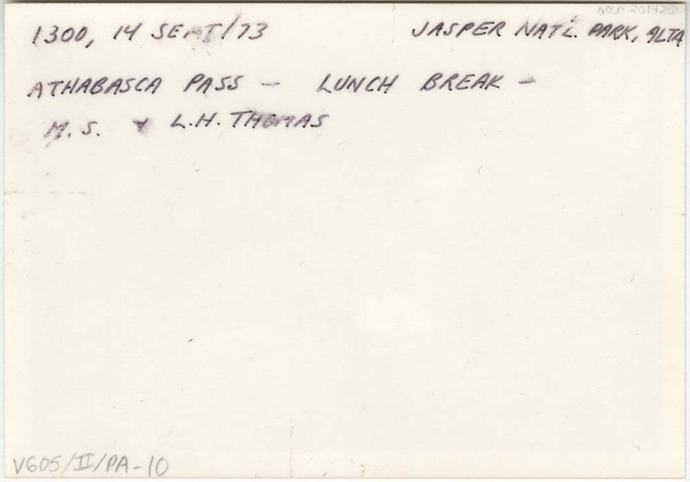
Athabasca Pass trip
https://archives.whyte.org/en/permalink/descriptions55684
- Part Of
- Maryalice Harvey Stewart fonds
- Scope & Content
- File consists of 10 photographs depicting Maryalice Harvey Stewart and friends during a trip to Athabasca Pass in Jasper National Park to celebrate the unveiling of a historic site plaque.
- Date Range
- 1973
- Reference Code
- V605 / II / PA - 1 to 10
- Description Level
- 5 / File
- GMD
- Photograph
2 images
- Part Of
- Maryalice Harvey Stewart fonds
- Description Level
- 5 / File
- Fonds Number
- M9
- S13
- V605
- Series
- V605 / II: Personal records
- Sous-Fonds
- V605
- Accession Number
- 2014.8310
- Reference Code
- V605 / II / PA - 1 to 10
- GMD
- Photograph
- Date Range
- 1973
- Physical Description
- 11 photographs : col. prints ; 12.5 x 9 cm and 9 x 9 cm
- Scope & Content
- File consists of 10 photographs depicting Maryalice Harvey Stewart and friends during a trip to Athabasca Pass in Jasper National Park to celebrate the unveiling of a historic site plaque.
- Name Access
- Stewart, Maryalice Harvey
- Subject Access
- Family and personal life
- Travel
- History
- National parks and reserves
- Events
- Geographic Access
- Canada
- Alberta
- Jasper National Park
- Athabasca
- Language
- English
- Conservation
- Items stored in mylar
- Title Source
- Title based on contents of file
- Processing Status
- Processed
Images
This material is presented as originally created; it may contain outdated cultural descriptions and
potentially offensive content.
Read more.
Banff National Park (general)
https://archives.whyte.org/en/permalink/descriptions55338
- Part Of
- Murray Hay fonds
- Scope & Content
- File consists of 4 prings : col. 35.1 x 24.8 cm or smaller and 4 maps (2 paper, 2 overlays) : col., on mylar ; 60.4 x 30. cm or smaller. File pertains to aerial views of Banff National Park, showing the towns of Banff and Lake Louise, ski hills (Norqay Ski Hill, Sunshine Village, and Lake Louise Sk…
- Date Range
- ca.1976-ca.2000
- Reference Code
- V795 / II / B / v / 1-2
- Description Level
- 5 / File
- GMD
- Map
- Private record
- Part Of
- Murray Hay fonds
- Description Level
- 5 / File
- Fonds Number
- M570 / V795
- Series
- V795 / II : Unpublished Material
- Sous-Fonds
- V795
- Sub-Series
- V795 / II / B : Alberta / v : Banff National Park
- Accession Number
- 2019.41
- Reference Code
- V795 / II / B / v / 1-2
- GMD
- Map
- Private record
- Date Range
- ca.1976-ca.2000
- Physical Description
- 4 prints : col. 35.1 x 24.8 cm or smaller
- 4 maps (2 paper, 2 overlays) : col., annotations, on mylar ; 60.4 x 30. cm or smaller
- Scope & Content
- File consists of 4 prings : col. 35.1 x 24.8 cm or smaller and 4 maps (2 paper, 2 overlays) : col., on mylar ; 60.4 x 30. cm or smaller. File pertains to aerial views of Banff National Park, showing the towns of Banff and Lake Louise, ski hills (Norqay Ski Hill, Sunshine Village, and Lake Louise Ski Resort), as well as other georgraphic features. The mylar overlays contain various amounts of detail and annotations - one consists of a dark red sheet overlayed with place names in negative.
- Notes
- Items not in oversize stored in downstairs vault.
- Name Access
- Hay, Murray
- Subject Access
- Advertising
- Artist
- Ski Maps
- Map
- Cartography
- Sports and recreation
- Tourism
- Tourist information
- Winter
- Winter sports
- Ski area
- Sunshine Village
- Norquay Ski Hill
- Lake Louise Ski Area
- Geographic Access
- Banff
- Lake Louise
- Banff National Park
- Alberta
- Canada
- Canadian Rocky Mountains
- Language
- English
- Creator
- Hay, Murray
- Title Source
- Title based on contents of file
- Processing Status
- Processed
This material is presented as originally created; it may contain outdated cultural descriptions and
potentially offensive content.
Read more.
Bow Valley area, mountain ranges and views
https://archives.whyte.org/en/permalink/descriptions55530
- Part Of
- Luxton family fonds
- Scope & Content
- File consists of 34 photographs depicting views of the Bow Valley and surrounding areas, and Quebec. Depicted locations include Chinaman's Peak (now Ha Ling), End Mountain, Fairholme Range, Mount McDougall, Mount Chester, Mount Galatea, Fisher Range in Kananaskis, Mount Lougheed and Mount Sparrowha…
- Date Range
- 1938-1939
- Reference Code
- LUX / III / D / PA - 171 to 204
- Description Level
- 5 / File
- GMD
- Photograph
- Part Of
- Luxton family fonds
- Description Level
- 5 / File
- Fonds Number
- LUX
- Series
- LUX / III / D : Other material
- Sous-Fonds
- LUX / III : Luxton family sous-fonds
- Accession Number
- LUX
- Reference Code
- LUX / III / D / PA - 171 to 204
- GMD
- Photograph
- Date Range
- 1938-1939
- Physical Description
- 34 photographs : b&w prints ; 11 x 7 cm
- Scope & Content
- File consists of 34 photographs depicting views of the Bow Valley and surrounding areas, and Quebec. Depicted locations include Chinaman's Peak (now Ha Ling), End Mountain, Fairholme Range, Mount McDougall, Mount Chester, Mount Galatea, Fisher Range in Kananaskis, Mount Lougheed and Mount Sparrowhawk in Alberta; and the Laurentian Mountains and St Adele (Quebec).
- Notes
- Some photographs are individually captioned with locations, dates and other related information
- Subject Access
- Exploration
- Travel
- Mountains
- Landscapes
- Environment
- Hiking
- Recreation
- Summit
- Geographic Access
- Canada
- Alberta
- Bow Valley
- Kananaskis
- Quebec
- Reproduction Restrictions
- Copyright status unknown
- Language
- English
- Conservation
- Items stored in mylar
- Title Source
- Title based on contents of file
- Processing Status
- Processed
This material is presented as originally created; it may contain outdated cultural descriptions and
potentially offensive content.
Read more.
Community events, friends
https://archives.whyte.org/en/permalink/descriptions55539
- Part Of
- Luxton family fonds
- Scope & Content
- File consists of photographs pertaining to travel photos, family and group portraits, and other events involving friends of the Luxton family. Includes images of unidentified individuals in Egypt, standing by a large glacier in the Rockies, visiting Stanford University, and feeding birds in Paris[?…
- Date Range
- [ca.1900-1960]
- Reference Code
- LUX / III / D / PA - 205 to 231
- Description Level
- 5 / File
- GMD
- Photograph
- Part Of
- Luxton family fonds
- Description Level
- 5 / File
- Fonds Number
- LUX
- Series
- LUX / III / D : Collected material
- Sous-Fonds
- LUX / III : Luxton family sous-fonds
- Accession Number
- LUX
- Reference Code
- LUX / III / D / PA - 205 to 231
- GMD
- Photograph
- Date Range
- [ca.1900-1960]
- Physical Description
- 27 photographs : b&w and col. prints ; 13.5 x 19.5 cm or smaller
- Scope & Content
- File consists of photographs pertaining to travel photos, family and group portraits, and other events involving friends of the Luxton family. Includes images of unidentified individuals in Egypt, standing by a large glacier in the Rockies, visiting Stanford University, and feeding birds in Paris[?]; group portraits of unidentified children; a pack train fording the Pipestone River; and related views.
- Subject Access
- Family and personal life
- Travel
- Tourism
- Children
- Public events
- Community life
- Horses
- Hiking
- Recreation
- Portrait
- Christmas
- Landscapes
- Glaciers
- Geographic Access
- Canada
- Alberta
- Pipestone River
- Canadian Rocky Mountains
- Egypt
- Europe
- United States of America
- California
- Reproduction Restrictions
- Restrictions may apply
- Title Source
- Title based on contents of file
- Processing Status
- Processed
This material is presented as originally created; it may contain outdated cultural descriptions and
potentially offensive content.
Read more.
Friends, travel
https://archives.whyte.org/en/permalink/descriptions56319
- Part Of
- Ben Gadd fonds
- Scope & Content
- File consists of photographs taken or collected by Ben Gadd between 1983 and ca.1990. Images pertain to unnamed friends at Maligne Canyon; and views of Wisconsin, South Dakota and other regions of the United States.
- Date Range
- 1983
- [1985-1990]
- Reference Code
- V810 / I / D / PA - 1 to 12
- Description Level
- 5 / File
- GMD
- Photograph
- Part Of
- Ben Gadd fonds
- Description Level
- 5 / File
- Fonds Number
- M590
- V810
- S61
- Series
- V810 / I : Personal records
- Sous-Fonds
- V810
- Sub-Series
- V810 / I / D : Other personal and collected
- Accession Number
- 2021.20
- Reference Code
- V810 / I / D / PA - 1 to 12
- GMD
- Photograph
- Date Range
- 1983
- [1985-1990]
- Physical Description
- 12 photographs : col. prints ; 10 x 15 cm or smaller
- Scope & Content
- File consists of photographs taken or collected by Ben Gadd between 1983 and ca.1990. Images pertain to unnamed friends at Maligne Canyon; and views of Wisconsin, South Dakota and other regions of the United States.
- Notes
- Some photographs in file are annotated on back
- Name Access
- Gadd, Ben
- Subject Access
- Travel
- Tourism
- Hiking
- Recreation
- Environment
- Family and personal life
- Geographic Access
- Canada
- Alberta
- Maligne Canyon
- United States of America
- Wisconsin
- South Dakota
- Language
- English
- Category
- Family and personal life
- Environment
- Sports, recreation and leisure
- Exploration, discovery and travel
- Title Source
- Title based on contents of file
- Processing Status
- Processed
This material is presented as originally created; it may contain outdated cultural descriptions and
potentially offensive content.
Read more.
Geology photos for geological views
https://archives.whyte.org/en/permalink/descriptions55990
- Part Of
- Ben Gadd fonds
- Scope & Content
- File consists of printed photographs compiled by Ben Gadd pertaining to his book, Handbook of the Canadian Rockies. Images depict mountain views; bighorn sheep posing on steep rock; and highway views, possibly including Icefields Parkway.
- Date Range
- [ca.1990-1995]
- Reference Code
- V810 / II / A / PA - 40 to 138
- Description Level
- 5 / File
- GMD
- Photograph
- Part Of
- Ben Gadd fonds
- Description Level
- 5 / File
- Fonds Number
- M590
- V810
- S61
- Series
- V810 / II : Research and publication records
- Sous-Fonds
- V810
- Sub-Series
- V810 / II / B : Handbook of the Canadian Rockies
- Accession Number
- 2021.20
- Reference Code
- V810 / II / A / PA - 40 to 138
- GMD
- Photograph
- Responsibility
- Produced by Ben Gadd
- Date Range
- [ca.1990-1995]
- Physical Description
- 99 photographs : col. prints ; 15 x 10 cm
- Scope & Content
- File consists of printed photographs compiled by Ben Gadd pertaining to his book, Handbook of the Canadian Rockies. Images depict mountain views; bighorn sheep posing on steep rock; and highway views, possibly including Icefields Parkway.
- Material Details
- Photographs were originally stored in Tekarra Color Lab envelope
- Subject Access
- Publication
- Landscapes
- Travel
- Roads
- Wildlife
- Bighorn Sheep
- Mountains
- Geology
- Environment
- Natural history
- Geographic Access
- Canada
- Alberta
- Columbia Icefield
- Jasper National Park
- Canadian Rocky Mountains
- Reproduction Restrictions
- Restrictions may apply
- Language
- English
- Title Source
- Original title used
- Processing Status
- Processed
This material is presented as originally created; it may contain outdated cultural descriptions and
potentially offensive content.
Read more.
Lake Louise Area
https://archives.whyte.org/en/permalink/descriptions54925
- Part Of
- Murray Hay fonds
- Scope & Content
- File consists of 6 prints : col. ; 25.5 x 20 cm or smaller. File pertains to Murray Hay's renderings of the Lake Louise ski area. File includes six reproduced draft prints of original paintings of the Lake Louise ski area created by Murray Hay (different iterations).
- Date Range
- ca.1976-ca.2000
- Reference Code
- V795 / II / B / ii / 1
- Description Level
- 5 / File
- GMD
- Map
- Private record
- Part Of
- Murray Hay fonds
- Description Level
- 5 / File
- Fonds Number
- M570 / V795
- Series
- V795 / I : Unpublished Material
- Sous-Fonds
- V795
- Sub-Series
- V795 / I / B : Alberta / ii : Lake Louise
- Accession Number
- 2019.41
- Reference Code
- V795 / II / B / ii / 1
- GMD
- Map
- Private record
- Date Range
- ca.1976-ca.2000
- Physical Description
- 6 prints : col. ; 25.5 x 20 cm or smaller
- Scope & Content
- File consists of 6 prints : col. ; 25.5 x 20 cm or smaller. File pertains to Murray Hay's renderings of the Lake Louise ski area. File includes six reproduced draft prints of original paintings of the Lake Louise ski area created by Murray Hay (different iterations).
- Name Access
- Hay, Murray
- Subject Access
- Advertising
- Artist
- Ski Maps
- Map
- Cartography
- Sports and recreation
- Tourism
- Tourist information
- Winter
- Winter sports
- Ski area
- Lake Louise Ski Area
- Geographic Access
- Lake Louise
- Alberta
- Canada
- Canadian Rocky Mountains
- Language
- English
- Related Material
- M570 / III / B / ii / 1-2
- Creator
- Hay, Murray
- Title Source
- Title based on contents of file
- Processing Status
- Processed
This material is presented as originally created; it may contain outdated cultural descriptions and
potentially offensive content.
Read more.
- Part Of
- Murray Hay fonds
- Scope & Content
- File consists of 2 prints : col. ; 35 x 28 cm. File pertains to Murray Hay's rendering of Marmot Basin ski area in Jasper National Park. File includes two iterations of reproduction draft prints of Hay's map of Marmot Basin.
- Date Range
- ca.1976-ca.2000
- Reference Code
- V795 / II / B / i / 1
- Description Level
- 5 / File
- GMD
- Map
- Private record
- Part Of
- Murray Hay fonds
- Description Level
- 5 / File
- Fonds Number
- M570 / V795
- Series
- V795 / II : Unpublished Material
- Sous-Fonds
- V795
- Sub-Series
- V795 / II / B : Alberta / i : Jasper National Park
- Accession Number
- 2019.41
- Reference Code
- V795 / II / B / i / 1
- GMD
- Map
- Private record
- Date Range
- ca.1976-ca.2000
- Physical Description
- 2 prints : col. ; 35 x 28 cm
- Scope & Content
- File consists of 2 prints : col. ; 35 x 28 cm. File pertains to Murray Hay's rendering of Marmot Basin ski area in Jasper National Park. File includes two iterations of reproduction draft prints of Hay's map of Marmot Basin.
- Name Access
- Hay, Murray
- Subject Access
- Advertising
- Artist
- Ski Maps
- Ski area
- Map
- Cartography
- Sports and recreation
- Tourism
- Tourist information
- Winter
- Winter sports
- Geographic Access
- Jasper Marmot Basin
- Jasper National Park
- Alberta
- Canada
- Canadian Rocky Mountains
- Language
- English
- Related Material
- M570 / III / B / iii / 1
- Creator
- Hay, Murray
- Title Source
- Title based on contents of file
- Processing Status
- Processed
This material is presented as originally created; it may contain outdated cultural descriptions and
potentially offensive content.
Read more.
Personal Interest Files
https://archives.whyte.org/en/permalink/descriptions55796
- Part Of
- Ben Gadd fonds
- Scope & Content
- Sub-series consists of textual records and photographs collected by Ben Gadd. Content pertains to various research subjects, current events and other topics of interest, including: environmental science; wildlife; sports and recreation; Parks Canada; clubs, charities and organizations; natural hist…
- Date Range
- [ca.1980-2015]
- Reference Code
- M590 / I / C
- V810 / I / C
- Description Level
- 4 / Sub-series
- GMD
- Textual record
- Photograph
- Digital image
- Part Of
- Ben Gadd fonds
- Description Level
- 4 / Sub-series
- Fonds Number
- M590
- V810
- Series
- Series I : Personal records
- Sous-Fonds
- M590
- V810
- Sub-Series
- Subseries C : Personal Interest Files
- Accession Number
- 2021.20
- Reference Code
- M590 / I / C
- V810 / I / C
- Date Range
- [ca.1980-2015]
- Physical Description
- ca.180 cm of textual records -- 5 CDs with digital image files -- 1 floppy disk -- ca.122 photograph prints : b&w and col. -- 2 negatives : b&w ; 6 x 7.5 cm -- 26 film strips : col. negatives ; 35 mm
- Scope & Content
- Sub-series consists of textual records and photographs collected by Ben Gadd. Content pertains to various research subjects, current events and other topics of interest, including: environmental science; wildlife; sports and recreation; Parks Canada; clubs, charities and organizations; natural history; and conservation.
- Notes
- Subjects are arranged alphabetically by title. Original titles and arrangement of materials by Ben Gadd has been preserved. See file-level descriptions for content details.
- Name Access
- Gadd, Ben
- Subject Access
- Animals
- Buildings
- Buildings and facilities
- Businesses
- Boats
- Climbing
- Columbia Icefield
- Community events
- Community life
- Conservation
- Dams
- Environment
- Events
- Forestry
- Fishing
- Flowers
- Government
- Geography
- Geology
- Hiking
- History
- Ice climbing
- Land, settlement and immigration
- Landscapes
- Laws and legislation
- Membership
- Mining
- Mountaineering
- Municipal views
- Natural history
- Natural resources
- Parks Canada
- Politics and government
- Property
- Provincial parks and reserves
- Recreation
- Rivers
- Science and technology
- Settlement
- Skiing
- Snakes, Insects
- Sports
- Tourism
- Townsite development
- Trails
- Transportation
- Travel
- Wildlife
- Geographic Access
- Canada
- Alberta
- British Columbia
- United States of America
- Rocky Mountains
- Canadian Rocky Mountains
- Reproduction Restrictions
- Restrictions may apply
- Language
- English
- Category
- Commerce and industry
- Environment
- Exploration, discovery and travel
- Government
- Land, settlement and immigration
- Law and justice
- Natural resources
- Politics
- Science and technology
- Sports, recreation and leisure
- Transportation
- Title Source
- Original title used
- Processing Status
- Processed
This material is presented as originally created; it may contain outdated cultural descriptions and
potentially offensive content.
Read more.
Sunshine Village
https://archives.whyte.org/en/permalink/descriptions54991
- Part Of
- Murray Hay fonds
- Scope & Content
- File consists of 9 prints : b&w and col. ; 35 x 28 cm or smaller, 2 maps (1 base, 4 overlays) : col., annotations, on mylar ; 26 x 35 cm and 23.5 x 31.5 cm, and 1 painting : landscape ; 46 x 43 cm. File pertains to ski trail maps and landscape maps/prints of Sunshine ski area created by Murray Hay.…
- Date Range
- ca.1980-ca.1999
- Reference Code
- V795 / II / B / vi / 1-3
- Description Level
- 5 / File
- GMD
- Map
- Painting
- Private record
- Part Of
- Murray Hay fonds
- Description Level
- 5 / File
- Fonds Number
- M570 / V795
- Series
- V795 / II : Unpublished Material
- Sous-Fonds
- V795
- Sub-Series
- V795 / II / B : Alberta / vi : Sunshine Village Ski Resort
- Accession Number
- 2019.41
- Reference Code
- V795 / II / B / vi / 1-3
- Date Range
- ca.1980-ca.1999
- Physical Description
- 9 prints : b&w and col. ; 35 x 28 cm or smaller
- 2 maps (1 base, 4 overlays) : col., annotations, on mylar ; 26 x 35 cm and 23.5 x 31.5 cm
- 1 painting : landscape ; 46 x 43 cm
- Scope & Content
- File consists of 9 prints : b&w and col. ; 35 x 28 cm or smaller, 2 maps (1 base, 4 overlays) : col., annotations, on mylar ; 26 x 35 cm and 23.5 x 31.5 cm, and 1 painting : landscape ; 46 x 43 cm. File pertains to ski trail maps and landscape maps/prints of Sunshine ski area created by Murray Hay. File includes 9 reproduced draft prints (various iterations), 2 reproduced maps with overlays held together with masking tape, and 1 original painting/drawing (unfinished).
- Name Access
- Hay, Murray
- Subject Access
- Advertising
- Artist
- Ski Maps
- Ski area
- Map
- Cartography
- Sports and recreation
- Tourism
- Tourist information
- Winter
- Winter sports
- Sunshine area
- Sunshine Village
- Sunshine Ski Resort
- Geographic Access
- Sunshine
- Alberta
- Canada
- Canadian Rocky Mountains
- Banff National Park
- Language
- English
- Related Material
- M570 / III / B / i / 1-2
- Creator
- Hay, Murray
- Title Source
- Title based on contents of file
- Processing Status
- Processed
This material is presented as originally created; it may contain outdated cultural descriptions and
potentially offensive content.
Read more.