Narrow Results By
Bennett Trips 1931 to 1936
https://archives.whyte.org/en/permalink/descriptions23415
- Part Of
- Bert Riggall fonds
- Scope & Content
- File consists of 22 b&w photographs, some captioned. Photographs pertain to the Bennett trips guided and outfitted by Riggall of 1931, 1933, 1934, 1935, and 1936. The photographs document packtrains, camp life, hiking, Herbst glacier, and fishing. Locations of photographs include: Wall Lake, Mount …
- Date Range
- 1931
- 1933-1936
- Reference Code
- V26 / II / A4 / PA - 130 to 152
- Description Level
- 5 / File
- GMD
- Photograph
- Photograph print
- Part Of
- Bert Riggall fonds
- Description Level
- 5 / File
- Fonds Number
- M376 / V26
- Series
- II.Business and Financial: Client Papers and Photographs
- Sous-Fonds
- V26
- Accession Number
- 7201
- Reference Code
- V26 / II / A4 / PA - 130 to 152
- Date Range
- 1931
- 1933-1936
- Physical Description
- Photographs: 22 b&w prints
- Scope & Content
- File consists of 22 b&w photographs, some captioned. Photographs pertain to the Bennett trips guided and outfitted by Riggall of 1931, 1933, 1934, 1935, and 1936. The photographs document packtrains, camp life, hiking, Herbst glacier, and fishing. Locations of photographs include: Wall Lake, Mount Festubert, Great Divide at South Kootenay Pass.
- Subject Access
- Guiding, Camping, Packtrains
- Hiking
- Camping
- Recreation
- Sports
- Fishing
- Geographic Access
- Canada
- Canadian Rocky Mountains
- British Columbia
- Kootenay National Park
- Great Divide
- Language
- N/A
- Title Source
- Title based on contents of file
- Processing Status
- Processed
This material is presented as originally created; it may contain outdated cultural descriptions and
potentially offensive content.
Read more.
- Part Of
- Malcolm Geddes fonds
- Scope & Content
- File consists of two lantern slide photographs of western and eastern Canadian national parks maps.
- Date Range
- [ca.1925]
- Reference Code
- V756 / III / A / PS - 231 and 232
- Description Level
- 5 / File
- GMD
- Photograph
- Lantern slide
- Map
- Part Of
- Malcolm Geddes fonds
- Description Level
- 5 / File
- Fonds Number
- M39
- V756
- Series
- V756 / III : Personal and family records
- Sous-Fonds
- V756
- Sub-Series
- V756 / III / A : Travel and mountain expeditions
- Accession Number
- 6504
- Reference Code
- V756 / III / A / PS - 231 and 232
- Date Range
- [ca.1925]
- Physical Description
- 2 photographs : lantern slides
- Scope & Content
- File consists of two lantern slide photographs of western and eastern Canadian national parks maps.
- Material Details
- Lantern slides are hand-coloured
- Subject Access
- Map
- Geography
- National parks and reserves
- Travel
- Geographic Access
- Canada
- Access Restrictions
- Fragile - restrictions may apply
- Language
- N/A
- Category
- Exploration, discovery and travel
- Title Source
- Title based on contents of file
- Processing Status
- Processed
This material is presented as originally created; it may contain outdated cultural descriptions and
potentially offensive content.
Read more.
Canadian scenes
https://archives.whyte.org/en/permalink/descriptions14787
- Part Of
- Malcolm Geddes fonds
- Scope & Content
- File consists of 20 lantern slide photographs depicting scenes in Victoria, Vancouver and vicinity in British Columbia; Edmonton, Calgary and vicinity in Alberta; Regina and other regions in Saskatchewan; Winnipeg in Manitoba; and shipping activity on the Great Lakes.
- Date Range
- [ca.1925]
- Reference Code
- V756 / III / A / PS - 312 to 331
- Description Level
- 5 / File
- GMD
- Photograph
- Lantern slide
- Part Of
- Malcolm Geddes fonds
- Description Level
- 5 / File
- Fonds Number
- M39
- V756
- Series
- V756 / III : Personal and family records
- Sous-Fonds
- V756
- Sub-Series
- V756 / III / A : Travel and mountain expeditions
- Accession Number
- 6504
- Reference Code
- V756 / III / A / PS - 312 to 331
- Responsibility
- Most images in file issued by Department of the Interior Natural Resources Intelligence Branch
- Date Range
- [ca.1925]
- Physical Description
- 20 photographs : lantern slides
- Scope & Content
- File consists of 20 lantern slide photographs depicting scenes in Victoria, Vancouver and vicinity in British Columbia; Edmonton, Calgary and vicinity in Alberta; Regina and other regions in Saskatchewan; Winnipeg in Manitoba; and shipping activity on the Great Lakes.
- Notes
- Most items in file are captioned
- Material Details
- Items in file are hand-coloured
- Subject Access
- Scenery
- Ship
- Transportation
- Travel
- Communities
- Geographic Access
- Canada
- British Columbia
- Vancouver
- Victoria
- Alberta
- Edmonton
- Calgary
- Saskatchewan
- Regina
- Manitoba
- Winnipeg
- Great Lakes
- Access Restrictions
- Fragile- restrictions may apply
- Language
- English
- Title Source
- Title based on contents of file
- Processing Status
- Processed
This material is presented as originally created; it may contain outdated cultural descriptions and
potentially offensive content.
Read more.
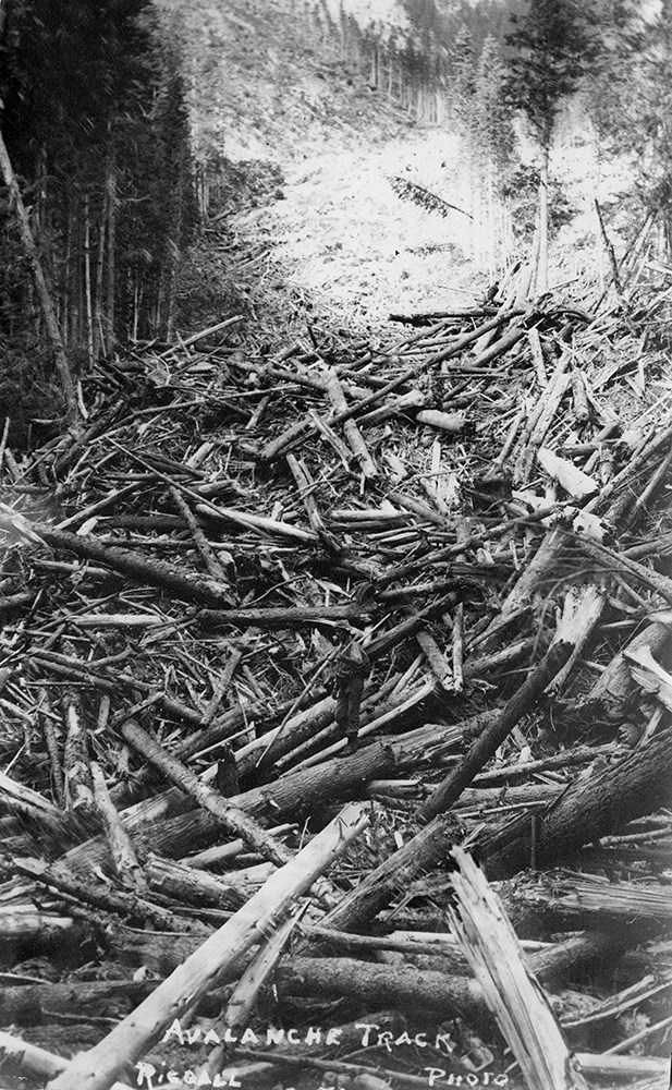
Bert Riggall's 1000 Mile Pack trip
https://archives.whyte.org/en/permalink/descriptions23454
- Part Of
- Bert Riggall fonds
- Scope & Content
- File consists of 43 b&w photographs, some captioned. Photographs pertain to Riggall's 1911 1000 mile pack trip undertaken to seek out areas for hunting and outfitting following the enlargement of Waterton National Park and the reduction of available hunting area for Riggall's clients. The prints do…
- Date Range
- 1911
- Reference Code
- V26 / II / A7 / PA - 119 to 161
- Description Level
- 5 / File
- GMD
- Photograph
- Photograph print
1 image
- Part Of
- Bert Riggall fonds
- Description Level
- 5 / File
- Fonds Number
- M376 / V26
- Series
- II.Business and Financial: Bert Riggall's 1000 Mile Pack trip, 1911
- Sous-Fonds
- V26
- Accession Number
- 7201
- Reference Code
- V26 / II / A7 / PA - 119 to 161
- Date Range
- 1911
- Physical Description
- 43 photographs: b&w prints
- Scope & Content
- File consists of 43 b&w photographs, some captioned. Photographs pertain to Riggall's 1911 1000 mile pack trip undertaken to seek out areas for hunting and outfitting following the enlargement of Waterton National Park and the reduction of available hunting area for Riggall's clients. The prints document this pack trip from stops in Banff, AB and Cranbrook, BC, and the extent of his mountain exploration from Fort Steele to Edson. On this trip, approximately 150 miles of new trail was cut including portions of Roger's Pass.
- Subject Access
- Pack trips
- Exploration
- Trails
- Trail making
- Recreation
- Hunting
- Outfitters, trail guides and packers
- Geographic Access
- Canada
- Alberta
- Banff National Park
- Waterton National Park
- British Columbia
- Cranbrook
- Rogers Pass
- Language
- English
- Title Source
- Title based on contents of file
- Processing Status
- Processed
Images

This material is presented as originally created; it may contain outdated cultural descriptions and
potentially offensive content.
Read more.
Bert Riggall's 1000 Mile Pack trip
https://archives.whyte.org/en/permalink/descriptions23455
- Part Of
- Bert Riggall fonds
- Scope & Content
- File consists of 20 b&w photographs, some captioned. Photographs pertain to Riggall's 1911 1000 mile pack trip undertaken to seek out areas for hunting and outfitting following the enlargement of Waterton National Park and the reduction of available hunting area for Riggall's clients. The prints do…
- Date Range
- 1911
- Reference Code
- V26 / II / A7 / PA - 162 to 181
- Description Level
- 5 / File
- GMD
- Photograph
- Photograph print
1 image
- Part Of
- Bert Riggall fonds
- Description Level
- 5 / File
- Fonds Number
- M376 / V26
- Series
- II.Business and Financial: Bert Riggall's 1000 Mile Pack trip, 1911
- Sous-Fonds
- V26
- Accession Number
- 7201
- Reference Code
- V26 / II / A7 / PA - 162 to 181
- Date Range
- 1911
- Physical Description
- Photographs: 20 prints, b&w
- Scope & Content
- File consists of 20 b&w photographs, some captioned. Photographs pertain to Riggall's 1911 1000 mile pack trip undertaken to seek out areas for hunting and outfitting following the enlargement of Waterton National Park and the reduction of available hunting area for Riggall's clients. The prints document this pack trip from stops in Banff, AB and Cranbrook, BC, and the extent of his mountain exploration from Fort Steele to Edson. On this trip, approximately 150 miles of new trail was cut including portions of Roger's Pass.
- Subject Access
- Pack trips
- Exploration
- Trails
- Trail making
- Recreation
- Hunting
- Outfitters, trail guides and packers
- Geographic Access
- Canada
- Alberta
- Banff National Park
- Waterton National Park
- British Columbia
- Cranbrook
- Rogers Pass
- Language
- English
- Title Source
- Title based on contents of file
- Processing Status
- Processed
Images
This material is presented as originally created; it may contain outdated cultural descriptions and
potentially offensive content.
Read more.
Canada and United States travel photographs
https://archives.whyte.org/en/permalink/descriptions55306
- Part Of
- Luxton family fonds
- Scope & Content
- File consists of 70 personal and family photograph prints. Content pertains to trips to the Okanagan region in British Columbia, Jasper, New Hampshire, and Banff; and views of the Luxton family property [206 Beaver St.]
- Date Range
- 1964 - 1965
- 1970
- Reference Code
- LUX / II / E / PA - 703 to 772
- Description Level
- 5 / File
- GMD
- Photograph
- Photograph print
- Part Of
- Luxton family fonds
- Description Level
- 5 / File
- Fonds Number
- LUX
- Series
- LUX / II / E : Travel and home records
- Sous-Fonds
- LUX / II : Eleanor Luxton sous-fonds
- Accession Number
- LUX
- Reference Code
- LUX / II / E / PA - 703 to 772
- Date Range
- 1964 - 1965
- 1970
- Physical Description
- 70 photographs : b&w prints ; 9 x 9 cm
- Scope & Content
- File consists of 70 personal and family photograph prints. Content pertains to trips to the Okanagan region in British Columbia, Jasper, New Hampshire, and Banff; and views of the Luxton family property [206 Beaver St.]
- Subject Access
- Family and personal life
- Travel
- Tourism
- Landscapes
- Mountains
- Geographic Access
- Canada
- Alberta
- Banff
- Jasper National Park
- Banff National Park
- British Columbia
- Okanagan
- United States of America
- New Hampshire
- Language
- English
- Conservation
- Items stored in file
- Title Source
- Title based on contents of file
- Processing Status
- Processed
This material is presented as originally created; it may contain outdated cultural descriptions and
potentially offensive content.
Read more.
Buildings and businesses, Banff area
https://archives.whyte.org/en/permalink/descriptions55330
- Part Of
- Luxton family fonds
- Scope & Content
- File consists of 34 photographs pertaining to businesses and other properties in and around Banff. Photographs depict individuals swimming at the Cave and Basin; a boathouse near the Bow River; several hotels, including Banff Springs Hotel, Chateau Lake Louise and the Mount Royal Hotel; Fairholme R…
- Date Range
- 1901
- [1910-1950]
- Reference Code
- LUX / III / D / PA - 1 to 34
- Description Level
- 5 / File
- GMD
- Photograph
- Photograph print
- Part Of
- Luxton family fonds
- Description Level
- 5 / File
- Fonds Number
- LUX
- Series
- LUX / III / D : Other material
- Sous-Fonds
- LUX / III : Luxton family sous-fonds
- Accession Number
- LUX
- Reference Code
- LUX / III / D / PA - 1 to 34
- Date Range
- 1901
- [1910-1950]
- Physical Description
- 34 photographs : b&w prints ; 25 x 20 cm or smaller
- Scope & Content
- File consists of 34 photographs pertaining to businesses and other properties in and around Banff. Photographs depict individuals swimming at the Cave and Basin; a boathouse near the Bow River; several hotels, including Banff Springs Hotel, Chateau Lake Louise and the Mount Royal Hotel; Fairholme Ranch; and other related views.
- Notes
- Some photographs are annotated
- Subject Access
- Businesses
- Hotels
- Animals
- Banff National Park
- Banff Upper Hot Springs
- Bow River Boat House
- Boats
- Buildings
- Cave and Basin
- Chateau Lake Louise
- Fairholme Ranch
- Mount Royal Hotel
- Postcards
- Ranches
- Teahouses
- Tourism
- Travel
- Upper Hot Springs
- Geographic Access
- Canada
- Alberta
- Banff
- Banff National Park
- Lake Louise
- Access Restrictions
- Restrictions may apply
- Reproduction Restrictions
- Copyright restrictions may apply
- Language
- English
- Conservation
- Some items stored in mylar
- Category
- Exploration, discovery and travel
- Title Source
- Title based on contents of file
- Processing Status
- Processed
This material is presented as originally created; it may contain outdated cultural descriptions and
potentially offensive content.
Read more.
Natural views, Banff area
https://archives.whyte.org/en/permalink/descriptions55331
- Part Of
- Luxton family fonds
- Scope & Content
- File consists of 66 b&w photographs and 4 colour photographs pertaining to natural views in and around Banff. Includes views of the town of Banff from Sulphur Mountain; Banff Springs Hotel; Sinclair Canyon; Marble Canyon; Emerald Lake; Mount Rundle and Tunnel Mountain; Banff Buffalo Paddock; a pack…
- Date Range
- [ca.1900-1910]
- 1902-1910
- [1920-1940]
- 1930
- 1950
- 1970
- Reference Code
- LUX / III / D / PA - 35 to 104
- Description Level
- 5 / File
- GMD
- Photograph
- Photograph print
- Part Of
- Luxton family fonds
- Description Level
- 5 / File
- Fonds Number
- LUX
- Series
- LUX / III / D : Other material
- Sous-Fonds
- LUX / III : Luxton family sous-fonds
- Accession Number
- LUX
- Reference Code
- LUX / III / D / PA - 35 to 104
- Date Range
- [ca.1900-1910]
- 1902-1910
- [1920-1940]
- 1930
- 1950
- 1970
- Physical Description
- 70 photographs : b&w and col. prints ; 28 x 18 cm or smaller
- Scope & Content
- File consists of 66 b&w photographs and 4 colour photographs pertaining to natural views in and around Banff. Includes views of the town of Banff from Sulphur Mountain; Banff Springs Hotel; Sinclair Canyon; Marble Canyon; Emerald Lake; Mount Rundle and Tunnel Mountain; Banff Buffalo Paddock; a pack trip; and related views.
- Notes
- Some items are annotated
- Subject Access
- Environment
- Travel
- Mountains
- Landscapes
- Animals
- Buffalo
- Moose
- Elk
- Animal Paddock
- Horses
- Pack trips
- Geographic Access
- Canada
- Alberta
- Banff
- Banff National Park
- Marble Canyon
- Mount Rundle
- Sulphur Mountain
- Tunnel Mountain
- British Columbia
- Sinclair Canyon
- Access Restrictions
- Restrictions may apply
- Reproduction Restrictions
- Restrictions may apply
- Language
- English
- Conservation
- Some items stored in mylar
- Title Source
- Title based on contents of file
- Processing Status
- Processed
This material is presented as originally created; it may contain outdated cultural descriptions and
potentially offensive content.
Read more.
Banff and Fort Calgary, 1956
https://archives.whyte.org/en/permalink/descriptions55503
- Part Of
- Luxton family fonds
- Scope & Content
- File consists of 6 negative photographs depicting views of downtown Banff and Fort Calgary, 1956.
- Date Range
- 1956
- Reference Code
- LUX / II / E / NA - 250 to 255
- Description Level
- 5 / File
- GMD
- Photograph
- Negative
- Part Of
- Luxton family fonds
- Description Level
- 5 / File
- Fonds Number
- LUX
- Series
- LUX / II / E : Travel and home records
- Sous-Fonds
- LUX / II : Eleanor Luxton sous-fonds
- Accession Number
- LUX
- Reference Code
- LUX / II / E / NA - 250 to 255
- GMD
- Photograph
- Negative
- Date Range
- 1956
- Physical Description
- 6 photographs : col. negatives ; 6.5 x 4.5 cm
- Scope & Content
- File consists of 6 negative photographs depicting views of downtown Banff and Fort Calgary, 1956.
- Notes
- Items in file are accompanied by 6 print duplicates
- Subject Access
- Travel
- Tourism
- Family and personal life
- Geographic Access
- Canada
- Alberta
- Banff
- Calgary
- Reproduction Restrictions
- Restrictions may apply
- Language
- N/A
- Title Source
- Title based on contents of file
- Processing Status
- Processed
This material is presented as originally created; it may contain outdated cultural descriptions and
potentially offensive content.
Read more.
Bow Valley area, mountain ranges and views
https://archives.whyte.org/en/permalink/descriptions55530
- Part Of
- Luxton family fonds
- Scope & Content
- File consists of 34 photographs depicting views of the Bow Valley and surrounding areas, and Quebec. Depicted locations include Chinaman's Peak (now Ha Ling), End Mountain, Fairholme Range, Mount McDougall, Mount Chester, Mount Galatea, Fisher Range in Kananaskis, Mount Lougheed and Mount Sparrowha…
- Date Range
- 1938-1939
- Reference Code
- LUX / III / D / PA - 171 to 204
- Description Level
- 5 / File
- GMD
- Photograph
- Part Of
- Luxton family fonds
- Description Level
- 5 / File
- Fonds Number
- LUX
- Series
- LUX / III / D : Other material
- Sous-Fonds
- LUX / III : Luxton family sous-fonds
- Accession Number
- LUX
- Reference Code
- LUX / III / D / PA - 171 to 204
- GMD
- Photograph
- Date Range
- 1938-1939
- Physical Description
- 34 photographs : b&w prints ; 11 x 7 cm
- Scope & Content
- File consists of 34 photographs depicting views of the Bow Valley and surrounding areas, and Quebec. Depicted locations include Chinaman's Peak (now Ha Ling), End Mountain, Fairholme Range, Mount McDougall, Mount Chester, Mount Galatea, Fisher Range in Kananaskis, Mount Lougheed and Mount Sparrowhawk in Alberta; and the Laurentian Mountains and St Adele (Quebec).
- Notes
- Some photographs are individually captioned with locations, dates and other related information
- Subject Access
- Exploration
- Travel
- Mountains
- Landscapes
- Environment
- Hiking
- Recreation
- Summit
- Geographic Access
- Canada
- Alberta
- Bow Valley
- Kananaskis
- Quebec
- Reproduction Restrictions
- Copyright status unknown
- Language
- English
- Conservation
- Items stored in mylar
- Title Source
- Title based on contents of file
- Processing Status
- Processed
This material is presented as originally created; it may contain outdated cultural descriptions and
potentially offensive content.
Read more.