Narrow Results By
Athabasca Pass trip
https://archives.whyte.org/en/permalink/descriptions55684
- Part Of
- Maryalice Harvey Stewart fonds
- Scope & Content
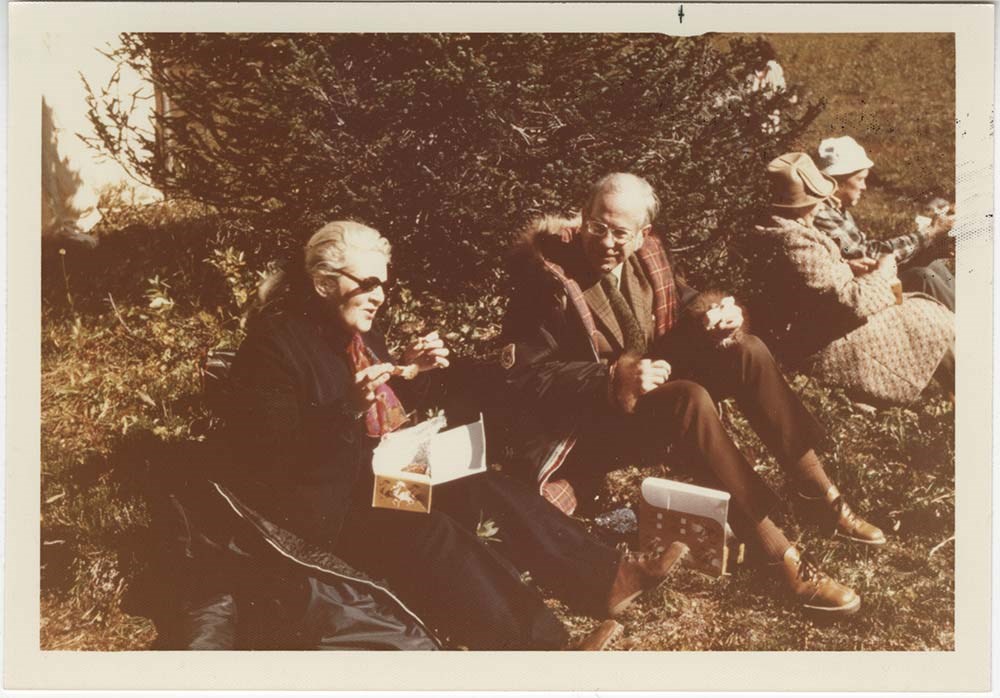
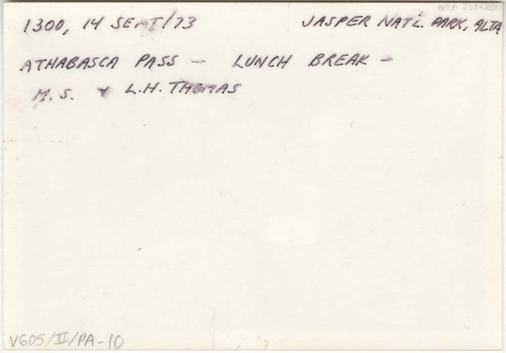
- File consists of 10 photographs depicting Maryalice Harvey Stewart and friends during a trip to Athabasca Pass in Jasper National Park to celebrate the unveiling of a historic site plaque.
- Date Range
- 1973
- Reference Code
- V605 / II / PA - 1 to 10
- Description Level
- 5 / File
- GMD
- Photograph
2 images
- Part Of
- Maryalice Harvey Stewart fonds
- Description Level
- 5 / File
- Fonds Number
- M9
- S13
- V605
- Series
- V605 / II: Personal records
- Sous-Fonds
- V605
- Accession Number
- 2014.8310
- Reference Code
- V605 / II / PA - 1 to 10
- GMD
- Photograph
- Date Range
- 1973
- Physical Description
- 11 photographs : col. prints ; 12.5 x 9 cm and 9 x 9 cm
- Scope & Content
- File consists of 10 photographs depicting Maryalice Harvey Stewart and friends during a trip to Athabasca Pass in Jasper National Park to celebrate the unveiling of a historic site plaque.
- Name Access
- Stewart, Maryalice Harvey
- Subject Access
- Family and personal life
- Travel
- History
- National parks and reserves
- Events
- Geographic Access
- Canada
- Alberta
- Jasper National Park
- Athabasca
- Language
- English
- Conservation
- Items stored in mylar
- Title Source
- Title based on contents of file
- Processing Status
- Processed
Images
This material is presented as originally created; it may contain outdated cultural descriptions and
potentially offensive content.
Read more.
Byron Harmon photograph calendars
https://archives.whyte.org/en/permalink/descriptions54723
- Part Of
- Luxton family fonds
- Scope & Content
- File consists of 5 commercial miniature calendars with photographs [one printed directly onto calendar, 4 attached to backing]. Photographs on calendars are by Byron Harmon [one is not attributed, but likely by Harmon as well], and pertain to: an unnamed Indigenous couple [possibly Stoney Nakoda co…
- Date Range
- 1907
- 1912
- Reference Code
- LUX / II / F1 / 26
- Description Level
- 5 / File
- GMD
- Calendar
- Textual record
- Published record
- Photograph
- Photograph print
- Part Of
- Luxton family fonds
- Description Level
- 5 / File
- Fonds Number
- LUX
- Series
- LUX / II / F : Collected material
- Sous-Fonds
- LUX / II : Eleanor Luxton sous-fonds
- Sub-Series
- LUX / II / F1 : Textual
- Accession Number
- LUX
- Reference Code
- LUX / II / F1 / 26
- Responsibility
- Photographs attributed to Byron Harmon
- Date Range
- 1907
- 1912
- Physical Description
- 5 calendars (17.8 x 36.5 cm or smaller)
- Scope & Content
- File consists of 5 commercial miniature calendars with photographs [one printed directly onto calendar, 4 attached to backing]. Photographs on calendars are by Byron Harmon [one is not attributed, but likely by Harmon as well], and pertain to: an unnamed Indigenous couple [possibly Stoney Nakoda community members], a view of Maligne Lake, an unidentified mountain, 4 ice climbers at the peak of Mt. Habel, and Stoney hunter and Trapper Silas Abraham. Calendar depicting Silas Abraham, 1907, includes printed advertisement for Norman Luxton's trading and taxidermy businesses in Banff and Exshaw.
- Name Access
- Harmon, Byron
- Luxton, Norman
- Subject Access
- Advertising
- Banff National Park
- Landscapes
- Mountain
- Hotel
- Indigenous Peoples
- Businesses
- Trapping
- Tourism
- Taxidermy
- Geographic Access
- Canada
- Alberta
- Banff
- Exshaw
- Jasper National Park
- Maligne Lake
- Mount Habel
- Access Restrictions
- Restrictions may apply
- Language
- English
- Conservation
- Items have been placed in mylar sheets
- Title Source
- Title based on contents of file
- Processing Status
- Processed
This material is presented as originally created; it may contain outdated cultural descriptions and
potentially offensive content.
Read more.
Canada and United States travel photographs
https://archives.whyte.org/en/permalink/descriptions55306
- Part Of
- Luxton family fonds
- Scope & Content
- File consists of 70 personal and family photograph prints. Content pertains to trips to the Okanagan region in British Columbia, Jasper, New Hampshire, and Banff; and views of the Luxton family property [206 Beaver St.]
- Date Range
- 1964 - 1965
- 1970
- Reference Code
- LUX / II / E / PA - 703 to 772
- Description Level
- 5 / File
- GMD
- Photograph
- Photograph print
- Part Of
- Luxton family fonds
- Description Level
- 5 / File
- Fonds Number
- LUX
- Series
- LUX / II / E : Travel and home records
- Sous-Fonds
- LUX / II : Eleanor Luxton sous-fonds
- Accession Number
- LUX
- Reference Code
- LUX / II / E / PA - 703 to 772
- Date Range
- 1964 - 1965
- 1970
- Physical Description
- 70 photographs : b&w prints ; 9 x 9 cm
- Scope & Content
- File consists of 70 personal and family photograph prints. Content pertains to trips to the Okanagan region in British Columbia, Jasper, New Hampshire, and Banff; and views of the Luxton family property [206 Beaver St.]
- Subject Access
- Family and personal life
- Travel
- Tourism
- Landscapes
- Mountains
- Geographic Access
- Canada
- Alberta
- Banff
- Jasper National Park
- Banff National Park
- British Columbia
- Okanagan
- United States of America
- New Hampshire
- Language
- English
- Conservation
- Items stored in file
- Title Source
- Title based on contents of file
- Processing Status
- Processed
This material is presented as originally created; it may contain outdated cultural descriptions and
potentially offensive content.
Read more.
Canadian Rockies
https://archives.whyte.org/en/permalink/descriptions54817
- Part Of
- Murray Hay fonds
- Scope & Content
- File consists of 1 cm of textual records, 10 x 22 cm. File pertains to tourist maps of the Canadian Rocky Mountains created by Murray Hay. File includes a brochure of titled "Canadian Rockies Access Maps" that, when unfolded, includes several maps of the various areas that make up the Canadian Rock…
- Date Range
- ca. 1990 - 1999
- 1999
- Reference Code
- M570 / III / D / i / 2
- Description Level
- 5 / File
- GMD
- Published record
- Map
- Textual record
- Part Of
- Murray Hay fonds
- Description Level
- 5 / File
- Fonds Number
- M570 / V795
- Series
- M570 / III : Murray Hay portfolio (published material)
- Sous-Fonds
- M570
- Sub-Series
- M570 / III / D : Miscellaneous / i : Canada (general)
- Accession Number
- 2019.41
- Reference Code
- M570 / III / D / i / 2
- Date Range
- ca. 1990 - 1999
- 1999
- Physical Description
- 1 cm of textual records (10 x 22 cm)
- Scope & Content
- File consists of 1 cm of textual records, 10 x 22 cm. File pertains to tourist maps of the Canadian Rocky Mountains created by Murray Hay. File includes a brochure of titled "Canadian Rockies Access Maps" that, when unfolded, includes several maps of the various areas that make up the Canadian Rocky Mountains, like Kananaskis Country, Canmore, Banff National Park, Jasper National Park, Yoho National Park, etc.
- Name Access
- Hay, Murray
- Subject Access
- Advertising
- Artist
- Banff
- Banff National Park
- Cartography
- Communications
- Lake Louise
- Kananaskis Country
- Map
- Mountains
- Tourism
- Tourist information
- Travel
- Geographic Access
- Canada
- Canadian Rocky Mountains
- Alberta
- British Columbia
- Yoho National Park
- Jasper National Park
- Banff National Park
- Glacier National Park
- Canmore
- Banff
- Jasper
- Lake Louise
- Kananaskis
- Kananaskis Country
- Kootenay National Park
- Language
- English
- Title Source
- Title based on contents of file
- Processing Status
- Processed
This material is presented as originally created; it may contain outdated cultural descriptions and
potentially offensive content.
Read more.
Geology photos for geological views
https://archives.whyte.org/en/permalink/descriptions55990
- Part Of
- Ben Gadd fonds
- Scope & Content
- File consists of printed photographs compiled by Ben Gadd pertaining to his book, Handbook of the Canadian Rockies. Images depict mountain views; bighorn sheep posing on steep rock; and highway views, possibly including Icefields Parkway.
- Date Range
- [ca.1990-1995]
- Reference Code
- V810 / II / A / PA - 40 to 138
- Description Level
- 5 / File
- GMD
- Photograph
- Part Of
- Ben Gadd fonds
- Description Level
- 5 / File
- Fonds Number
- M590
- V810
- S61
- Series
- V810 / II : Research and publication records
- Sous-Fonds
- V810
- Sub-Series
- V810 / II / B : Handbook of the Canadian Rockies
- Accession Number
- 2021.20
- Reference Code
- V810 / II / A / PA - 40 to 138
- GMD
- Photograph
- Responsibility
- Produced by Ben Gadd
- Date Range
- [ca.1990-1995]
- Physical Description
- 99 photographs : col. prints ; 15 x 10 cm
- Scope & Content
- File consists of printed photographs compiled by Ben Gadd pertaining to his book, Handbook of the Canadian Rockies. Images depict mountain views; bighorn sheep posing on steep rock; and highway views, possibly including Icefields Parkway.
- Material Details
- Photographs were originally stored in Tekarra Color Lab envelope
- Subject Access
- Publication
- Landscapes
- Travel
- Roads
- Wildlife
- Bighorn Sheep
- Mountains
- Geology
- Environment
- Natural history
- Geographic Access
- Canada
- Alberta
- Columbia Icefield
- Jasper National Park
- Canadian Rocky Mountains
- Reproduction Restrictions
- Restrictions may apply
- Language
- English
- Title Source
- Original title used
- Processing Status
- Processed
This material is presented as originally created; it may contain outdated cultural descriptions and
potentially offensive content.
Read more.
Jasper Institute 1994
https://archives.whyte.org/en/permalink/descriptions55997
- Part Of
- Ben Gadd fonds
- Scope & Content
- File consists of three transparency slide photographs sent to Ben Gadd from Dave Thomas. Images pertain to a five-day ecology course near Suplhur Skyline Trail and Geraldine Lakes Trail which Ben led through the Jasper Institute in 1994. Images in file are accompanied by a letter from Dave to Ben, …
- Date Range
- 1994
- Reference Code
- V810 / III / B / NS - 1 to 3
- Description Level
- 5 / File
- GMD
- Photograph
- Transparency
- Part Of
- Ben Gadd fonds
- Description Level
- 5 / File
- Fonds Number
- M590
- V810
- S61
- Series
- V810 / III : Professional records
- Sous-Fonds
- V810
- Sub-Series
- V810 / III / B : Interpretive guiding
- Accession Number
- 2021.20
- Reference Code
- V810 / III / B / NS - 1 to 3
- Responsibility
- Produced by Dave Thomas
- Date Range
- 1994
- Physical Description
- 3 photographs : col. transparency slides ; 35 mm -- 1 textual record
- Scope & Content
- File consists of three transparency slide photographs sent to Ben Gadd from Dave Thomas. Images pertain to a five-day ecology course near Suplhur Skyline Trail and Geraldine Lakes Trail which Ben led through the Jasper Institute in 1994. Images in file are accompanied by a letter from Dave to Ben, thanking him for leading the program.
- Name Access
- Gadd, Ben
- Thomas, Dave
- Subject Access
- Guiding
- Exploration
- Education
- Environment
- Ecology
- Hiking
- Trails
- Recreation
- Geographic Access
- Canada
- Alberta
- Jasper National Park
- Reproduction Restrictions
- Restrictions may apply
- Language
- English
- Title Source
- Title based on contents of file
- Processing Status
- Processed
This material is presented as originally created; it may contain outdated cultural descriptions and
potentially offensive content.
Read more.
Jasper Marmot Basin
https://archives.whyte.org/en/permalink/descriptions54813
- Part Of
- Murray Hay fonds
- Scope & Content
- File consists of 1 cm of textual records, 10 x 23.5 cm or smaller. File pertains to ski trail maps of Jasper Marmot Basin and ski area created by Murray Hay. File includes three brochures promoting the ski runs at Marmot Basin that each include a reproduced map by Hay.
- Date Range
- 2001-2003
- 2001
- 2003
- Reference Code
- M570 / III / B / iii / 1
- Description Level
- 5 / File
- GMD
- Map
- Textual record
- Published record
- Part Of
- Murray Hay fonds
- Description Level
- 5 / File
- Fonds Number
- M570 / V795
- Series
- M570 / III : Murray Hay portfolio (published material)
- Sous-Fonds
- M570
- Sub-Series
- M570 / III / B : Alberta / iii : Jasper
- Accession Number
- 2019.41
- Reference Code
- M570 / III / B / iii / 1
- Date Range
- 2001-2003
- 2001
- 2003
- Physical Description
- 1 cm of textual records (10 x 23.5 cm or smaller)
- Scope & Content
- File consists of 1 cm of textual records, 10 x 23.5 cm or smaller. File pertains to ski trail maps of Jasper Marmot Basin and ski area created by Murray Hay. File includes three brochures promoting the ski runs at Marmot Basin that each include a reproduced map by Hay.
- Name Access
- Hay, Murray
- Subject Access
- Ski Maps
- Skiing
- Ski areas
- Map
- Marmot Basin Ski Area
- Cartography
- Sports and recreation
- Tourism
- Tourist information
- Travel
- Winter
- Winter sports
- Advertising
- Artist
- Geographic Access
- Jasper
- Jasper Marmot Basin
- Jasper National Park
- Alberta
- Canada
- Canadian Rocky Mountains
- Language
- English
- Related Material
- V795 / II / B / i / 1
- Title Source
- Title based on contents of file
- Processing Status
- Processed
This material is presented as originally created; it may contain outdated cultural descriptions and
potentially offensive content.
Read more.
- Part Of
- Murray Hay fonds
- Scope & Content
- File consists of 2 prints : col. ; 35 x 28 cm. File pertains to Murray Hay's rendering of Marmot Basin ski area in Jasper National Park. File includes two iterations of reproduction draft prints of Hay's map of Marmot Basin.
- Date Range
- ca.1976-ca.2000
- Reference Code
- V795 / II / B / i / 1
- Description Level
- 5 / File
- GMD
- Map
- Private record
- Part Of
- Murray Hay fonds
- Description Level
- 5 / File
- Fonds Number
- M570 / V795
- Series
- V795 / II : Unpublished Material
- Sous-Fonds
- V795
- Sub-Series
- V795 / II / B : Alberta / i : Jasper National Park
- Accession Number
- 2019.41
- Reference Code
- V795 / II / B / i / 1
- GMD
- Map
- Private record
- Date Range
- ca.1976-ca.2000
- Physical Description
- 2 prints : col. ; 35 x 28 cm
- Scope & Content
- File consists of 2 prints : col. ; 35 x 28 cm. File pertains to Murray Hay's rendering of Marmot Basin ski area in Jasper National Park. File includes two iterations of reproduction draft prints of Hay's map of Marmot Basin.
- Name Access
- Hay, Murray
- Subject Access
- Advertising
- Artist
- Ski Maps
- Ski area
- Map
- Cartography
- Sports and recreation
- Tourism
- Tourist information
- Winter
- Winter sports
- Geographic Access
- Jasper Marmot Basin
- Jasper National Park
- Alberta
- Canada
- Canadian Rocky Mountains
- Language
- English
- Related Material
- M570 / III / B / iii / 1
- Creator
- Hay, Murray
- Title Source
- Title based on contents of file
- Processing Status
- Processed
This material is presented as originally created; it may contain outdated cultural descriptions and
potentially offensive content.
Read more.
National Parks - Kootenay, Yoho, Glacier, Jasper, Waterton Lakes
https://archives.whyte.org/en/permalink/descriptions55243
- Part Of
- Malcolm Geddes fonds
- Scope & Content
- File consists of 70 lantern slide images pertaining to views from Kootenay, Yoho, Glacier, Jasper and Waterton Lakes National Parks. Specific locations include: Marble Canyon and Sinclair Canyon; Mount Stephen, Lake Oesa, Lake O'Hara, Lake McArthur, Takakkaw Falls, Twin Falls and Yoho Glacier; Ille…
- Date Range
- [ca.1925]
- Reference Code
- V756 / III / A / PS - 161 to 230
- Description Level
- 5 / File
- GMD
- Photograph
- Lantern slide
- Part Of
- Malcolm Geddes fonds
- Description Level
- 5 / File
- Fonds Number
- M39
- V756
- Series
- V756 / III : Personal and family records
- Sous-Fonds
- V756
- Sub-Series
- V756 / III / A : Travel and mountain expeditions
- Accession Number
- 6504
- Reference Code
- V756 / III / A / PS - 161 to 230
- Responsibility
- Some items issued by Department of the Interior Natural Resources Intelligence Branch and by Canadian National Railways
- Date Range
- [ca.1925]
- Physical Description
- 70 photographs : lantern slides
- Scope & Content
- File consists of 70 lantern slide images pertaining to views from Kootenay, Yoho, Glacier, Jasper and Waterton Lakes National Parks. Specific locations include: Marble Canyon and Sinclair Canyon; Mount Stephen, Lake Oesa, Lake O'Hara, Lake McArthur, Takakkaw Falls, Twin Falls and Yoho Glacier; Illecillewaet Glacier and surrounding area; Jasper town and Jasper Park Lodge; Maligne Lake, Maligne Canyon, Mount Edith Cavell and Mount Robson; and Waterton Lake area. Most items are captioned.
- Notes
- Slides are organized by location: V756 / III / A / PS - 161 to 167 : Kootenay V756 / III / A / PS - 168 to 185 : Yoho V756 / III / A / PS - 186 to 194 : Glacier V756 / III / A / PS - 195 to 226 : Jasper V756 / III / A / PS - 227 to 230 : Waterton Lakes
- Subject Access
- Travel
- Exploration
- Mountains
- Landscapes
- Glaciers
- Hotels
- Waterfalls
- National parks and reserves
- Tourism
- Recreation
- Geographic Access
- Canada
- Alberta
- British Columbia
- Canadian Rocky Mountains
- Kootenay National Park
- Yoho National Park
- Glacier National Park
- Jasper National Park
- Jasper
- Waterton Lakes National Park
- Waterton
- Access Restrictions
- Fragile - restrictions may apply
- Language
- English
- Title Source
- Title based on contents of file
- Processing Status
- Processed
This material is presented as originally created; it may contain outdated cultural descriptions and
potentially offensive content.
Read more.
Our National Playground [Glacier National Park and Mount Robson]
https://archives.whyte.org/en/permalink/descriptions55237
- Part Of
- Malcolm Geddes fonds
- Scope & Content
- File consists of 19 b&w photographs pertaining to a trip to Glacier and Jasper National Park. File includes images of Malcolm Geddes hiking inside caves, and an exterior view of Mt. Robson.
- Date Range
- [1900 - 1920]
- Reference Code
- V756 / III / A / PA - 1 to 19
- Description Level
- 5 / File
- GMD
- Photograph
- Photograph print
- Part Of
- Malcolm Geddes fonds
- Description Level
- 5 / File
- Fonds Number
- M39
- V756
- Series
- V756 / III : Personal and family records
- Sous-Fonds
- V756
- Sub-Series
- V756 / III / A : Travel and mountain expeditions
- Accession Number
- 2015.8558
- Reference Code
- V756 / III / A / PA - 1 to 19
- Date Range
- [1900 - 1920]
- Physical Description
- 19 photographs : b&w prints ; 18 x 25 cm
- Scope & Content
- File consists of 19 b&w photographs pertaining to a trip to Glacier and Jasper National Park. File includes images of Malcolm Geddes hiking inside caves, and an exterior view of Mt. Robson.
- Notes
- Some items are annotated on reverse side
- Name Access
- Geddes, Malcolm
- Subject Access
- Sports
- Recreation
- Hiking
- Mountains
- Landscapes
- Travel
- Exploration
- Geographic Access
- Canada
- Alberta
- Glacier National Park
- Jasper National Park
- Mount Robson
- Language
- English
- Related Material
- Photographs were previously stored in folder with typed copy of "Our National Playground"; textual records stored in M39 / I / B.
- Title Source
- Title based on contents of file
- Processing Status
- Processed
This material is presented as originally created; it may contain outdated cultural descriptions and
potentially offensive content.
Read more.