Narrow Results By
Athabasca Pass trip
https://archives.whyte.org/en/permalink/descriptions55684
- Part Of
- Maryalice Harvey Stewart fonds
- Scope & Content
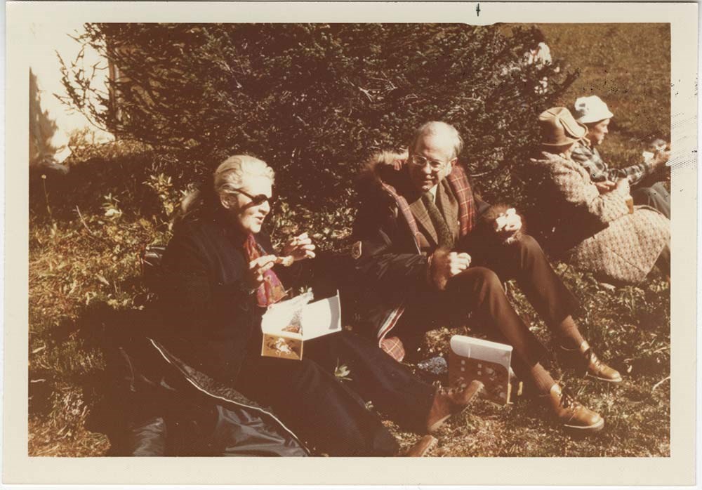
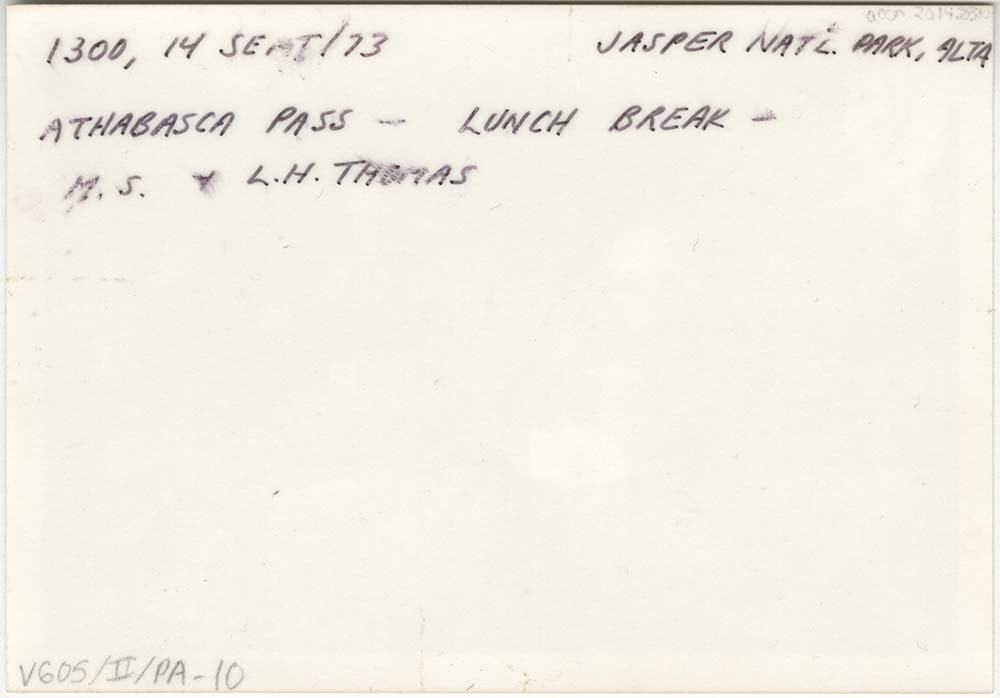
- File consists of 10 photographs depicting Maryalice Harvey Stewart and friends during a trip to Athabasca Pass in Jasper National Park to celebrate the unveiling of a historic site plaque.
- Date Range
- 1973
- Reference Code
- V605 / II / PA - 1 to 10
- Description Level
- 5 / File
- GMD
- Photograph
2 images
- Part Of
- Maryalice Harvey Stewart fonds
- Description Level
- 5 / File
- Fonds Number
- M9
- S13
- V605
- Series
- V605 / II: Personal records
- Sous-Fonds
- V605
- Accession Number
- 2014.8310
- Reference Code
- V605 / II / PA - 1 to 10
- GMD
- Photograph
- Date Range
- 1973
- Physical Description
- 11 photographs : col. prints ; 12.5 x 9 cm and 9 x 9 cm
- Scope & Content
- File consists of 10 photographs depicting Maryalice Harvey Stewart and friends during a trip to Athabasca Pass in Jasper National Park to celebrate the unveiling of a historic site plaque.
- Name Access
- Stewart, Maryalice Harvey
- Subject Access
- Family and personal life
- Travel
- History
- National parks and reserves
- Events
- Geographic Access
- Canada
- Alberta
- Jasper National Park
- Athabasca
- Language
- English
- Conservation
- Items stored in mylar
- Title Source
- Title based on contents of file
- Processing Status
- Processed
Images
This material is presented as originally created; it may contain outdated cultural descriptions and
potentially offensive content.
Read more.
Auyuittuq National Park
https://archives.whyte.org/en/permalink/descriptions54979
- Part Of
- Murray Hay fonds
- Scope & Content
- File consists of 1 painting : landscape ; 50.5 x 39.5 cm. File pertains to a map Murray Hay created of Auyuittuq National Park in Nunavut, Canada. File includes 1 colour painting of the park and surrounding area (Nunavut, Baffin Island) and one sheet of tracing paper that is annotated and taped wit…
- Date Range
- ca.1980-ca.1989
- Reference Code
- V795 / II / C / vi / 1
- Description Level
- 5 / File
- GMD
- Map
- Painting
- Private record
- Part Of
- Murray Hay fonds
- Description Level
- 5 / File
- Fonds Number
- M570 / V795
- Series
- V795 / II : Unpublished Material
- Sous-Fonds
- V795
- Sub-Series
- V795 / II / C : Canada [general] / vi : Auyuittuq National Park
- Accession Number
- 2020.03
- Reference Code
- V795 / II / C / vi / 1
- Date Range
- ca.1980-ca.1989
- Physical Description
- 1 painting : landscape ; 50.5 x 39.5 cm
- Scope & Content
- File consists of 1 painting : landscape ; 50.5 x 39.5 cm. File pertains to a map Murray Hay created of Auyuittuq National Park in Nunavut, Canada. File includes 1 colour painting of the park and surrounding area (Nunavut, Baffin Island) and one sheet of tracing paper that is annotated and taped with masking tape over the painting.
- Name Access
- Hay, Murray
- Subject Access
- Advertising
- Artist
- Map
- Cartography
- Painting
- Geography
- Tourism
- Tourist information
- Travel
- National parks and reserves
- Auyuittuq National Park
- Geographic Access
- Auyuittuq National Park
- Nunavut
- Canada
- Language
- English
- Conservation
- Masking tape should be removed and alternative preservation methods should be considered at a reasonable time to do so.
- Creator
- Hay, Murray
- Title Source
- Title based on contents of file
- Processing Status
- Processed
This material is presented as originally created; it may contain outdated cultural descriptions and
potentially offensive content.
Read more.
Banff National Park and Lake Louise maps
https://archives.whyte.org/en/permalink/descriptions54945
- Scope & Content
- File consists of two folded maps and a small clipping [possibly top or bottom portion from a different map or one of maps in file]. One map is of Banff National Park and one is of Lake Louise [1959]. Banff National Park map has black pencil tracings over trail section near the bottom of the map and…
- Date Range
- 1959
- [1960-1970]
- Reference Code
- M545 / V / 53
- Description Level
- 5 / File
- GMD
- Textual record
- Published record
- Map
- Description Level
- 5 / File
- Fonds Number
- M545 / V635
- Series
- M545 / V : Administrative records
- Sous-Fonds
- M545
- Accession Number
- 8235
- Reference Code
- M545 / V / 53
- Date Range
- 1959
- [1960-1970]
- Physical Description
- 0.5 cm of textual records (2 maps ; 60.5 x 57.5 and 60 x 56.5 cm)
- Scope & Content
- File consists of two folded maps and a small clipping [possibly top or bottom portion from a different map or one of maps in file]. One map is of Banff National Park and one is of Lake Louise [1959]. Banff National Park map has black pencil tracings over trail section near the bottom of the map and annotation in bottom right corner which reads "Natural Bridge". Lake Louise map produced by the Government of Canada.
- Subject Access
- Banff National Park
- Environment
- Geography
- Map
- Lake Louise
- Travel
- Government
- National parks and reserves
- Trails
- Geographic Access
- Canada
- Alberta
- Banff National Park
- Lake Louise
- Language
- English
- Conservation
- Clipping stored in mylar due to significant staining and residue from tape
- Items kept folded [not placed in mylar] due to mass production of content and minimal/no annotations
- Title Source
- Title based on contents of file
- Processing Status
- Processed
This material is presented as originally created; it may contain outdated cultural descriptions and
potentially offensive content.
Read more.
Banff National Park (general)
https://archives.whyte.org/en/permalink/descriptions55338
- Part Of
- Murray Hay fonds
- Scope & Content
- File consists of 4 prings : col. 35.1 x 24.8 cm or smaller and 4 maps (2 paper, 2 overlays) : col., on mylar ; 60.4 x 30. cm or smaller. File pertains to aerial views of Banff National Park, showing the towns of Banff and Lake Louise, ski hills (Norqay Ski Hill, Sunshine Village, and Lake Louise Sk…
- Date Range
- ca.1976-ca.2000
- Reference Code
- V795 / II / B / v / 1-2
- Description Level
- 5 / File
- GMD
- Map
- Private record
- Part Of
- Murray Hay fonds
- Description Level
- 5 / File
- Fonds Number
- M570 / V795
- Series
- V795 / II : Unpublished Material
- Sous-Fonds
- V795
- Sub-Series
- V795 / II / B : Alberta / v : Banff National Park
- Accession Number
- 2019.41
- Reference Code
- V795 / II / B / v / 1-2
- GMD
- Map
- Private record
- Date Range
- ca.1976-ca.2000
- Physical Description
- 4 prints : col. 35.1 x 24.8 cm or smaller
- 4 maps (2 paper, 2 overlays) : col., annotations, on mylar ; 60.4 x 30. cm or smaller
- Scope & Content
- File consists of 4 prings : col. 35.1 x 24.8 cm or smaller and 4 maps (2 paper, 2 overlays) : col., on mylar ; 60.4 x 30. cm or smaller. File pertains to aerial views of Banff National Park, showing the towns of Banff and Lake Louise, ski hills (Norqay Ski Hill, Sunshine Village, and Lake Louise Ski Resort), as well as other georgraphic features. The mylar overlays contain various amounts of detail and annotations - one consists of a dark red sheet overlayed with place names in negative.
- Notes
- Items not in oversize stored in downstairs vault.
- Name Access
- Hay, Murray
- Subject Access
- Advertising
- Artist
- Ski Maps
- Map
- Cartography
- Sports and recreation
- Tourism
- Tourist information
- Winter
- Winter sports
- Ski area
- Sunshine Village
- Norquay Ski Hill
- Lake Louise Ski Area
- Geographic Access
- Banff
- Lake Louise
- Banff National Park
- Alberta
- Canada
- Canadian Rocky Mountains
- Language
- English
- Creator
- Hay, Murray
- Title Source
- Title based on contents of file
- Processing Status
- Processed
This material is presented as originally created; it may contain outdated cultural descriptions and
potentially offensive content.
Read more.
Big White Ski Village
https://archives.whyte.org/en/permalink/descriptions54801
- Part Of
- Murray Hay fonds
- Scope & Content
- File consists of 0.5 cm of textual records, 90 x 60.5 cm. File pertains to ski trail maps of Big White Ski Village and Area created by Murray Hay. File includes one oversized published reproduction of a Big White trail map in poster format.
- Date Range
- ca.1980 - ca.2000
- Reference Code
- M570 / III / A / v / 1
- Description Level
- 5 / File
- GMD
- Map
- Poster
- Published record
- Textual record
- Part Of
- Murray Hay fonds
- Description Level
- 5 / File
- Fonds Number
- M570 / V795
- Series
- M570 / III : Murray Hay portfolio (published material)
- Sous-Fonds
- M570
- Sub-Series
- M570 / III / A : British Columbia / v : Big White
- Accession Number
- 2019.41
- Reference Code
- M570 / III / A / v / 1
- Date Range
- ca.1980 - ca.2000
- Physical Description
- 0.5 cm of textual records (90 x 60.5 cm)
- Scope & Content
- File consists of 0.5 cm of textual records, 90 x 60.5 cm. File pertains to ski trail maps of Big White Ski Village and Area created by Murray Hay. File includes one oversized published reproduction of a Big White trail map in poster format.
- Name Access
- Hay, Murray
- Subject Access
- Ski Maps
- Map
- Ski area
- Skiing
- Tourism
- Travel
- Winter
- Winter sports
- Sports and recreation
- Big White Ski Area
- Tourist information
- Artist
- Advertising
- Geographic Access
- Kelowna
- British Columbia
- Canada
- Language
- English
- Related Material
- V795 / II / A / iv / 5
- Title Source
- Title based on contents of file
- Processing Status
- Processed
This material is presented as originally created; it may contain outdated cultural descriptions and
potentially offensive content.
Read more.
Bow Valley area, mountain ranges and views
https://archives.whyte.org/en/permalink/descriptions55530
- Part Of
- Luxton family fonds
- Scope & Content
- File consists of 34 photographs depicting views of the Bow Valley and surrounding areas, and Quebec. Depicted locations include Chinaman's Peak (now Ha Ling), End Mountain, Fairholme Range, Mount McDougall, Mount Chester, Mount Galatea, Fisher Range in Kananaskis, Mount Lougheed and Mount Sparrowha…
- Date Range
- 1938-1939
- Reference Code
- LUX / III / D / PA - 171 to 204
- Description Level
- 5 / File
- GMD
- Photograph
- Part Of
- Luxton family fonds
- Description Level
- 5 / File
- Fonds Number
- LUX
- Series
- LUX / III / D : Other material
- Sous-Fonds
- LUX / III : Luxton family sous-fonds
- Accession Number
- LUX
- Reference Code
- LUX / III / D / PA - 171 to 204
- GMD
- Photograph
- Date Range
- 1938-1939
- Physical Description
- 34 photographs : b&w prints ; 11 x 7 cm
- Scope & Content
- File consists of 34 photographs depicting views of the Bow Valley and surrounding areas, and Quebec. Depicted locations include Chinaman's Peak (now Ha Ling), End Mountain, Fairholme Range, Mount McDougall, Mount Chester, Mount Galatea, Fisher Range in Kananaskis, Mount Lougheed and Mount Sparrowhawk in Alberta; and the Laurentian Mountains and St Adele (Quebec).
- Notes
- Some photographs are individually captioned with locations, dates and other related information
- Subject Access
- Exploration
- Travel
- Mountains
- Landscapes
- Environment
- Hiking
- Recreation
- Summit
- Geographic Access
- Canada
- Alberta
- Bow Valley
- Kananaskis
- Quebec
- Reproduction Restrictions
- Copyright status unknown
- Language
- English
- Conservation
- Items stored in mylar
- Title Source
- Title based on contents of file
- Processing Status
- Processed
This material is presented as originally created; it may contain outdated cultural descriptions and
potentially offensive content.
Read more.
Canadian Rockies
https://archives.whyte.org/en/permalink/descriptions54817
- Part Of
- Murray Hay fonds
- Scope & Content
- File consists of 1 cm of textual records, 10 x 22 cm. File pertains to tourist maps of the Canadian Rocky Mountains created by Murray Hay. File includes a brochure of titled "Canadian Rockies Access Maps" that, when unfolded, includes several maps of the various areas that make up the Canadian Rock…
- Date Range
- ca. 1990 - 1999
- 1999
- Reference Code
- M570 / III / D / i / 2
- Description Level
- 5 / File
- GMD
- Published record
- Map
- Textual record
- Part Of
- Murray Hay fonds
- Description Level
- 5 / File
- Fonds Number
- M570 / V795
- Series
- M570 / III : Murray Hay portfolio (published material)
- Sous-Fonds
- M570
- Sub-Series
- M570 / III / D : Miscellaneous / i : Canada (general)
- Accession Number
- 2019.41
- Reference Code
- M570 / III / D / i / 2
- Date Range
- ca. 1990 - 1999
- 1999
- Physical Description
- 1 cm of textual records (10 x 22 cm)
- Scope & Content
- File consists of 1 cm of textual records, 10 x 22 cm. File pertains to tourist maps of the Canadian Rocky Mountains created by Murray Hay. File includes a brochure of titled "Canadian Rockies Access Maps" that, when unfolded, includes several maps of the various areas that make up the Canadian Rocky Mountains, like Kananaskis Country, Canmore, Banff National Park, Jasper National Park, Yoho National Park, etc.
- Name Access
- Hay, Murray
- Subject Access
- Advertising
- Artist
- Banff
- Banff National Park
- Cartography
- Communications
- Lake Louise
- Kananaskis Country
- Map
- Mountains
- Tourism
- Tourist information
- Travel
- Geographic Access
- Canada
- Canadian Rocky Mountains
- Alberta
- British Columbia
- Yoho National Park
- Jasper National Park
- Banff National Park
- Glacier National Park
- Canmore
- Banff
- Jasper
- Lake Louise
- Kananaskis
- Kananaskis Country
- Kootenay National Park
- Language
- English
- Title Source
- Title based on contents of file
- Processing Status
- Processed
This material is presented as originally created; it may contain outdated cultural descriptions and
potentially offensive content.
Read more.
Cariboo Monashee Heli-Skiing
https://archives.whyte.org/en/permalink/descriptions54812
- Part Of
- Murray Hay fonds
- Scope & Content
- File consists of 1 cm of textual records, 28 x 21.5 cm. File pertains to maps related to the ski areas utilized by Helicopter Skiing Canada in Cariboo Monashee Country, created by Murray Hay. File includes reproductions of the maps in an individual promotional map with information on the back and a…
- Date Range
- ca. 1978 - ca. 1979
- Reference Code
- M570 / III / A / vii / 1
- Description Level
- 5 / File
- GMD
- Map
- Published record
- Textual record
- Part Of
- Murray Hay fonds
- Description Level
- 5 / File
- Fonds Number
- M570 / V795
- Series
- M570 / III : Murray Hay portfolio (published material)
- Sous-Fonds
- M570
- Sub-Series
- M570 / III / A : British Columbia / vii : Cariboo Monashee
- Accession Number
- 2019.41
- Reference Code
- M570 / III / A / vii / 1
- Date Range
- ca. 1978 - ca. 1979
- Physical Description
- 1 cm of textual records (28 x 21.5 cm)
- Scope & Content
- File consists of 1 cm of textual records, 28 x 21.5 cm. File pertains to maps related to the ski areas utilized by Helicopter Skiing Canada in Cariboo Monashee Country, created by Murray Hay. File includes reproductions of the maps in an individual promotional map with information on the back and a bound brochure (which also includes the map) promoting helicopter skiing.
- Notes
- Dates are approximate based on the ages of the daughter of Mike Wiegele (owner of Cariboo Monashee Helicopter Skiing Canada), who was born in 1970 and is aged 8 in the photographs included in the booklet.
- Name Access
- Hay, Murray
- Subject Access
- Ski Maps
- Skiing
- Ski touring
- Ski areas
- Helicopter skiing
- Cartography
- Tourism
- Tourist information
- Sports and recreation
- Travel
- Winter
- Winter sports
- Advertising
- Artist
- Geographic Access
- British Columbia
- Canada
- Monashee Mountains
- Cariboo Mountains
- Language
- English
- Title Source
- Title based on contents of file
- Processing Status
- Processed
This material is presented as originally created; it may contain outdated cultural descriptions and
potentially offensive content.
Read more.
Charlevoix Region
https://archives.whyte.org/en/permalink/descriptions54969
- Part Of
- Murray Hay fonds
- Scope & Content
- File consists of 1 print : col. ; 35.5 x 28 cm. File pertains to Murray Hay's work on Charlevoix, Quebec. FIle includes one print, labelled "Charlevoix Region - Quebec," that depicts the landscape of the region.
- Date Range
- ca. 1976 - ca. 2000
- Reference Code
- V795 / II / C / iii / 1
- Description Level
- 5 / File
- GMD
- Map
- Private record
- Part Of
- Murray Hay fonds
- Description Level
- 5 / File
- Fonds Number
- M570 / V795
- Series
- V795 / II : Unpublished Material
- Sous-Fonds
- V795
- Sub-Series
- V795 / II / C : Canada [general] / iii : Quebec
- Accession Number
- 2019.41
- Reference Code
- V795 / II / C / iii / 1
- GMD
- Map
- Private record
- Date Range
- ca. 1976 - ca. 2000
- Physical Description
- 1 print : col. ; 35.5 x 28 cm
- Scope & Content
- File consists of 1 print : col. ; 35.5 x 28 cm. File pertains to Murray Hay's work on Charlevoix, Quebec. FIle includes one print, labelled "Charlevoix Region - Quebec," that depicts the landscape of the region.
- Name Access
- Hay, Murray
- Subject Access
- Advertising
- Artist
- Map
- Cartography
- Tourism
- Landscapes
- Geography
- Geographic Access
- Quebec
- Canada
- Language
- English
- Creator
- Hay, Murray
- Title Source
- Title based on contents of file
- Processing Status
- Processed
This material is presented as originally created; it may contain outdated cultural descriptions and
potentially offensive content.
Read more.
Community events, friends
https://archives.whyte.org/en/permalink/descriptions55539
- Part Of
- Luxton family fonds
- Scope & Content
- File consists of photographs pertaining to travel photos, family and group portraits, and other events involving friends of the Luxton family. Includes images of unidentified individuals in Egypt, standing by a large glacier in the Rockies, visiting Stanford University, and feeding birds in Paris[?…
- Date Range
- [ca.1900-1960]
- Reference Code
- LUX / III / D / PA - 205 to 231
- Description Level
- 5 / File
- GMD
- Photograph
- Part Of
- Luxton family fonds
- Description Level
- 5 / File
- Fonds Number
- LUX
- Series
- LUX / III / D : Collected material
- Sous-Fonds
- LUX / III : Luxton family sous-fonds
- Accession Number
- LUX
- Reference Code
- LUX / III / D / PA - 205 to 231
- GMD
- Photograph
- Date Range
- [ca.1900-1960]
- Physical Description
- 27 photographs : b&w and col. prints ; 13.5 x 19.5 cm or smaller
- Scope & Content
- File consists of photographs pertaining to travel photos, family and group portraits, and other events involving friends of the Luxton family. Includes images of unidentified individuals in Egypt, standing by a large glacier in the Rockies, visiting Stanford University, and feeding birds in Paris[?]; group portraits of unidentified children; a pack train fording the Pipestone River; and related views.
- Subject Access
- Family and personal life
- Travel
- Tourism
- Children
- Public events
- Community life
- Horses
- Hiking
- Recreation
- Portrait
- Christmas
- Landscapes
- Glaciers
- Geographic Access
- Canada
- Alberta
- Pipestone River
- Canadian Rocky Mountains
- Egypt
- Europe
- United States of America
- California
- Reproduction Restrictions
- Restrictions may apply
- Title Source
- Title based on contents of file
- Processing Status
- Processed
This material is presented as originally created; it may contain outdated cultural descriptions and
potentially offensive content.
Read more.