Narrow Results By
Antique Maps of India and Germany, Walter Wilcox Mounts
https://archives.whyte.org/en/permalink/descriptions54204
- Part Of
- Nicholas Morant fonds
- Scope & Content
- File consists of 13 antique maps, 6 of which depict regions in India and 7 which depict regions in Germany. Content pertains to a small map collection originally issued to Tim Ffrench (?) during WWII which were later owned by Nicholas Morant. Some maps of reserves contain personal annotations and h…
- Date Range
- 1868
- 1892
- 1894
- 1903
- 1904
- 1917
- 1921
- 1950
- Reference Code
- M300 / III / D / 5 / 54 to 66 O.S. & V500 / III / D / 5 / PA - 96 O.S.
- Description Level
- 5 / File
- GMD
- Map
- Textual record
- Part Of
- Nicholas Morant fonds
- Description Level
- 5 / File
- Fonds Number
- V500
- Sous-Fonds
- V500
- Sub-Series
- M300 & V500 / III / D / 5 : Personal Interest and Gifts
- Accession Number
- 7784
- Reference Code
- M300 / III / D / 5 / 54 to 66 O.S. & V500 / III / D / 5 / PA - 96 O.S.
- GMD
- Map
- Textual record
- Other Title Info
- Parallel title is original title
- Responsibility
- Nicholas Morant
- Date Range
- 1868
- 1892
- 1894
- 1903
- 1904
- 1917
- 1921
- 1950
- Physical Description
- 13 Maps: print; b&w, and set of 4 rag paper mounts
- Scope & Content
- File consists of 13 antique maps, 6 of which depict regions in India and 7 which depict regions in Germany. Content pertains to a small map collection originally issued to Tim Ffrench (?) during WWII which were later owned by Nicholas Morant. Some maps of reserves contain personal annotations and highlighted/coloured routes; none of German maps are annotated. File also contains set of 4 rag paper mounts, annotated. 3 naming artist Walter Wilcox (likely formerly held his works but are now blank). One labelled 'Model'.
- Notes
- Maps were originally stored together in one poster tube labelled: "MAPS OF GERMANY INDIA See notes inside" Shipping label: PLS HOLD Armand To Nicholas Morant 222 Melville Ave Westmount Montreal" (with two 3 - cent stamps attached) Note inside, written by Nicholas Morant: "These maps were among those issued to Capt. Tim Ffrench (?) preparatory to intelligence work done during W. War II" Signed "Nick M." Wilcox mounts were stored in brown paper packaging with several other blank mounts (disposed of). Labelled section of original paper packaging has been stored with mounts in oversize box for reference.
- Geographic Access
- Germany
- India
- Access Restrictions
- Items in this file are not to be accessed or distributed without the explicit permission of their identified owners
- Reproduction Restrictions
- Items in this file are not to be reproduced without the explicit permission of their identified owners.
- Language
- English
- German
- Conservation
- Items must be kept only with items of similar materials, and stored with protective acid-free barriers to prevent further damage.
- Title Source
- Title based on contents of file
- Processing Status
- Processed
This material is presented as originally created; it may contain outdated cultural descriptions and
potentially offensive content.
Read more.
Maps of Banff and Western Canada
https://archives.whyte.org/en/permalink/descriptions54772
- Part Of
- Luxton family fonds
- Scope & Content
- File consists of 9 printed maps, b&w and col. [including zoning and topographical maps] depicting the Town of Banff and Banff National Park, the Rocky Mountains Forest Reserve, the Moose Mountain region, Medicine Hat, and the province of Alberta. File includes Trail Riders' Map of the Canadian Rock…
- Date Range
- 1912
- 1914
- 1924
- 1926
- 1932
- 1957
- [1970-1980]
- Reference Code
- LUX / II / C5 / 25
- Description Level
- 5 / File
- GMD
- Textual record
- Published record
- Map
- Part Of
- Luxton family fonds
- Description Level
- 5 / File
- Fonds Number
- LUX
- Series
- LUX / II / C : Personal
- Sous-Fonds
- LUX / II : Eleanor Luxton sous-fonds
- Sub-Series
- LUX / II / C5 : Other
- Accession Number
- LUX
- Reference Code
- LUX / II / C5 / 25
- Date Range
- 1912
- 1914
- 1924
- 1926
- 1932
- 1957
- [1970-1980]
- Physical Description
- 9 maps : b&w and col. ; 168 x 71 cm or smaller
- Scope & Content
- File consists of 9 printed maps, b&w and col. [including zoning and topographical maps] depicting the Town of Banff and Banff National Park, the Rocky Mountains Forest Reserve, the Moose Mountain region, Medicine Hat, and the province of Alberta. File includes Trail Riders' Map of the Canadian Rockies which has smaller maps of Waterton Lakes, Glacier, Revelstoke, and other national parks printed on the back. Map of Medicine Hat includes annotated storage envelope with dimensions written on the front.
- Subject Access
- Cartography
- Geography
- Land use
- Government
- Travel
- National parks and reserves
- Geographic Access
- Canada
- Alberta
- Banff
- Banff National Park
- Medicine Hat
- Rocky Mountains
- Glacier National Park
- Revelstoke
- Waterton Lakes National Park
- Reproduction Restrictions
- Restrictions may apply
- Language
- English
- Title Source
- Title based on contents of file
- Processing Status
- Processed
This material is presented as originally created; it may contain outdated cultural descriptions and
potentially offensive content.
Read more.
Map, Indian Tribes of North America
https://archives.whyte.org/en/permalink/descriptions54800
- Part Of
- Luxton family fonds
- Scope & Content
- File consists of one b&w printed paper copy of a map titled "Indian Tribes of North America" [n.d., creator unknown].
- Date Range
- [1950-1970]
- Reference Code
- LUX / II / F1 / 56
- Description Level
- 5 / File
- GMD
- Map
- Textual record
- Published record
- Part Of
- Luxton family fonds
- Description Level
- 5 / File
- Fonds Number
- LUX
- Series
- LUX / II / F : Collected material
- Sous-Fonds
- LUX / II : Eleanor Luxton sous-fonds
- Sub-Series
- LUX / II / F1 : Textual
- Accession Number
- LUX
- Reference Code
- LUX / II / F1 / 56
- Date Range
- [1950-1970]
- Physical Description
- 0.1 cm of textual records (map : b&w ; 48 x 53.5 cm)
- Scope & Content
- File consists of one b&w printed paper copy of a map titled "Indian Tribes of North America" [n.d., creator unknown].
- Notes
- Date range is estimate provided by Processing Archivist
- Subject Access
- Geography
- Indigenous Peoples
- Land, settlement and immigration
- Geographic Access
- Canada
- United States of America
- Reproduction Restrictions
- Restrictions may apply
- Language
- English
- Title Source
- Title taken from item in file
- Processing Status
- Processed
This material is presented as originally created; it may contain outdated cultural descriptions and
potentially offensive content.
Read more.
- Part Of
- Stocken family fonds
- Scope & Content
- File pertains to a scrapbook of newsclippings pertaining to literary, religious, and Stocken family matters.
- Date Range
- 1894-1955
- Reference Code
- M11 / 3
- Description Level
- 5 / File
- GMD
- Scrapbook
1 image
1 Electronic Resource
- Part Of
- Stocken family fonds
- Description Level
- 5 / File
- Fonds Number
- M11 / V606
- Sous-Fonds
- M11
- Accession Number
- 9
- Reference Code
- M11 / 3
- GMD
- Scrapbook
- Date Range
- 1894-1955
- Physical Description
- 4 cm of textual records (83 pages ; 22.5 x 30.5 cm)
- History / Biographical
- See fonds level description.
- Scope & Content
- File pertains to a scrapbook of newsclippings pertaining to literary, religious, and Stocken family matters.
- Subject Access
- Banff
- Biographical
- Businesses
- Community events
- Community life
- Education
- Family
- Family and personal life
- Genealogy
- Geography
- History
- Municipal views
- Newspaper
- Obituary
- Religions
- Songs
- Geographic Access
- Banff
- Canmore
- Calgary
- Alberta
- Canada
- Banff National Park
- Language
- English
- Conservation
- Re-house with paper.
- Title Source
- Title based on contents of file
- Processing Status
- Processed
Electronic Resources
Images
This material is presented as originally created; it may contain outdated cultural descriptions and
potentially offensive content.
Read more.
Published regional and trail maps
https://archives.whyte.org/en/permalink/descriptions54847
- Scope & Content
- File consists of maps depicting the Banff townsite and nearby travel routes. Includes a trail map for Banff, Yoho and Kootenay National Parks; a road map for Banff and nearby areas [1965]; a numbered townsite map of Banff marking local hotels and attractions; and a photocopied map of a trail route …
- Date Range
- [1950-1970]
- 1965
- Reference Code
- M545 / III / 29
- Description Level
- 5 / File
- GMD
- Textual record
- Published record
- Map
- Description Level
- 5 / File
- Fonds Number
- M545 / V635
- Series
- M545 / III : Published records
- Sous-Fonds
- M545
- Accession Number
- 5939
- Reference Code
- M545 / III / 29
- Date Range
- [1950-1970]
- 1965
- Physical Description
- 0.5 cm of textual records (4 maps ; 35.5 x 21.5 cm or smaller)
- Scope & Content
- File consists of maps depicting the Banff townsite and nearby travel routes. Includes a trail map for Banff, Yoho and Kootenay National Parks; a road map for Banff and nearby areas [1965]; a numbered townsite map of Banff marking local hotels and attractions; and a photocopied map of a trail route used by the Trail Riders of the Canadian Rockies [n.d.]
- Notes
- Banff townsite map has annotation marking the location of the Trail Ride Office on Caribou St.
- Subject Access
- Travel
- Trails
- Map
- Land, settlement and immigration
- Geography
- Geographic Access
- Canada
- Alberta
- Banff
- Banff National Park
- Yoho National Park
- Kootenay National Park
- Reproduction Restrictions
- Restrictions may apply
- Language
- English
- Title Source
- Title based on contents of file
- Processing Status
- Processed
This material is presented as originally created; it may contain outdated cultural descriptions and
potentially offensive content.
Read more.
Banff National Park and Lake Louise maps
https://archives.whyte.org/en/permalink/descriptions54945
- Scope & Content
- File consists of two folded maps and a small clipping [possibly top or bottom portion from a different map or one of maps in file]. One map is of Banff National Park and one is of Lake Louise [1959]. Banff National Park map has black pencil tracings over trail section near the bottom of the map and…
- Date Range
- 1959
- [1960-1970]
- Reference Code
- M545 / V / 53
- Description Level
- 5 / File
- GMD
- Textual record
- Published record
- Map
- Description Level
- 5 / File
- Fonds Number
- M545 / V635
- Series
- M545 / V : Administrative records
- Sous-Fonds
- M545
- Accession Number
- 8235
- Reference Code
- M545 / V / 53
- Date Range
- 1959
- [1960-1970]
- Physical Description
- 0.5 cm of textual records (2 maps ; 60.5 x 57.5 and 60 x 56.5 cm)
- Scope & Content
- File consists of two folded maps and a small clipping [possibly top or bottom portion from a different map or one of maps in file]. One map is of Banff National Park and one is of Lake Louise [1959]. Banff National Park map has black pencil tracings over trail section near the bottom of the map and annotation in bottom right corner which reads "Natural Bridge". Lake Louise map produced by the Government of Canada.
- Subject Access
- Banff National Park
- Environment
- Geography
- Map
- Lake Louise
- Travel
- Government
- National parks and reserves
- Trails
- Geographic Access
- Canada
- Alberta
- Banff National Park
- Lake Louise
- Language
- English
- Conservation
- Clipping stored in mylar due to significant staining and residue from tape
- Items kept folded [not placed in mylar] due to mass production of content and minimal/no annotations
- Title Source
- Title based on contents of file
- Processing Status
- Processed
This material is presented as originally created; it may contain outdated cultural descriptions and
potentially offensive content.
Read more.
Canadian history and tourism publications
https://archives.whyte.org/en/permalink/descriptions55109
- Part Of
- Luxton family fonds
- Scope & Content
- File consists of published materials pertaining to topics of Canadian, provincial and regional history, related statistical information, and national politics; information booklets and guides for Banff National Park, Alberta, Victoria, B.C., and other regions within Canada; and other Canadian trave…
- Date Range
- 1902-1905
- 1919
- 1928
- 1930-1931
- 1934
- 1940-1941
- 1948
- 1951
- 1955-1957
- 1960
- 1963
- 1979
- 1988
- Reference Code
- LUX / II / F1 / 63 to 64
- Description Level
- 5 / File
- GMD
- Textual record
- Published record
- Part Of
- Luxton family fonds
- Description Level
- 5 / File
- Fonds Number
- LUX
- Series
- LUX / II / F : Collected material
- Sous-Fonds
- LUX / II : Eleanor Luxton sous-fonds
- Sub-Series
- LUX / II / F1 : Textual
- Accession Number
- LUX
- Reference Code
- LUX / II / F1 / 63 to 64
- Date Range
- 1902-1905
- 1919
- 1928
- 1930-1931
- 1934
- 1940-1941
- 1948
- 1951
- 1955-1957
- 1960
- 1963
- 1979
- 1988
- Physical Description
- 4.5 cm of textual records
- Scope & Content
- File consists of published materials pertaining to topics of Canadian, provincial and regional history, related statistical information, and national politics; information booklets and guides for Banff National Park, Alberta, Victoria, B.C., and other regions within Canada; and other Canadian travel and promotional material.
- Notes
- Some items are annotated
- Subject Access
- Advertising
- Travel
- Tourism
- Transportation
- History
- Geography
- Geographic Access
- Canada
- Alberta
- Banff
- Banff National Park
- British Columbia
- Victoria
- Saskatchewan
- Language
- English
- Category
- Commerce and industry
- Exploration, discovery and travel
- Government
- Natural resources
- Politics
- Sports, recreation and leisure
- Transportation
- Title Source
- Title based on contents of file
- Content Details
- File stored in two folders arranged by subject: LUX / II / F1 / 63 : Canadian history and research material LUX / II / F1 / 64 : Canadian tourism publications
- Processing Status
- Processed
This material is presented as originally created; it may contain outdated cultural descriptions and
potentially offensive content.
Read more.
The Selkirk Range Text and Maps
https://archives.whyte.org/en/permalink/descriptions54163
- Part Of
- Nicholas Morant fonds
- Scope & Content
- File consists of 2 volumes, 1 textual and 1 cartographic, from 'The Selkirk Range British Columbia'. Volume 1 pertains to a textual account of the Selkirk region; volume 2 pertains to a collection of various topographical maps of the Selkirk region. Volume 1 is signed by Emmeline Wheeler.
- Date Range
- 1951
- Reference Code
- M300 / III / D / 5 / 52 to 53
- Description Level
- 5 / File
- GMD
- Textual record
- Private record
- Map
- Part Of
- Nicholas Morant fonds
- Description Level
- 5 / File
- Fonds Number
- M300 / S20 / V500
- Sous-Fonds
- M300
- Sub-Series
- M300 / III / D / 5 : Personal Interest and Gifts
- Accession Number
- 7784
- Reference Code
- M300 / III / D / 5 / 52 to 53
- Responsibility
- Produced by A.O. Wheeler
- Date Range
- 1951
- Physical Description
- Textual record: book & Cartographic records: maps
- Scope & Content
- File consists of 2 volumes, 1 textual and 1 cartographic, from 'The Selkirk Range British Columbia'. Volume 1 pertains to a textual account of the Selkirk region; volume 2 pertains to a collection of various topographical maps of the Selkirk region. Volume 1 is signed by Emmeline Wheeler.
- Storage Range
- In file box M300 / III / D / 5 / 52 to M300 / III / D / 5 / 53.
- Name Access
- Wheeler, A.O.
- Geographic Access
- Canada
- Canadian Rocky Mountains
- Selkirks
- Access Restrictions
- Items in this file are not to be accessed or distributed without the explicit permission of their identified copyright owners.
- Reproduction Restrictions
- Items in this file are not to be reproduced without the explicit permission of their identified copyright owners.
- Language
- English
- Creator
- A.O. Wheeler
- Title Source
- Title based on contents of file
- Processing Status
- Processed
This material is presented as originally created; it may contain outdated cultural descriptions and
potentially offensive content.
Read more.
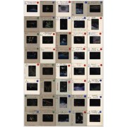
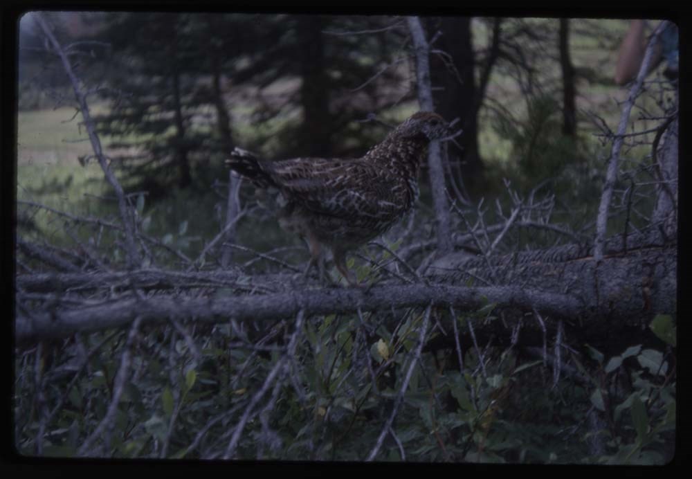
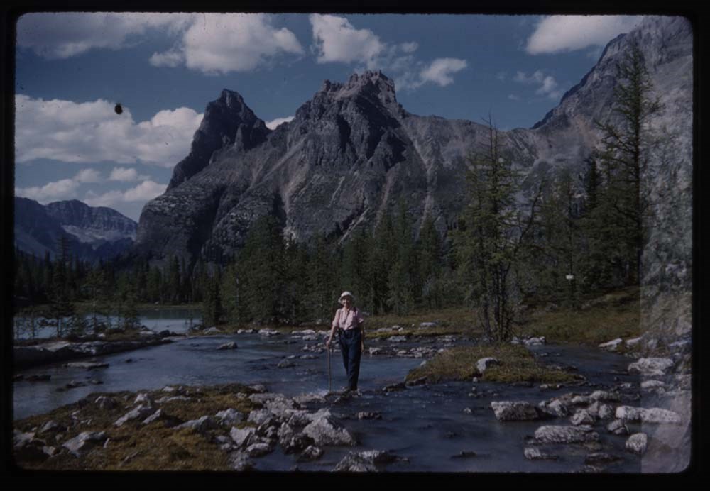
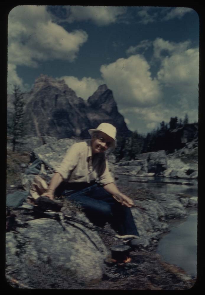
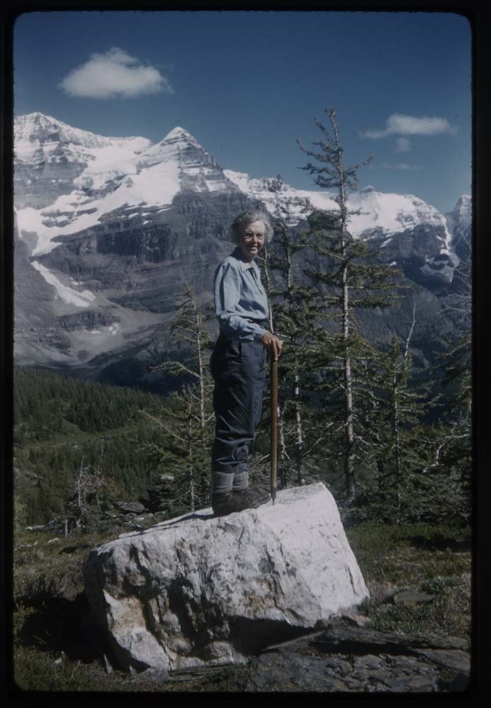
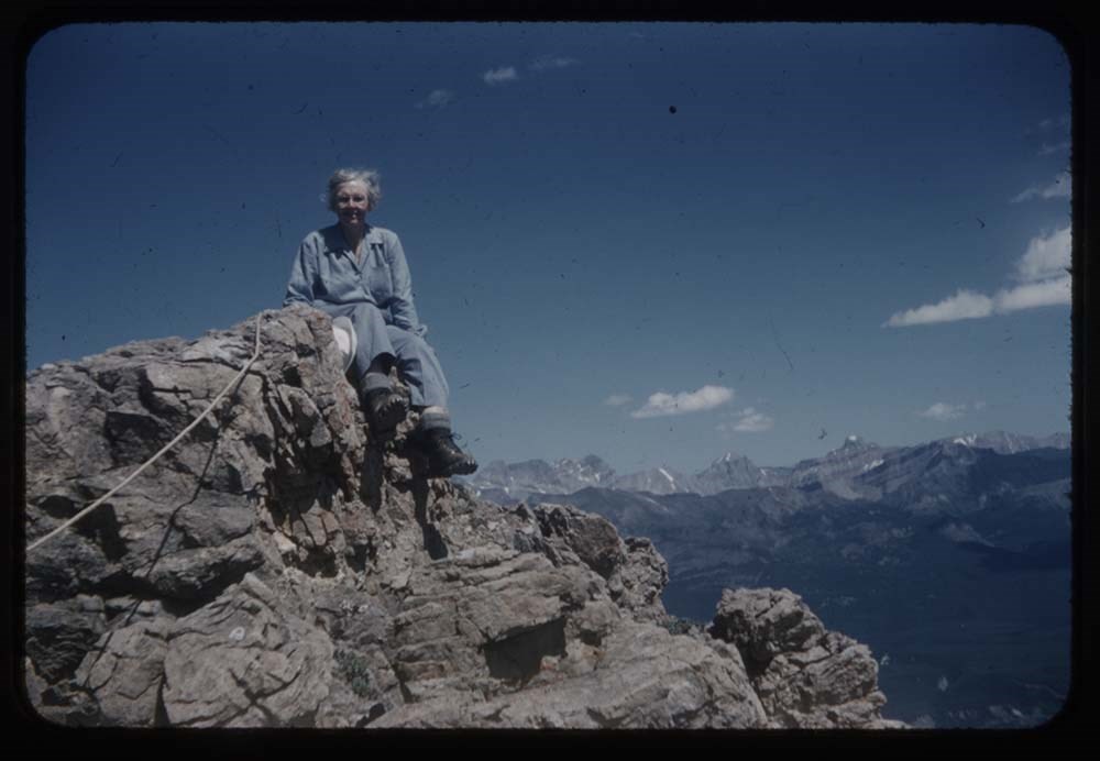
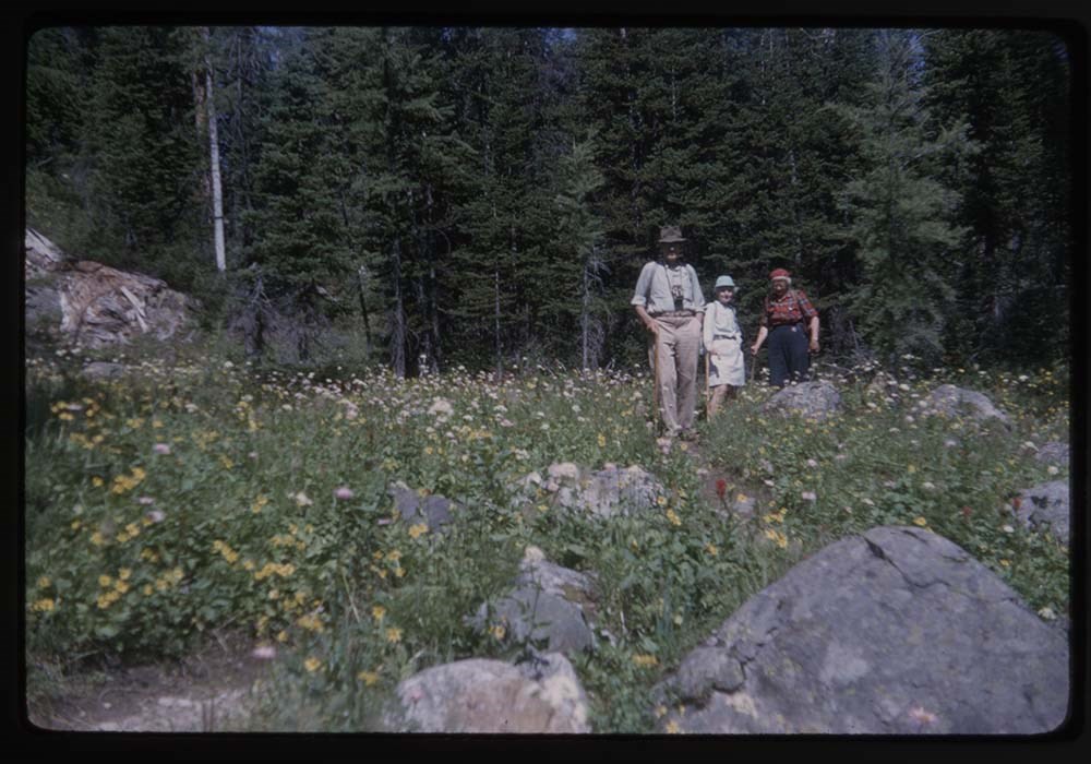
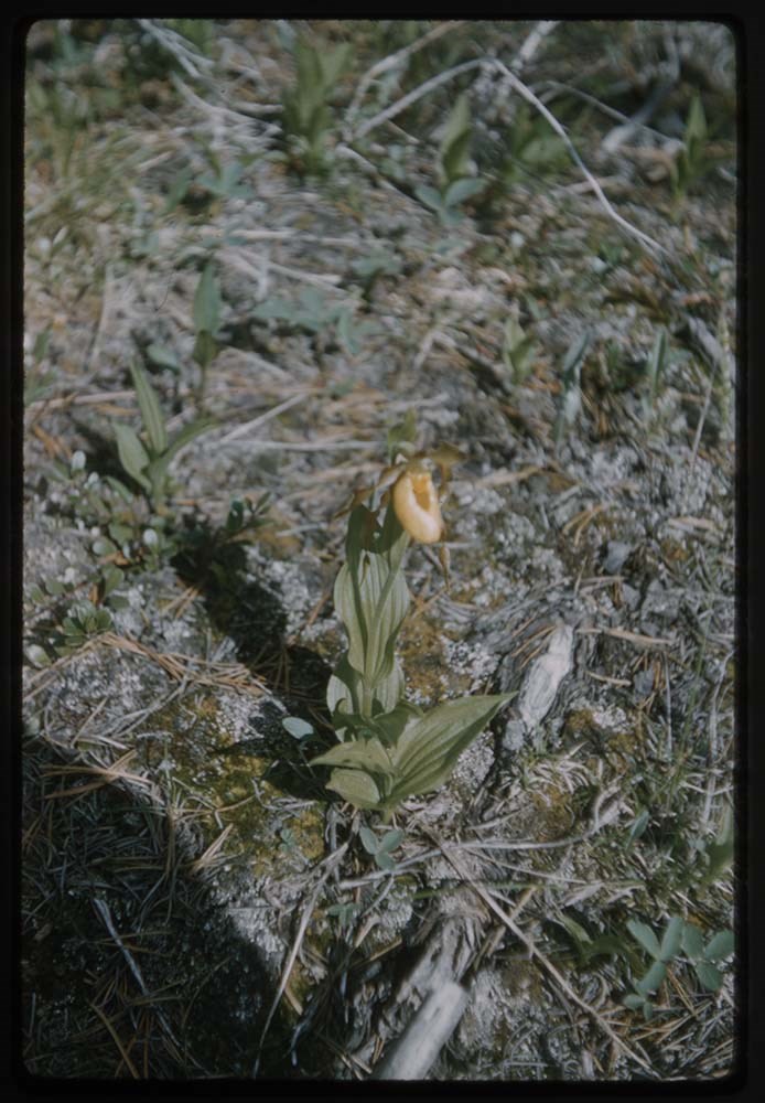
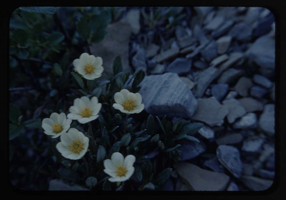
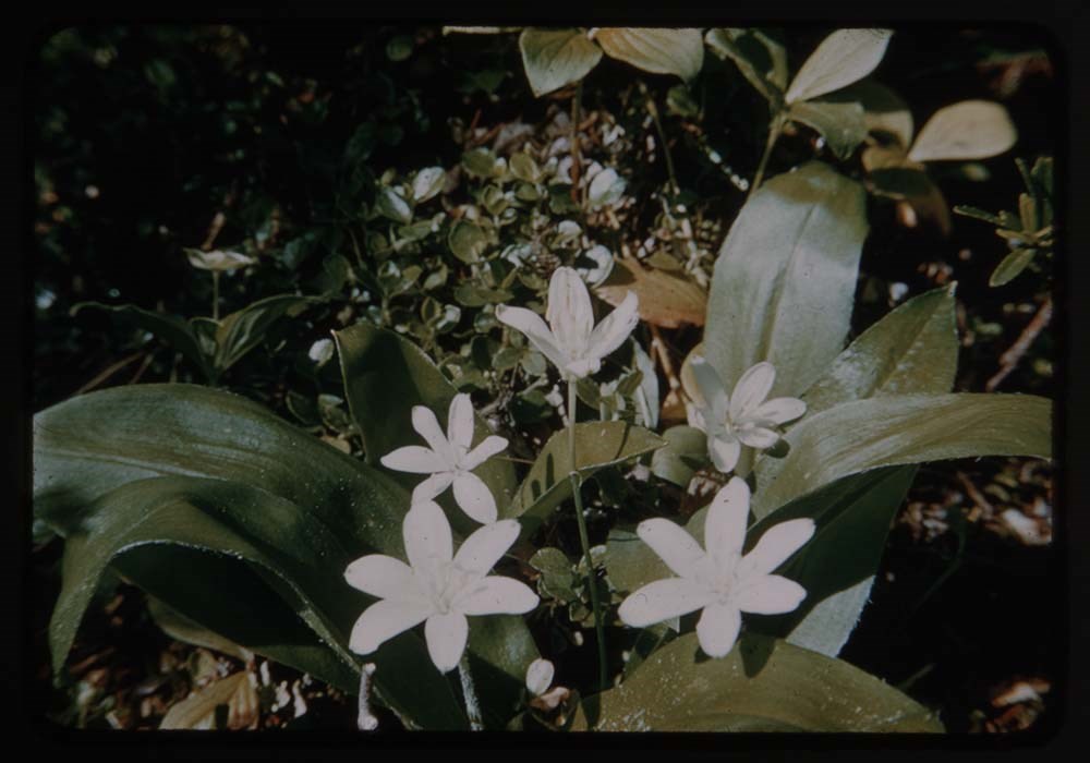
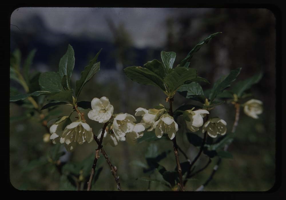
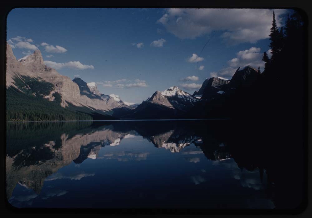
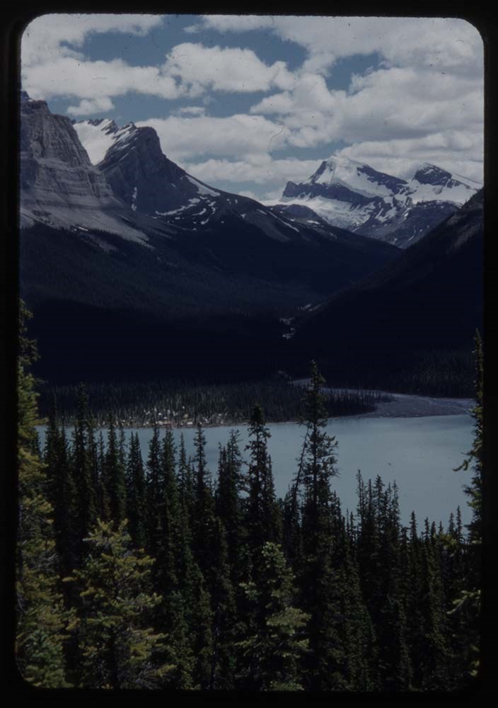
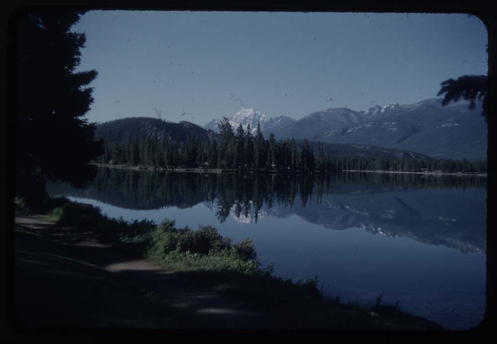
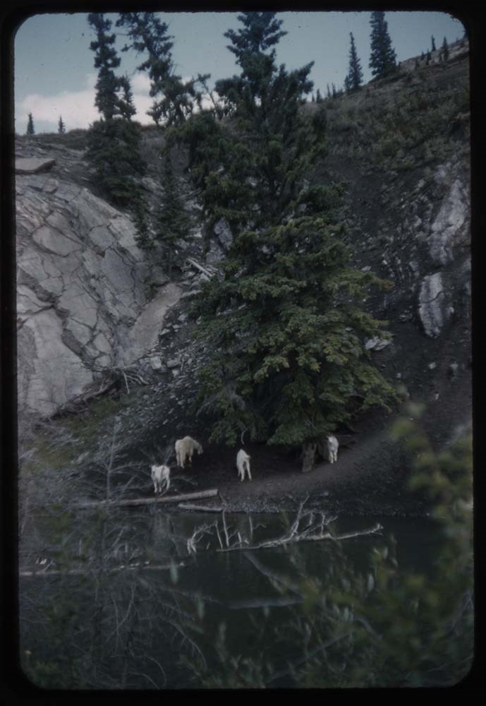
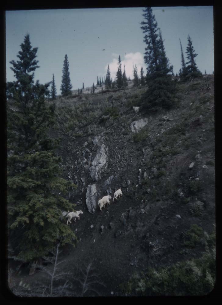
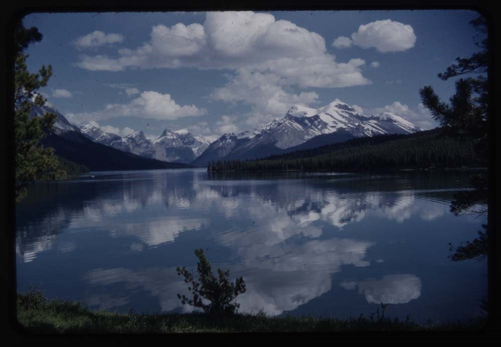
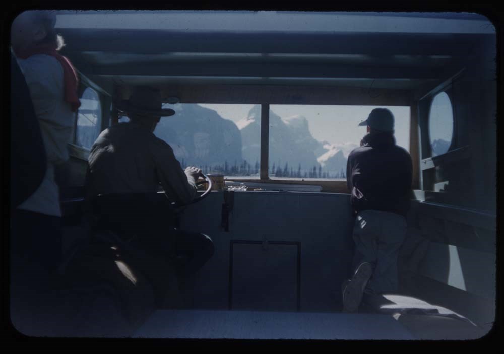
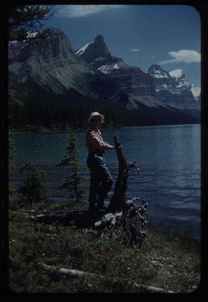
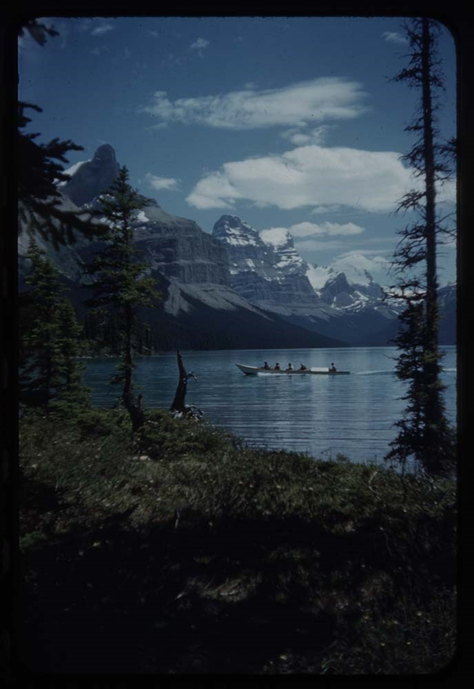
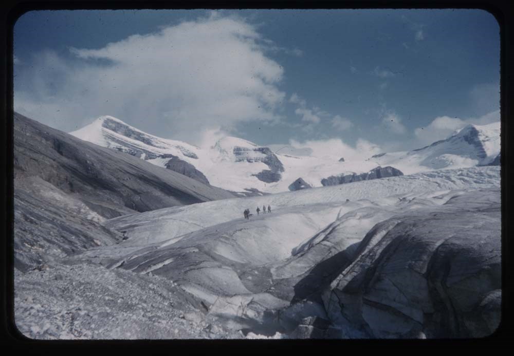
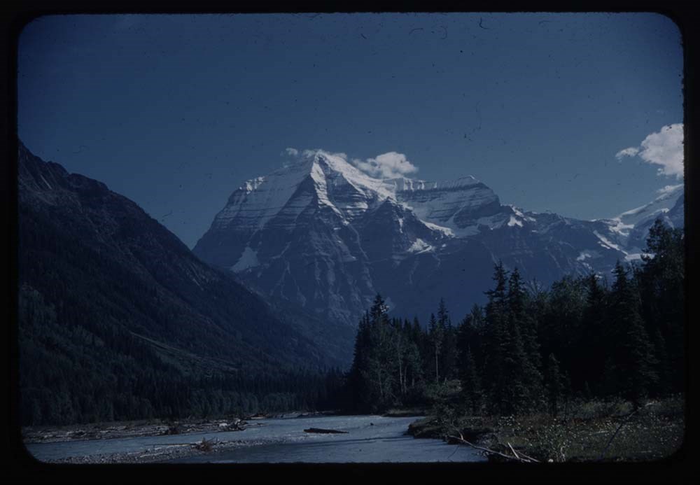
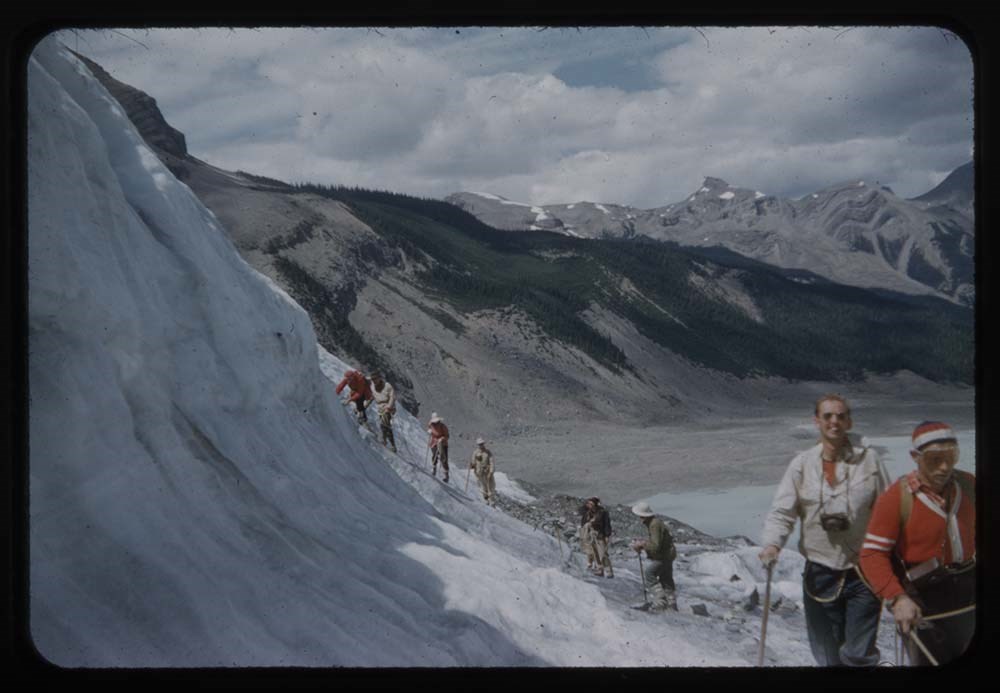
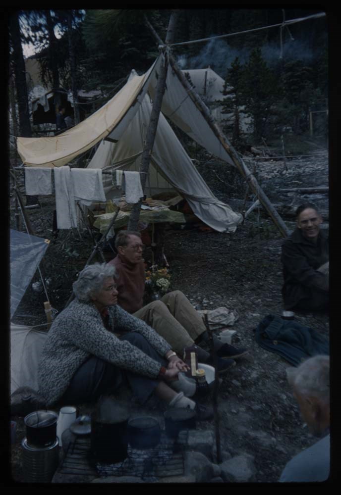
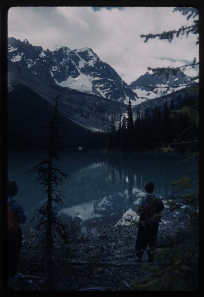
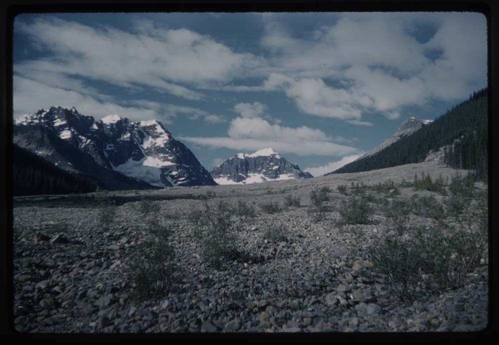
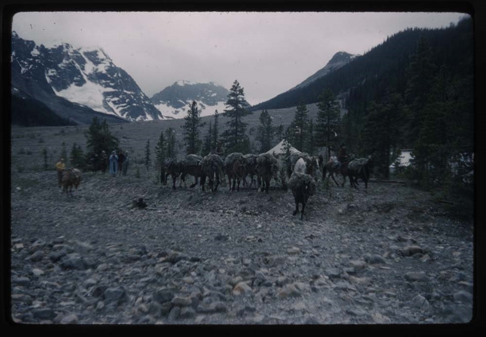
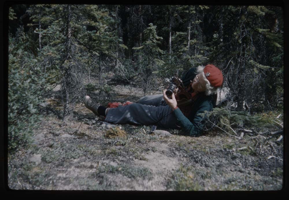
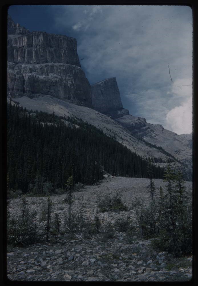
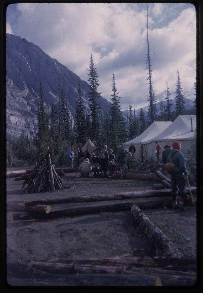
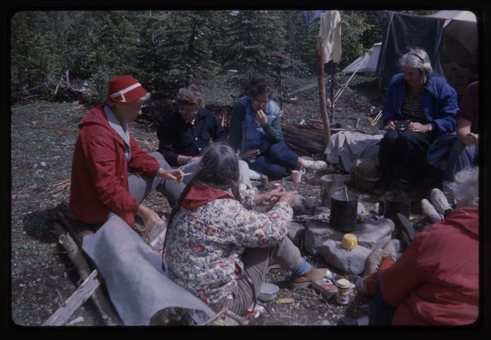
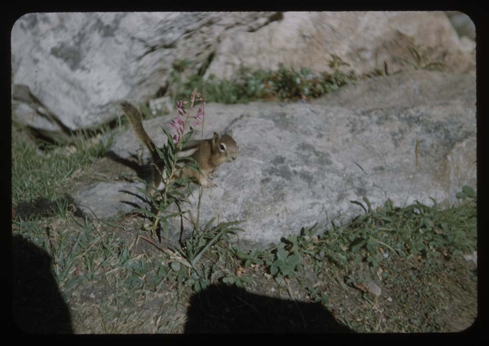
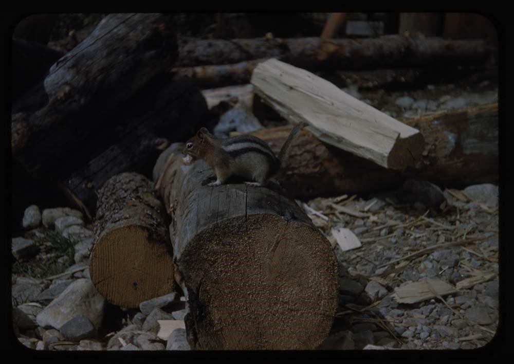
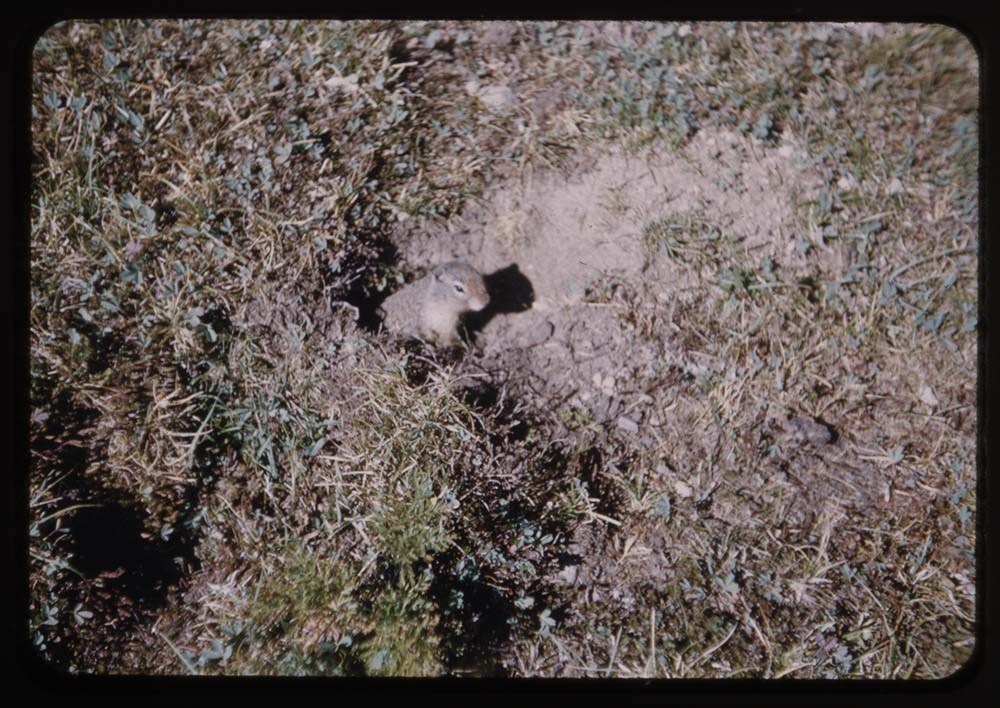
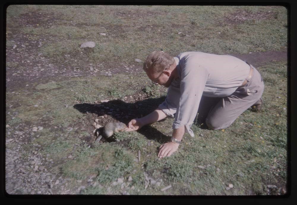
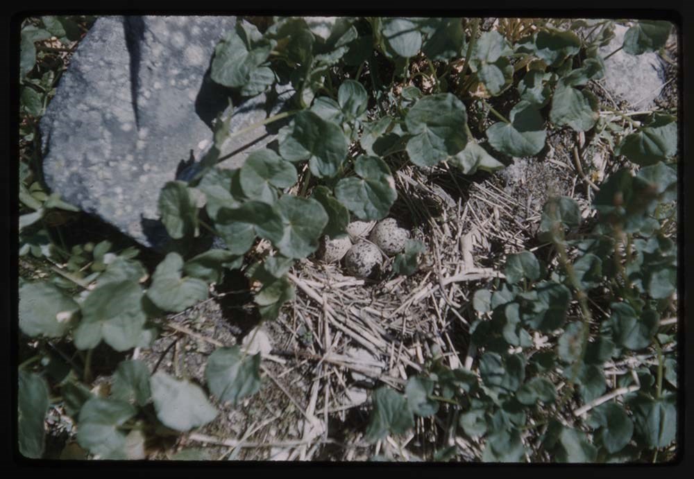
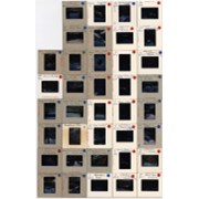
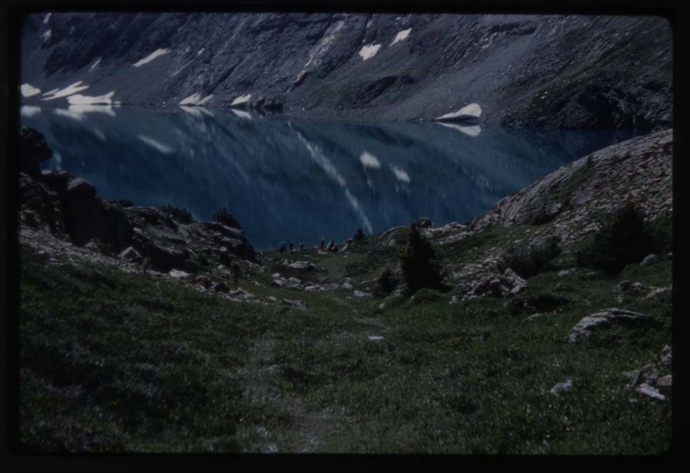
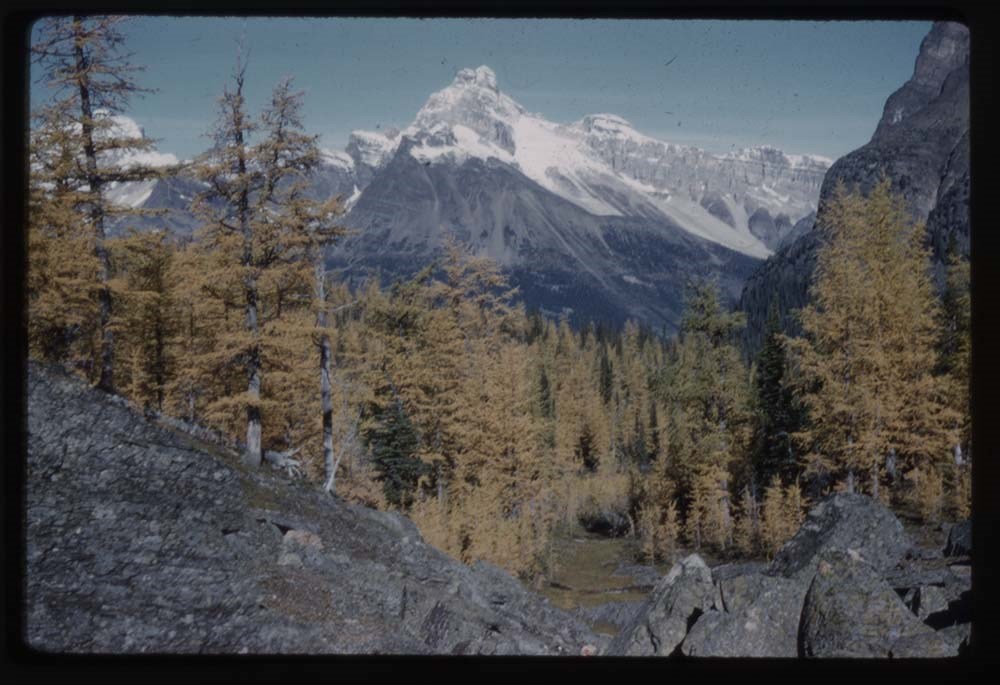
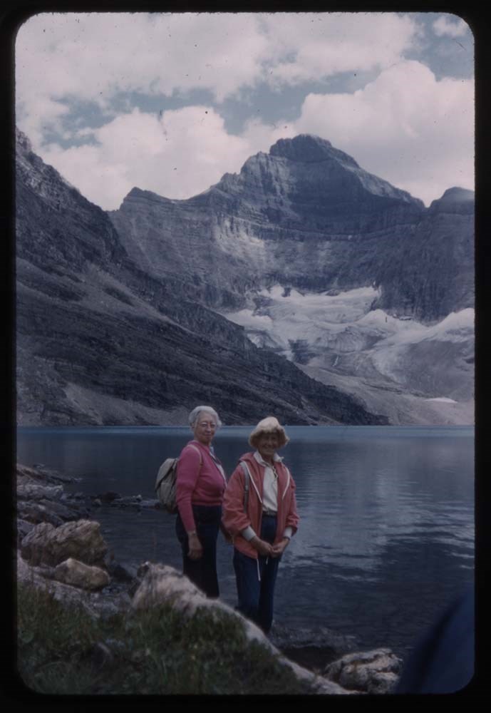
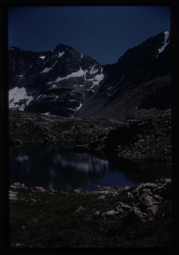
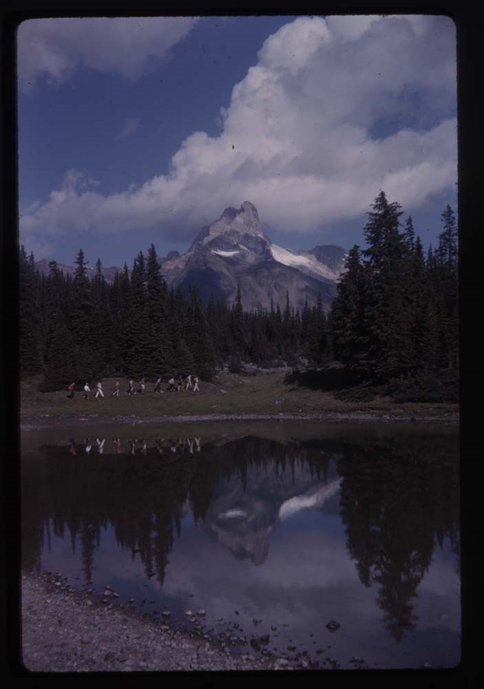
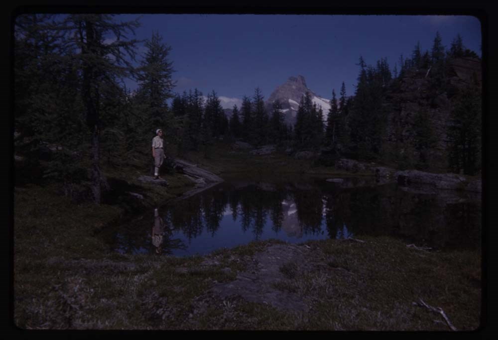
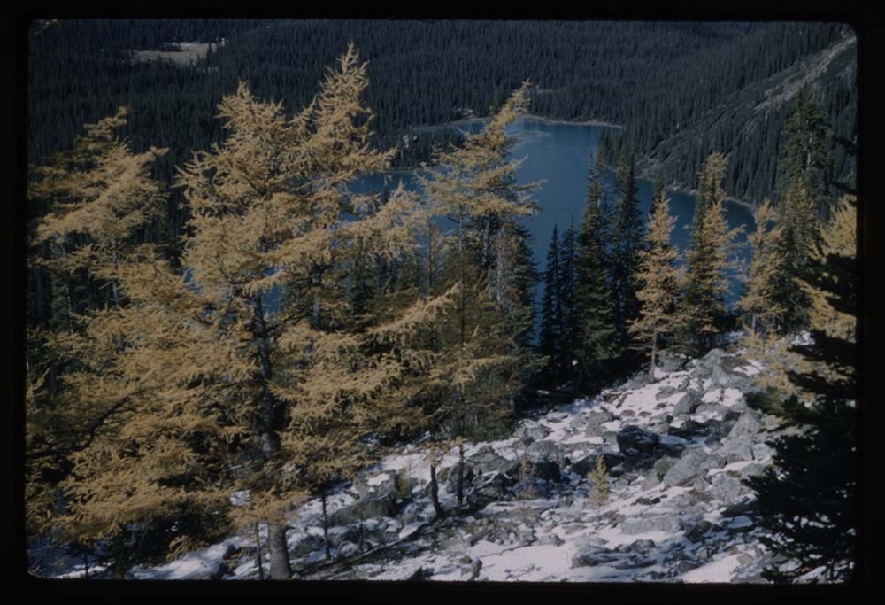
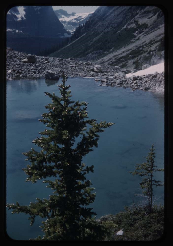
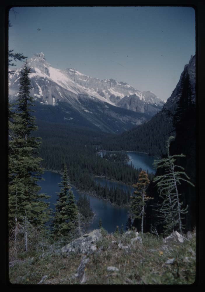
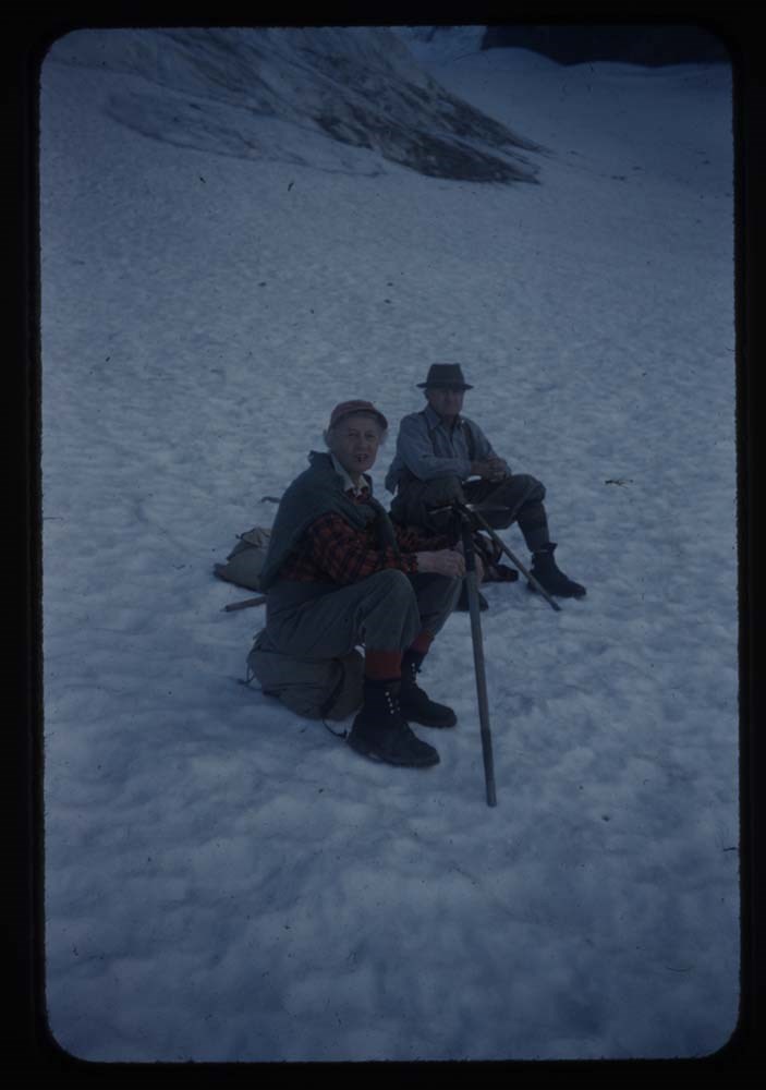
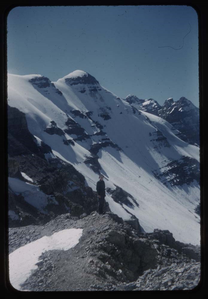
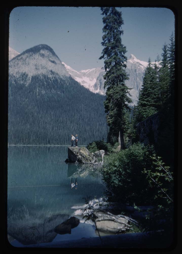
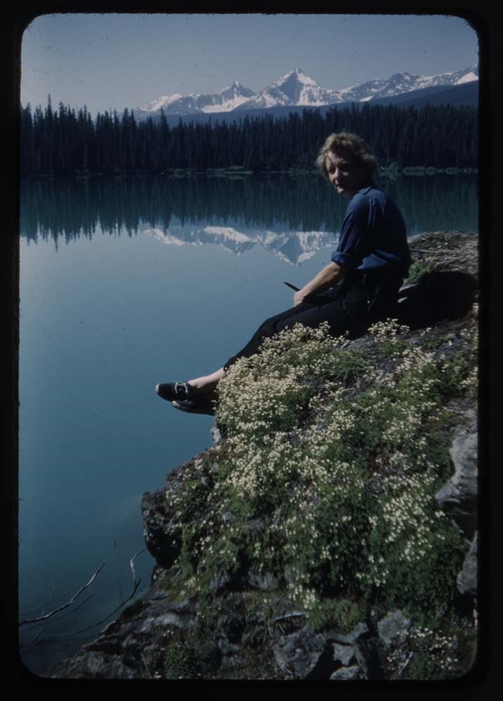
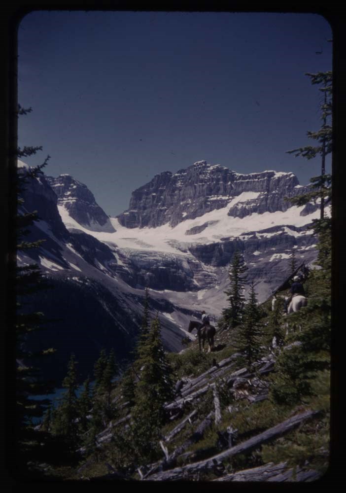
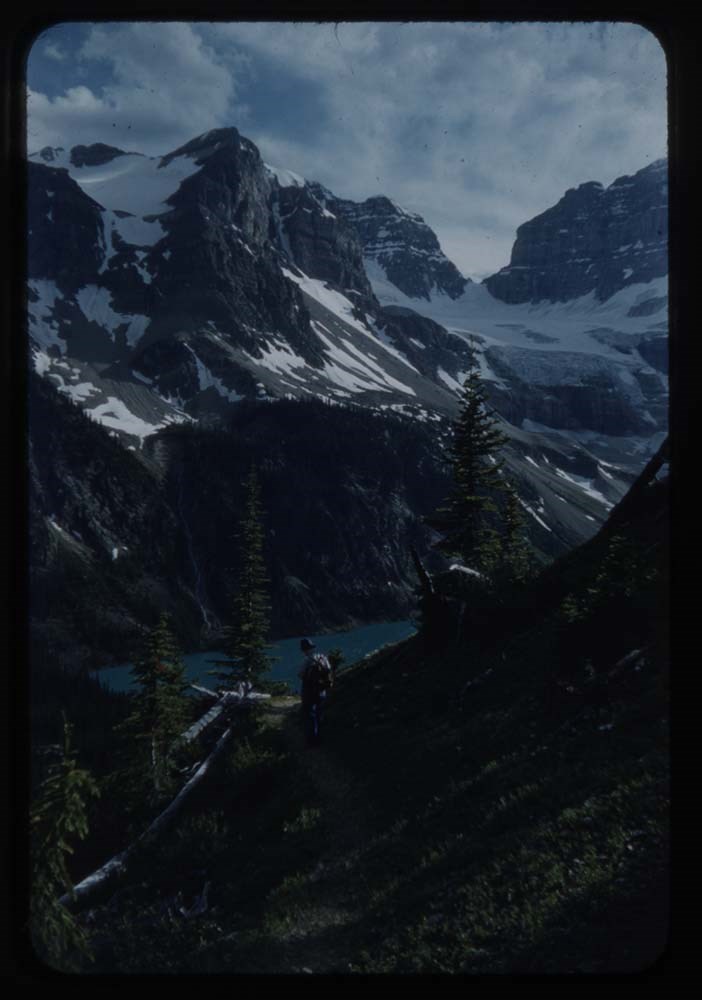
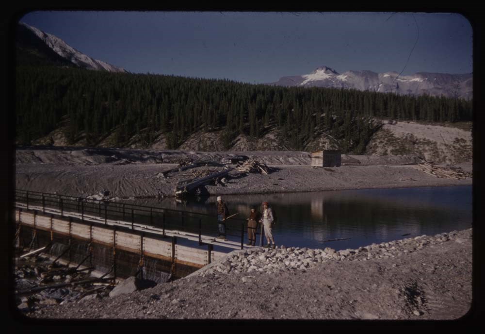
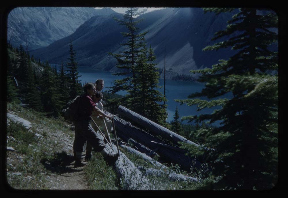
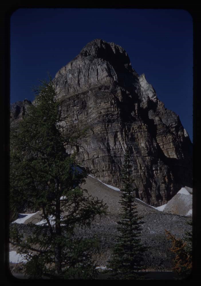
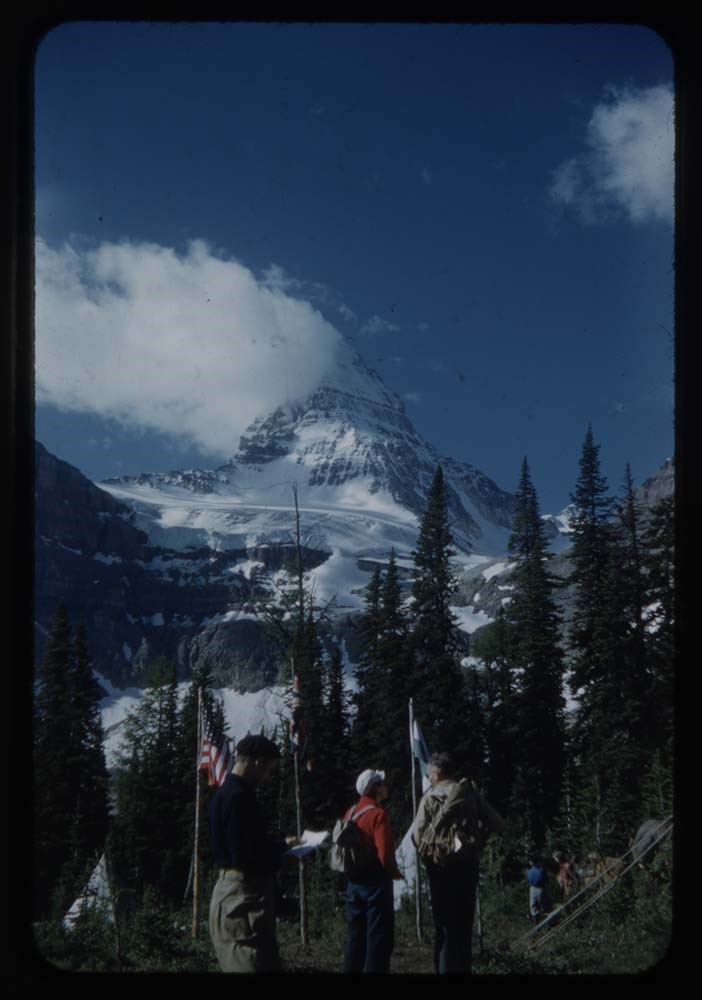
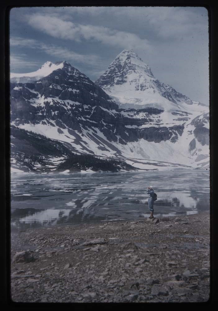
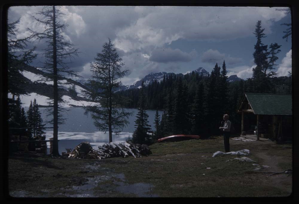
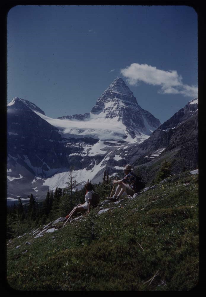
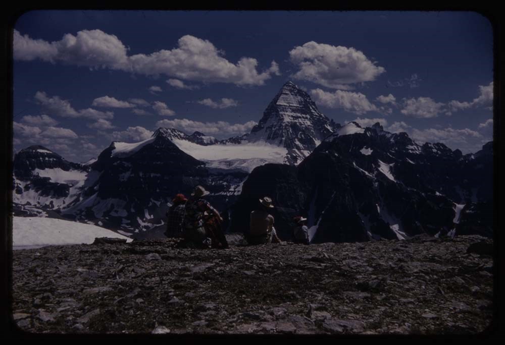
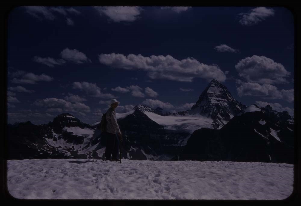
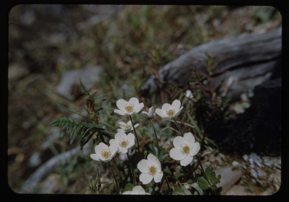
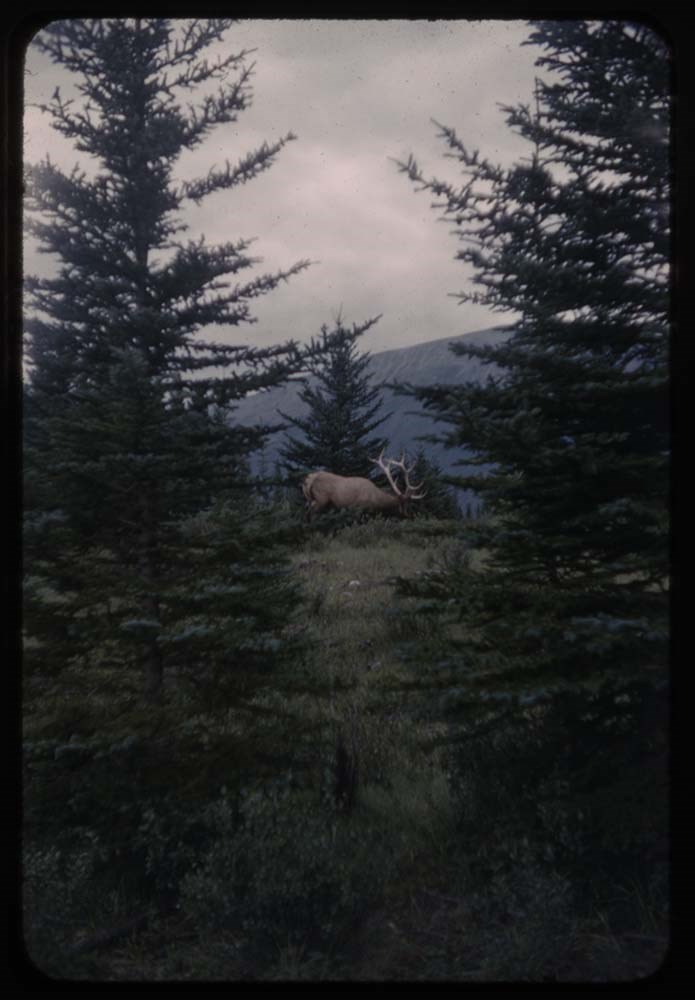
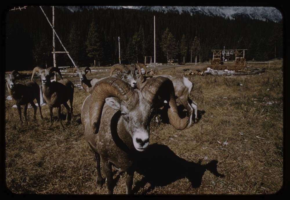
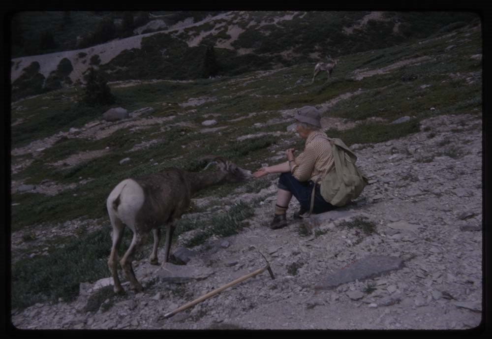
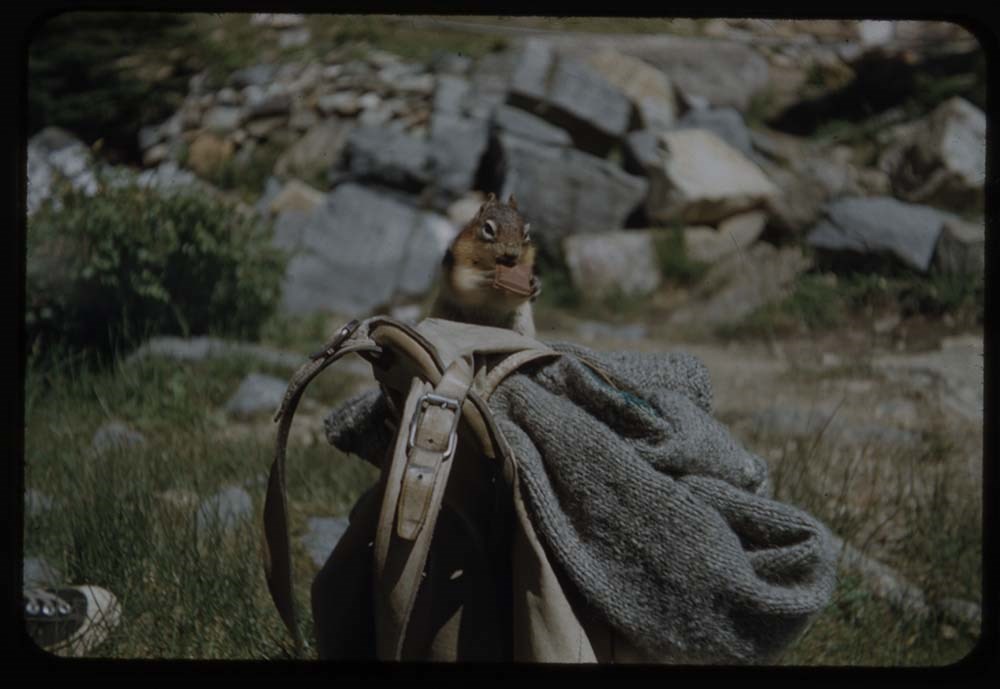
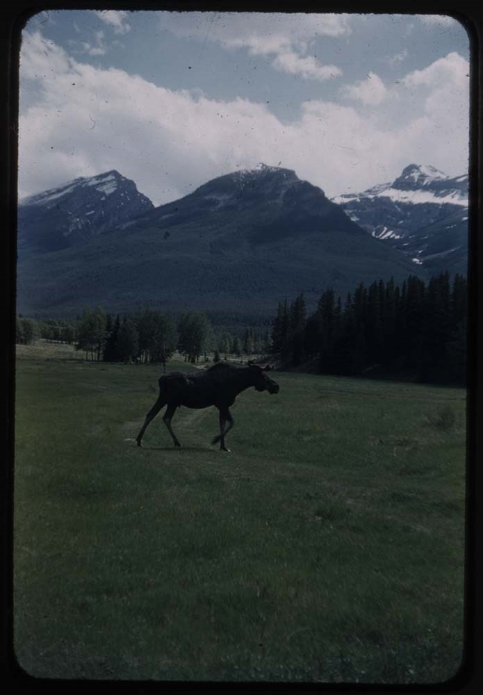
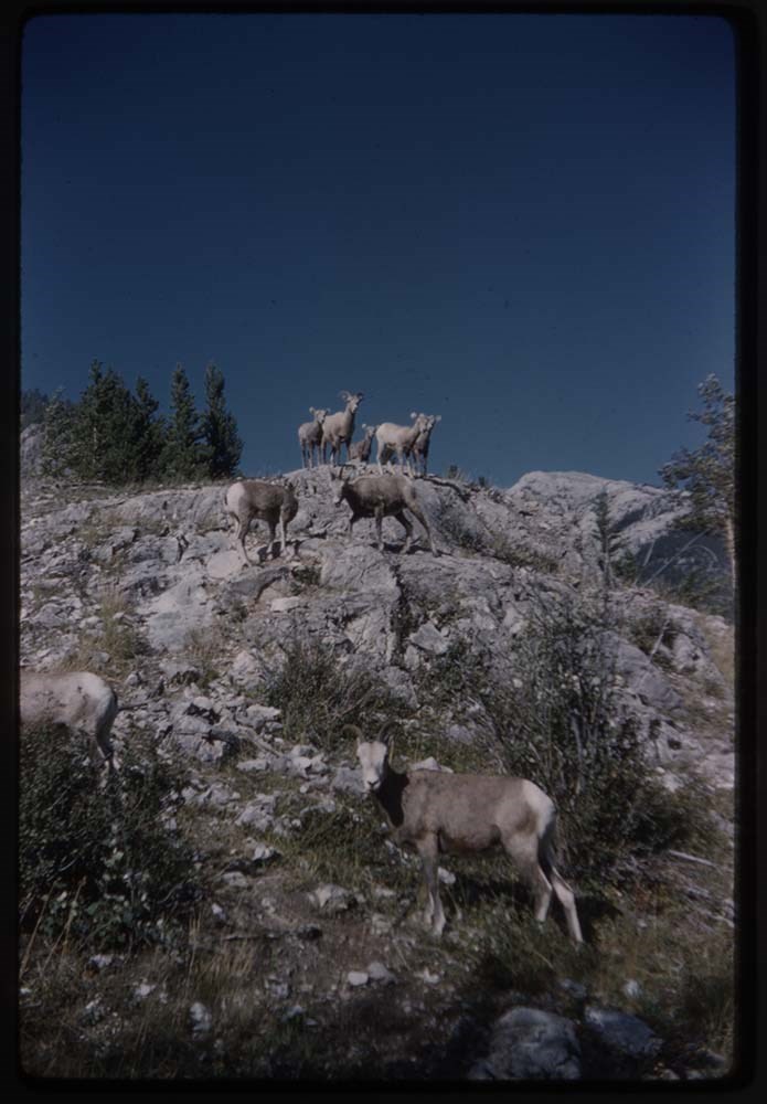
Canadian Rockies Slide Show - Series IV [1/2]
https://archives.whyte.org/en/permalink/descriptions1849
- Part Of
- Lillian Gest fonds
- Scope & Content
- File pertains to 80 slides assembled by Lillian Gest in 1973 into a show from slides pertaining to various summertime trips to the Canadian Rockies throughout the 1960s and early 1970s. Topics include mountains, mountain views, wildflowers, wildlife [including elks, goats, pekas, ground squirrels, …
- Date Range
- [ca. 1953-1973]
- Reference Code
- V225 / II / C / ii / a / ii / NS - IV / 1
- Description Level
- 5 / File
- GMD
- Film
- Transparency
80 images
1 Electronic Resource
- Part Of
- Lillian Gest fonds
- Description Level
- 5 / File
- Fonds Number
- M67 / S36 / V225
- Series
- II.C. Activities / photography
- Sous-Fonds
- V225
- Sub-Series
- ii.a.ii Photographic material / transparencies / carousels
- Accession Number
- 5142
- Reference Code
- V225 / II / C / ii / a / ii / NS - IV / 1
- GMD
- Film
- Transparency
- Parallel Title
- 1973 Can R series IV No 1. -- [before 1973] V225 / NS 21
- Date Range
- [ca. 1953-1973]
- Physical Description
- 80 photographs : col. slides ; 35 mm
- History / Biographical
- See fonds level description.
- Scope & Content
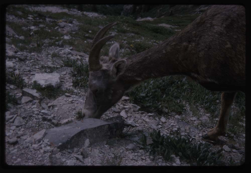
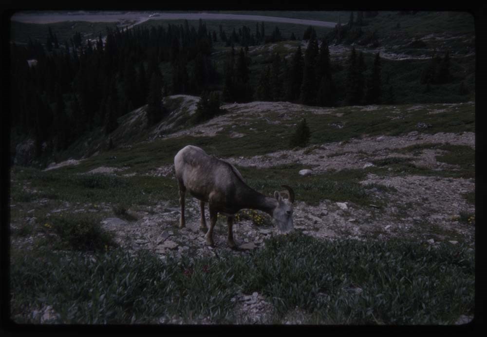
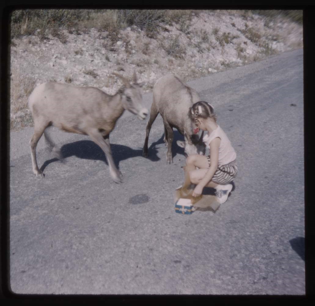
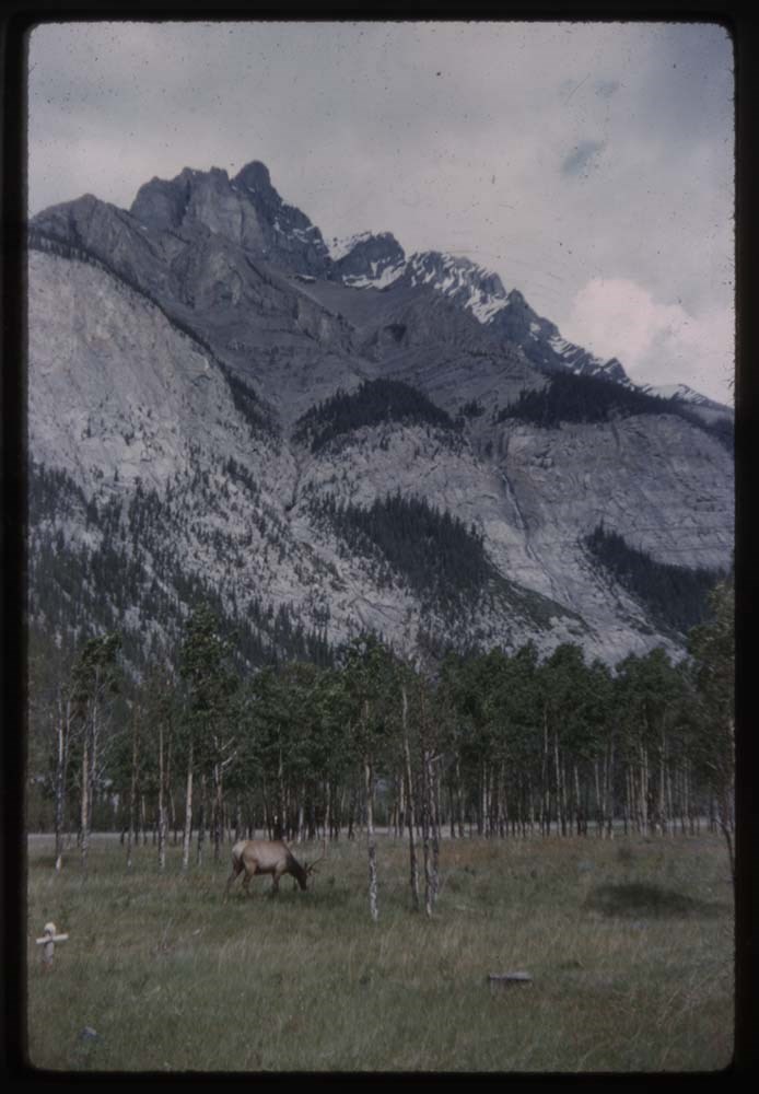
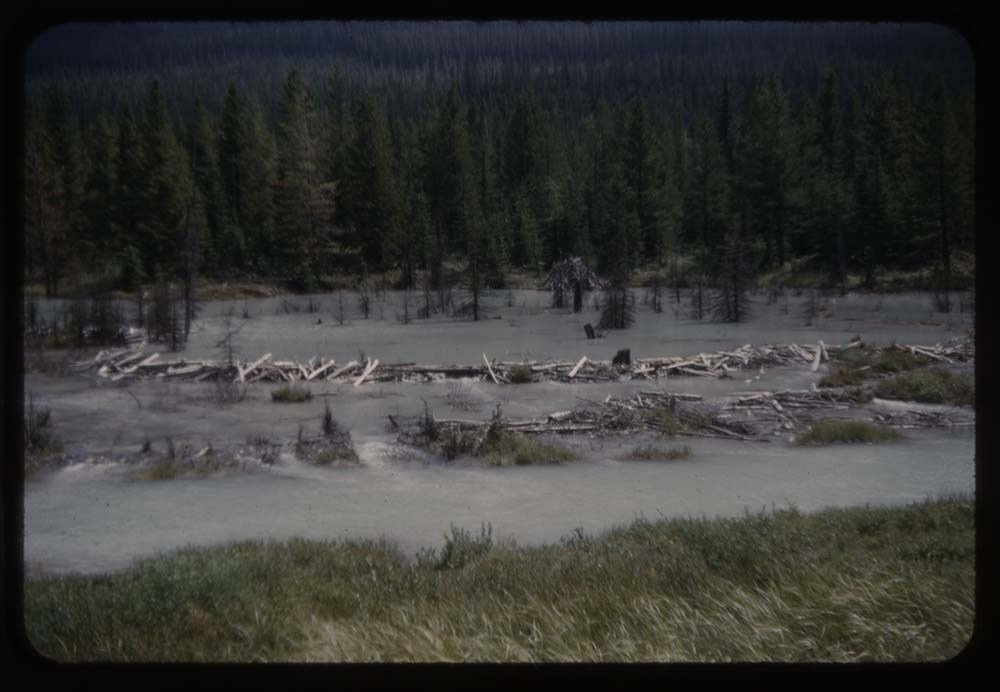
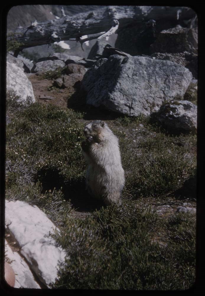
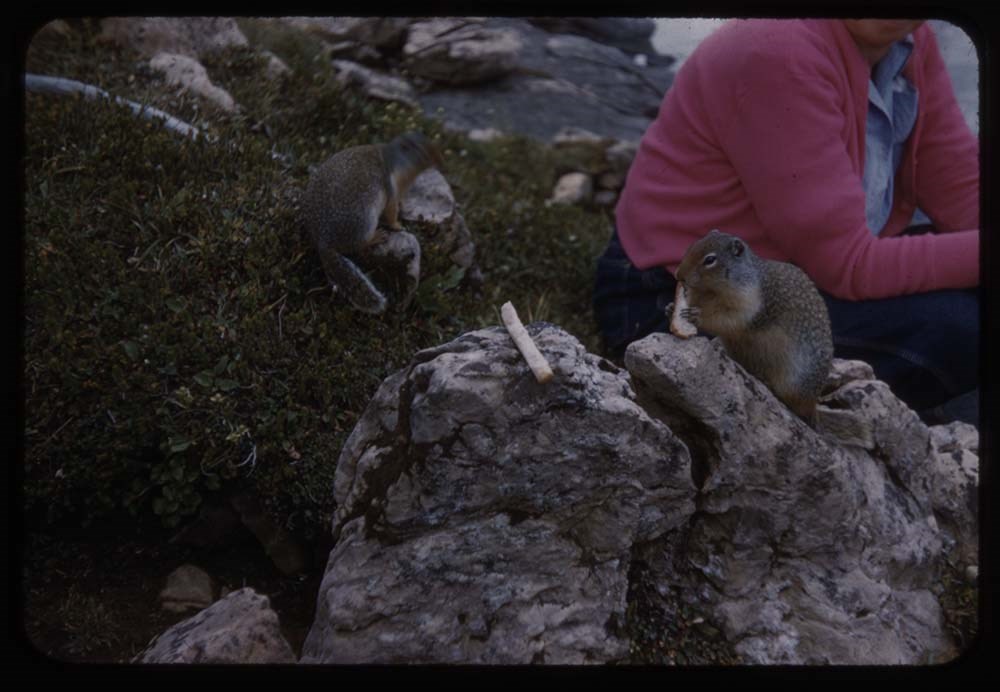
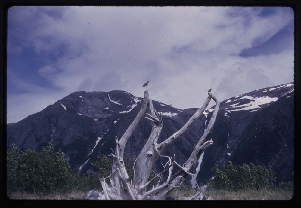
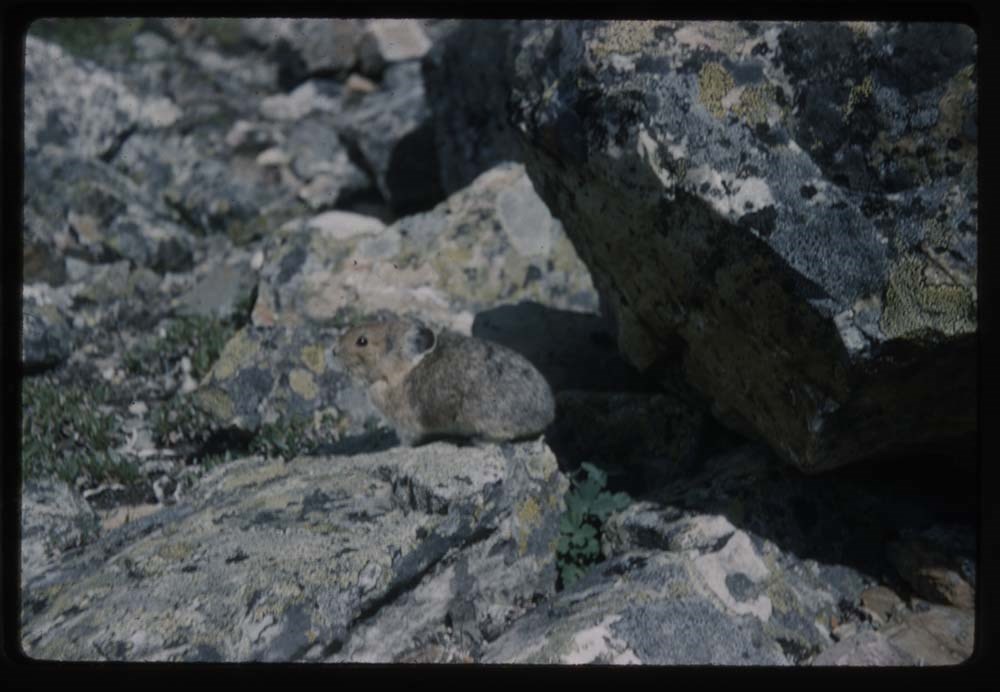
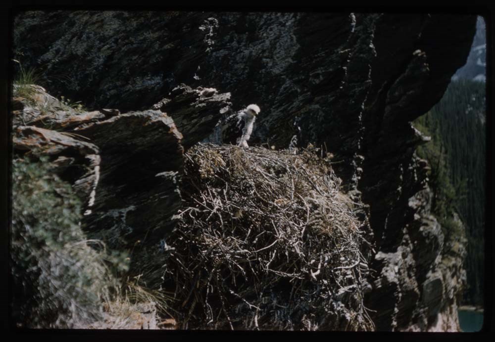
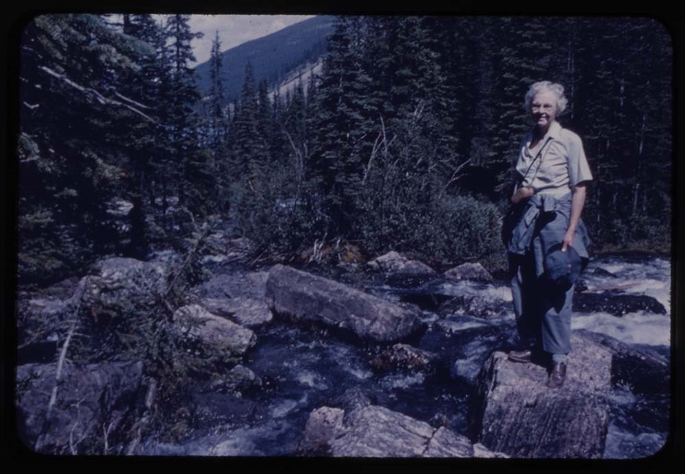
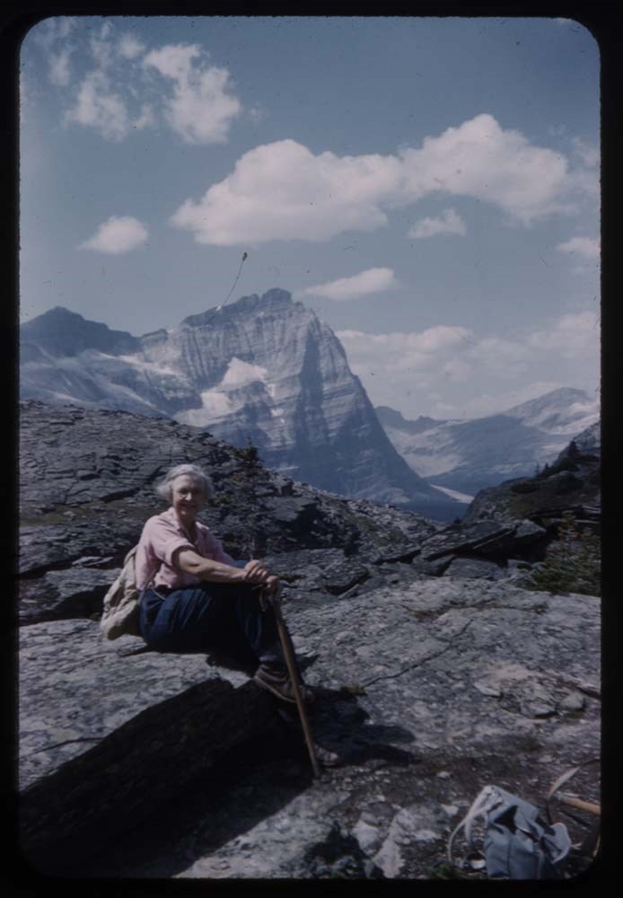
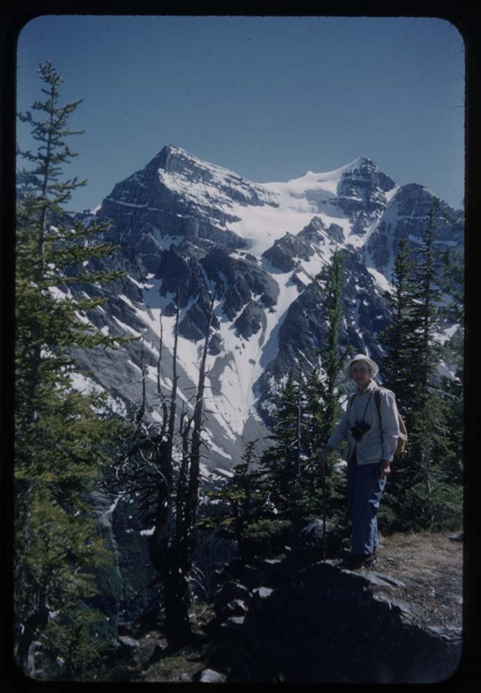
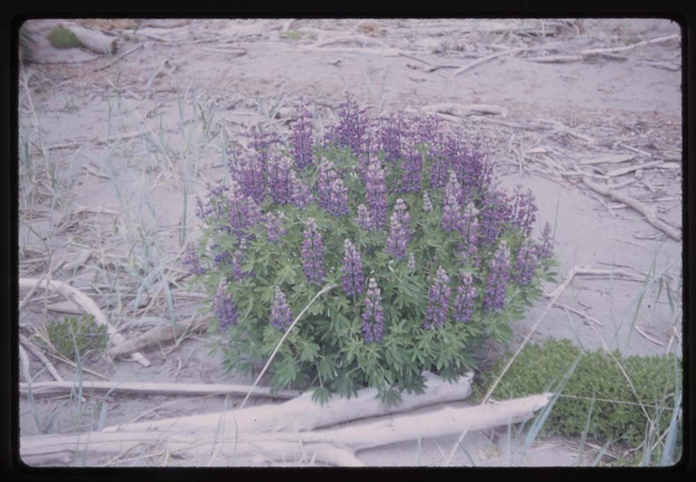
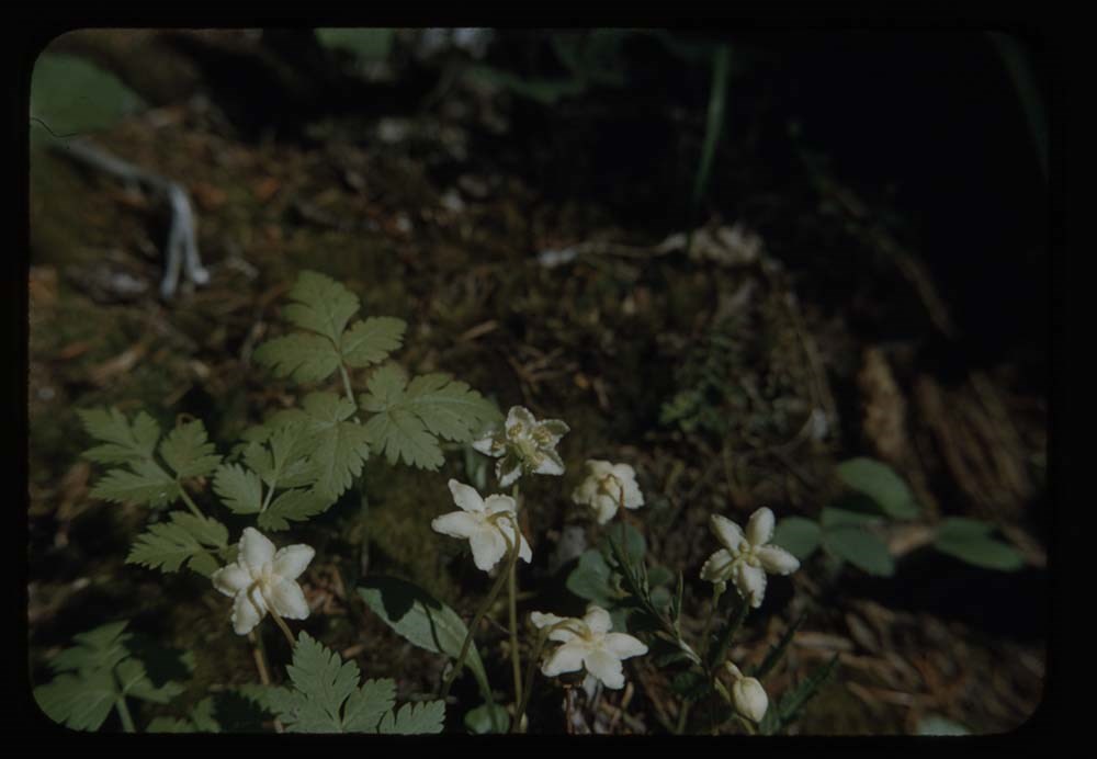
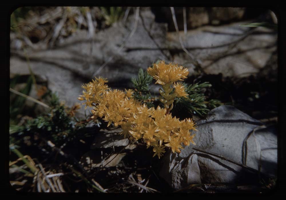
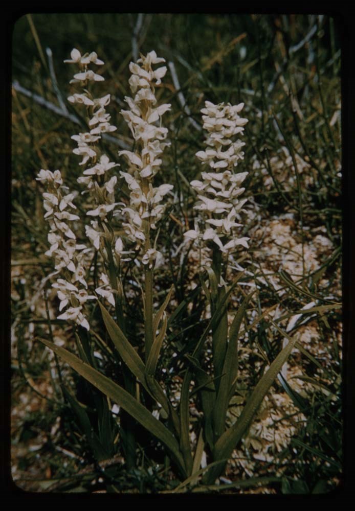
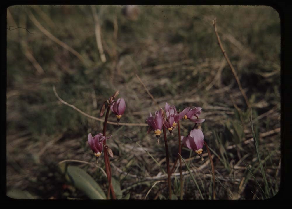
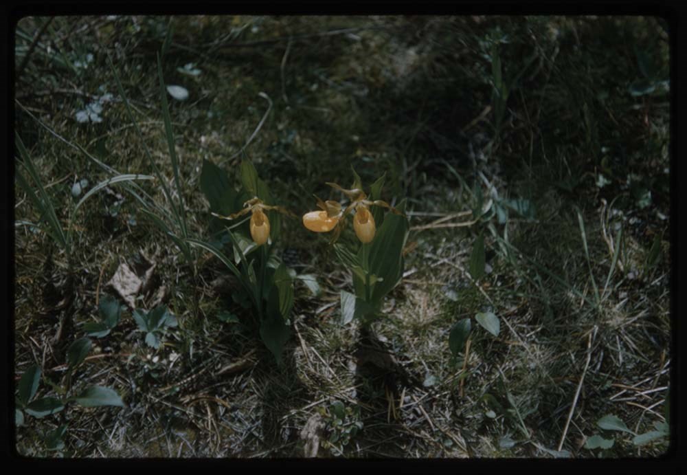
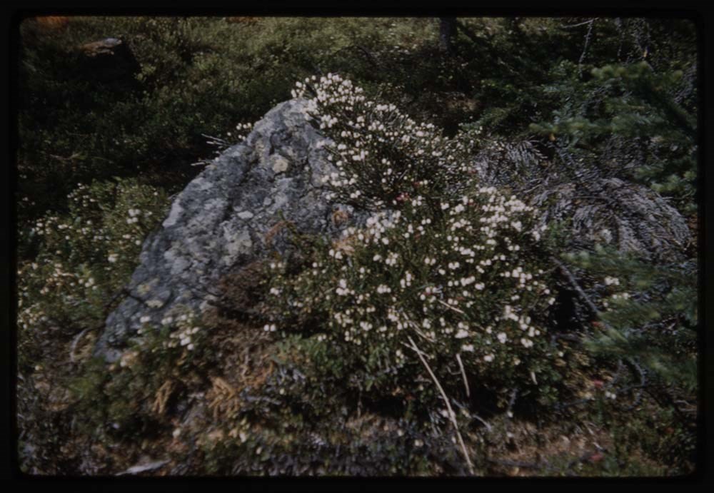
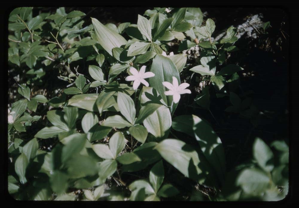
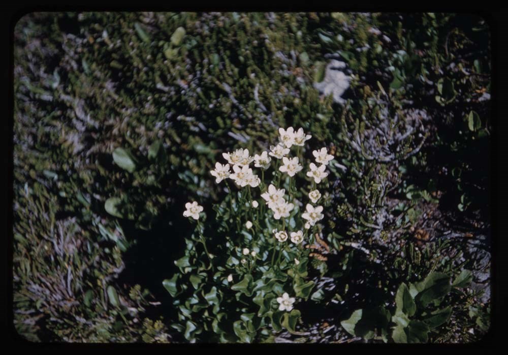
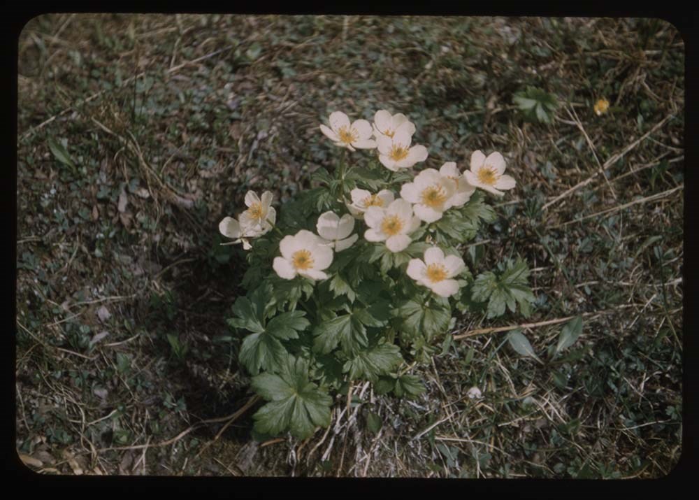
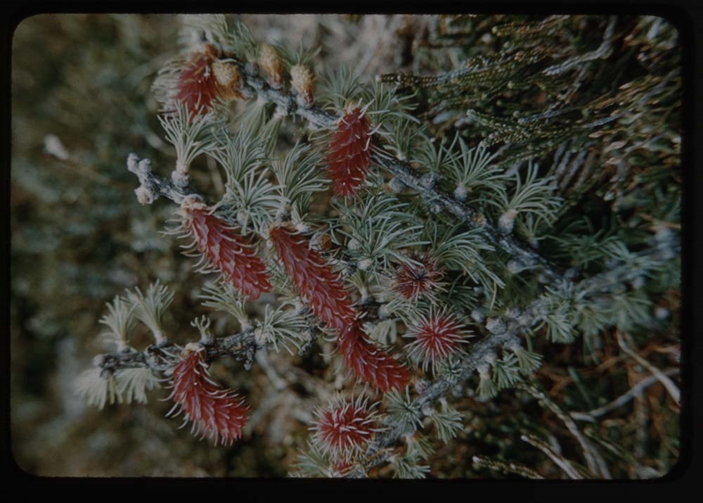
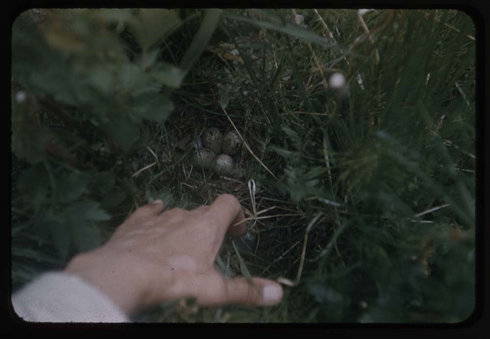
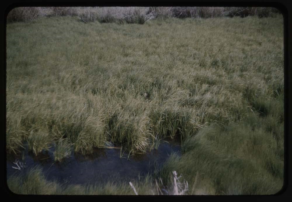
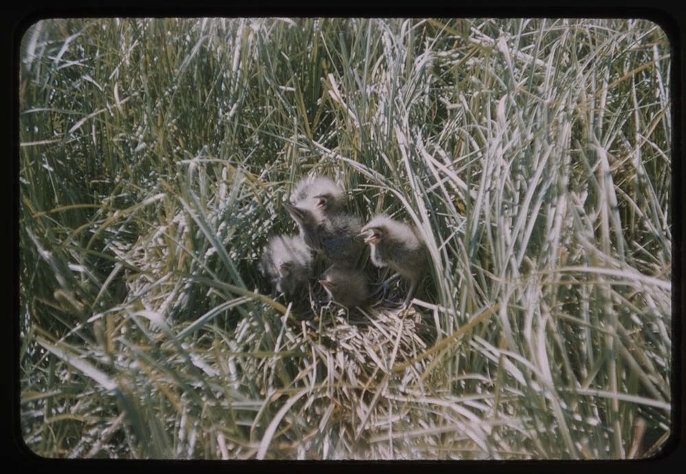
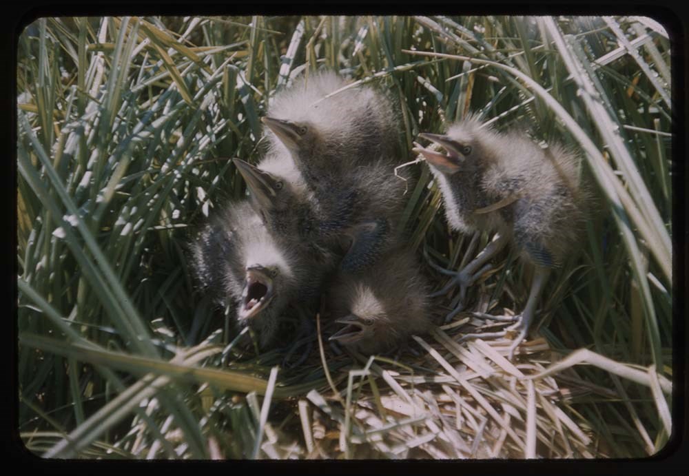
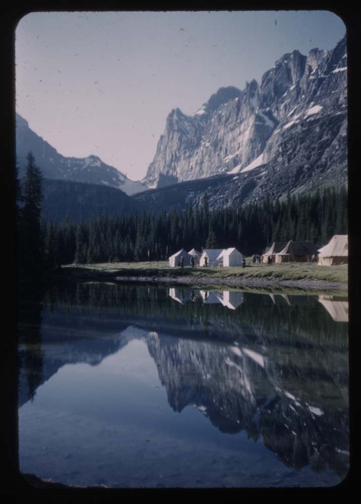
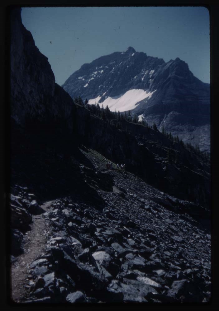
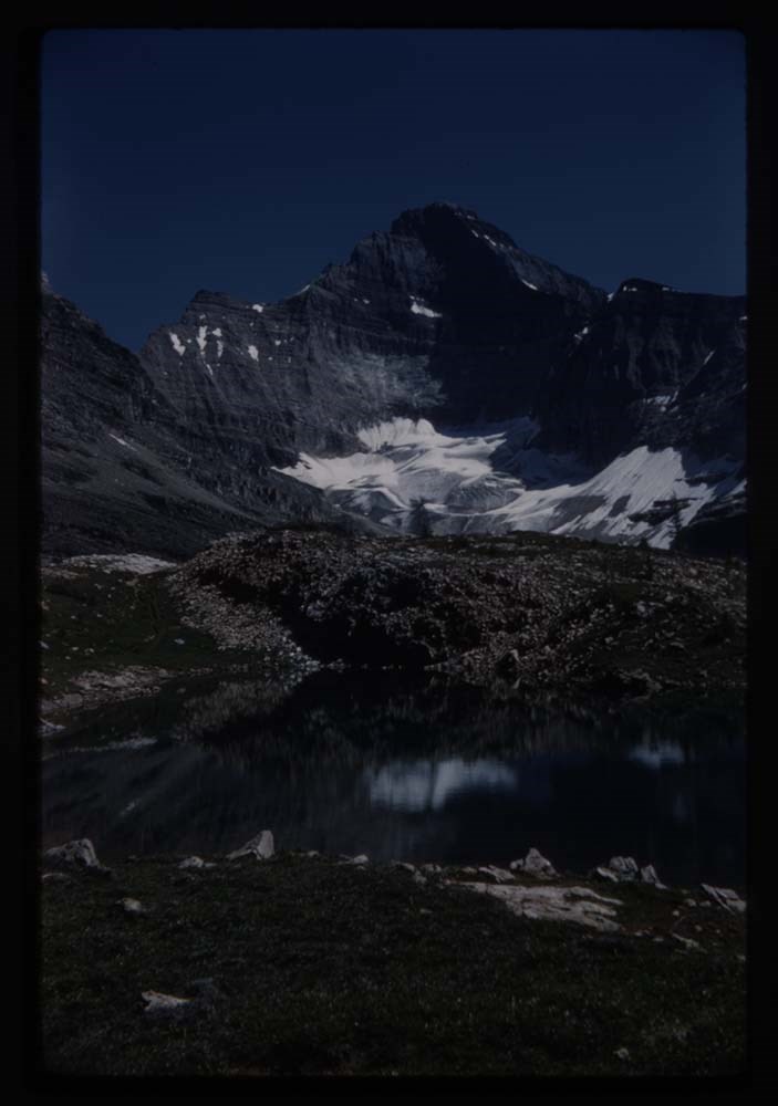
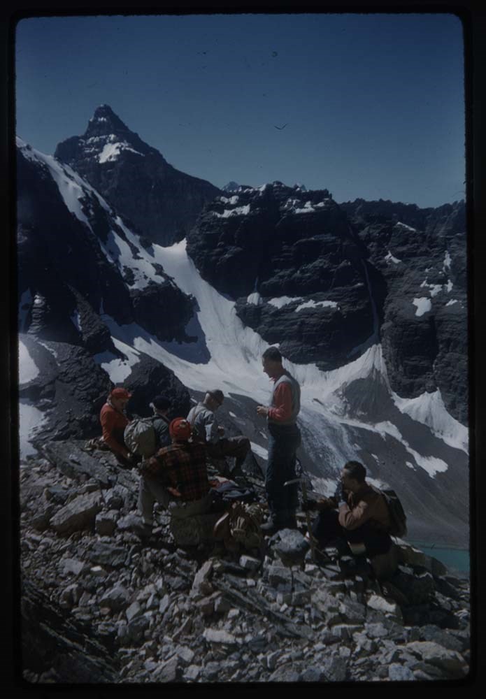
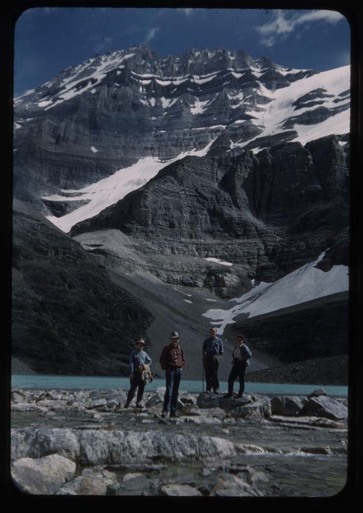
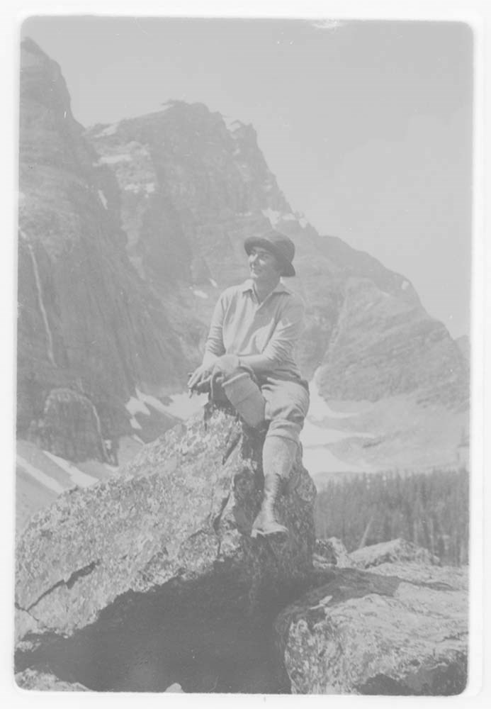
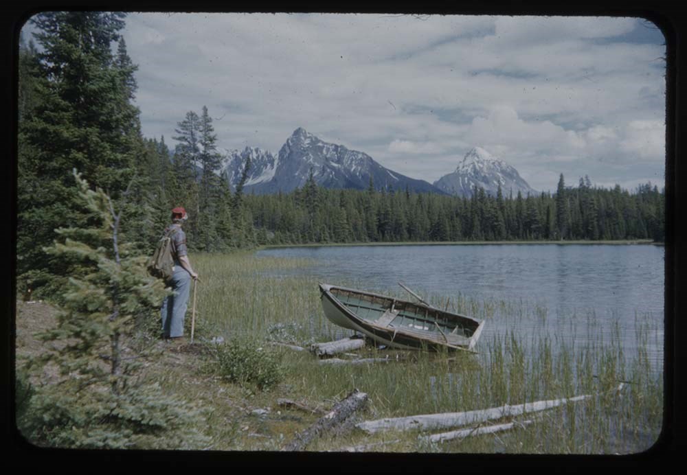
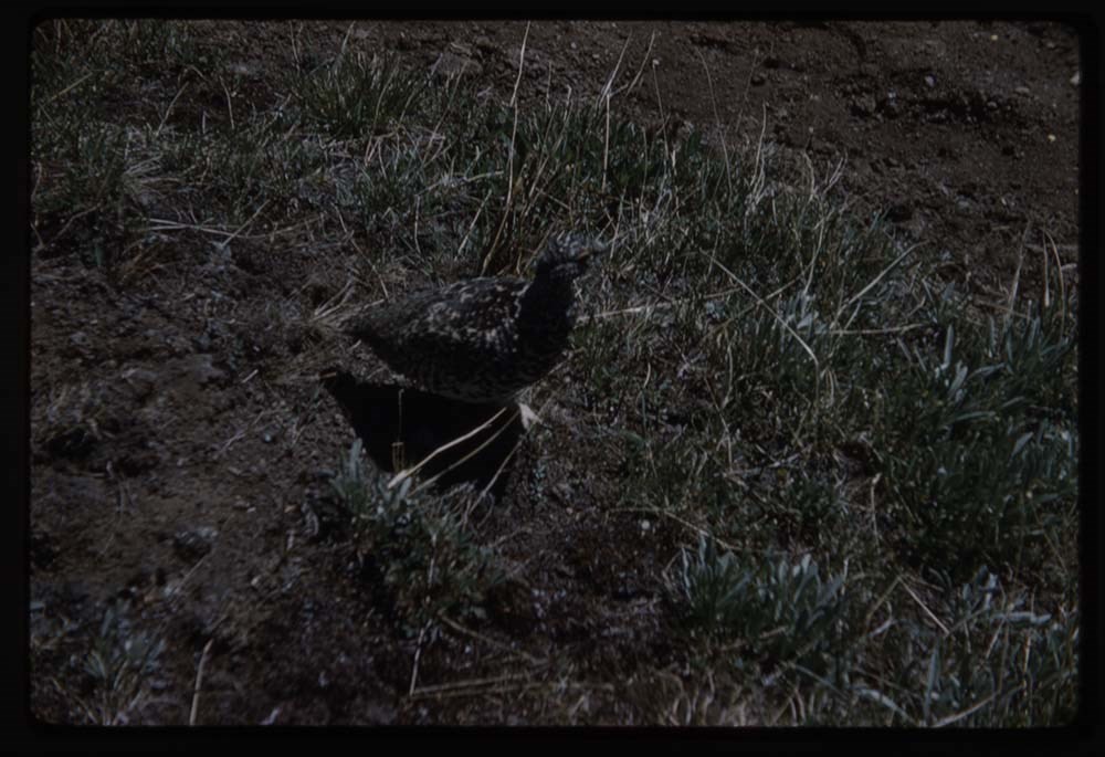
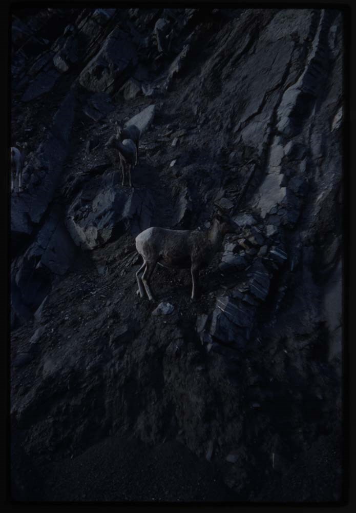
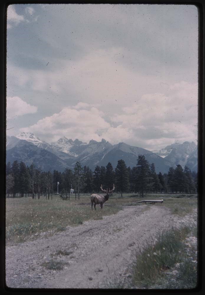
- File pertains to 80 slides assembled by Lillian Gest in 1973 into a show from slides pertaining to various summertime trips to the Canadian Rockies throughout the 1960s and early 1970s. Topics include mountains, mountain views, wildflowers, wildlife [including elks, goats, pekas, ground squirrels, and birds], Lillian and her friends [Polly and Phyl, as well as ACC camp members], lakes, boats, fishing, hiking, camps, and various other activities. Titles: 1. B55-10 Fool hen walking log 1963 40 Mile Ck. 1. B55-7 [Fool hen] nearer 3. B55-9 [Fool hen] & chick 4. B71-33 Sheep close-up Wilcox Pass 65 5. B71-32 [Sheep] Wilcox Pass 6. B27-38 Two sheep & child on raod 1959 7. B22-3 Elk 8. R183-4 Beaver dam by RR at Wapta 9. R199-10 Marmot 10. B20-22 Polly & gophers 11. A6-6 Two [gophers] on dead tree 12. B30-5 Peka 13. B23-6 Eagle cliff - 14 Eagle on nest (Gmoser Slide) 14. B49-16A L.G. at Moraine Lake - E. Res B Eld.[?] 15. B20-18 L.G. above Oesa 16. B6-27 L.G. & Ax[?] & Sir Donald 17. B19-37 L.G. by alpine stream 18. B6-27 L.G. on trail 19. R209-3 L.G. Cathedral Basin 20. R207-1[crossed out] LG. above O'Hara 21. R207-19 L.G. on Needles 22. R196-30 LG Aberdeen in bg 23. B51-21 Avalanche slides[?] - close-up 24. A6-5 FLower clump - phascelia 25. CH-0 Stonecrop 26. CH-0 Stonecrop 27. CH-51 White Rain orche's[?] 28. CH Shooting star 29. B28-25 Lady slippers? 30. B25-2 White heather on rock 31. R69-13 Queen cup Emerald Lake 32. R175-23 Measle[?] grass of Parnassus 33. R173-22 Clobe flower 34. CH 51 Lyall's Larch in Bbone[?] 35. B69-6 Three on Schaffer L.G Trail Phyl M & 36. B28-24 Yellow flower 37. CH.0 Drunmond's Dryas 38. CH.51 Queen cup Toby Creek 39. CH.0 Wild rhodedendrone 40. CH.6/70 Maligne Lake - sun & shadow & reflec. 41. CH.0 ACC camp Muligne Lake 42. R190-25 Jasper Park Lodge & Pyramid Lake 43. R190-29 Edith Cavel & Lake 44. R183-9 Elk nearest & best 45. B11-5 Goats at Jasper - good 46. B11-8 [Goats] go up bank 47. R185-32 Polly 1953 Maligne Lake 48. CH.0 Maligne Lake 49. R185-37 View from boat 50. R186-24 Logs & back water at Narrows 51. R186-20 L.G. Narrows 52. R186-21 Boat near narrows 53. R206 34 Party from Lynx 54. Pernine 35 Mt Robson 55. R189-12 Party on ice 56. B30-22 Camp Phyl coffee party 1960 57. B30-21 [Camp] coffee party 1960 58. B30-23 Phyl & tent 59. B30-36 High Camp[?] 60. B30-35 Lake & reflections 1960 61. B30-34 Lake & Beth 1960 62. B30-33 Lake & Peaks 2 people 63. B30-32 Olympus & Xerxes 64. B30-31 Pack train leaving camp 65. B30-30 Phyl taking picture nest 66. B30-29 Phyl & Brussels 67. B30-28 Mt Brussels 68. B68-3 Camp & fire circle 69. B68-9 Girls camp fire 70. B14-20 Mrs Krat[?] on Verm. Lake 71. R164-25 Gr. Squirrel back of flower 72. R148-6 [Gr. Squirrel] Peyto Lake camp gr. 73. R175-2 Gopher coming out of hole 74. A10-21 Dennis feeds gopher 75. B32-1 Feeding gopher taken out 3/28/78 76. B20-20 Polly M & gopher taken out 3/28/78 77. R202-2 Spotted Sand pipers best 78. R206-5 Baby spotted sandpiper 79. B15-30 Bitter's nest in [illegible] 80. B29-27 Nest w. 4 spotted eggs B15-37 & 35 Bitterns in nest taken fr. Series I put in 79 & 80
- Notes
- Please note: Behavior towards wildlife, primarily human proximity and feeding, is outdated and no longer tolerated throughout all National Parks - do not feed or approach wildlife. Slides originally in Kodak Carousel 80 slide tray.
- Name Access
- Gest, Lillian
- Alpine Club of Canada
- Hinman, Caroline
- Prescott, Polly
- Prescott, Kay
- Brooks, Eric
- Munday, Phyllis
- Subject Access
- Activities
- Alpine Club of Canada
- Animals
- Avalanches
- Backpacking
- Birds
- Boats
- Cabins and shelters
- Camping
- Camps
- Canoes and canoeing
- Climbing
- Club
- Elk
- Entertainment
- Environment
- Environment and Nature
- Flowers
- Geography
- Glaciers
- Guides
- Guiding
- Hiking
- Holidays
- Horses
- Huts
- Lake O'Hara region
- Landscapes
- Leisure
- Mountain
- Mountain Goat
- Mountaineering
- Mountains
- National parks and reserves
- Outfitters, trail guides and packers
- Pack trains
- Pack trips
- Personal and Family Life
- Photography
- Portrait
- Recreation
- Scenery
- Tavel
- Trails
- Travel
- Wildlife
- Women
- Geographic Access
- Lake O'Hara
- Emerald Lake
- Yoho National Park
- Moraine Lake
- Banff National Park
- Mount Robson
- Maligne Lake
- Jasper
- Jasper National Park
- British Columbia
- Alberta
- Canada
- Language
- English
- Conservation
- Slides rehoused into protective sleeves and acid-free folders after scanning.
- Related Material
- M67 / II / C / i / c / 56 / IV - 1 and IV - 2 ; M67 / 51 [notebook of original slide orders]
- Creator
- Gest, Lillian
- Title Source
- Title based on contents of file
- Processing Status
- Processed
Electronic Resources
Images


This material is presented as originally created; it may contain outdated cultural descriptions and
potentially offensive content.
Read more.
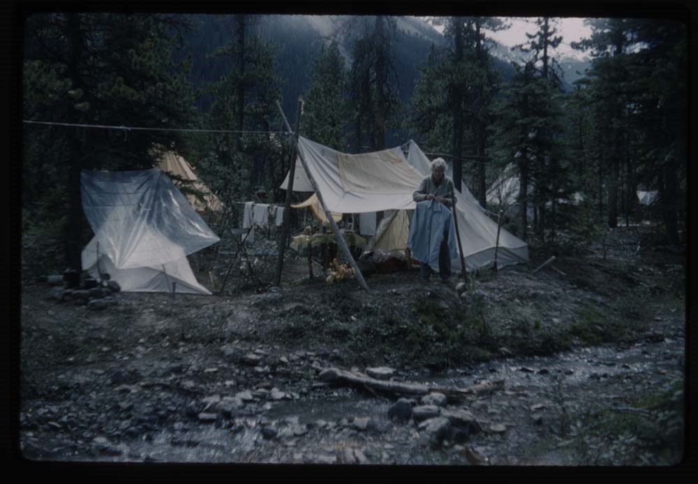
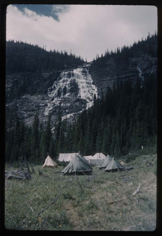
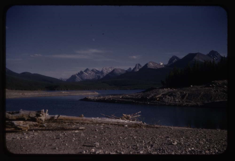
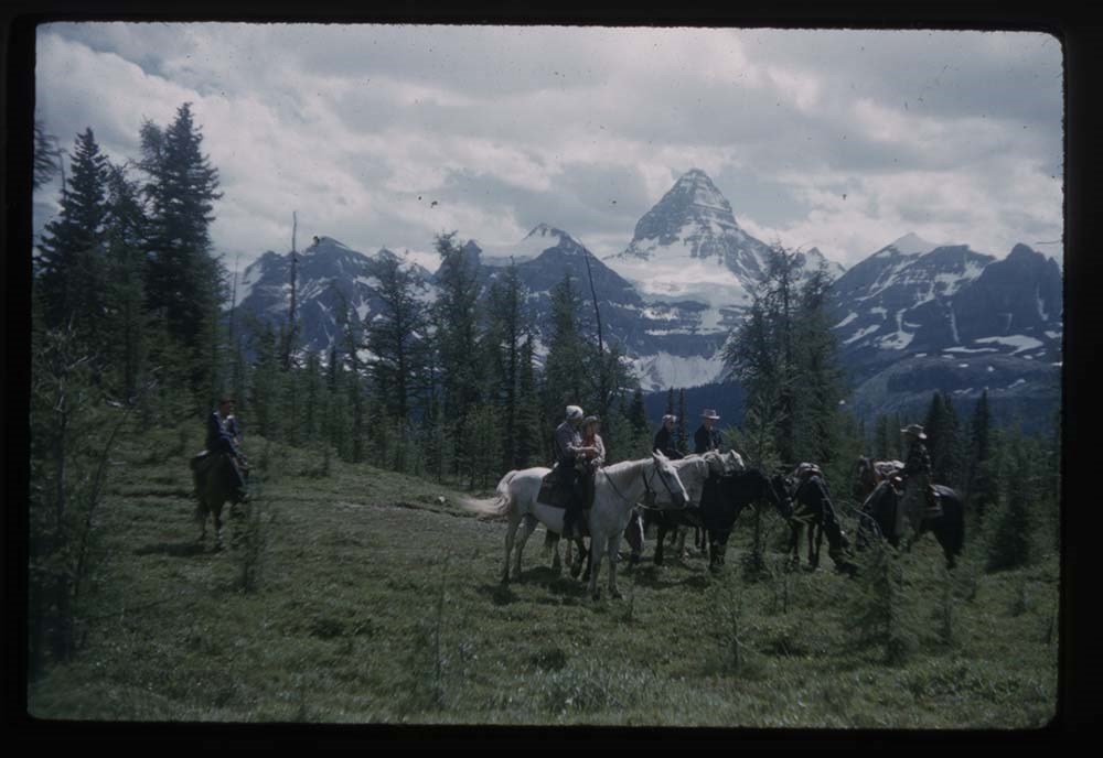
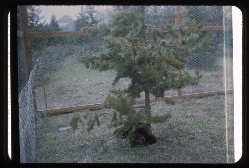
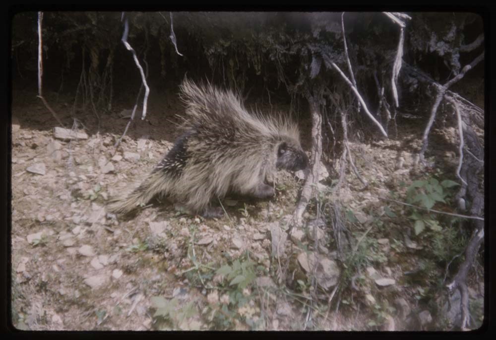
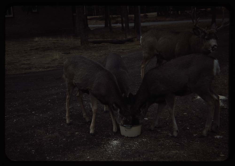
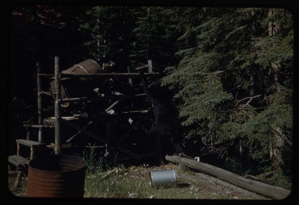
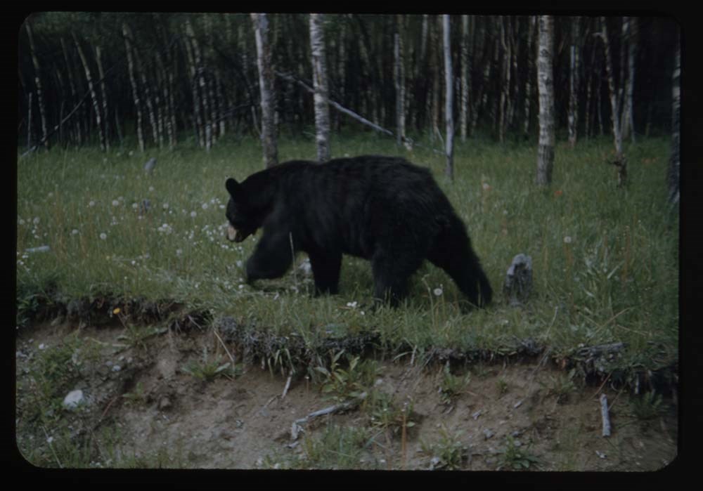
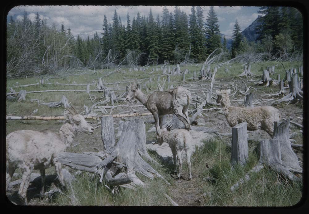
Canadian Rockies Slide Show - Series IV [2/2]
https://archives.whyte.org/en/permalink/descriptions1850
- Part Of
- Lillian Gest fonds
- Scope & Content
- File pertains to 78 slides assembled by Lillian Gest in 1973 into a show from slides pertaining to various summertime trips to the Canadian Rockies throughout the 1950s to the early 1970s. Topics include mountains, mountain views, wildflowers, wildlife [including elks, goats, pekas, ground squirrel…
- Date Range
- 1951-1973
- Reference Code
- V225 / II / C / ii / a / ii / NS - IV / 2
- Description Level
- 5 / File
- GMD
- Film
- Transparency
77 images
1 Electronic Resource
- Part Of
- Lillian Gest fonds
- Description Level
- 5 / File
- Fonds Number
- M67 / S36 / V225
- Series
- II.C. Activities / photography
- Sous-Fonds
- V225
- Sub-Series
- ii.a.ii Photographic material / transparencies / carousels
- Accession Number
- 5142
- Reference Code
- V225 / II / C / ii / a / ii / NS - IV / 2
- GMD
- Film
- Transparency
- Parallel Title
- 19__ Can R series IV No 2. -- [197-] V225 / NS 22
- Date Range
- 1951-1973
- Physical Description
- 78 photographs : col. slides ; 35 mm
- History / Biographical
- See fonds level description.
- Scope & Content
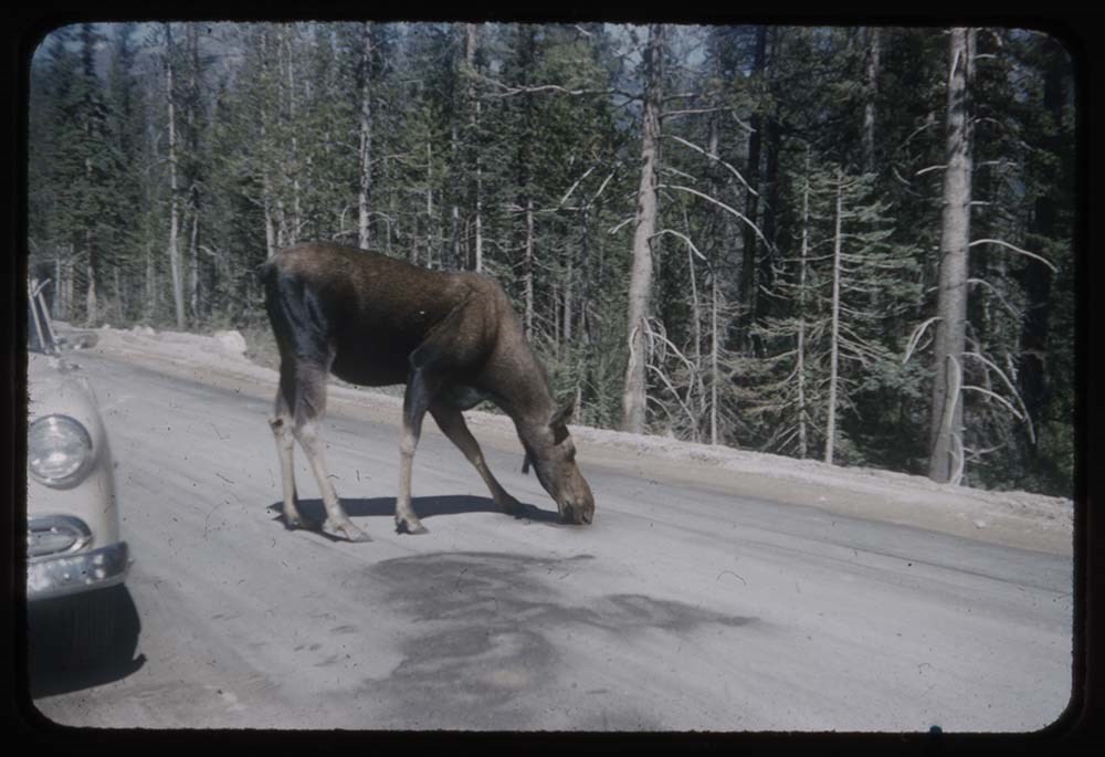
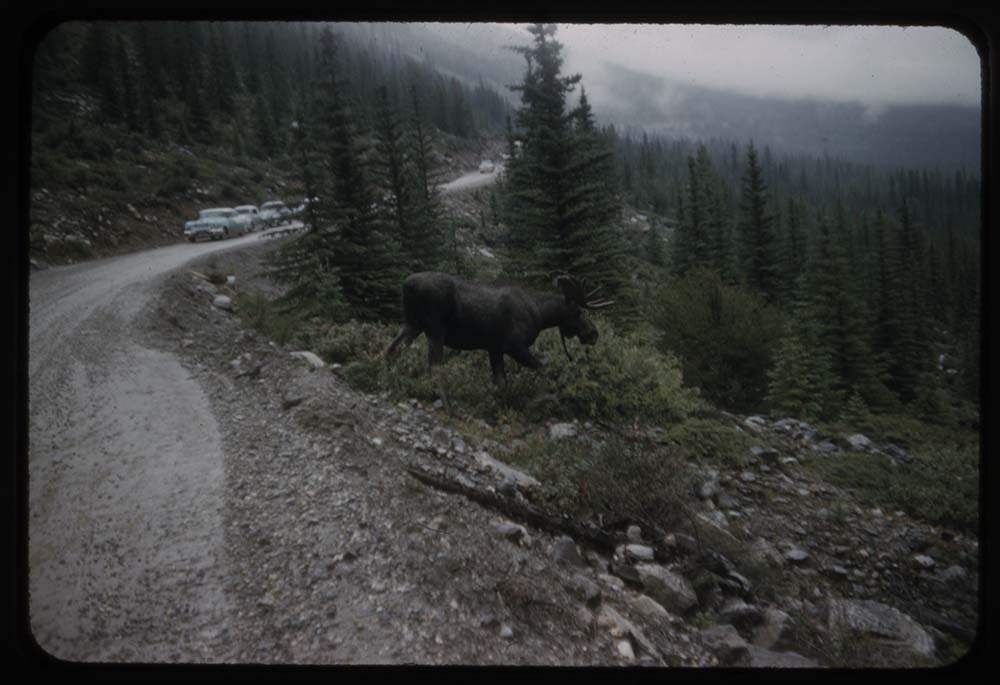
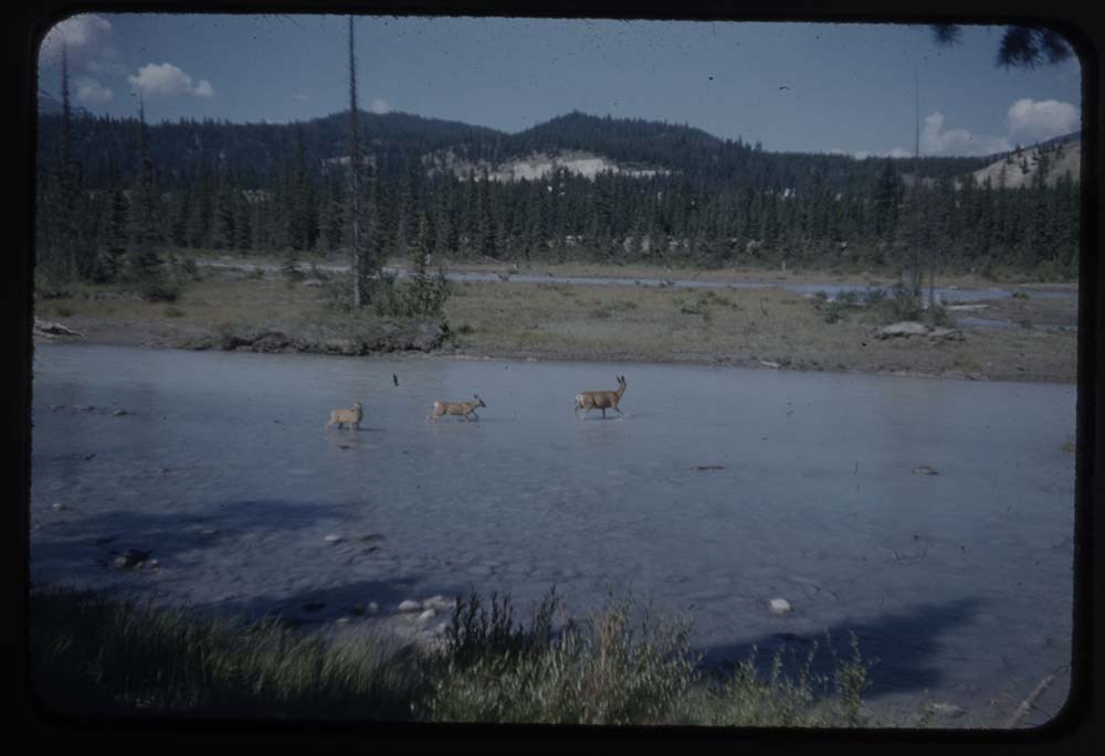
- File pertains to 78 slides assembled by Lillian Gest in 1973 into a show from slides pertaining to various summertime trips to the Canadian Rockies throughout the 1950s to the early 1970s. Topics include mountains, mountain views, wildflowers, wildlife [including elks, goats, pekas, ground squirrels, and birds], Lillian and her friends [Polly and Phyl, as well as ACC camp members], lakes, boats, fishing, hiking, camps, and various other activities. Titles: 1960 1. B31-37 Lake MacArthur - ice 2. grassi 18-59 Mt Huber & larches 1958 3. B20-24 Polly Merrick & Eileen 1951 4. R172-11 Camp & reflections - Opabin Pass in b.g. 5. R171-6 Alpine Party by lake 1963 6. B54-38 My ice ax points to glacier worm cores 1960 7. B31-35 Trail near Lake MacArthur 8. B31-36 [Trail near Lake MacArthur] different 9. B29-32 4 hikers neet John Linn on horse 10. B32-3 MacArthur Lake & reflections 11. B32-4 Big rock by MacA Lake & hikers 12. B32-8 Lake & reflections 13. B32-9 MacA Lake, Mt Biddle & reflections 14. B32-10 [MacA Lake] looking towards Biddle - Park col. 15. B32-11 Tepees in meadow at O'Hara 1963 16. B54-29 Group of hikers across lake Mt Cath in b.g naturalist group 17. B54-31 Diana Park by on Opabin Lake 18. Grassi 16 Larches at O'Hara 1959 19. B24-27 Tree with cones 1960 20. B29-14 Tree with cones - Lake O'Hara in bg 1955 21. R207-25 Abbot Pass 22. R207-24 Eileen & Edward on glacier 23. R207-36 L.G at Abbot Pass Vic ridge in b.g. 24. R208-4 Party below Pass 1951 25. R174-5 Party at Oesa - Lefroy in b.g. 26. R172-22 Edwards Party - Opabin Pass in b.g. 27. O Caroline Hinman in 1932 1953 28. R185-27 Polly Prescott & boat by lake 1952 29. R183-14 Miette Pool 30. O CH Maligne Lake 1952 31. R183-6 Lake Beauvert 1953 32. R191-4 Mt Cavel & Jasper Lodge 1951 33. R169-11 Emerald Lake & Mt President & Vice P. 34. Reel 44-9 Mt Burgess 1951 35. R169-15 Kelloggs on rock. Emerald Lake 36. R169-17 Frances on rock 37. CH 6/70 Assiniboine 1952 38. R179-20 Mt Assiniboine w. plume [MISSING] 39. R181-29 Marg, Fleming and Muriel on horses - Mt Assiniboine [MISSING] 40. R181-31 Mt Aye & riders 41. R181-32 End of trail by dam - out of Assiniboine 42. R181-33 Spray Lake by dam 43. R179-9 Trail far side of Wonder Pass 45. R179-39 2 hikers above marvel Lake 46. R180-31 Assiniboine fr. near Sunburst Lake 47. R180-34 Wedgwood Pt. 48. R179-22 Mt Assiniboine & campers 1955 49. R202-35 Strom's Halfway camp 50. R205-21 Party on horses. Mt Assin. in bg 51. R205-10 Stroms w. corral - main Lodge 52. R203-4 L.G. - Lake Magog - Assin & Magog 53. R203-19 Elizabeth Rummel's Cabin and Sunburnt L. 1952. 54. R180.38 Mt Assin. & 2 climbers 55. R181.23 Mt Assin - hikers on Nub 56. R181.22 [Mt Assin] LG on Nub 1951 57. R170-10 Chalice cup 58. O CH Wind flower (on globe) 1952 59. R183-8 Elk - head down 1954 60. R195-39 Wolverine Disney's animal farm 1965 61. B72-10 Porcupine 62. CH.49 3 Does & buck eating oatmeal 63. CH.0 Rams 1965 64. B71-34 Marg, Fleming & ewe July '52 65. R178-26 Squirrel on rucksack - Lake Agnes July '52 66. R178-28 Bear at the Clubhouse 1964 67. B67-15 Strom & porcupine on hitching post 68. B67-21 Porcupine on same - boy looks on 1959 69. B26-18 Ptarmigan 70. Ruth B. Water onzel[?] rock - near Assin. 1955 71. R207-12 Cow moose on road to Moraine Lake 1957 72. B11-33 Moose moves off road - good 1953 73. R190-37 Deer crossing river 1956 74. B1-1 Moose at Hilldale 1958 75. B15-33A Phyl's bitterns 1952 76. R177-33 Bear walking back above road 1959 77. B27-33 Sheep on rocks 1954 78. R196-19 SHeep among dead stumps 1960 79. B32-37 A sheep on cliff 1959 80. B22-2 Elk apposite air strip
- Notes
- Slides 38 and 39 are missing. Please note: Behavior towards wildlife, primarily human proximity and feeding, is outdated and no longer tolerated throughout all National Parks - do not feed or approach wildlife. Slides originally in Kodak Carousel 80 slide tray.
- Name Access
- Gest, Lillian
- Alpine Club of Canada
- Hinman, Caroline
- Prescott, Polly
- Prescott, Kay
- Brooks, Eric
- Munday, Phyllis
- Strom, Erling
- Subject Access
- Activities
- Alpine Club of Canada
- Animals
- Avalanches
- Backpacking
- Birds
- Boats
- Cabins and shelters
- Camping
- Camps
- Canoes and canoeing
- Climbing
- Club
- Elk
- Entertainment
- Environment
- Environment and Nature
- Flowers
- Geography
- Glaciers
- Guides
- Guiding
- Hiking
- Holidays
- Horses
- Huts
- Lake O'Hara region
- Landscapes
- Leisure
- Mountain
- Mountain Goat
- Mountaineering
- Mountains
- National parks and reserves
- Outfitters, trail guides and packers
- Pack trains
- Pack trips
- Personal and Family Life
- Photography
- Portrait
- Recreation
- Scenery
- Tavel
- Trails
- Travel
- Wildlife
- Women
- Geographic Access
- Lake O'Hara
- Emerald Lake
- Yoho National Park
- Moraine Lake
- Banff National Park
- Mount Robson
- Maligne Lake
- Jasper
- Jasper National Park
- British Columbia
- Alberta
- Canada
- Language
- English
- Conservation
- Slides rehoused into protective sleeves and acid-free folders after scanning.
- Related Material
- M67 / II / C / i / c / 56 / IV - 1 and IV - 2 ; M67 / 51 [notebook of original slide orders]
- Creator
- Gest, Lillian
- Title Source
- Title based on contents of file
- Processing Status
- Processed
Electronic Resources
Images


This material is presented as originally created; it may contain outdated cultural descriptions and
potentially offensive content.
Read more.