Narrow Results By
- Ben Gadd fonds 37
- Luxton family fonds 13
- Murray Hay fonds 11
- Chic Scott fonds 8
- Lillian Gest fonds 8
- Trail Riders of the Canadian Rockies fonds 5
- Nicholas Morant fonds 4
- Maryalice Harvey Stewart fonds 3
- Dorothy Wardle fonds 2
- Aileen Harmon fonds 1
- Archives General File Collection 1
- Malcolm Geddes fonds 1
- Part Of
- Murray Hay fonds
- Scope & Content
- File consists of 144 photographs : col. negatives ; 35 m m; 12 prints : col. ; 42 x 35 cm or smaller ; 1 cm of visual material. File pertains to various projects Murray Hay was involved with related to Alaska, USA, particularly in the mid-1990s. File includes: aerial photographs of the landscape (A…
- Date Range
- ca.1990-ca.1999
- 1992
- 1994
- Reference Code
- V795 / II / D / i / 1-2
- Description Level
- 5 / File
- GMD
- Drawing
- Map
- Photograph print
- Negative
- Private record
- Textual record
- Part Of
- Murray Hay fonds
- Description Level
- 5 / File
- Fonds Number
- M570 / V795
- Series
- V795 / II : Unpublished Material
- Sous-Fonds
- V795
- Sub-Series
- V795 / II / D : International / i : United States of America
- Accession Number
- 2019.41
- Reference Code
- V795 / II / D / i / 1-2
- Date Range
- ca.1990-ca.1999
- 1992
- 1994
- Physical Description
- 144 photographs : col. negatives ; 35 mm
- 12 prints : col. ; 42 x 35 cm or smaller
- 1 cm of visual material
- Scope & Content
- File consists of 144 photographs : col. negatives ; 35 m m; 12 prints : col. ; 42 x 35 cm or smaller ; 1 cm of visual material. File pertains to various projects Murray Hay was involved with related to Alaska, USA, particularly in the mid-1990s. File includes: aerial photographs of the landscape (Anchorage area, Homer, Prince William Sound, Valdez); hand-drawn draft maps of the Prince William Sound region (created for a cruise line); a variety of printed maps with annotations demonstrating comments (including a fax with an attached map from Dana at Adventure Media International); and a variety of printed reproductions of draft maps (Alyeska Ski Resort, City of Anchorage for the 1992 Olympic Bid, and Glacier Bay and the Tongass National Forest).
- Notes
- Items not in oversize (negatives) stored in downstairs vault.
- Name Access
- Hay, Murray
- Subject Access
- Advertising
- Artist
- Ski Maps
- Map
- Cartography
- Sports and recreation
- Tourism
- Tourist information
- Travel
- Geography
- Winter
- Winter sports
- Ski area
- Olympic Games (Winter)
- Geographic Access
- Alaska
- United States
- Valdez
- Prince William Sound
- Anchorage
- Glacier Bay and Tongass National Forest
- Language
- English
- Conservation
- Masking tape should be removed and alternative preservation methods used in the future.
- Related Material
- M570 / IV / A / 2-3
- Creator
- Hay, Murray
- Title Source
- Title based on contents of file
- Processing Status
- Processed
This material is presented as originally created; it may contain outdated cultural descriptions and
potentially offensive content.
Read more.
Antique Maps of India and Germany, Walter Wilcox Mounts
https://archives.whyte.org/en/permalink/descriptions54204
- Part Of
- Nicholas Morant fonds
- Scope & Content
- File consists of 13 antique maps, 6 of which depict regions in India and 7 which depict regions in Germany. Content pertains to a small map collection originally issued to Tim Ffrench (?) during WWII which were later owned by Nicholas Morant. Some maps of reserves contain personal annotations and h…
- Date Range
- 1868
- 1892
- 1894
- 1903
- 1904
- 1917
- 1921
- 1950
- Reference Code
- M300 / III / D / 5 / 54 to 66 O.S. & V500 / III / D / 5 / PA - 96 O.S.
- Description Level
- 5 / File
- GMD
- Map
- Textual record
- Part Of
- Nicholas Morant fonds
- Description Level
- 5 / File
- Fonds Number
- V500
- Sous-Fonds
- V500
- Sub-Series
- M300 & V500 / III / D / 5 : Personal Interest and Gifts
- Accession Number
- 7784
- Reference Code
- M300 / III / D / 5 / 54 to 66 O.S. & V500 / III / D / 5 / PA - 96 O.S.
- GMD
- Map
- Textual record
- Other Title Info
- Parallel title is original title
- Responsibility
- Nicholas Morant
- Date Range
- 1868
- 1892
- 1894
- 1903
- 1904
- 1917
- 1921
- 1950
- Physical Description
- 13 Maps: print; b&w, and set of 4 rag paper mounts
- Scope & Content
- File consists of 13 antique maps, 6 of which depict regions in India and 7 which depict regions in Germany. Content pertains to a small map collection originally issued to Tim Ffrench (?) during WWII which were later owned by Nicholas Morant. Some maps of reserves contain personal annotations and highlighted/coloured routes; none of German maps are annotated. File also contains set of 4 rag paper mounts, annotated. 3 naming artist Walter Wilcox (likely formerly held his works but are now blank). One labelled 'Model'.
- Notes
- Maps were originally stored together in one poster tube labelled: "MAPS OF GERMANY INDIA See notes inside" Shipping label: PLS HOLD Armand To Nicholas Morant 222 Melville Ave Westmount Montreal" (with two 3 - cent stamps attached) Note inside, written by Nicholas Morant: "These maps were among those issued to Capt. Tim Ffrench (?) preparatory to intelligence work done during W. War II" Signed "Nick M." Wilcox mounts were stored in brown paper packaging with several other blank mounts (disposed of). Labelled section of original paper packaging has been stored with mounts in oversize box for reference.
- Geographic Access
- Germany
- India
- Access Restrictions
- Items in this file are not to be accessed or distributed without the explicit permission of their identified owners
- Reproduction Restrictions
- Items in this file are not to be reproduced without the explicit permission of their identified owners.
- Language
- English
- German
- Conservation
- Items must be kept only with items of similar materials, and stored with protective acid-free barriers to prevent further damage.
- Title Source
- Title based on contents of file
- Processing Status
- Processed
This material is presented as originally created; it may contain outdated cultural descriptions and
potentially offensive content.
Read more.
- Part Of
- Murray Hay fonds
- Scope & Content
- File consists of 1 map : col., annotations, 96.5 x 69 cm. File pertains to an original unfinished hand-drawn map of interior Arizona in red, blue, black, and purple ink. Includes geographic features and labeled cities (including Yuma, Nogales, Bisbee, and Flagstaff).
- Date Range
- ca.1990-ca.1999
- Reference Code
- V795 / II / D / i / 4
- Description Level
- 5 / File
- GMD
- Drawing
- Map
- Private record
- Textual record
- Part Of
- Murray Hay fonds
- Description Level
- 5 / File
- Fonds Number
- M570 / V795
- Series
- V795 / II : Unpublished Material
- Sous-Fonds
- V795
- Sub-Series
- V795 / II / D : International / i : United States of America
- Accession Number
- 2019.41
- Reference Code
- V795 / II / D / i / 4
- Date Range
- ca.1990-ca.1999
- Physical Description
- 1 map : col., annotations ; 96.5 x 69 cm
- Scope & Content
- File consists of 1 map : col., annotations, 96.5 x 69 cm. File pertains to an original unfinished hand-drawn map of interior Arizona in red, blue, black, and purple ink. Includes geographic features and labeled cities (including Yuma, Nogales, Bisbee, and Flagstaff).
- Name Access
- Hay, Murray
- Subject Access
- Advertising
- Artist
- Ski Maps
- Map
- Cartography
- Sports and recreation
- Tourism
- Tourist information
- Travel
- Geography
- Winter
- Winter sports
- Ski area
- Geographic Access
- Arizona
- United States
- Language
- English
- Creator
- Hay, Murray
- Title Source
- Title based on contents of file
- Processing Status
- Processed
This material is presented as originally created; it may contain outdated cultural descriptions and
potentially offensive content.
Read more.
Author's copy of Geology Road Tours
https://archives.whyte.org/en/permalink/descriptions56293
- Part Of
- Ben Gadd fonds
- Scope & Content
- File consists of one author's copy of Ben Gadd's book, Geology Road Tours, which includes corrections and other annotations by the author.
- Date Range
- 2008
- Reference Code
- M590 / II / B / 59
- Description Level
- 5 / File
- GMD
- Textual record
- Published record
- Part Of
- Ben Gadd fonds
- Description Level
- 5 / File
- Fonds Number
- M590
- V810
- S61
- Series
- M590 / II : Research and publication records
- Sous-Fonds
- M590
- Sub-Series
- M590 / II / B : Other publications
- Accession Number
- 2021.20
- Reference Code
- M590 / II / B / 59
- Responsibility
- Produced by Ben Gadd, Corax Press
- Date Range
- 2008
- Physical Description
- 3.5 cm of textual records : 1 volume ; 15.5 x 23 cm
- Scope & Content
- File consists of one author's copy of Ben Gadd's book, Geology Road Tours, which includes corrections and other annotations by the author.
- Name Access
- Gadd, Ben
- Subject Access
- Publication
- Commercial products
- Environment
- Geology
- Science and technology
- Geography
- Natural history
- Travel
- Roads
- Map
- Geographic Access
- Canada
- Alberta
- British Columbia
- Canadian Rocky Mountains
- Reproduction Restrictions
- Copyright restrictions may apply
- Language
- English
- Title Source
- Title based on contents of file
- Processing Status
- Processed
This material is presented as originally created; it may contain outdated cultural descriptions and
potentially offensive content.
Read more.
Auyuittuq National Park
https://archives.whyte.org/en/permalink/descriptions54979
- Part Of
- Murray Hay fonds
- Scope & Content
- File consists of 1 painting : landscape ; 50.5 x 39.5 cm. File pertains to a map Murray Hay created of Auyuittuq National Park in Nunavut, Canada. File includes 1 colour painting of the park and surrounding area (Nunavut, Baffin Island) and one sheet of tracing paper that is annotated and taped wit…
- Date Range
- ca.1980-ca.1989
- Reference Code
- V795 / II / C / vi / 1
- Description Level
- 5 / File
- GMD
- Map
- Painting
- Private record
- Part Of
- Murray Hay fonds
- Description Level
- 5 / File
- Fonds Number
- M570 / V795
- Series
- V795 / II : Unpublished Material
- Sous-Fonds
- V795
- Sub-Series
- V795 / II / C : Canada [general] / vi : Auyuittuq National Park
- Accession Number
- 2020.03
- Reference Code
- V795 / II / C / vi / 1
- Date Range
- ca.1980-ca.1989
- Physical Description
- 1 painting : landscape ; 50.5 x 39.5 cm
- Scope & Content
- File consists of 1 painting : landscape ; 50.5 x 39.5 cm. File pertains to a map Murray Hay created of Auyuittuq National Park in Nunavut, Canada. File includes 1 colour painting of the park and surrounding area (Nunavut, Baffin Island) and one sheet of tracing paper that is annotated and taped with masking tape over the painting.
- Name Access
- Hay, Murray
- Subject Access
- Advertising
- Artist
- Map
- Cartography
- Painting
- Geography
- Tourism
- Tourist information
- Travel
- National parks and reserves
- Auyuittuq National Park
- Geographic Access
- Auyuittuq National Park
- Nunavut
- Canada
- Language
- English
- Conservation
- Masking tape should be removed and alternative preservation methods should be considered at a reasonable time to do so.
- Creator
- Hay, Murray
- Title Source
- Title based on contents of file
- Processing Status
- Processed
This material is presented as originally created; it may contain outdated cultural descriptions and
potentially offensive content.
Read more.
Baja California Sur, Mexico
https://archives.whyte.org/en/permalink/descriptions54974
- Part Of
- Murray Hay fonds
- Scope & Content
- File consists of 11 maps : mss. and reproductions, some col., annotations ; 43 x 94 cm or smaller. File pertains to a project Murray Hay worked on for Glacier Bay Tours and Cruises (based out of Alaska). File includes 11 original hand-drawn and reproduced drafts, including annotations, of a map dep…
- Date Range
- ca.1990-ca.1999
- ca. 1998
- Reference Code
- V795 / II / D / ii / 2-3
- Description Level
- 5 / File
- GMD
- Drawing
- Map
- Private record
- Part Of
- Murray Hay fonds
- Description Level
- 5 / File
- Fonds Number
- M570 / V795
- Series
- V795 / II : Unpublished Material
- Sous-Fonds
- V795
- Sub-Series
- V795 / II / D : International / ii : Miscellaneous
- Accession Number
- 2019.41
- Reference Code
- V795 / II / D / ii / 2-3
- GMD
- Drawing
- Map
- Private record
- Date Range
- ca.1990-ca.1999
- ca. 1998
- Physical Description
- 11 maps : mss. and reproductions, some col., annotations ; 43 x 94 cm or smaller
- Scope & Content
- File consists of 11 maps : mss. and reproductions, some col., annotations ; 43 x 94 cm or smaller. File pertains to a project Murray Hay worked on for Glacier Bay Tours and Cruises (based out of Alaska). File includes 11 original hand-drawn and reproduced drafts, including annotations, of a map depicting the Baja California Sur region and the cruise's route in this area.
- Notes
- Originally filed with correspondence related to this project [see related material]. "For Steve Cowart" is also written on at least one map (who Murray Hay is corresponding with in M570 / IV / A / 1). Items not in oversize stored in downstairs vault.
- Name Access
- Hay, Murray
- Cowart, Steve
- Subject Access
- Advertising
- Artist
- Cartography
- Map
- Tourism
- Tourist information
- Travel
- Geography
- Geographic Access
- Mexico
- Baja California Sur
- Language
- English
- Related Material
- M570 / IV / A /1
- Creator
- Hay, Murray
- Title Source
- Title based on contents of file
- Processing Status
- Processed
This material is presented as originally created; it may contain outdated cultural descriptions and
potentially offensive content.
Read more.
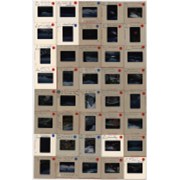
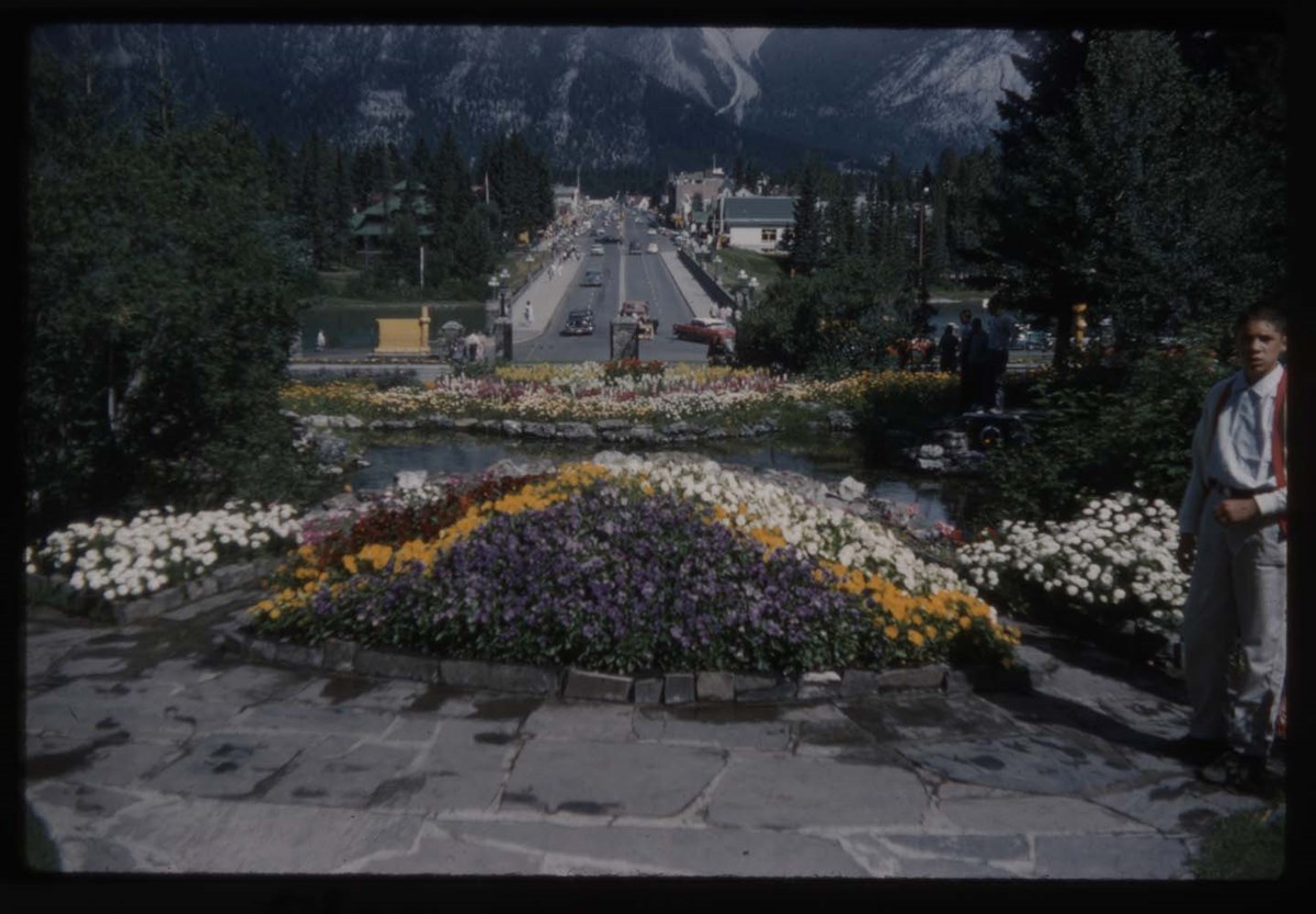
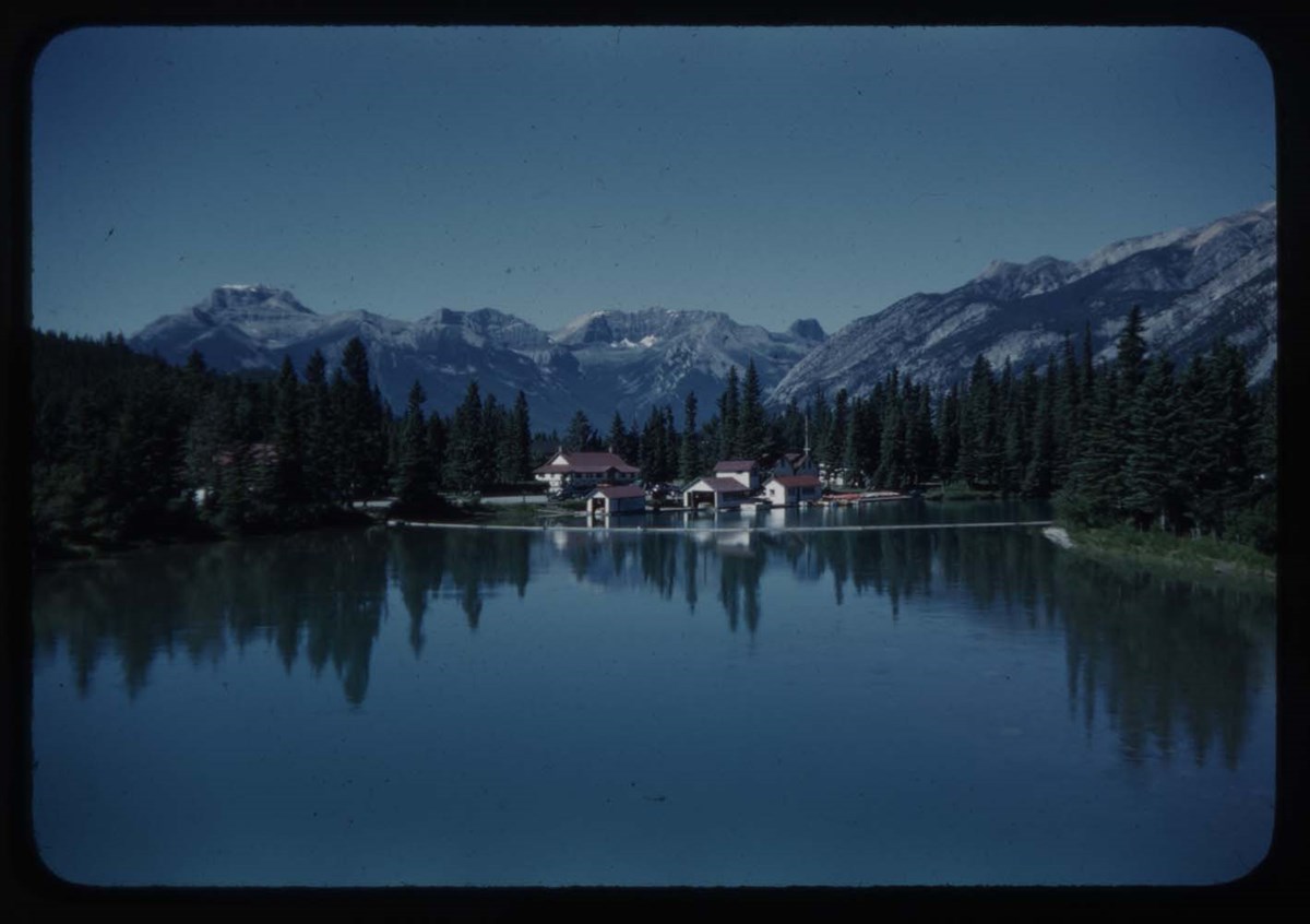
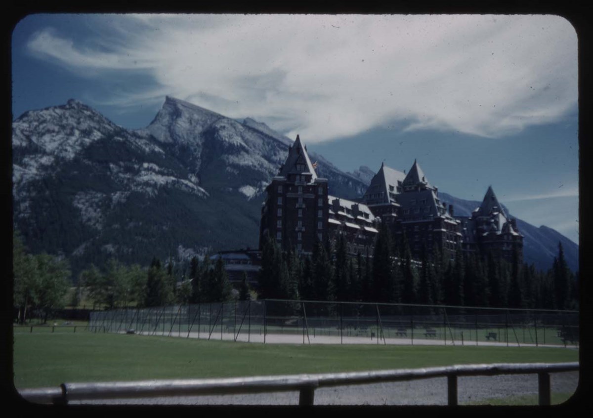
Banff and Lake Louise Slide Show - Series III [1/2]
https://archives.whyte.org/en/permalink/descriptions1851
- Part Of
- Lillian Gest fonds
- Scope & Content
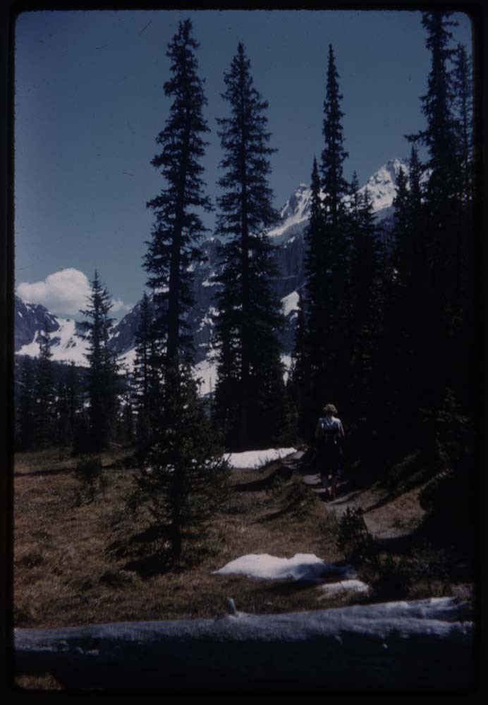
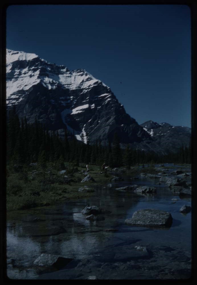
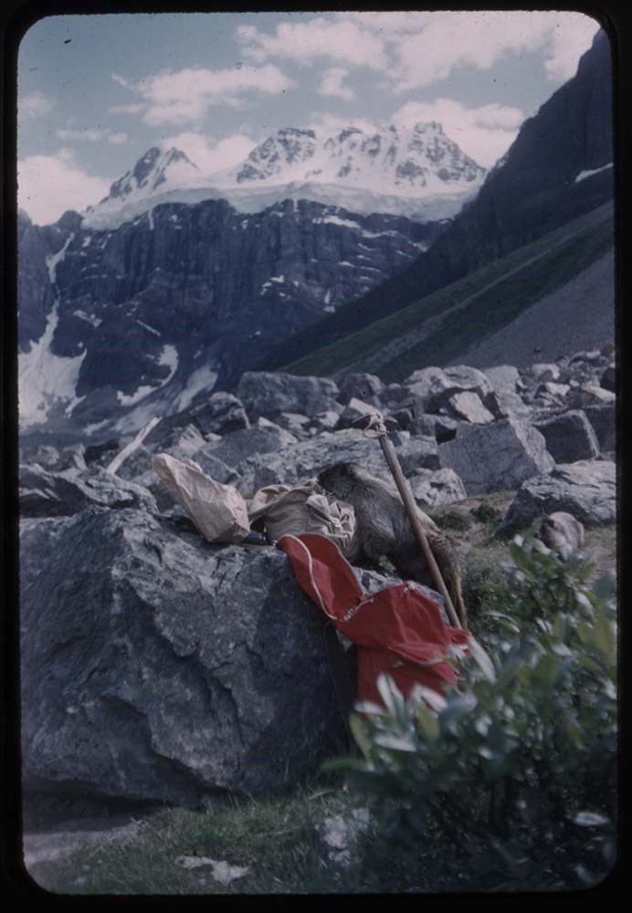
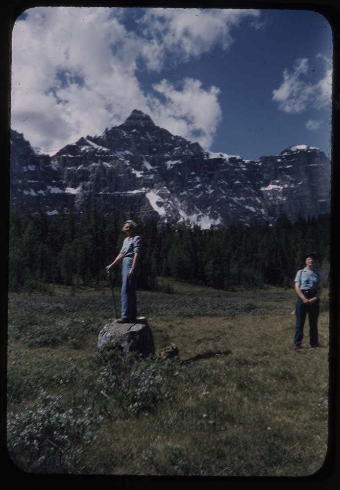
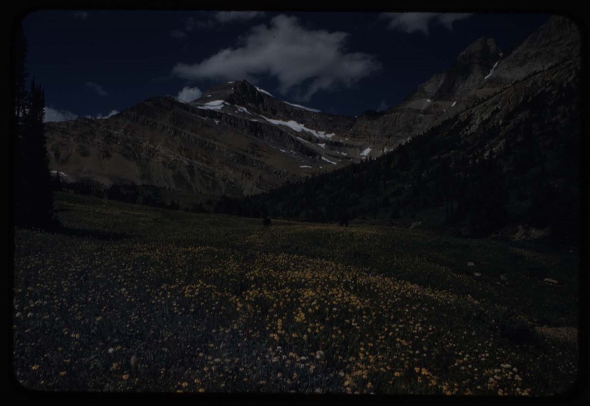
- File pertains to 80 slides assembled by Lillian Gest in 1977 into a show from slides pertaining to various summertime trips to the Canadian Rockies throughout the 1960s and early 1970s. Topics include mountains [mostly those located around the town of Banff], mountain views, wildflowers, wildlife, …
- Date Range
- [ca. 1960-1977]
- Reference Code
- V225 / II / C / ii / a / ii / NS - III / 1
- Description Level
- 5 / File
- GMD
- Film
- Transparency
80 images
1 Electronic Resource
- Part Of
- Lillian Gest fonds
- Description Level
- 5 / File
- Fonds Number
- M67 / S36 / V225
- Series
- II.C. Activities / photography
- Sous-Fonds
- V225
- Sub-Series
- ii.a.ii Photographic material / transparencies / carousels
- Accession Number
- 5142
- Reference Code
- V225 / II / C / ii / a / ii / NS - III / 1
- GMD
- Film
- Transparency
- Parallel Title
- Selected C R series 3 Reel 1 show Sept 1977. -- [before 1977] V225 / 23
- Date Range
- [ca. 1960-1977]
- Physical Description
- 80 photographs : col. slides ; 35 mm
- History / Biographical
- See fonds level description.
- Scope & Content
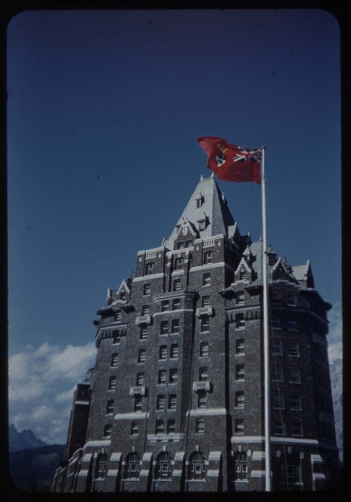
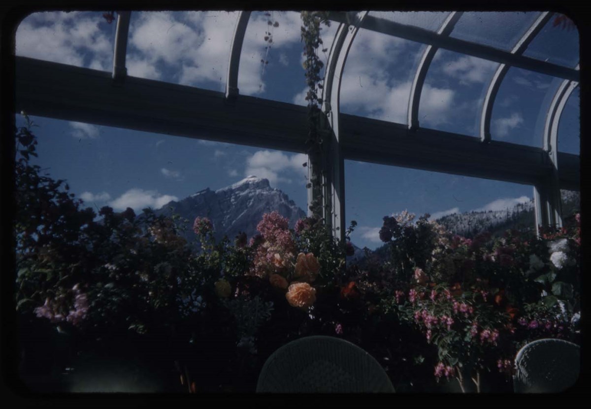
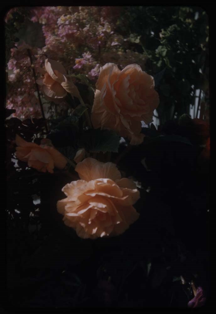
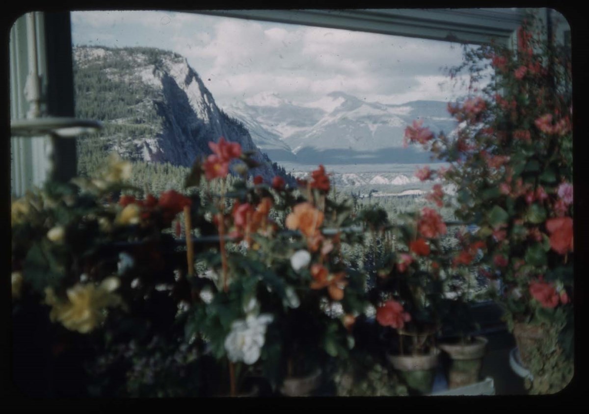
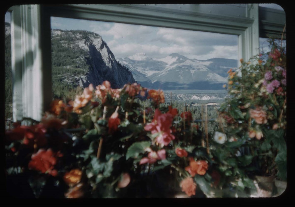
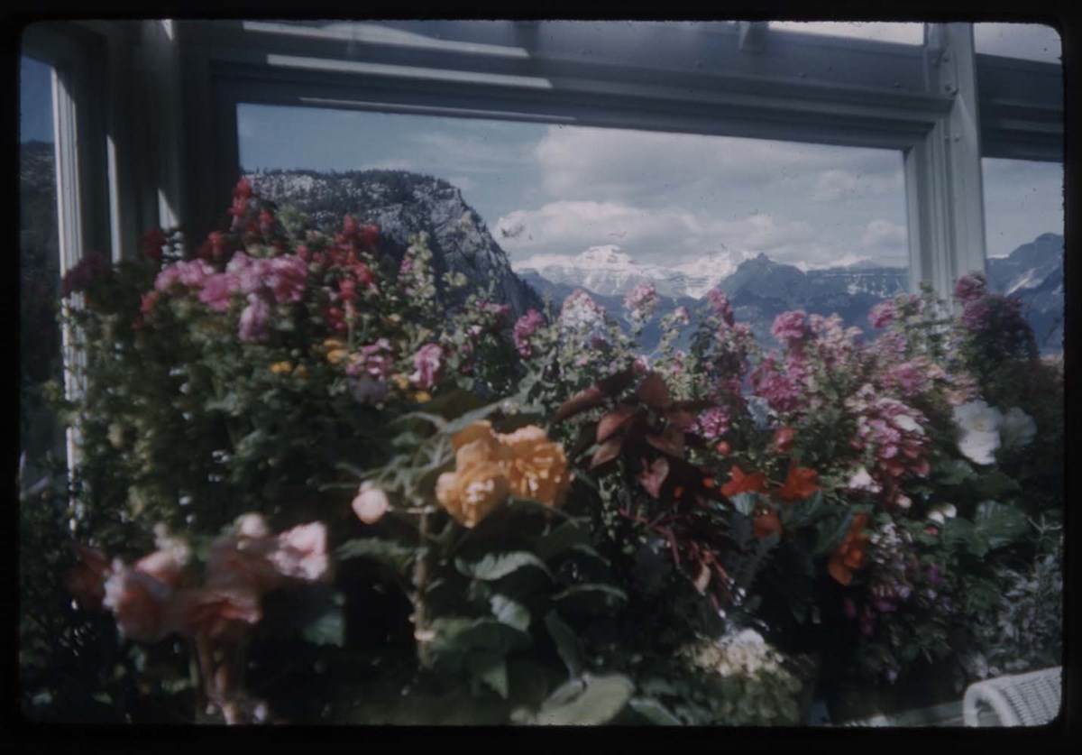
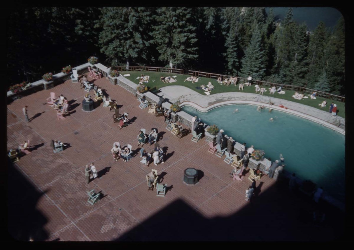
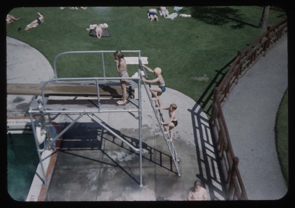
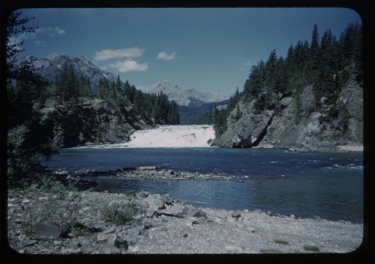
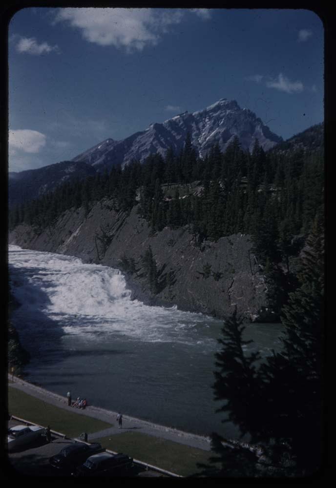
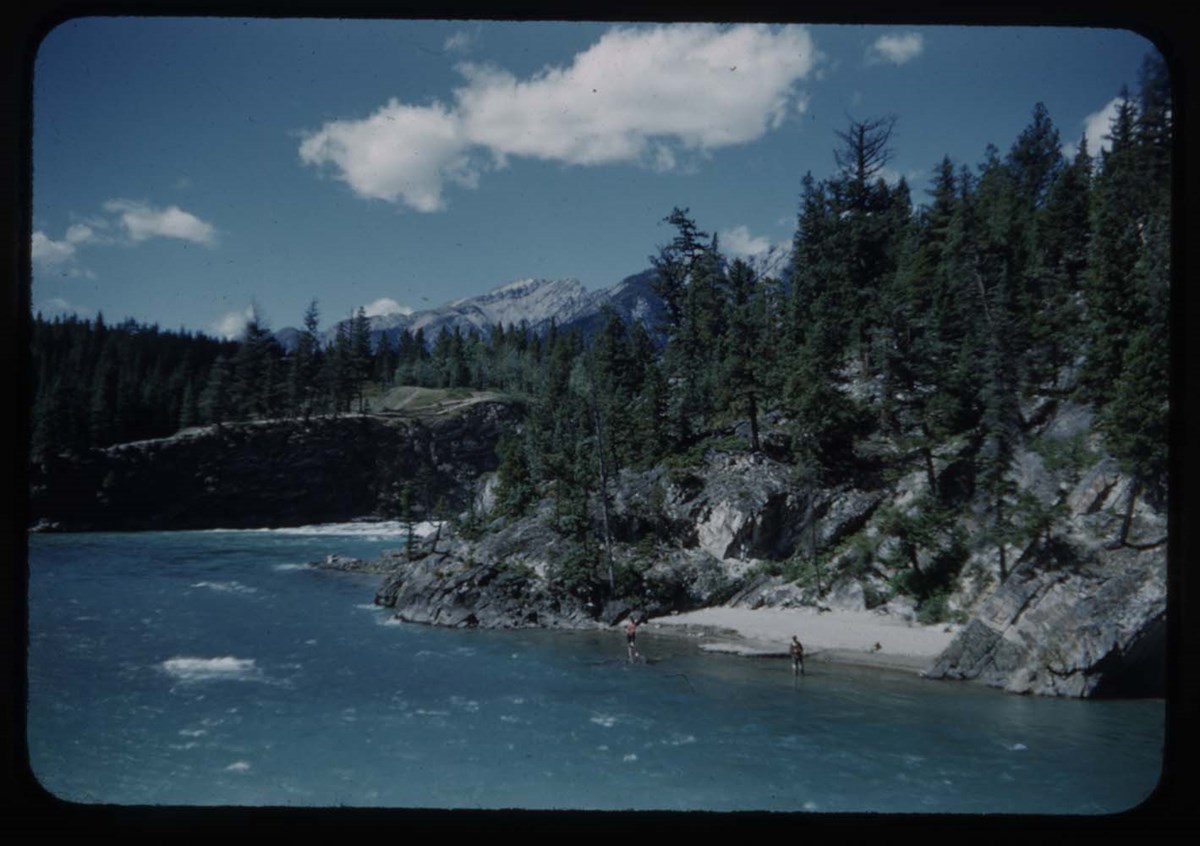
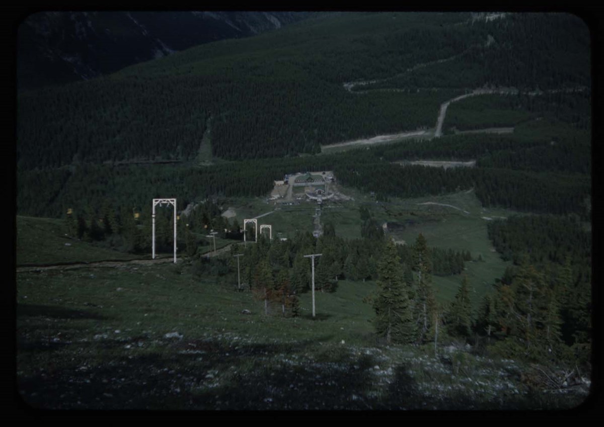
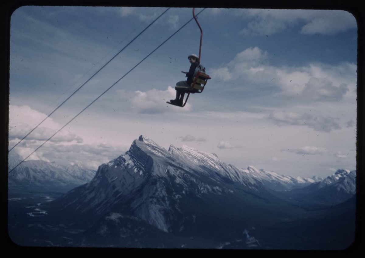
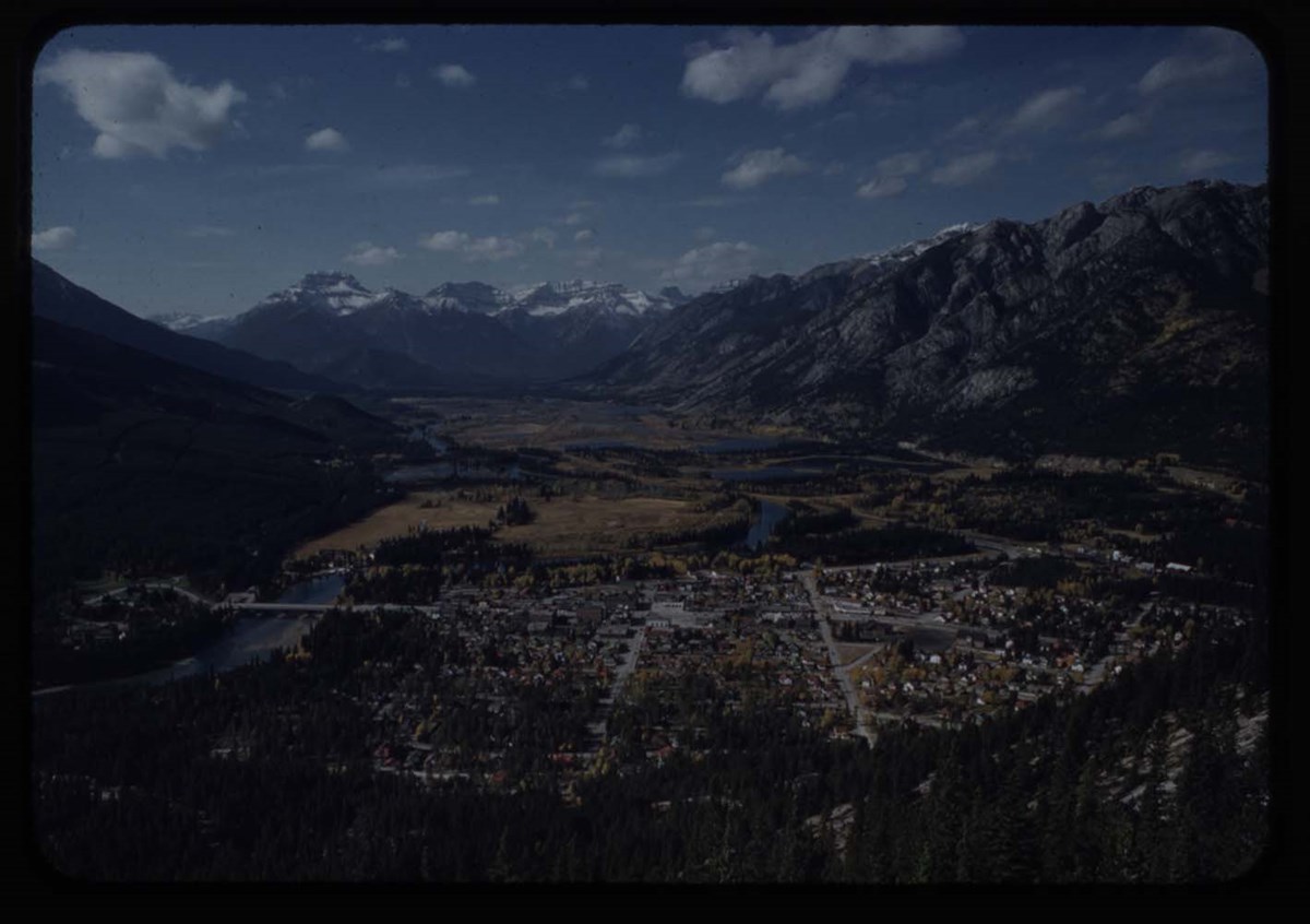
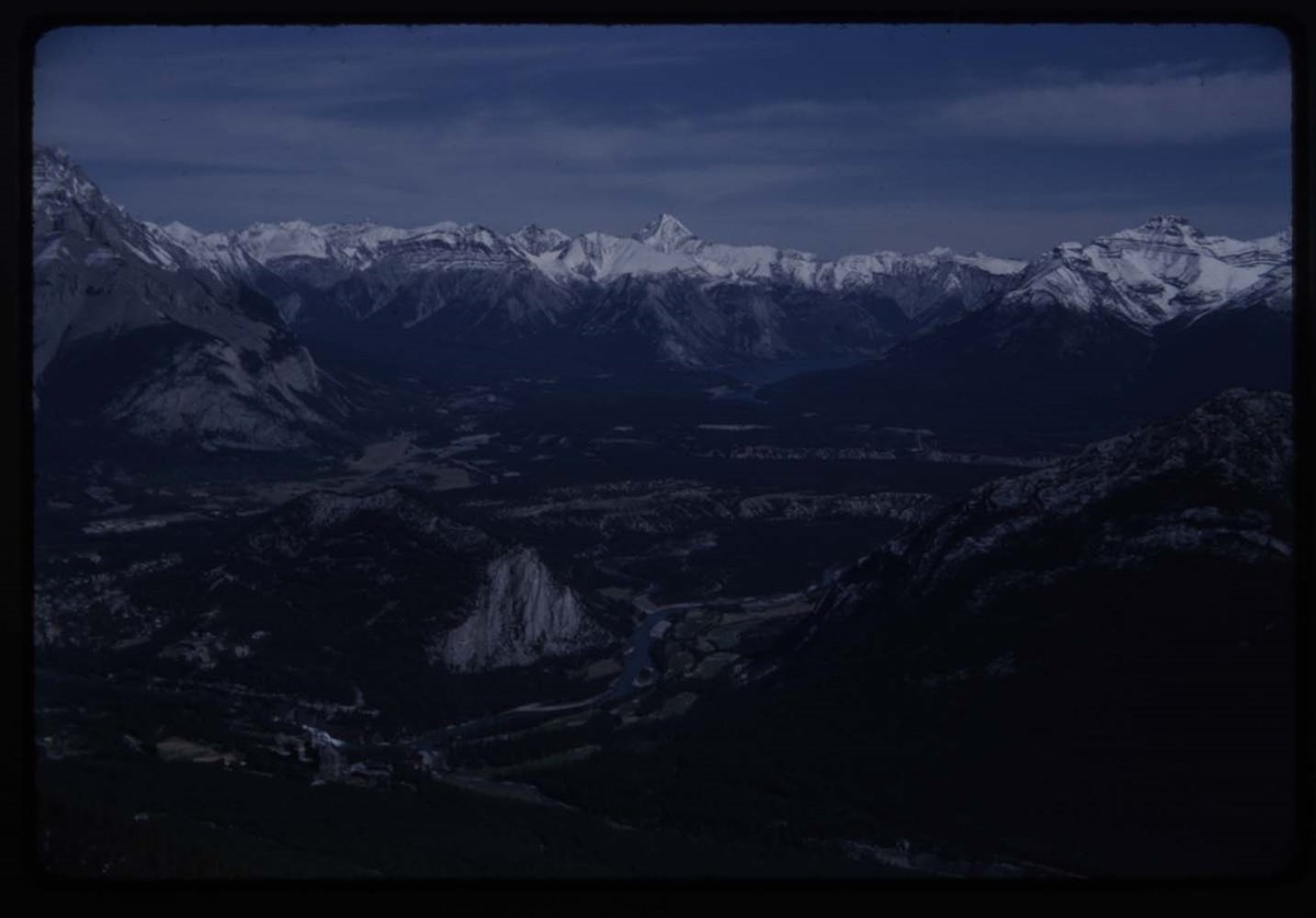
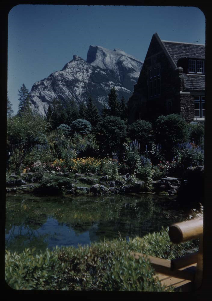
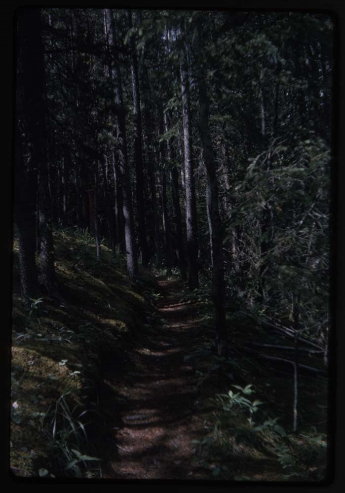
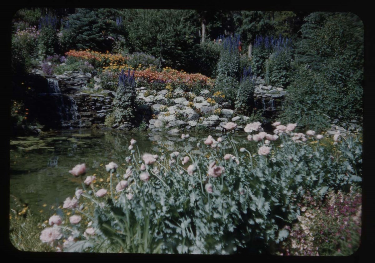
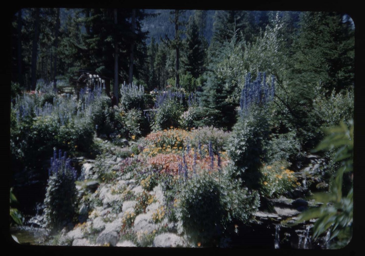
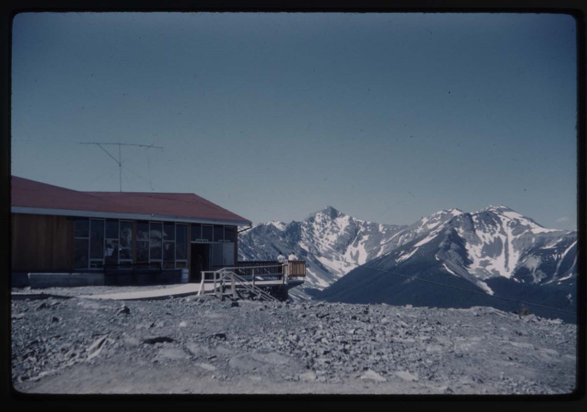
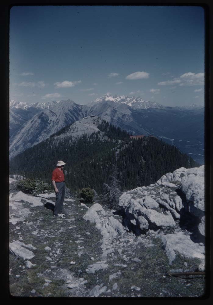
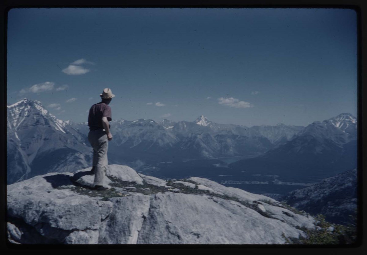
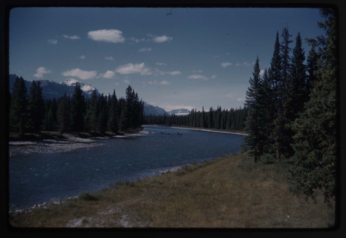
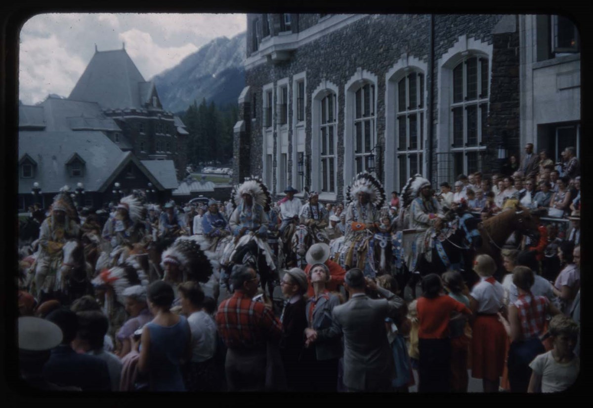
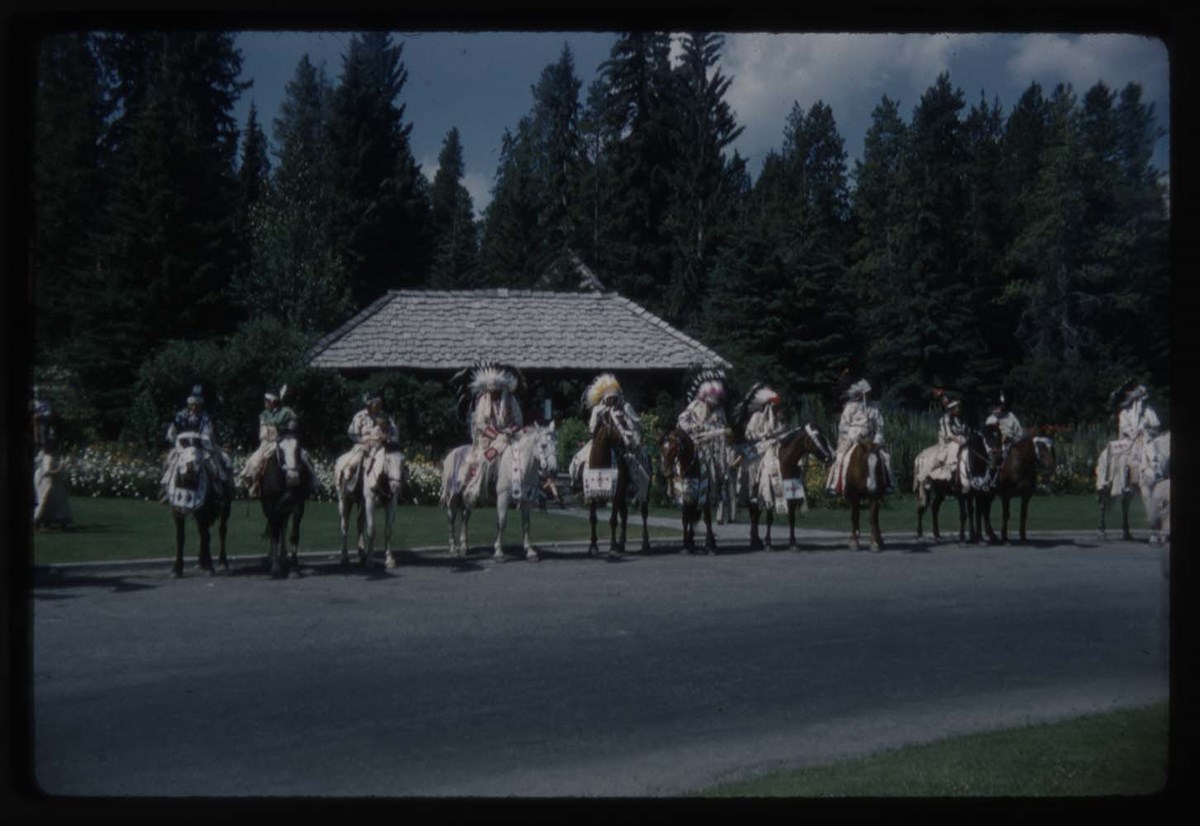
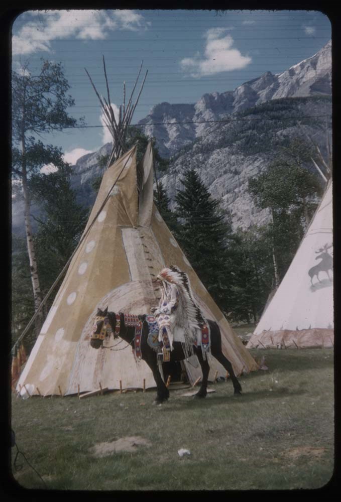
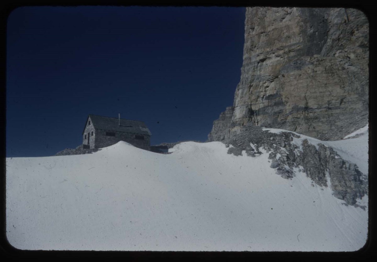
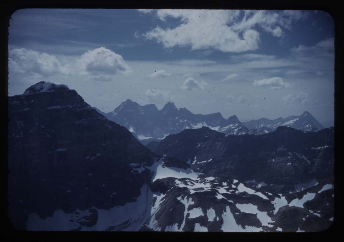
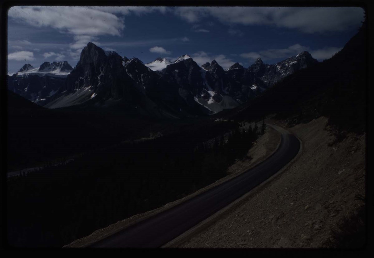
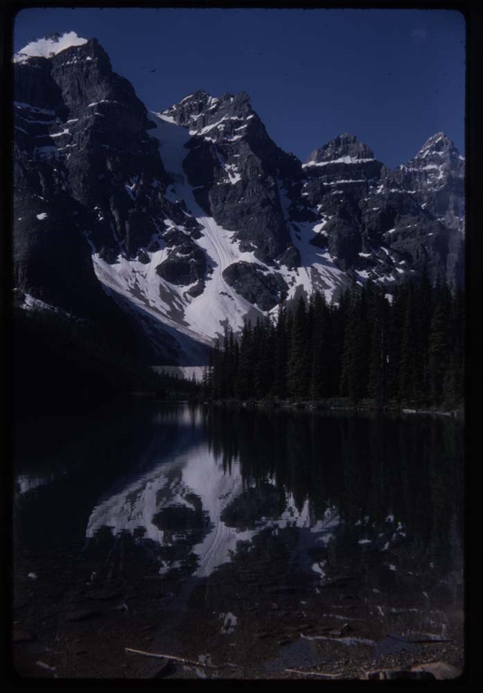
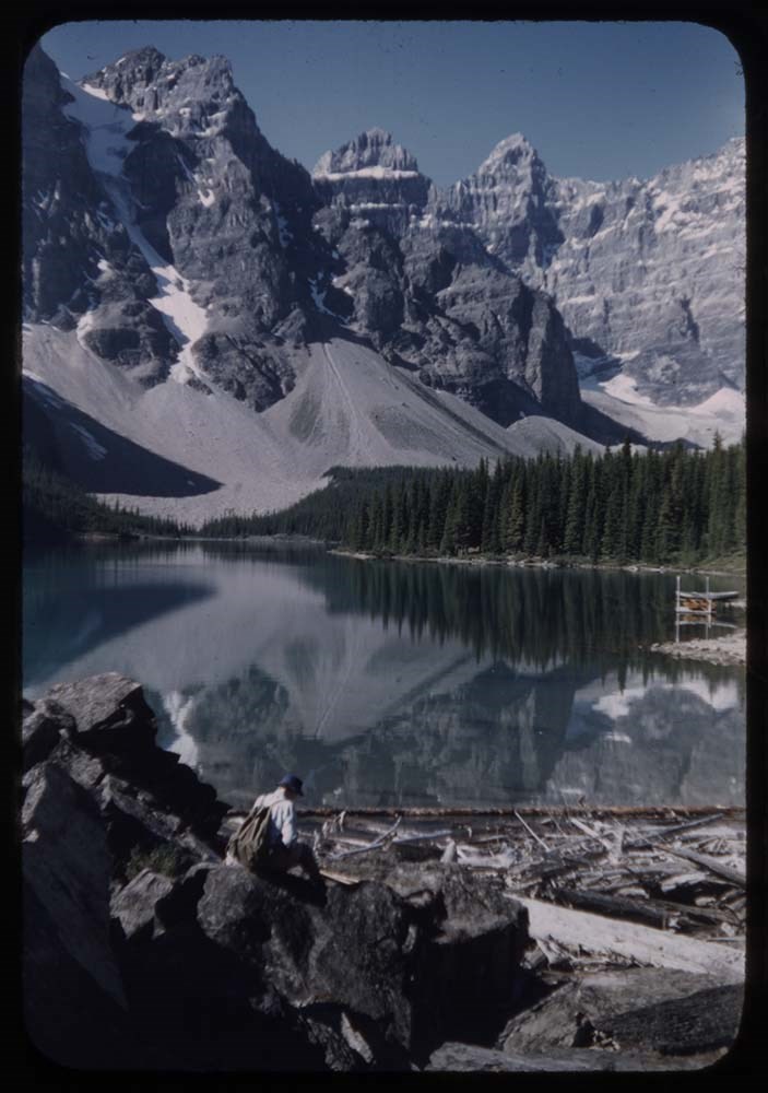
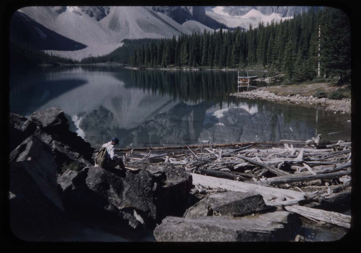
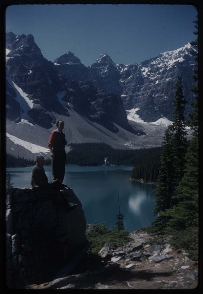
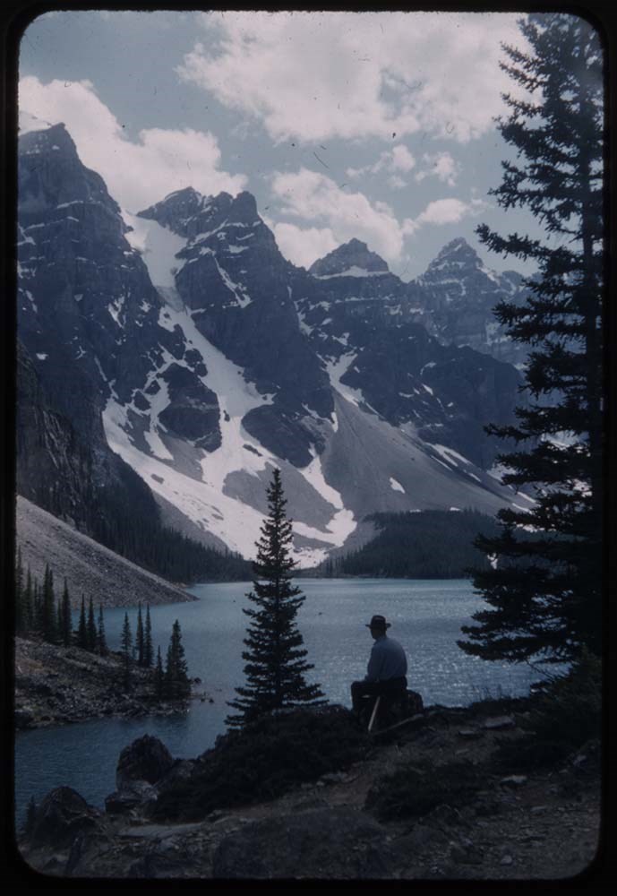
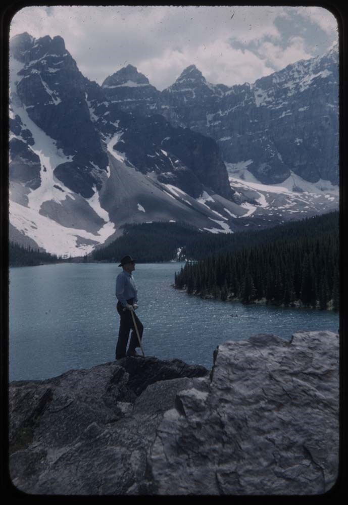
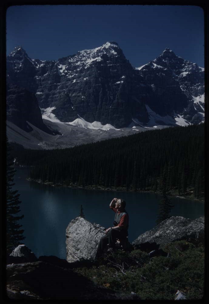
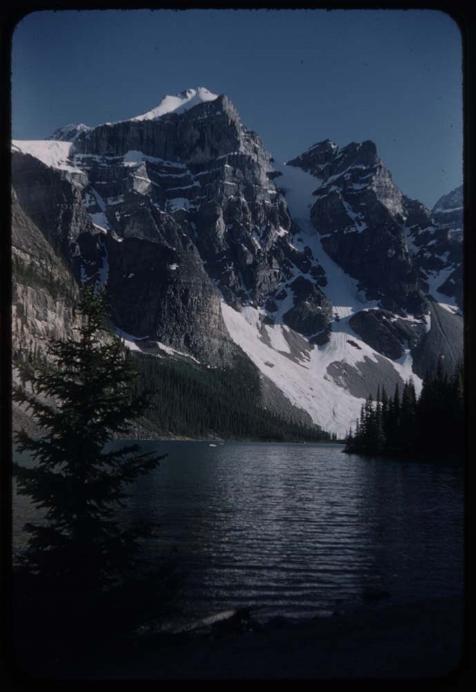
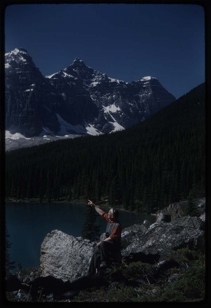
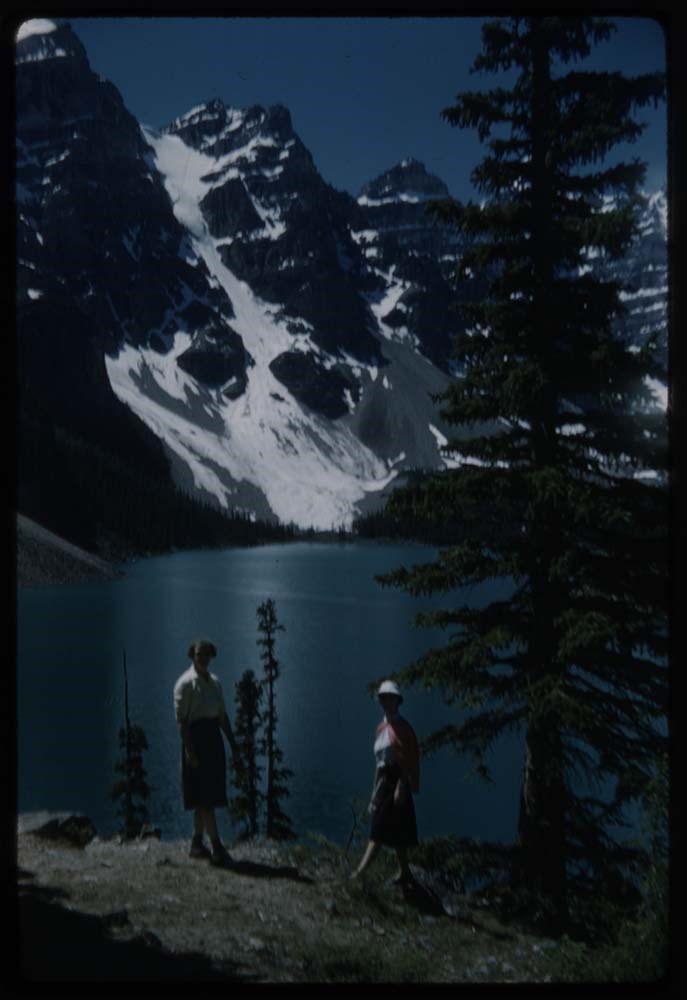
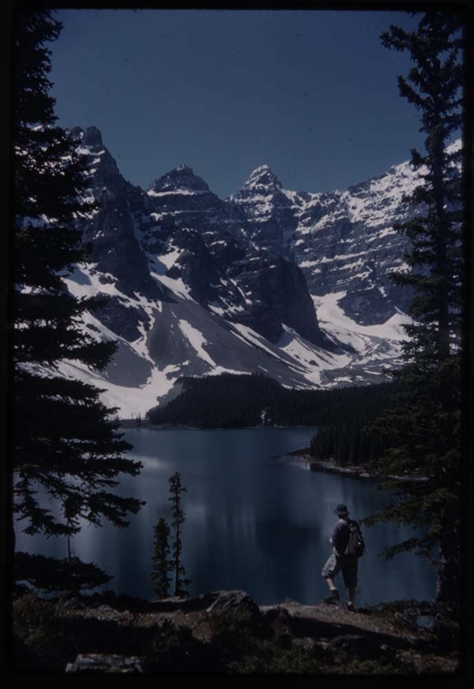
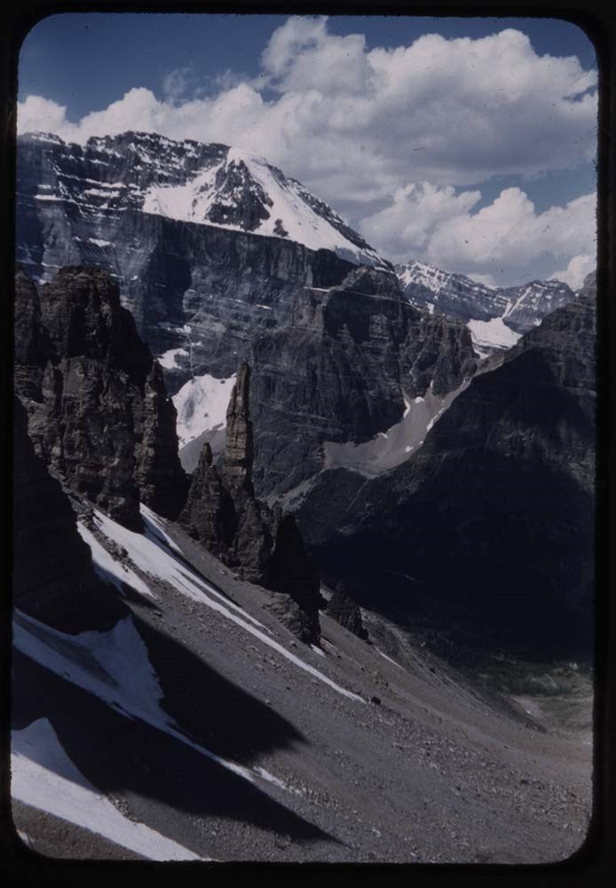
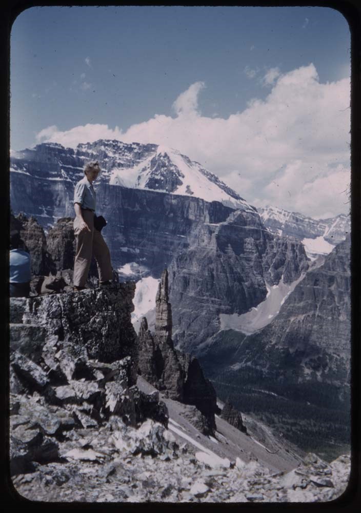
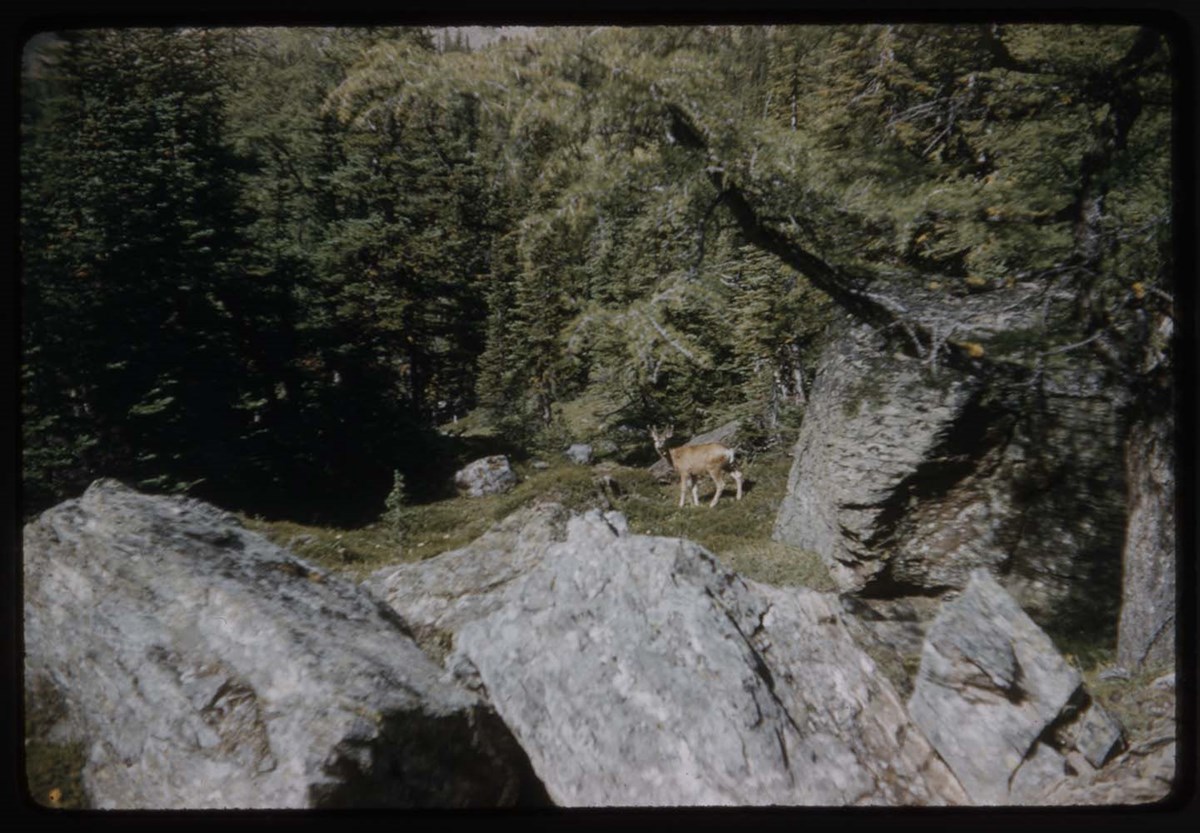
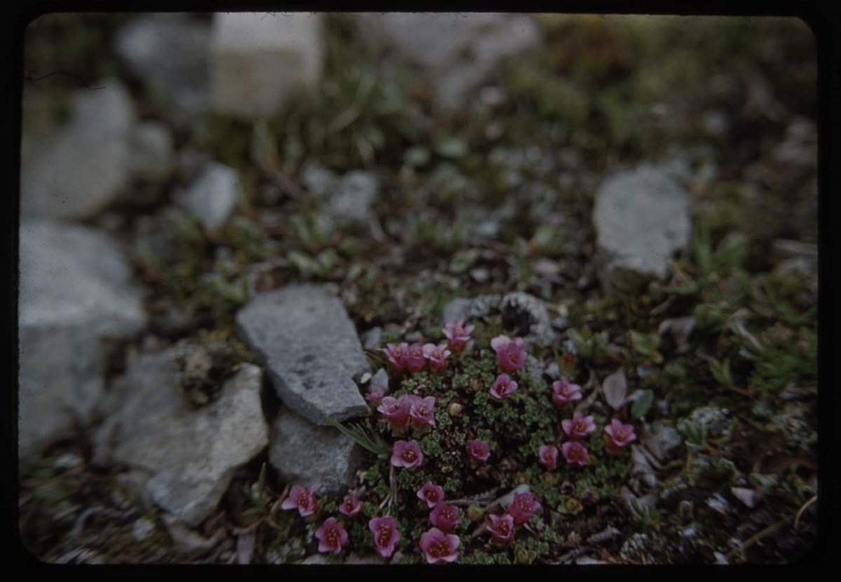
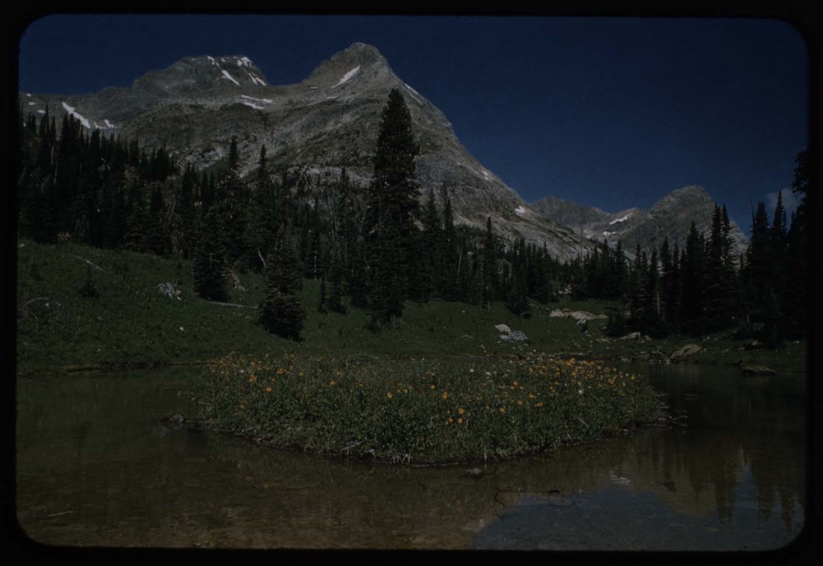
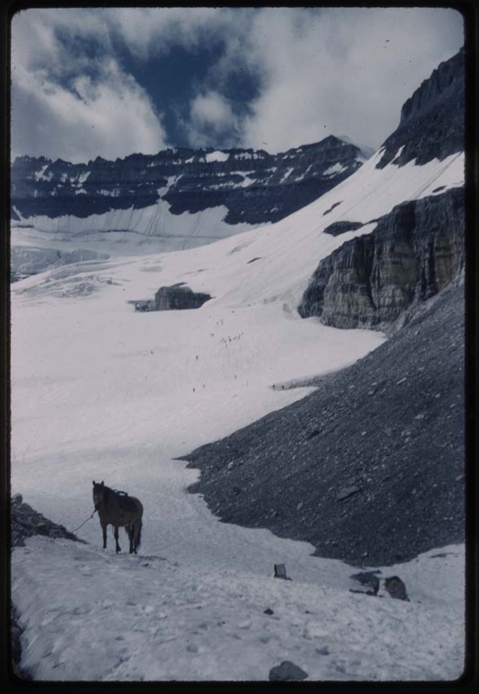
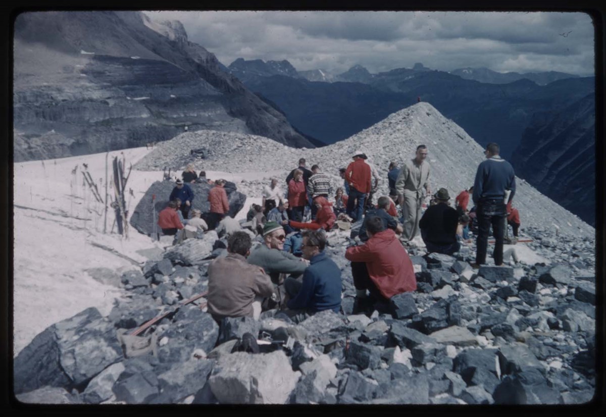
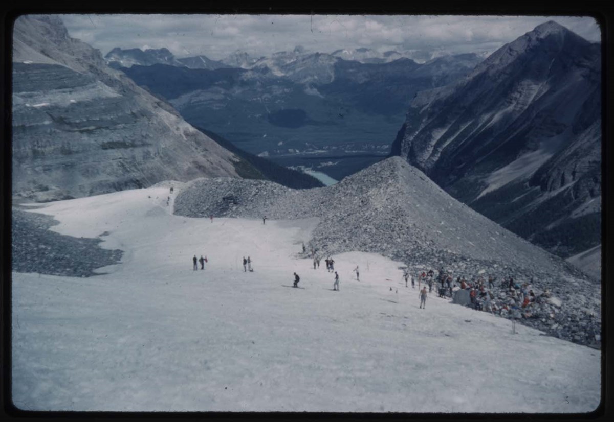
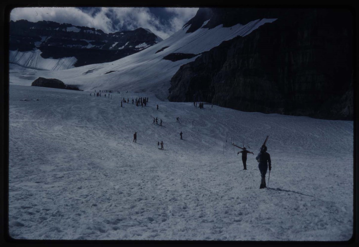
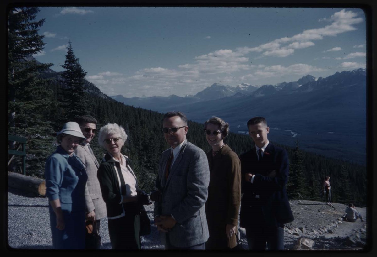
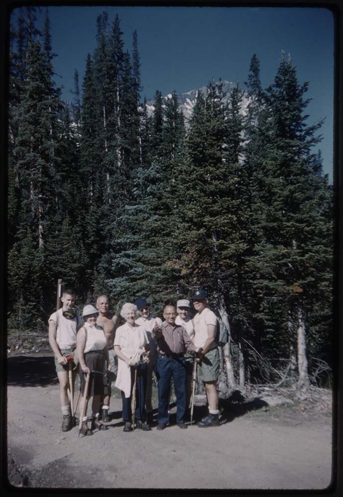
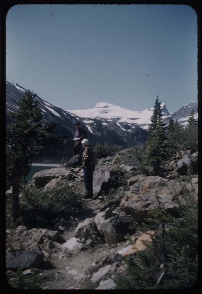
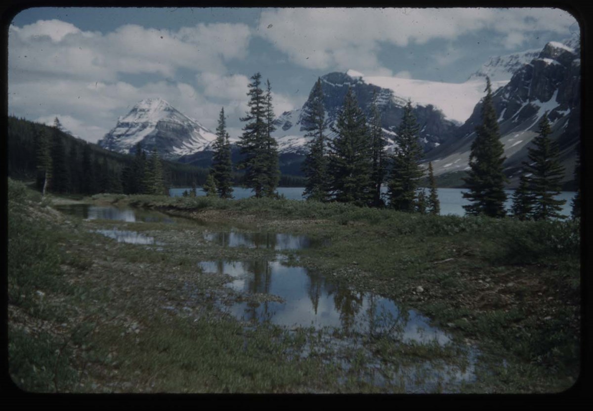
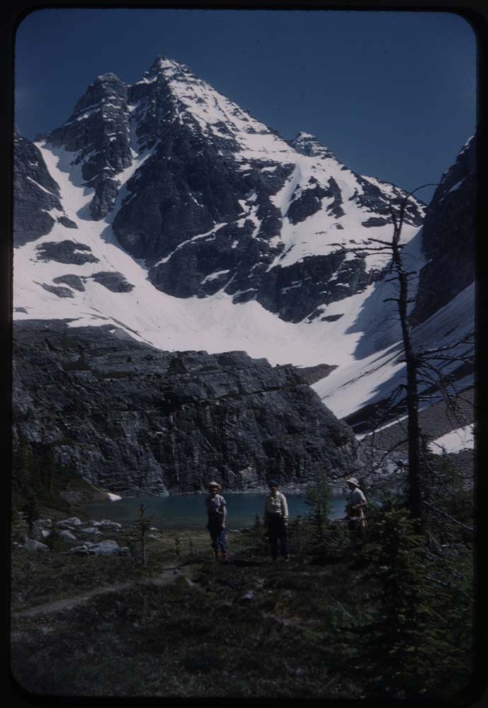
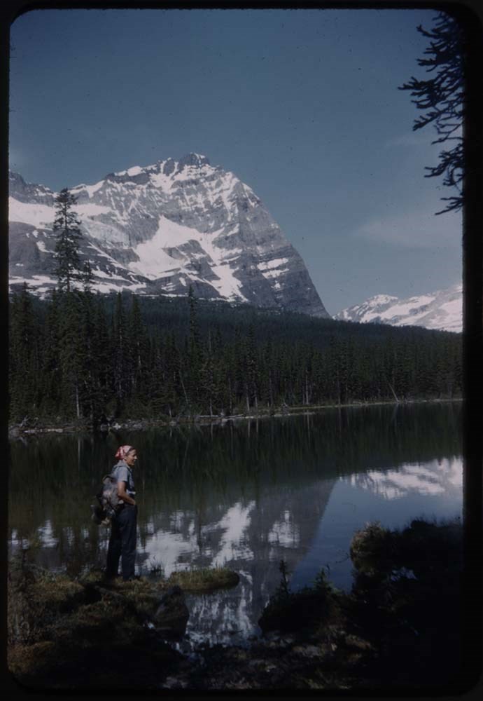
- File pertains to 80 slides assembled by Lillian Gest in 1977 into a show from slides pertaining to various summertime trips to the Canadian Rockies throughout the 1960s and early 1970s. Topics include mountains [mostly those located around the town of Banff], mountain views, wildflowers, wildlife, Lillian and her friends, lakes, boats, fishing, hiking, and various other scenic views around Banff, Lake Louise, and Moraine Lake. Titles: 1. B32-15 Garden & Main St. Banff 2. B162-3 Boat House & reflections 3. R160-31 Banff Springs Hotel 4. R160-38 [Banff Springs Hotel] fr. Spray R. & flag 5. R159-4 Pool, lawn & Bow V. 6. R202-18 Conservatory 7. R202-19 [Conservatory] 8. R261-34 Fr. [Conservatory] & flowers 9. R161-33 Fr. [Conservatory] & Louize[?] 10. R202-22 [Fr. Conservatory & Louize[?]] 11. R161-8 Terrace & pool fr. fire escape 12. R160-35 Swim Pool 13. R160-5 Diving Board 14. R162-17 Bow Falls 15. R202-14 [Bow Falls] 16. R202-15 [Bow Falls] 17. R162-26 Boys fishing across river 18. B14-4 Boom Lake 19. R162-7 On Rundle saddle L.G 20. R167-33 Mt Louis & snow 21. B11-13 Old L.L. Rd. fr. Trans Canada 22. R158-6 Train approaches Canmore 23. R168-8 Norquay Ski Lift 24. R168-12 Nick[?] on Ski Lift 25. R168-10 Eliz Brett on Lift 26. R189-24 Ted Goodall 27. C.H. 49 Middle Section Two Jack Lake 28. C.H. 56 Lake Minnewanka fr. shoulder Cascade 29. R162-9 L.G on Little Rundle 30. 0 Banff fr. Tunnel 31. B52-11 View fr. Sulphur Mt. 32. B75-5 View of valley fr. Sulphur Mt. 33. R161-2 Pool & Rundle 34. B48-6 To Grassis Lookout 35. R160-29 The Pool 36. R160-27 Gardens 37. B29-4 Bldgs on Sulphur 38. B29-7 On Sulphur Mt. 39. B29-8 [On Sulphur Mt.] 40. B27-23 Canadian on curve 41. B27-26 Canadian on curve 42. R195-32 Stampede 43. R196-33 BSH India 44. B30-17 Indigenous 45. B10-23 Indigenous person on horse in front of tepee 46. R159-10 Lake Louise (tree to left) 47. R159-30 Chateau & boat fr. east shore 48. R169-5 Abbot Pass 49. R207-27 [Abbot Pass] Hut 50. Reel 94-14 Goodsirs across Wenchemna Pass 51. C.H. 6/70 Ten Peaks 52. A14-8 4 Peaks & Moraine L. 53. R141-4? Moraine L. Reflections Polly 54. R183-21 Shore Moraine Lake 55. R141-3 Moraine Lake Reflections Polly 56. R207-7 H.G. Edw. & PKs4-7 57. B2-27 L.C at Moraine Lake sitting 58. B2-26 [L.C at Moraine Lake] standing 59. B2-28 Moraine L. & far pt of Moraine 60. R207-4 H.G at Moraine 61. B1-32 Moraine & Mt. Little & 3 62. R207-5 H.G at Moraine 63. B28-31 Harry West & friend at Moraine L. 64. B22-15 L.G Moraine L 65. B22-14 Eleanor Hammilton, Moraine L. 66. R94-3 Glaciers on Moraine Peaks 67. B22-11 Quadra & Babek fr, road 68. B22-17 Trail to Consolation L. 69. B28-13 At Consolation Lake 70. B28-34 Stream fr. [Consolation Lake] 71. B15-20 Marmot [Consolation Lake] 72. R95-7 On trail - Mt Fay in b.g. 73. R141-6 L.G. Larch V. 74. R141-5 3 girls [Larch V.] 75. R141-8 Lefroy fr. Sentinel Pass 76. R141-30 Polly on [Sentinel Pass] 77. A10-13 Moose Larch V. 78. B12-32 Deer 79. R202-30 Deer 80. R178-30 Aileen 0 Mt. Averdeen in b.g
- Notes
- Please note: Language used pertaining to First Nations people is outdated and offensive Please note: Behavior towards wildlife, primarily human proximity and feeding, is outdated and no longer tolerated throughout all National Parks - do not feed or approach wildlife. Slides originally in Kodak Carousel 80 slide tray.
- Name Access
- Gest, Lillian
- Hinman, Caroline
- Goodall, Ted
- Subject Access
- Abbot Pass Hut
- Activities
- Alpine Club of Canada
- Animals
- Avalanches
- Backpacking
- Banff
- Banff Indian Days
- Banff Springs Hotel
- Birds
- Boats
- Boat House
- Cabins and shelters
- Calgary Stampede
- Canoes and canoeing
- Climbing
- Club
- Elk
- Entertainment
- Environment
- Environment and Nature
- First Nations
- Flowers
- Geography
- Glaciers
- Guides
- Guiding
- Hiking
- Holidays
- Horses
- Huts
- Indigenous Peoples
- Lake O'Hara region
- Landscapes
- Leisure
- Mountain
- Mountain Goat
- Mountaineering
- Mountains
- National parks and reserves
- Norquay Ski Hill
- Outfitters, trail guides and packers
- Pack trains
- Pack trips
- Personal and Family Life
- Photography
- Portrait
- Recreation
- Scenery
- Stoney Nakoda First Nations
- Tavel
- Trails
- Trains
- Travel
- Wildlife
- Women
- Geographic Access
- Boom Lake
- Kootenay National Park
- Banff
- Lake Louise
- Moraine Lake
- Banff National Park
- Canmore
- British Columbia
- Alberta
- Canada
- Language
- English
- Conservation
- Slides rehoused into protective sleeves and acid-free folders after scanning.
- Related Material
- M67 / II / C / i / c / 56 - 5 ; M67 / 51 [notebook of original slide orders]
- Creator
- Gest, Lillian
- Title Source
- Title based on contents of file
- Processing Status
- Processed
Electronic Resources
Images


This material is presented as originally created; it may contain outdated cultural descriptions and
potentially offensive content.
Read more.
Banff and Lake Louise Slide Show - Series III [1/2]
https://archives.whyte.org/en/permalink/descriptions1852
- Part Of
- Lillian Gest fonds
- Scope & Content
- File pertains to 40 slides assembled by Lillian Gest in 1977 into a show from slides pertaining to various summertime trips to the Canadian Rockies throughout the 1960s and early 1970s. Topics include mountains [mostly those located around the town of Banff], mountain views, wildflowers, wildlife, …
- Date Range
- [ca. 1960-1977]
- Reference Code
- V225 / II / C / ii / a / ii / NS - III / 2
- Description Level
- 5 / File
- GMD
- Film
- Transparency
80 images
1 Electronic Resource
- Part Of
- Lillian Gest fonds
- Description Level
- 5 / File
- Fonds Number
- M67 / S36 / V225
- Series
- II.C. Activities / photography
- Sous-Fonds
- V225
- Sub-Series
- ii.a.ii Photographic material / transparencies / carousels
- Accession Number
- 5142
- Reference Code
- V225 / II / C / ii / a / ii / NS - III / 2
- GMD
- Film
- Transparency
- Parallel Title
- Selected slides series III Can R reel II show Fall 1977. -- [before 1977] V225 / 24
- Date Range
- [ca. 1960-1977]
- Physical Description
- 40 photographs : col. slides ; 35 mm
- History / Biographical
- See fonds level description.
- Scope & Content
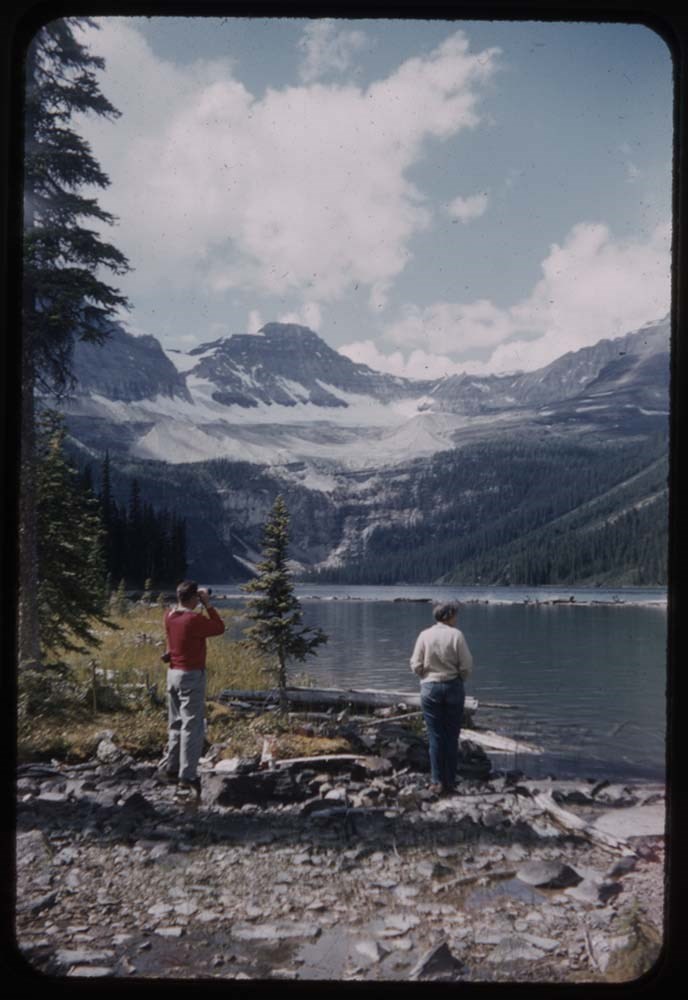
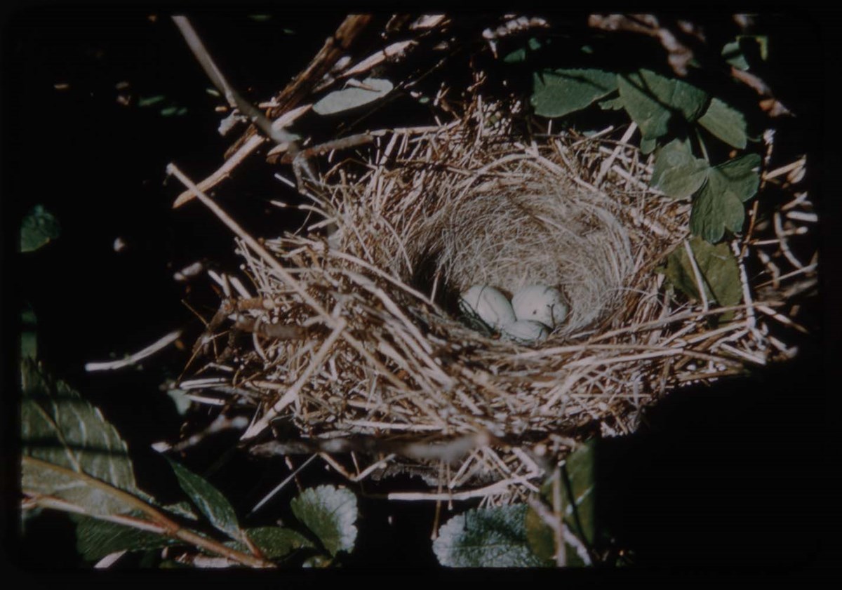
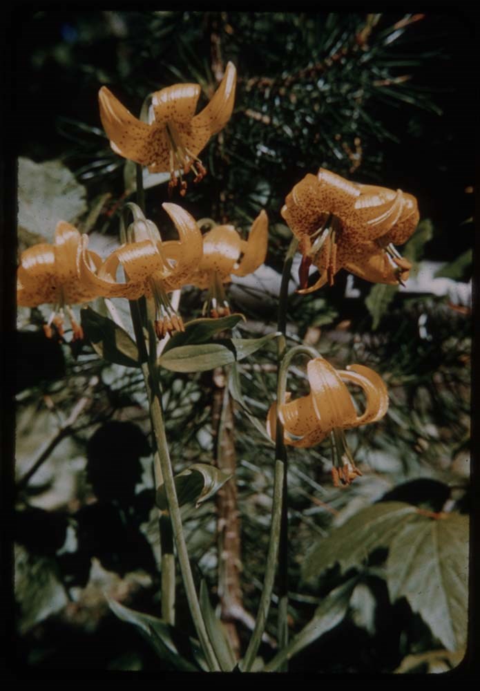
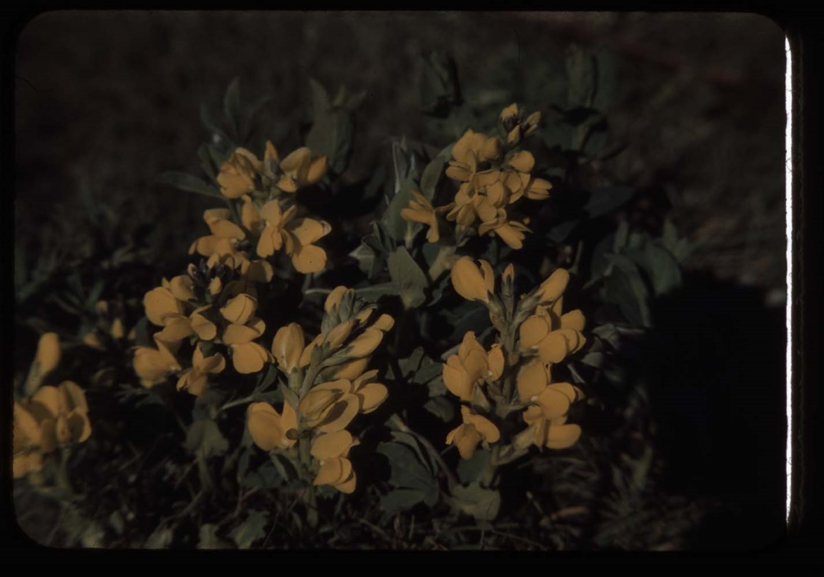
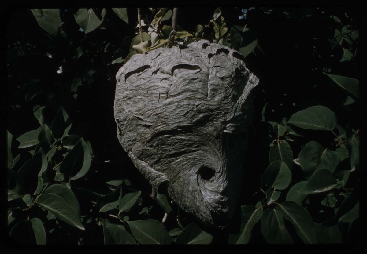
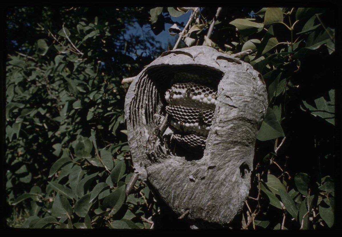
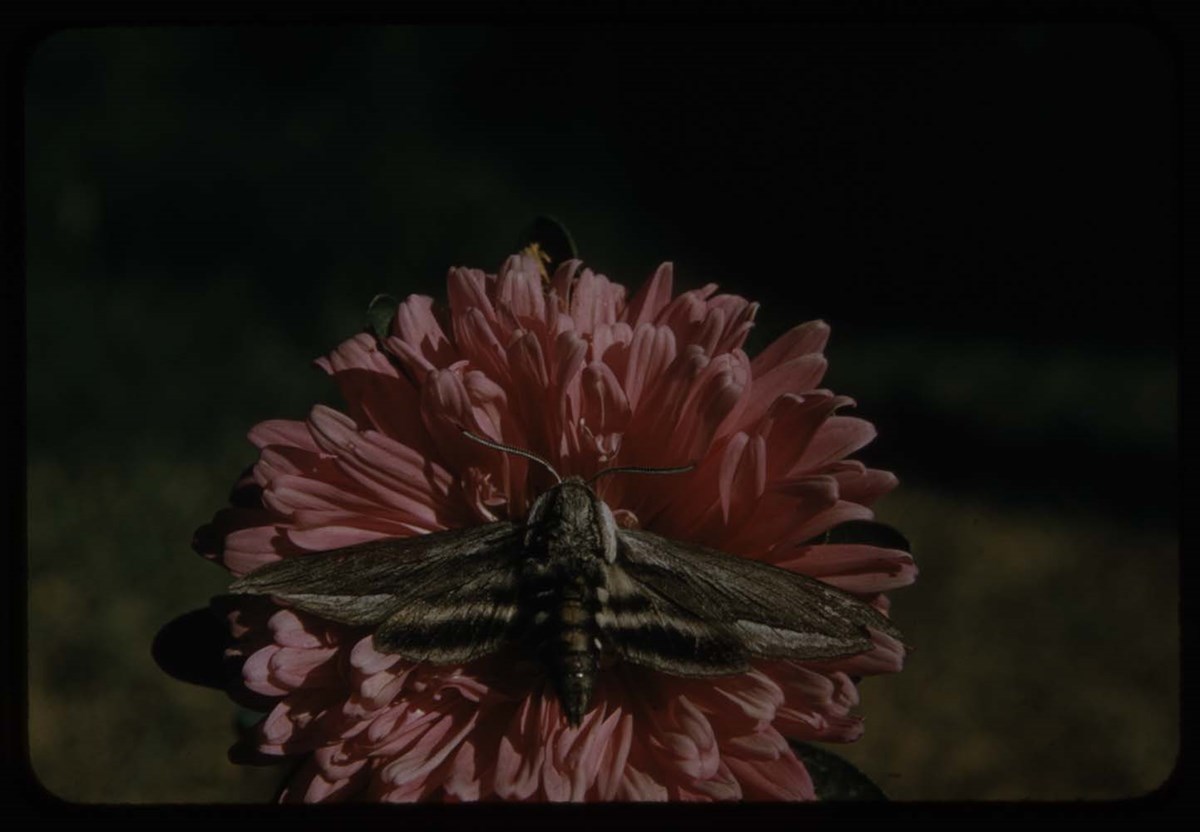
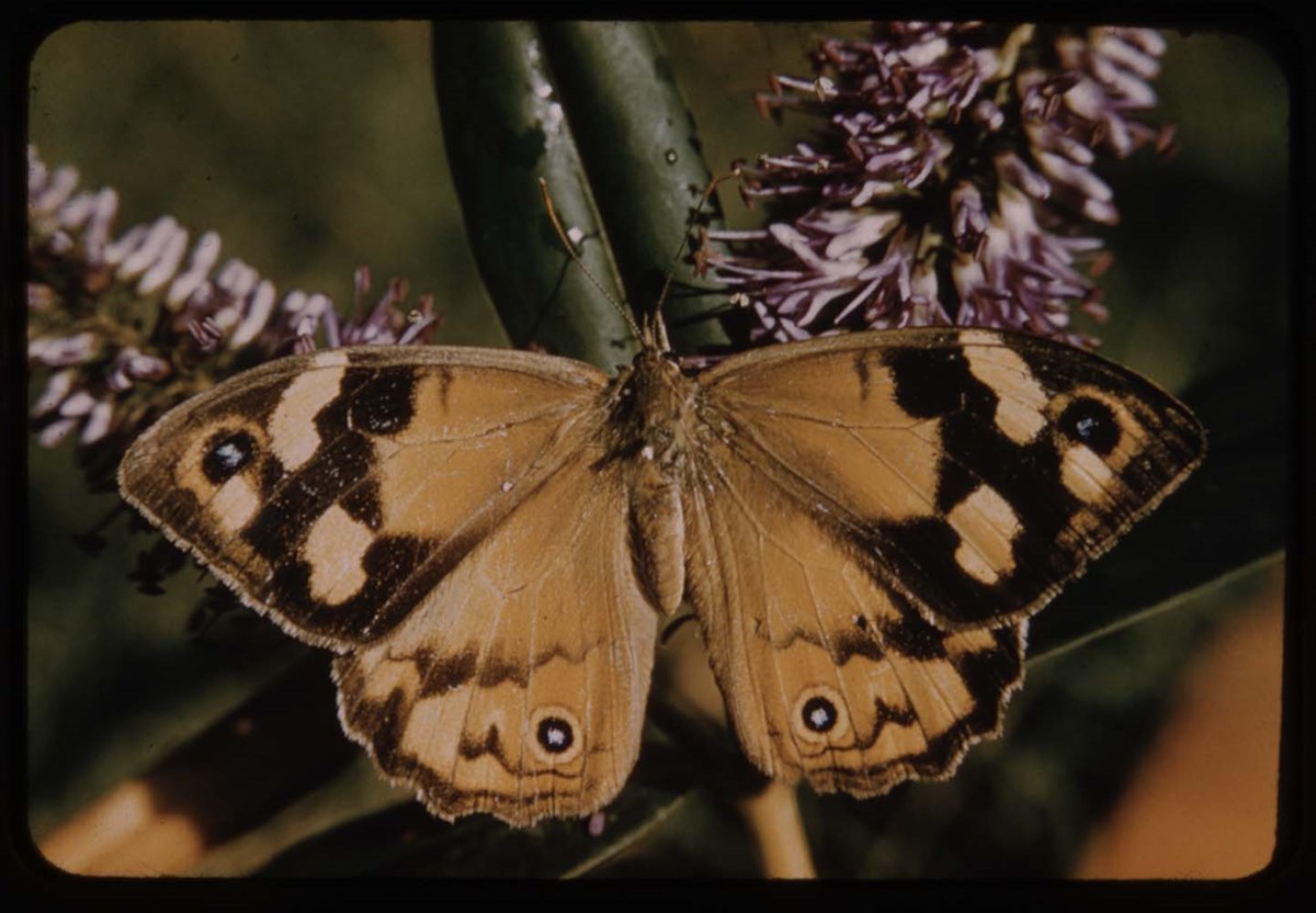
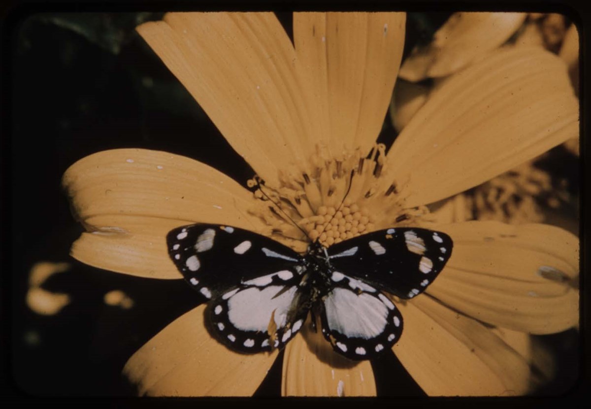
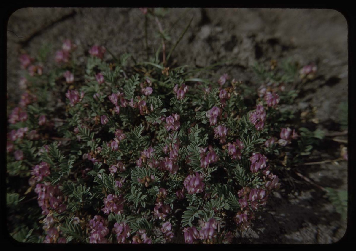
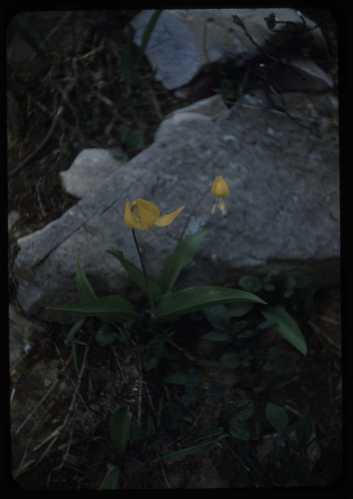
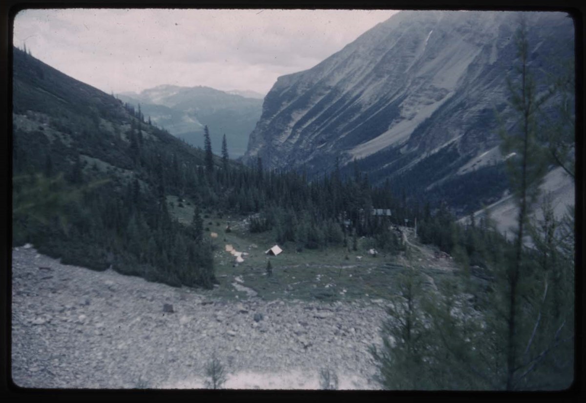
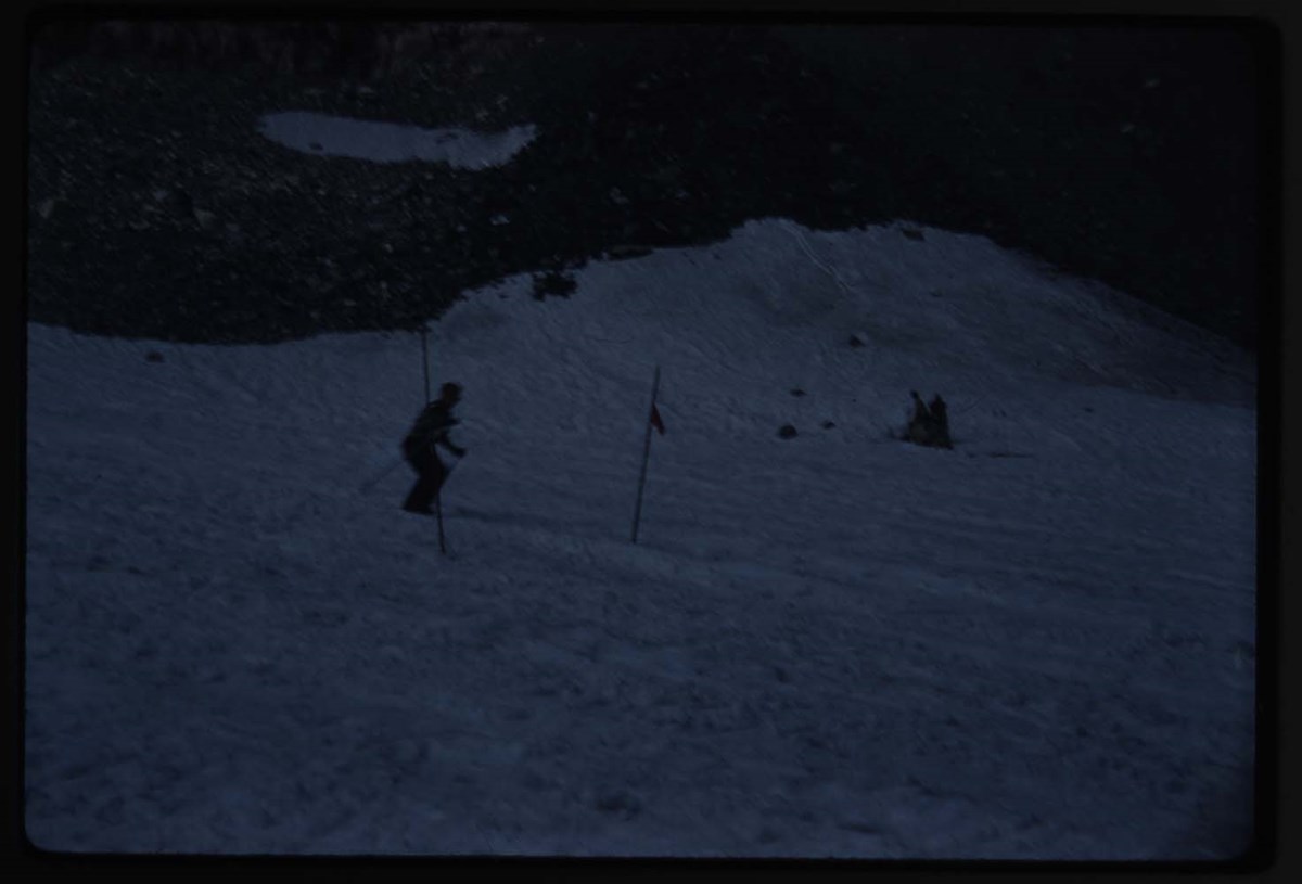
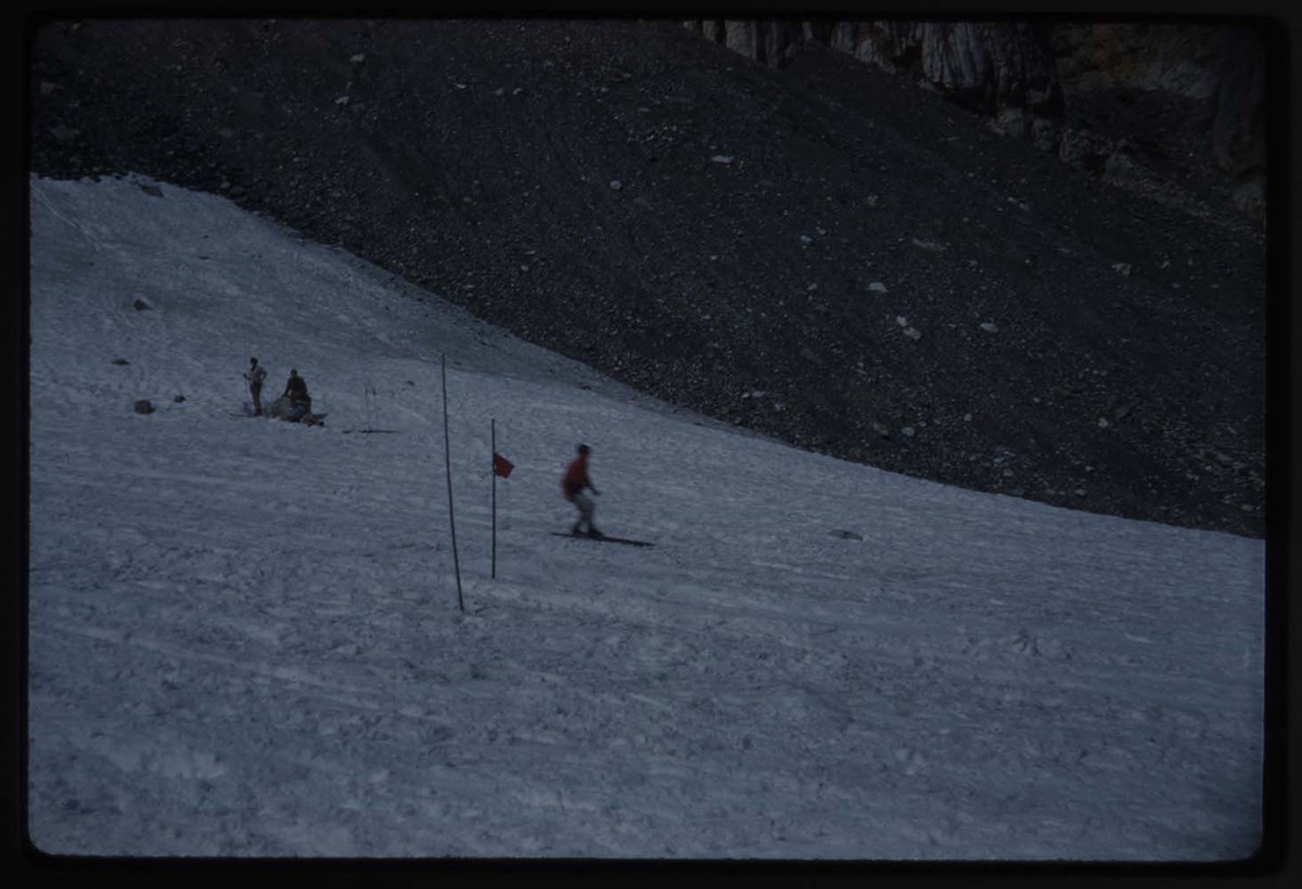
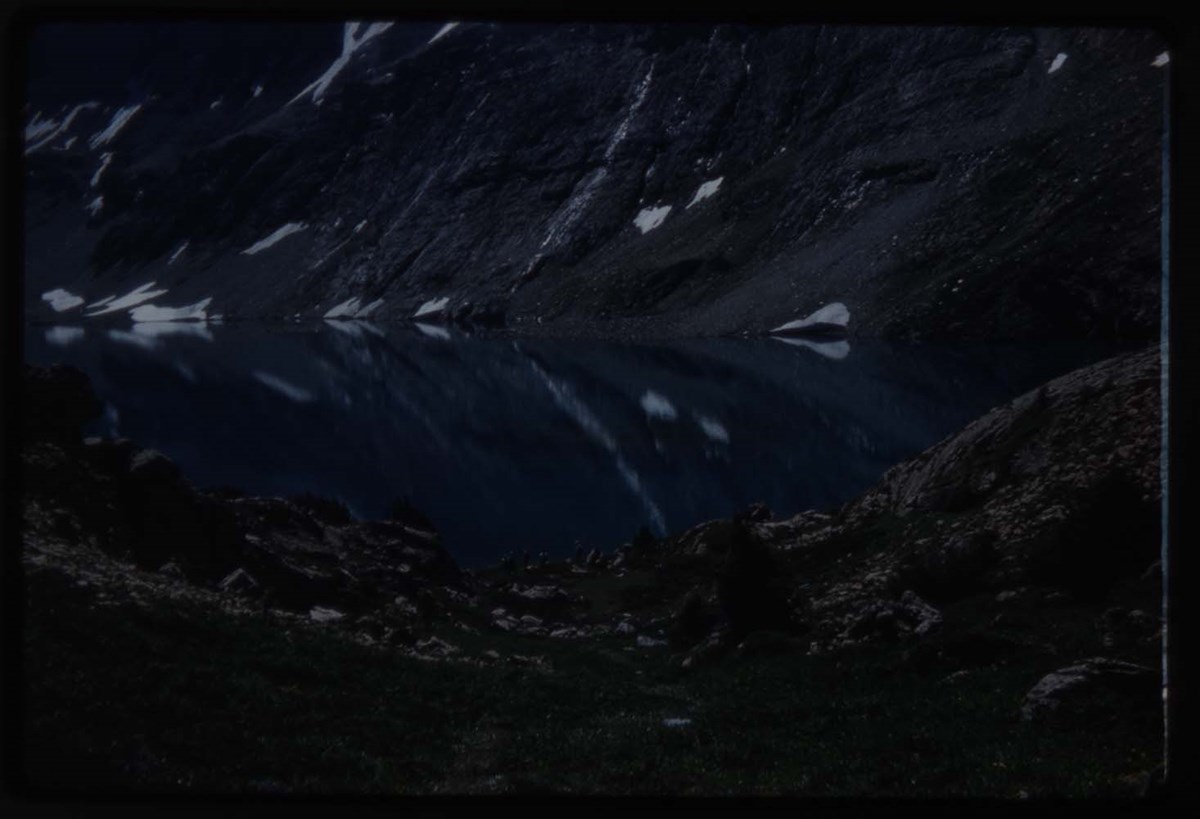
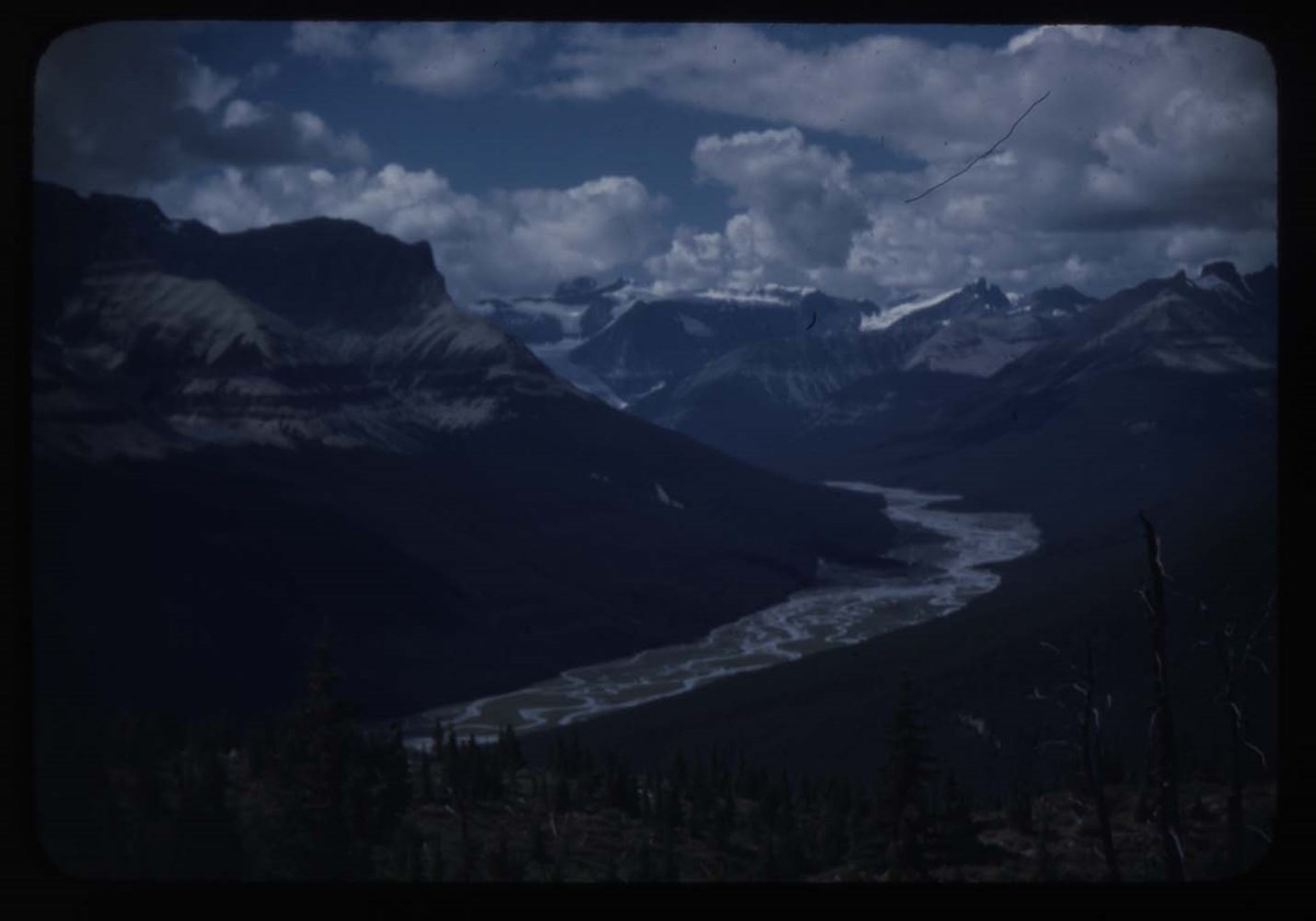
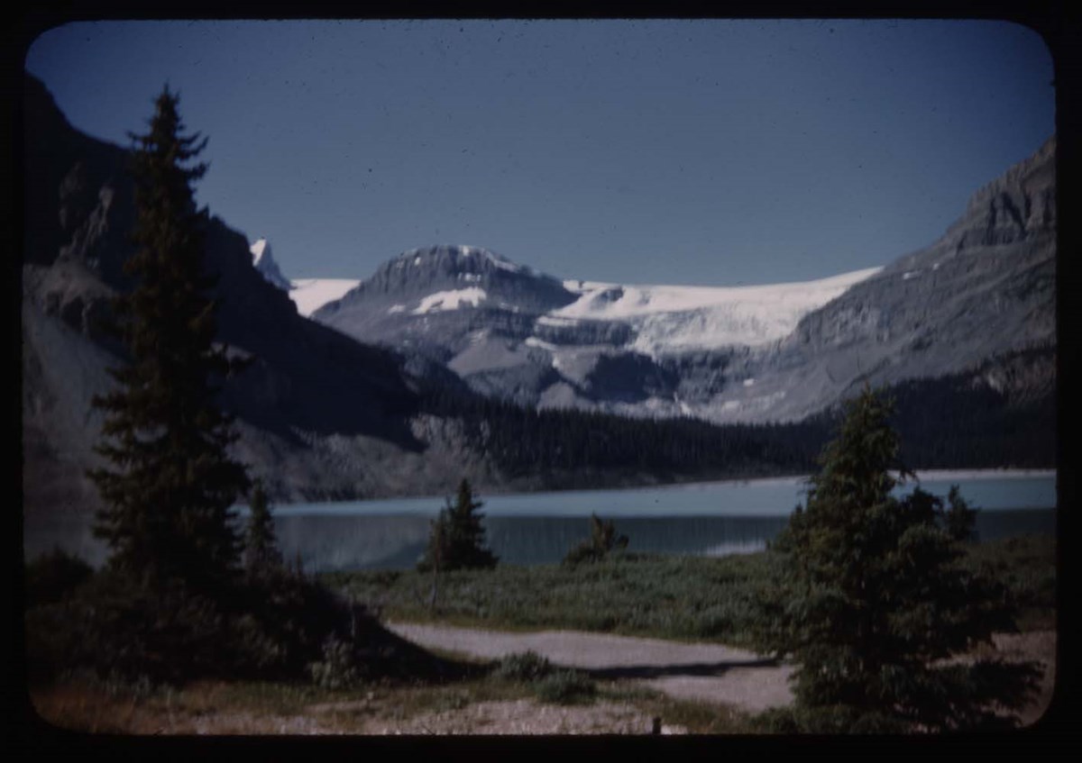
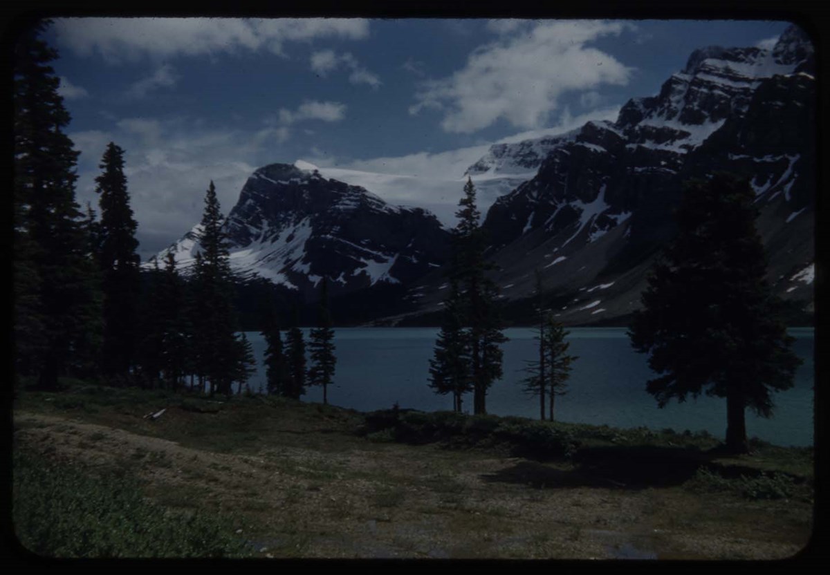
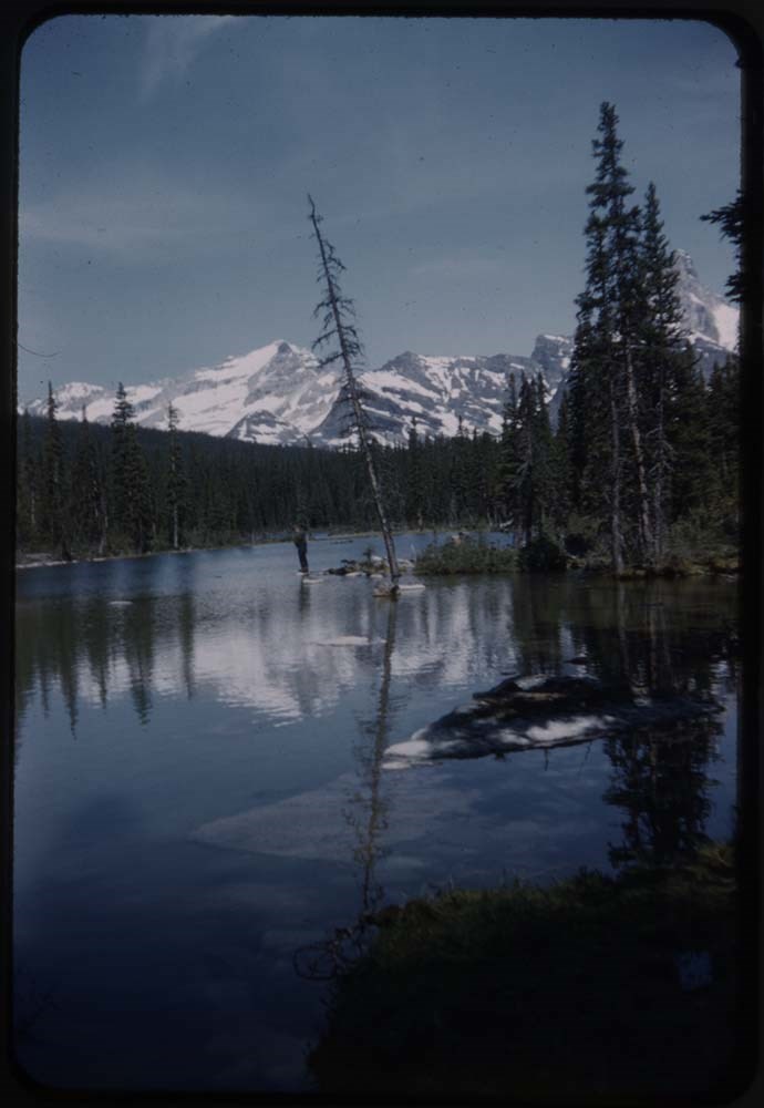
- File pertains to 40 slides assembled by Lillian Gest in 1977 into a show from slides pertaining to various summertime trips to the Canadian Rockies throughout the 1960s and early 1970s. Topics include mountains [mostly those located around the town of Banff], mountain views, wildflowers, wildlife, Lillian and her friends, lakes, boats, fishing, hiking, and various other scenic views around Banff, Lake Louise, and Moraine Lake. Titles: 1. R178-7 L.G at Crowfoot GLacier 2. B28-29 Mt Aberdeen - girls on rocks 3. B28-30 Rainbow at L.L. 4. B74-23 Abbots Pass 5. B73-38 Horses at Mirror Lake 6. CH '49 Birds nest, portrait lens 13in 7. CH Ducks nest 8. CH '51 Birds nest 9. CH '51 Chalice cup 10. R171-8 Calice cup 11. CH White vetch 12. CH '51 Turks cap lily Toby Creek 13. CH Vetch 14. CH Black Hornets 15. CH Nest of Black Hornets 16. CH Moth on pink flower 17. CH '58 Butterfly blue green & black border 18. CH '58 [Butterfly] yellow w. [black] spots 19. CH '58 [Butterfly] black & white 20. CH Pink heather 21. CH Calypso - Rungius 22. CH Purple Hedysarum 23. CH '51 Purple Hedysarum 24. R169-23Avalanche lily 25. CH '56 Flower gardens on island Palliser Pass 26. CH '55 Corral Creek 27. B31 19 Ski meet - View towards L.L. 28. B31 20 [Ski meet] Trail until flower 29. B31 21 [Ski meet] Horse on glacier 30. B31 22 Ski meet - crowd on rock 1960 31. B31 23 Skiers on snow 32. B31 24 Ski meet 33. B31 25 [Ski meet] & slopes Abbot Pass in b.g 34. B31 26 [Ski meet] 35. B31 27 Slalom poles & skiers 36. B31 28 [Slalom poles & skiers] 37. B31 29 [Slalom] slope 38. B31 30 [illegible] 6 people 39. B31 15 Flowers - stone crop 40. B31 32 Watyeks 8 people 41. B31 33 Teepees in meadow 42. B31 38 MacArthur & reflections 43. Reel 99-17 [Blank] 44. B73 29 Mary at Lake 45. B72 38 Icefield Chalet 46. B1 36 Tourists at Peyto Lookout 47. B2-10 Canyon at Bow Lakes 48. R179-3 Murray [illegible] fishing chephroe[?] 49. R175 5 Mt Shaeffer from Moose Lake 50. B2-17 MSC & Polly at Mary Lake 51. B2-21 Pool near Mary Lake 52. B2-15 [Pool near Mary Lake] 53. B2-8 Coveney on Trail Bow L. 54. R178-14 Bow Lake 55. R106-9 [Bow Lake] 56. R178-8 [Bow Lake] 57. B9-11 Numtijah Lodge 58. B9-10 Bow Lakes 59. B73-16 Mitchell Hut 60. B73-14 Skyline Camp 61. B30-38 Edw & Martha 62. B23-14 2 on rock 63. B23 23 Party on Opabin 64. B23-1 O'Hara & cabins 65. B23-25 Frozen L. Opabin 66. B23-24 Two & lake frozen 67. B23-27 L.G - opabin 68. B23-32 Fr Goat Cabin I 69. B24-11 Crowd oesa 70. B24-12 Vallances oesa 71. B24-14 Oesa frozen & L.G 72. B24-16 [illegible] on Oesa Ledges 73. B24-18 Falls near Oesa 74. B24-9 Enroute to oesa 75. B24-22 A at oesa frozen 76. B269-13 Party at Schafer cairn 77. B24-26 Party & Ringrose 78. B24-31 Water Lake & fishermen 79. B25-6 O'Hara fr. odaray 80. B24-30 Aileen, lake & odaray
- Notes
- Please note: Behavior towards wildlife, primarily human proximity and feeding, is outdated and no longer tolerated throughout all National Parks - do not feed or approach wildlife. Slides originally in Kodak Carousel 80 slide tray.
- Name Access
- Gest, Lillian
- Hinman, Caroline
- Rungius, Carl
- Vallance, Sydney
- Subject Access
- Abbot Pass Hut
- Activities
- Alpine Club of Canada
- Animals
- Avalanches
- Backpacking
- Banff
- Banff Springs Hotel
- Birds
- Boats
- Boat House
- Cabins and shelters
- Camps
- Canoes and canoeing
- Climbing
- Club
- Elk
- Entertainment
- Environment
- Environment and Nature
- First Nations
- Flowers
- Geography
- Glaciers
- Guides
- Guiding
- Hiking
- Holidays
- Horses
- Huts
- Indigenous Peoples
- Lake O'Hara region
- Landscapes
- Leisure
- Mountain
- Mountain Goat
- Mountaineering
- Mountains
- National parks and reserves
- Norquay Ski Hill
- Outfitters, trail guides and packers
- Pack trains
- Pack trips
- Personal and Family Life
- Photography
- Portrait
- Recreation
- Scenery
- Skyline Hikers of the Canadian Rockies
- Skyline Trail Hikers of the Canadian Rockies
- Stoney Nakoda First Nations
- Tavel
- Trails
- Trains
- Travel
- Wildlife
- Women
- Geographic Access
- Boom Lake
- Kootenay National Park
- Banff
- Lake Louise
- Moraine Lake
- Bow Lake
- Banff National Park
- Canmore
- Lake O'Hara
- Yoho National Park
- British Columbia
- Alberta
- Canada
- Language
- English
- Conservation
- Slides rehoused into protective sleeves and acid-free folders after scanning.
- Related Material
- M67 / II / C / i / c / 56 / 6 ; M67 / 51 [notebook of original slide orders]
- Creator
- Gest, Lillian
- Title Source
- Title based on contents of file
- Processing Status
- Processed
Electronic Resources
Images


This material is presented as originally created; it may contain outdated cultural descriptions and
potentially offensive content.
Read more.
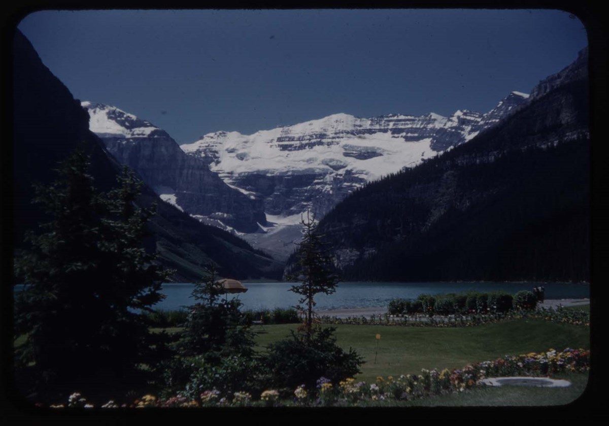
Banff National Park and Lake Louise maps
https://archives.whyte.org/en/permalink/descriptions54945
- Scope & Content
- File consists of two folded maps and a small clipping [possibly top or bottom portion from a different map or one of maps in file]. One map is of Banff National Park and one is of Lake Louise [1959]. Banff National Park map has black pencil tracings over trail section near the bottom of the map and…
- Date Range
- 1959
- [1960-1970]
- Reference Code
- M545 / V / 53
- Description Level
- 5 / File
- GMD
- Textual record
- Published record
- Map
- Description Level
- 5 / File
- Fonds Number
- M545 / V635
- Series
- M545 / V : Administrative records
- Sous-Fonds
- M545
- Accession Number
- 8235
- Reference Code
- M545 / V / 53
- Date Range
- 1959
- [1960-1970]
- Physical Description
- 0.5 cm of textual records (2 maps ; 60.5 x 57.5 and 60 x 56.5 cm)
- Scope & Content
- File consists of two folded maps and a small clipping [possibly top or bottom portion from a different map or one of maps in file]. One map is of Banff National Park and one is of Lake Louise [1959]. Banff National Park map has black pencil tracings over trail section near the bottom of the map and annotation in bottom right corner which reads "Natural Bridge". Lake Louise map produced by the Government of Canada.
- Subject Access
- Banff National Park
- Environment
- Geography
- Map
- Lake Louise
- Travel
- Government
- National parks and reserves
- Trails
- Geographic Access
- Canada
- Alberta
- Banff National Park
- Lake Louise
- Language
- English
- Conservation
- Clipping stored in mylar due to significant staining and residue from tape
- Items kept folded [not placed in mylar] due to mass production of content and minimal/no annotations
- Title Source
- Title based on contents of file
- Processing Status
- Processed
This material is presented as originally created; it may contain outdated cultural descriptions and
potentially offensive content.
Read more.
Blueprints of Connaught Tunnel and Map of Deutchman Cave
https://archives.whyte.org/en/permalink/descriptions54207
- Part Of
- Nicholas Morant fonds
- Scope & Content
- File consists of 2 printed paper copies of older hand-illustrated works. Pertains to a copied 1947 blueprint of Connaught Tunnel depicting burn damage on tracks from an accident that year; and a copied hand-drawn map of Deutchman Cave from 1902, with annotations bottom right (copied from the origin…
- Date Range
- [ca. 1950 - ca. 1970]
- Reference Code
- V500 / III / D / 5 / PA - 73 to 74 O.S.
- Description Level
- 5 / File
- GMD
- Drawing
- Map
- Blueprint
- Part Of
- Nicholas Morant fonds
- Description Level
- 5 / File
- Fonds Number
- M300 / S20 / V500
- Sous-Fonds
- V500
- Sub-Series
- V500 / III / D / 5 : Personal Interest and Gifts
- Accession Number
- 7784
- Reference Code
- V500 / III / D / 5 / PA - 73 to 74 O.S.
- Responsibility
- Nicholas Morant
- Date Range
- [ca. 1950 - ca. 1970]
- Physical Description
- 2 paper copies: 1 blueprint, 1 map
- Scope & Content
- File consists of 2 printed paper copies of older hand-illustrated works. Pertains to a copied 1947 blueprint of Connaught Tunnel depicting burn damage on tracks from an accident that year; and a copied hand-drawn map of Deutchman Cave from 1902, with annotations bottom right (copied from the original).
- Notes
- Items were stored together in a poster tube labelled: "Canadian Pacific Blueprints - CPR Passenger Train in Connaught Tunnel - Nakimu Caves at Glacier"
- Subject Access
- Geography
- Connaught Tunnel
- Canadian Pacific Railway
- Train
- Transportation
- Geographic Access
- Canada
- British Columbia
- Canadian Rocky Mountains
- Access Restrictions
- Items in this file are not to be accessed or distributed without the explicit permission of their identified copyright owners.
- Reproduction Restrictions
- Items in this file are not to be reproduced without the explicit permission of their identified copyright owners.
- Language
- English
- Conservation
- Items must be stored flat with similar materials
- Creator
- Nicholas Morant
- Title Source
- Title based on contents of file
- Processing Status
- Processed
This material is presented as originally created; it may contain outdated cultural descriptions and
potentially offensive content.
Read more.