Narrow Results By
- Luxton family fonds 8
- Ben Gadd fonds 6
- Parks Canada fonds 3
- Trail Riders of the Canadian Rockies fonds 3
- Arthur Oliver Wheeler fonds 1
- Banff School District No. 102 fonds 1
- Boorne and May fonds 1
- Brett family fonds 1
- Bruno Engler fonds 1
- Canadian Government Photo Service fonds 1
- Canadian Inventory of Historic Building Survey fonds 1
- Canadian Wildlife Service fonds 1
"The Pool" Banff
https://archives.whyte.org/en/permalink/descriptions49253
- Part Of
- Boorne and May fonds
- Scope & Content
- Image of Cave and Basin National Historic Site
- Date Range
- [1880-1890]
- Reference Code
- v10 / 1 / 28 / na66 - 628
- Description Level
- 6 / Item
- GMD
- Photograph
- Album
- Negative, copy
- Photograph print
1 image
- Part Of
- Boorne and May fonds
- Description Level
- 6 / Item
- Fonds Number
- V10
- Reference Code
- v10 / 1 / 28 / na66 - 628
- Date Range
- [1880-1890]
- Physical Description
- 1 photograph : negative : copy negative
- Scope & Content
- Image of Cave and Basin National Historic Site
- Subject Access
- Environment and Nature
- Discovery and Exploration
- Politics and government
- Sports and Recreation
- Health services
- Geographic Access
- Alberta
- British Columbia
Images

This material is presented as originally created; it may contain outdated cultural descriptions and
potentially offensive content.
Read more.
Staged, copyright and published trail riders photographs
https://archives.whyte.org/en/permalink/descriptions54351
- Scope & Content
- File consists of 12 b&w photographs pertaining to the Trail Riders of the Canadian Rockies. Includes staged photographs of riders on horseback and scenic views of the Canadian Rockies. Most images annotated with return address of Trail Riders of the Canadian Rockies on back [copyrighted photographs…
- Date Range
- [ca. 1960 - ca. 1980]
- Reference Code
- V635 / III / PA - 1 to 12
- Description Level
- 5 / File
- GMD
- Photograph
- Photograph print
- Description Level
- 5 / File
- Fonds Number
- M545 / V635
- Series
- V635 / III : Published records
- Sous-Fonds
- V635
- Accession Number
- 5757
- Reference Code
- V635 / III / PA - 1 to 12
- Responsibility
- One photograph copyright of the Canadian Government Travel Bureau
- Date Range
- [ca. 1960 - ca. 1980]
- Physical Description
- 12 photographs : b&w prints ; 20.5 x 25.5 cm or smaller
- Scope & Content
- File consists of 12 b&w photographs pertaining to the Trail Riders of the Canadian Rockies. Includes staged photographs of riders on horseback and scenic views of the Canadian Rockies. Most images annotated with return address of Trail Riders of the Canadian Rockies on back [copyrighted photographs?], and one with text on back identifying it as property of the Canadian Government Travel Bureau. Locations include Monarch Ridge, "Pul. Pass", and Mount Assiniboine Park.
- Notes
- Most photographs in this file were likely produced and/or used for publication purposes but this is not confirmed. Further research into origins of individual photographs required.
- Subject Access
- Horses
- Trails
- Travel
- Tourism
- Mountain
- Landscapes
- Trail Riders of the Canadian Rockies
- Geographic Access
- Canada
- Alberta
- Monarch Ridge
- Mount Assiniboine Park
- Access Restrictions
- Restrictions may apply
- Reproduction Restrictions
- Restrictions may apply
- Language
- English
- Title Source
- Title based on contents of file
- Processing Status
- Processed
This material is presented as originally created; it may contain outdated cultural descriptions and
potentially offensive content.
Read more.
Maps of Banff and Western Canada
https://archives.whyte.org/en/permalink/descriptions54772
- Part Of
- Luxton family fonds
- Scope & Content
- File consists of 9 printed maps, b&w and col. [including zoning and topographical maps] depicting the Town of Banff and Banff National Park, the Rocky Mountains Forest Reserve, the Moose Mountain region, Medicine Hat, and the province of Alberta. File includes Trail Riders' Map of the Canadian Rock…
- Date Range
- 1912
- 1914
- 1924
- 1926
- 1932
- 1957
- [1970-1980]
- Reference Code
- LUX / II / C5 / 25
- Description Level
- 5 / File
- GMD
- Textual record
- Published record
- Map
- Part Of
- Luxton family fonds
- Description Level
- 5 / File
- Fonds Number
- LUX
- Series
- LUX / II / C : Personal
- Sous-Fonds
- LUX / II : Eleanor Luxton sous-fonds
- Sub-Series
- LUX / II / C5 : Other
- Accession Number
- LUX
- Reference Code
- LUX / II / C5 / 25
- Date Range
- 1912
- 1914
- 1924
- 1926
- 1932
- 1957
- [1970-1980]
- Physical Description
- 9 maps : b&w and col. ; 168 x 71 cm or smaller
- Scope & Content
- File consists of 9 printed maps, b&w and col. [including zoning and topographical maps] depicting the Town of Banff and Banff National Park, the Rocky Mountains Forest Reserve, the Moose Mountain region, Medicine Hat, and the province of Alberta. File includes Trail Riders' Map of the Canadian Rockies which has smaller maps of Waterton Lakes, Glacier, Revelstoke, and other national parks printed on the back. Map of Medicine Hat includes annotated storage envelope with dimensions written on the front.
- Subject Access
- Cartography
- Geography
- Land use
- Government
- Travel
- National parks and reserves
- Geographic Access
- Canada
- Alberta
- Banff
- Banff National Park
- Medicine Hat
- Rocky Mountains
- Glacier National Park
- Revelstoke
- Waterton Lakes National Park
- Reproduction Restrictions
- Restrictions may apply
- Language
- English
- Title Source
- Title based on contents of file
- Processing Status
- Processed
This material is presented as originally created; it may contain outdated cultural descriptions and
potentially offensive content.
Read more.
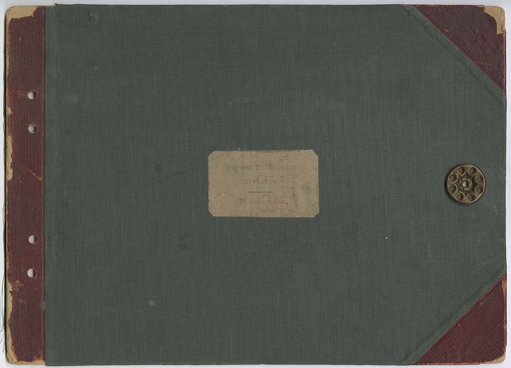
Forest Protection Division Photographs
https://archives.whyte.org/en/permalink/descriptions54938
- Part Of
- Parks Canada fonds
- Scope & Content
- File consists of an album of photographs pertaining to forest protection and fire fighting methods and equipment employed in Banff National Park. Includes black and white photographs of pumps, machinery, fire trucks, horse-drawn wagons, members of testing teams, and various other pieces of fire fig…
- Date Range
- 1915-1926
- Reference Code
- V488 / I / A / PD - 1
- Description Level
- 5 / File
- GMD
- Album
- Photograph
- Photograph print
1 image
1 Electronic Resource
- Part Of
- Parks Canada fonds
- Description Level
- 5 / File
- Fonds Number
- M317 / S23 / V488
- Series
- I.A. Banff National Park photograph collection
- Sous-Fonds
- V488
- Accession Number
- 8134
- Reference Code
- V488 / I / A / PD - 1
- Date Range
- 1915-1926
- Physical Description
- 1 album (79 photographs : b&w ; 23.5 x 18.5 cm or smaller)
- Scope & Content
- File consists of an album of photographs pertaining to forest protection and fire fighting methods and equipment employed in Banff National Park. Includes black and white photographs of pumps, machinery, fire trucks, horse-drawn wagons, members of testing teams, and various other pieces of fire fighting equipment ; most photos have typed text captions below them.
- Notes
- Metal hinging mechanism removed, wrapped in paper and stored alongside album
- Subject Access
- Automobiles
- Fire
- Fire fighters
- Fire fighting equipment
- Fire wardens
- Forestry
- Government
- Horses
- National parks and reserves
- Parks
- Parks Canada
- Photography
- Geographic Access
- Banff National Park
- Alberta
- Canada
- Language
- English
- Conservation
- Many photographs loose from page mounts, replaced where possible.
- Title Source
- Title based on contents of file
- Processing Status
- Processed
Electronic Resources

Images
This material is presented as originally created; it may contain outdated cultural descriptions and
potentially offensive content.
Read more.
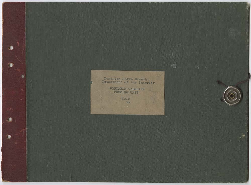
Dominion Parks Branch Department of the Interior Portable Gasoline Pump Unit
https://archives.whyte.org/en/permalink/descriptions54940
- Part Of
- Parks Canada fonds
- Scope & Content
- File consists of an album of photographs pertaining to forest protection and fire fighting methods and equipment employed in Banff National Park. Focusses on the development and implemtation of pumps and generators for use in fire fighting ; most photos have typed text captions below them.
- Date Range
- 1915-1921
- Reference Code
- V488 / I / A / PD - 2
- Description Level
- 5 / File
- GMD
- Album
- Photograph
- Photograph print
1 image
1 Electronic Resource
- Part Of
- Parks Canada fonds
- Description Level
- 5 / File
- Fonds Number
- M317 / S23 / V488
- Series
- I.A. Banff National Park photograph collection
- Sous-Fonds
- V488
- Accession Number
- 8134
- Reference Code
- V488 / I / A / PD - 2
- Date Range
- 1915-1921
- Physical Description
- 1 album (53 photographs : b&w ; 16.5 x 12 cm or smaller)
- Scope & Content
- File consists of an album of photographs pertaining to forest protection and fire fighting methods and equipment employed in Banff National Park. Focusses on the development and implemtation of pumps and generators for use in fire fighting ; most photos have typed text captions below them.
- Notes
- Metal hinging mechanism removed, wrapped in paper and stored alongside album.
- Subject Access
- Automobiles
- Fire
- Fire fighters
- Fire fighting equipment
- Fire wardens
- Forestry
- Government
- Horses
- National parks and reserves
- Parks
- Parks Canada
- Photography
- Geographic Access
- Banff National Park
- Alberta
- Canada
- Language
- English
- Conservation
- Many photographs loose from page mounts, replaced where possible.
- Title Source
- Title based on contents of file
- Processing Status
- Processed
Electronic Resources
Images
This material is presented as originally created; it may contain outdated cultural descriptions and
potentially offensive content.
Read more.
Banff National Park and Lake Louise maps
https://archives.whyte.org/en/permalink/descriptions54945
- Scope & Content
- File consists of two folded maps and a small clipping [possibly top or bottom portion from a different map or one of maps in file]. One map is of Banff National Park and one is of Lake Louise [1959]. Banff National Park map has black pencil tracings over trail section near the bottom of the map and…
- Date Range
- 1959
- [1960-1970]
- Reference Code
- M545 / V / 53
- Description Level
- 5 / File
- GMD
- Textual record
- Published record
- Map
- Description Level
- 5 / File
- Fonds Number
- M545 / V635
- Series
- M545 / V : Administrative records
- Sous-Fonds
- M545
- Accession Number
- 8235
- Reference Code
- M545 / V / 53
- Date Range
- 1959
- [1960-1970]
- Physical Description
- 0.5 cm of textual records (2 maps ; 60.5 x 57.5 and 60 x 56.5 cm)
- Scope & Content
- File consists of two folded maps and a small clipping [possibly top or bottom portion from a different map or one of maps in file]. One map is of Banff National Park and one is of Lake Louise [1959]. Banff National Park map has black pencil tracings over trail section near the bottom of the map and annotation in bottom right corner which reads "Natural Bridge". Lake Louise map produced by the Government of Canada.
- Subject Access
- Banff National Park
- Environment
- Geography
- Map
- Lake Louise
- Travel
- Government
- National parks and reserves
- Trails
- Geographic Access
- Canada
- Alberta
- Banff National Park
- Lake Louise
- Language
- English
- Conservation
- Clipping stored in mylar due to significant staining and residue from tape
- Items kept folded [not placed in mylar] due to mass production of content and minimal/no annotations
- Title Source
- Title based on contents of file
- Processing Status
- Processed
This material is presented as originally created; it may contain outdated cultural descriptions and
potentially offensive content.
Read more.
Papaschase Indian Reserve land zoning map
https://archives.whyte.org/en/permalink/descriptions55611
- Part Of
- Luxton family fonds
- Scope & Content
- File consists of one zoning map depicting the Papaschase Indian Reserve south of the Saskatchewan River and surrounding area. Map is titled "Plan of Township 52 Range 24 West of the Fourth Meridian".
- Date Range
- 1908
- Reference Code
- LUX / III / C2 / 22
- Description Level
- 5 / File
- GMD
- Map
- Part Of
- Luxton family fonds
- Description Level
- 5 / File
- Fonds Number
- LUX
- Series
- LUX / III / C : Extended family
- Sous-Fonds
- LUX / III : Luxton family sous-fonds
- Sub-Series
- LUX / III / C2 : McDougall and Ross families papers and photographs
- Accession Number
- LUX
- Reference Code
- LUX / III / C2 / 22
- GMD
- Map
- Responsibility
- Produced by the Canadian Department of the Interior
- Date Range
- 1908
- Physical Description
- 1 map : b&w photozincograph print ; 34 x 41 cm
- Scope & Content
- File consists of one zoning map depicting the Papaschase Indian Reserve south of the Saskatchewan River and surrounding area. Map is titled "Plan of Township 52 Range 24 West of the Fourth Meridian".
- Geographic Access
- Canada
- Alberta
- Saskatchewan River
- Edmonton
- Access Restrictions
- Fragile material - handle with caution
- Language
- English
- Title Source
- Title based on contents of file
- Processing Status
- Processed
This material is presented as originally created; it may contain outdated cultural descriptions and
potentially offensive content.
Read more.
Jasper Trails Project - printed trail maps
https://archives.whyte.org/en/permalink/descriptions56152
- Part Of
- Ben Gadd fonds
- Scope & Content
- File consists of printed drafts of trail maps depicting regions near Pyramid Bench, Maligne Canyon, Wabasso Lake and Miette River; and quotes from three printing companies in Alberta. Materials pertain to the updating of trail signage and interpretive information through the Jasper Trails Project.
- Date Range
- 1997-1998
- Reference Code
- M590 / III / D / 106
- Description Level
- 5 / File
- GMD
- Textual record
- Map
- Part Of
- Ben Gadd fonds
- Description Level
- 5 / File
- Fonds Number
- M590
- V810
- S61
- Series
- M590 / III : Published records
- Sous-Fonds
- M590
- Sub-Series
- M590 / III / D : Other contracts and projects
- Accession Number
- 2021.20
- Reference Code
- M590 / III / D / 106
- GMD
- Textual record
- Map
- Date Range
- 1997-1998
- Physical Description
- 0.2 cm of textual records
- Scope & Content
- File consists of printed drafts of trail maps depicting regions near Pyramid Bench, Maligne Canyon, Wabasso Lake and Miette River; and quotes from three printing companies in Alberta. Materials pertain to the updating of trail signage and interpretive information through the Jasper Trails Project.
- Subject Access
- Organization
- Trails
- Research
- Map
- Environment
- Hiking
- Recreation
- Geography
- Parks Canada
- Government
- Geographic Access
- Canada
- Alberta
- Jasper
- Jasper National Park
- Edmonton
- Reproduction Restrictions
- Restrictions may apply
- Language
- English
- Title Source
- Title based on contents of file
- Processing Status
- Processed
This material is presented as originally created; it may contain outdated cultural descriptions and
potentially offensive content.
Read more.
Jasper Trails Project - sign location maps
https://archives.whyte.org/en/permalink/descriptions56154
- Part Of
- Ben Gadd fonds
- Scope & Content
- File consists of maps showing the locations of interpretive signs which were updated and installed as part of the Jasper Trails Project. File includes film positive copies of maps, and related notes and correspondence.
- Date Range
- 1995
- 1997
- Reference Code
- M590 / III / D / 107
- Description Level
- 5 / File
- GMD
- Textual record
- Map
- Part Of
- Ben Gadd fonds
- Description Level
- 5 / File
- Fonds Number
- M590
- V810
- S61
- Series
- M590 / III : Published records
- Sous-Fonds
- M590
- Sub-Series
- M590 / III / D : Other contracts and projects
- Accession Number
- 2021.20
- Reference Code
- M590 / III / D / 107
- GMD
- Textual record
- Map
- Date Range
- 1995
- 1997
- Physical Description
- 1 cm of textual records
- Scope & Content
- File consists of maps showing the locations of interpretive signs which were updated and installed as part of the Jasper Trails Project. File includes film positive copies of maps, and related notes and correspondence.
- Subject Access
- Organization
- Trails
- Research
- Map
- Environment
- Hiking
- Recreation
- Geography
- Parks Canada
- Government
- Geographic Access
- Canada
- Alberta
- Jasper
- Jasper National Park
- Reproduction Restrictions
- Restrictions may apply
- Language
- English
- Title Source
- Title based on contents of file
- Processing Status
- Processed
This material is presented as originally created; it may contain outdated cultural descriptions and
potentially offensive content.
Read more.
Arthur Oliver Wheeler fonds
https://archives.whyte.org/en/permalink/descriptions673
- Part Of
- Arthur Oliver Wheeler fonds
- Scope & Content
- Fonds consists of 53 diaries pertaining to personal life, travel, office work, and Alpine Club of Canada camps. Diaries range in date from 1885 to 1944. Also included are two volumes/scrapbooks compiled by A.O. Wheeler. Both volumes include numerous articles, newspaper clippings, letters, ACC broc…
- Date Range
- 1885-1944
- Reference Code
- M546 / V771
- Description Level
- 1 / Fonds
- GMD
- Photograph
- Album
- Photograph print
- Textual record
- Diary
- Map
- Private record
- Scrapbook
- Part Of
- Arthur Oliver Wheeler fonds
- Description Level
- 1 / Fonds
- Fonds Number
- M 546
- V 771
- Sous-Fonds
- M546 / V771
- Accession Number
- 2016.8598
- 2014.8312
- 8144
- 8160
- Reference Code
- M546 / V771
- Date Range
- 1885-1944
- Physical Description
- 62 vol. of textual material. -- 66 vol. of photograph albums
- History / Biographical
- Arthur Oliver Wheeler (1860-1945) DLS, ALS, BCLS, was born in Ireland, arriving in Canada in 1876. Wheeler was a mountaineer, co-founder of the Alpine Club of Canada (1906), and Dominion Land Surveyor. In 1913, Wheeler was appointed Boundary Commissioner and tasked with photo surveying the Alberta / British Columbia interprovincial boundary.
- Scope & Content
- Fonds consists of 53 diaries pertaining to personal life, travel, office work, and Alpine Club of Canada camps. Diaries range in date from 1885 to 1944. Also included are two volumes/scrapbooks compiled by A.O. Wheeler. Both volumes include numerous articles, newspaper clippings, letters, ACC brochures and notices addressed to ACC members. Volume one covers the period 1902 to 1913; volume two includes materials from 1914 to 1940. A inventory of both volumes, compiled by ACC member Paul Geddes, is also included. Additionally there are 7 volumes of notes corresponding to the photographs A.O. Wheeler took. Photographic material consists of 66 albums which contain approximately 5000 photographs, black and white positive prints from glass negatives, all 12 x 16 cm. The first album is dated 1915, the last 1924. Some of the albums contain a small map printed on linen. Each album contains an index to the photographs taken for the Alberta - British Columbia Interprovincial Boundary photo survey and are organized by Station, Bearing, and Subject.
- Name Access
- Alberta/British Columbia Boundary Survey
- Dominion of Canada Land Surveyor
- Wheeler, Arthur Oliver
- Subject Access
- Environment
- Exploration, discovery and travel
- Government
- Access Restrictions
- No restrictions on access
- Copyright, privacy, commercial use and other restrictions may apply
- Language
- Language is English
- Finding Aid
- electronic finding aid
- Creator
- Wheeler, Arthur Oliver
- Title Source
- Title based on contents of fonds
- Processing Status
- Processed
This material is presented as originally created; it may contain outdated cultural descriptions and
potentially offensive content.
Read more.