Narrow Results By
- Date
- 1954
- Medium
- graphite; ink on paper
- Catalogue Number
- WyP.03.952 p
- Description
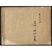
- Left: blue ink map drawing “300 yds” Right: in pencil person sitting on stool wearing hate holding paintbrush facing away from viewer.Verso: drawings of person holding paintbrush facing away from viewer. Math equations. Type written: “Banff Alberta. Sunday Sept. 19, 1954 Dear Dorothy, How awfully”
1 image
- Title
- Untitled
- Date
- 1954
- Medium
- graphite; ink on paper
- Dimensions
- 16.5 x 25.0 cm
- Description
- Left: blue ink map drawing “300 yds” Right: in pencil person sitting on stool wearing hate holding paintbrush facing away from viewer.Verso: drawings of person holding paintbrush facing away from viewer. Math equations. Type written: “Banff Alberta. Sunday Sept. 19, 1954 Dear Dorothy, How awfully”
- Credit
- Gift of Catharine Robb Whyte, O. C., Banff, 1975
- Catalogue Number
- WyP.03.952 p
Images

This material is presented as originally created; it may contain outdated cultural descriptions and
potentially offensive content.
Read more.
Dinwoody Glacier
https://archives.whyte.org/en/permalink/catalogue21331
- Medium
- Library - Maps and blueprints (unannotated; published)
- Map
- Published Date
- 1950-1952
- Author
- Meier, Mark F.
- Publisher
- Research Committee, American Alpine Club
- Call Number
- C5-4.1
- Author
- Meier, Mark F.
- Publisher
- Research Committee, American Alpine Club
- Published Date
- 1950-1952
- Subjects
- Glacier Map
- Notes
- Wind River Mountains, Wyoming
- Geology by Mark F. Meier
- Base map compiled from air photos
- Text on back of map. Photo of glacier.
- Accession Number
- 2613
- Call Number
- C5-4.1
- Collection
- Archives Library
This material is presented as originally created; it may contain outdated cultural descriptions and
potentially offensive content.
Read more.
Personal Interest Files - "Parks Canada Reorganization" to "Rocky Mountain Youth Initiative"
https://archives.whyte.org/en/permalink/descriptions55808
- Part Of
- Ben Gadd fonds
- Scope & Content
- File consists of personal interest materials, including newspaper clippings, research articles, loose notes, and other textual records collected by Ben Gadd. Materials are arranged alphabetically by subject title.
- Date Range
- [ca.1980-2015]
- Reference Code
- M590 / I / C / 127 to 143
- Description Level
- 5 / File
- GMD
- Textual record
- Published record
- Newspaper clipping
- Part Of
- Ben Gadd fonds
- Description Level
- 5 / File
- Fonds Number
- M590
- V810
- S61
- Series
- M590 / I : Personal records
- Sous-Fonds
- M590
- Sub-Series
- M590 / I / C : Personal Interest Files
- Accession Number
- 2021.20
- Reference Code
- M590 / I / C / 127 to 143
- Responsibility
- Compiled by Ben Gadd
- Date Range
- [ca.1980-2015]
- Physical Description
- 12 cm of textual records
- Scope & Content
- File consists of personal interest materials, including newspaper clippings, research articles, loose notes, and other textual records collected by Ben Gadd. Materials are arranged alphabetically by subject title.
- Notes
- Contents of individual folders in file: M590 / I / C / 127 to 128 : Parks Canada Reorganization [Files 1 and 2 of 2] M590 / I / C / 129 : Pipeline (Trans Canada, etc.) M590 / I / C / 130 : Plans M590 / I / C / 131 : Pocahontas (Maps, Plans) M590 / I / C / 132 : Pole, Graeme M590 / I / C / 133 : Poisons, Pesticides, Pollution M590 / I / C / 134 : Population Explosion M590 / I / C / 135 : Provincial Parks M590 / I / C / 136 : Railways M590 / I / C / 137 : Rapson, Dwight M590 / I / C / 138 : RCMP M590 / I / C / 139 : Resorts, Industrial Tourism M590 / I / C / 140 : Roy Richards M590 / I / C / 141 : Rivers, Flooding M590 / I / C / 142 : Roads + Highways, Salting M590 / I / C / 143 : Rocky Mountain Youth Initiative
- Name Access
- Gadd, Ben
- Subject Access
- Tourism
- National parks and reserves
- Government
- Travel
- Transportation
- Trains
- Railways
- Royal Canadian Mounted Police
- Rivers
- Provincial parks and reserves
- Pollution
- Oil
- Natural resources
- Roads
- Map
- Geography
- Geographic Access
- Canada
- Alberta
- Jasper National Park
- Reproduction Restrictions
- Restrictions may apply
- Language
- English
- Category
- Environment
- Natural resources
- Government
- Title Source
- Original title used
- Processing Status
- Processed
This material is presented as originally created; it may contain outdated cultural descriptions and
potentially offensive content.
Read more.
Travel guides and maps
https://archives.whyte.org/en/permalink/descriptions56361
- Part Of
- Ben Gadd fonds
- Scope & Content
- Sub-series consists of travel brochures and maps which were collected and used by Ben Gadd. Sub-series contains five sub-sub series: M590 / I / A / i : Travel guides and pocket maps M590 / I / A / ii : Topographical maps M590 / I / A / iii : Geological maps M590 / I / A / iv : Highway maps M590 / …
- Date Range
- [ca.1920-2010]
- Reference Code
- M590 / I / A
- Description Level
- 4 / Sub-series
- GMD
- Map
- Textual record
- Part Of
- Ben Gadd fonds
- Description Level
- 4 / Sub-series
- Fonds Number
- M590
- V810
- S61
- Series
- M590 / I : Personal records
- Sous-Fonds
- M590
- Sub-Series
- M590 / I / A : Travel guides and maps
- Accession Number
- 2021.20
- Reference Code
- M590 / I / A
- GMD
- Map
- Textual record
- Date Range
- [ca.1920-2010]
- Physical Description
- ca. 274 maps -- ca. 61 travel guides, brochures
- Scope & Content
- Sub-series consists of travel brochures and maps which were collected and used by Ben Gadd. Sub-series contains five sub-sub series: M590 / I / A / i : Travel guides and pocket maps M590 / I / A / ii : Topographical maps M590 / I / A / iii : Geological maps M590 / I / A / iv : Highway maps M590 / I / A / v : Index maps, other
- Notes
- Some materials in sub-series are annotated with notes by Ben Gadd
- Name Access
- Gadd, Ben
- Subject Access
- Geography
- Geology
- Environment
- Map
- Tourism
- Tourist information
- Travel
- Trails
- Roads
- Transportation
- Natural history
- National parks and reserves
- Provincial parks and reserves
- Government
- Sports
- Recreation
- Hiking
- Geographic Access
- Canada
- Alberta
- British Columbia
- Banff National Park
- Jasper National Park
- Kootenay National Park
- Yoho National Park
- Waterton Lakes National Park
- Columbia Icefields
- United States of America
- Colorado
- Montana
- Yellowstone National Park
- Access Restrictions
- Restrictions may apply - some materials are fragile
- Reproduction Restrictions
- Restrictions may apply
- Language
- English
- Conservation
- Some fragile/torn materials stored in mylar
- Category
- Environment
- Exploration, discovery and travel
- Government
- Sports, recreation and leisure
- Transportation
- Tourism
- Title Source
- Title based on contents of sub-series
- Processing Status
- Processed
This material is presented as originally created; it may contain outdated cultural descriptions and
potentially offensive content.
Read more.
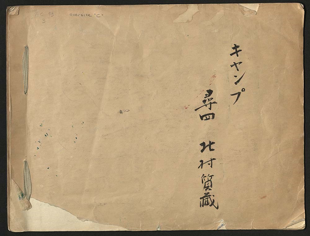
Japanese Sketchbook
https://archives.whyte.org/en/permalink/descriptions54789
- Part Of
- Alpine Club of Canada fonds
- Scope & Content
- File consists of a sketchbook containing Japanese writing, hand-drawn maps, and illustrations. Many of the illustrations are done in either watercolour paint or crayon.
- Date Range
- [ca. 1950-1960]
- Reference Code
- M200 / AC 093M / 2
- Description Level
- 5 / File
- GMD
- Scrapbook
- Painting
1 image
1 Electronic Resource
- Part Of
- Alpine Club of Canada fonds
- Description Level
- 5 / File
- Fonds Number
- M200 / S6 / V14
- Series
- I.A.1.b. Administration: general
- Sous-Fonds
- AC 093M
- Accession Number
- .
- Reference Code
- M200 / AC 093M / 2
- Date Range
- [ca. 1950-1960]
- Physical Description
- 0.5 cm of textual records (30 pages ; 37.5 x 28.5 cm)
- History / Biographical
- See fonds level description.
- Scope & Content
- File consists of a sketchbook containing Japanese writing, hand-drawn maps, and illustrations. Many of the illustrations are done in either watercolour paint or crayon.
- Name Access
- Alpine Club of Canada
- Subject Access
- Art
- Arts and crafts
- Backpacking
- Calligraphy
- Climbing
- Club
- Environment and Nature
- Painting
- Map
- Mountaineering
- Mountaineers
- Language
- Japanese
- Title Source
- Title based on material
- Processing Status
- Processed
Electronic Resources
Images
This material is presented as originally created; it may contain outdated cultural descriptions and
potentially offensive content.
Read more.
Published regional and trail maps
https://archives.whyte.org/en/permalink/descriptions54847
- Scope & Content
- File consists of maps depicting the Banff townsite and nearby travel routes. Includes a trail map for Banff, Yoho and Kootenay National Parks; a road map for Banff and nearby areas [1965]; a numbered townsite map of Banff marking local hotels and attractions; and a photocopied map of a trail route …
- Date Range
- [1950-1970]
- 1965
- Reference Code
- M545 / III / 29
- Description Level
- 5 / File
- GMD
- Textual record
- Published record
- Map
- Description Level
- 5 / File
- Fonds Number
- M545 / V635
- Series
- M545 / III : Published records
- Sous-Fonds
- M545
- Accession Number
- 5939
- Reference Code
- M545 / III / 29
- Date Range
- [1950-1970]
- 1965
- Physical Description
- 0.5 cm of textual records (4 maps ; 35.5 x 21.5 cm or smaller)
- Scope & Content
- File consists of maps depicting the Banff townsite and nearby travel routes. Includes a trail map for Banff, Yoho and Kootenay National Parks; a road map for Banff and nearby areas [1965]; a numbered townsite map of Banff marking local hotels and attractions; and a photocopied map of a trail route used by the Trail Riders of the Canadian Rockies [n.d.]
- Notes
- Banff townsite map has annotation marking the location of the Trail Ride Office on Caribou St.
- Subject Access
- Travel
- Trails
- Map
- Land, settlement and immigration
- Geography
- Geographic Access
- Canada
- Alberta
- Banff
- Banff National Park
- Yoho National Park
- Kootenay National Park
- Reproduction Restrictions
- Restrictions may apply
- Language
- English
- Title Source
- Title based on contents of file
- Processing Status
- Processed
This material is presented as originally created; it may contain outdated cultural descriptions and
potentially offensive content.
Read more.
Banff National Park and Lake Louise maps
https://archives.whyte.org/en/permalink/descriptions54945
- Scope & Content
- File consists of two folded maps and a small clipping [possibly top or bottom portion from a different map or one of maps in file]. One map is of Banff National Park and one is of Lake Louise [1959]. Banff National Park map has black pencil tracings over trail section near the bottom of the map and…
- Date Range
- 1959
- [1960-1970]
- Reference Code
- M545 / V / 53
- Description Level
- 5 / File
- GMD
- Textual record
- Published record
- Map
- Description Level
- 5 / File
- Fonds Number
- M545 / V635
- Series
- M545 / V : Administrative records
- Sous-Fonds
- M545
- Accession Number
- 8235
- Reference Code
- M545 / V / 53
- Date Range
- 1959
- [1960-1970]
- Physical Description
- 0.5 cm of textual records (2 maps ; 60.5 x 57.5 and 60 x 56.5 cm)
- Scope & Content
- File consists of two folded maps and a small clipping [possibly top or bottom portion from a different map or one of maps in file]. One map is of Banff National Park and one is of Lake Louise [1959]. Banff National Park map has black pencil tracings over trail section near the bottom of the map and annotation in bottom right corner which reads "Natural Bridge". Lake Louise map produced by the Government of Canada.
- Subject Access
- Banff National Park
- Environment
- Geography
- Map
- Lake Louise
- Travel
- Government
- National parks and reserves
- Trails
- Geographic Access
- Canada
- Alberta
- Banff National Park
- Lake Louise
- Language
- English
- Conservation
- Clipping stored in mylar due to significant staining and residue from tape
- Items kept folded [not placed in mylar] due to mass production of content and minimal/no annotations
- Title Source
- Title based on contents of file
- Processing Status
- Processed
This material is presented as originally created; it may contain outdated cultural descriptions and
potentially offensive content.
Read more.
Summits and Icefields - textual
https://archives.whyte.org/en/permalink/descriptions55076
- Part Of
- Chic Scott fonds
- Scope & Content
- Series consists of textual records pertaining to the creation and publication of Summits and Icefields; includes research documents, maps and other related material.
- Date Range
- 2003 - 2012
- Reference Code
- M57 / III
- Description Level
- 3 / Series
- GMD
- Textual record
- Part Of
- Chic Scott fonds
- Description Level
- 3 / Series
- Fonds Number
- M57 / V40 / S47
- Series
- M57 / III: Summits and Icefields
- Sous-Fonds
- M57
- Sub-Series
- M57 / III / A: Research files
- M57 / III / B: Maps
- M57 / III / C: Collected publications
- Accession Number
- .
- Reference Code
- M57 / III
- GMD
- Textual record
- Date Range
- 2003 - 2012
- Physical Description
- 20 cm of textual records
- History / Biographical
- These are your dream books; “When the first snows fly in November, sit down in front of the fire and dream of endless powder slopes, dazzling icefields and wilderness cabins under northern lights.” Couloir Magazine called Summits and Icefields “The best guidebook yet published in North America.” Now available in two volumes (The Canadian Rockies and The Columbia Mountains) these books are a skier's guide to Rogers Pass, the classic ski ascents of the Rockies, the backcountry lodges, the grand traverses and much, much more. They also contain a taste of the exciting ski history of these ranges.
- Scope & Content
- Series consists of textual records pertaining to the creation and publication of Summits and Icefields; includes research documents, maps and other related material.
- Notes
- Series consists of three sub-series:
- M57 / III / A: Research files
- M57 / III / B: Maps
- M57 / III / C: Collected publications
- Name Access
- Scott, Chic
- Subject Access
- Geography
- Guiding
- Guides
- History
- Map
- Publication
- Recreation
- Research
- Ski Maps
- Skiing
- Sports and recreation
- Sports
- Trail guides
- Travel and Exploration
- Winter sports
- Geographic Access
- Canada
- Alberta
- British Columbia
- Rogers Pass
- Canadian Rocky Mountains
- Columbia Icefield
- Language
- English
- Related Material
- V40 / III
- Biographical Source Notes
- http://chicscott.com/books.htm
- Title Source
- Title based on contents of file
- Processing Status
- Processed
This material is presented as originally created; it may contain outdated cultural descriptions and
potentially offensive content.
Read more.
Summits and Icefields - visual
https://archives.whyte.org/en/permalink/descriptions55077
- Part Of
- Chic Scott fonds
- Scope & Content
- Series consists of image scans pertaining to the creation of the book Summits and Icefields.
- Date Range
- 2003 - 2012
- Reference Code
- V40 / III
- Description Level
- 3 / Series
- GMD
- Digital image
- Photograph
- Part Of
- Chic Scott fonds
- Description Level
- 3 / Series
- Fonds Number
- M57 / V40 / S47
- Series
- V40 / III : Summits and Icefields
- Sous-Fonds
- V40
- Accession Number
- .
- Reference Code
- V40 / III
- Date Range
- 2003 - 2012
- Physical Description
- 24 CDs : digital photo scans
- History / Biographical
- These are your dream books; “When the first snows fly in November, sit down in front of the fire and dream of endless powder slopes, dazzling icefields and wilderness cabins under northern lights.” Couloir Magazine called Summits and Icefields “The best guidebook yet published in North America.” Now available in two volumes (The Canadian Rockies and The Columbia Mountains) these books are a skier's guide to Rogers Pass, the classic ski ascents of the Rockies, the backcountry lodges, the grand traverses and much, much more. They also contain a taste of the exciting ski history of these ranges.
- Scope & Content
- Series consists of image scans pertaining to the creation of the book Summits and Icefields.
- Name Access
- Scott, Chic
- Subject Access
- Geography
- Guiding
- Guides
- History
- Map
- Publication
- Recreation
- Research
- Ski Maps
- Skiing
- Sports and recreation
- Sports
- Trail guides
- Travel and Exploration
- Winter sports
- Geographic Access
- Canada
- Alberta
- British Columbia
- Rogers Pass
- Canadian Rocky Mountains
- Columbia Icefield
- Access Restrictions
- Reference only
- Reproduction Restrictions
- Restricted: copyright remains with owner
- Language
- English
- Related Material
- M57 / III
- Biographical Source Notes
- http://chicscott.com/books.htm
- Title Source
- Title based on contents of file
- Processing Status
- Processed
This material is presented as originally created; it may contain outdated cultural descriptions and
potentially offensive content.
Read more.
Ski Trails in the Canadian Rockies - textual
https://archives.whyte.org/en/permalink/descriptions55078
- Part Of
- Chic Scott fonds
- Scope & Content
- Series consists of research documents, published materials and maps used during the creation of the book Ski Trails in the Canadian Rockies.
- Date Range
- 1999 - 2015
- Reference Code
- M57 / VI
- Description Level
- 3 / Series
- GMD
- Textual record
- Part Of
- Chic Scott fonds
- Description Level
- 3 / Series
- Fonds Number
- M57 / V40 / S47
- Series
- M57 / VI: Ski Trails in the Canadian Rockies
- Sous-Fonds
- M57
- Sub-Series
- M57 / VI / A: Research Files
- M57 / VI / B: Collected publications
- M57 / VI / C: Maps
- Accession Number
- .
- Reference Code
- M57 / VI
- GMD
- Textual record
- Date Range
- 1999 - 2015
- Physical Description
- 18 cm of textual records
- History / Biographical
- The classic guidebook to cross country ski trails in Waterton, Banff, Kootenay, Yoho and Jasper National Parks as well as Mount Assiniboine and Mount Robson Provincial Parks and Kananaskis Country, now greatly expanded to includes ski trails in the front ranges of the Rockies, in the Crowsnest Pass and in the Columbia Valley. Jointly authored with Darren Farley. This book also covers topics such as accommodation, regulations, weather and snow conditions.
- Scope & Content
- Series consists of research documents, published materials and maps used during the creation of the book Ski Trails in the Canadian Rockies.
- Notes
- Series consists of three sub-series: M57 / VI / A: Research Files
- M57 / VI / B: Collected publications
- M57 / VI / C: Maps
- Name Access
- Scott, Chic
- Subject Access
- Activities
- Environment
- Exploration
- Geography
- Guide
- Map
- Mountaineering
- Mountains
- National parks and reserves
- Publication
- Recreation
- Ski areas
- Ski Maps
- Ski mountaineering
- Ski lodges and cabins
- Skiing
- Sports and recreation
- Sports
- Tourism
- Tourist information
- Trail guides
- Trails
- Travel
- Winter sports
- Geographic Access
- Canada
- Alberta
- British Columbia
- Canadian Rocky Mountains
- Banff National Park
- Yoho National Park
- Jasper National Park
- Waterton
- Kootenay National Park
- Rogers Pass
- Columbia Valley
- Crowsnest Pass
- Language
- English
- Related Material
- S47 / VI
- V40 / VI
- Title Source
- Title based on contents of file
- Processing Status
- Processed
This material is presented as originally created; it may contain outdated cultural descriptions and
potentially offensive content.
Read more.