Narrow Results By
- Date
- 1954
- Medium
- graphite; ink on paper
- Catalogue Number
- WyP.03.952 p
- Description
- Left: blue ink map drawing “300 yds” Right: in pencil person sitting on stool wearing hate holding paintbrush facing away from viewer.Verso: drawings of person holding paintbrush facing away from viewer. Math equations. Type written: “Banff Alberta. Sunday Sept. 19, 1954 Dear Dorothy, How awfully”
1 image
- Title
- Untitled
- Date
- 1954
- Medium
- graphite; ink on paper
- Dimensions
- 16.5 x 25.0 cm
- Description
- Left: blue ink map drawing “300 yds” Right: in pencil person sitting on stool wearing hate holding paintbrush facing away from viewer.Verso: drawings of person holding paintbrush facing away from viewer. Math equations. Type written: “Banff Alberta. Sunday Sept. 19, 1954 Dear Dorothy, How awfully”
- Credit
- Gift of Catharine Robb Whyte, O. C., Banff, 1975
- Catalogue Number
- WyP.03.952 p
Images

This material is presented as originally created; it may contain outdated cultural descriptions and
potentially offensive content.
Read more.
Dr. Gerald Wright fonds
https://archives.whyte.org/en/permalink/descriptions55580
- Part Of
- Dr. Gerald Wright fonds
- Scope & Content
- Fonds pertains to 3 photograph prints of members of the St. Elias expedition in the Yukon, a large-format black and white print of a mountain range [possibly including St. Elias], 11 typed letters to Wright from W.E. (Smoke) Blanchard dated January-May 1965 discussing the expedition, 2 typed one-pa…
- Date Range
- 1965-1967
- Reference Code
- M585 / V805
- Description Level
- 1 / Fonds
- GMD
- Organization record
- Photograph print
- Textual record
- Part Of
- Dr. Gerald Wright fonds
- Description Level
- 1 / Fonds
- Fonds Number
- M585 / V805
- Sous-Fonds
- M585
- Accession Number
- 2021.19
- Reference Code
- M585 / V805
- Date Range
- 1965-1967
- Physical Description
- 1 cm of textual records (18 pages ; 21.6 x 27.9 cm) ; 4 photographs : b&w and col. ; 29.2 x 21.8 cm or smaller
- History / Biographical
- Dr. Gerald Wright (1917-2007) grew up in Brecon, South Wales, and studied medicine in Wales and London, England, throughout the 1940s. He served in the British Army in the Royal Army Medical Corps from 1942-1946 in North Africa and Italy. In 1951 Wright moved to Lethbridge, Alberta, due to its close proximity to the Canadian Rockies, where he maintained a general practice as a member of the Hunt Clinic. He went on to serve as Chief of Medicine at St. Michael's Hospital and the Lethbridge Municipal Hospital until his retirement in 1988. Shortly after arriving in Canada he became a member of the Alpine Club of Canada and attended many annual camps, often as camp doctor. He also participated in ACC expeditions to Mount St. Elias (1967, unsuccessful), Mount Alberta (1967, successful as part of the Alberta Team), and Mt. Waddington (1969). He also successfully summited Mt. Robson on his third attempt at the mountain. Wright hiked extensively throughout Nepal, Switzerland, South America, and New Zealand in addtion to the Rockies. He was also a member of the Skyline Trail Hikers of the Canadian Rockies and was a founding member of the Castle-Crown Wilderness Coalition, where he served on the Board of Directors, helping to plan and lead many annual hiking trips.
- Scope & Content
- Fonds pertains to 3 photograph prints of members of the St. Elias expedition in the Yukon, a large-format black and white print of a mountain range [possibly including St. Elias], 11 typed letters to Wright from W.E. (Smoke) Blanchard dated January-May 1965 discussing the expedition, 2 typed one-page summaries of the attempt on the mountain [one written by Blanchard and includes a hand-drawn map of the area around the mountain], a Xerox copy of a letter written on University of Oregon Medical School letterhead listing the members of the St. Elias party and recommended medical tests to have completed prior to the expedition, a two-page typed list of gear & equipment, and a hand-written list of expedition members and the University of Oregon Medical School doctor and their contact information.
- Name Access
- Alpine Club of Canada
- Wright, Gerald
- Blanchard, W.E. (Smoke)
- Johnson, Roy
- Mock, R.G. (Tex)
- Sharp, Dave
- Swift, Bob
- Subject Access
- Activities
- Alpine Club of Canada
- Camps
- Centennial
- Climbing
- Club
- Discovery and exploration
- Glaciers
- Hiking
- Map
- Medicine
- Membership
- Mount St. Elias
- Mountain
- Mountaineering
- Mountaineers
- Mountains
- Photography
- Records
- Record keeping
- Scenery
- Sports and recreation
- Travel and Exploration
- Geographic Access
- Yukon
- Canada
- Language
- English
- Conservation
- Staples removed from letters and equipment lists
- Biographical Source Notes
- Memorial card
- Title Source
- Title based on contents of fonds
- Processing Status
- Processed
This material is presented as originally created; it may contain outdated cultural descriptions and
potentially offensive content.
Read more.
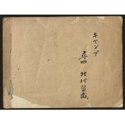
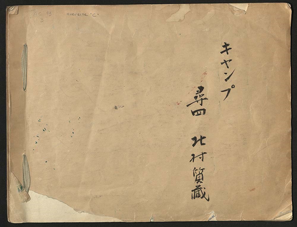
Japanese Sketchbook
https://archives.whyte.org/en/permalink/descriptions54789
- Part Of
- Alpine Club of Canada fonds
- Scope & Content
- File consists of a sketchbook containing Japanese writing, hand-drawn maps, and illustrations. Many of the illustrations are done in either watercolour paint or crayon.
- Date Range
- [ca. 1950-1960]
- Reference Code
- M200 / AC 093M / 2
- Description Level
- 5 / File
- GMD
- Scrapbook
- Painting
1 image
1 Electronic Resource
- Part Of
- Alpine Club of Canada fonds
- Description Level
- 5 / File
- Fonds Number
- M200 / S6 / V14
- Series
- I.A.1.b. Administration: general
- Sous-Fonds
- AC 093M
- Accession Number
- .
- Reference Code
- M200 / AC 093M / 2
- Date Range
- [ca. 1950-1960]
- Physical Description
- 0.5 cm of textual records (30 pages ; 37.5 x 28.5 cm)
- History / Biographical
- See fonds level description.
- Scope & Content
- File consists of a sketchbook containing Japanese writing, hand-drawn maps, and illustrations. Many of the illustrations are done in either watercolour paint or crayon.
- Name Access
- Alpine Club of Canada
- Subject Access
- Art
- Arts and crafts
- Backpacking
- Calligraphy
- Climbing
- Club
- Environment and Nature
- Painting
- Map
- Mountaineering
- Mountaineers
- Language
- Japanese
- Title Source
- Title based on material
- Processing Status
- Processed
Electronic Resources
Images
This material is presented as originally created; it may contain outdated cultural descriptions and
potentially offensive content.
Read more.
- Date
- 1917 – 1966
- Medium
- ink on paper
- Catalogue Number
- WyP.03.513
- Description
- A detailed ink drawing of a map South America, in a double-rectangle border.
1 image
- Title
- South America
- Date
- 1917 – 1966
- Medium
- ink on paper
- Dimensions
- 23.5 x 15.1 cm
- Description
- A detailed ink drawing of a map South America, in a double-rectangle border.
- Subject
- South America
- map
- Credit
- Gift of Catharine Robb Whyte, O. C., Banff, 1975
- Catalogue Number
- WyP.03.513
Images

This material is presented as originally created; it may contain outdated cultural descriptions and
potentially offensive content.
Read more.
The Great Lakes and the States that Bound Them
https://archives.whyte.org/en/permalink/artifactwyp.03.514
- Date
- 1917 – 1966
- Medium
- ink on paper
- Catalogue Number
- WyP.03.514
- Description
- Ink drawing of a geographic perspective of the Great Lakes region, including the states that border on Canada
1 image
- Title
- The Great Lakes and the States that Bound Them
- Date
- 1917 – 1966
- Medium
- ink on paper
- Dimensions
- 15.1 x 22.5 cm
- Description
- Ink drawing of a geographic perspective of the Great Lakes region, including the states that border on Canada
- Subject
- map
- Great Lakes
- Canada
- United States
- geography
- Credit
- Gift of Catharine Robb Whyte, O. C., Banff, 1975
- Catalogue Number
- WyP.03.514
Images

This material is presented as originally created; it may contain outdated cultural descriptions and
potentially offensive content.
Read more.
- Date
- 1917 – 1966
- Medium
- ink on drawing
- Catalogue Number
- WyP.03.515
- Description
- An ink drawing of a map of Saskatchewan on paper. Labelled SASKATEWAN [sic] in centre, written vertically towards the top edge.
1 image
- Title
- Untitled
- Date
- 1917 – 1966
- Medium
- ink on drawing
- Dimensions
- 22.5 x 15.1 cm
- Description
- An ink drawing of a map of Saskatchewan on paper. Labelled SASKATEWAN [sic] in centre, written vertically towards the top edge.
- Subject
- map
- Saskatchewan
- province
- Canada
- geography
- Credit
- Gift of Catharine Robb Whyte, O. C., Banff, 1975
- Catalogue Number
- WyP.03.515
Images

This material is presented as originally created; it may contain outdated cultural descriptions and
potentially offensive content.
Read more.
- Date
- n.d.
- Medium
- graphite; ink on paper
- Catalogue Number
- WyP.03.549
- Description
- An ink and pencil drawing of Quebec, New Brunswick, Ontario and Manitoba, from a cartographical perspective.
1 image
- Title
- Map of Quebec
- Date
- n.d.
- Medium
- graphite; ink on paper
- Dimensions
- 22.5 x 15.1 cm
- Description
- An ink and pencil drawing of Quebec, New Brunswick, Ontario and Manitoba, from a cartographical perspective.
- Subject
- map
- cartography
- Ontario
- Manitoba
- New Brunswick
- Quebec
- Credit
- Gift of Catharine Robb Whyte, O. C., Banff, 1979
- Catalogue Number
- WyP.03.549
Images

This material is presented as originally created; it may contain outdated cultural descriptions and
potentially offensive content.
Read more.
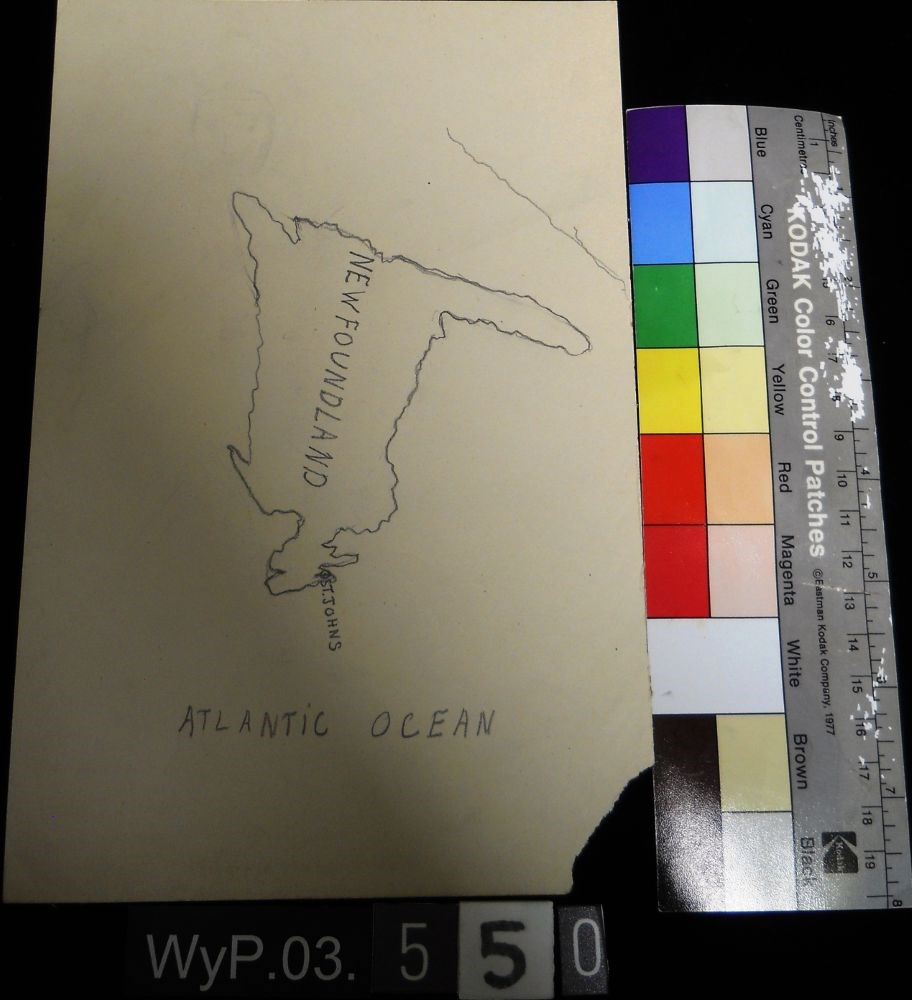
Map of Newfoundland
https://archives.whyte.org/en/permalink/artifactwyp.03.550
- Date
- n.d.
- Medium
- graphite on paper
- Catalogue Number
- WyP.03.550
- Description
- A pencil drawn map of Newfoundland, including the Atlantic Ocean.
1 image
- Title
- Map of Newfoundland
- Date
- n.d.
- Medium
- graphite on paper
- Dimensions
- 22.5 x 15.1 cm
- Description
- A pencil drawn map of Newfoundland, including the Atlantic Ocean.
- Subject
- map
- cartography
- Newfoundland
- Atlantic Ocean
- Credit
- Gift of Catharine Robb Whyte, O. C., Banff, 1979
- Catalogue Number
- WyP.03.550
Images
This material is presented as originally created; it may contain outdated cultural descriptions and
potentially offensive content.
Read more.
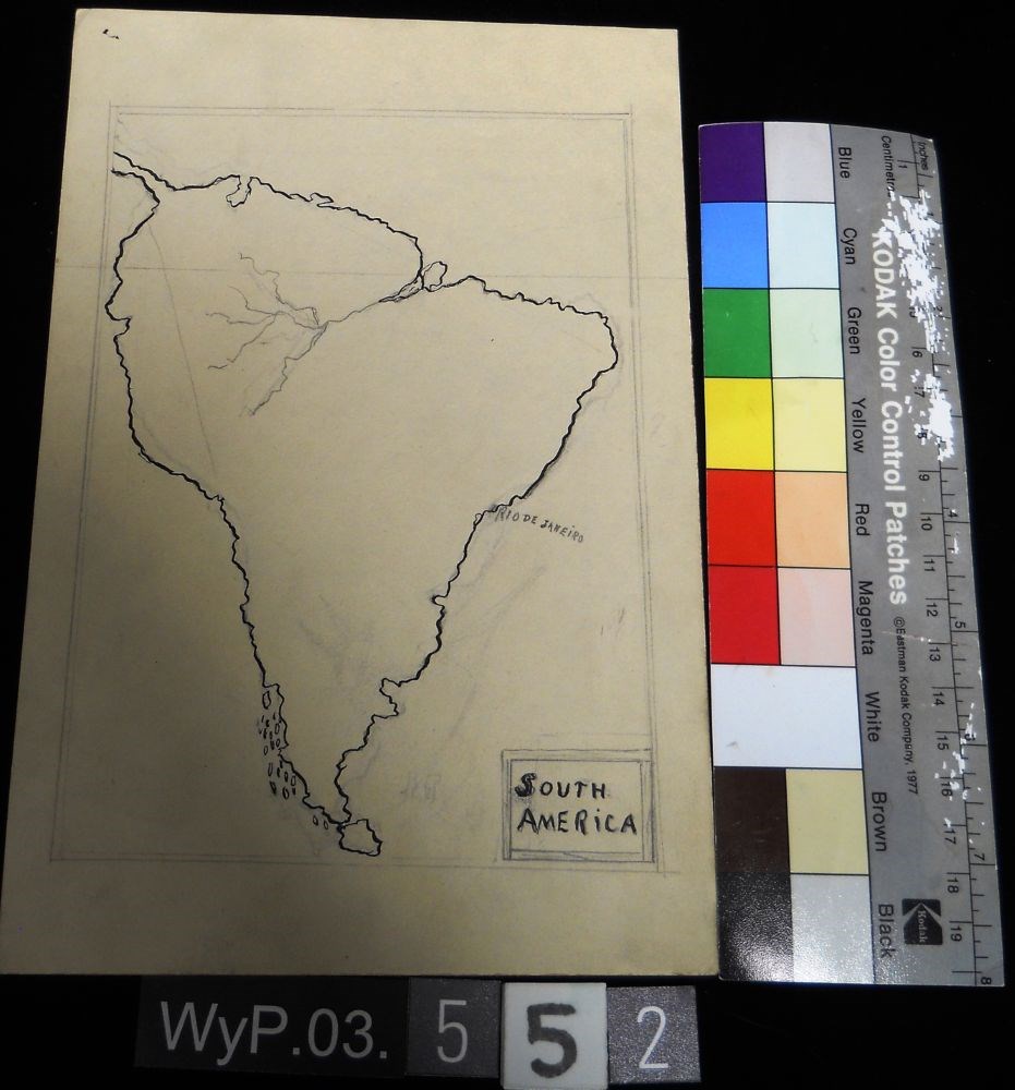
- Date
- n.d.
- Medium
- graphite; ink on paper
- Catalogue Number
- WyP.03.552
- Description
- A pencil and ink drawing of a map of South America. Rio de Janeiro is labeled on right edge of the continent.
1 image
- Title
- Untitled
- Date
- n.d.
- Medium
- graphite; ink on paper
- Dimensions
- 22.5 x 15.1 cm
- Description
- A pencil and ink drawing of a map of South America. Rio de Janeiro is labeled on right edge of the continent.
- Subject
- South America
- Rio de Janeiro
- map
- cartography
- Credit
- Gift of Catharine Robb Whyte, O. C., Banff, 1979
- Catalogue Number
- WyP.03.552
Images
This material is presented as originally created; it may contain outdated cultural descriptions and
potentially offensive content.
Read more.
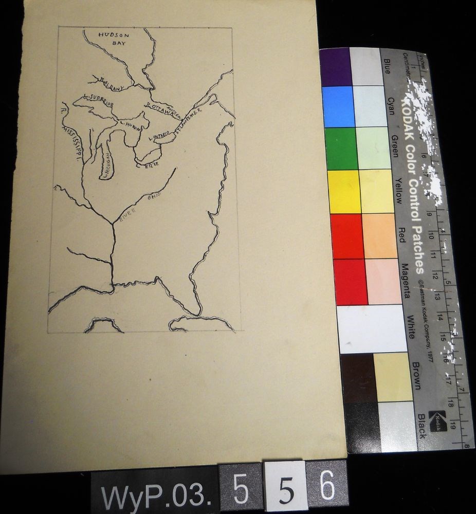
- Date
- 1917 – 1929
- Medium
- graphite; ink on paper
- Catalogue Number
- WyP.03.556
- Description
- A pencil and ink drawing of a map of Hudson Bay and the river system in eastern Canada and United States. Includes Great Lakes as well. Bodies of water are labeled.
1 image
- Title
- Untitled
- Date
- 1917 – 1929
- Medium
- graphite; ink on paper
- Dimensions
- 22.5 x 15.1 cm
- Description
- A pencil and ink drawing of a map of Hudson Bay and the river system in eastern Canada and United States. Includes Great Lakes as well. Bodies of water are labeled.
- Subject
- Canada
- Hudson Bay
- rivers
- United States
- U.S.A.
- map
- Credit
- Gift of Catharine Robb Whyte, O. C., Banff, 1979
- Catalogue Number
- WyP.03.556
Images
This material is presented as originally created; it may contain outdated cultural descriptions and
potentially offensive content.
Read more.