Narrow Results By
The triangle tour of British Columbia
https://archives.whyte.org/en/permalink/catalogue7932
- Medium
- Library - Book (including soft-cover and pamphlets)
- Published Date
- 1926
- Call Number
- 02.5 C16tr Pam copy 1 1926
- 02.5 C16tr PAM copy 2
1 website
- Responsibility
- Canadian National Railways
- Published Date
- 1926
- Physical Description
- 16p. : ill., map
- Subjects
- Travel
- Tourism
- Canadian National Railway
- Railway map
- Railway routes
- Jasper National Park
- Prince Rupert - Stewart
- Vancouver
- Abstract
- Pertains to the Triangle Tour of British Columbia which route includes Jasper to Prince Rupert to Vancouver to Jasper on Canadian National Railway - includes detailed map of railway route, summary of trip, and photographs of Jasper and other sightseeing opportunities along the route, list of Canadian National Railway Office of the Travel Department and layout of the Canadian National Railway steamships the Prince Rupert and the Prince George
- Notes
- Publication date of copy 2 unknown, varies from copy 1 1926 pamphlet
- Accession Number
- 20500
- 2019.103
- Call Number
- 02.5 C16tr Pam copy 1 1926
- 02.5 C16tr PAM copy 2
- Collection
- Archives Library
- URL Notes
- Version available online
Websites
This material is presented as originally created; it may contain outdated cultural descriptions and
potentially offensive content.
Read more.
Kananaski Lakes
https://archives.whyte.org/en/permalink/catalogue20042
- Publisher
- Geological Survey
- Scale
- 1:126,720
- NTS 82J West 1/2
- Medium
- Library - Map
- Subjects
- Kananaskis
- Kananaskis Country
- Kananaskis Lakes
- Kananaskis Lakes 82 J - Alta.-B.C.
- Geological Map
- Geological Survey of Canada
- Geology
- Geology - Kananaskis Country - Kananaskis Lakes
- Abstract
- Pertains to the geological make up of the Kananaskis Lakes area - hand annotated NTS 82J West 1/2 map (copy)
- Notes
- Stamp reads: "This map has been reprinted from a scanned version of the original map"
- Accession Number
- 2019.81
- Call Number
- C7
- Collection
- Archives Library
- URL Notes
- Geologic Survey of Canada website
Websites
This material is presented as originally created; it may contain outdated cultural descriptions and
potentially offensive content.
Read more.
Japanese Sketchbook
https://archives.whyte.org/en/permalink/descriptions54789
- Part Of
- Alpine Club of Canada fonds
- Scope & Content
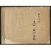
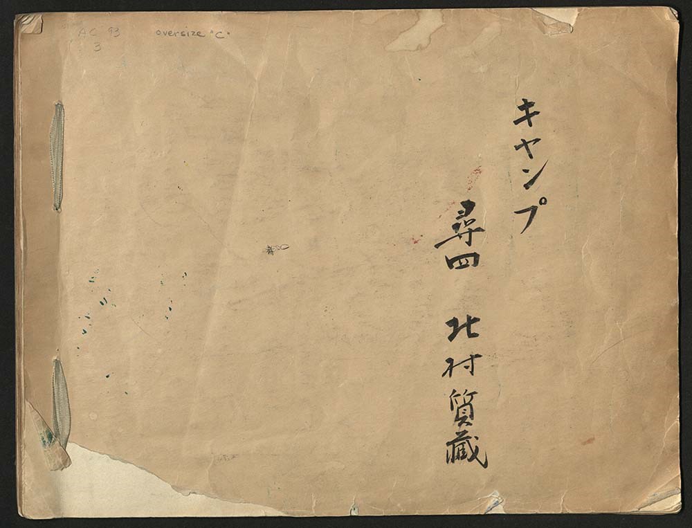
- File consists of a sketchbook containing Japanese writing, hand-drawn maps, and illustrations. Many of the illustrations are done in either watercolour paint or crayon.
- Date Range
- [ca. 1950-1960]
- Reference Code
- M200 / AC 093M / 2
- Description Level
- 5 / File
- GMD
- Scrapbook
- Painting
1 image
1 Electronic Resource
- Part Of
- Alpine Club of Canada fonds
- Description Level
- 5 / File
- Fonds Number
- M200 / S6 / V14
- Series
- I.A.1.b. Administration: general
- Sous-Fonds
- AC 093M
- Accession Number
- .
- Reference Code
- M200 / AC 093M / 2
- Date Range
- [ca. 1950-1960]
- Physical Description
- 0.5 cm of textual records (30 pages ; 37.5 x 28.5 cm)
- History / Biographical
- See fonds level description.
- Scope & Content
- File consists of a sketchbook containing Japanese writing, hand-drawn maps, and illustrations. Many of the illustrations are done in either watercolour paint or crayon.
- Name Access
- Alpine Club of Canada
- Subject Access
- Art
- Arts and crafts
- Backpacking
- Calligraphy
- Climbing
- Club
- Environment and Nature
- Painting
- Map
- Mountaineering
- Mountaineers
- Language
- Japanese
- Title Source
- Title based on material
- Processing Status
- Processed
Electronic Resources
Images
This material is presented as originally created; it may contain outdated cultural descriptions and
potentially offensive content.
Read more.