Narrow Results By
The Great Lakes and the States that Bound Them
https://archives.whyte.org/en/permalink/artifactwyp.03.514
- Date
- 1917 – 1966
- Medium
- ink on paper
- Catalogue Number
- WyP.03.514
- Description
- Ink drawing of a geographic perspective of the Great Lakes region, including the states that border on Canada
1 image
- Title
- The Great Lakes and the States that Bound Them
- Date
- 1917 – 1966
- Medium
- ink on paper
- Dimensions
- 15.1 x 22.5 cm
- Description
- Ink drawing of a geographic perspective of the Great Lakes region, including the states that border on Canada
- Subject
- map
- Great Lakes
- Canada
- United States
- geography
- Credit
- Gift of Catharine Robb Whyte, O. C., Banff, 1975
- Catalogue Number
- WyP.03.514
Images

This material is presented as originally created; it may contain outdated cultural descriptions and
potentially offensive content.
Read more.
Japanese Sketchbook
https://archives.whyte.org/en/permalink/descriptions54789
- Part Of
- Alpine Club of Canada fonds
- Scope & Content
- File consists of a sketchbook containing Japanese writing, hand-drawn maps, and illustrations. Many of the illustrations are done in either watercolour paint or crayon.
- Date Range
- [ca. 1950-1960]
- Reference Code
- M200 / AC 093M / 2
- Description Level
- 5 / File
- GMD
- Scrapbook
- Painting
1 image
1 Electronic Resource
- Part Of
- Alpine Club of Canada fonds
- Description Level
- 5 / File
- Fonds Number
- M200 / S6 / V14
- Series
- I.A.1.b. Administration: general
- Sous-Fonds
- AC 093M
- Accession Number
- .
- Reference Code
- M200 / AC 093M / 2
- Date Range
- [ca. 1950-1960]
- Physical Description
- 0.5 cm of textual records (30 pages ; 37.5 x 28.5 cm)
- History / Biographical
- See fonds level description.
- Scope & Content
- File consists of a sketchbook containing Japanese writing, hand-drawn maps, and illustrations. Many of the illustrations are done in either watercolour paint or crayon.
- Name Access
- Alpine Club of Canada
- Subject Access
- Art
- Arts and crafts
- Backpacking
- Calligraphy
- Climbing
- Club
- Environment and Nature
- Painting
- Map
- Mountaineering
- Mountaineers
- Language
- Japanese
- Title Source
- Title based on material
- Processing Status
- Processed
Electronic Resources
Images
This material is presented as originally created; it may contain outdated cultural descriptions and
potentially offensive content.
Read more.
Map Drawing Book For Use in Public Schools
https://archives.whyte.org/en/permalink/artifactwyp.03.584
- Date
- c. 1914
- Medium
- graphite on paper
- Catalogue Number
- WyP.03.584
- Description
- Peter Whyte’s Map Drawing sketchbook, likely an exercise book for school, with a printed cover page and map drawings inside. Cover page reads: MAP DRAWING BOOK [across top]; FOR USE IN THE PUBLIC SCHOOLS/ THE COPP, CLARK CO., LIMITED, TORONTO [across bottom] Inside, pencil drawings include: the Gul…
1 image
- Title
- Map Drawing Book For Use in Public Schools
- Date
- c. 1914
- Medium
- graphite on paper
- Dimensions
- 24.9 x 31.0 cm
- Description
- Peter Whyte’s Map Drawing sketchbook, likely an exercise book for school, with a printed cover page and map drawings inside. Cover page reads: MAP DRAWING BOOK [across top]; FOR USE IN THE PUBLIC SCHOOLS/ THE COPP, CLARK CO., LIMITED, TORONTO [across bottom] Inside, pencil drawings include: the Gulf of St. Lawrence, the Philippine Islands, Asia and the Middle East, and Africa.
- Subject
- world
- map
- globe
- geography
- cartography
- Asia
- Middle East
- Africa
- Philippine Islands
- Gulf of St. Lawrence
- Credit
- Gift of Catharine Robb Whyte, O. C., Banff, 1975
- Catalogue Number
- WyP.03.584
Images

This material is presented as originally created; it may contain outdated cultural descriptions and
potentially offensive content.
Read more.
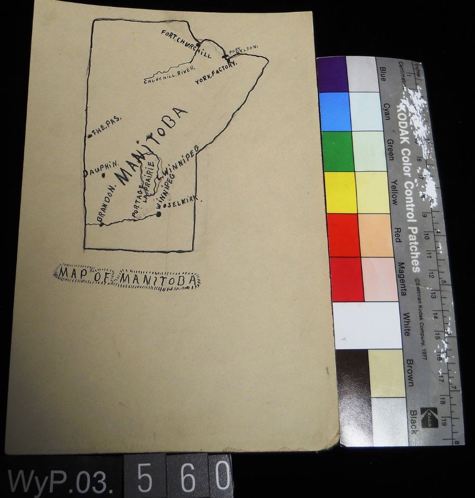
Map of Manitoba
https://archives.whyte.org/en/permalink/artifactwyp.03.560
- Date
- 1917 – 1929
- Medium
- ink; graphite on paper
- Catalogue Number
- WyP.03.560
- Description
- Pencil and ink drawing of a map of Manitoba with rivers, lakes and urban centres labeled. [Below drawing, surrounded by circle of short marks] MAP of MANITOBA
1 image
- Title
- Map of Manitoba
- Date
- 1917 – 1929
- Medium
- ink; graphite on paper
- Dimensions
- 22.5 x 15.1 cm
- Description
- Pencil and ink drawing of a map of Manitoba with rivers, lakes and urban centres labeled. [Below drawing, surrounded by circle of short marks] MAP of MANITOBA
- Credit
- Gift of Catharine Robb Whyte, O. C., Banff, 1979
- Catalogue Number
- WyP.03.560
Images
This material is presented as originally created; it may contain outdated cultural descriptions and
potentially offensive content.
Read more.
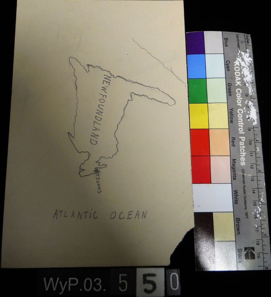
Map of Newfoundland
https://archives.whyte.org/en/permalink/artifactwyp.03.550
- Date
- n.d.
- Medium
- graphite on paper
- Catalogue Number
- WyP.03.550
- Description
- A pencil drawn map of Newfoundland, including the Atlantic Ocean.
1 image
- Title
- Map of Newfoundland
- Date
- n.d.
- Medium
- graphite on paper
- Dimensions
- 22.5 x 15.1 cm
- Description
- A pencil drawn map of Newfoundland, including the Atlantic Ocean.
- Subject
- map
- cartography
- Newfoundland
- Atlantic Ocean
- Credit
- Gift of Catharine Robb Whyte, O. C., Banff, 1979
- Catalogue Number
- WyP.03.550
Images
This material is presented as originally created; it may contain outdated cultural descriptions and
potentially offensive content.
Read more.
Map of Ontario
https://archives.whyte.org/en/permalink/artifactwyp.03.559
- Date
- 1917 – 1929
- Medium
- graphite; ink on paper
- Catalogue Number
- WyP.03.559
- Description
- Pencil and ink drawing of Ontario, the Manitoba border, and Great Lakes with rivers and urban centres labeled.title: MAP OF ONTARIO [top left, surrounded by short marks]
1 image
- Title
- Map of Ontario
- Date
- 1917 – 1929
- Medium
- graphite; ink on paper
- Dimensions
- 15.1 x 22.5 cm
- Description
- Pencil and ink drawing of Ontario, the Manitoba border, and Great Lakes with rivers and urban centres labeled.title: MAP OF ONTARIO [top left, surrounded by short marks]
- Credit
- Gift of Catharine Robb Whyte, O. C., Banff, 1979
- Catalogue Number
- WyP.03.559
Images

This material is presented as originally created; it may contain outdated cultural descriptions and
potentially offensive content.
Read more.
- Date
- n.d.
- Medium
- graphite; ink on paper
- Catalogue Number
- WyP.03.549
- Description
- An ink and pencil drawing of Quebec, New Brunswick, Ontario and Manitoba, from a cartographical perspective.
1 image
- Title
- Map of Quebec
- Date
- n.d.
- Medium
- graphite; ink on paper
- Dimensions
- 22.5 x 15.1 cm
- Description
- An ink and pencil drawing of Quebec, New Brunswick, Ontario and Manitoba, from a cartographical perspective.
- Subject
- map
- cartography
- Ontario
- Manitoba
- New Brunswick
- Quebec
- Credit
- Gift of Catharine Robb Whyte, O. C., Banff, 1979
- Catalogue Number
- WyP.03.549
Images

This material is presented as originally created; it may contain outdated cultural descriptions and
potentially offensive content.
Read more.
Province of Alberta Heritage Map
https://archives.whyte.org/en/permalink/artifacttuj.04.01
- Date
- 1980
- Medium
- print on paper
- Catalogue Number
- TuJ.04.01
- Description
- Off-white coloured map of alberta with blue bodies of water, green mppuntain rangte, and coloured drawings of animals, points of interest, and people. Brown background around map with blue ribbons and portraits of significant people, including Queen Elizabeth II at top. The Alberta coat of arms is …
1 image
- Title
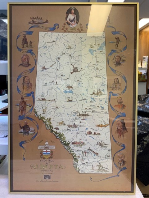
- Province of Alberta Heritage Map
- Date
- 1980
- Medium
- print on paper
- Dimensions
- 91.0 x 96.0 cm
- Description
- Off-white coloured map of alberta with blue bodies of water, green mppuntain rangte, and coloured drawings of animals, points of interest, and people. Brown background around map with blue ribbons and portraits of significant people, including Queen Elizabeth II at top. The Alberta coat of arms is at bottom left with “1905” “1980” “PROVINCE OF ALBERTA HERITAGE MAP COMMISSIONED BY Alberta Historical Resources Foundation” Signed J.D. TURNER bottom right. In thin brass frame with glass.
- Credit
- Gift of John Davenall Turner (Estate), 2020
- Catalogue Number
- TuJ.04.01
Images
This material is presented as originally created; it may contain outdated cultural descriptions and
potentially offensive content.
Read more.
- Date
- 1917 – 1966
- Medium
- ink on paper
- Catalogue Number
- WyP.03.513
- Description
- A detailed ink drawing of a map South America, in a double-rectangle border.
1 image
- Title
- South America
- Date
- 1917 – 1966
- Medium
- ink on paper
- Dimensions
- 23.5 x 15.1 cm
- Description
- A detailed ink drawing of a map South America, in a double-rectangle border.
- Subject
- South America
- map
- Credit
- Gift of Catharine Robb Whyte, O. C., Banff, 1975
- Catalogue Number
- WyP.03.513
Images

This material is presented as originally created; it may contain outdated cultural descriptions and
potentially offensive content.
Read more.
Sunshine Lodge
https://archives.whyte.org/en/permalink/artifact105.02.1041
- Date
- 1937
- Material
- plaster; wood
- Catalogue Number
- 105.02.1041
- Description
- Relief plaster map of Sunshine area. Detailed plaster relief map of Sunshine area, painted,trails, rivers, peaks, etc. indicated. In black lettering near bottom edge: " modelled by C.A. Beil (R) Banff, Alta." in wooden case 9.5 high 1.2 thick. Case painted black, 8.8 x 40.5 board hinged to case, b…
1 image
- Title
- Sunshine Lodge
- Date
- 1937
- Material
- plaster; wood
- Dimensions
- 9.5 x 74.2 x 84.0 cm
- Description
- Relief plaster map of Sunshine area. Detailed plaster relief map of Sunshine area, painted,trails, rivers, peaks, etc. indicated. In black lettering near bottom edge: " modelled by C.A. Beil (R) Banff, Alta." in wooden case 9.5 high 1.2 thick. Case painted black, 8.8 x 40.5 board hinged to case, black lettering on white: "Sunshine Lodge and Ski Terrain. In the Canadian Rockies near Banff - Alberta".
- Subject
- lodges
- Sunshine Village
- artists
- Charlie Beil
- Credit
- Gift of Unknown, 1968
- Catalogue Number
- 105.02.1041
Images

This material is presented as originally created; it may contain outdated cultural descriptions and
potentially offensive content.
Read more.