Narrow Results By
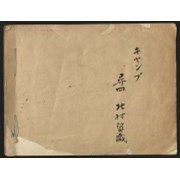
Japanese Sketchbook
https://archives.whyte.org/en/permalink/descriptions54789
- Part Of
- Alpine Club of Canada fonds
- Scope & Content
- File consists of a sketchbook containing Japanese writing, hand-drawn maps, and illustrations. Many of the illustrations are done in either watercolour paint or crayon.
- Date Range
- [ca. 1950-1960]
- Reference Code
- M200 / AC 093M / 2
- Description Level
- 5 / File
- GMD
- Scrapbook
- Painting
1 image
1 Electronic Resource
- Part Of
- Alpine Club of Canada fonds
- Description Level
- 5 / File
- Fonds Number
- M200 / S6 / V14
- Series
- I.A.1.b. Administration: general
- Sous-Fonds
- AC 093M
- Accession Number
- .
- Reference Code
- M200 / AC 093M / 2
- Date Range
- [ca. 1950-1960]
- Physical Description
- 0.5 cm of textual records (30 pages ; 37.5 x 28.5 cm)
- History / Biographical
- See fonds level description.
- Scope & Content
- File consists of a sketchbook containing Japanese writing, hand-drawn maps, and illustrations. Many of the illustrations are done in either watercolour paint or crayon.
- Name Access
- Alpine Club of Canada
- Subject Access
- Art
- Arts and crafts
- Backpacking
- Calligraphy
- Climbing
- Club
- Environment and Nature
- Painting
- Map
- Mountaineering
- Mountaineers
- Language
- Japanese
- Title Source
- Title based on material
- Processing Status
- Processed
Electronic Resources
Images
This material is presented as originally created; it may contain outdated cultural descriptions and
potentially offensive content.
Read more.
Rocky Mountains Park topographical map
https://archives.whyte.org/en/permalink/descriptions55707
- Part Of
- Luxton family fonds
- Scope & Content
- File consists of one printed map on canvas depicting Rocky Mountains Park and surrounding areas, ca.1910-1930. Map is annotated with red hand-coloured markers and small notes written in black ink.
- Date Range
- [ca.1910-1930]
- Reference Code
- LUX / III / D / 38 (oversize)
- Description Level
- 5 / File
- GMD
- Map
- Part Of
- Luxton family fonds
- Description Level
- 5 / File
- Fonds Number
- LUX
- Series
- LUX / III / D : Other material
- Sous-Fonds
- LUX / III : Luxton family sous-fonds
- Accession Number
- LUX
- Reference Code
- LUX / III / D / 38 (oversize)
- GMD
- Map
- Date Range
- [ca.1910-1930]
- Physical Description
- 1 topographical map : hand col., annotations, on canvas ; 150 x 100 cm
- History / Biographical
- Rocky Mountains Park was renamed Banff National Park on May 30, 1930 as part of the National Parks Act passed by the Government of Canada.
- Scope & Content
- File consists of one printed map on canvas depicting Rocky Mountains Park and surrounding areas, ca.1910-1930. Map is annotated with red hand-coloured markers and small notes written in black ink.
- Notes
- Context of map mostly unknown. Missing title, date and other identifying information.
- Subject Access
- Map
- Geography
- Landscapes
- Parks
- Geographic Access
- Canada
- Alberta
- Canadian Rocky Mountains
- Access Restrictions
- Map is difficult to handle due to size and condition. Assistance from archival staff required for physical access
- Language
- English
- Conservation
- Use nitrile gloves while handling map
- Biographical Source Notes
- http://parkscanadahistory.com/publications/national-parks-act-1930.htm
- Title Source
- Title based on contents of file
- Processing Status
- Processed
This material is presented as originally created; it may contain outdated cultural descriptions and
potentially offensive content.
Read more.