Narrow Results By
Auyuittuq National Park
https://archives.whyte.org/en/permalink/descriptions54979
- Part Of
- Murray Hay fonds
- Scope & Content
- File consists of 1 painting : landscape ; 50.5 x 39.5 cm. File pertains to a map Murray Hay created of Auyuittuq National Park in Nunavut, Canada. File includes 1 colour painting of the park and surrounding area (Nunavut, Baffin Island) and one sheet of tracing paper that is annotated and taped wit…
- Date Range
- ca.1980-ca.1989
- Reference Code
- V795 / II / C / vi / 1
- Description Level
- 5 / File
- GMD
- Map
- Painting
- Private record
- Part Of
- Murray Hay fonds
- Description Level
- 5 / File
- Fonds Number
- M570 / V795
- Series
- V795 / II : Unpublished Material
- Sous-Fonds
- V795
- Sub-Series
- V795 / II / C : Canada [general] / vi : Auyuittuq National Park
- Accession Number
- 2020.03
- Reference Code
- V795 / II / C / vi / 1
- Date Range
- ca.1980-ca.1989
- Physical Description
- 1 painting : landscape ; 50.5 x 39.5 cm
- Scope & Content
- File consists of 1 painting : landscape ; 50.5 x 39.5 cm. File pertains to a map Murray Hay created of Auyuittuq National Park in Nunavut, Canada. File includes 1 colour painting of the park and surrounding area (Nunavut, Baffin Island) and one sheet of tracing paper that is annotated and taped with masking tape over the painting.
- Name Access
- Hay, Murray
- Subject Access
- Advertising
- Artist
- Map
- Cartography
- Painting
- Geography
- Tourism
- Tourist information
- Travel
- National parks and reserves
- Auyuittuq National Park
- Geographic Access
- Auyuittuq National Park
- Nunavut
- Canada
- Language
- English
- Conservation
- Masking tape should be removed and alternative preservation methods should be considered at a reasonable time to do so.
- Creator
- Hay, Murray
- Title Source
- Title based on contents of file
- Processing Status
- Processed
This material is presented as originally created; it may contain outdated cultural descriptions and
potentially offensive content.
Read more.
Big White Ski Village
https://archives.whyte.org/en/permalink/descriptions54801
- Part Of
- Murray Hay fonds
- Scope & Content
- File consists of 0.5 cm of textual records, 90 x 60.5 cm. File pertains to ski trail maps of Big White Ski Village and Area created by Murray Hay. File includes one oversized published reproduction of a Big White trail map in poster format.
- Date Range
- ca.1980 - ca.2000
- Reference Code
- M570 / III / A / v / 1
- Description Level
- 5 / File
- GMD
- Map
- Poster
- Published record
- Textual record
- Part Of
- Murray Hay fonds
- Description Level
- 5 / File
- Fonds Number
- M570 / V795
- Series
- M570 / III : Murray Hay portfolio (published material)
- Sous-Fonds
- M570
- Sub-Series
- M570 / III / A : British Columbia / v : Big White
- Accession Number
- 2019.41
- Reference Code
- M570 / III / A / v / 1
- Date Range
- ca.1980 - ca.2000
- Physical Description
- 0.5 cm of textual records (90 x 60.5 cm)
- Scope & Content
- File consists of 0.5 cm of textual records, 90 x 60.5 cm. File pertains to ski trail maps of Big White Ski Village and Area created by Murray Hay. File includes one oversized published reproduction of a Big White trail map in poster format.
- Name Access
- Hay, Murray
- Subject Access
- Ski Maps
- Map
- Ski area
- Skiing
- Tourism
- Travel
- Winter
- Winter sports
- Sports and recreation
- Big White Ski Area
- Tourist information
- Artist
- Advertising
- Geographic Access
- Kelowna
- British Columbia
- Canada
- Language
- English
- Related Material
- V795 / II / A / iv / 5
- Title Source
- Title based on contents of file
- Processing Status
- Processed
This material is presented as originally created; it may contain outdated cultural descriptions and
potentially offensive content.
Read more.
Canada Olympic Park
https://archives.whyte.org/en/permalink/descriptions54779
- Part Of
- Murray Hay fonds
- Scope & Content
- File consists of 0.5 cm of textual records, 75.5 x 64.5 cm. File pertains to Murray Hay's rendering of Canada Olympic Park (A Site of the Calgary 1988 Olympic Winter Games) in the early to mid-1980s. File includes a reproduction of Hay's original painted map in poster form.
- Date Range
- ca.1980-ca. 1986
- Reference Code
- M570 / III / C / i / 1
- Description Level
- 5 / File
- GMD
- Map
- Poster
- Published record
- Textual record
- Part Of
- Murray Hay fonds
- Description Level
- 5 / File
- Fonds Number
- M570 / V795
- Series
- M570 / III : Murray Hay Portfolio (published material)
- Sous-Fonds
- M570
- Sub-Series
- M570 / III / C : Olympic Bids / i : Canada
- Accession Number
- 2019.41
- Reference Code
- M570 / III / C / i / 1
- Date Range
- ca.1980-ca. 1986
- Physical Description
- 0.5 cm of textual records (75.5 x 64.5 cm)
- Scope & Content
- File consists of 0.5 cm of textual records, 75.5 x 64.5 cm. File pertains to Murray Hay's rendering of Canada Olympic Park (A Site of the Calgary 1988 Olympic Winter Games) in the early to mid-1980s. File includes a reproduction of Hay's original painted map in poster form.
- Notes
- Date range is approximate based on the year the park was constructed (1984-1986)
- A sticky note was attached to M570 / III / C / i / 1 that read: "This was drawn and painted before the park was built", which has been removed for preservation purposes.
- Name Access
- Hay, Murray
- Subject Access
- Ski Maps
- Cartography
- Winter
- Winter sports
- Olympic Games (Winter)
- Ski area
- Map
- Artist
- Sports and recreation
- Geographic Access
- Calgary
- Alberta
- Canada
- Canada Olympic Park
- Language
- English
- Related Material
- V795 / II / B / iv / 1-2
- Title Source
- Title based on contents of file
- Processing Status
- Processed
This material is presented as originally created; it may contain outdated cultural descriptions and
potentially offensive content.
Read more.
Invermere Area
https://archives.whyte.org/en/permalink/descriptions54889
- Part Of
- Murray Hay fonds
- Scope & Content
- File consists of 1 map (1 base, 1 overlay) : ms., col., annotations, on tracing paper. File pertains to Murray Hay's rendering of the Invermere area (including the town, key local areas, and Radium). File includes one original painting on a piece of white board.
- Date Range
- ca.1980-ca.1989
- Reference Code
- V795 / II / A / vii / 2
- Description Level
- 5 / File
- GMD
- Map
- Painting
- Part Of
- Murray Hay fonds
- Description Level
- 5 / File
- Fonds Number
- M570 / V795
- Series
- V795 / II : Unpublished Material
- Sous-Fonds
- V795
- Sub-Series
- V795 / II / A : British Columbia / vii : Invermere
- Accession Number
- 2020.03
- Reference Code
- V795 / II / A / vii / 2
- Date Range
- ca.1980-ca.1989
- Physical Description
- 1 map (1 base, 1 overlay) : ms., col., annotations, on tracing paper
- Scope & Content
- File consists of 1 map (1 base, 1 overlay) : ms., col., annotations, on tracing paper. File pertains to Murray Hay's rendering of the Invermere area (including the town, key local areas, and Radium). File includes one original painting on a piece of white board.
- Notes
- Copyright Key West Publishers on the bottom right corner.
- Name Access
- Hay, Murray
- Subject Access
- Advertising
- Art
- Artist
- Painting
- Tourism
- Tourist information
- Travel
- Map
- Cartography
- Geographic Access
- British Columbia
- Canada
- Canadian Rocky Mountains
- Invermere
- Language
- English
- Creator
- Hay, Murray
- Title Source
- Title based on contents of file
- Processing Status
- Processed
This material is presented as originally created; it may contain outdated cultural descriptions and
potentially offensive content.
Read more.
James Bay Area
https://archives.whyte.org/en/permalink/descriptions54978
- Part Of
- Murray Hay fonds
- Scope & Content
- File consists 1 painting : landscape ; 73.5 x 59 cm. File includes one original, hand-painted map created by Murray Hay of the James Bay region. File includes the painting on a piece of white board and a layer of tracing paper that is annotated and taped with masking tape over the map.
- Date Range
- ca.1980-ca.1999
- Reference Code
- V795 / II / C / v / 1
- Description Level
- 5 / File
- GMD
- Map
- Painting
- Private record
- Part Of
- Murray Hay fonds
- Description Level
- 5 / File
- Fonds Number
- M570 / V795
- Series
- V795 / II : Unpublished Material
- Sous-Fonds
- V795
- Sub-Series
- V795 / II / C : Canada [general] / v : James Bay
- Accession Number
- 2020.03
- Reference Code
- V795 / II / C / v / 1
- Date Range
- ca.1980-ca.1999
- Physical Description
- 1 painting : landscape ; 73.5 x 59 cm
- Scope & Content
- File consists 1 painting : landscape ; 73.5 x 59 cm. File includes one original, hand-painted map created by Murray Hay of the James Bay region. File includes the painting on a piece of white board and a layer of tracing paper that is annotated and taped with masking tape over the map.
- Name Access
- Hay, Murray
- Subject Access
- Painting
- Landscapes
- Map
- Cartography
- Artist
- Geographic Access
- Ontario
- Quebec
- Nunavut
- Canada
- James Bay
- Language
- English
- Conservation
- Masking tape should be removed and alternate preservation methods should be used when it is reasonable to do this.
- Creator
- Hay, Murray
- Title Source
- Title based on contents of file
- Processing Status
- Processed
This material is presented as originally created; it may contain outdated cultural descriptions and
potentially offensive content.
Read more.
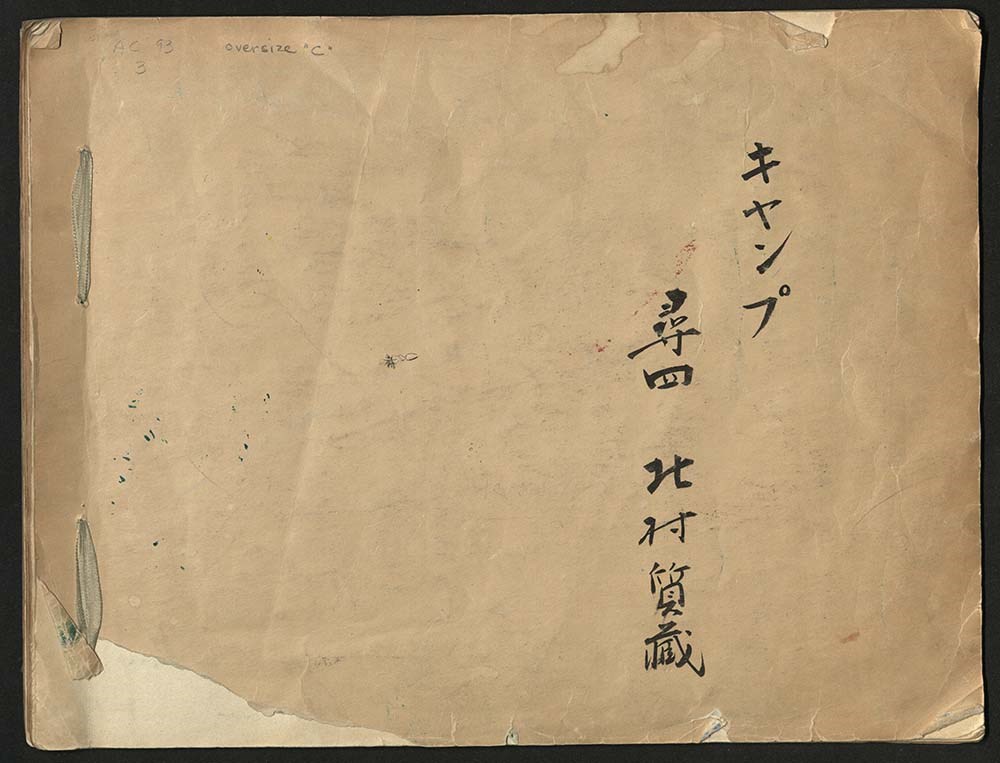
Japanese Sketchbook
https://archives.whyte.org/en/permalink/descriptions54789
- Part Of
- Alpine Club of Canada fonds
- Scope & Content
- File consists of a sketchbook containing Japanese writing, hand-drawn maps, and illustrations. Many of the illustrations are done in either watercolour paint or crayon.
- Date Range
- [ca. 1950-1960]
- Reference Code
- M200 / AC 093M / 2
- Description Level
- 5 / File
- GMD
- Scrapbook
- Painting
1 image
1 Electronic Resource
- Part Of
- Alpine Club of Canada fonds
- Description Level
- 5 / File
- Fonds Number
- M200 / S6 / V14
- Series
- I.A.1.b. Administration: general
- Sous-Fonds
- AC 093M
- Accession Number
- .
- Reference Code
- M200 / AC 093M / 2
- Date Range
- [ca. 1950-1960]
- Physical Description
- 0.5 cm of textual records (30 pages ; 37.5 x 28.5 cm)
- History / Biographical
- See fonds level description.
- Scope & Content
- File consists of a sketchbook containing Japanese writing, hand-drawn maps, and illustrations. Many of the illustrations are done in either watercolour paint or crayon.
- Name Access
- Alpine Club of Canada
- Subject Access
- Art
- Arts and crafts
- Backpacking
- Calligraphy
- Climbing
- Club
- Environment and Nature
- Painting
- Map
- Mountaineering
- Mountaineers
- Language
- Japanese
- Title Source
- Title based on material
- Processing Status
- Processed
Electronic Resources
Images
This material is presented as originally created; it may contain outdated cultural descriptions and
potentially offensive content.
Read more.
Kananaskis and Spray Lakes
https://archives.whyte.org/en/permalink/descriptions54802
- Part Of
- Murray Hay fonds
- Scope & Content
- File consists of 1.5 cm of textual records, 35 x 35 cm or smaller. File pertains to travel and tourism materials related to the Kananaskis-Canmore area. File includes four published Murray Hay trail maps of ski hills in Kananaskis (Nakiska, Fortress, Mount Allan) and a travel brochure relating to t…
- Date Range
- 1978 - ca.1995
- 1988
- 1978-1979
- Reference Code
- M570 / III / B / iv / 1-2
- Description Level
- 5 / File
- GMD
- Map
- Published record
- Textual record
- Poster
- Part Of
- Murray Hay fonds
- Description Level
- 5 / File
- Fonds Number
- M570 / V795
- Series
- M570 / III : Murray Hay portfolio (published material)
- Sous-Fonds
- M570
- Sub-Series
- M570 / III / B : Alberta / iv : Kananaskis
- Accession Number
- 2019.41
- Reference Code
- M570 / III / B / iv / 1-2
- Date Range
- 1978 - ca.1995
- 1988
- 1978-1979
- Physical Description
- 1.5 cm of textual records (35 x 35 cm or smaller)
- Scope & Content
- File consists of 1.5 cm of textual records, 35 x 35 cm or smaller. File pertains to travel and tourism materials related to the Kananaskis-Canmore area. File includes four published Murray Hay trail maps of ski hills in Kananaskis (Nakiska, Fortress, Mount Allan) and a travel brochure relating to the Kananaskis and Canmore area. The Mount Allan maps include recreational ski runs and Olympic ski runs.
- Notes
- M570 / III / B / iv / 2 is oversize.
- Name Access
- Hay, Murray
- Subject Access
- Ski area
- Ski Maps
- Skiing
- Cartography
- Map
- Tourism
- Travel
- Winter
- Winter sports
- Nakiska Ski Area
- Fortress Mountain
- Mount Allan
- Tourist information
- Artist
- Advertising
- Geographic Access
- Kananaskis
- Spray Valley
- Alberta
- Canada
- Canmore
- Language
- English
- Title Source
- Title based on contents of file
- Processing Status
- Processed
This material is presented as originally created; it may contain outdated cultural descriptions and
potentially offensive content.
Read more.
- Part Of
- Murray Hay fonds
- Scope & Content
- File consists of 1.5 cm of textual records, 53 x 80.5 cm and 10 x 23.5 cm. File pertains to ski trail maps of Lake Louise ski area created by Murray Hay. File includes two published reproductions of three original trail maps in a fold-out brochure (1992/1993) and in poster format. The three maps de…
- Date Range
- ca.1980 - ca. 1995
- 1992-1993
- Reference Code
- M570 / III / B / ii / 1-2
- Description Level
- 5 / File
- GMD
- Textual record
- Published record
- Map
- Poster
- Part Of
- Murray Hay fonds
- Description Level
- 5 / File
- Fonds Number
- M570 / V795
- Series
- M570 / III : Murray Hay portfolio (published material)
- Sous-Fonds
- M570
- Sub-Series
- M570 / III / B : Alberta / ii : Lake Louise
- Accession Number
- 2019.41
- Reference Code
- M570 / III / B / ii / 1-2
- Date Range
- ca.1980 - ca. 1995
- 1992-1993
- Physical Description
- 1.5 cm of textual records (53 x 80.5 cm and 10 x 23.5 cm)
- Scope & Content
- File consists of 1.5 cm of textual records, 53 x 80.5 cm and 10 x 23.5 cm. File pertains to ski trail maps of Lake Louise ski area created by Murray Hay. File includes two published reproductions of three original trail maps in a fold-out brochure (1992/1993) and in poster format. The three maps depict South Face, Back Bowls, and Larch Area.
- Name Access
- Hay, Murray
- Subject Access
- Ski area
- Ski Maps
- Skiing
- Tourism
- Cartography
- Map
- Winter
- Winter sports
- Sports and recreation
- Travel
- Lake Louise Ski Area
- Lake Louise
- Artist
- Advertising
- Geographic Access
- Lake Louise
- Alberta
- Canada
- Canadian Rocky Mountains
- Language
- English
- Related Material
- V795 / II / B / ii / 1
- Title Source
- Title based on contents of file
- Processing Status
- Processed
This material is presented as originally created; it may contain outdated cultural descriptions and
potentially offensive content.
Read more.
- Part Of
- Murray Hay fonds
- Scope & Content
- File consists of 4 maps, 2 prints, and 3 paintings, 60 x 30 cm or smaller. File pertains to a variety of maps Murray Hay created for Equinox Magazine in the 1980s. File includes original paintings (Middle East, Jamaica, North Atlantic Ocean/Europe area), two reproduced prints (South Korea Olympic a…
- Date Range
- ca.1980-ca.1989
- Reference Code
- V795 / II / D / ii / 4-6
- Description Level
- 5 / File
- GMD
- Painting
- Private record
- Map
- Part Of
- Murray Hay fonds
- Description Level
- 5 / File
- Fonds Number
- M570 / V795
- Series
- V795 / II : Unpublished Material
- Sous-Fonds
- V795
- Sub-Series
- V795 / II / D : International / ii : Miscellaneous
- Accession Number
- 2019.41
- 2020.03
- Reference Code
- V795 / II / D / ii / 4-6
- Date Range
- ca.1980-ca.1989
- Physical Description
- 4 maps (4 overlays) : col., annotations
- 2 prints : col. ; 36 x 28 cm
- 3 paintings ; 60 x 30 cm or smaller
- Scope & Content
- File consists of 4 maps, 2 prints, and 3 paintings, 60 x 30 cm or smaller. File pertains to a variety of maps Murray Hay created for Equinox Magazine in the 1980s. File includes original paintings (Middle East, Jamaica, North Atlantic Ocean/Europe area), two reproduced prints (South Korea Olympic area), and other maps (coloured red) with overlays (Nepal and the Caribbean).
- Notes
- Items not in oversize stored in downstairs vault.
- Name Access
- Hay, Murray
- Subject Access
- Advertising
- Artist
- Map
- Cartography
- Tourism
- Tourist information
- Travel
- Geography
- Olympic Games (Winter)
- Geographic Access
- South Korea
- Nepal
- Caribbean
- Mexico
- Belize
- Jamaica
- Europe
- Canada
- Middle East
- India
- Russia
- Language
- English
- Creator
- Hay, Murray
- Category
- Arts
- Exploration, discovery and travel
- Title Source
- Title based on contents of file
- Processing Status
- Processed
This material is presented as originally created; it may contain outdated cultural descriptions and
potentially offensive content.
Read more.
Sunshine Ski Area
https://archives.whyte.org/en/permalink/descriptions54780
- Part Of
- Murray Hay fonds
- Scope & Content
- File consists of 1.5 cm of textual records, 58 x 72.5 cm and 21.5 x 27.5 cm. File pertains to ski trail maps of Sunshine Ski Area created by Murray Hay. File includes two published reproductions of original trail maps in poster format made by Hay for the Husky World Downhill and Giant Slalom on Mar…
- Date Range
- ca.1985-1986
- 1986
- Reference Code
- M570 / III / B / i / 1-2
- Description Level
- 5 / File
- GMD
- Map
- Poster
- Textual record
- Published record
- Part Of
- Murray Hay fonds
- Description Level
- 5 / File
- Fonds Number
- M570 / V795
- Series
- M570 / III : Murray Hay Portfolio (published material)
- Sous-Fonds
- M570
- Sub-Series
- M570 / III / B : Alberta / i : Sunshine
- Accession Number
- 2019.41
- Reference Code
- M570 / III / B / i / 1-2
- Date Range
- ca.1985-1986
- 1986
- Physical Description
- 1.5 cm of textual records (58 x 72.5 cm and 21.5 x 27.5 cm)
- Scope & Content
- File consists of 1.5 cm of textual records, 58 x 72.5 cm and 21.5 x 27.5 cm. File pertains to ski trail maps of Sunshine Ski Area created by Murray Hay. File includes two published reproductions of original trail maps in poster format made by Hay for the Husky World Downhill and Giant Slalom on March 8-9, 1986.
- Notes
- M570 / III / B / i / 2 is oversize.
- Name Access
- Hay, Murray
- Subject Access
- Skiing
- Ski Maps
- Ski area
- Tourism
- Cartography
- Map
- Winter
- Winter sports
- Travel
- Sunshine Village
- Sunshine Ski Resort
- Sunshine area
- Sports and recreation
- Artist
- Advertising
- Geographic Access
- Banff National Park
- Alberta
- Canada
- Canadian Rocky Mountains
- Language
- English
- Related Material
- V795 / II / B / vi / 1-3
- Title Source
- Title based on contents of file
- Processing Status
- Processed
This material is presented as originally created; it may contain outdated cultural descriptions and
potentially offensive content.
Read more.