Narrow Results By
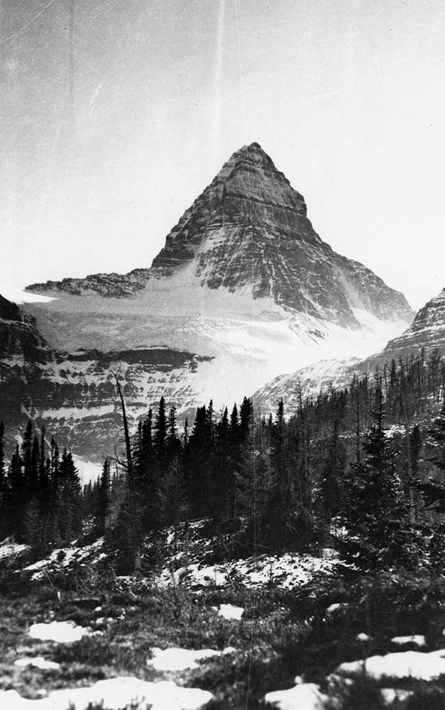
Prairie Mountain [2000]
https://archives.whyte.org/en/permalink/descriptions57786
- Part Of
- Alpine Club of Canada fonds
- Scope & Content
- File consists of a summit record from Prairie Mountain produced by the Alpine Club of Canada in 2000. Summit record includes entries from visitors to the various summits which pertain to individuals' hiking and climbing trips; details of specific events which occurred while at the summit, wildlife …
- Date Range
- 2000
- Reference Code
- M200 / V / A / 202
- Description Level
- 5 / File
- GMD
- Textual record
- Organization record
- Part Of
- Alpine Club of Canada fonds
- Description Level
- 5 / File
- Fonds Number
- M200
- V14
- S6
- Series
- M200 / V: Summit Records
- Sous-Fonds
- M200
- Sub-Series
- M200 / V / A: Identified Summit Records
- Accession Number
- accn. 2023.10
- Reference Code
- M200 / V / A / 202
- Responsibility
- Summit Registers and Notes produced by Alpine Club of Canada
- Date Range
- 2000
- Physical Description
- 1 volume 1 cm of textual record
- History / Biographical
- Prairie Mountain is located in Kananaskis, Alberta. Prairie Mountain is nearby Calgary, Bragg Creek, Spray Valley Provincial Park and Peter Lougheed Provincial Park.
- Scope & Content
- File consists of a summit record from Prairie Mountain produced by the Alpine Club of Canada in 2000. Summit record includes entries from visitors to the various summits which pertain to individuals' hiking and climbing trips; details of specific events which occurred while at the summit, wildlife sightings, trail updates, and related topics. File: M200 / V / A / 202: Prairie Mountain [2000]
- Name Access
- Alpine Club of Canada
- Subject Access
- Alberta
- Alpine Club of Canada
- Backpacking
- Bow Valley
- Climbing
- Club
- Description and travel
- Environment
- Environment and Nature
- Hiking
- Mountain
- Mountaineering
- Mountaineers
- Mountains
- Provincial parks and reserves
- Record keeping
- Sports and leisure
- Sports and recreation
- Summit
- Trails
- Geographic Access
- Canada
- Canadian Rocky Mountains
- Rocky Mountains
- Alberta
- Kananaskis
- Kananaskis Country
- Kananaskis, AB
- Calgary
- Calgary, AB
- Calgary, Alberta
- Bragg Creek
- Spray Valley
- Spray Valley Provincial Park
- Peter Lougheed Provincial Park
- Prairie Mountain
- Access Restrictions
- Restrictions may apply
- Language
- English
- Japanese
- Related Material
- M235
- Biographical Source Notes
- Peak Finder: Prairie Mountain, Canadian Rockies Database: https://cdnrockiesdatabases.ca/peaks/1104
- Title Source
- Title based on contents of file
- Processing Status
- Processed
This material is presented as originally created; it may contain outdated cultural descriptions and
potentially offensive content.
Read more.
Pembina River Provincial Park interpretive signs
https://archives.whyte.org/en/permalink/descriptions55898
- Part Of
- Ben Gadd fonds
- Scope & Content
- File consists of a signed contract agreement, correspondence, text drafts and sample designs pertaining to interpretive signs created by Ben Gadd on behalf of the Government of Alberta's Environmental Protection department. Interpretive signs pertain to geological history, natural features and wild…
- Date Range
- 1997
- Reference Code
- M590 / III / D / 17
- Description Level
- 5 / File
- GMD
- Textual record
- Part Of
- Ben Gadd fonds
- Description Level
- 5 / File
- Fonds Number
- M590
- V810
- S61
- Series
- M590 / III : Professional records
- Sous-Fonds
- M590
- Sub-Series
- M590 / III / D : Other contracts and projects
- Accession Number
- 2021.20
- Reference Code
- M590 / III / D / 17
- GMD
- Textual record
- Responsibility
- Produced by Ben Gadd
- Date Range
- 1997
- Physical Description
- 1.5 cm of textual records
- Scope & Content
- File consists of a signed contract agreement, correspondence, text drafts and sample designs pertaining to interpretive signs created by Ben Gadd on behalf of the Government of Alberta's Environmental Protection department. Interpretive signs pertain to geological history, natural features and wildlife in Pembina River Provincial Park.
- Name Access
- Gadd, Ben
- Subject Access
- Government
- Trails
- Guiding
- Tourism
- Travel
- Environment
- Wildlife
- Recreation
- Natural history
- Provincial parks and reserves
- Geographic Access
- Canada
- Alberta
- Pembina River Provincial Park
- Title Source
- Title based on contents of file
- Processing Status
- Processed
This material is presented as originally created; it may contain outdated cultural descriptions and
potentially offensive content.
Read more.
- Part Of
- Ben Gadd fonds
- Scope & Content
- File consists of photographs taken by Ben Gadd during a trip to Jackman Flats Provincial Park in 1997. Images depict unidentified individuals posing next to interpretive signs; hiking trails; a truck driving through sand; and measurements of a geological artifact.
- Date Range
- 1997
- Reference Code
- V810 / III / D / PA - 128 to 172
- Description Level
- 5 / File
- GMD
- Photograph
- Part Of
- Ben Gadd fonds
- Description Level
- 5 / File
- Fonds Number
- M590
- V810
- S61
- Series
- V810 / III : Professional records
- Sous-Fonds
- V810
- Sub-Series
- V810 / III / D : Other contracts and projects
- Accession Number
- 2021.20
- Reference Code
- V810 / III / D / PA - 128 to 172
- GMD
- Photograph
- Responsibility
- Produced by Ben Gadd
- Date Range
- 1997
- Physical Description
- 45 photographs : col. prints ; 10 x 15 cm
- Scope & Content
- File consists of photographs taken by Ben Gadd during a trip to Jackman Flats Provincial Park in 1997. Images depict unidentified individuals posing next to interpretive signs; hiking trails; a truck driving through sand; and measurements of a geological artifact.
- Name Access
- Gadd, Ben
- Subject Access
- Tourism
- Tourist information
- Hiking
- Recreation
- Trails
- Provincial parks and reserves
- Family and personal life
- Geology
- Research
- Geographic Access
- Canada
- British Columbia
- Jackman Flats Provincial Park
- Language
- N/A
- Related Material
- V810/III/D/NA-52 to 53
- Title Source
- Original title used
- Processing Status
- Processed
This material is presented as originally created; it may contain outdated cultural descriptions and
potentially offensive content.
Read more.
Pembina River Provincial Park
https://archives.whyte.org/en/permalink/descriptions56397
- Part Of
- Ben Gadd fonds
- Scope & Content
- File consists of photographs taken by Ben Gadd during a trip to Pembina River Provincial Park, including winter views of hiking trails and forested areas.
- Date Range
- 1997
- Reference Code
- V810 / III / D / PA - 173 to 180
- Description Level
- 5 / File
- GMD
- Photograph
- Part Of
- Ben Gadd fonds
- Description Level
- 5 / File
- Fonds Number
- M590
- V810
- S61
- Series
- V810 / III : Professional records
- Sous-Fonds
- V810
- Sub-Series
- V810 / III / D : Other contracts and projects
- Accession Number
- 2021.20
- Reference Code
- V810 / III / D / PA - 173 to 180
- GMD
- Photograph
- Responsibility
- Produced by Ben Gadd
- Date Range
- 1997
- Physical Description
- 8 photographs : col. prints ; 10 x 15 cm
- Scope & Content
- File consists of photographs taken by Ben Gadd during a trip to Pembina River Provincial Park, including winter views of hiking trails and forested areas.
- Name Access
- Gadd, Ben
- Subject Access
- Tourism
- Tourist information
- Hiking
- Recreation
- Trails
- Provincial parks and reserves
- Geographic Access
- Canada
- British Columbia
- Pembina River Provincial Park
- Language
- N/A
- Category
- Tourism
- Sports, recreation and leisure
- Title Source
- Original title used
- Processing Status
- Processed
This material is presented as originally created; it may contain outdated cultural descriptions and
potentially offensive content.
Read more.
Mt. Jelico [Jellicoe] 1989
https://archives.whyte.org/en/permalink/descriptions57755
- Part Of
- Alpine Club of Canada fonds
- Scope & Content
- File consists of a summit record from Mount Jellicoe produced by the Alpine Club of Canada in 1989. Summit record includes entries from visitors to the various summits which pertain to individuals' hiking and climbing trips; details of specific events which occurred while at the summit, wildlife si…
- Date Range
- 1989
- Reference Code
- M200 / V / A / 168
- Description Level
- 5 / File
- GMD
- Textual record
- Organization record
- Part Of
- Alpine Club of Canada fonds
- Description Level
- 5 / File
- Fonds Number
- M200
- V14
- S6
- Series
- M200 / V: Summit Records
- Sous-Fonds
- M200
- Sub-Series
- M200 / V / A: Identified Summit Records
- Accession Number
- accn. 2023.20
- Reference Code
- M200 / V / A / 168
- Responsibility
- Summit Registers and Notes produced by Alpine Club of Canada
- Date Range
- 1989
- Physical Description
- 1 volume 1 cm of textual record
- History / Biographical
- Mount Jellicoe is a part of the Spray Mountain Range of the Canadian Rockies, on the Alberta side. It is located in Peter Lougheed Provincial Park, Kananaskis. Nearby are Haig Glacier, Mount Smith-Dorrien,and the Continental Divide.
- Scope & Content
- File consists of a summit record from Mount Jellicoe produced by the Alpine Club of Canada in 1989. Summit record includes entries from visitors to the various summits which pertain to individuals' hiking and climbing trips; details of specific events which occurred while at the summit, wildlife sightings, trail updates, and related topics. File: M200 / V / A / 168: Mt. Jelico [Jellicoe] 1989
- Name Access
- Alpine Club of Canada
- Subject Access
- Alberta
- Alpine Club of Canada
- Climbing
- Club
- Description and travel
- Environment
- Environment and Nature
- Great Divide
- Hiking
- Mountain
- Mountaineering
- Mountaineers
- Mountains
- Provincial parks and reserves
- Record keeping
- Sports and leisure
- Sports and recreation
- Summit
- Trails
- Geographic Access
- Canada
- Great Divide
- Continental Divide
- Canadian Rocky Mountains
- Rocky Mountains
- Alberta
- Kananaskis
- Peter Lougheed Provincial Park
- Haig Glacier
- Mount Jellicoe
- Mount Jelico
- Access Restrictions
- Restrictions may apply
- Reproduction Restrictions
- Poor condition of register; black mold present throughout register
- Language
- English
- Conservation
- Register placed in mylar due to severe water damage, rust damage and black mold
- Related Material
- M235
- Biographical Source Notes
- Peak Finder: Mount Jellicoe, Canadian Rockies Database: https://cdnrockiesdatabases.ca/peaks/692#undefined1
- Title Source
- Title based on contents of the file
- Processing Status
- Processed
This material is presented as originally created; it may contain outdated cultural descriptions and
potentially offensive content.
Read more.
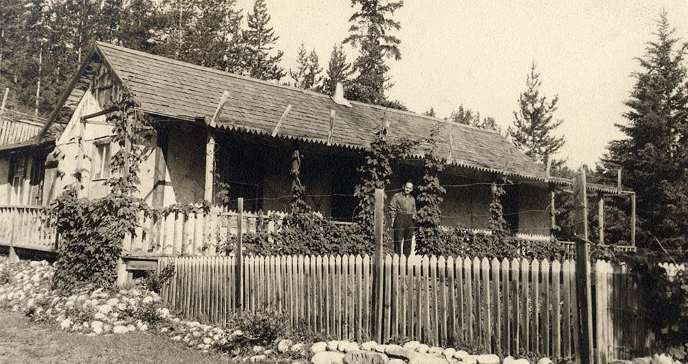
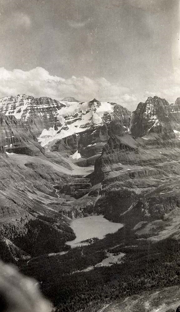
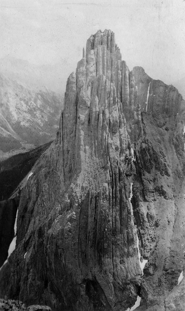
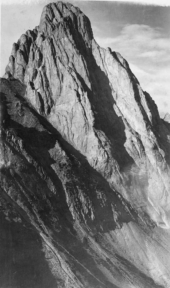
Canadian Rockies Photograph Album
https://archives.whyte.org/en/permalink/descriptions3599
- Part Of
- Lawrence Grassi fonds
- Scope & Content
- File pertains to a photo album that Includes an assortment of views of the Canadian Rockies; mainly duplicates of those images in Series I. Landscape Photographs. Item-level inventory available.
- Date Range
- [ca. 1930-1970]
- Reference Code
- V240 / II / A / PD - 624
- Description Level
- 5 / File
- GMD
- Album
- Photograph
6 images
- Part Of
- Lawrence Grassi fonds
- Description Level
- 5 / File
- Fonds Number
- M45 / V240
- Series
- II.A. Landscape photographs
- Sous-Fonds
- V240
- Accession Number
- 3159
- Reference Code
- V240 / II / A / PD - 624
- GMD
- Album
- Photograph
- Date Range
- [ca. 1930-1970]
- Physical Description
- 1 photograph album (180 prints)
- History / Biographical
- See fonds level description
- Scope & Content
- File pertains to a photo album that Includes an assortment of views of the Canadian Rockies; mainly duplicates of those images in Series I. Landscape Photographs. Item-level inventory available.
- Name Access
- Grassi, Lawrence
- Subject Access
- Activities
- Alpine Club of Canada
- Animals
- Cabins and shelters
- Camps
- Environment and Nature
- Exploration
- Family and personal life
- Grassi Lakes
- Home
- Kananaskis Country
- Lake O'Hara region
- Mountains
- Parks
- Provincial parks and reserves
- Scenery
- Trails
- Trail making
- Travel
- Geographic Access
- Canmore
- Lake Louise
- Lake O'Hara
- Banff
- Banff National Park
- Yoho National Park
- Kananaskis
- Alberta
- British Columbia
- Canada
- Language
- English
- Title Source
- Title based on contents of file
- Processing Status
- Processed
Images

This material is presented as originally created; it may contain outdated cultural descriptions and
potentially offensive content.
Read more.
Personal Interest Files
https://archives.whyte.org/en/permalink/descriptions55796
- Part Of
- Ben Gadd fonds
- Scope & Content
- Sub-series consists of textual records and photographs collected by Ben Gadd. Content pertains to various research subjects, current events and other topics of interest, including: environmental science; wildlife; sports and recreation; Parks Canada; clubs, charities and organizations; natural hist…
- Date Range
- [ca.1980-2015]
- Reference Code
- M590 / I / C
- V810 / I / C
- Description Level
- 4 / Sub-series
- GMD
- Textual record
- Photograph
- Digital image
- Part Of
- Ben Gadd fonds
- Description Level
- 4 / Sub-series
- Fonds Number
- M590
- V810
- Series
- Series I : Personal records
- Sous-Fonds
- M590
- V810
- Sub-Series
- Subseries C : Personal Interest Files
- Accession Number
- 2021.20
- Reference Code
- M590 / I / C
- V810 / I / C
- Date Range
- [ca.1980-2015]
- Physical Description
- ca.180 cm of textual records -- 5 CDs with digital image files -- 1 floppy disk -- ca.122 photograph prints : b&w and col. -- 2 negatives : b&w ; 6 x 7.5 cm -- 26 film strips : col. negatives ; 35 mm
- Scope & Content
- Sub-series consists of textual records and photographs collected by Ben Gadd. Content pertains to various research subjects, current events and other topics of interest, including: environmental science; wildlife; sports and recreation; Parks Canada; clubs, charities and organizations; natural history; and conservation.
- Notes
- Subjects are arranged alphabetically by title. Original titles and arrangement of materials by Ben Gadd has been preserved. See file-level descriptions for content details.
- Name Access
- Gadd, Ben
- Subject Access
- Animals
- Buildings
- Buildings and facilities
- Businesses
- Boats
- Climbing
- Columbia Icefield
- Community events
- Community life
- Conservation
- Dams
- Environment
- Events
- Forestry
- Fishing
- Flowers
- Government
- Geography
- Geology
- Hiking
- History
- Ice climbing
- Land, settlement and immigration
- Landscapes
- Laws and legislation
- Membership
- Mining
- Mountaineering
- Municipal views
- Natural history
- Natural resources
- Parks Canada
- Politics and government
- Property
- Provincial parks and reserves
- Recreation
- Rivers
- Science and technology
- Settlement
- Skiing
- Snakes, Insects
- Sports
- Tourism
- Townsite development
- Trails
- Transportation
- Travel
- Wildlife
- Geographic Access
- Canada
- Alberta
- British Columbia
- United States of America
- Rocky Mountains
- Canadian Rocky Mountains
- Reproduction Restrictions
- Restrictions may apply
- Language
- English
- Category
- Commerce and industry
- Environment
- Exploration, discovery and travel
- Government
- Land, settlement and immigration
- Law and justice
- Natural resources
- Politics
- Science and technology
- Sports, recreation and leisure
- Transportation
- Title Source
- Original title used
- Processing Status
- Processed
This material is presented as originally created; it may contain outdated cultural descriptions and
potentially offensive content.
Read more.
Whiskers Point
https://archives.whyte.org/en/permalink/descriptions56010
- Part Of
- Ben Gadd fonds
- Scope & Content
- File consists of records pertaining to Ben Gadd's contracted work producing interpretive trail signs for Whiskers Point Provincial Park for the Government of British Columbia. File includes a signed contract, correspondence, drafts, reference material (including maps), quotes from subcontractors an…
- Date Range
- 1997-1998
- Reference Code
- M590 / III / D / 36 to 37
- Description Level
- 5 / File
- GMD
- Textual record
- Published record
- Part Of
- Ben Gadd fonds
- Description Level
- 5 / File
- Fonds Number
- M590
- V810
- S61
- Series
- M590 / III : Professional records
- Sous-Fonds
- M590
- Sub-Series
- M590 / III / D : Other contracts and projects
- Accession Number
- 2021.20
- Reference Code
- M590 / III / D / 36 to 37
- Date Range
- 1997-1998
- Physical Description
- 3 cm of textual records
- Scope & Content
- File consists of records pertaining to Ben Gadd's contracted work producing interpretive trail signs for Whiskers Point Provincial Park for the Government of British Columbia. File includes a signed contract, correspondence, drafts, reference material (including maps), quotes from subcontractors and other related materials.
- Name Access
- Gadd, Ben
- Subject Access
- Natural history
- Research
- Environment
- Publication
- Travel
- Trails
- Guiding
- Government
- Provincial parks and reserves
- Geographic Access
- Canada
- British Columbia
- Whiskers Point Provincial Park
- Reproduction Restrictions
- Restrictions may apply
- Language
- English
- Category
- Environment
- Government
- Title Source
- Original title used
- Processing Status
- Processed
This material is presented as originally created; it may contain outdated cultural descriptions and
potentially offensive content.
Read more.
Kinney Lake and Robson Corridor signs
https://archives.whyte.org/en/permalink/descriptions56011
- Part Of
- Ben Gadd fonds
- Scope & Content
- File consists of records pertaining to Ben Gadd's contracted work producing interpretive signs for trails near Kinney Lake and Robson Corridor in Mt. Robson Provincial Park. File includes correspondence between Ben and the Government of British Columbia's Ministry of Environment, Lands and Parks; n…
- Date Range
- 1994-1996
- Reference Code
- M590 / III / D / 38
- Description Level
- 5 / File
- GMD
- Textual record
- Published record
- Part Of
- Ben Gadd fonds
- Description Level
- 5 / File
- Fonds Number
- M590
- V810
- S61
- Series
- M590 / III : Professional records
- Sous-Fonds
- M590
- Sub-Series
- M590 / III / D : Other contracts and projects
- Accession Number
- 2021.20
- Reference Code
- M590 / III / D / 38
- Date Range
- 1994-1996
- Physical Description
- 2 cm of textual records
- Scope & Content
- File consists of records pertaining to Ben Gadd's contracted work producing interpretive signs for trails near Kinney Lake and Robson Corridor in Mt. Robson Provincial Park. File includes correspondence between Ben and the Government of British Columbia's Ministry of Environment, Lands and Parks; notes, sample drafts and corrections; a copy of Explorer newspaper from summer 1994 pertaining to Mount Robson Provincial Park; and other related materials.
- Name Access
- Gadd, Ben
- Subject Access
- Natural history
- Research
- Environment
- Publication
- Travel
- Trails
- Guiding
- Government
- Provincial parks and reserves
- Geographic Access
- Canada
- British Columbia
- Whiskers Point Provincial Park
- Reproduction Restrictions
- Restrictions may apply
- Language
- English
- Category
- Environment
- Government
- Title Source
- Original title used
- Processing Status
- Processed
This material is presented as originally created; it may contain outdated cultural descriptions and
potentially offensive content.
Read more.
- Part Of
- Ben Gadd fonds
- Scope & Content
- File consists of documents pertaining to Ben Gadd's work as a consultant for a project involving the creation of interpretive signs and structures for several locations in William A. Switzer Provincial Park. File includes specification manuals for the project; a contract between Ben Gadd and the Mi…
- Date Range
- 1995-1996
- Reference Code
- M590 / III / D / 48 to 52
- Description Level
- 5 / File
- GMD
- Textual record
- Published record
- Government record
- Part Of
- Ben Gadd fonds
- Description Level
- 5 / File
- Fonds Number
- M590
- V810
- S61
- Series
- M590 / III : Professional records
- Sous-Fonds
- M590
- Sub-Series
- M590 / III / D : Other contracts and projects
- Accession Number
- 2021.20
- Reference Code
- M590 / III / D / 48 to 52
- Date Range
- 1995-1996
- Physical Description
- 9 cm of textual records
- Scope & Content
- File consists of documents pertaining to Ben Gadd's work as a consultant for a project involving the creation of interpretive signs and structures for several locations in William A. Switzer Provincial Park. File includes specification manuals for the project; a contract between Ben Gadd and the Minister of Environmental Protection, Government of Alberta; a project proposal; complete textual drafts; research materials, notes and sketches; and other related material.
- Notes
- Contents of individual folders in file: M590 / III / D / 48 : Project specification manual, consulting contract agreement, project proposal M590 / III / D / 49 : Text drafts, sample illustrations and complete designs M590 / III / D / 50 : Correspondence, notes, reference materials, 1995/96 edition of "William A. Switzer Provincial Park Times" newsletter M590 / III / D / 51 : Text corrections for existing signage; bound notes from a Jasper field trip, titled "Geomorphology of Jarvis Lake Valley" M590 / III / D / 52 : one bound volume [reference material] titled "Mountain Trails: The Story of an Alberta Forest Ranger, 1920-1942" by Jack Glen
- Name Access
- Gadd, Ben
- Glen, Jack
- Subject Access
- Research
- Publication
- Guiding
- Tourist information
- Trails
- Trail guides
- Tourism
- Education
- Employment
- Environment
- Government
- Recreation
- Hiking
- Conservation
- Wildlife
- Geology
- Natural history
- Provincial parks and reserves
- Geographic Access
- Canada
- Alberta
- William A. Switzer Provincial Park
- Reproduction Restrictions
- Restrictions may apply
- Language
- English
- Related Material
- V810/III/D/PA-181 to 215
- V810/III/D/NA-54 to 75
- Title Source
- Original title used
- Processing Status
- Processed
This material is presented as originally created; it may contain outdated cultural descriptions and
potentially offensive content.
Read more.