Narrow Results By
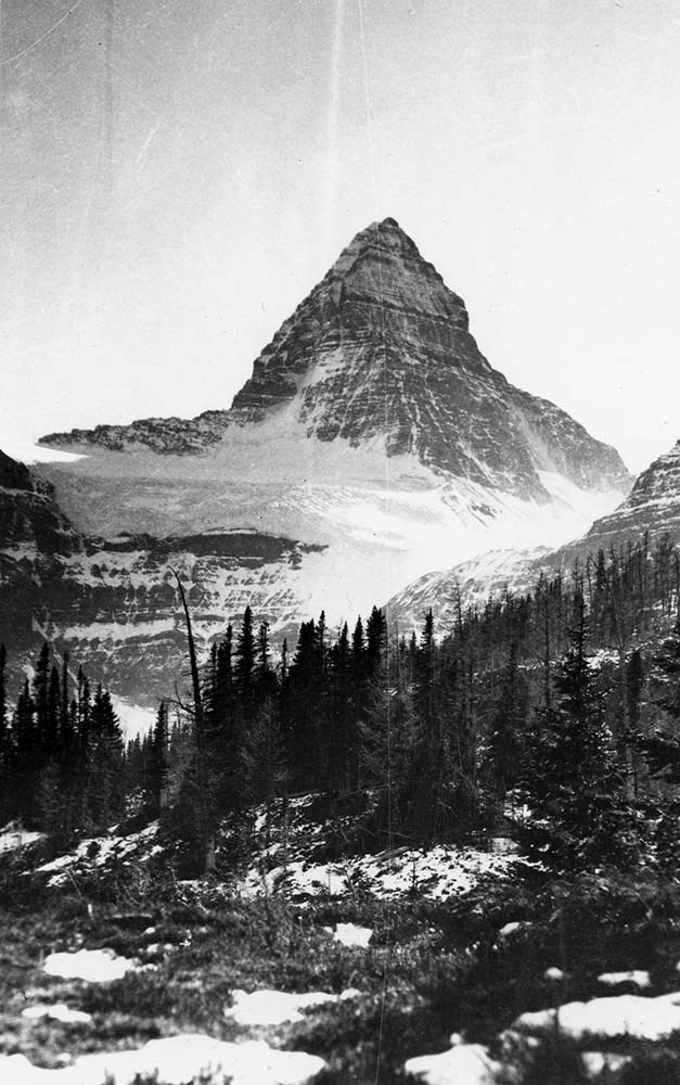
A. O. Wheeler Hut Registers
https://archives.whyte.org/en/permalink/descriptions57639
- Part Of
- Alpine Club of Canada fonds
- Scope & Content
- Sub-series of hut registers from the A. O. Wheeler Hut produced by the Alpine Club of Canada between 1989 and 2016. Registers include entries from visitors to the huts which pertain to individuals' hiking and climbing trips; details of specific events which occurred while staying at the hut, wildli…
- Date Range
- 1989-2022
- Reference Code
- M200 / IV / D
- Description Level
- 4 / Sub-series
- GMD
- Textual record
- Organization record
- Part Of
- Alpine Club of Canada fonds
- Description Level
- 4 / Sub-series
- Fonds Number
- M200
- V14
- S6
- Series
- M200 / IV: Hut Registers
- Sous-Fonds
- M200
- Sub-Series
- M200 / IV / D: A. O. Wheeler Hut Registers
- Accession Number
- accn. 2023.10
- accn. 8002
- accn. 2014.8293
- accn. 2023.19
- accn. 2024.20
- Reference Code
- M200 / IV / D
- Responsibility
- Registers produced by the Alpine Club of Canada
- Date Range
- 1989-2022
- Physical Description
- 27 cm of textual records (11 volumes)
- History / Biographical
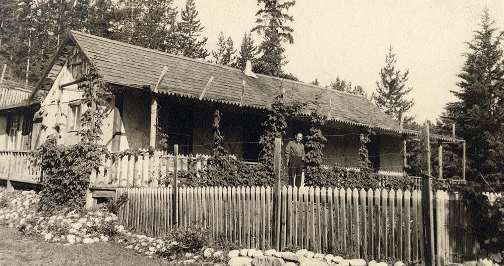
- The A. O. Wheeler Hut is located at Rogers Pass National Historic Site in Glacier National Park. The hut was built between 1945 and 1946, and it is a Recognized Federal Historic Building. The hut is named after one of the founding members of the Alpine Club of Canada, Arthur Oliver Wheeler. A. O. Wheeler was the first President of the Alpine Club of Canada, and he served as Honorary President of the Club for almost twenty years. According to the Alpine Club of Canada's website: "Carrying on the tradition of the Glacier House which was closed in 1925 and now exists only as a few concrete foundation pieces, the Wheeler Hut serves as a base for the legendary powder skiing of the Rogers Pass area. In summer there are numerous opportunities for climbing and hiking. This is the birthplace of alpinism in North America. Many of the routes are steeped in tradition and history, an interesting fact to remember as you reach for that next impeccable quartzite handhold or take that next footstep along one of the many trails which wind through the lush cedar forests that dominate the region. This is the one and only ACC hut which can be reached by vehicle in summer. Winter access is a mere 2 km along a well-broken and level trail. It is difficult to convey to the first time visitor the number and quality of the summer and winter day trips possible from the hut. The potential is outstanding from this single hut including summer hikes to Asulkan Pass or up the Great Glacier Trail to the Illecillewaet Glacier, summer climbs to Sapphire Col, Mt. Sir Donald, and Avalanche Peak; winter ski tours to Young’s Peak, the Seven Steps of Paradise, the Dome Glacier – the list goes on and on. Go and explore for yourself, you will not be disappointed! The Wheeler Hut is quite luxurious! A propane system provides the cooking and lighting, with two wood stoves for heating. The hut sleeps 30 in summer and 24 in winter."
- Scope & Content
- Sub-series of hut registers from the A. O. Wheeler Hut produced by the Alpine Club of Canada between 1989 and 2016. Registers include entries from visitors to the huts which pertain to individuals' hiking and climbing trips; details of specific events which occurred while staying at the hut, wildlife sightings, custodial issues and updates, and related topics. The sub-series is separated into individual hut registers, arranged by date:
- M200 / IV / D / 1: "A. O. Wheeler Hut Register" May 13, 1989 - Sept. 30, 1995
- M200 / IV / D / 2: Wheeler Hut register Oct. 6, 1995 - Mar. 28, 1998
- M200 / IV / D / 3: Wheeler Hut [1998 - 2000]
- M200 / IV / D / 4: A. O. Wheeler Hut Register 2000-2006
- M200 / IV / D / 5: A. O. Wheeler Hut 2001 - 2003
- M200 / IV / D / 6: A. O. Wheeler Hut Register 2003 - 2006
- M200 / IV / D / 7: The Wheeler Hut Registers. Part 1 of 2.
- M200 / IV / D / 8: The Wheeler Hut Registers. Part 2 of 2.
- M200 / IV / D / 9: [2009 - 2012 Wheeler Hut Register]
- M200 / IV / D / 10: 2013 - 2016 Wheeler Hut Register
- M200 / IV / D / 11: Wheeler Hut Register [2014-2022]
- Name Access
- Alpine Club of Canada
- Subject Access
- Huts
- Cabins and shelters
- Cabins
- Alpine Club of Canada
- Backcountry skiing
- British Columbia
- Buildings
- Buildings and facilities
- Climbing
- Club
- Environment and Nature
- Mountain
- Mountaineering
- National parks and reserves
- Parks Canada
- Provincial parks and reserves
- Winter sports
- Geographic Access
- Canada
- British Columbia
- Glacier National Park
- Rogers Pass
- Illecillewaet Valley
- Access Restrictions
- Restrictions may apply
- Reproduction Restrictions
- Contains personal information
- Language
- English
- Spanish
- French
- Biographical Source Notes
- The Alpine Club of Canada website: https://www.alpineclubofcanada.ca/a-o-wheeler-hut/ The Government of Canada - Parks Canada website: https://www.pc.gc.ca/apps/dfhd/page_fhbro_eng.aspx?id=11716
- Title Source
- Title based on contents of sub-series
- Processing Status
- Processed
This material is presented as originally created; it may contain outdated cultural descriptions and
potentially offensive content.
Read more.
[Bennington Summit Register]
https://archives.whyte.org/en/permalink/descriptions57730
- Part Of
- Alpine Club of Canada fonds
- Scope & Content
- File consists of a summit record from Bennington Peak produced by the Alpine Club of Canada from around 1970. Entries are illegible due to severe water and mold damage. File: [Bennington Summit Register]
- Date Range
- ca. 1970
- Reference Code
- M200 / V / A / 138
- Description Level
- 5 / File
- GMD
- Textual record
- Organization record
- Part Of
- Alpine Club of Canada fonds
- Description Level
- 5 / File
- Fonds Number
- M200
- V14
- S6
- Series
- M200 / V: Summit Records
- Sous-Fonds
- M200
- Sub-Series
- M200 / V / A: Identified Summit Records
- Accession Number
- accn. 2023.18
- Reference Code
- M200 / V / A / 138
- Responsibility
- Summit Registers and Notes produced by Alpine Club of Canada
- Date Range
- ca. 1970
- Physical Description
- 1 volume 1 cm of textual record
- History / Biographical
- Bennington Peak is located along the Continental Divide/Great Divide along the Alberta/British Columbia provincial border. Bennington Peak is one of the peaks of Mount Fraser and is part of the Bennington Glacier. It is situated on on the border of Jasper National Park, Alberta and Mount Robson Provincial Park, British Columbia.
- Scope & Content
- File consists of a summit record from Bennington Peak produced by the Alpine Club of Canada from around 1970. Entries are illegible due to severe water and mold damage. File: [Bennington Summit Register]
- Notes
- Summit entries are illegible due to severe water and mold damage.
- Name Access
- Alpine Club of Canada
- Subject Access
- Alpine Club of Canada
- British Columbia
- Alberta
- Description and travel
- Mountain
- Mountains
- National parks and reserves
- Provincial parks and reserves
- Record keeping
- Summit
- Geographic Access
- Canada
- Continental Divide
- Great Divide
- Canadian Rocky Mountains
- Alberta
- British Columbia
- Jasper National Park
- Mount Robson Provincial Park
- Mount Fraser
- Bennington Peak
- Access Restrictions
- Restrictions may apply
- Conservation
- Register placed in mylar due to severe mold, water and rust damage. Entries in register are illegible due to damage.
- Related Material
- M235
- Biographical Source Notes
- Peak Finder: Bennington Peak, Canadian Rockies Database: https://cdnrockiesdatabases.ca/peaks/111
- Title Source
- Title based on contents of file
- Processing Status
- Processed
This material is presented as originally created; it may contain outdated cultural descriptions and
potentially offensive content.
Read more.
Canadian Rockies Photograph Album
https://archives.whyte.org/en/permalink/descriptions3599
- Part Of
- Lawrence Grassi fonds
- Scope & Content
- File pertains to a photo album that Includes an assortment of views of the Canadian Rockies; mainly duplicates of those images in Series I. Landscape Photographs. Item-level inventory available.
- Date Range
- [ca. 1930-1970]
- Reference Code
- V240 / II / A / PD - 624
- Description Level
- 5 / File
- GMD
- Album
- Photograph
6 images
- Part Of
- Lawrence Grassi fonds
- Description Level
- 5 / File
- Fonds Number
- M45 / V240
- Series
- II.A. Landscape photographs
- Sous-Fonds
- V240
- Accession Number
- 3159
- Reference Code
- V240 / II / A / PD - 624
- GMD
- Album
- Photograph
- Date Range
- [ca. 1930-1970]
- Physical Description
- 1 photograph album (180 prints)
- History / Biographical
- See fonds level description
- Scope & Content
- File pertains to a photo album that Includes an assortment of views of the Canadian Rockies; mainly duplicates of those images in Series I. Landscape Photographs. Item-level inventory available.
- Name Access
- Grassi, Lawrence
- Subject Access
- Activities
- Alpine Club of Canada
- Animals
- Cabins and shelters
- Camps
- Environment and Nature
- Exploration
- Family and personal life
- Grassi Lakes
- Home
- Kananaskis Country
- Lake O'Hara region
- Mountains
- Parks
- Provincial parks and reserves
- Scenery
- Trails
- Trail making
- Travel
- Geographic Access
- Canmore
- Lake Louise
- Lake O'Hara
- Banff
- Banff National Park
- Yoho National Park
- Kananaskis
- Alberta
- British Columbia
- Canada
- Language
- English
- Title Source
- Title based on contents of file
- Processing Status
- Processed
Images

This material is presented as originally created; it may contain outdated cultural descriptions and
potentially offensive content.
Read more.
Identified Summit Records
https://archives.whyte.org/en/permalink/descriptions57799
- Part Of
- Alpine Club of Canada fonds
- Scope & Content
- Sub-series of identified summit registers and notes produced by the Alpine Club of Canada between 1930 and 2020. Summit records include entries from visitors to the various summits which pertain to individuals' hiking and climbing trips; details of specific events which occurred while at the summit…
- Date Range
- 1930-1931
- 1959-1968
- 1970-1989
- 1992 -2020
- Reference Code
- M200 / V / A
- Description Level
- 4 / Sub-series
- GMD
- Textual record
- Organization record
- Part Of
- Alpine Club of Canada fonds
- Description Level
- 4 / Sub-series
- Fonds Number
- M200
- V14
- S6
- Series
- M200 / V: Summit Records
- Sous-Fonds
- M200
- Sub-Series
- M200 / V / A: Identified Summit Records
- Accession Number
- accn. 2023.20 accn. 7779 accn. 2023.10 accn. 2014.8347 accn. 6465 accn. 8002 accn. 2020.05 accn. 2023.19 accn. 2014.8293 accn. 8119 accn. 2023.32 accn. 2023.41 accn. 6623 accn. 6062 accn. 2014.8318 accn. 6767 accn. 2014.8315 accn. 2014.8317 accn. 5680 accn. 2023.16 accn. 2018.9010 accn. 5396 accn. 6459 accn. 2014.8316 accn. 2023.18 accn. 5631 accn. 2013.8245 accn. 2014.8275 accn. 2023.06 accn. 2023.14 accn. 2023.17 accn. 5569 accn. 8113 accn. 6396
- Reference Code
- M200 / V / A
- Responsibility
- Summit Registers and Notes produced by Alpine Club of Canada
- Date Range
- 1930-1931
- 1959-1968
- 1970-1989
- 1992 -2020
- Physical Description
- 95 cm of textual records 219 volumes
- Scope & Content
- Sub-series of identified summit registers and notes produced by the Alpine Club of Canada between 1930 and 2020. Summit records include entries from visitors to the various summits which pertain to individuals' hiking and climbing trips; details of specific events which occurred while at the summit, wildlife sightings, trail updates, and related topics. The sub-series is separated into individual identified summit records.
- Notes
- See file-level entries for inventories of identified summit registers and notes.
- Name Access
- Alpine Club of Canada
- Subject Access
- Alberta
- Alpine Club of Canada
- Backpacking
- Backcountry skiing
- Banff
- Banff National Park
- Bow Valley
- British Columbia
- Castle Mountain
- Cascade Mountain
- Centennial
- Climbing
- Club
- Cross-country skiing
- Description and travel
- Environment
- Environment and Nature
- Fortress Mountain
- Great Divide
- Hiking
- Kananaskis Country
- Mount Assiniboine
- Mount Logan
- Mountain
- Mountain guides
- Mountaineering
- Mountaineers
- Mountains
- Provincial parks and reserves
- Parks
- National parks and reserves
- Record keeping
- Ski area
- Ski areas
- Ski mountaineering
- Skiing
- Skis
- Skiers
- Snowshoes and snowshoeing
- Sports and leisure
- Sports and recreation
- Summit
- Trails
- Winter sports
- Geographic Access
- Canada
- Canadian Rocky Mountains
- Rocky Mountains
- Continental Divide
- Great Divide
- Alberta
- British Columbia
- Abbot Pass
- Mount Assiniboine
- Cascade Mountain
- Canmore
- Assiniboine
- Banff National Park
- Banff, Alberta
- Bugaboos
- Castle Mountain, AB
- Cathedral Mountain
- Glacier
- Jasper National Park
- Kananaskis Country
- Little Yoho Valley
- Mount Baldy
- Mount Baker
- Mount Cory
- Mount Edith
- Mount Lefroy
- Mount Norquay
- Mount Rundle
- Rundle Mountain
- Mount Temple
- Mount Victoria
- Mount Yamnuska
- Selkirks
- Yoho National Park
- Access Restrictions
- Restrictions may apply
- Language
- English
- Conservation
- Some records have been placed in mylar. Some record have mold, rust or water damage.
- Related Material
- M235
- Title Source
- Title based on contents of sub-series
- Processing Status
- Processed
This material is presented as originally created; it may contain outdated cultural descriptions and
potentially offensive content.
Read more.
- Part Of
- Ben Gadd fonds
- Scope & Content
- File consists of photographs taken by Ben Gadd during a trip to Jackman Flats Provincial Park in 1997. Images depict unidentified individuals posing next to interpretive signs; hiking trails; a truck driving through sand; and measurements of a geological artifact.
- Date Range
- 1997
- Reference Code
- V810 / III / D / PA - 128 to 172
- Description Level
- 5 / File
- GMD
- Photograph
- Part Of
- Ben Gadd fonds
- Description Level
- 5 / File
- Fonds Number
- M590
- V810
- S61
- Series
- V810 / III : Professional records
- Sous-Fonds
- V810
- Sub-Series
- V810 / III / D : Other contracts and projects
- Accession Number
- 2021.20
- Reference Code
- V810 / III / D / PA - 128 to 172
- GMD
- Photograph
- Responsibility
- Produced by Ben Gadd
- Date Range
- 1997
- Physical Description
- 45 photographs : col. prints ; 10 x 15 cm
- Scope & Content
- File consists of photographs taken by Ben Gadd during a trip to Jackman Flats Provincial Park in 1997. Images depict unidentified individuals posing next to interpretive signs; hiking trails; a truck driving through sand; and measurements of a geological artifact.
- Name Access
- Gadd, Ben
- Subject Access
- Tourism
- Tourist information
- Hiking
- Recreation
- Trails
- Provincial parks and reserves
- Family and personal life
- Geology
- Research
- Geographic Access
- Canada
- British Columbia
- Jackman Flats Provincial Park
- Language
- N/A
- Related Material
- V810/III/D/NA-52 to 53
- Title Source
- Original title used
- Processing Status
- Processed
This material is presented as originally created; it may contain outdated cultural descriptions and
potentially offensive content.
Read more.
- Part Of
- Ben Gadd fonds
- Scope & Content
- File consists of one VHS tape containing a video discussing the environment, conservation, ecosystems and related topics in Jackman Flats Provincial Park. Ben Gadd appears in the film, discussing the area's natural history.
- Date Range
- 1993
- Reference Code
- V810 / III / D / NV - 15
- Description Level
- 5 / File
- GMD
- Video
- Published record
- Part Of
- Ben Gadd fonds
- Description Level
- 5 / File
- Fonds Number
- M590
- V810
- S61
- Series
- V810 / III : Professional records
- Sous-Fonds
- V810
- Sub-Series
- V810 / III / D : Other contracts and projects
- Accession Number
- 2021.20
- Reference Code
- V810 / III / D / NV - 15
- Responsibility
- Produced by Valemount Community Television
- Date Range
- 1993
- Physical Description
- 1 VHS tape
- Scope & Content
- File consists of one VHS tape containing a video discussing the environment, conservation, ecosystems and related topics in Jackman Flats Provincial Park. Ben Gadd appears in the film, discussing the area's natural history.
- Notes
- Ben Gadd appears in video at 3 min. 50 sec.; total running time 22 min. 12 sec.
- Name Access
- Gadd, Ben
- Subject Access
- Environment
- Conservation
- Ecology
- Geology
- Natural history
- Provincial parks and reserves
- Television
- Geographic Access
- Canada
- British Columbia
- Jackman Flats Provincial Park
- Reproduction Restrictions
- Restrictions may apply
- Language
- English
- Category
- Environment
- Title Source
- Original title used
- Processing Status
- Processed
This material is presented as originally created; it may contain outdated cultural descriptions and
potentially offensive content.
Read more.
Kinney Lake and Robson Corridor signs
https://archives.whyte.org/en/permalink/descriptions56011
- Part Of
- Ben Gadd fonds
- Scope & Content
- File consists of records pertaining to Ben Gadd's contracted work producing interpretive signs for trails near Kinney Lake and Robson Corridor in Mt. Robson Provincial Park. File includes correspondence between Ben and the Government of British Columbia's Ministry of Environment, Lands and Parks; n…
- Date Range
- 1994-1996
- Reference Code
- M590 / III / D / 38
- Description Level
- 5 / File
- GMD
- Textual record
- Published record
- Part Of
- Ben Gadd fonds
- Description Level
- 5 / File
- Fonds Number
- M590
- V810
- S61
- Series
- M590 / III : Professional records
- Sous-Fonds
- M590
- Sub-Series
- M590 / III / D : Other contracts and projects
- Accession Number
- 2021.20
- Reference Code
- M590 / III / D / 38
- Date Range
- 1994-1996
- Physical Description
- 2 cm of textual records
- Scope & Content
- File consists of records pertaining to Ben Gadd's contracted work producing interpretive signs for trails near Kinney Lake and Robson Corridor in Mt. Robson Provincial Park. File includes correspondence between Ben and the Government of British Columbia's Ministry of Environment, Lands and Parks; notes, sample drafts and corrections; a copy of Explorer newspaper from summer 1994 pertaining to Mount Robson Provincial Park; and other related materials.
- Name Access
- Gadd, Ben
- Subject Access
- Natural history
- Research
- Environment
- Publication
- Travel
- Trails
- Guiding
- Government
- Provincial parks and reserves
- Geographic Access
- Canada
- British Columbia
- Whiskers Point Provincial Park
- Reproduction Restrictions
- Restrictions may apply
- Language
- English
- Category
- Environment
- Government
- Title Source
- Original title used
- Processing Status
- Processed
This material is presented as originally created; it may contain outdated cultural descriptions and
potentially offensive content.
Read more.
Mt. Assiniboine Summit Records
https://archives.whyte.org/en/permalink/descriptions57697
- Part Of
- Alpine Club of Canada fonds
- Scope & Content
- Files consist of summit notes and summit registers from Mount Assiniboine produced by the Alpine Club of Canada between 1977 and 1998. Summit records include entries from visitors to the various summits which pertain to individuals' hiking and climbing trips; details of specific events which occurr…
- Date Range
- 1977-1998
- Reference Code
- M200 / V / A / 107 to 108
- Description Level
- 5 / File
- GMD
- Textual record
- Organization record
- Part Of
- Alpine Club of Canada fonds
- Description Level
- 5 / File
- Fonds Number
- M200
- V14
- S6
- Series
- M200 / V: Summit Records
- Sous-Fonds
- M200
- Sub-Series
- M200 / V / A: Identified Summit Records
- Accession Number
- accn. 5396
- accn. 7779
- Reference Code
- M200 / V / A / 107 to 108
- Responsibility
- Summit Registers and Notes produced by Alpine Club of Canada
- Date Range
- 1977-1998
- Physical Description
- 2 volumes 2 cm of textual records
- History / Biographical
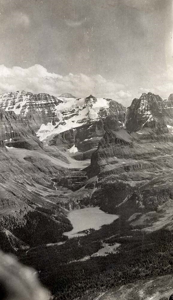
- Mount Assiniboine is located along the Continental Divide, in the Rocky Mountains, in British Columbia. It was named in 1885, and it sits on the border of Mount Assiniboine Provincial Park, B. C. and Banff National Park, AB. In 1925, Lawrence Grassi became the first person to make a solo attempt of the mountain. Mount Assiniboine was first climbed in 1901 by James Outram, Christian Bohren and Christian Hasler.
- Scope & Content
- Files consist of summit notes and summit registers from Mount Assiniboine produced by the Alpine Club of Canada between 1977 and 1998. Summit records include entries from visitors to the various summits which pertain to individuals' hiking and climbing trips; details of specific events which occurred while at the summit, wildlife sightings, trail updates, and related topics. Files include: M200 / V / A / 107: [Mt. Assiniboine log book 1977-1987] M200 / V / A / 108: [Mt. Assiniboine Aug. 1978 - Aug. 1998]
- Notes
- File M200 / V / A / 108: [Mt. Assiniboine Aug. 1978 - Aug. 1998] contains a piece of engraved metal.
- Name Access
- Alpine Club of Canada
- Subject Access
- Alpine Club of Canada
- Backcountry skiing
- Backpacking
- Alberta
- Banff National Park
- Banff
- Bow Valley
- British Columbia
- Climbing
- Club
- Cross-country skiing
- Description and travel
- Environment
- Environment and Nature
- Hiking
- Mount Assiniboine
- Mountain
- Mountaineering
- Mountaineers
- Mountains
- National parks and reserves
- Parks Canada
- Parks
- Provincial parks and reserves
- Record keeping
- Ski area
- Ski areas
- Ski mountaineering
- Skiing
- Skis
- Sports and leisure
- Sports and recreation
- Summit
- Trails
- Winter sports
- Geographic Access
- Canada
- Canadian Rocky Mountains
- Rocky Mountains
- Continental Divide
- Alberta
- British Columbia
- Banff National Park
- Assiniboine Provincial Park
- Mount Assiniboine Park
- Bow Valley
- Mount Assiniboine
- Access Restrictions
- Restrictions may apply
- Reproduction Restrictions
- Contains personal information
- Language
- English
- Conservation
- Some materials have been placed in mylar. Some materials have water damage. File M200 / V / A / 108: [Mt. Assiniboine Aug. 1978 - Aug. 1998] contains a piece of engraved metal that has been placed in a conservation bag within the file.
- Related Material
- M235
- Biographical Source Notes
- Peak Finder: Mount Assiniboine, Canadian Rockies Database: https://cdnrockiesdatabases.ca/peaks/57#undefined1
- Title Source
- Title based on contents of file
- Processing Status
- Processed
This material is presented as originally created; it may contain outdated cultural descriptions and
potentially offensive content.
Read more.
Mt. Lefroy Summit Records
https://archives.whyte.org/en/permalink/descriptions57737
- Part Of
- Alpine Club of Canada fonds
- Scope & Content
- Files consist of summit notes and summit registers Mount Lefroy produced by the Alpine Club of Canada between 1985 and 2010. Summit records include entries from visitors to the various summits which pertain to individuals' hiking and climbing trips; details of specific events which occurred while a…
- Date Range
- 1985-2010
- Reference Code
- M200 / V / A / 148 to 149
- Description Level
- 5 / File
- GMD
- Textual record
- Organization record
- Part Of
- Alpine Club of Canada fonds
- Description Level
- 5 / File
- Fonds Number
- M200
- V14
- S6
- Series
- M200 / V: Summit Records
- Sous-Fonds
- M200
- Sub-Series
- M200 / V / A: Identified Summit Records
- Accession Number
- accn. 5631
- accn. 2023.19
- Reference Code
- M200 / V / A / 148 to 149
- Responsibility
- Summit Registers and Notes produced by Alpine Club of Canada
- Date Range
- 1985-2010
- Physical Description
- 2 volumes 3 cm of textual records
- History / Biographical
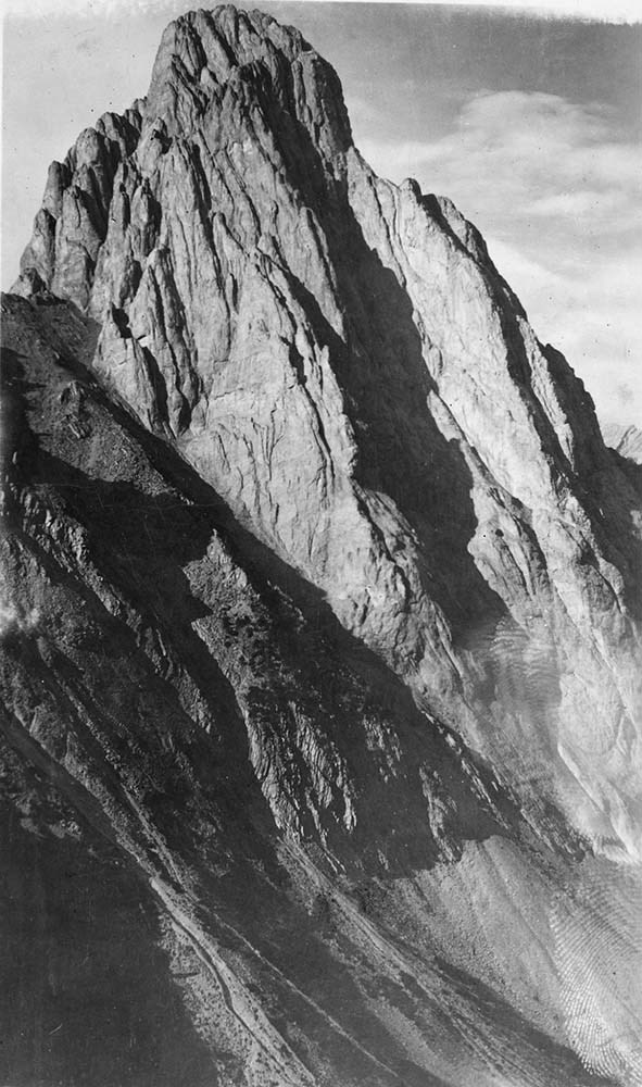
- Mount Lefroy is located in along the Continental/Great Divide, and is part of the Canadian Rocky Mountains. Nearby are Abbot Pass and Mount Victoria. Mount Lefroy is the site of the first fatal mountaineering accident in Canada.
- Scope & Content
- Files consist of summit notes and summit registers Mount Lefroy produced by the Alpine Club of Canada between 1985 and 2010. Summit records include entries from visitors to the various summits which pertain to individuals' hiking and climbing trips; details of specific events which occurred while at the summit, wildlife sightings, trail updates, and related topics. Files include: M200 / V / A / 148: [Mt. Lefroy register 1985-1987] M200 / V / A / 149: Mt. Lefroy. [ca. 1986-2010]
- Name Access
- Alpine Club of Canada
- Subject Access
- Alberta
- Alpine Club of Canada
- Backcountry skiing
- Backpacking
- Banff
- Banff National Park
- British Columbia
- Climbing
- Club
- Description and travel
- Environment
- Environment and Nature
- Great Divide
- Hiking
- Mountain
- Mountaineering
- Mountaineers
- Mountains
- National parks and reserves
- Provincial parks and reserves
- Record keeping
- Ski mountaineering
- Skiing
- Skiers
- Skis
- Sports and leisure
- Sports and recreation
- Summit
- Trails
- Geographic Access
- Canada
- Canadian Rocky Mountains
- Rocky Mountains
- Continental Divide
- Great Divide
- Alberta
- British Columbia
- Banff National Park
- Yoho National Park
- Abbott Pass
- Abbot Pass
- Mount Victoria
- Mount Lefroy
- Access Restrictions
- Restrictions may apply
- Language
- English
- Japanese
- French
- Conservation
- Register has evidence of rust damage and loose pages. Pages have tears and some water damage.
- Related Material
- M235
- Title Source
- Title based on contents of file
- Processing Status
- Processed
This material is presented as originally created; it may contain outdated cultural descriptions and
potentially offensive content.
Read more.
Mt. McPhail Summit Register
https://archives.whyte.org/en/permalink/descriptions57711
- Part Of
- Alpine Club of Canada fonds
- Scope & Content
- File consists of a summit record from Mount McPhail produced by the Alpine Club of Canada around 1994. Summit record includes entries from visitors to the various summits which pertain to individuals' hiking and climbing trips; details of specific events which occurred while at the summit, wildlife…
- Date Range
- ca. 1994
- Reference Code
- M200 / V / A / 121
- Description Level
- 5 / File
- GMD
- Textual record
- Organization record
- Part Of
- Alpine Club of Canada fonds
- Description Level
- 5 / File
- Fonds Number
- M200
- V14
- S6
- Series
- M200 / V: Summit Records
- Sous-Fonds
- M200
- Sub-Series
- M200 / V / A: Identified Summit Records
- Accession Number
- accn. 2014.8293
- Reference Code
- M200 / V / A / 121
- Responsibility
- Summit Registers and Notes produced by Alpine Club of Canada
- Date Range
- ca. 1994
- Physical Description
- 1 volume 1 cm of textual record
- History / Biographical
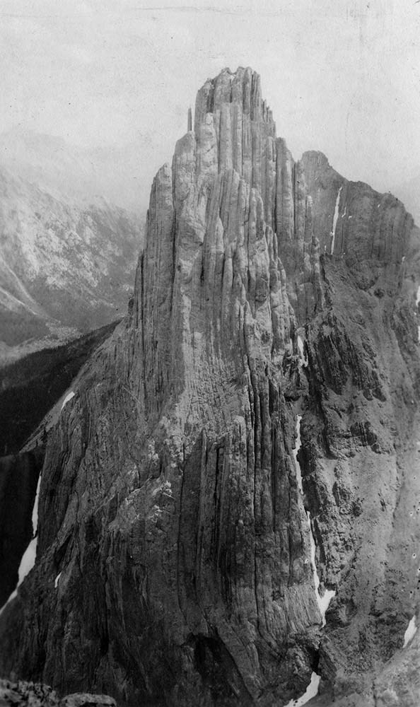
- Mount McPhail is located in the Elk Range of the Park Ranges of the Canadian Rockies and is along the Continental Divide, between the Alberta and British Columbia border. It is within the Kananaskis Country Provincial Park boundary, Mount McPhail is also known as "The Pyramid" for its shape. The mountain was named for Corporal Norman RR. McPhail, a member of the Surveyor General staff, who fought and was killed in action in WWI.
- Scope & Content
- File consists of a summit record from Mount McPhail produced by the Alpine Club of Canada around 1994. Summit record includes entries from visitors to the various summits which pertain to individuals' hiking and climbing trips; details of specific events which occurred while at the summit, wildlife sightings, trail updates, and related topics. File: M200 / V / A / 121: Mt. McPhail Summit Register
- Name Access
- Alpine Club of Canada
- Subject Access
- Alberta
- Alpine Club of Canada
- Backcountry skiing
- Backpacking
- Banff
- Banff National Park
- Bow Valley
- British Columbia
- Climbing
- Club
- Cross-country skiing
- Description and travel
- Environment
- Environment and Nature
- Hiking
- Kananaskis Country
- Mountain
- Mountaineering
- Mountaineers
- Mountains
- National parks and reserves
- Provincial parks and reserves
- Record keeping
- Ski area
- Ski areas
- Ski mountaineering
- Skiing
- Skiers
- Sports and leisure
- Sports and recreation
- Summit
- Winter sports
- Geographic Access
- Canada
- Canadian Rocky Mountains
- Alberta
- British Columbia
- Banff National Park
- Yoho National Park
- Continental Divide
- Elk Range Mountains
- Mount McPhail
- Access Restrictions
- Restrictions may apply
- Language
- English
- Conservation
- Register contains black mold, water damage. Register is placed in mylar.
- Related Material
- M235
- Biographical Source Notes
- Peak Finder: Mount McPhail, Canadian Rockies Database: https://cdnrockiesdatabases.ca/peaks/889
- Title Source
- Original title used
- Processing Status
- Processed
This material is presented as originally created; it may contain outdated cultural descriptions and
potentially offensive content.
Read more.