Narrow Results By
Banff Springs Hotel, Rocky Mountains 1887
https://archives.whyte.org/en/permalink/artifactfic.05.01
- Artist
- C. Firth
- Date
- 1887
- Medium
- watercolour on paper
- Catalogue Number
- FiC.05.01
- Description
- Scene showing Banff springs hotel at right perched on a hillside. In the background the Bow River winds through a valley between Tunnel Mountain and Mt. Roundly. More mountains in distance. Trees in foreground. My. Roundly is hazy, almost unfinished in appearance.
1 image
- Artist
- C. Firth
- Title
- Banff Springs Hotel, Rocky Mountains 1887
- Date
- 1887
- Medium
- watercolour on paper
- Dimensions
- 12.0 x 16.0 cm
- Description
- Scene showing Banff springs hotel at right perched on a hillside. In the background the Bow River winds through a valley between Tunnel Mountain and Mt. Roundly. More mountains in distance. Trees in foreground. My. Roundly is hazy, almost unfinished in appearance.
- Credit
- Gift of Dorothy and Jim McLeod, Calgary, 2021
- Catalogue Number
- FiC.05.01
Images

This material is presented as originally created; it may contain outdated cultural descriptions and
potentially offensive content.
Read more.
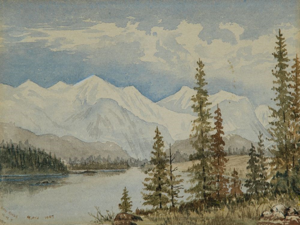
Bow River NWT, 1887
https://archives.whyte.org/en/permalink/artifactfic.05.02
- Artist
- C. Firth
- Date
- 1887
- Medium
- watercolour on paper
- Catalogue Number
- FiC.05.02
- Description
- Large river [The Bow River] with snow-capped mountains at back and stands of conifers on the banks. River winds from left foreground into right background. Stand of trees at right foreground.
1 image
- Artist
- C. Firth
- Title
- Bow River NWT, 1887
- Date
- 1887
- Medium
- watercolour on paper
- Dimensions
- 12.0 x 16.0 cm
- Description
- Large river [The Bow River] with snow-capped mountains at back and stands of conifers on the banks. River winds from left foreground into right background. Stand of trees at right foreground.
- Credit
- Gift of Dorothy and Jim McLeod, Calgary, 2021
- Catalogue Number
- FiC.05.02
Images
This material is presented as originally created; it may contain outdated cultural descriptions and
potentially offensive content.
Read more.
[Cline River 83C/2 East, Alberta]
https://archives.whyte.org/en/permalink/catalogue23557
- Medium
- Library - Maps and blueprints (unannotated; published)
- Map
- Published Date
- 1961
- Publisher
- Dept. of Mines and Technical Surveys
- Call Number
- NTS
- 83C/2E
- Publisher
- Dept. of Mines and Technical Surveys
- Published Date
- 1961
- Physical Description
- 1 map : black and white
- Scale
- Scale: 1:50,000
- Relief: Contour interval 100'
- Subjects
- Cline River
- Alberta
- Notes
- National Topographic System
- Provisional map
- Accession Number
- 6283
- Call Number
- NTS
- 83C/2E
- Collection
- Archives Library
This material is presented as originally created; it may contain outdated cultural descriptions and
potentially offensive content.
Read more.
[Cline River 83C/2 West, Alberta]
https://archives.whyte.org/en/permalink/catalogue23558
- Medium
- Library - Maps and blueprints (unannotated; published)
- Map
- Published Date
- 1961
- Publisher
- Dept. of Mines and Technical Surveys
- Call Number
- NTS
- 83C/2W
- Publisher
- Dept. of Mines and Technical Surveys
- Published Date
- 1961
- Physical Description
- 1 map : black and white
- Scale
- Scale: 1:50,000
- Relief: Contour interval 100'
- Subjects
- Cline River
- Alberta
- Notes
- National Topographic System
- Provisional map
- Accession Number
- 6283
- Call Number
- NTS
- 83C/2W
- Collection
- Archives Library
This material is presented as originally created; it may contain outdated cultural descriptions and
potentially offensive content.
Read more.
National Topographic System
https://archives.whyte.org/en/permalink/catalogue23885
- Medium
- Library - Maps and blueprints (unannotated; published)
- Map
- Published Date
- 1961
- Publisher
- Dept. of Mines and Techinical Surveys
- Call Number
- NTS
- 82N/16E
- Publisher
- Dept. of Mines and Techinical Surveys
- Published Date
- 1961
- Physical Description
- 1 map : col
- Scale
- Scale: 1:50,000
- Relief: Contour interval 100'
- Subjects
- Siffleur River
- Alberta
- Accession Number
- 6283 (duplicate)
- Call Number
- NTS
- 82N/16E
- Collection
- Archives Library
This material is presented as originally created; it may contain outdated cultural descriptions and
potentially offensive content.
Read more.
National Topographic System
https://archives.whyte.org/en/permalink/catalogue23886
- Medium
- Library - Maps and blueprints (unannotated; published)
- Map
- Published Date
- 1961
- Publisher
- Dept. of Mines and Techinical Surveys
- Call Number
- NTS
- 82N/16W
- Publisher
- Dept. of Mines and Techinical Surveys
- Published Date
- 1961
- Physical Description
- 1 map : col
- Scale
- Scale: 1:50,000
- Relief: Contour interval 100'
- Subjects
- Siffleur River
- Alberta
- Call Number
- NTS
- 82N/16W
- Collection
- Archives Library
This material is presented as originally created; it may contain outdated cultural descriptions and
potentially offensive content.
Read more.
[Peace River, Alberta] Canada Land Inventory Map, Land capability for wildlife-waterfowl
https://archives.whyte.org/en/permalink/catalogue24119
- Medium
- Library - Maps and blueprints (unannotated; published)
- Map
- Published Date
- 1971
- Publisher
- Dept. of Energy, Mines and Resources
- Call Number
- NTS
- 84C
- Publisher
- Dept. of Energy, Mines and Resources
- Published Date
- 1971
- Physical Description
- 1 map : col
- Scale
- Scale: 1:250,000
- Subjects
- Peace River
- Alberta
- Accession Number
- 4000
- Call Number
- NTS
- 84C
- Collection
- Archives Library
This material is presented as originally created; it may contain outdated cultural descriptions and
potentially offensive content.
Read more.
[Sand River, Alberta] Canada Land Inventory Map, Land Capability for Recreation
https://archives.whyte.org/en/permalink/catalogue24142
- Medium
- Library - Maps and blueprints (unannotated; published)
- Map
- Published Date
- 1972
- Publisher
- Dept. of Energy Mines & Resources
- Call Number
- NTS
- 73L
- Publisher
- Dept. of Energy Mines & Resources
- Published Date
- 1972
- Physical Description
- 1 map : col
- Scale
- Scale: 1:250,000
- Subjects
- Sand River
- Alberta
- Accession Number
- 6000
- Call Number
- NTS
- 73L
- Collection
- Archives Library
This material is presented as originally created; it may contain outdated cultural descriptions and
potentially offensive content.
Read more.
[Sand River, Alberta] Canada Land Inventory Map, Land Capability for Wildlife-Waterfowl
https://archives.whyte.org/en/permalink/catalogue24143
- Medium
- Library - Maps and blueprints (unannotated; published)
- Map
- Published Date
- 1971
- Publisher
- Department of Energy, Mines and Resources
- Call Number
- NTS
- 73L
- Publisher
- Department of Energy, Mines and Resources
- Published Date
- 1971
- Physical Description
- 1 map : col
- Scale
- Scale: 1:250,000
- Subjects
- Sand River
- Alberta
- Accession Number
- 7000
- Call Number
- NTS
- 73L
- Collection
- Archives Library
This material is presented as originally created; it may contain outdated cultural descriptions and
potentially offensive content.
Read more.
[Wabasca River 84SE, Alta.]
https://archives.whyte.org/en/permalink/catalogue24211
- Medium
- Library - Maps and blueprints (unannotated; published)
- Map
- Published Date
- 1973
- Publisher
- Department of Energy, Mines and Resources
- Call Number
- NTS
- 84SE
- Publisher
- Department of Energy, Mines and Resources
- Published Date
- 1973
- Scale
- Scale: 1:500,000
- Hypsometric tints
- Subjects
- Wabasca River
- Alberta
- Notes
- National Topographic System
- Accession Number
- 7000
- Call Number
- NTS
- 84SE
- Collection
- Archives Library
This material is presented as originally created; it may contain outdated cultural descriptions and
potentially offensive content.
Read more.