Narrow Results By
Mountain Views
https://archives.whyte.org/en/permalink/descriptions57203
- Part Of
- Bruno Engler fonds
- Scope & Content
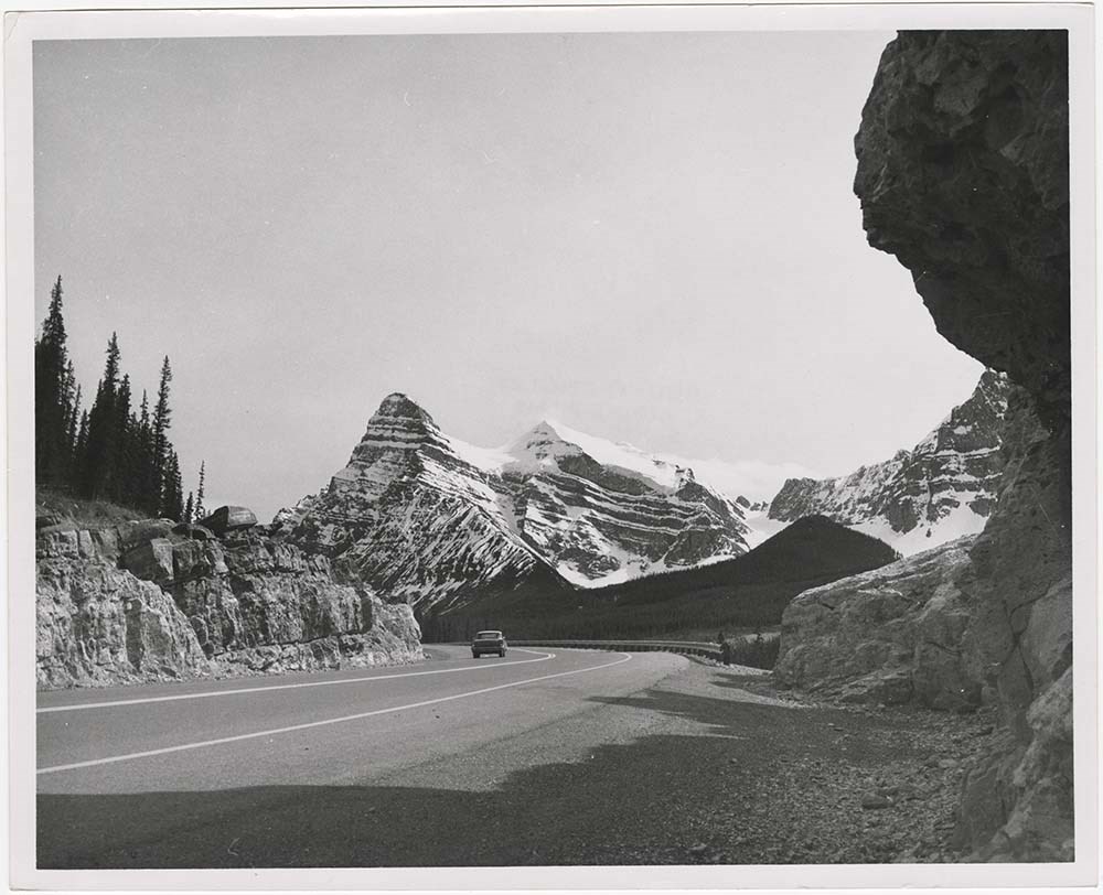
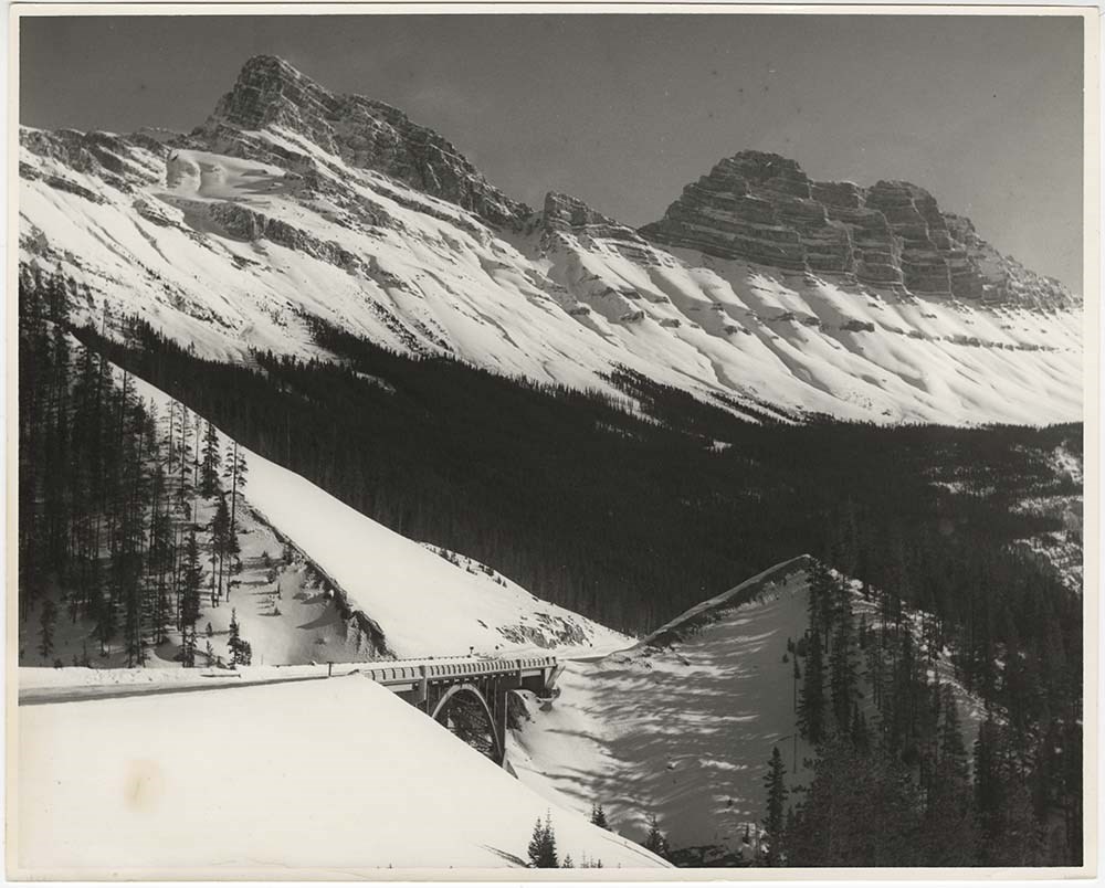
- File pertains to 12 b&w prints of various mountain views, including summer and winter. Includes glaciers, highways, bridges, and possibly the town of Field.
- Date Range
- [ca. 1935-1975]
- Reference Code
- V190 / VI / M / ix / PA - 01 to PA - 12
- Description Level
- 5 / File
- GMD
- Photograph
5 images
- Part Of
- Bruno Engler fonds
- Description Level
- 5 / File
- Fonds Number
- M323 / S40 / V190
- Series
- VI : Retained file, M : Alphabetical order
- Sous-Fonds
- V190
- Sub-Series
- ix : Mountain Views
- Accession Number
- 7436
- Reference Code
- V190 / VI / M / ix / PA - 01 to PA - 12
- GMD
- Photograph
- Date Range
- [ca. 1935-1975]
- Physical Description
- 12 photographs : b&w ; 25.2 x 20.2 cm or smaller
- History / Biographical
- See fonds level description
- Scope & Content
- File pertains to 12 b&w prints of various mountain views, including summer and winter. Includes glaciers, highways, bridges, and possibly the town of Field.
- Subject Access
- Automobiles
- Banff-Jasper Highway
- Bridges
- Glaciers
- Mountains
- Rivers
- Roads
- scenic
- Winter
- Geographic Access
- Banff National Park
- Field
- Yoho National Park
- British Columbia
- Language
- English
- Creator
- Engler, Bruno
- Title Source
- Original title kept
- Processing Status
- Processed
Images


This material is presented as originally created; it may contain outdated cultural descriptions and
potentially offensive content.
Read more.
Travel guides and maps
https://archives.whyte.org/en/permalink/descriptions56361
- Part Of
- Ben Gadd fonds
- Scope & Content
- Sub-series consists of travel brochures and maps which were collected and used by Ben Gadd. Sub-series contains five sub-sub series: M590 / I / A / i : Travel guides and pocket maps M590 / I / A / ii : Topographical maps M590 / I / A / iii : Geological maps M590 / I / A / iv : Highway maps M590 / …
- Date Range
- [ca.1920-2010]
- Reference Code
- M590 / I / A
- Description Level
- 4 / Sub-series
- GMD
- Map
- Textual record
- Part Of
- Ben Gadd fonds
- Description Level
- 4 / Sub-series
- Fonds Number
- M590
- V810
- S61
- Series
- M590 / I : Personal records
- Sous-Fonds
- M590
- Sub-Series
- M590 / I / A : Travel guides and maps
- Accession Number
- 2021.20
- Reference Code
- M590 / I / A
- GMD
- Map
- Textual record
- Date Range
- [ca.1920-2010]
- Physical Description
- ca. 274 maps -- ca. 61 travel guides, brochures
- Scope & Content
- Sub-series consists of travel brochures and maps which were collected and used by Ben Gadd. Sub-series contains five sub-sub series: M590 / I / A / i : Travel guides and pocket maps M590 / I / A / ii : Topographical maps M590 / I / A / iii : Geological maps M590 / I / A / iv : Highway maps M590 / I / A / v : Index maps, other
- Notes
- Some materials in sub-series are annotated with notes by Ben Gadd
- Name Access
- Gadd, Ben
- Subject Access
- Geography
- Geology
- Environment
- Map
- Tourism
- Tourist information
- Travel
- Trails
- Roads
- Transportation
- Natural history
- National parks and reserves
- Provincial parks and reserves
- Government
- Sports
- Recreation
- Hiking
- Geographic Access
- Canada
- Alberta
- British Columbia
- Banff National Park
- Jasper National Park
- Kootenay National Park
- Yoho National Park
- Waterton Lakes National Park
- Columbia Icefields
- United States of America
- Colorado
- Montana
- Yellowstone National Park
- Access Restrictions
- Restrictions may apply - some materials are fragile
- Reproduction Restrictions
- Restrictions may apply
- Language
- English
- Conservation
- Some fragile/torn materials stored in mylar
- Category
- Environment
- Exploration, discovery and travel
- Government
- Sports, recreation and leisure
- Transportation
- Tourism
- Title Source
- Title based on contents of sub-series
- Processing Status
- Processed
This material is presented as originally created; it may contain outdated cultural descriptions and
potentially offensive content.
Read more.