Narrow Results By
Alberta, Canada : transportation
https://archives.whyte.org/en/permalink/catalogue24407
- Medium
- Library - Maps and blueprints (unannotated; published)
- Map
- Published Date
- 1980
- Publisher
- Edmonton : Alberta Transportation
- Call Number
- C9-1.17
- Publisher
- Edmonton : Alberta Transportation
- Published Date
- 1980
- Physical Description
- 1 map : col
- Scale
- Scale indeterminable
- Accession Number
- 3287
- Call Number
- C9-1.17
- Collection
- Archives Library
This material is presented as originally created; it may contain outdated cultural descriptions and
potentially offensive content.
Read more.
Columbia River Highway Views
https://archives.whyte.org/en/permalink/descriptions54985
- Part Of
- Luxton family fonds
- Scope & Content
- File consists of 19 postcard prints by company Cross & Dimmitt depicting views of the Columbia River Highway in Portland, Oregon and the surrounding region [ca.1918-1925]. File also contains original storage envelope for postcards.
- Date Range
- [1918-1925]
- Reference Code
- LUX / I / E4 / PA - 286 to 304
- Description Level
- 5 / File
- GMD
- Postcard
- Part Of
- Luxton family fonds
- Description Level
- 5 / File
- Fonds Number
- LUX
- Series
- LUX / I / E : Collected material
- Sous-Fonds
- LUX / I : Norman Luxton sous-fonds
- Sub-Series
- LUX / I / E4 : Photographs
- Accession Number
- LUX
- Reference Code
- LUX / I / E4 / PA - 286 to 304
- Responsibility
- Postcards produced by Cross & Dimmitt
- Date Range
- [1918-1925]
- Physical Description
- 19 postcards : b&w ; 14 x 9 cm
- Scope & Content
- File consists of 19 postcard prints by company Cross & Dimmitt depicting views of the Columbia River Highway in Portland, Oregon and the surrounding region [ca.1918-1925]. File also contains original storage envelope for postcards.
- Notes
- Specific dates unknown; date range is estimate based on production era, content and format of postcards.
- Subject Access
- Aerial photography
- Columbia River Highway
- Landscapes
- Postcards
- Businesses
- Transportation
- Travel
- Roads
- Geographic Access
- United States of America
- Oregon
- Portland
- Language
- English
- Conservation
- Items stored in mylar; original envelope stored in separate mylar sheet in same folder
- Title Source
- Original title of contents used for file
- Processing Status
- Processed
This material is presented as originally created; it may contain outdated cultural descriptions and
potentially offensive content.
Read more.
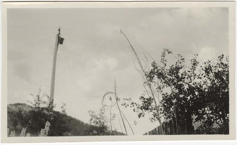
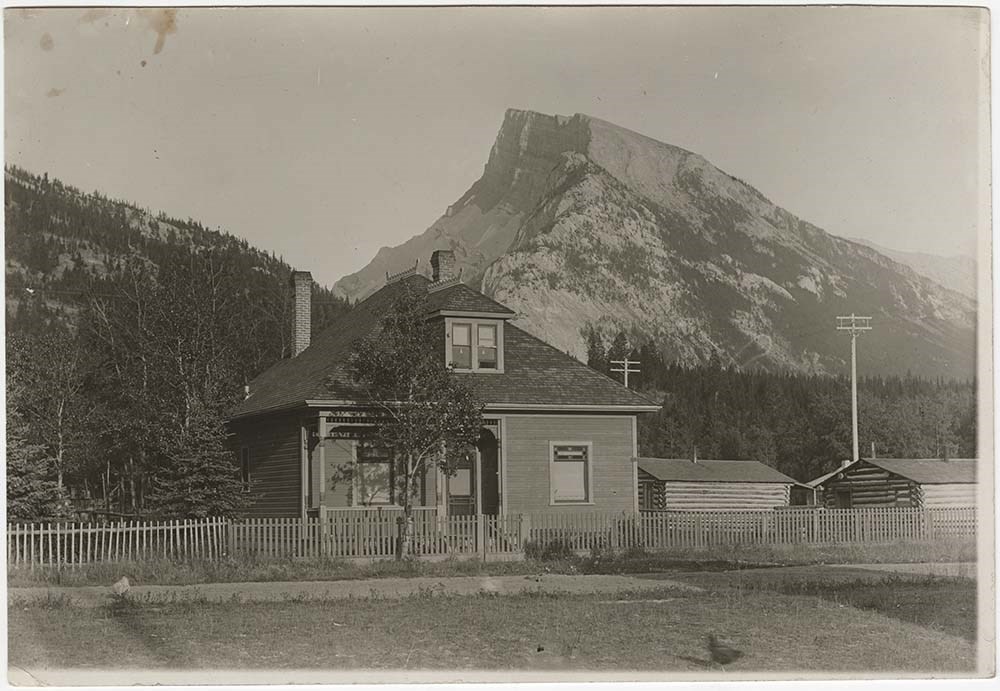
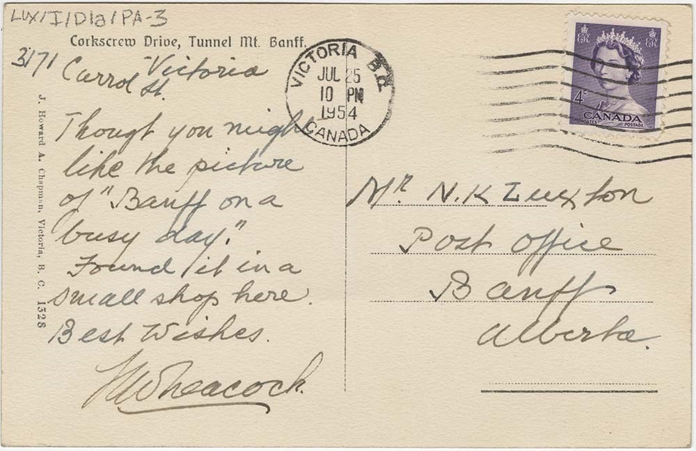
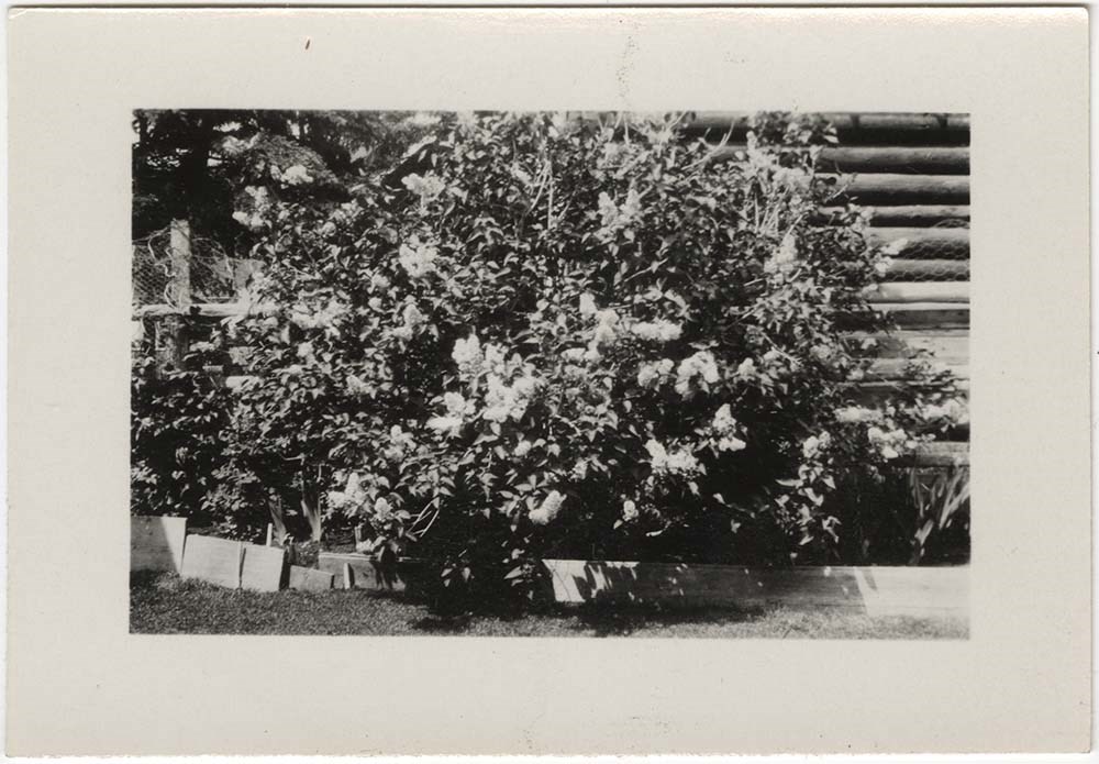
Luxton home views, Tunnel Mountain
https://archives.whyte.org/en/permalink/descriptions55010
- Part Of
- Luxton family fonds
- Scope & Content
- File consists of 9 photograph prints [including one postcard print] depicting views of the Luxton family home and property in Banff. Postcard print depicts Tunnel Mountain facing the Luxton home [ca.1910?] with a letter to Norman Luxton from Henry William Leacock[?] [Possibly Walter Heacock] on the…
- Date Range
- [ca.1905-1910]
- 1908
- [1930-1940]
- 1954
- Reference Code
- LUX / I / D1a / PA - 1 to 9
- Description Level
- 5 / File
- GMD
- Photograph
- Photograph print
- Postcard
10 images
- Part Of
- Luxton family fonds
- Description Level
- 5 / File
- Fonds Number
- LUX
- Series
- LUX / I / D : Personal and professional
- Sous-Fonds
- LUX / I : Norman Luxton sous-fonds
- Sub-Series
- LUX / I / D1 : Personal and family life
- Accession Number
- LUX
- Reference Code
- LUX / I / D1a / PA - 1 to 9
- Responsibility
- Some photos attributed to J. Howard. A. Chapman
- Date Range
- [ca.1905-1910]
- 1908
- [1930-1940]
- 1954
- Physical Description
- 9 photographs : b&w prints ; 17 x 12 cm or smaller
- Scope & Content
- File consists of 9 photograph prints [including one postcard print] depicting views of the Luxton family home and property in Banff. Postcard print depicts Tunnel Mountain facing the Luxton home [ca.1910?] with a letter to Norman Luxton from Henry William Leacock[?] [Possibly Walter Heacock] on the back dated 1954.
- Notes
- Item LUX/I/D1a/PA-2 possibly produced by George Luxton
- Material Details
- Item LUX/I/D1a/PA-3 has postage stamp affixed to back side
- Subject Access
- Family and personal life
- Home
- Townsite development
- Immigration and homesteading
- Land use
- Settlement
- Roads
- Mountain
- Landscapes
- Geographic Access
- Canada
- Alberta
- Banff
- Tunnel Mountain
- Language
- English
- Title Source
- Title based on contents of file
- Processing Status
- Processed
Images

This material is presented as originally created; it may contain outdated cultural descriptions and
potentially offensive content.
Read more.
Map of Banff and vicinity showing major highway, other roads, viewpoints, campgrounds, trailer park, picnic areas, lifts, trails
https://archives.whyte.org/en/permalink/catalogue21352
- Medium
- Library - Maps and blueprints (unannotated; published)
- Map
- Published Date
- ca. 1970
- Call Number
- C6-4.3(f)
- Published Date
- ca. 1970
- Notes
- Map B on reverse side of A shows the townsite in a larger scale
- file transfer
- Accession Number
- 5500
- Call Number
- C6-4.3(f)
- Collection
- Archives Library
This material is presented as originally created; it may contain outdated cultural descriptions and
potentially offensive content.
Read more.
Map of Banff and vicinity showing major highway, other roads, viewpoints, campgrounds, trailer park, picnic areas, lifts, trails
https://archives.whyte.org/en/permalink/catalogue21382
- Medium
- Library - Maps and blueprints (unannotated; published)
- Map
- Published Date
- ca. 1970
- Call Number
- C6-4.3(f)
- Published Date
- ca. 1970
- Notes
- Map B on reverse side of A shows the townsite in a larger scale
- file transfer
- Accession Number
- 5500
- Call Number
- C6-4.3(f)
- Collection
- Archives Library
This material is presented as originally created; it may contain outdated cultural descriptions and
potentially offensive content.
Read more.
Map showing trail outings at Banff, Spray River Valley, Tunnel Mountain area, Summit of Sulphur, Stoney Squaw Mountain, Lower Bow Valley, Sundance Canyon, Rundle Mountain
https://archives.whyte.org/en/permalink/catalogue21353
- Medium
- Library - Maps and blueprints (unannotated; published)
- Map
- Publisher
- Northern Affairs & Natural Resources
- Call Number
- C6-4.3(g)
- Publisher
- Northern Affairs & Natural Resources
- Subjects
- Banff National Park - Roads & Trails
- Notes
- Info on reverse side re: routes etc.
- Accession Number
- 2613
- Call Number
- C6-4.3(g)
- Collection
- Archives Library
This material is presented as originally created; it may contain outdated cultural descriptions and
potentially offensive content.
Read more.
Map showing trail outings at Banff, Spray River Valley, Tunnel Mountain area, Summit of Sulphur, Stoney Squaw Mountain, Lower Bow Valley, Sundance Canyon, Rundle Mountain
https://archives.whyte.org/en/permalink/catalogue21383
- Medium
- Library - Maps and blueprints (unannotated; published)
- Map
- Publisher
- Northern Affairs & Natural Resources
- Call Number
- C6-4.3(g)
- Publisher
- Northern Affairs & Natural Resources
- Subjects
- Banff National Park - Roads & Trails
- Notes
- Info on reverse side re: routes etc.
- Accession Number
- 2613
- Call Number
- C6-4.3(g)
- Collection
- Archives Library
This material is presented as originally created; it may contain outdated cultural descriptions and
potentially offensive content.
Read more.
Motor roads to the Canadian Rockies
https://archives.whyte.org/en/permalink/catalogue24316
- Medium
- Library - Maps and blueprints (unannotated; published)
- Map
- Published Date
- 1920
- Call Number
- C6-4.3(b)
- Published Date
- 1920
- Scale
- 1 inch - 18 miles
- Subjects
- Motor Roads
- Notes
- Photostatic copu from Public Archives
- Accession Number
- 675
- Call Number
- C6-4.3(b)
- Collection
- Archives Library
This material is presented as originally created; it may contain outdated cultural descriptions and
potentially offensive content.
Read more.
Motor roads to the Canadian Rockies
https://archives.whyte.org/en/permalink/catalogue23383
- Medium
- Library - Maps and blueprints (unannotated; published)
- Map
- Published Date
- 1920
- Call Number
- C6-4.3(b)
- Published Date
- 1920
- Scale
- 1 inch - 18 miles
- Subjects
- Motor Roads
- Notes
- Photostatic copu from Public Archives
- Accession Number
- 675
- Call Number
- C6-4.3(b)
- Collection
- Archives Library
This material is presented as originally created; it may contain outdated cultural descriptions and
potentially offensive content.
Read more.
Sketch map showing the vicinity of Lake Louise, Moraine Lake and Vermilion Pass
https://archives.whyte.org/en/permalink/catalogue21355
- Medium
- Library - Maps and blueprints (unannotated; published)
- Map
- Published Date
- 1905
- Publisher
- Department of the Interior
- Call Number
- C6-4.3(i)
- Publisher
- Department of the Interior
- Published Date
- 1905
- Subjects
- Lake Louise - Roads & Trails
- Notes
- Driving Roads, Pony trails
- From photographic surveys by A.O. Wheeler, Topographer of the Department assisted by M.P. Bridgland D.L.S. and H.G. Wheeler
- Accession Number
- 3120
- Call Number
- C6-4.3(i)
- Collection
- Archives Library
This material is presented as originally created; it may contain outdated cultural descriptions and
potentially offensive content.
Read more.