Narrow Results By
Mountain Views
https://archives.whyte.org/en/permalink/descriptions57203
- Part Of
- Bruno Engler fonds
- Scope & Content
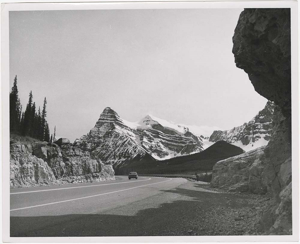
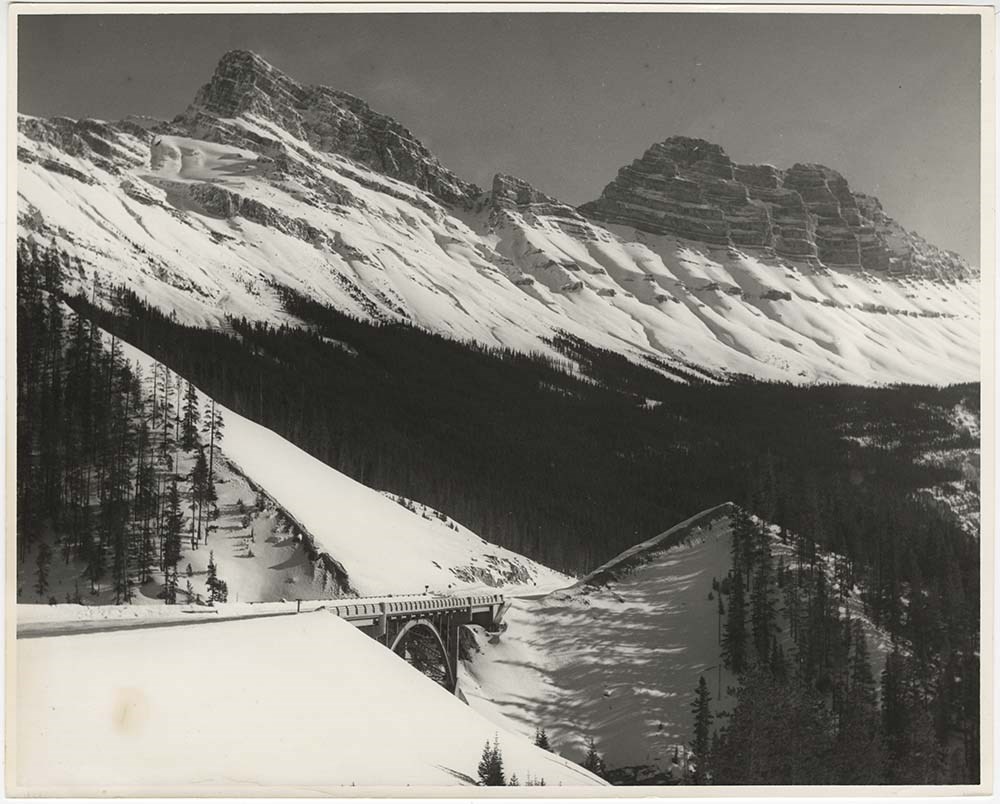
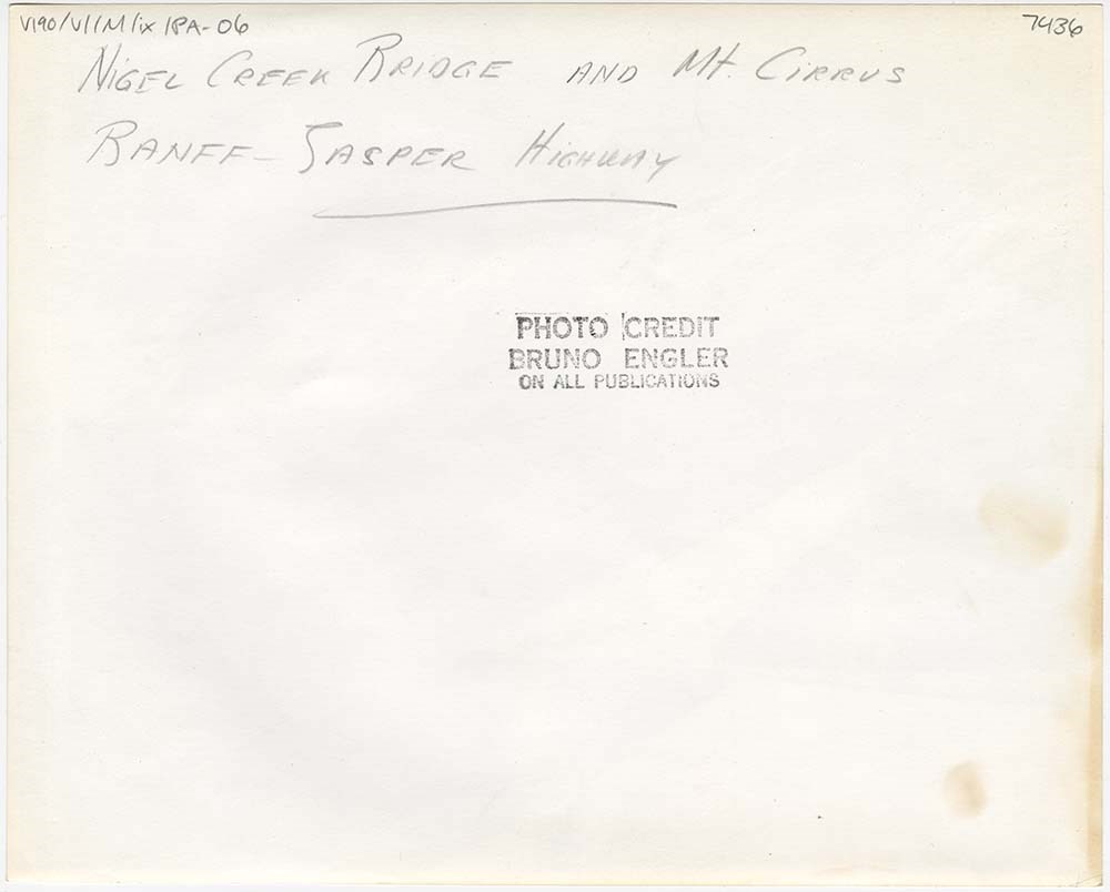
- File pertains to 12 b&w prints of various mountain views, including summer and winter. Includes glaciers, highways, bridges, and possibly the town of Field.
- Date Range
- [ca. 1935-1975]
- Reference Code
- V190 / VI / M / ix / PA - 01 to PA - 12
- Description Level
- 5 / File
- GMD
- Photograph
5 images
- Part Of
- Bruno Engler fonds
- Description Level
- 5 / File
- Fonds Number
- M323 / S40 / V190
- Series
- VI : Retained file, M : Alphabetical order
- Sous-Fonds
- V190
- Sub-Series
- ix : Mountain Views
- Accession Number
- 7436
- Reference Code
- V190 / VI / M / ix / PA - 01 to PA - 12
- GMD
- Photograph
- Date Range
- [ca. 1935-1975]
- Physical Description
- 12 photographs : b&w ; 25.2 x 20.2 cm or smaller
- History / Biographical
- See fonds level description
- Scope & Content
- File pertains to 12 b&w prints of various mountain views, including summer and winter. Includes glaciers, highways, bridges, and possibly the town of Field.
- Subject Access
- Automobiles
- Banff-Jasper Highway
- Bridges
- Glaciers
- Mountains
- Rivers
- Roads
- scenic
- Winter
- Geographic Access
- Banff National Park
- Field
- Yoho National Park
- British Columbia
- Language
- English
- Creator
- Engler, Bruno
- Title Source
- Original title kept
- Processing Status
- Processed
Images


This material is presented as originally created; it may contain outdated cultural descriptions and
potentially offensive content.
Read more.
- Part Of
- Bruno Engler fonds
- Scope & Content
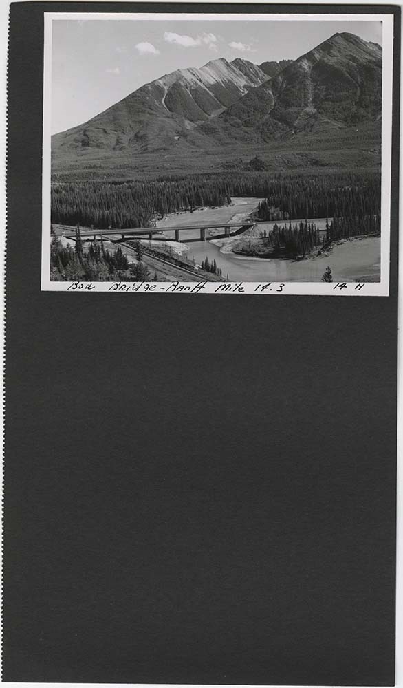
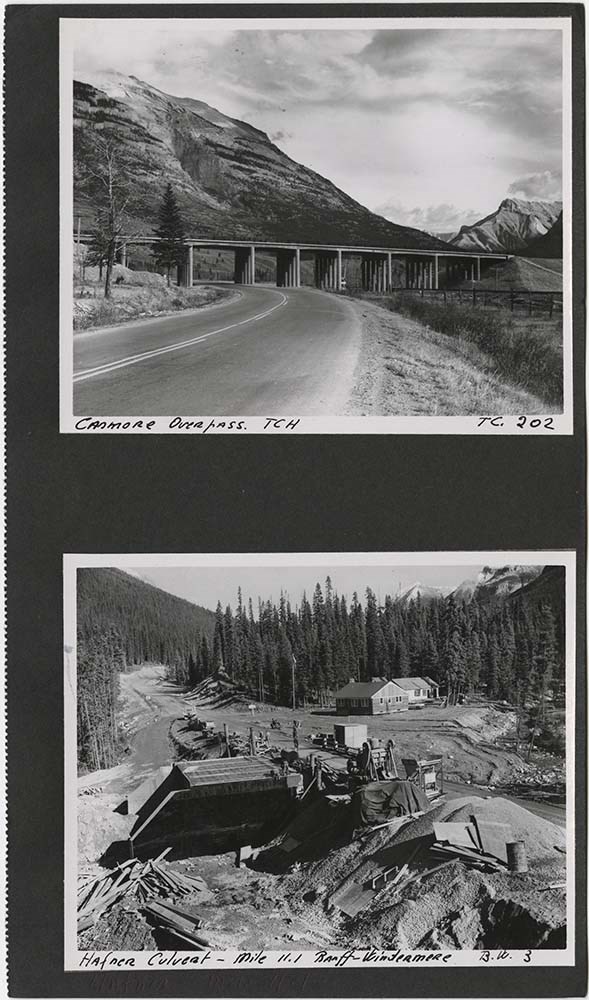
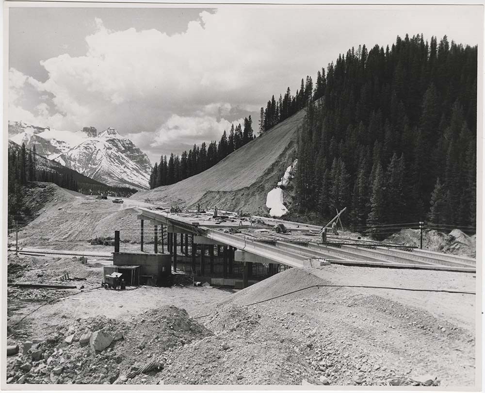
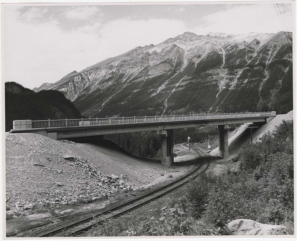
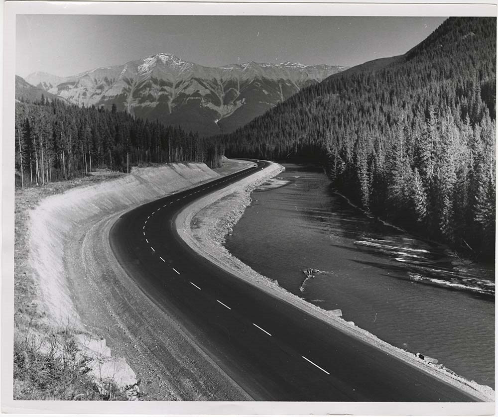
- File pertains to 41 b&w prints of various bridge and road construction projects, mostly concerning the Trans-Canada Highway. Includes active construction, the power station outside Banff, bridges, road grading, the Banff townsite from Sulphur Mountain, and stretches of the completed highway between…
- Date Range
- 1957-1962
- Reference Code
- V190 / VI / R / ii / a / PA - 01 to PA - 41
- Description Level
- 5 / File
- GMD
- Photograph
11 images
- Part Of
- Bruno Engler fonds
- Description Level
- 5 / File
- Fonds Number
- M323 / S40 / V190
- Series
- VI : Retained file, R : Alphabetical order
- Sous-Fonds
- V190
- Sub-Series
- ii : Roads, a : Building
- Accession Number
- 7436
- Reference Code
- V190 / VI / R / ii / a / PA - 01 to PA - 41
- GMD
- Photograph
- Date Range
- 1957-1962
- Physical Description
- 41 photographs : b&w ; 25.2 x 20.2 cm or smaller
- History / Biographical
- See fonds level description
- Scope & Content
- File pertains to 41 b&w prints of various bridge and road construction projects, mostly concerning the Trans-Canada Highway. Includes active construction, the power station outside Banff, bridges, road grading, the Banff townsite from Sulphur Mountain, and stretches of the completed highway between Canmore and Yoho National Park.
- Subject Access
- Bridges
- Construction
- Mountains
- Trans-Canada Highway
- Roads
- Geographic Access
- Banff
- Banff National Park
- Canmore
- Alberta
- Yoho National Park
- Language
- English
- Creator
- Engler, Bruno
- Title Source
- Original title kept
- Processing Status
- Processed
Images


This material is presented as originally created; it may contain outdated cultural descriptions and
potentially offensive content.
Read more.
Travel guides and maps
https://archives.whyte.org/en/permalink/descriptions56361
- Part Of
- Ben Gadd fonds
- Scope & Content
- Sub-series consists of travel brochures and maps which were collected and used by Ben Gadd. Sub-series contains five sub-sub series: M590 / I / A / i : Travel guides and pocket maps M590 / I / A / ii : Topographical maps M590 / I / A / iii : Geological maps M590 / I / A / iv : Highway maps M590 / …
- Date Range
- [ca.1920-2010]
- Reference Code
- M590 / I / A
- Description Level
- 4 / Sub-series
- GMD
- Map
- Textual record
- Part Of
- Ben Gadd fonds
- Description Level
- 4 / Sub-series
- Fonds Number
- M590
- V810
- S61
- Series
- M590 / I : Personal records
- Sous-Fonds
- M590
- Sub-Series
- M590 / I / A : Travel guides and maps
- Accession Number
- 2021.20
- Reference Code
- M590 / I / A
- GMD
- Map
- Textual record
- Date Range
- [ca.1920-2010]
- Physical Description
- ca. 274 maps -- ca. 61 travel guides, brochures
- Scope & Content
- Sub-series consists of travel brochures and maps which were collected and used by Ben Gadd. Sub-series contains five sub-sub series: M590 / I / A / i : Travel guides and pocket maps M590 / I / A / ii : Topographical maps M590 / I / A / iii : Geological maps M590 / I / A / iv : Highway maps M590 / I / A / v : Index maps, other
- Notes
- Some materials in sub-series are annotated with notes by Ben Gadd
- Name Access
- Gadd, Ben
- Subject Access
- Geography
- Geology
- Environment
- Map
- Tourism
- Tourist information
- Travel
- Trails
- Roads
- Transportation
- Natural history
- National parks and reserves
- Provincial parks and reserves
- Government
- Sports
- Recreation
- Hiking
- Geographic Access
- Canada
- Alberta
- British Columbia
- Banff National Park
- Jasper National Park
- Kootenay National Park
- Yoho National Park
- Waterton Lakes National Park
- Columbia Icefields
- United States of America
- Colorado
- Montana
- Yellowstone National Park
- Access Restrictions
- Restrictions may apply - some materials are fragile
- Reproduction Restrictions
- Restrictions may apply
- Language
- English
- Conservation
- Some fragile/torn materials stored in mylar
- Category
- Environment
- Exploration, discovery and travel
- Government
- Sports, recreation and leisure
- Transportation
- Tourism
- Title Source
- Title based on contents of sub-series
- Processing Status
- Processed
This material is presented as originally created; it may contain outdated cultural descriptions and
potentially offensive content.
Read more.