Narrow Results By
Alaska Highway signs project
https://archives.whyte.org/en/permalink/descriptions56124
- Part Of
- Ben Gadd fonds
- Scope & Content
- File consists of notes, contracts and correspondence pertaining to Ben Gadd's work producing text for interpretive signs along the Alaska Highway on behalf of the British Columbia Ministry of Parks.
- Date Range
- 1990-1991
- Reference Code
- M590 / III / D / 97
- Description Level
- 5 / File
- GMD
- Textual record
- Part Of
- Ben Gadd fonds
- Description Level
- 5 / File
- Fonds Number
- M590
- V810
- S61
- Series
- M590 / III : Professional records
- Sous-Fonds
- M590
- Sub-Series
- M590 / III / D : Other contracts and projects
- Accession Number
- 2021.20
- Reference Code
- M590 / III / D / 97
- GMD
- Textual record
- Responsibility
- Produced by Ben Gadd
- Date Range
- 1990-1991
- Physical Description
- 0.5 cm of textual records
- Scope & Content
- File consists of notes, contracts and correspondence pertaining to Ben Gadd's work producing text for interpretive signs along the Alaska Highway on behalf of the British Columbia Ministry of Parks.
- Notes
- File includes a brochure containing a map and travel information for Mount Robson Berg Lake Trail, with a note by Ben Gadd. brochure was possibly used as research/reference material in the production of Alaska Highway signs text
- Name Access
- Gadd, Ben
- Subject Access
- Research
- Publication
- Travel
- Roads
- Environment
- Employment
- Government
- Geographic Access
- Canada
- British Columbia
- Reproduction Restrictions
- Restrictions may apply
- Language
- English
- Category
- Environment
- Government
- Title Source
- Title based on contents of file
- Processing Status
- Processed
This material is presented as originally created; it may contain outdated cultural descriptions and
potentially offensive content.
Read more.
Author's copy of Geology Road Tours
https://archives.whyte.org/en/permalink/descriptions56293
- Part Of
- Ben Gadd fonds
- Scope & Content
- File consists of one author's copy of Ben Gadd's book, Geology Road Tours, which includes corrections and other annotations by the author.
- Date Range
- 2008
- Reference Code
- M590 / II / B / 59
- Description Level
- 5 / File
- GMD
- Textual record
- Published record
- Part Of
- Ben Gadd fonds
- Description Level
- 5 / File
- Fonds Number
- M590
- V810
- S61
- Series
- M590 / II : Research and publication records
- Sous-Fonds
- M590
- Sub-Series
- M590 / II / B : Other publications
- Accession Number
- 2021.20
- Reference Code
- M590 / II / B / 59
- Responsibility
- Produced by Ben Gadd, Corax Press
- Date Range
- 2008
- Physical Description
- 3.5 cm of textual records : 1 volume ; 15.5 x 23 cm
- Scope & Content
- File consists of one author's copy of Ben Gadd's book, Geology Road Tours, which includes corrections and other annotations by the author.
- Name Access
- Gadd, Ben
- Subject Access
- Publication
- Commercial products
- Environment
- Geology
- Science and technology
- Geography
- Natural history
- Travel
- Roads
- Map
- Geographic Access
- Canada
- Alberta
- British Columbia
- Canadian Rocky Mountains
- Reproduction Restrictions
- Copyright restrictions may apply
- Language
- English
- Title Source
- Title based on contents of file
- Processing Status
- Processed
This material is presented as originally created; it may contain outdated cultural descriptions and
potentially offensive content.
Read more.
Banff National Park
https://archives.whyte.org/en/permalink/descriptions14775
- Part Of
- Malcolm Geddes fonds
- Scope & Content
- File consists of 31 lantern slides with images pertaining to mountains (including Mount Assiniboine), glaciers, canyons, and water features in Banff National Park; views of Banff townsite and hotels; and roads between Canmore and Lake Louise.
- Date Range
- [ca.1925]
- Reference Code
- V756 / III / A / PS - 130 to 160
- Description Level
- 5 / File
- Part Of
- Malcolm Geddes fonds
- Description Level
- 5 / File
- Fonds Number
- M39
- V756
- Series
- V756 / III : Personal and family records
- Sous-Fonds
- V756
- Sub-Series
- V756 / III / A : Travel and mountain expeditions
- Accession Number
- 6504
- Reference Code
- V756 / III / A / PS - 130 to 160
- Responsibility
- Most images issued by Department of the Interior Natural Resources Intelligence Branch
- Date Range
- [ca.1925]
- Physical Description
- 31 photographs : lantern slides
- Scope & Content
- File consists of 31 lantern slides with images pertaining to mountains (including Mount Assiniboine), glaciers, canyons, and water features in Banff National Park; views of Banff townsite and hotels; and roads between Canmore and Lake Louise.
- Notes
- Most images are captioned
- Material Details
- Some items hand-coloured
- Subject Access
- Mountains
- Glaciers
- Landscapes
- Businesses
- Hotels
- Travel
- Roads
- Environment
- National parks and reserves
- Geographic Access
- Canada
- Alberta
- Banff National Park
- Banff
- Access Restrictions
- Fragile- restrictions may apply
- Language
- English
- Title Source
- Title based on contents of file
- Processing Status
- Processed
This material is presented as originally created; it may contain outdated cultural descriptions and
potentially offensive content.
Read more.
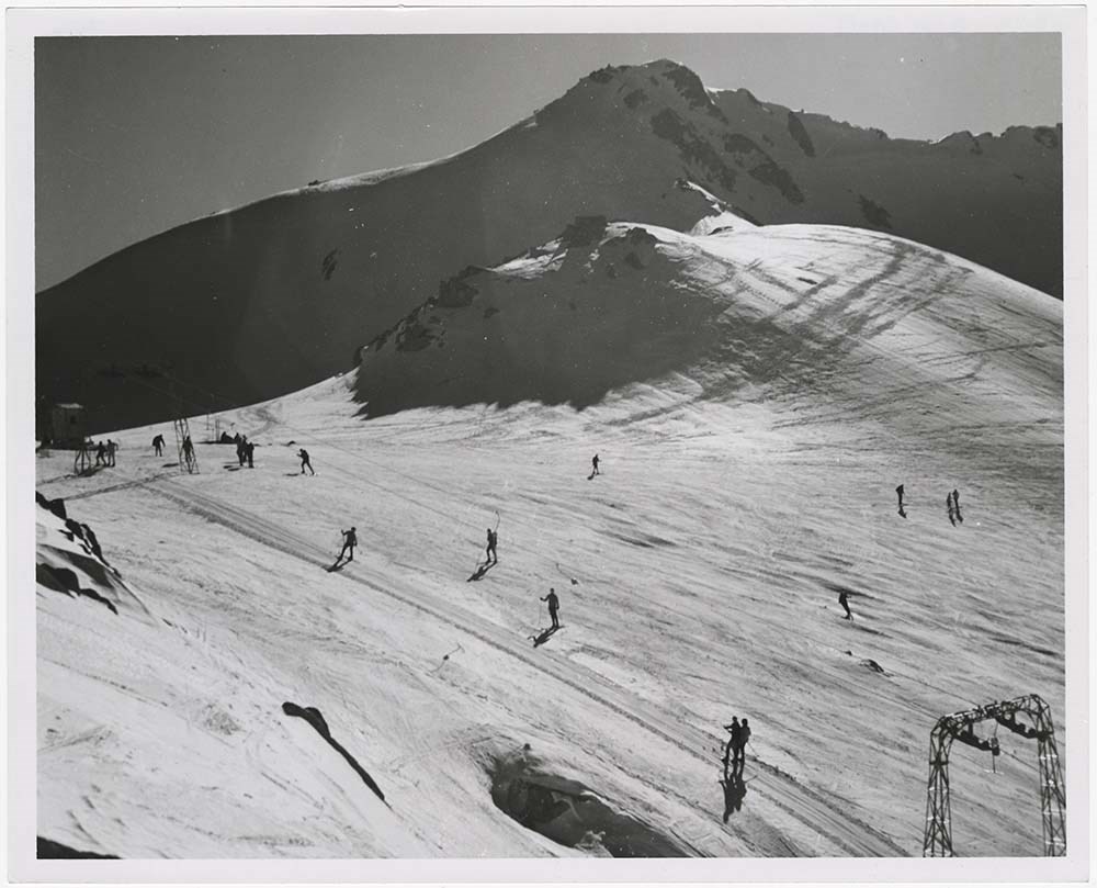
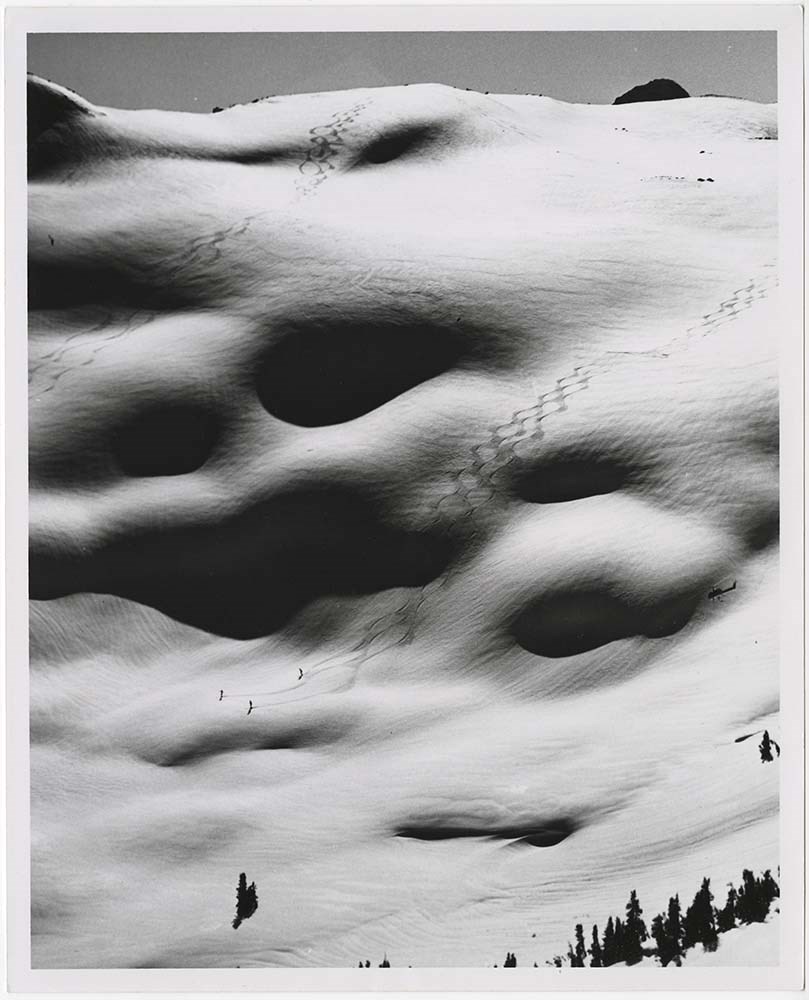
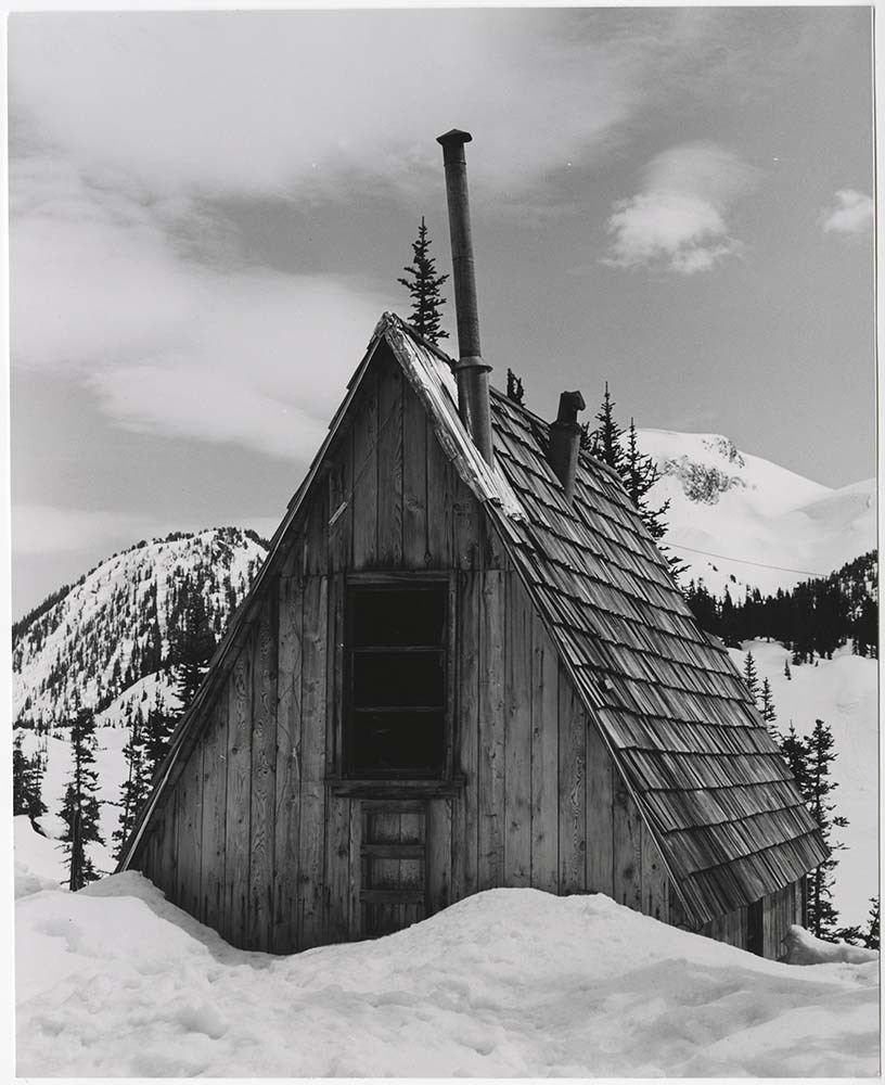
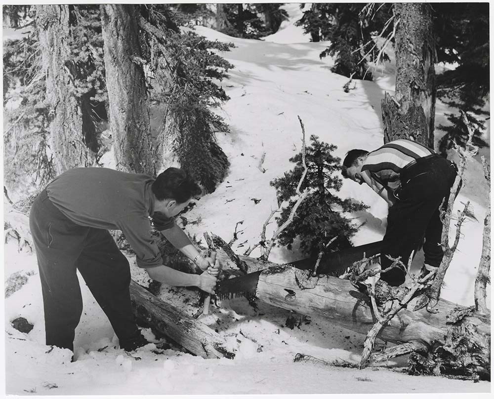
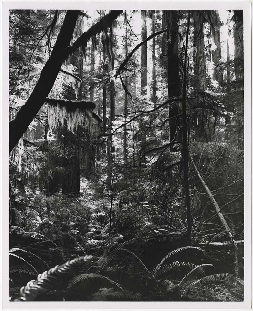
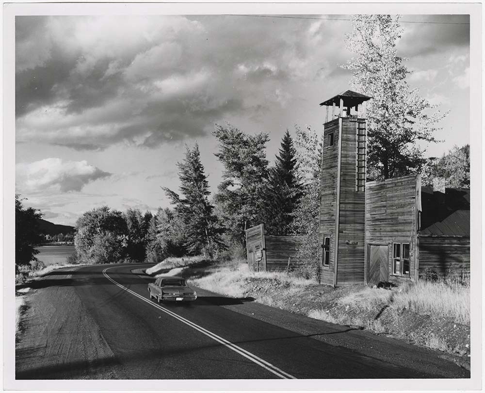
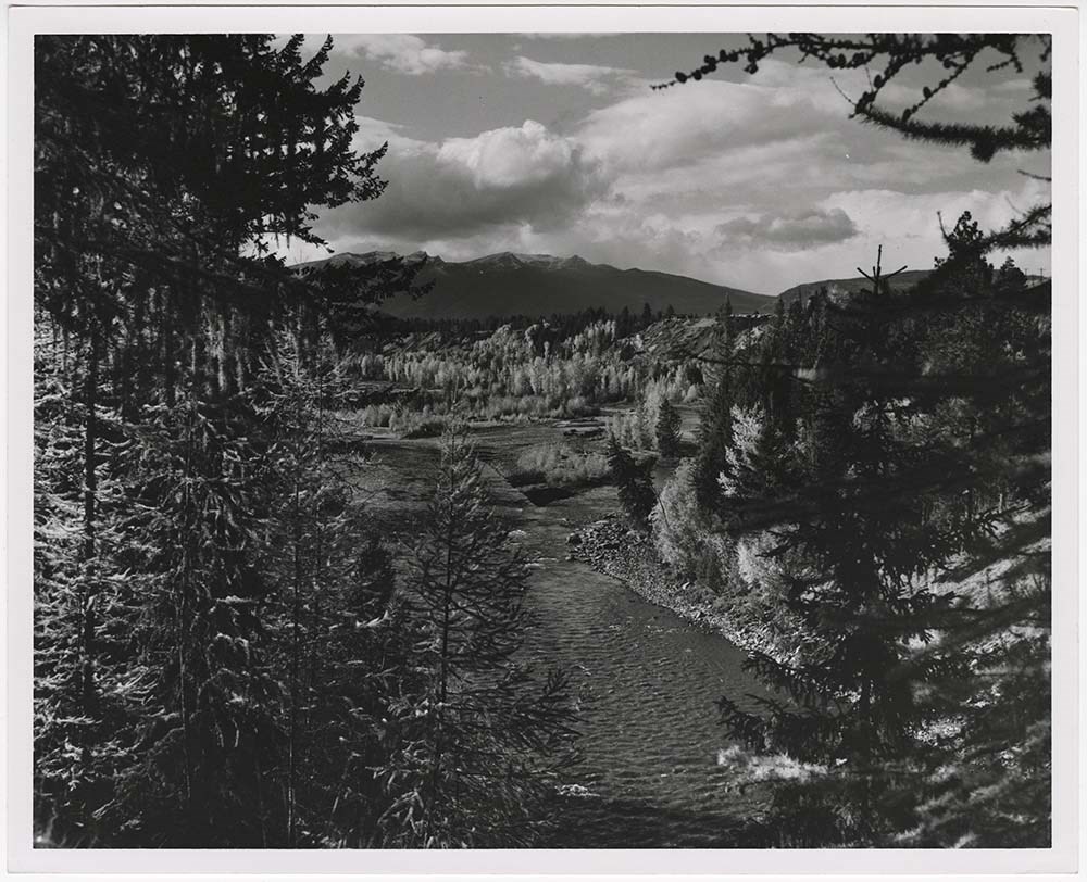
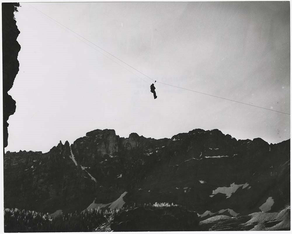
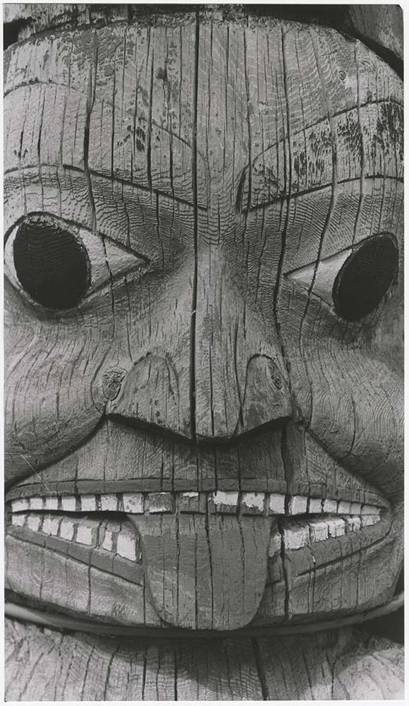
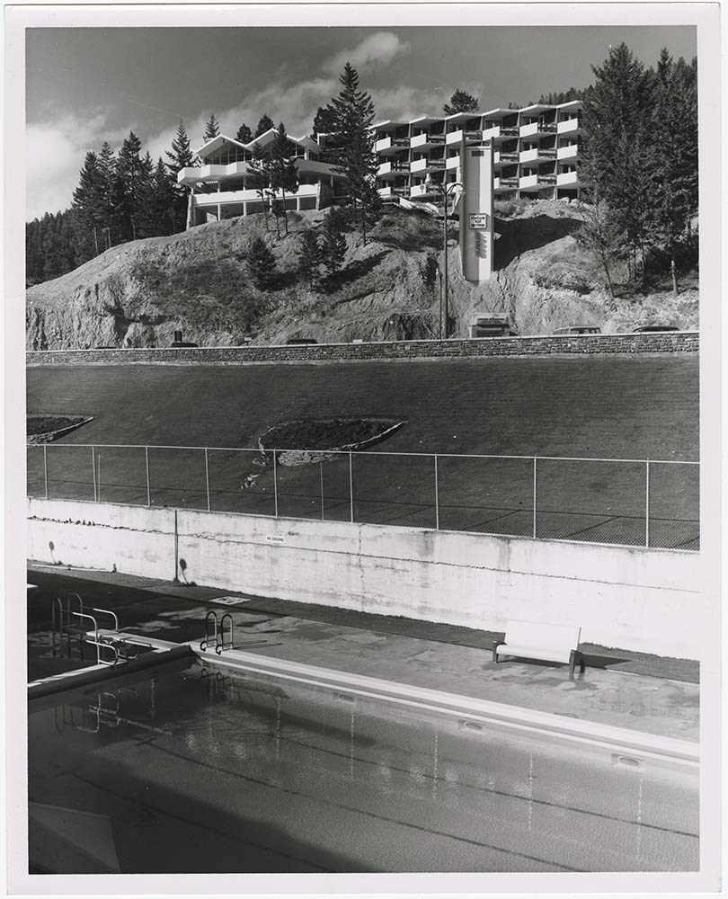
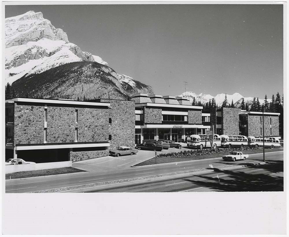
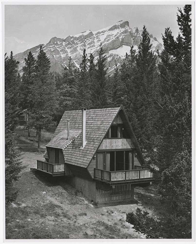
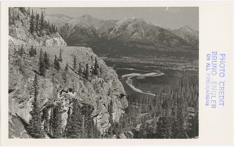
BC Scenic Views
https://archives.whyte.org/en/permalink/descriptions56777
- Part Of
- Bruno Engler fonds
- Scope & Content
- File pertains to 52 b&w prints of various scenic views around British Columbia. Includes views overlooking towns, skiing, beaches, A-frame cabins, highways, rivers, portraits, and the inner harbour & Empress Hotel in Victoria.
- Date Range
- [ca. 1959-1965]
- Reference Code
- V190 / VI / B / v / PA - 01 to PA - 52
- Description Level
- 5 / File
- GMD
- Photograph
14 images
- Part Of
- Bruno Engler fonds
- Description Level
- 5 / File
- Fonds Number
- M323 / S40 / V190
- Series
- VI : Retained file, B : Alphabetical order
- Sous-Fonds
- V190
- Sub-Series
- v : BC Scenic Views
- Accession Number
- 7436
- Reference Code
- V190 / VI / B / v / PA - 01 to PA - 52
- GMD
- Photograph
- Date Range
- [ca. 1959-1965]
- Physical Description
- 52 photographs : b&w ; 25.2 x 20.2 cm or smaller
- History / Biographical
- See fonds level description
- Scope & Content
- File pertains to 52 b&w prints of various scenic views around British Columbia. Includes views overlooking towns, skiing, beaches, A-frame cabins, highways, rivers, portraits, and the inner harbour & Empress Hotel in Victoria.
- Subject Access
- Activities
- Architecture
- Backcountry skiing
- Boats
- Buildings
- Empress Hotel
- Environment and Nature
- Family and personal life
- Glaciers
- Landscape
- Mountains
- Personal and Professional Life
- Portrait
- Rivers
- Roads
- Scenery
- Ship
- Ski areas
- Skiing
- Sports and leisure
- Totem pole
- Winter sports
- Geographic Access
- Victoria
- British Columbia
- Language
- English
- Creator
- Engler, Bruno
- Title Source
- Original title kept
- Processing Status
- Processed
Images


This material is presented as originally created; it may contain outdated cultural descriptions and
potentially offensive content.
Read more.
Bradford - Biofile
https://archives.whyte.org/en/permalink/catalogue25566
- Subjects
- Buildings
- Development
- Roads
- Tourism
- Town of Banff
- Notes
- 7 copyprints of views of Banff tsken by Alison's uncle on a visit from South Calgary
- Accession Number
- 8147
- Call Number
- Bio-file : Bradford
- Collection
- Archives Library
This material is presented as originally created; it may contain outdated cultural descriptions and
potentially offensive content.
Read more.
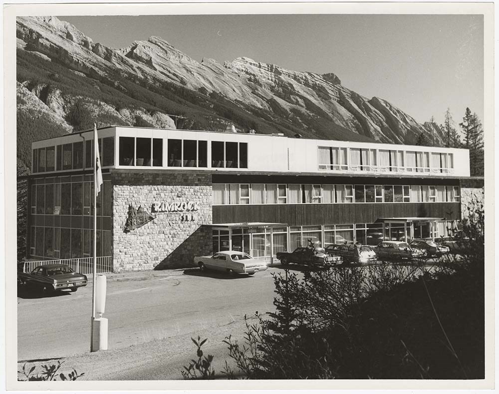
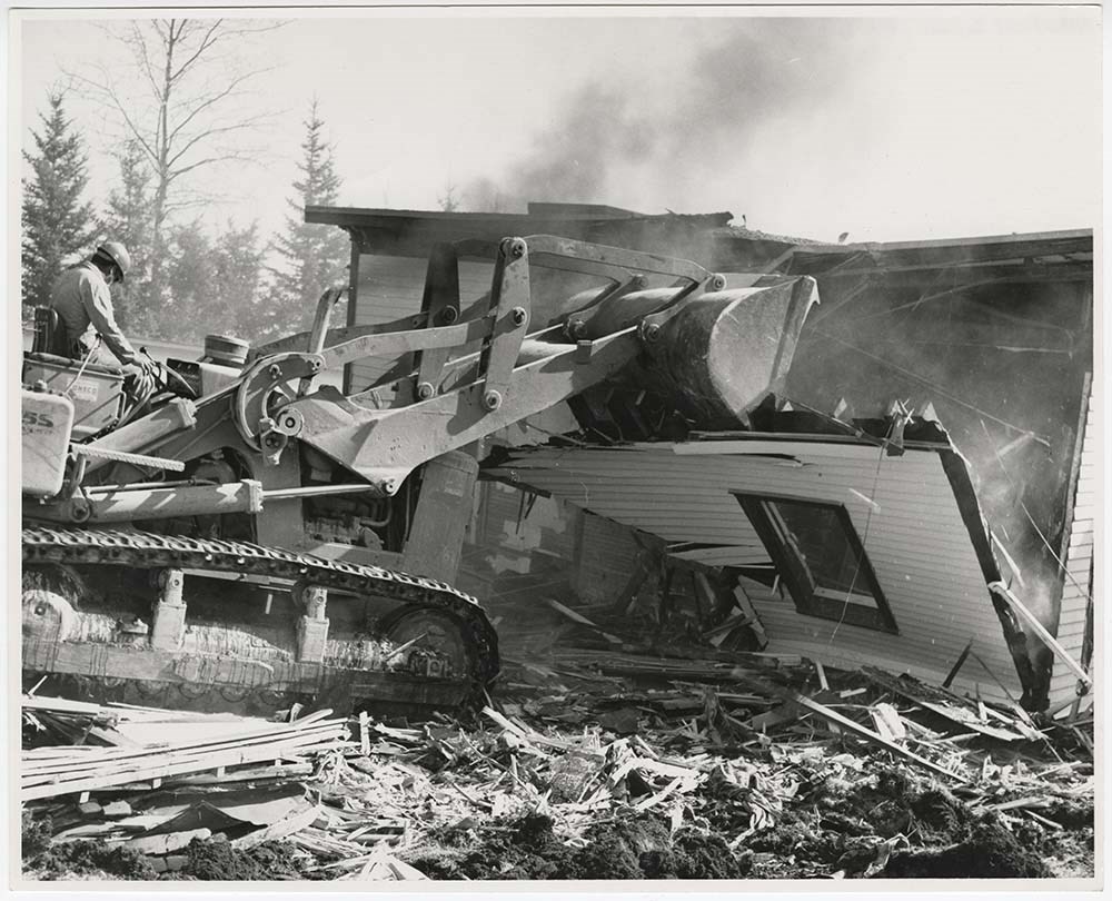
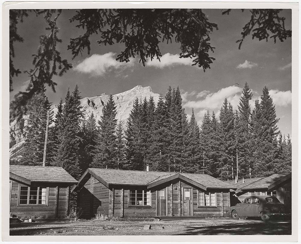
Buildings and Hotels
https://archives.whyte.org/en/permalink/descriptions56793
- Part Of
- Bruno Engler fonds
- Scope & Content
- File pertains to 68 b&w prints of various buildings' interiors and exteriors around Banff, Edmonton, Radium, and Wapta. Includes St. Paul's Presbyterian Church, Mineral Springs Hospital (located on the south side of the Bow River), the Voyager Inn, the Rimrock Inn, the Parks Canada Administration B…
- Date Range
- [ca. 1960-1977]
- Reference Code
- V190 / VI / B / vii / PA - 01 to PA - 68
- Description Level
- 5 / File
- GMD
- Photograph
10 images
- Part Of
- Bruno Engler fonds
- Description Level
- 5 / File
- Fonds Number
- M323 / S40 / V190
- Series
- VI : Retained file, B : Alphabetical order
- Sous-Fonds
- V190
- Sub-Series
- vii : Buildings and Hotels
- Accession Number
- 7436
- Reference Code
- V190 / VI / B / vii / PA - 01 to PA - 68
- GMD
- Photograph
- Date Range
- [ca. 1960-1977]
- Physical Description
- 68 photographs : b&w ; 25.2 x 20.2 cm or smaller
- History / Biographical
- See fonds level description
- Scope & Content
- File pertains to 68 b&w prints of various buildings' interiors and exteriors around Banff, Edmonton, Radium, and Wapta. Includes St. Paul's Presbyterian Church, Mineral Springs Hospital (located on the south side of the Bow River), the Voyager Inn, the Rimrock Inn, the Parks Canada Administration Building, Num-ti-Jaw Lodge, the lobby of the Bank of Montreal, various unidentified houses (both intact and being demolished), a federal building in Edmonton, the Radium Hot Springs Inn, the Wapta Inn, alters and shrines (interior and exterior), and the interiors of various hotels - including public spaces and rooms.
- Subject Access
- Buildings
- Businesses
- Cabins
- Churches
- Hot Springs
- Hotels
- Government
- Mountains
- Parks Canada
- Rivers
- Roads
- Winter
- Geographic Access
- Banff
- Lake Louise
- Banff National Park
- Edmonton
- Alberta
- Radium
- British Columbia
- Language
- English
- Related Material
- V190 / VI / B / vii / NA - 01 to NA - 04
- Creator
- Engler, Bruno
- Title Source
- Original title kept
- Processing Status
- Processed
Images

This material is presented as originally created; it may contain outdated cultural descriptions and
potentially offensive content.
Read more.
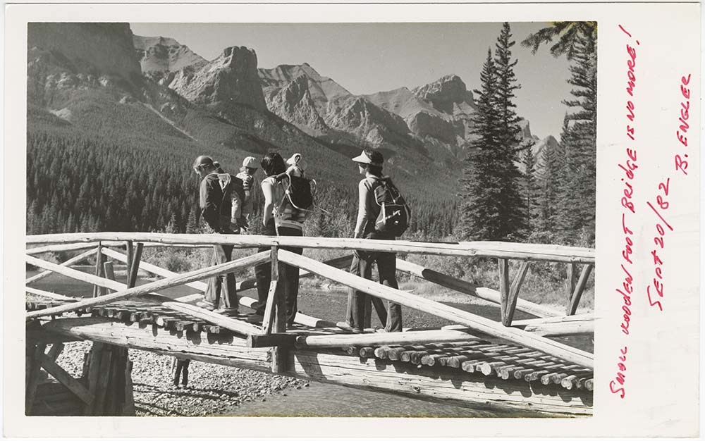
Canmore, Alta.
https://archives.whyte.org/en/permalink/descriptions56861
- Part Of
- Bruno Engler fonds
- Scope & Content
- File pertains to 36 b&w prints of the Canmore area. Includes scenic views of trails, rivers, and mountains, people hiking, a child feeding ducks, and buildings.
- Date Range
- 1982-1998
- Reference Code
- V190 / VI / C / ii / PA - 01 to PA - 36
- Description Level
- 5 / File
- GMD
- Photograph
7 images
- Part Of
- Bruno Engler fonds
- Description Level
- 5 / File
- Fonds Number
- M323 / S40 / V190
- Series
- VI : Retained file, C : Alphabetical order
- Sous-Fonds
- V190
- Sub-Series
- ii : Canmore, Alta.
- Accession Number
- 7436
- Reference Code
- V190 / VI / C / ii / PA - 01 to PA - 36
- GMD
- Photograph
- Date Range
- 1982-1998
- Physical Description
- 36 photographs : b&w ; 25.2 x 20.2 cm or smaller
- History / Biographical
- See fonds level description
- Scope & Content
- File pertains to 36 b&w prints of the Canmore area. Includes scenic views of trails, rivers, and mountains, people hiking, a child feeding ducks, and buildings.
- Geographic Access
- Canmore
- Alberta
- Language
- English
- Creator
- Engler, Bruno
- Title Source
- Original title kept
- Processing Status
- Processed
Images


This material is presented as originally created; it may contain outdated cultural descriptions and
potentially offensive content.
Read more.
Canmore, Alta. - negatives
https://archives.whyte.org/en/permalink/descriptions56868
- Part Of
- Bruno Engler fonds
- Scope & Content
- File pertains to 31 b&w negatives of the Canmore area. Includes scenic views of trails, rivers, and mountains, people hiking, and buildings.
- Date Range
- 1982-1998
- Reference Code
- V190 / VI / C / ii / NA - 01 to NA - 06
- Description Level
- 5 / File
- GMD
- Film
- Negative
- Part Of
- Bruno Engler fonds
- Description Level
- 5 / File
- Fonds Number
- M323 / S40 / V190
- Series
- VI : Retained file, C : Alphabetical order
- Sous-Fonds
- V190
- Sub-Series
- ii : Canmore, Alta.
- Accession Number
- 7436
- Reference Code
- V190 / VI / C / ii / NA - 01 to NA - 06
- Date Range
- 1982-1998
- Physical Description
- 31 photographs : b&w negatives ; 6.1 x 18.8 cm or smaller
- History / Biographical
- See fonds level description
- Scope & Content
- File pertains to 31 b&w negatives of the Canmore area. Includes scenic views of trails, rivers, and mountains, people hiking, and buildings.
- Geographic Access
- Canmore
- Alberta
- Language
- English
- Creator
- Engler, Bruno
- Title Source
- Original title kept
- Processing Status
- Processed
This material is presented as originally created; it may contain outdated cultural descriptions and
potentially offensive content.
Read more.
Columbia River Highway Views
https://archives.whyte.org/en/permalink/descriptions54985
- Part Of
- Luxton family fonds
- Scope & Content
- File consists of 19 postcard prints by company Cross & Dimmitt depicting views of the Columbia River Highway in Portland, Oregon and the surrounding region [ca.1918-1925]. File also contains original storage envelope for postcards.
- Date Range
- [1918-1925]
- Reference Code
- LUX / I / E4 / PA - 286 to 304
- Description Level
- 5 / File
- GMD
- Postcard
- Part Of
- Luxton family fonds
- Description Level
- 5 / File
- Fonds Number
- LUX
- Series
- LUX / I / E : Collected material
- Sous-Fonds
- LUX / I : Norman Luxton sous-fonds
- Sub-Series
- LUX / I / E4 : Photographs
- Accession Number
- LUX
- Reference Code
- LUX / I / E4 / PA - 286 to 304
- Responsibility
- Postcards produced by Cross & Dimmitt
- Date Range
- [1918-1925]
- Physical Description
- 19 postcards : b&w ; 14 x 9 cm
- Scope & Content
- File consists of 19 postcard prints by company Cross & Dimmitt depicting views of the Columbia River Highway in Portland, Oregon and the surrounding region [ca.1918-1925]. File also contains original storage envelope for postcards.
- Notes
- Specific dates unknown; date range is estimate based on production era, content and format of postcards.
- Subject Access
- Aerial photography
- Columbia River Highway
- Landscapes
- Postcards
- Businesses
- Transportation
- Travel
- Roads
- Geographic Access
- United States of America
- Oregon
- Portland
- Language
- English
- Conservation
- Items stored in mylar; original envelope stored in separate mylar sheet in same folder
- Title Source
- Original title of contents used for file
- Processing Status
- Processed
This material is presented as originally created; it may contain outdated cultural descriptions and
potentially offensive content.
Read more.
Family walks and hikes in the Canadian Rockies. Volume 1 : Bragg Creek - Kananaskis - Bow Valley - Banff National Park
https://archives.whyte.org/en/permalink/catalogue25204
- Medium
- Library - Book (including soft-cover and pamphlets)
- Published Date
- 2019
- Author
- Nugara, Andrew
- Publisher
- [Victoria, BC] : Rocky Mountain Books Ltd.
- Call Number
- 02.6 N89f Vol. 1
1 website
- Author
- Nugara, Andrew
- Responsibility
- Andrew Nugara
- Publisher
- [Victoria, BC] : Rocky Mountain Books Ltd.
- Published Date
- 2019
- Physical Description
- xx, 156 pages) : color illustrations, color maps
- Subjects
- Hiking
- Travel
- Banff National Park
- Kootenay National Park
- Highways
- Highways - Alberta
- Kananaskis Country
- Maps
- Lake Louise
- Lake Louise - Roads & Trails
- Abstract
- Family Walks and Hikes is an exciting new series of books written specifically for outdoor enthusiasts of all ages and abilities. These accurate, attractive guides feature expertly curated routes, informative maps, and colour photographs. The first book for the Canadian Rockies in the series brings together an inspiring collection of comfortable walks and spectacular hikes for visitors and locals looking for unique, guided wanderings in a number of diverse locations in the Rockies, including: Elbow Falls Powderface Ridge Troll Falls Elbow Lake Grotto Canyon Grassi Lakes Tunnel Mountain Johnston Canyon Stanley Glacier Plain Of Six Glaciers Bow Summit Ranging from charmingly easy to moderately challenging, these hikes are all accessible from reliable roads and popular staging areas. In addition, each hike is accompanied by a clear, colourful map, step by step directions, and full-colour photographs. Each route includes: detailed directions to trailheads colour maps and photographs seasonal information round-trip distances trail commentary difficulty ratings (from Rocky Mountain Books website)
- Contents
- Introduction
- Area Maps
- Highway 66, The Elbow
- Highway 40 South, Kananaskis Trail
- Highway 1, Bow Valley, Canmore, Highway 742 South
- Banff
- Kootenay National Park
- Lake Louise
- Icefield Parkway (Highway 93 North(
- Important Contacts
- Acknowledgements
- ISBN
- 9781771602242
- Accession Number
- P2020.07
- Call Number
- 02.6 N89f Vol. 1
- Collection
- Archives Library
- URL Notes
- Publishers website
Websites
This material is presented as originally created; it may contain outdated cultural descriptions and
potentially offensive content.
Read more.