Narrow Results By
Copy of Profile of Canadian Pacific Railway main line Winnipeg to Vancouver, Manitoba, Assiniboia, Alberta, British Columbia
https://archives.whyte.org/en/permalink/catalogue21507
- Subjects
- Selkirk Range - B.C.
- Notes
- Accompanies The Selkirk Range by A.O. Wheeler
- Shows miles from Montreal
- Altitudes above sea level
- Accession Number
- 1039
- Call Number
- C12-2.7
- Collection
- Archives Library
This material is presented as originally created; it may contain outdated cultural descriptions and
potentially offensive content.
Read more.
The Great Glacier of the Selkirks
https://archives.whyte.org/en/permalink/catalogue24915
- Medium
- Library - Book (including soft-cover and pamphlets)
- Published Date
- 1889
- Author
- Ingersoll, Ernest
- Publisher
- Harper's Weekly
- Call Number
- 02.6 In4t PAM O.S.
- Author
- Ingersoll, Ernest
- Responsibility
- Ernest Ingersoll
- Publisher
- Harper's Weekly
- Published Date
- 1889
- Subjects
- Glaciers
- Selkirk Mountains
- Selkirk Mountains - Hermit Range
- Selkirk Range
- Selkirk Range - B.C.
- Hotels
- Canadian Pacific Railway
- Canadian Pacific Railway Company
- Canadian Pacific Railway Hotels
- Travel
- Tourism
- Geography
- Illecillewaet Glacier
- Abstract
- Pertains to the Selkirk Mountains, Illecillewaete Glacier, Glacier Creek, Sir Donald, the hotel and Canadian Pacific Railway access to the area as of 1889.
- Notes
- In Harper's Weekly, Vol. XXXIII No. 1702, August 3, 1889, pp. 616 - 618
- Accession Number
- 7890
- Call Number
- 02.6 In4t PAM O.S.
- Collection
- Archives Library
This material is presented as originally created; it may contain outdated cultural descriptions and
potentially offensive content.
Read more.
Map of the Selkirks from a photographic survey by A.O. Wheeler assisted by H.G. Wheeler and M.P. Bridgland
https://archives.whyte.org/en/permalink/catalogue21502
- Medium
- Library - Maps and blueprints (unannotated; published)
- Map
- Published Date
- 1901-02
- Publisher
- Dept. of the Interior
- Call Number
- C12-2.1
- Publisher
- Dept. of the Interior
- Published Date
- 1901-02
- Series
- From Volume II/The Selkirk Range
- Subjects
- Selkirk Range - B.C.
- Accession Number
- 1039
- Call Number
- C12-2.1
- Collection
- Archives Library
This material is presented as originally created; it may contain outdated cultural descriptions and
potentially offensive content.
Read more.
Part of the Selkirk Range to illustrate the climbing done in 1890 from Glacier House
https://archives.whyte.org/en/permalink/catalogue24801
- Scale
- 2 miles - 1 inch
- Series
- From Volume II. The Selkirk Range by A.O. Wheeler
- Subjects
- Selkirk Range - B.C.
- Notes
- From Surveys and photographs by Messrs. Emil Huber and Harold W. Toopham (42 references, mtns. glaciers etc.)
- Accession Number
- 1039
- 4013
- Call Number
- C12-2.4
- Collection
- Archives Library
This material is presented as originally created; it may contain outdated cultural descriptions and
potentially offensive content.
Read more.
[Selkirk Range - B.C.]
https://archives.whyte.org/en/permalink/catalogue21503
- Medium
- Library - Maps and blueprints (unannotated; published)
- Map
- Published Date
- June 15th, 1906
- Publisher
- Topographical Surveys Branch
- Call Number
- C12-2.2
- Publisher
- Topographical Surveys Branch
- Published Date
- June 15th, 1906
- Series
- Included in volume II/ The Selkirk Range
- Subjects
- Selkirk Range - B.C.
- Notes
- Ranges 25, 26,
- Tp 23, 25, 26, 27
- Accession Number
- 1039
- Call Number
- C12-2.2
- Collection
- Archives Library
This material is presented as originally created; it may contain outdated cultural descriptions and
potentially offensive content.
Read more.
[Selkirk Range - B.C.]
https://archives.whyte.org/en/permalink/catalogue21504
- Series
- From A.O. Wheeler's The Selkirk Range volume II
- Subjects
- Selkirk Range - B.C.
- Notes
- Ranges 24, 25, 26, 27
- Tp. 27, 28, 29, 30
- Accession Number
- 1039
- Call Number
- C12-2.3
- Collection
- Archives Library
This material is presented as originally created; it may contain outdated cultural descriptions and
potentially offensive content.
Read more.
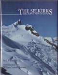
The Selkirks - Nelson's Mountains
https://archives.whyte.org/en/permalink/catalogue20153
- Medium
- Library - Book (including soft-cover and pamphlets)
- Published Date
- 1984
- Author
- Garden, J.F.
- Publisher
- Revelstoke, BC : Footprint
- Call Number
- F1089 G37 S45
- Author
- Garden, J.F.
- Responsibility
- J.F. Garden (author), William Lowell Putnman (introduction)
- Publisher
- Revelstoke, BC : Footprint
- Published Date
- 1984
- Physical Description
- 143 pages : chiefly color illustrations
- Subjects
- Mountains
- Selkirk Mountains
- Selkirk Range
- Selkirk Range - B.C.
- Purcell Mountains
- Purcell Range
- Bugaboos
- Expeditions
- Asulkan Glacier
- Clubs
- Photography
- Geography
- Abstract
- Features the photography of Glen Boles, Fred Duchman, Roger Laurilla, Jim Maitre, Mike Pirnke, Dust Veideman with text by J.F. Garden pertaining to the Selkirk Mountains
- Contents
- Foreward
- Introduction by W.L. Putnam
- I Nelson's Mountains
- II Purcells - Conrad Icefield, Bugaboos, Lake of the Hanging Glaciers
- III Southern Selkirks - Valhalla, The Battle Range, An Expedition, Asulkan Pass, Bivouac!
- IV Norther Selkirks - Clachnacudainn, Founding of the "Club", Balu Pass, The Major's Mountain, Conquering Mermaid, Mt. Sir Sandford and the Adamants
- V Bibliography
- VI Notes
- Notes
- Signed by author - addressed to Margaret Gmoser
- ISBN
- 0969162103
- Accession Number
- AC637
- Call Number
- F1089 G37 S45
- Collection
- Alpine Club of Canada Library
This material is presented as originally created; it may contain outdated cultural descriptions and
potentially offensive content.
Read more.
Sketch showing ascent of Swiss Peak and Rogers Peak
https://archives.whyte.org/en/permalink/catalogue21506
- Subjects
- Selkirk Range - B.C.
- Notes
- Made from a photograph taken from Tupper Crest
- Herr Carl Sulzer's route in 1890
- Abbott, Thompson and Little's route 1896
- Topo Survey route 1901 shown
- Accession Number
- 1039
- Call Number
- C12-2.6
- Collection
- Archives Library
This material is presented as originally created; it may contain outdated cultural descriptions and
potentially offensive content.
Read more.
Sketch showing ascents of Mt. Sir Donald and Uto Peak made from a photograph from Abbott Ridge
https://archives.whyte.org/en/permalink/catalogue21505
- Series
- From volume II The Selkirk Rane by A.O. Wheeler
- Subjects
- Selkirk Range - B.C.
- Notes
- Shows routes followed by Huber and Sulzer, 1890; Green & Leprince-Ringuet in 1888-1899
- Shows camps no 1 and 2. Green's camp
- Accession Number
- 1039
- 4013
- Call Number
- C12-2.5
- Collection
- Archives Library
This material is presented as originally created; it may contain outdated cultural descriptions and
potentially offensive content.
Read more.