Narrow Results By
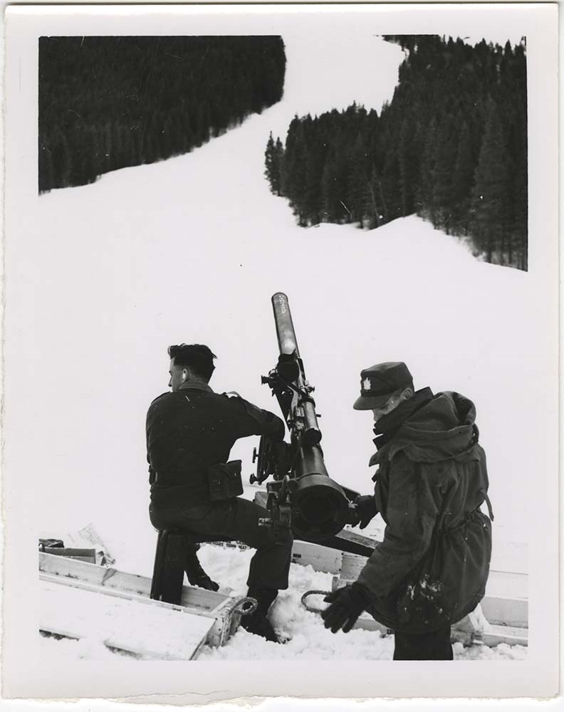
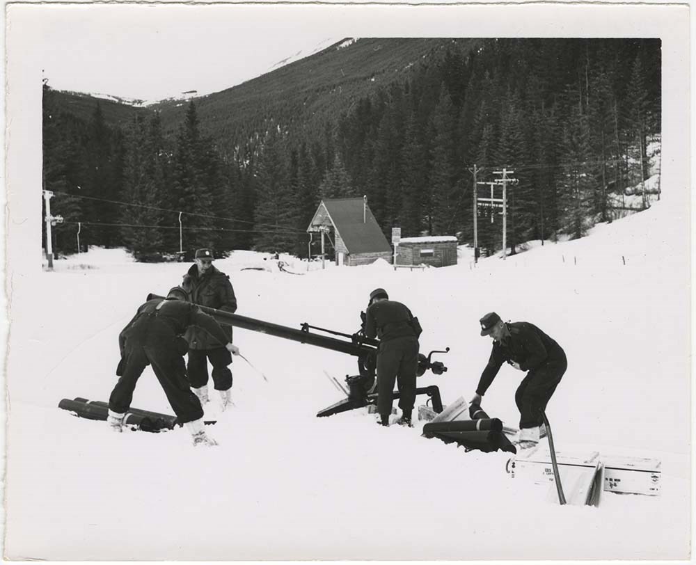
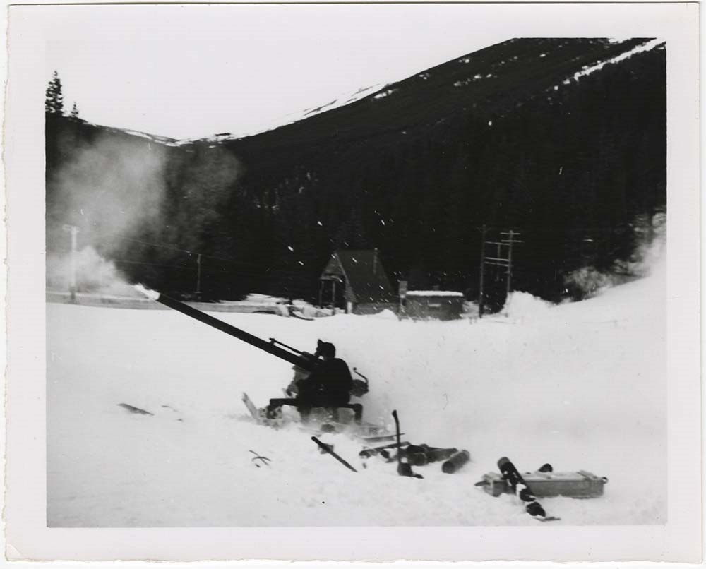
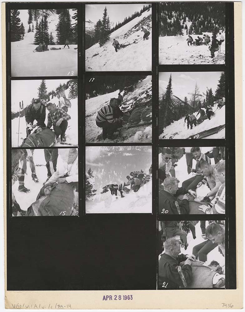
Avalanche Control [1/2]
https://archives.whyte.org/en/permalink/descriptions56748
- Part Of
- Bruno Engler fonds
- Scope & Content
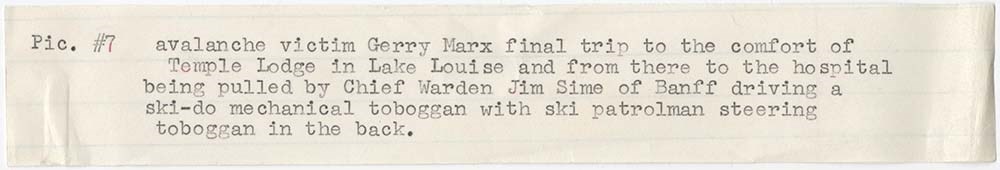
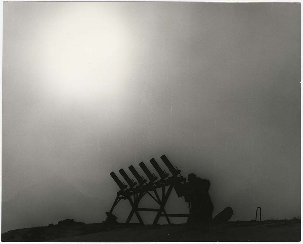
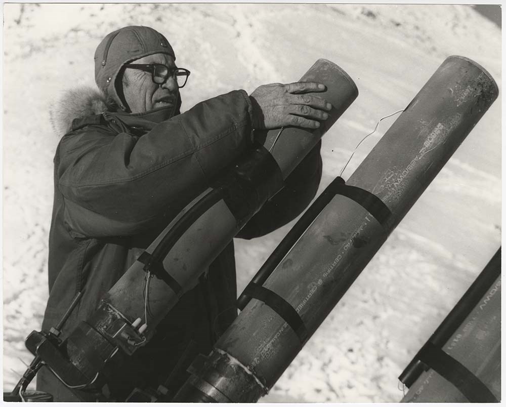
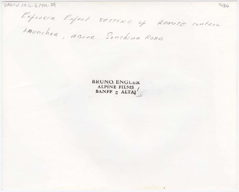
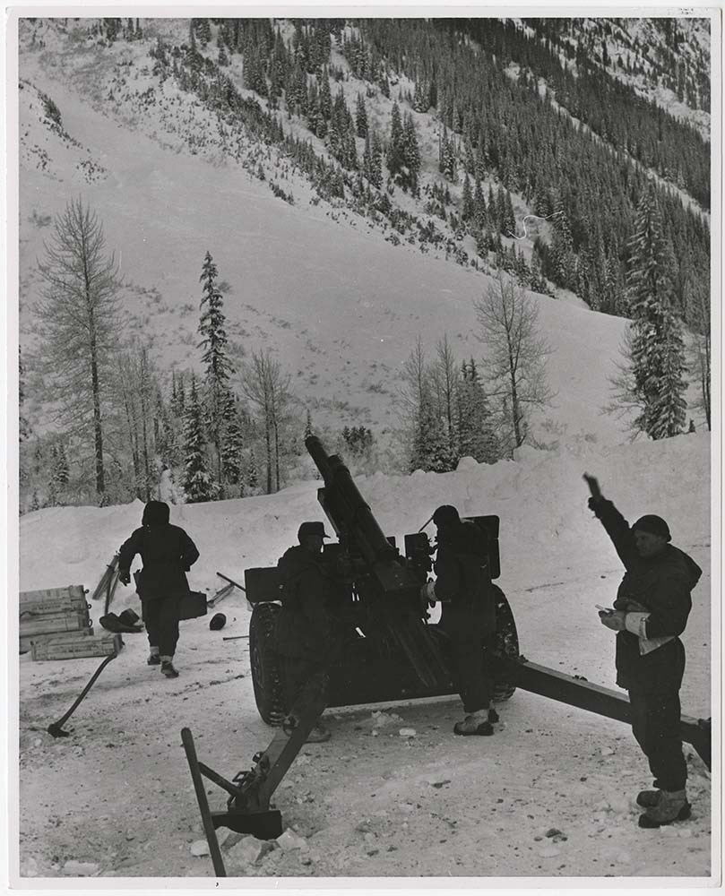
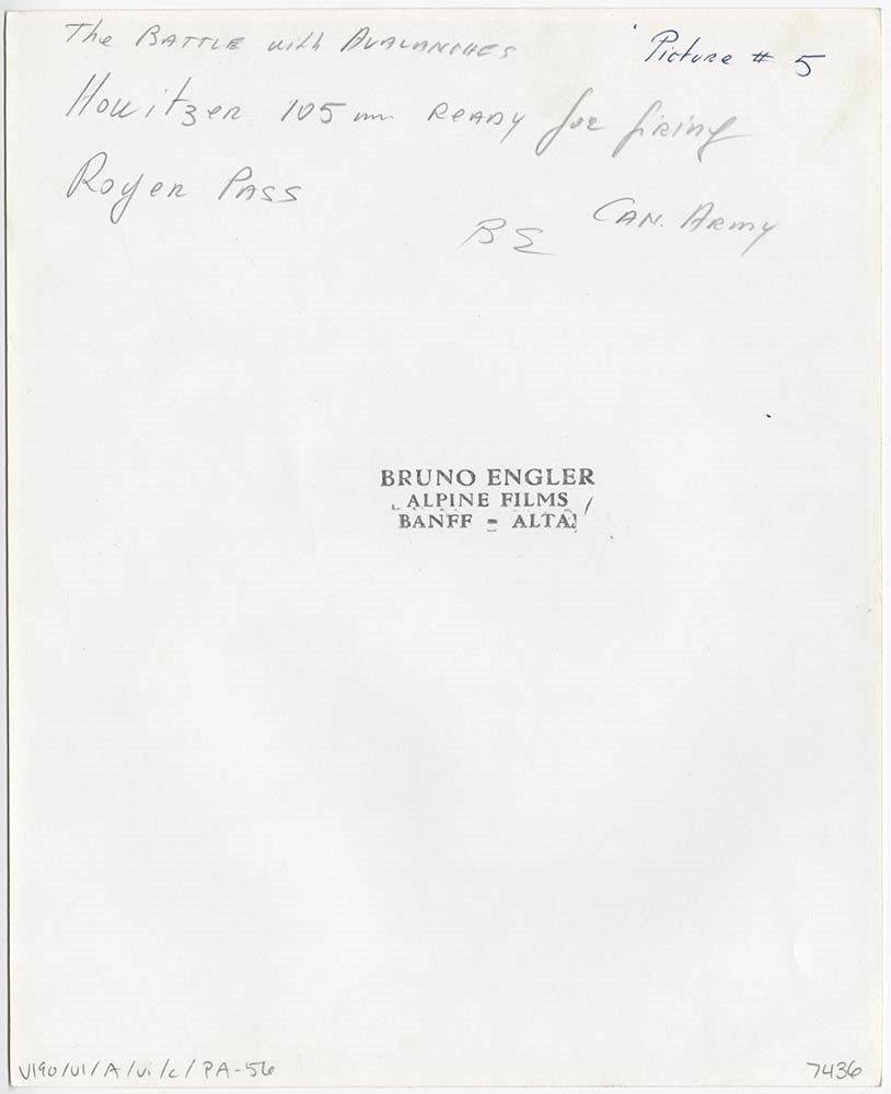
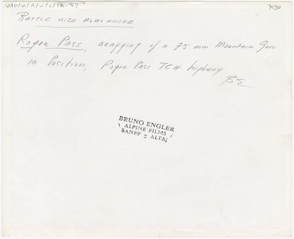
- File pertains to 62 b&w prints of various avalanche control operations around Banff National Park, usually along highways and around ski hills. Also includes photographs from a rescue operation and accompanying news clippings pertaining to that rescue.
- Date Range
- 1956-1979
- Reference Code
- V190 / VI / A / vi / c / PA - 01 to PA - 62
- Description Level
- 5 / File
- GMD
- Photograph
17 images
- Part Of
- Bruno Engler fonds
- Description Level
- 5 / File
- Fonds Number
- M323 / S40 / V190
- Series
- VI : Retained file, A : Alphabetical order
- Sous-Fonds
- V190
- Sub-Series
- vi : Avalanches, c : Control
- Accession Number
- 7436
- Reference Code
- V190 / VI / A / vi / c / PA - 01 to PA - 62
- GMD
- Photograph
- Date Range
- 1956-1979
- Physical Description
- 62 photographs : b&w ; 20.3 x 25.4 cm or smaller
- History / Biographical
- See fonds level description
- Scope & Content
- File pertains to 62 b&w prints of various avalanche control operations around Banff National Park, usually along highways and around ski hills. Also includes photographs from a rescue operation and accompanying news clippings pertaining to that rescue.
- Notes
- Photographs included in this entry were originally housed in a photo paper box identified by Bruno Engler prior to accessioning.
- Subject Access
- Aerial photography
- Avalanches
- Banff-Jasper Highway
- Lake Louise Ski Area
- Mountains
- Rescue
- Rogers Pass
- Ski areas
- Sunshine Ski Resort
- Winter
- Geographic Access
- Banff National Park
- Jasper National Park
- Alberta
- Language
- English
- Conservation
- PA - 25 has two overlapping pieces of masking tape on the back, holding the two torn pieces of the print together
- Creator
- Engler, Bruno
- Title Source
- Original title kept
- Processing Status
- Processed
Images


This material is presented as originally created; it may contain outdated cultural descriptions and
potentially offensive content.
Read more.
Avalanche Control [2/2]
https://archives.whyte.org/en/permalink/descriptions57495
- Part Of
- Bruno Engler fonds
- Scope & Content
- File pertains to 6 boards with b&w negative contact sheets adhered to them depicting various areas prone to avalanches taken from a plane or helicopter. Includes views of ski areas and roads.
- Date Range
- 1956-1979
- Reference Code
- V190 / VI / A / vi / c / PA - 63 to PA - 68
- Description Level
- 5 / File
- GMD
- Photograph
- Part Of
- Bruno Engler fonds
- Description Level
- 5 / File
- Fonds Number
- M323 / S40 / V190
- Series
- VI : Retained file, A : Alphabetical order
- Sous-Fonds
- V190
- Sub-Series
- vi : Avalanches, c : Control
- Accession Number
- 7436
- Reference Code
- V190 / VI / A / vi / c / PA - 63 to PA - 68
- GMD
- Photograph
- Date Range
- 1956-1979
- Physical Description
- 6 photographs : b&w ; 23.4 x 34.2 cm or smaller
- History / Biographical
- See fonds level description
- Scope & Content
- File pertains to 6 boards with b&w negative contact sheets adhered to them depicting various areas prone to avalanches taken from a plane or helicopter. Includes views of ski areas and roads.
- Notes
- File came from box XVI, separate from alphabetised boxes
- Subject Access
- Aerial photography
- Avalanches
- Banff-Jasper Highway
- Lake Louise Ski Area
- Mountains
- Rescue
- Rogers Pass
- Ski areas
- Sunshine Ski Resort
- Winter
- Geographic Access
- Banff National Park
- Jasper National Park
- Alberta
- Language
- English
- Creator
- Engler, Bruno
- Title Source
- Original title kept
- Processing Status
- Processed
This material is presented as originally created; it may contain outdated cultural descriptions and
potentially offensive content.
Read more.
Identified Summit Records
https://archives.whyte.org/en/permalink/descriptions57799
- Part Of
- Alpine Club of Canada fonds
- Scope & Content
- Sub-series of identified summit registers and notes produced by the Alpine Club of Canada between 1930 and 2022. Summit records include entries from visitors to the various summits which pertain to individuals' hiking and climbing trips; details of specific events which occurred while at the summit…
- Date Range
- 1930-1931
- 1959-1968
- 1970-1989
- 1992 -2022
- Reference Code
- M200 / V / A
- Description Level
- 4 / Sub-series
- GMD
- Textual record
- Organization record
- Part Of
- Alpine Club of Canada fonds
- Description Level
- 4 / Sub-series
- Fonds Number
- M200
- V14
- S6
- Series
- M200 / V: Summit Records
- Sous-Fonds
- M200
- Sub-Series
- M200 / V / A: Identified Summit Records
- Accession Number
- accn. 2023.20 accn. 7779 accn. 2023.10 accn. 2014.8347 accn. 6465 accn. 8002 accn. 2020.05 accn. 2023.19 accn. 2014.8293 accn. 8119 accn. 2023.32 accn. 2023.41 accn. 6623 accn. 6062 accn. 2014.8318 accn. 6767 accn. 2014.8315 accn. 2014.8317 accn. 5680 accn. 2023.16 accn. 2018.9010 accn. 5396 accn. 6459 accn. 2014.8316 accn. 2023.18 accn. 5631 accn. 2013.8245 accn. 2014.8275 accn. 2023.06 accn. 2023.14 accn. 2023.17 accn. 5569 accn. 8113 accn. 6396 accn. 2024.20
- Reference Code
- M200 / V / A
- Responsibility
- Summit Registers and Notes produced by Alpine Club of Canada
- Date Range
- 1930-1931
- 1959-1968
- 1970-1989
- 1992 -2022
- Physical Description
- 97 cm of textual records 221 volumes
- Scope & Content
- Sub-series of identified summit registers and notes produced by the Alpine Club of Canada between 1930 and 2022. Summit records include entries from visitors to the various summits which pertain to individuals' hiking and climbing trips; details of specific events which occurred while at the summit, wildlife sightings, trail updates, and related topics. The sub-series is separated into individual identified summit records.
- Notes
- See file-level entries for inventories of identified summit registers and notes.
- Name Access
- Alpine Club of Canada
- Subject Access
- Alberta
- Alpine Club of Canada
- Backpacking
- Backcountry skiing
- Banff
- Banff National Park
- Bow Valley
- British Columbia
- Castle Mountain
- Cascade Mountain
- Centennial
- Climbing
- Club
- Cross-country skiing
- Description and travel
- Environment
- Environment and Nature
- Fortress Mountain
- Great Divide
- Hiking
- Kananaskis Country
- Mount Assiniboine
- Mount Logan
- Mountain
- Mountain guides
- Mountaineering
- Mountaineers
- Mountains
- Provincial parks and reserves
- Parks
- National parks and reserves
- Record keeping
- Ski area
- Ski areas
- Ski mountaineering
- Skiing
- Skis
- Skiers
- Snowshoes and snowshoeing
- Sports and leisure
- Sports and recreation
- Summit
- Trails
- Winter sports
- Geographic Access
- Canada
- Canadian Rocky Mountains
- Rocky Mountains
- Continental Divide
- Great Divide
- Alberta
- British Columbia
- Abbot Pass
- Mount Assiniboine
- Cascade Mountain
- Canmore
- Assiniboine
- Banff National Park
- Banff, Alberta
- Bugaboos
- Castle Mountain, AB
- Cathedral Mountain
- Glacier
- Jasper National Park
- Kananaskis Country
- Little Yoho Valley
- Mount Baldy
- Mount Baker
- Mount Cory
- Mount Edith
- Mount Lefroy
- Mount Norquay
- Mount Rundle
- Rundle Mountain
- Mount Temple
- Mount Victoria
- Mount Yamnuska
- Selkirks
- Yoho National Park
- Access Restrictions
- Restrictions may apply
- Reproduction Restrictions
- Contains personal information
- Language
- English
- Conservation
- Some records have been placed in mylar. Some record have mold, rust or water damage.
- Related Material
- M235
- Title Source
- Title based on contents of sub-series
- Processing Status
- Processed
This material is presented as originally created; it may contain outdated cultural descriptions and
potentially offensive content.
Read more.
Jasper Marmot Basin
https://archives.whyte.org/en/permalink/descriptions54813
- Part Of
- Murray Hay fonds
- Scope & Content
- File consists of 1 cm of textual records, 10 x 23.5 cm or smaller. File pertains to ski trail maps of Jasper Marmot Basin and ski area created by Murray Hay. File includes three brochures promoting the ski runs at Marmot Basin that each include a reproduced map by Hay.
- Date Range
- 2001-2003
- 2001
- 2003
- Reference Code
- M570 / III / B / iii / 1
- Description Level
- 5 / File
- GMD
- Map
- Textual record
- Published record
- Part Of
- Murray Hay fonds
- Description Level
- 5 / File
- Fonds Number
- M570 / V795
- Series
- M570 / III : Murray Hay portfolio (published material)
- Sous-Fonds
- M570
- Sub-Series
- M570 / III / B : Alberta / iii : Jasper
- Accession Number
- 2019.41
- Reference Code
- M570 / III / B / iii / 1
- Date Range
- 2001-2003
- 2001
- 2003
- Physical Description
- 1 cm of textual records (10 x 23.5 cm or smaller)
- Scope & Content
- File consists of 1 cm of textual records, 10 x 23.5 cm or smaller. File pertains to ski trail maps of Jasper Marmot Basin and ski area created by Murray Hay. File includes three brochures promoting the ski runs at Marmot Basin that each include a reproduced map by Hay.
- Name Access
- Hay, Murray
- Subject Access
- Ski Maps
- Skiing
- Ski areas
- Map
- Marmot Basin Ski Area
- Cartography
- Sports and recreation
- Tourism
- Tourist information
- Travel
- Winter
- Winter sports
- Advertising
- Artist
- Geographic Access
- Jasper
- Jasper Marmot Basin
- Jasper National Park
- Alberta
- Canada
- Canadian Rocky Mountains
- Language
- English
- Related Material
- V795 / II / B / i / 1
- Title Source
- Title based on contents of file
- Processing Status
- Processed
This material is presented as originally created; it may contain outdated cultural descriptions and
potentially offensive content.
Read more.
- Part Of
- Murray Hay fonds
- Scope & Content
- File consists of 2 prints : col. ; 35 x 28 cm. File pertains to Murray Hay's rendering of Marmot Basin ski area in Jasper National Park. File includes two iterations of reproduction draft prints of Hay's map of Marmot Basin.
- Date Range
- ca.1976-ca.2000
- Reference Code
- V795 / II / B / i / 1
- Description Level
- 5 / File
- GMD
- Map
- Private record
- Part Of
- Murray Hay fonds
- Description Level
- 5 / File
- Fonds Number
- M570 / V795
- Series
- V795 / II : Unpublished Material
- Sous-Fonds
- V795
- Sub-Series
- V795 / II / B : Alberta / i : Jasper National Park
- Accession Number
- 2019.41
- Reference Code
- V795 / II / B / i / 1
- GMD
- Map
- Private record
- Date Range
- ca.1976-ca.2000
- Physical Description
- 2 prints : col. ; 35 x 28 cm
- Scope & Content
- File consists of 2 prints : col. ; 35 x 28 cm. File pertains to Murray Hay's rendering of Marmot Basin ski area in Jasper National Park. File includes two iterations of reproduction draft prints of Hay's map of Marmot Basin.
- Name Access
- Hay, Murray
- Subject Access
- Advertising
- Artist
- Ski Maps
- Ski area
- Map
- Cartography
- Sports and recreation
- Tourism
- Tourist information
- Winter
- Winter sports
- Geographic Access
- Jasper Marmot Basin
- Jasper National Park
- Alberta
- Canada
- Canadian Rocky Mountains
- Language
- English
- Related Material
- M570 / III / B / iii / 1
- Creator
- Hay, Murray
- Title Source
- Title based on contents of file
- Processing Status
- Processed
This material is presented as originally created; it may contain outdated cultural descriptions and
potentially offensive content.
Read more.
Newspaper Clippings
https://archives.whyte.org/en/permalink/descriptions54745
- Part Of
- Murray Hay fonds
- Scope & Content
- File consists of 1 cm of textual material in the form of newspaper clippings, 32 x 60 cm or smaller. File pertains to the career of Murray Hay as a ski map artist. File documents Hay's wide-ranging success creating trail maps for ski resorts, particularly in Alberta and British Columbia, Canada (al…
- Date Range
- 1991
- 1993
- 1996
- 1998
- Reference Code
- M570 / I / 1
- Description Level
- 5 / File
- GMD
- Published record
- Textual record
- Newspaper clipping
- Part Of
- Murray Hay fonds
- Description Level
- 5 / File
- Fonds Number
- M570 / V795
- Series
- M570 / I : Newspaper Clippings
- Sous-Fonds
- M570
- Accession Number
- 2019.41
- Reference Code
- M570 / I / 1
- Date Range
- 1991
- 1993
- 1996
- 1998
- Physical Description
- 1 cm of textual records (32 x 60 cm or smaller)
- Scope & Content
- File consists of 1 cm of textual material in the form of newspaper clippings, 32 x 60 cm or smaller. File pertains to the career of Murray Hay as a ski map artist. File documents Hay's wide-ranging success creating trail maps for ski resorts, particularly in Alberta and British Columbia, Canada (although he made maps for ski resorts and other organizations internationally, particularly in the United States). File also includes interviews with Hay about his mapmaking process and style, successes, challenges (including the impact of technology on his work).
- 2020-02-14
- Notes
- Includes articles that were published in the Calgary Sun (January 17, 1991) and the Calgary Herald (March 11, 1993; March 2, 1996; April 16, 1998).
- Name Access
- Hay, Murray
- Subject Access
- Ski areas
- Skiing
- Sports and recreation
- Art
- Artist
- Map
- Ski Maps
- Activities
- Banff National Park
- Cartography
- Lake Louise Ski Area
- Landscapes
- Professional and Personal Life
- Winter
- Winter sports
- Whistler Blackcomb
- Newspaper
- Calgary Herald
- Calgary Sun
- Geographic Access
- Canada
- Canadian Rocky Mountains
- Alberta
- Banff National Park
- Jasper National Park
- British Columbia
- Calgary
- Language
- English
- Title Source
- Title based on contents of file
- Processing Status
- Processed
This material is presented as originally created; it may contain outdated cultural descriptions and
potentially offensive content.
Read more.
Powder Pioneers : Ski Stories from the Canadian Rockies and Columbia Mountains - sound recordings
https://archives.whyte.org/en/permalink/descriptions55075
- Part Of
- Chic Scott fonds
- Scope & Content
- Series consists of 23 interviews recorded between 1999 and 2009, which were used during the creation of the book Powder Pioneers : Ski Stories from the Canadian Rockies and Columbia Mountains.
- Date Range
- 1999 - 2009
- Reference Code
- S47 / IV
- Description Level
- 3 / Series
- GMD
- Sound recording
- Part Of
- Chic Scott fonds
- Description Level
- 3 / Series
- Fonds Number
- M57 / V40 / S47
- Series
- S47 / IV : Powder Pioneers : Ski Stories from the Canadian Rockies and Columbia Mountains
- Sous-Fonds
- S47
- Accession Number
- 8110
- Reference Code
- S47 / IV
- GMD
- Sound recording
- Date Range
- 1999 - 2009
- Physical Description
- 23 sound recordings
- History / Biographical
- Discover the rich history of skiing in the Canadian Rockies and Columbia Mountains of Alberta and British Columbia. From the early ski jumpers at Revelstoke, through the birth of the backcountry lodges and ski resorts to the heli-skiers and snowboarders of today, the stories are all here.
- Scope & Content
- Series consists of 23 interviews recorded between 1999 and 2009, which were used during the creation of the book Powder Pioneers : Ski Stories from the Canadian Rockies and Columbia Mountains.
- Notes
- Series consists of 23 interviews: S47 / IV / 1 : Syd Scroggle in Dundee
- S47 / IV / 2 : Hans Gmoser
- S47 / IV / 3 : Bob Sayer 16-Feb-02
- S47 / IV / 4 : Toni Klettl 15-Feb-02
- S47 / IV / 5 : Art Patterson 12-May-99
- S47 / IV / 6 & 7 : Hans Gmoser 29-Apr-04
- S47 / IV / 8 to 10 : Philippe Delesalle 28-Apr-04
- S47 / IV / 11 to 14 : Doug Gardner 19-May-04
- S47 / IV / 15 & 16 : Tony and Gill Daffern 06-Jan-04
- S47 / IV / 17 & 18 : Bob Saunders 08-Aug-09
- S47 / IV / 19 : Booty Griffiths 27-Oct-04
- S47 / IV / 20 to 23 : Steve Smith 04-Nov-04
- Name Access
- Scott, Chic
- Scroggle, Syd
- Gmoser, Hans
- Sayer, Bob
- Klettl, Toni
- Patterson, Art
- Delesalle, Philippe
- Gardner, Doug
- Daffern, Tony
- Daffern, Gill
- Griffiths, Booty
- Smith, Steve
- Subject Access
- Community events
- Banff Ski Club
- Mount Norquay Ski Area
- Banff Winter Carnival
- Biography
- Competition
- Cross-country skiing
- Helicopter skiing
- Interview
- History
- Leisure
- Mountains
- Publication
- Public events
- Public entertainment
- Recreation
- Research
- Ski areas
- Ski jumping
- Ski mountaineering
- Skiers
- Ski racing
- Skiing
- Sports
- Sports and recreation
- Winter sports
- Geographic Access
- Canada
- Alberta
- British Columbia
- Canadian Rocky Mountains
- Banff National Park
- Yoho National Park
- Jasper National Park
- Waterton
- Kootenay National Park
- Rogers Pass
- Columbia Valley
- Crowsnest Pass
- Language
- English
- Related Material
- M57 / VI
- V40 / VI
- Biographical Source Notes
- http://chicscott.com/books.htm
- Title Source
- Title based on contents of file
- Processing Status
- Processed
This material is presented as originally created; it may contain outdated cultural descriptions and
potentially offensive content.
Read more.
[Roche Miette Summit Register 1995 - 2002]
https://archives.whyte.org/en/permalink/descriptions57718
- Part Of
- Alpine Club of Canada fonds
- Scope & Content
- File consists of a summit record from Roche Miette produced by the Alpine Club of Canada between 1995 and 2002. Summit record includes entries from visitors to the various summits which pertain to individuals' hiking and climbing trips; details of specific events which occurred while at the summit,…
- Date Range
- 1995-2002
- Reference Code
- M200 / V / A / 128
- Description Level
- 5 / File
- GMD
- Textual record
- Organization record
- Part Of
- Alpine Club of Canada fonds
- Description Level
- 5 / File
- Fonds Number
- M200
- V14
- S6
- Series
- M200 / V: Summit Records
- Sous-Fonds
- M200
- Sub-Series
- M200 / V / A: Identified Summit Records
- Accession Number
- accn. 7779
- Reference Code
- M200 / V / A / 128
- Responsibility
- Summit Registers and Notes produced by Alpine Club of Canada
- Date Range
- 1995-2002
- Physical Description
- 1 volume 1 cm of textual record
- History / Biographical
- Roche Miette mountain is at the northern tip of the Miette Range in Jasper National Park, Alberta. The peak is visible in the Athabasca Valley. Nearby are the Jasper town site, Capitol Mountain and the Athabasca River.
- Scope & Content
- File consists of a summit record from Roche Miette produced by the Alpine Club of Canada between 1995 and 2002. Summit record includes entries from visitors to the various summits which pertain to individuals' hiking and climbing trips; details of specific events which occurred while at the summit, wildlife sightings, trail updates, and related topics. File: M200 / V / A / 128: [Roche Miette Summit Register 1995 - 2002]
- Name Access
- Alpine Club of Canada
- Subject Access
- Alberta
- Alpine Club of Canada
- Backcountry skiing
- Backpacking
- Climbing
- Club
- Cross-country skiing
- Description and travel
- Environment
- Environment and Nature
- Hiking
- Mountain
- Mountaineering
- Mountaineers
- Mountains
- National parks and reserves
- Parks
- Record keeping
- Ski mountaineering
- Ski area
- Ski areas
- Skiing
- Skiers
- Skis
- Sports and leisure
- Sports and recreation
- Summit
- Trails
- Winter sports
- Geographic Access
- Canada
- Canadian Rocky Mountains
- Alberta
- Jasper National Park
- Jasper, AB
- Athabasca River
- Capitol Mountain
- Miette Range
- Miette Mountain Range
- Roche Miette
- Access Restrictions
- Restrictions may apply
- Language
- English
- Conservation
- Register contains water damage and rust damage.
- Related Material
- M235
- Biographical Source Notes
- Peak Finder: Roche Miette, Canadian Rockies Database: https://cdnrockiesdatabases.ca/peaks/903
- Title Source
- Title based on contents of file
- Processing Status
- Processed
This material is presented as originally created; it may contain outdated cultural descriptions and
potentially offensive content.
Read more.
Summit Records
https://archives.whyte.org/en/permalink/descriptions57660
- Part Of
- Alpine Club of Canada fonds
- Scope & Content
- Series of summit records from various summits produced by the Alpine Club of Canada between 1916 and 2020. Summit records include entries from visitors to the various summits which pertain to individuals' hiking and climbing trips; details of specific events which occurred while at the summit, wil…
- Date Range
- 1916
- 1930-1931
- 1959-1968
- 1970-1989
- 1992 -2020
- Reference Code
- M200 / V
- Description Level
- 3 / Series
- GMD
- Textual record
- Organization record
- Part Of
- Alpine Club of Canada fonds
- Description Level
- 3 / Series
- Fonds Number
- M200
- V14
- S6
- Series
- M200 / V: Summit Records
- Sous-Fonds
- M200
- Accession Number
- accn. 2023.20
- accn. 7779
- accn. 2023.10
- accn. 2014.8347
- accn. 6465
- accn. 8002
- accn. 2020.05
- accn. 2023.19
- accn. 2014.8293
- accn. 8119
- accn. 2023.32
- accn. 2023.41
- accn. 6623
- accn. 6062
- accn. 2014.8318
- accn. 6767
- accn. 2014.8315
- accn. 2014.8317
- accn. 5680
- accn. 2023.16
- accn. 2018.9010
- accn. 5396
- accn. 6459
- accn. 2014.8316
- accn. 2023.18
- accn. 5631
- accn. 2013.8245
- accn. 2014.8275
- accn. 2023.06
- accn. 2023.14
- accn. 2023.17
- accn. 5569
- accn. 8113
- accn. 6396
- Reference Code
- M200 / V
- Responsibility
- Registers produced by the Alpine Club of Canada
- Date Range
- 1916
- 1930-1931
- 1959-1968
- 1970-1989
- 1992 -2020
- Physical Description
- 110 cm of textual records ca. 235 volumes
- Scope & Content
- Series of summit records from various summits produced by the Alpine Club of Canada between 1916 and 2020. Summit records include entries from visitors to the various summits which pertain to individuals' hiking and climbing trips; details of specific events which occurred while at the summit, wildlife sightings, trail updates, and related topics.
- Notes
- See file-level entries for inventories of summit registers and notes.
- Name Access
- Alpine Club of Canada
- Subject Access
- Abbot Pass Hut
- Activities
- Alberta
- Alpine Club of Canada
- Backcountry skiing
- Backpacking
- Banff National Park
- Bow Valley
- British Columbia
- Castle Mountain
- Centennial
- Climbing
- Club
- Environment
- Environment and Nature
- Fay Hut
- Fortress Mountain
- Glaciers
- Hiking
- Ice climbing
- Kananaskis Country
- Mount Assiniboine
- Mountain
- Mountaineering
- Mountaineers
- Mountains
- National parks and reserves
- Parks Canada
- Porcupine
- Provincial parks and reserves
- Rundle Mountain
- Ski area
- Ski mountaineering
- Skiing
- Sports and recreation
- Summit
- Temple Mountain
- Trail making
- Trails
- Travel and Exploration
- Winter sports
- Yamnuska Mountain
- Geographic Access
- Canada
- Alberta
- British Columbia
- Abbot Pass
- Assiniboine
- Banff National Park
- Banff, Alberta
- Bugaboos
- Canadian Rocky Mountains
- Canmore
- Cascade Mountain
- Castle Mountain, AB
- Cathedral Mountain
- Glacier
- Jasper National Park
- Kananaskis Country
- Little Yoho Valley
- Mount Assiniboine
- Mount Baldy
- Mount Baker
- Mount Cory
- Mount Edith
- Mount Lefroy
- Mount Norquay
- Mount Rundle
- Mount Temple
- Mount Victoria
- Mount Yamnuska
- Rocky Mountains
- Rundle Mountain
- Selkirks
- Yoho National Park
- Access Restrictions
- Restrictions may apply
- Language
- English
- Conservation
- Some records have been placed in mylar. Some record have mold, rust or water damage.
- Related Material
- M235
- Title Source
- Title based on contents of series
- Processing Status
- Processed
This material is presented as originally created; it may contain outdated cultural descriptions and
potentially offensive content.
Read more.