Narrow Results By
- Alpine Club of Canada fonds 68
- Luxton family fonds 20
- Douglas Leighton fonds 18
- Murray Hay fonds 18
- Ben Gadd fonds 15
- Chic Scott fonds 14
- Dorothy Wardle fonds 7
- Malcolm Geddes fonds 6
- Bert Riggall fonds 5
- Trail Riders of the Canadian Rockies fonds 5
- Jean A. Hembroff MacDonald fonds 4
- Kidney family fonds 4
Album, Canadian and American Rocky Mountains
https://archives.whyte.org/en/permalink/descriptions56762
- Part Of
- Mary (Molly) Wright Adams fonds
- Scope & Content
- File consists of one photograph album compiled by Molly Wright Adams containing ca.107 photographs. Images pertain to Molly's travels in the American and Canadian Rocky Mountains in 1904.
- Date Range
- 1904
- Reference Code
- V777 / II / PD - 1
- Description Level
- 5 / File
- GMD
- Album
- Photograph
- Part Of
- Mary (Molly) Wright Adams fonds
- Description Level
- 5 / File
- Fonds Number
- M555
- V777
- Series
- V777 / II : Personal and collected records
- Sous-Fonds
- V777
- Accession Number
- 2018.8685
- Reference Code
- V777 / II / PD - 1
- GMD
- Album
- Photograph
- Responsibility
- Produced by Molly W. Adams
- Date Range
- 1904
- Physical Description
- 1 photo album (ca. 107 photographs : b&w prints)
- Scope & Content
- File consists of one photograph album compiled by Molly Wright Adams containing ca.107 photographs. Images pertain to Molly's travels in the American and Canadian Rocky Mountains in 1904.
- Notes
- Some pages include annotations below photographs
- Name Access
- Adams, Molly
- Subject Access
- Family and personal life
- Mountains
- Landscape
- Travel
- Exploration
- Environment
- Recreation
- Hiking
- Geographic Access
- United States of America
- Rocky Mountains
- Canada
- British Columbia
- Canadian Rocky Mountains
- Access Restrictions
- Materials in file are fragile - handle with caution
- Language
- N/A
- Conservation
- Pages interleaved with acid-free issue paper in 2018
- Title Source
- Title based on contents of file
- Processing Status
- Processed
This material is presented as originally created; it may contain outdated cultural descriptions and
potentially offensive content.
Read more.
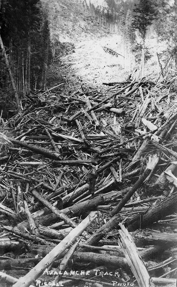
Bert Riggall's 1000 Mile Pack trip
https://archives.whyte.org/en/permalink/descriptions23454
- Part Of
- Bert Riggall fonds
- Scope & Content
- File consists of 43 b&w photographs, some captioned. Photographs pertain to Riggall's 1911 1000 mile pack trip undertaken to seek out areas for hunting and outfitting following the enlargement of Waterton National Park and the reduction of available hunting area for Riggall's clients. The prints do…
- Date Range
- 1911
- Reference Code
- V26 / II / A7 / PA - 119 to 161
- Description Level
- 5 / File
- GMD
- Photograph
- Photograph print
1 image
- Part Of
- Bert Riggall fonds
- Description Level
- 5 / File
- Fonds Number
- M376 / V26
- Series
- II.Business and Financial: Bert Riggall's 1000 Mile Pack trip, 1911
- Sous-Fonds
- V26
- Accession Number
- 7201
- Reference Code
- V26 / II / A7 / PA - 119 to 161
- Date Range
- 1911
- Physical Description
- 43 photographs: b&w prints
- Scope & Content
- File consists of 43 b&w photographs, some captioned. Photographs pertain to Riggall's 1911 1000 mile pack trip undertaken to seek out areas for hunting and outfitting following the enlargement of Waterton National Park and the reduction of available hunting area for Riggall's clients. The prints document this pack trip from stops in Banff, AB and Cranbrook, BC, and the extent of his mountain exploration from Fort Steele to Edson. On this trip, approximately 150 miles of new trail was cut including portions of Roger's Pass.
- Subject Access
- Pack trips
- Exploration
- Trails
- Trail making
- Recreation
- Hunting
- Outfitters, trail guides and packers
- Geographic Access
- Canada
- Alberta
- Banff National Park
- Waterton National Park
- British Columbia
- Cranbrook
- Rogers Pass
- Language
- English
- Title Source
- Title based on contents of file
- Processing Status
- Processed
Images

This material is presented as originally created; it may contain outdated cultural descriptions and
potentially offensive content.
Read more.
Bert Riggall's 1000 Mile Pack trip
https://archives.whyte.org/en/permalink/descriptions23455
- Part Of
- Bert Riggall fonds
- Scope & Content
- File consists of 20 b&w photographs, some captioned. Photographs pertain to Riggall's 1911 1000 mile pack trip undertaken to seek out areas for hunting and outfitting following the enlargement of Waterton National Park and the reduction of available hunting area for Riggall's clients. The prints do…
- Date Range
- 1911
- Reference Code
- V26 / II / A7 / PA - 162 to 181
- Description Level
- 5 / File
- GMD
- Photograph
- Photograph print
1 image
- Part Of
- Bert Riggall fonds
- Description Level
- 5 / File
- Fonds Number
- M376 / V26
- Series
- II.Business and Financial: Bert Riggall's 1000 Mile Pack trip, 1911
- Sous-Fonds
- V26
- Accession Number
- 7201
- Reference Code
- V26 / II / A7 / PA - 162 to 181
- Date Range
- 1911
- Physical Description
- Photographs: 20 prints, b&w
- Scope & Content
- File consists of 20 b&w photographs, some captioned. Photographs pertain to Riggall's 1911 1000 mile pack trip undertaken to seek out areas for hunting and outfitting following the enlargement of Waterton National Park and the reduction of available hunting area for Riggall's clients. The prints document this pack trip from stops in Banff, AB and Cranbrook, BC, and the extent of his mountain exploration from Fort Steele to Edson. On this trip, approximately 150 miles of new trail was cut including portions of Roger's Pass.
- Subject Access
- Pack trips
- Exploration
- Trails
- Trail making
- Recreation
- Hunting
- Outfitters, trail guides and packers
- Geographic Access
- Canada
- Alberta
- Banff National Park
- Waterton National Park
- British Columbia
- Cranbrook
- Rogers Pass
- Language
- English
- Title Source
- Title based on contents of file
- Processing Status
- Processed
Images
This material is presented as originally created; it may contain outdated cultural descriptions and
potentially offensive content.
Read more.
Mount Robson Ascent, 1924
https://archives.whyte.org/en/permalink/descriptions55261
- Part Of
- Malcolm Geddes fonds
- Scope & Content
- File consists of 3 photographs depicting Malcolm Geddes and several other members of the Alpine Club of Canada during an ascent of Mount Robson on July 25, 1924.
- Date Range
- 1924
- Reference Code
- V756 / III / A / PA - 25 to 27
- Description Level
- 5 / File
- GMD
- Photograph
- Photograph print
- Part Of
- Malcolm Geddes fonds
- Description Level
- 5 / File
- Fonds Number
- M39
- V756
- Series
- V756 / III : Personal and family records
- Sous-Fonds
- V756
- Sub-Series
- V756 / III / A : Travel and mountain expeditions
- Accession Number
- 2015.8558
- Reference Code
- V756 / III / A / PA - 25 to 27
- Date Range
- 1924
- Physical Description
- 3 photographs : b&w prints; 14 x 8 cm and 10.5 x 8 cm
- Scope & Content
- File consists of 3 photographs depicting Malcolm Geddes and several other members of the Alpine Club of Canada during an ascent of Mount Robson on July 25, 1924.
- Notes
- Item V756/III/A/PA-25 in file is accompanied by a note listing the names of all individuals in the photograph.
- Name Access
- Geddes, Malcolm
- Moffat, Thomas B.
- Buck, Annette
- Pollard, Harry
- Subject Access
- Alpine Club of Canada
- Hiking
- Mountains
- Mountaineering
- Climbing
- Recreation
- Exploration
- Geographic Access
- Canada
- British Columbia
- Mount Robson
- Language
- English
- Conservation
- Items stored in mylar
- Related Material
- Newspaper clippings pertaining to same ascent are stored in file M39/III/A/2
- Title Source
- Title based on contents of file
- Processing Status
- Processed
This material is presented as originally created; it may contain outdated cultural descriptions and
potentially offensive content.
Read more.
Mount Robson ascent, 1924
https://archives.whyte.org/en/permalink/descriptions55262
- Part Of
- Malcolm Geddes fonds
- Scope & Content
- File consists of 7 newspaper clippings pertaining to the third ascent of Mount Robson by Malcolm Geddes and other members of the Alpine Club of Canada on July 25, 1924.
- Date Range
- 1924
- Reference Code
- M39 / III / A / 2
- Description Level
- 5 / File
- GMD
- Textual record
- Published record
- Newspaper clipping
- Part Of
- Malcolm Geddes fonds
- Description Level
- 5 / File
- Fonds Number
- M39
- V756
- Series
- V756 / III : Personal and family records
- Sous-Fonds
- V756
- Sub-Series
- V756 / III / A : Travel and mountain expeditions
- Accession Number
- 2015.8558
- Reference Code
- M39 / III / A / 2
- Date Range
- 1924
- Physical Description
- 0.2 cm of textual records (7 newspaper clippings)
- Scope & Content
- File consists of 7 newspaper clippings pertaining to the third ascent of Mount Robson by Malcolm Geddes and other members of the Alpine Club of Canada on July 25, 1924.
- Name Access
- Geddes, Malcolm
- Kain, Conrad
- Moffat, Thomas B.
- Pollard, Harry
- Subject Access
- Hiking
- Climbing
- Mountains
- Mountaineering
- Alpine Club of Canada
- Exploration
- Recreation
- Publication
- Geographic Access
- Canada
- British Columbia
- Mount Robson
- Language
- English
- Related Material
- Photograph prints pertaining to same ascent are stored in file V756/III/A/PA-25 to 27
- Title Source
- Title based on contents of file
- Processing Status
- Processed
This material is presented as originally created; it may contain outdated cultural descriptions and
potentially offensive content.
Read more.
[Summit note, Phyllis & Don Munday Sockeye Peak, 1931]
https://archives.whyte.org/en/permalink/descriptions57717
- Part Of
- Alpine Club of Canada fonds
- Scope & Content
- File consists of one summit note from Sockeye Peak produced by the Alpine Club of Canada in 1931. Summit note describes weather, elevation of the peak, and the visitors' hiking/climbing trip. File: M200 / V / A / 127: [Summit note, Phyllis & Don Munday Sockeye Peak, 1931]
- Date Range
- 1931
- Reference Code
- M200 / V / A / 127
- Description Level
- 5 / File
- GMD
- Textual record
- Organization record
- Part Of
- Alpine Club of Canada fonds
- Description Level
- 5 / File
- Fonds Number
- M200
- V14
- S6
- Series
- M200 / V: Summit Records
- Sous-Fonds
- M200
- Sub-Series
- M200 / V / A: Identified Summit Records
- Accession Number
- accn. 6465
- Reference Code
- M200 / V / A / 127
- Responsibility
- Summit Registers and Notes produced by Alpine Club of Canada
- Date Range
- 1931
- Physical Description
- 1 summit note 0.5 cm of textual record
- History / Biographical
- Sockeye Peak is located in British Columbia, along the Coast Mountains/Coast Range. Nearby are Mount Munday, Mount Agur, and Agur Glacier.
- Scope & Content
- File consists of one summit note from Sockeye Peak produced by the Alpine Club of Canada in 1931. Summit note describes weather, elevation of the peak, and the visitors' hiking/climbing trip. File: M200 / V / A / 127: [Summit note, Phyllis & Don Munday Sockeye Peak, 1931]
- Name Access
- Alpine Club of Canada
- Subject Access
- Alpine Club of Canada
- British Columbia
- Climbing
- Club
- Description and travel
- Environment
- Environment and Nature
- Hiking
- Mountain
- Mountaineering
- Mountaineers
- Mountains
- Record keeping
- Sports and leisure
- Sports and recreation
- Summit
- Trails
- Geographic Access
- Canada
- British Columbia
- Coast Range
- Coast Mountains
- Mount Munday
- Mount Agur
- Sockeye Peak
- Access Restrictions
- Restrictions may apply
- Language
- English
- Conservation
- Summit note placed in mylar.
- Related Material
- M235
- Title Source
- Title based on contents of file
- Processing Status
- Processed
This material is presented as originally created; it may contain outdated cultural descriptions and
potentially offensive content.
Read more.
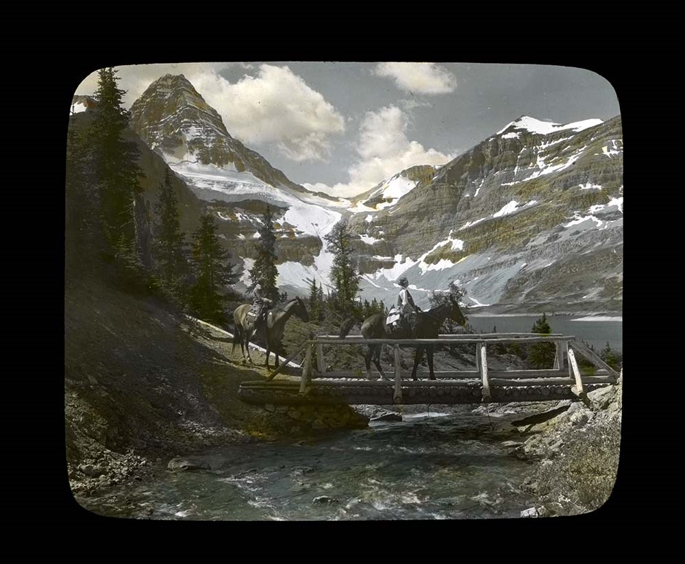
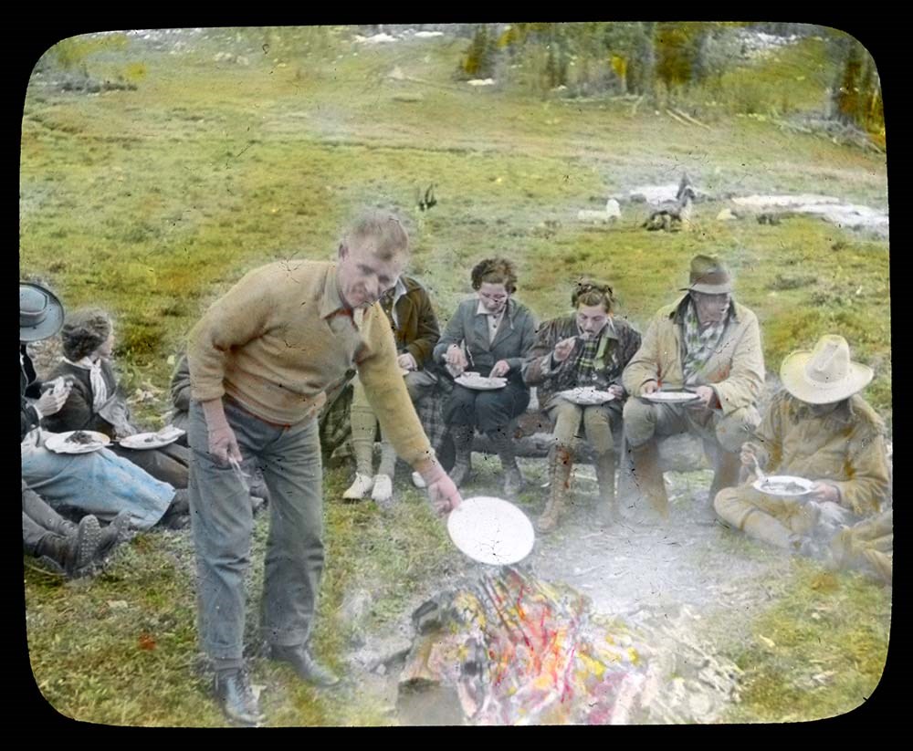
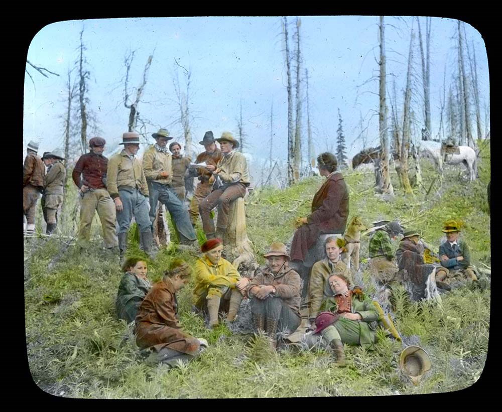
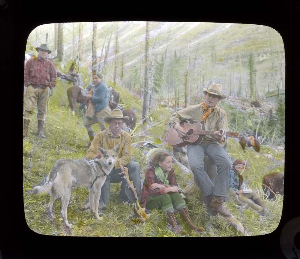
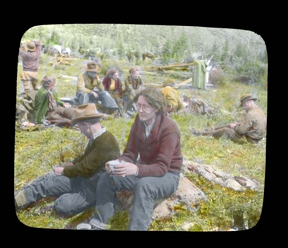
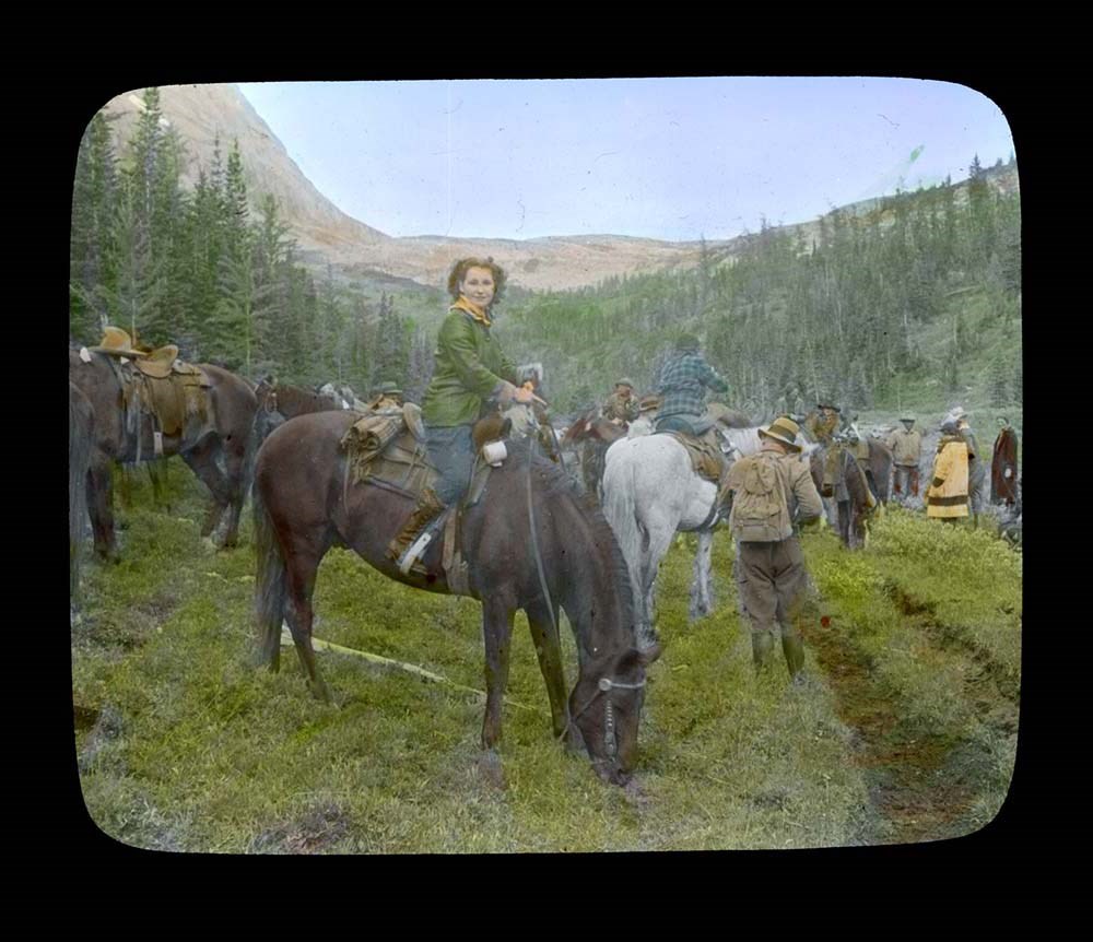
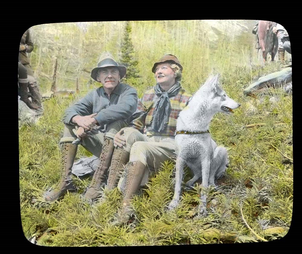
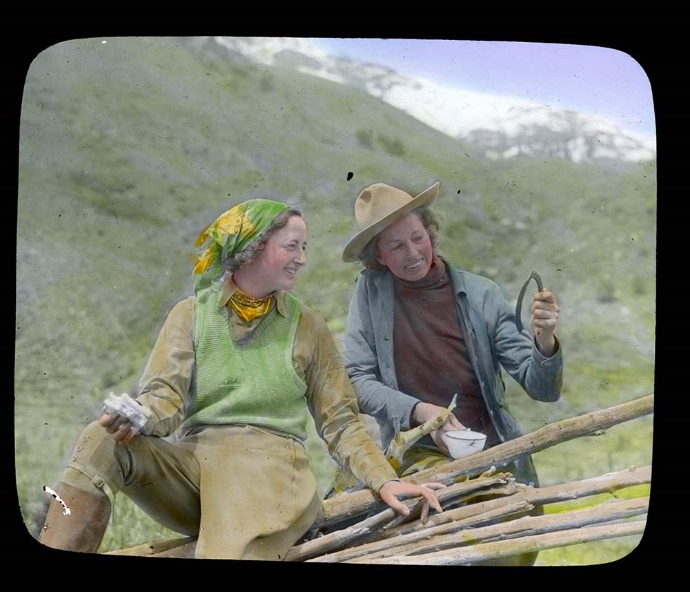
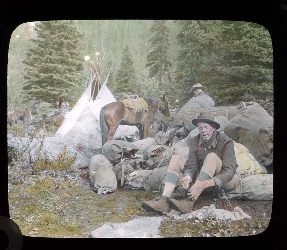
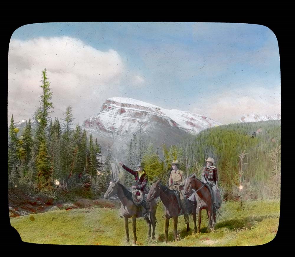
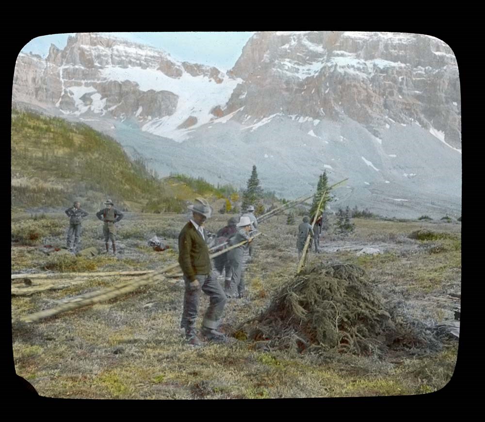
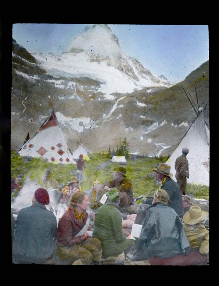
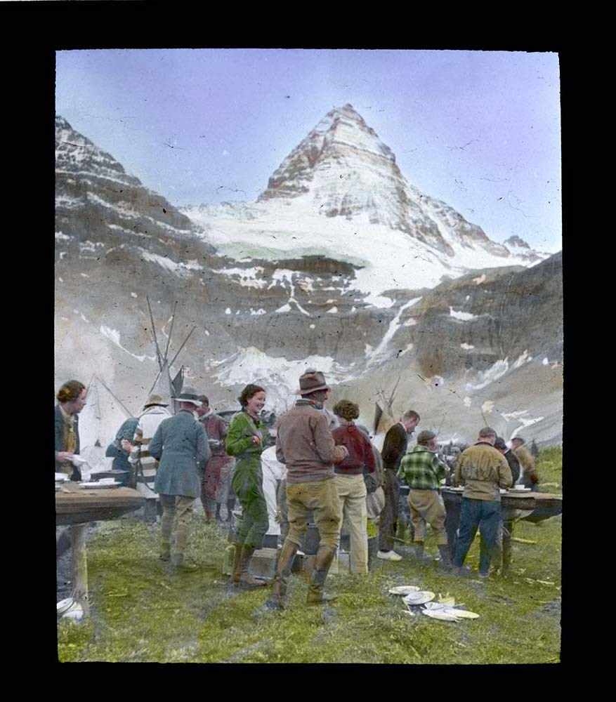
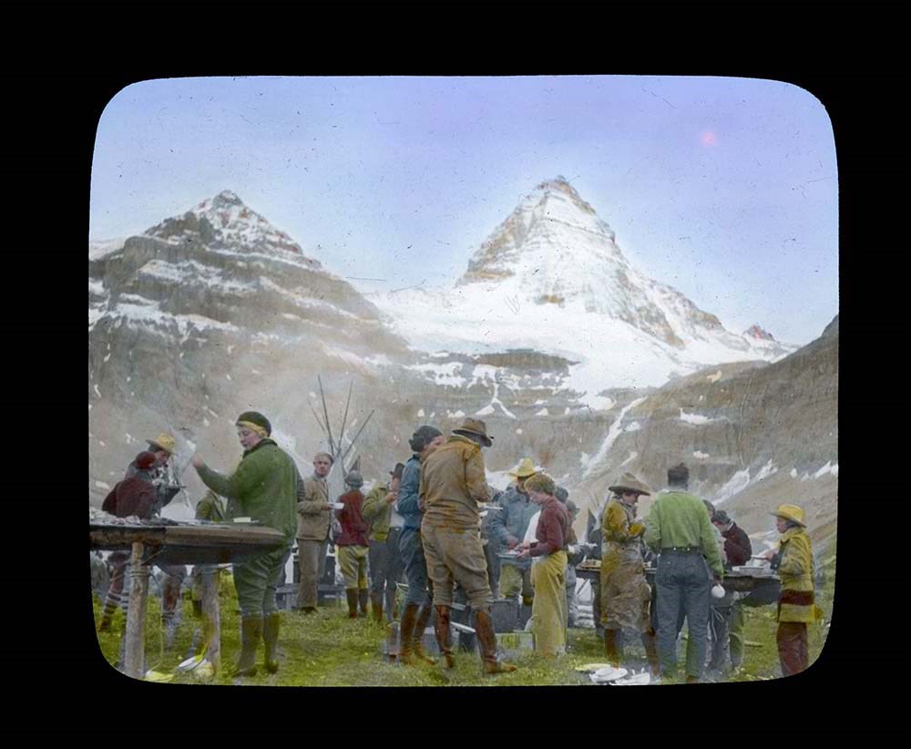
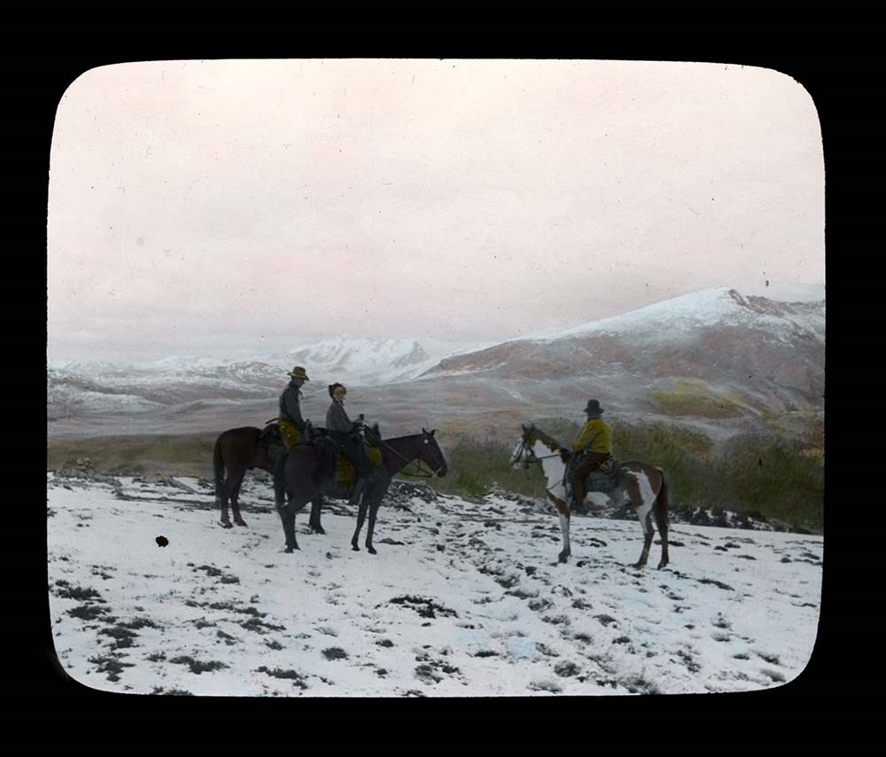
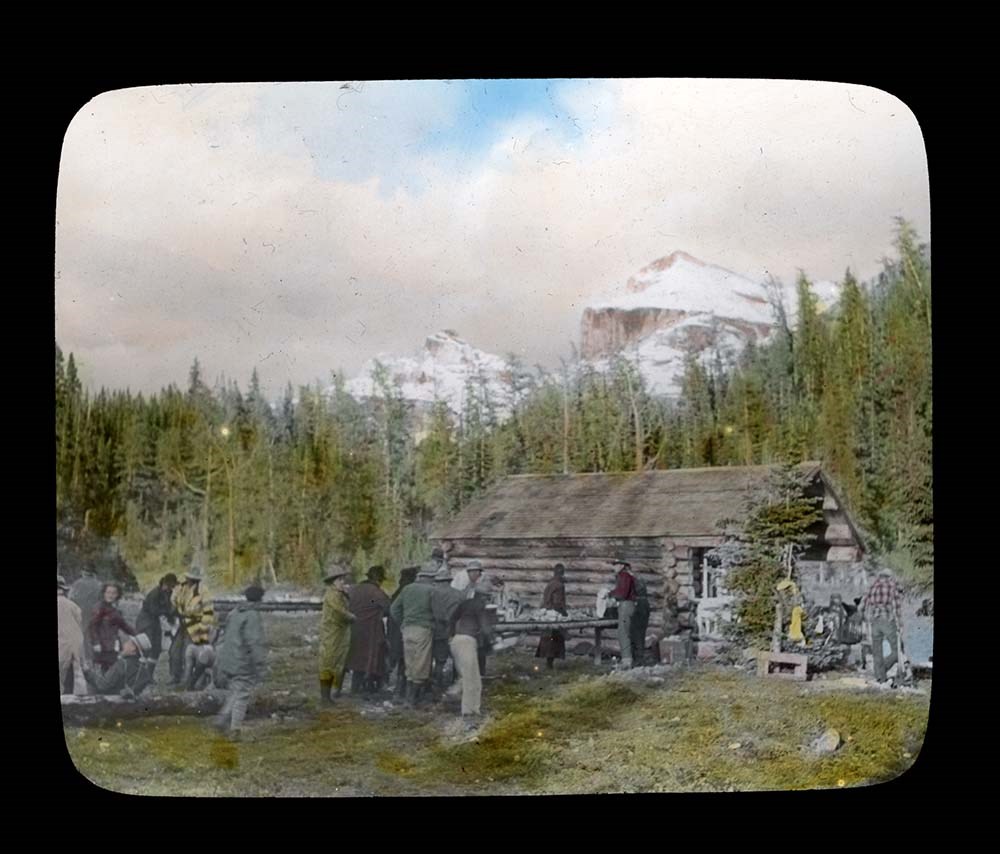
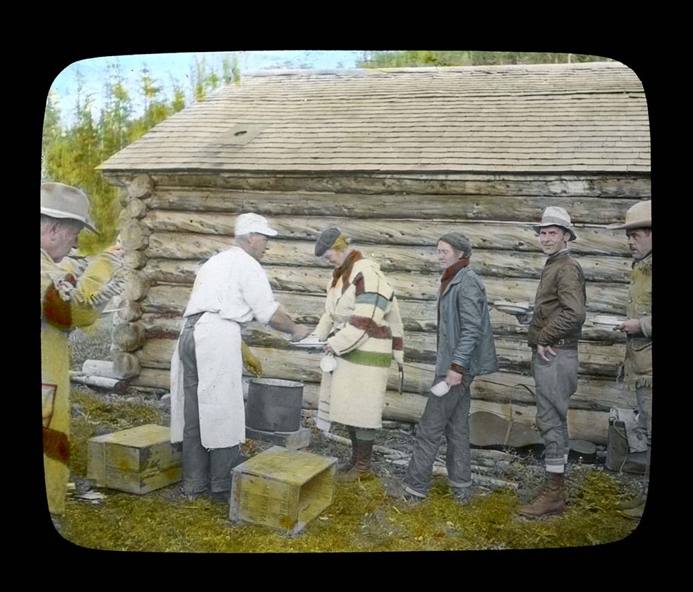
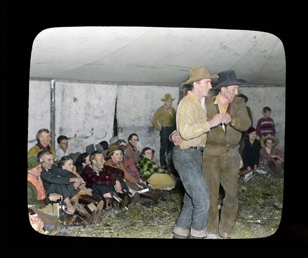
Trail Ride of 1937
https://archives.whyte.org/en/permalink/descriptions54697
- Part Of
- Jean A. Hembroff MacDonald fonds
- Scope & Content
- File consists of 27 colour photograph transparencies (lantern slides). File pertains to the Official Trail Ride of 1937 organized by the Trail Riders of the Canadian Rockies, which Jean Hembroff MacDonald participated in. File documents the trail ride to Mount Assiniboine and the camp at Mount Assi…
- Date Range
- 1937
- Reference Code
- V797 / II / PS - 1 to 27
- Description Level
- 5 / File
- GMD
- Lantern slide
- Photograph
- Transparency
27 images
- Part Of
- Jean A. Hembroff MacDonald fonds
- Description Level
- 5 / File
- Fonds Number
- M573 / V797 / S60
- Series
- V797 / II : Lantern Slides
- Sous-Fonds
- V797
- Accession Number
- 2019.111
- Reference Code
- V797 / II / PS - 1 to 27
- Date Range
- 1937
- Physical Description
- 27 photographs : col. slides
- Scope & Content
- File consists of 27 colour photograph transparencies (lantern slides). File pertains to the Official Trail Ride of 1937 organized by the Trail Riders of the Canadian Rockies, which Jean Hembroff MacDonald participated in. File documents the trail ride to Mount Assiniboine and the camp at Mount Assiniboine, with several landscape photographs but mostly of the hikers.
- Notes
- Jean wrote an article about her experience in the form of an article and a poem [see related material], and used this experience for future lectures.
- Slides are numbered on the back. Some are missing, the new number and order was imposed by Archive and Library Assistant for clarity.
- Slides were stored with a note stating: "Slides taken by the C.P.R. of Trail Ride, 1936-1937."
- Name Access
- Hembroff MacDonald, Jean
- Rungius, Carl
- Fisher, George
- Subject Access
- Trail Riders of the Canadian Rockies
- Hiking
- Mount Assiniboine
- Travel
- Tourism
- Trail guides
- Trails
- Horse packing
- Horseback riding
- Horses
- Geographic Access
- British Columbia
- Alberta
- Great Divide
- Mount Assiniboine
- Mount Assiniboine Park
- Canada
- Canadian Rocky Mountains
- Language
- English
- Related Material
- M573 / I / 18
- Trail Riders of the Canadian Rockies, Bulletin No. 48 (October 1937)
- Title Source
- Title based on contents of file
- Processing Status
- Processed
Images


This material is presented as originally created; it may contain outdated cultural descriptions and
potentially offensive content.
Read more.
Okanagan trip 1970 and EGL garden shots
https://archives.whyte.org/en/permalink/descriptions55191
- Part Of
- Luxton family fonds
- Scope & Content
- File consists of negative photographs pertaining to a trip to the Okanagan with Eleanor Luxton and friends/family in 1970, and views of the Luxton family home gardens. Includes images depicting camping, swimming, fishing, boating and canoeing.
- Date Range
- 1970
- Reference Code
- LUX / II / E / NA - 151 to 170
- Description Level
- 5 / File
- GMD
- Photograph
- Negative
- Part Of
- Luxton family fonds
- Description Level
- 5 / File
- Fonds Number
- LUX
- Series
- LUX / II / E : Travel and home records
- Sous-Fonds
- LUX / II : Eleanor Luxton sous-fonds
- Accession Number
- LUX
- Reference Code
- LUX / II / E / NA - 151 to 170
- GMD
- Photograph
- Negative
- Date Range
- 1970
- Physical Description
- 20 photographs : col. negatives ; 35 mm
- Scope & Content
- File consists of negative photographs pertaining to a trip to the Okanagan with Eleanor Luxton and friends/family in 1970, and views of the Luxton family home gardens. Includes images depicting camping, swimming, fishing, boating and canoeing.
- Name Access
- Luxton, Eleanor
- Subject Access
- Recreation
- Leisure
- Fishing
- Swimming
- Beach
- Boats
- Family and personal life
- Family
- Travel
- Camping
- Canoes and canoeing
- Garden
- Property
- Home
- Geographic Access
- Canada
- British Columbia
- Okanagan
- Alberta
- Banff
- Language
- English
- Related Material
- Photographs in file are negative copies of photographs from LUX / II / E / PA - 703 to 723
- Title Source
- Title copied from original
- Processing Status
- Processed
This material is presented as originally created; it may contain outdated cultural descriptions and
potentially offensive content.
Read more.
Summit Notes - MT. Hooker, 1978
https://archives.whyte.org/en/permalink/descriptions57716
- Part Of
- Alpine Club of Canada fonds
- Scope & Content
- File consists of summit notes from Mount Hooker, produced by the Alpine Club of Canada in 1978. Summit record includes entries from visitors to the various summits which pertain to individuals' hiking and climbing trips; details of specific events which occurred while at the summit, wildlife sighti…
- Date Range
- 1978
- Reference Code
- M200 / V / A / 126
- Description Level
- 5 / File
- GMD
- Textual record
- Organization record
- Part Of
- Alpine Club of Canada fonds
- Description Level
- 5 / File
- Fonds Number
- M200
- V14
- S6
- Series
- M200 / V: Summit Records
- Sous-Fonds
- M200
- Sub-Series
- M200 / V / A: Identified Summit Records
- Accession Number
- accn. 8002
- Reference Code
- M200 / V / A / 126
- Responsibility
- Summit Registers and Notes produced by Alpine Club of Canada
- Date Range
- 1978
- Physical Description
- 1 cm of textual records 5 summit notes
- History / Biographical
- Mount Hooker is part of the Canadian Rockies, along the Continental Divide/Great Divide separating Alberta and British Columbia. Mount Hooker lies above the Hooker Icefield and the Athabasca Pass. The mountain was named after accomplished botanist, Sir William Jackson Hooker, in 1827.
- Scope & Content
- File consists of summit notes from Mount Hooker, produced by the Alpine Club of Canada in 1978. Summit record includes entries from visitors to the various summits which pertain to individuals' hiking and climbing trips; details of specific events which occurred while at the summit, wildlife sightings, trail updates, and related topics. File: M200 / V / A / 126: Summit Notes - MT. Hooker, 1978
- Name Access
- Alpine Club of Canada
- Subject Access
- Alberta
- Alpine Club of Canada
- Backcountry skiing
- Backpacking
- British Columbia
- Climbing
- Club
- Cross-country skiing
- Description and travel
- Environment
- Environment and Nature
- Great Divide
- Hiking
- Mountain
- Mountaineering
- Mountaineers
- Mountains
- Parks
- Record keeping
- Ski areas
- Ski area
- Ski mountaineering
- Sports and leisure
- Sports and recreation
- Summit
- Trails
- Winter sports
- Geographic Access
- Canada
- Canadian Rocky Mountains
- Continental Divide
- Great Divide
- Alberta
- British Columbia
- Athabasca Pass
- Hooker Icefield
- Mount Clemenceau
- Mount Hooker
- Access Restrictions
- Restrictions may apply
- Language
- English
- Conservation
- Summit notes placed in individual mylar sleeves due to fragile state of paper. Water damage and mold on every summit note.
- Related Material
- M235
- Biographical Source Notes
- Peak Finder: Mount Hooker, Canadian Rockies Database: https://cdnrockiesdatabases.ca/peaks/647#undefined3
- Title Source
- Original title
- Processing Status
- Processed
This material is presented as originally created; it may contain outdated cultural descriptions and
potentially offensive content.
Read more.
Mount Deltaform Summit Note
https://archives.whyte.org/en/permalink/descriptions57779
- Part Of
- Alpine Club of Canada fonds
- Scope & Content
- File consists of a summit record from Mount Deltaform produced by the Alpine Club of Canada in 1983. Summit note by Hans Fuhrer and David Wilkinson depicting their route to the summit.
- Date Range
- 1983
- Reference Code
- M200 / V / A / 193
- Description Level
- 5 / File
- GMD
- Textual record
- Organization record
- Part Of
- Alpine Club of Canada fonds
- Description Level
- 5 / File
- Fonds Number
- M200
- V14
- S6
- Series
- M200 / V: Summit Records
- Sous-Fonds
- M200
- Sub-Series
- M200 / V / A: Identified Summit Records
- Accession Number
- accn. 8119
- Reference Code
- M200 / V / A / 193
- Responsibility
- Summit Registers and Notes produced by Alpine Club of Canada
- Date Range
- 1983
- Physical Description
- 0.5 cm of textual record 1 summit note
- History / Biographical
- Mount Deltaform is located in the Valley of the Ten Peaks, along the Continental Divide/Great Divide of the Canadian Rockies. Mount Deltaform is also on the border of Kootenay National Park, BC and Banff National Park, AB. Nearby are Hungabee Mountain, Mount Tuzo, and Mount Whymper.
- Scope & Content
- File consists of a summit record from Mount Deltaform produced by the Alpine Club of Canada in 1983. Summit note by Hans Fuhrer and David Wilkinson depicting their route to the summit.
- Name Access
- Alpine Club of Canada
- Subject Access
- Alberta
- Banff National Park
- British Columbia
- Climbing
- Description and travel
- Environment
- Environment and Nature
- Great Divide
- Hiking
- Mountain
- Mountaineering
- Mountaineers
- Mountains
- National parks and reserves
- Record keeping
- Sports and leisure
- Sports and recreation
- Summit
- Geographic Access
- Canada
- Canadian Rocky Mountains
- Rocky Mountains
- Continental Divide
- Great Divide
- Alberta
- British Columbia
- Banff National Park
- Kootenay National Park
- Valley of the Ten Peaks
- Hungabee Mountain
- Mount Whymper
- Mount Tuzo
- Mount Deltaform
- Access Restrictions
- Restrictions may apply
- Language
- English
- Related Material
- M235
- Biographical Source Notes
- Peak Finder: Deltaform Mountain, Canadian Rockies Database: https://cdnrockiesdatabases.ca/peaks/365
- Title Source
- Original title
- Processing Status
- Processed
This material is presented as originally created; it may contain outdated cultural descriptions and
potentially offensive content.
Read more.