Narrow Results By
- Alpine Club of Canada fonds 68
- Luxton family fonds 20
- Douglas Leighton fonds 18
- Murray Hay fonds 18
- Ben Gadd fonds 15
- Chic Scott fonds 14
- Dorothy Wardle fonds 7
- Malcolm Geddes fonds 6
- Bert Riggall fonds 5
- Trail Riders of the Canadian Rockies fonds 5
- Jean A. Hembroff MacDonald fonds 4
- Kidney family fonds 4
National Geographic, Wapta ski tour 2001
https://archives.whyte.org/en/permalink/descriptions56485
- Part Of
- Ben Gadd fonds
- Scope & Content
- File consists of one DVD containing a video of Ben and Will Gadd skiing and hiking near Wapta Icefield. Footage was published in a program by National Geographic.
- Date Range
- 2001
- Reference Code
- V810 / III / D / NV - 18
- Description Level
- 5 / File
- GMD
- Video
- Published record
- Part Of
- Ben Gadd fonds
- Description Level
- 5 / File
- Fonds Number
- M590
- V810
- S61
- Series
- V810 / III : Professional records
- Sous-Fonds
- V810
- Sub-Series
- V810 / III / D : Other contracts and projects
- Accession Number
- 2021.20
- Reference Code
- V810 / III / D / NV - 18
- Responsibility
- National Geographic
- Date Range
- 2001
- Physical Description
- 1 DVD
- Scope & Content
- File consists of one DVD containing a video of Ben and Will Gadd skiing and hiking near Wapta Icefield. Footage was published in a program by National Geographic.
- Name Access
- Gadd, Ben
- Subject Access
- Sports
- Winter sports
- Skiing
- Hiking
- Recreation
- Geographic Access
- Canada
- Alberta
- British Columbia
- Wapta Lake
- Wapta Icefield
- Reproduction Restrictions
- Restrictions may apply
- Language
- English
- Category
- Sports, recreation and leisure
- Title Source
- Original title used
- Processing Status
- Processed
This material is presented as originally created; it may contain outdated cultural descriptions and
potentially offensive content.
Read more.
- Part Of
- Ben Gadd fonds
- Scope & Content
- File consists of photographs taken by Ben Gadd during a trip to Jackman Flats Provincial Park in 1997. Images depict unidentified individuals posing next to interpretive signs; hiking trails; a truck driving through sand; and measurements of a geological artifact.
- Date Range
- 1997
- Reference Code
- V810 / III / D / PA - 128 to 172
- Description Level
- 5 / File
- GMD
- Photograph
- Part Of
- Ben Gadd fonds
- Description Level
- 5 / File
- Fonds Number
- M590
- V810
- S61
- Series
- V810 / III : Professional records
- Sous-Fonds
- V810
- Sub-Series
- V810 / III / D : Other contracts and projects
- Accession Number
- 2021.20
- Reference Code
- V810 / III / D / PA - 128 to 172
- GMD
- Photograph
- Responsibility
- Produced by Ben Gadd
- Date Range
- 1997
- Physical Description
- 45 photographs : col. prints ; 10 x 15 cm
- Scope & Content
- File consists of photographs taken by Ben Gadd during a trip to Jackman Flats Provincial Park in 1997. Images depict unidentified individuals posing next to interpretive signs; hiking trails; a truck driving through sand; and measurements of a geological artifact.
- Name Access
- Gadd, Ben
- Subject Access
- Tourism
- Tourist information
- Hiking
- Recreation
- Trails
- Provincial parks and reserves
- Family and personal life
- Geology
- Research
- Geographic Access
- Canada
- British Columbia
- Jackman Flats Provincial Park
- Language
- N/A
- Related Material
- V810/III/D/NA-52 to 53
- Title Source
- Original title used
- Processing Status
- Processed
This material is presented as originally created; it may contain outdated cultural descriptions and
potentially offensive content.
Read more.
Pembina River Provincial Park
https://archives.whyte.org/en/permalink/descriptions56397
- Part Of
- Ben Gadd fonds
- Scope & Content
- File consists of photographs taken by Ben Gadd during a trip to Pembina River Provincial Park, including winter views of hiking trails and forested areas.
- Date Range
- 1997
- Reference Code
- V810 / III / D / PA - 173 to 180
- Description Level
- 5 / File
- GMD
- Photograph
- Part Of
- Ben Gadd fonds
- Description Level
- 5 / File
- Fonds Number
- M590
- V810
- S61
- Series
- V810 / III : Professional records
- Sous-Fonds
- V810
- Sub-Series
- V810 / III / D : Other contracts and projects
- Accession Number
- 2021.20
- Reference Code
- V810 / III / D / PA - 173 to 180
- GMD
- Photograph
- Responsibility
- Produced by Ben Gadd
- Date Range
- 1997
- Physical Description
- 8 photographs : col. prints ; 10 x 15 cm
- Scope & Content
- File consists of photographs taken by Ben Gadd during a trip to Pembina River Provincial Park, including winter views of hiking trails and forested areas.
- Name Access
- Gadd, Ben
- Subject Access
- Tourism
- Tourist information
- Hiking
- Recreation
- Trails
- Provincial parks and reserves
- Geographic Access
- Canada
- British Columbia
- Pembina River Provincial Park
- Language
- N/A
- Category
- Tourism
- Sports, recreation and leisure
- Title Source
- Original title used
- Processing Status
- Processed
This material is presented as originally created; it may contain outdated cultural descriptions and
potentially offensive content.
Read more.
British Columbia album "active best"
https://archives.whyte.org/en/permalink/descriptions56447
- Part Of
- Douglas Leighton fonds
- Scope & Content
- File consists of photographs compiled by Douglas Leighton in an album Album was held in a a non descript binder. Includes scenic photographs of British Columbia.
- Date Range
- 1984
- Reference Code
- V222 / VI / D / 1 - 2 / NS
- Description Level
- 5 / File
- GMD
- Photograph
- Transparency
- Part Of
- Douglas Leighton fonds
- Description Level
- 5 / File
- Fonds Number
- M133
- V222
- Series
- V222 / VI : Publication
- Sous-Fonds
- V222
- Sub-Series
- V222 / VI / D: British Columbia Album
- Accession Number
- 2020.24
- Reference Code
- V222 / VI / D / 1 - 2 / NS
- Date Range
- 1984
- Physical Description
- 44 photographs : col. slides ; 35 mm
- Scope & Content
- File consists of photographs compiled by Douglas Leighton in an album Album was held in a a non descript binder. Includes scenic photographs of British Columbia.
- Name Access
- Leighton, Douglas
- Subject Access
- British Columbia
- Geographic Access
- British Columbia
- Nelson, BC
- Nakusp, BC
- Kootenay, BC
- Chase, BC
- Cranbook, BC
- Vancouver, BC
- Valhalla Wildlife Park
- Kokanee Glacier Provincial Park
- Kaslo, BC
- Language
- English
- Creator
- Douglas Leighton
- Title Source
- Title based on contents of file
- Processing Status
- Processed
This material is presented as originally created; it may contain outdated cultural descriptions and
potentially offensive content.
Read more.
Mt. Wheeler 1984
https://archives.whyte.org/en/permalink/descriptions57767
- Part Of
- Alpine Club of Canada fonds
- Scope & Content
- File consists of a summit record from Mount Wheeler produced by the Alpine Club of Canada in 1984. Summit record includes entries from visitors to the various summits which pertain to individuals' hiking and climbing trips; details of specific events which occurred while at the summit, wildlife sig…
- Date Range
- 1984
- Reference Code
- M200 / V / A / 181
- Description Level
- 5 / File
- GMD
- Textual record
- Organization record
- Part Of
- Alpine Club of Canada fonds
- Description Level
- 5 / File
- Fonds Number
- M200
- V14
- S6
- Series
- M200 / V: Summit Records
- Sous-Fonds
- M200
- Sub-Series
- M200 / V / A: Identified Summit Records
- Accession Number
- accn. 2023.20
- Reference Code
- M200 / V / A / 181
- Responsibility
- Summit Registers and Notes produced by Alpine Club of Canada
- Date Range
- 1984
- Physical Description
- 1 volume 0.5 cm of textual record
- History / Biographical
- Mount Wheeler is located in Glacier National Park, British Columbia. Arthur Wheeler made the first ascent of the mountain in 1902; the mountain was named in his honour.
- Scope & Content
- File consists of a summit record from Mount Wheeler produced by the Alpine Club of Canada in 1984. Summit record includes entries from visitors to the various summits which pertain to individuals' hiking and climbing trips; details of specific events which occurred while at the summit, wildlife sightings, trail updates, and related topics. File: M200 / V / A / 181: Mt. Wheeler 1984
- Name Access
- Alpine Club of Canada
- Subject Access
- Alpine Club of Canada
- Backpacking
- British Columbia
- Climbing
- Club
- Description and travel
- Environment
- Environment and Nature
- Hiking
- Mountain
- Mountaineering
- Mountaineers
- Mountains
- National parks and reserves
- Record keeping
- Sports and leisure
- Sports and recreation
- Summit
- Geographic Access
- Canada
- Canadian Rocky Mountains
- Rocky Mountains
- British Columbia
- Selkirks
- Glacier National Park
- Revelstoke
- Golden
- Golden, BC
- Mount Selwyn
- Deville Glacier
- Black Glacier
- Thor Glacier
- Mount Wheeler
- Access Restrictions
- Restrictions may apply
- Language
- English
- Conservation
- Register placed in mylar due to water damage and mold.
- Related Material
- M235
- Title Source
- Original title
- Processing Status
- Processed
This material is presented as originally created; it may contain outdated cultural descriptions and
potentially offensive content.
Read more.
Mount Deltaform Summit Note
https://archives.whyte.org/en/permalink/descriptions57779
- Part Of
- Alpine Club of Canada fonds
- Scope & Content
- File consists of a summit record from Mount Deltaform produced by the Alpine Club of Canada in 1983. Summit note by Hans Fuhrer and David Wilkinson depicting their route to the summit.
- Date Range
- 1983
- Reference Code
- M200 / V / A / 193
- Description Level
- 5 / File
- GMD
- Textual record
- Organization record
- Part Of
- Alpine Club of Canada fonds
- Description Level
- 5 / File
- Fonds Number
- M200
- V14
- S6
- Series
- M200 / V: Summit Records
- Sous-Fonds
- M200
- Sub-Series
- M200 / V / A: Identified Summit Records
- Accession Number
- accn. 8119
- Reference Code
- M200 / V / A / 193
- Responsibility
- Summit Registers and Notes produced by Alpine Club of Canada
- Date Range
- 1983
- Physical Description
- 0.5 cm of textual record 1 summit note
- History / Biographical
- Mount Deltaform is located in the Valley of the Ten Peaks, along the Continental Divide/Great Divide of the Canadian Rockies. Mount Deltaform is also on the border of Kootenay National Park, BC and Banff National Park, AB. Nearby are Hungabee Mountain, Mount Tuzo, and Mount Whymper.
- Scope & Content
- File consists of a summit record from Mount Deltaform produced by the Alpine Club of Canada in 1983. Summit note by Hans Fuhrer and David Wilkinson depicting their route to the summit.
- Name Access
- Alpine Club of Canada
- Subject Access
- Alberta
- Banff National Park
- British Columbia
- Climbing
- Description and travel
- Environment
- Environment and Nature
- Great Divide
- Hiking
- Mountain
- Mountaineering
- Mountaineers
- Mountains
- National parks and reserves
- Record keeping
- Sports and leisure
- Sports and recreation
- Summit
- Geographic Access
- Canada
- Canadian Rocky Mountains
- Rocky Mountains
- Continental Divide
- Great Divide
- Alberta
- British Columbia
- Banff National Park
- Kootenay National Park
- Valley of the Ten Peaks
- Hungabee Mountain
- Mount Whymper
- Mount Tuzo
- Mount Deltaform
- Access Restrictions
- Restrictions may apply
- Language
- English
- Related Material
- M235
- Biographical Source Notes
- Peak Finder: Deltaform Mountain, Canadian Rockies Database: https://cdnrockiesdatabases.ca/peaks/365
- Title Source
- Original title
- Processing Status
- Processed
This material is presented as originally created; it may contain outdated cultural descriptions and
potentially offensive content.
Read more.
Summit Notes - MT. Hooker, 1978
https://archives.whyte.org/en/permalink/descriptions57716
- Part Of
- Alpine Club of Canada fonds
- Scope & Content
- File consists of summit notes from Mount Hooker, produced by the Alpine Club of Canada in 1978. Summit record includes entries from visitors to the various summits which pertain to individuals' hiking and climbing trips; details of specific events which occurred while at the summit, wildlife sighti…
- Date Range
- 1978
- Reference Code
- M200 / V / A / 126
- Description Level
- 5 / File
- GMD
- Textual record
- Organization record
- Part Of
- Alpine Club of Canada fonds
- Description Level
- 5 / File
- Fonds Number
- M200
- V14
- S6
- Series
- M200 / V: Summit Records
- Sous-Fonds
- M200
- Sub-Series
- M200 / V / A: Identified Summit Records
- Accession Number
- accn. 8002
- Reference Code
- M200 / V / A / 126
- Responsibility
- Summit Registers and Notes produced by Alpine Club of Canada
- Date Range
- 1978
- Physical Description
- 1 cm of textual records 5 summit notes
- History / Biographical
- Mount Hooker is part of the Canadian Rockies, along the Continental Divide/Great Divide separating Alberta and British Columbia. Mount Hooker lies above the Hooker Icefield and the Athabasca Pass. The mountain was named after accomplished botanist, Sir William Jackson Hooker, in 1827.
- Scope & Content
- File consists of summit notes from Mount Hooker, produced by the Alpine Club of Canada in 1978. Summit record includes entries from visitors to the various summits which pertain to individuals' hiking and climbing trips; details of specific events which occurred while at the summit, wildlife sightings, trail updates, and related topics. File: M200 / V / A / 126: Summit Notes - MT. Hooker, 1978
- Name Access
- Alpine Club of Canada
- Subject Access
- Alberta
- Alpine Club of Canada
- Backcountry skiing
- Backpacking
- British Columbia
- Climbing
- Club
- Cross-country skiing
- Description and travel
- Environment
- Environment and Nature
- Great Divide
- Hiking
- Mountain
- Mountaineering
- Mountaineers
- Mountains
- Parks
- Record keeping
- Ski areas
- Ski area
- Ski mountaineering
- Sports and leisure
- Sports and recreation
- Summit
- Trails
- Winter sports
- Geographic Access
- Canada
- Canadian Rocky Mountains
- Continental Divide
- Great Divide
- Alberta
- British Columbia
- Athabasca Pass
- Hooker Icefield
- Mount Clemenceau
- Mount Hooker
- Access Restrictions
- Restrictions may apply
- Language
- English
- Conservation
- Summit notes placed in individual mylar sleeves due to fragile state of paper. Water damage and mold on every summit note.
- Related Material
- M235
- Biographical Source Notes
- Peak Finder: Mount Hooker, Canadian Rockies Database: https://cdnrockiesdatabases.ca/peaks/647#undefined3
- Title Source
- Original title
- Processing Status
- Processed
This material is presented as originally created; it may contain outdated cultural descriptions and
potentially offensive content.
Read more.
Okanagan trip 1970 and EGL garden shots
https://archives.whyte.org/en/permalink/descriptions55191
- Part Of
- Luxton family fonds
- Scope & Content
- File consists of negative photographs pertaining to a trip to the Okanagan with Eleanor Luxton and friends/family in 1970, and views of the Luxton family home gardens. Includes images depicting camping, swimming, fishing, boating and canoeing.
- Date Range
- 1970
- Reference Code
- LUX / II / E / NA - 151 to 170
- Description Level
- 5 / File
- GMD
- Photograph
- Negative
- Part Of
- Luxton family fonds
- Description Level
- 5 / File
- Fonds Number
- LUX
- Series
- LUX / II / E : Travel and home records
- Sous-Fonds
- LUX / II : Eleanor Luxton sous-fonds
- Accession Number
- LUX
- Reference Code
- LUX / II / E / NA - 151 to 170
- GMD
- Photograph
- Negative
- Date Range
- 1970
- Physical Description
- 20 photographs : col. negatives ; 35 mm
- Scope & Content
- File consists of negative photographs pertaining to a trip to the Okanagan with Eleanor Luxton and friends/family in 1970, and views of the Luxton family home gardens. Includes images depicting camping, swimming, fishing, boating and canoeing.
- Name Access
- Luxton, Eleanor
- Subject Access
- Recreation
- Leisure
- Fishing
- Swimming
- Beach
- Boats
- Family and personal life
- Family
- Travel
- Camping
- Canoes and canoeing
- Garden
- Property
- Home
- Geographic Access
- Canada
- British Columbia
- Okanagan
- Alberta
- Banff
- Language
- English
- Related Material
- Photographs in file are negative copies of photographs from LUX / II / E / PA - 703 to 723
- Title Source
- Title copied from original
- Processing Status
- Processed
This material is presented as originally created; it may contain outdated cultural descriptions and
potentially offensive content.
Read more.
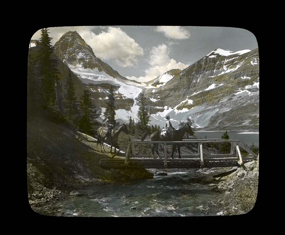
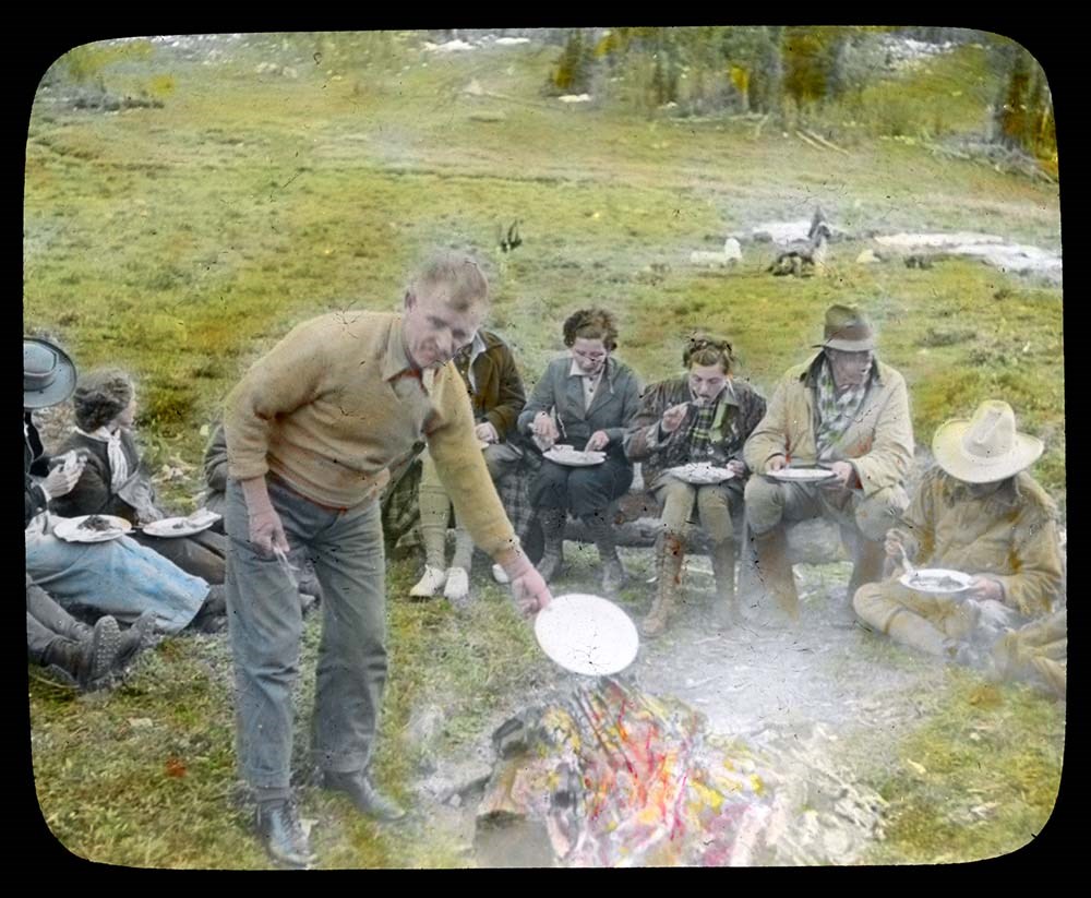
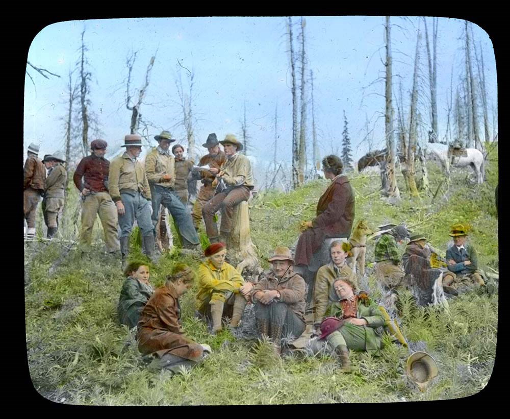
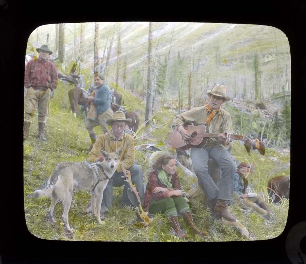
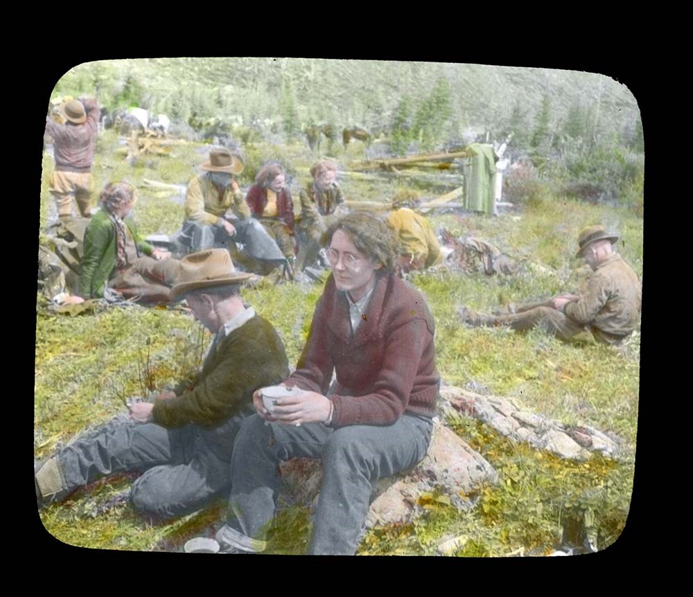
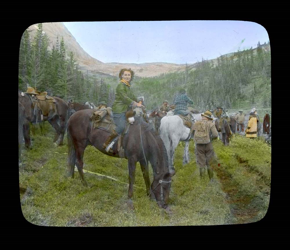
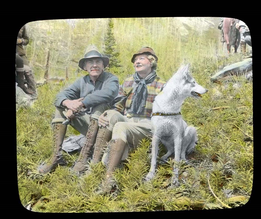
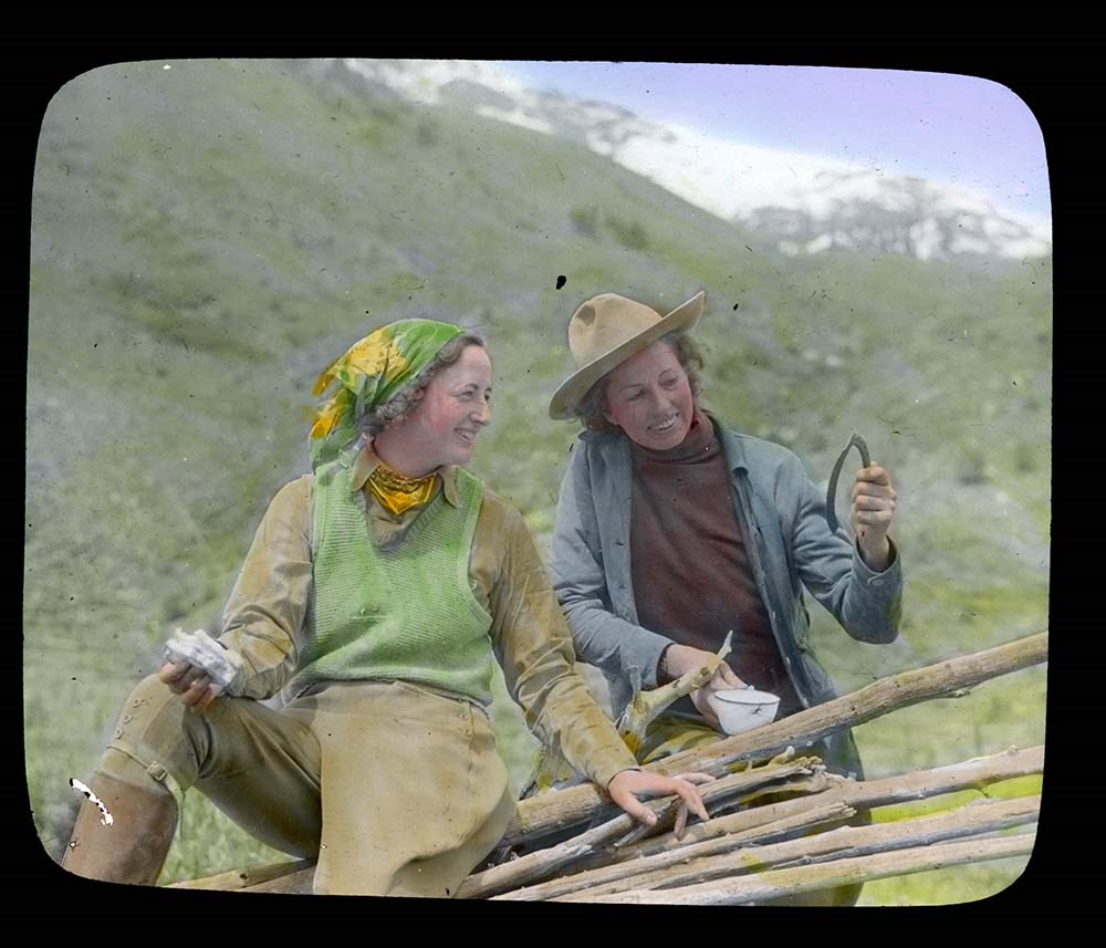
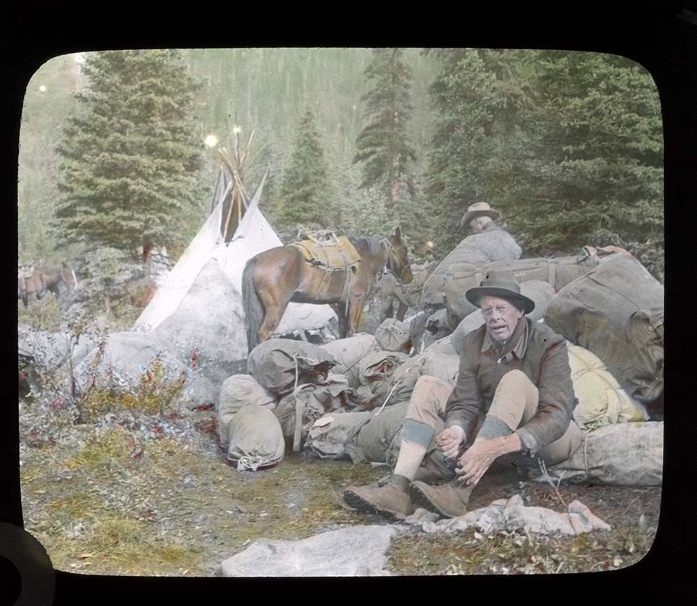
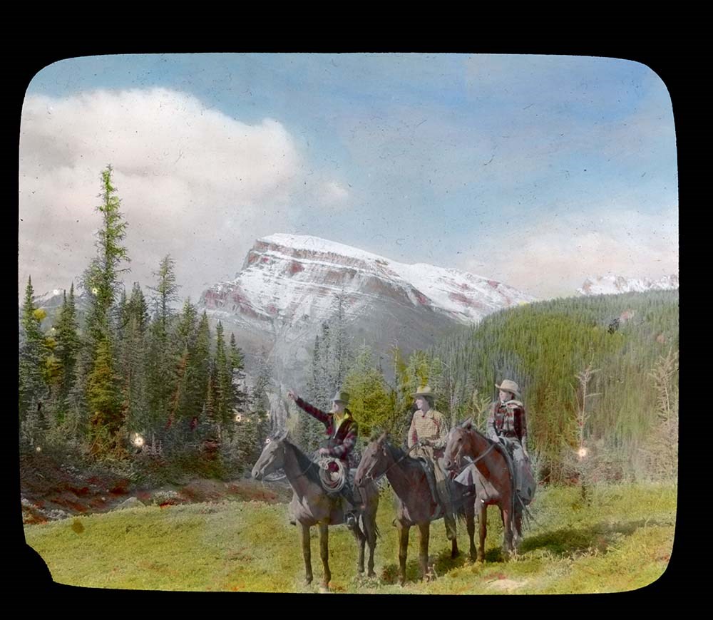
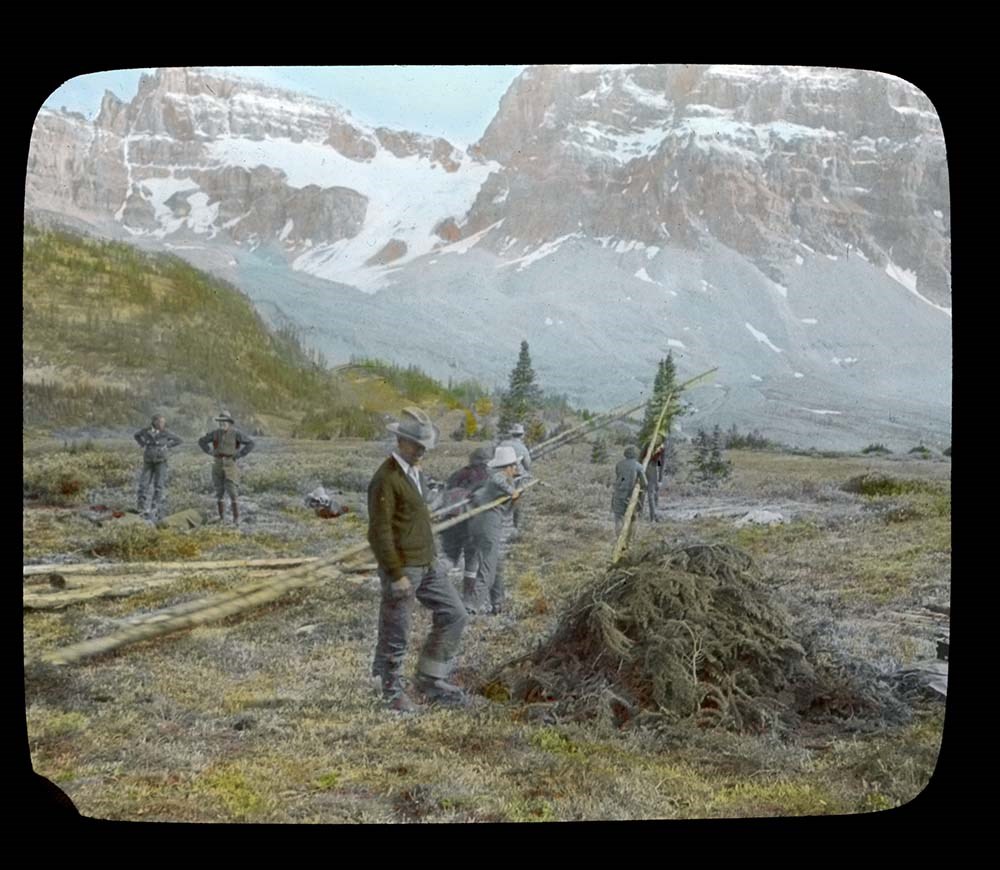
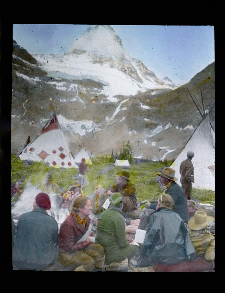
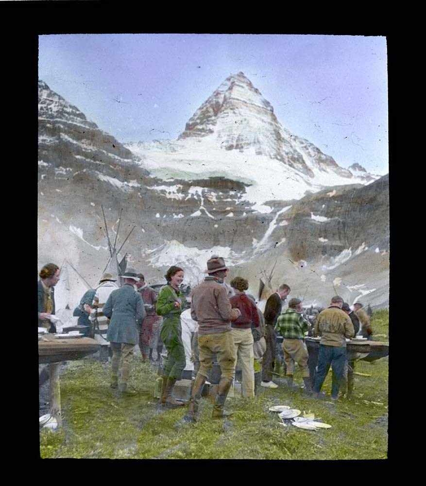
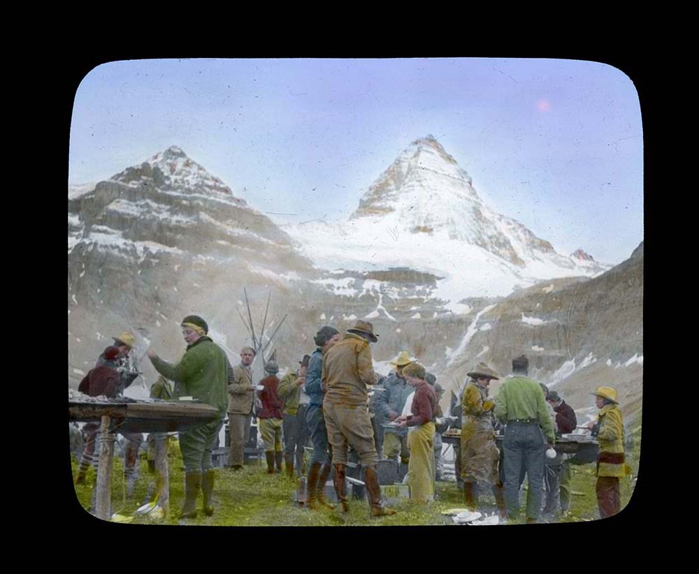
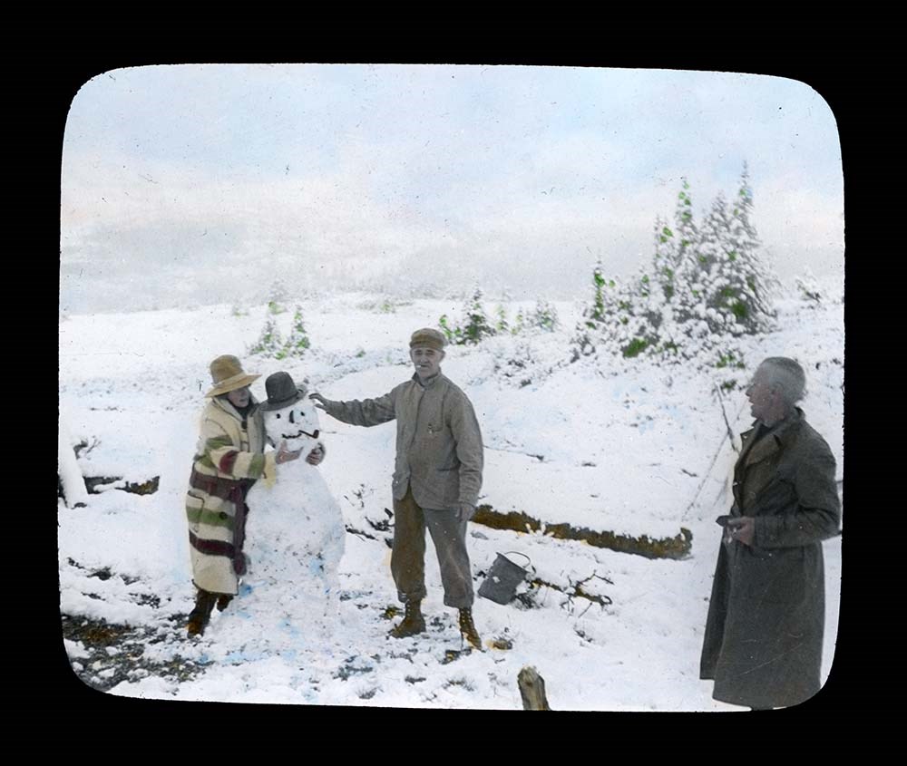
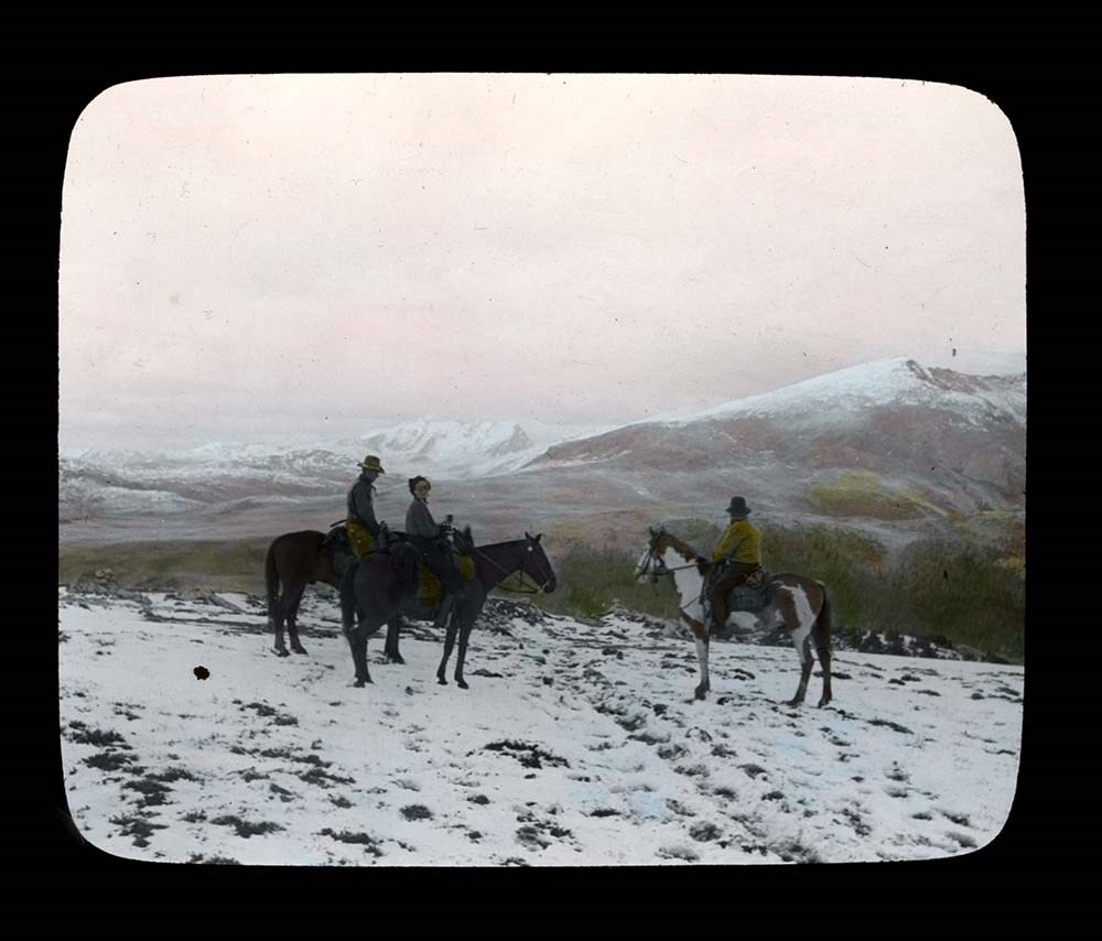
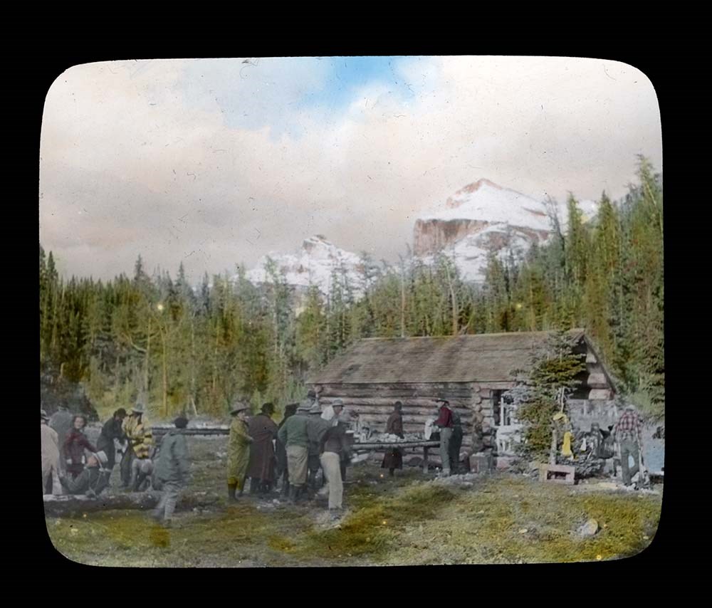
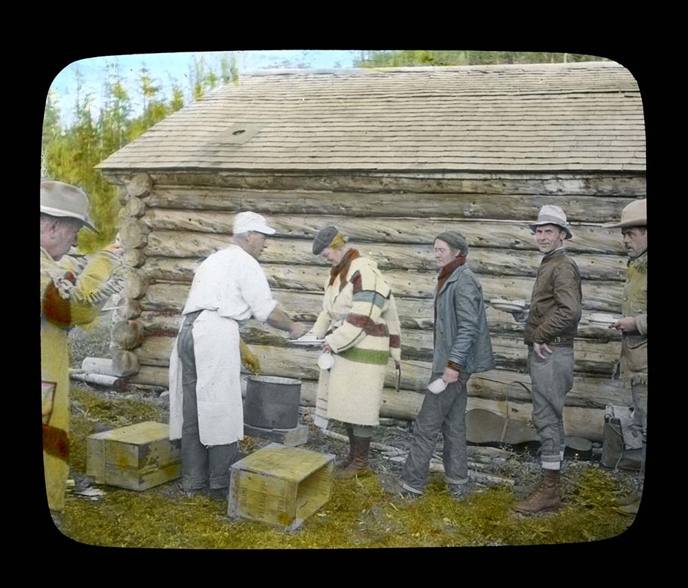
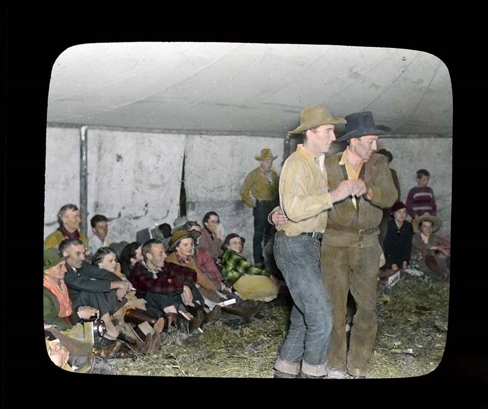
Trail Ride of 1937
https://archives.whyte.org/en/permalink/descriptions54697
- Part Of
- Jean A. Hembroff MacDonald fonds
- Scope & Content
- File consists of 27 colour photograph transparencies (lantern slides). File pertains to the Official Trail Ride of 1937 organized by the Trail Riders of the Canadian Rockies, which Jean Hembroff MacDonald participated in. File documents the trail ride to Mount Assiniboine and the camp at Mount Assi…
- Date Range
- 1937
- Reference Code
- V797 / II / PS - 1 to 27
- Description Level
- 5 / File
- GMD
- Lantern slide
- Photograph
- Transparency
27 images
- Part Of
- Jean A. Hembroff MacDonald fonds
- Description Level
- 5 / File
- Fonds Number
- M573 / V797 / S60
- Series
- V797 / II : Lantern Slides
- Sous-Fonds
- V797
- Accession Number
- 2019.111
- Reference Code
- V797 / II / PS - 1 to 27
- Date Range
- 1937
- Physical Description
- 27 photographs : col. slides
- Scope & Content
- File consists of 27 colour photograph transparencies (lantern slides). File pertains to the Official Trail Ride of 1937 organized by the Trail Riders of the Canadian Rockies, which Jean Hembroff MacDonald participated in. File documents the trail ride to Mount Assiniboine and the camp at Mount Assiniboine, with several landscape photographs but mostly of the hikers.
- Notes
- Jean wrote an article about her experience in the form of an article and a poem [see related material], and used this experience for future lectures.
- Slides are numbered on the back. Some are missing, the new number and order was imposed by Archive and Library Assistant for clarity.
- Slides were stored with a note stating: "Slides taken by the C.P.R. of Trail Ride, 1936-1937."
- Name Access
- Hembroff MacDonald, Jean
- Rungius, Carl
- Fisher, George
- Subject Access
- Trail Riders of the Canadian Rockies
- Hiking
- Mount Assiniboine
- Travel
- Tourism
- Trail guides
- Trails
- Horse packing
- Horseback riding
- Horses
- Geographic Access
- British Columbia
- Alberta
- Great Divide
- Mount Assiniboine
- Mount Assiniboine Park
- Canada
- Canadian Rocky Mountains
- Language
- English
- Related Material
- M573 / I / 18
- Trail Riders of the Canadian Rockies, Bulletin No. 48 (October 1937)
- Title Source
- Title based on contents of file
- Processing Status
- Processed
Images


This material is presented as originally created; it may contain outdated cultural descriptions and
potentially offensive content.
Read more.
[Summit note, Phyllis & Don Munday Sockeye Peak, 1931]
https://archives.whyte.org/en/permalink/descriptions57717
- Part Of
- Alpine Club of Canada fonds
- Scope & Content
- File consists of one summit note from Sockeye Peak produced by the Alpine Club of Canada in 1931. Summit note describes weather, elevation of the peak, and the visitors' hiking/climbing trip. File: M200 / V / A / 127: [Summit note, Phyllis & Don Munday Sockeye Peak, 1931]
- Date Range
- 1931
- Reference Code
- M200 / V / A / 127
- Description Level
- 5 / File
- GMD
- Textual record
- Organization record
- Part Of
- Alpine Club of Canada fonds
- Description Level
- 5 / File
- Fonds Number
- M200
- V14
- S6
- Series
- M200 / V: Summit Records
- Sous-Fonds
- M200
- Sub-Series
- M200 / V / A: Identified Summit Records
- Accession Number
- accn. 6465
- Reference Code
- M200 / V / A / 127
- Responsibility
- Summit Registers and Notes produced by Alpine Club of Canada
- Date Range
- 1931
- Physical Description
- 1 summit note 0.5 cm of textual record
- History / Biographical
- Sockeye Peak is located in British Columbia, along the Coast Mountains/Coast Range. Nearby are Mount Munday, Mount Agur, and Agur Glacier.
- Scope & Content
- File consists of one summit note from Sockeye Peak produced by the Alpine Club of Canada in 1931. Summit note describes weather, elevation of the peak, and the visitors' hiking/climbing trip. File: M200 / V / A / 127: [Summit note, Phyllis & Don Munday Sockeye Peak, 1931]
- Name Access
- Alpine Club of Canada
- Subject Access
- Alpine Club of Canada
- British Columbia
- Climbing
- Club
- Description and travel
- Environment
- Environment and Nature
- Hiking
- Mountain
- Mountaineering
- Mountaineers
- Mountains
- Record keeping
- Sports and leisure
- Sports and recreation
- Summit
- Trails
- Geographic Access
- Canada
- British Columbia
- Coast Range
- Coast Mountains
- Mount Munday
- Mount Agur
- Sockeye Peak
- Access Restrictions
- Restrictions may apply
- Language
- English
- Conservation
- Summit note placed in mylar.
- Related Material
- M235
- Title Source
- Title based on contents of file
- Processing Status
- Processed
This material is presented as originally created; it may contain outdated cultural descriptions and
potentially offensive content.
Read more.