Narrow Results By
Article corrections, slide presentation notes
https://archives.whyte.org/en/permalink/descriptions54943
- Scope & Content
- File consists of scanned copies of two articles [one dated 1962] pertaining to the Trail Riders of the Canadian Rockies with corrections added in pen; and typed and written notes pertaining to a slide presentation about the history of the Trail Riders and the organization's 50th anniversary in 1973.
- Date Range
- 1962
- [ca. 1970]
- 1973
- Reference Code
- M545 / V / 42
- Description Level
- 5 / File
- GMD
- Textual record
- Published record
- Description Level
- 5 / File
- Fonds Number
- M545 / V635
- Series
- M545 / V : Administrative records
- Sous-Fonds
- M545
- Accession Number
- 5939
- Reference Code
- M545 / V / 42
- Date Range
- 1962
- [ca. 1970]
- 1973
- Physical Description
- 0.1 cm of textual records
- Scope & Content
- File consists of scanned copies of two articles [one dated 1962] pertaining to the Trail Riders of the Canadian Rockies with corrections added in pen; and typed and written notes pertaining to a slide presentation about the history of the Trail Riders and the organization's 50th anniversary in 1973.
- Name Access
- Hawkins, Linda
- Bagley, George
- Primrose, Tom
- Subject Access
- Administration
- Activities
- Community events
- Publication
- Organizations
- Poets
- Research
- Sports and recreation
- Geographic Access
- Canada
- Alberta
- Language
- English
- Title Source
- Title based on contents of file
- Processing Status
- Processed
This material is presented as originally created; it may contain outdated cultural descriptions and
potentially offensive content.
Read more.
Balfour Hut Registers
https://archives.whyte.org/en/permalink/descriptions57646
- Part Of
- Alpine Club of Canada fonds
- Scope & Content
- Sub-series of hut registers from the Balfour (Rob Ritchie) Hut produced by the Alpine Club of Canada between 1966 and 2019. Registers include entries from visitors to the huts which pertain to individuals' hiking and climbing trips; details of specific events which occurred while staying at the hut…
- Date Range
- 1966-2001
- 2007-2019
- Reference Code
- M200 / IV / I
- Description Level
- 4 / Sub-series
- GMD
- Textual record
- Organization record
- Part Of
- Alpine Club of Canada fonds
- Description Level
- 4 / Sub-series
- Fonds Number
- M200
- V14
- S6
- Series
- M200 / IV: Hut Registers
- Sous-Fonds
- M200
- Sub-Series
- M200 / IV / I: Balfour Hut Registers
- Accession Number
- accn. 2376
- accn. 3298
- accn. 3560
- accn. 7779
- accn. 2023.10
- accn. 2023.31
- accn. 2023.15
- Reference Code
- M200 / IV / I
- Responsibility
- Registers produced by Alpine Club of Canada
- Date Range
- 1966-2001
- 2007-2019
- Physical Description
- 20 cm of textual records 9 volumes
- History / Biographical
- According to the Alpine Club of Canada's website: "The Rob Ritchie Hut, also known as the Balfour Hut, is found on low, rocky hills at the toe of the Vulture Glacier, approximately 28 km northwest of the town of Lake Louise, AB. It is east of Balfour Pass and the Continental divide, just inside the Banff National Park boundary.[...] The Rob Ritchie Hut, also known as the Balfour Hut, is found on low, rocky hills at the toe of the Vulture Glacier, approximately 28 km northwest of the town of Lake Louise, AB. It is east of Balfour Pass and the Continental divide, just inside the Banff National Park boundary. This is the half-way mark for the Wapta Traverse and is usually used in conjunction with the other huts in this chain while attempting this classic cross-glacier ski trip. Usual approach is from Bow Hut through the Olive/St. Nicholas Col then down the gentle and pleasant Vulture Glacier to Balfour Pass, where the hut sits on a section of moraine beneath the impressive bulk of Mt. Balfour. Though most people will spend one night at the R.J. Ritchie (Balfour) Hut before continuing on to Scott Duncan, there is potential for good skiing here, especially on the Diableret Glacier which sits northwest of Mt. Balfour and makes for a fantastic run on a clear day! There is also an optional route to the summit of Mt. Gordon from this hut, which would be an excellent loop trip if combined with the normal route back towards Bow Hut. Use your imagination and some neat trip ideas will present themselves!"
- Scope & Content
- Sub-series of hut registers from the Balfour (Rob Ritchie) Hut produced by the Alpine Club of Canada between 1966 and 2019. Registers include entries from visitors to the huts which pertain to individuals' hiking and climbing trips; details of specific events which occurred while staying at the hut, wildlife sightings, custodial issues and updates, and related topics. The sub-series is separated into individual hut registers, arranged by date:
- M200 / IV / I / 1: Balfour Hut [Register] [1966-1971]
- M200 / IV / I / 2: Balfour Pass Hut [1971-1972]
- M200 / IV / I / 3: Balfour Pass Hut Register [1973-1974]
- M200 / IV / I / 4: Balfour Pass Hut [register 1974-1982]
- M200 / IV / I / 5: "Balfour Hut" [register] Sept. 2, 1982 - Nov. 17, 1989
- M200 / IV / I / 6: Balfour Hut Journal Nov. 22, 1989 - Apr. 25, 1997
- M200 / IV / I / 7: Balfour Hut Register [1997 -2001]
- M200 / IV / I / 8: Balfour Hut Register 2007 - 2015
- M200 / IV / I / 9: Balfour Hut register 2011 - 2019
- Name Access
- Alpine Club of Canada
- Subject Access
- Huts
- Cabins
- Cabins and shelters
- Backcountry skiing
- Banff National Park
- Buildings and facilities
- Climbing
- Environment and Nature
- Lake Louise
- Mountaineering
- Mountains
- Ski mountaineering
- Sports and leisure
- Sports and recreation
- Winter sports
- Wapta Traverse
- Geographic Access
- Canada
- Alberta
- Banff National Park
- Lake Louise, AB
- Access Restrictions
- Restrictions may apply
- Language
- English
- French
- German
- Japanese
- Spanish
- Biographical Source Notes
- Alpine Club of Canada website: https://www.alpineclubofcanada.ca/rob-ritchie-balfour-hut/"
- Title Source
- Title based on contents of sub-series
- Processing Status
- Processed
This material is presented as originally created; it may contain outdated cultural descriptions and
potentially offensive content.
Read more.
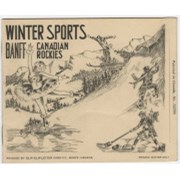
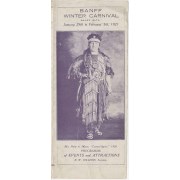
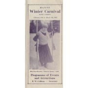
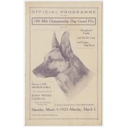
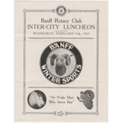
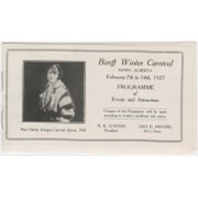
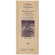
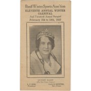
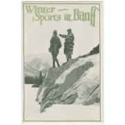
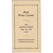
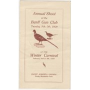
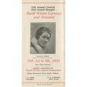
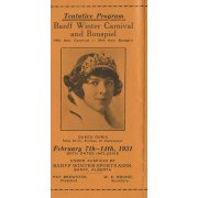
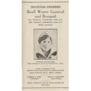
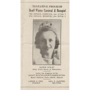
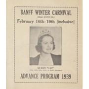
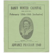
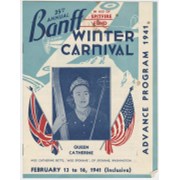
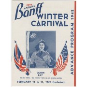
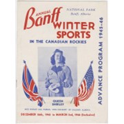
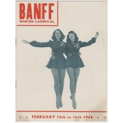
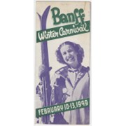
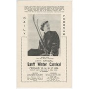
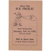
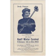
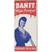
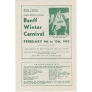
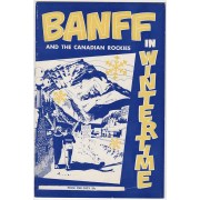
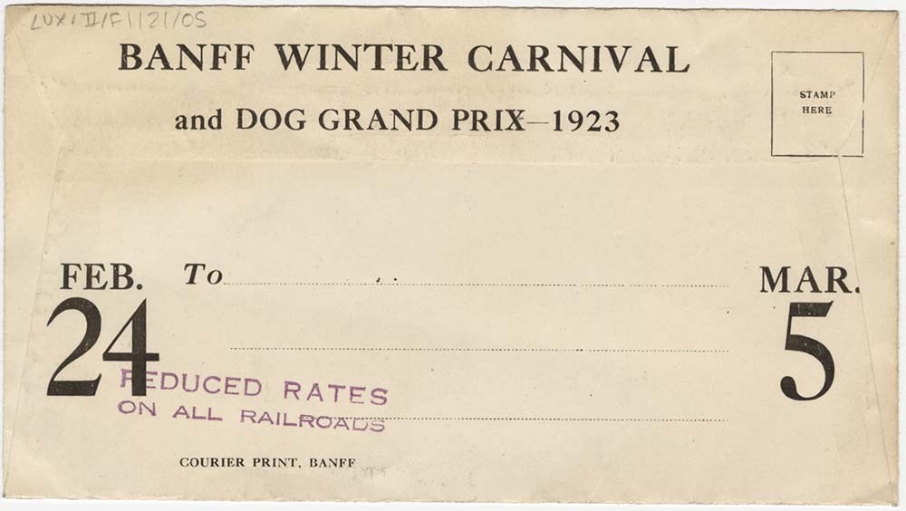
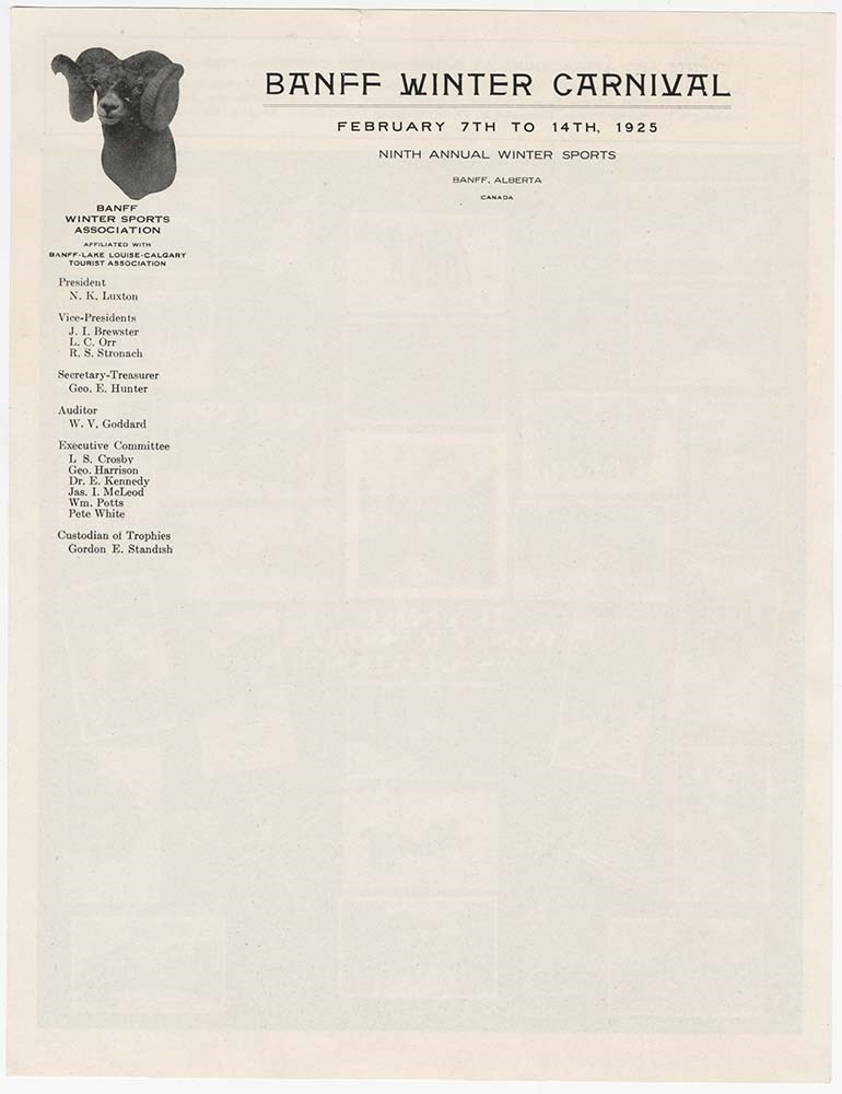
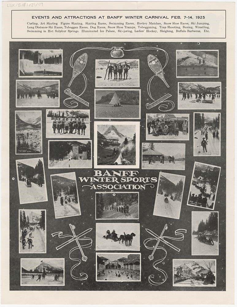
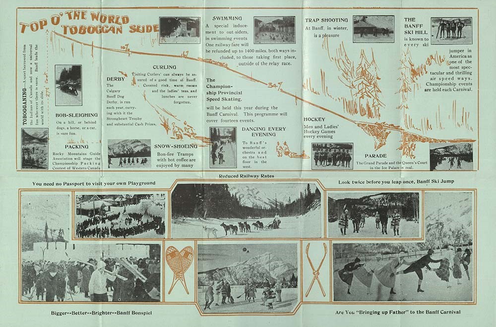
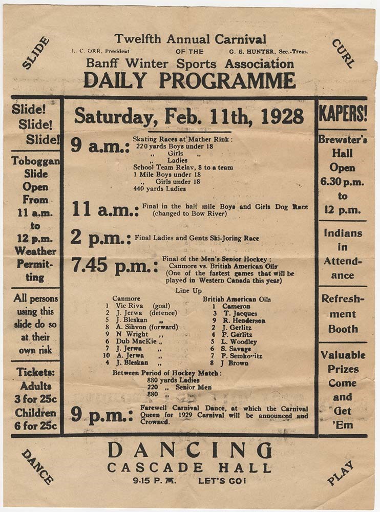
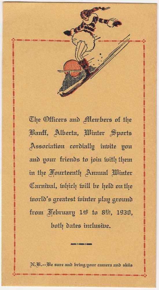
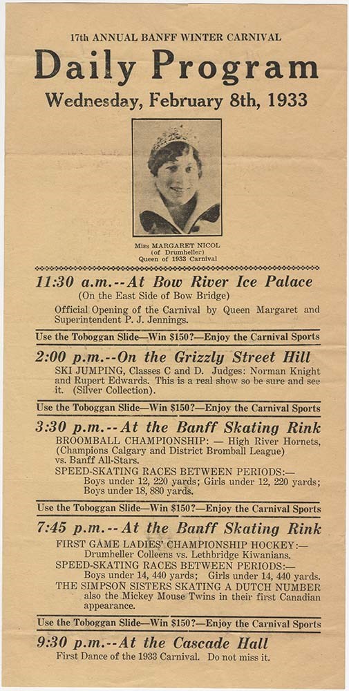
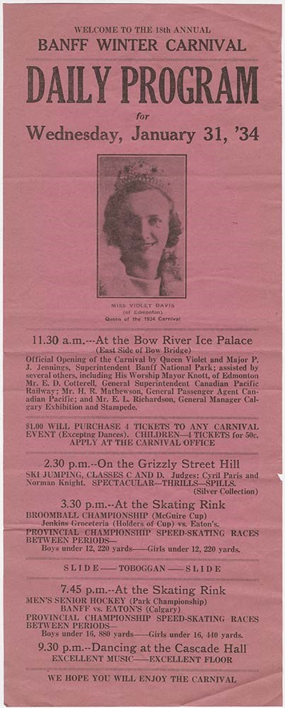
Banff Winter Carnival
https://archives.whyte.org/en/permalink/descriptions54715
- Part Of
- Luxton family fonds
- Scope & Content
- File consists of advertisements, programs, itineraries, information booklets and brochures pertaining to Banff Winter Carnival events held between 1921 and 1958, and an affiliated "Grand Prix" dog racing event in 1923. File also includes an invitation to a Banff Winter Carnival Homecoming Reunion e…
- Date Range
- 1921
- 1923
- 1925-1931
- 1933-1934
- 1939-1942
- 1944
- 1945
- 1946
- 1948-1958
- 1980
- Reference Code
- LUX / II / F1 / 21
- Description Level
- 5 / File
- GMD
- Textual record
- Published record
33 images
28 Electronic Resources
- Part Of
- Luxton family fonds
- Description Level
- 5 / File
- Fonds Number
- LUX
- Series
- LUX / II / F : Collected material
- Sous-Fonds
- LUX / II : Eleanor Luxton sous-fonds
- Sub-Series
- LUX / II / F1 : Textual
- Accession Number
- LUX
- Reference Code
- LUX / II / F1 / 21
- Date Range
- 1921
- 1923
- 1925-1931
- 1933-1934
- 1939-1942
- 1944
- 1945
- 1946
- 1948-1958
- 1980
- Physical Description
- 3 cm of textual records : 46 texts
- Scope & Content
- File consists of advertisements, programs, itineraries, information booklets and brochures pertaining to Banff Winter Carnival events held between 1921 and 1958, and an affiliated "Grand Prix" dog racing event in 1923. File also includes an invitation to a Banff Winter Carnival Homecoming Reunion event [1980].
- Notes
- Items in file are arranged chronologically
- File contains numerous duplicates, some of which have been temporarily removed from file
- Subject Access
- Advertising
- Banff Winter Carnival
- Community events
- Dogs
- Events
- Winter sports
- Sports and recreation
- Tourism
- Snowshoes and snowshoeing
- Skiing
- Ski racing
- Ski jumping
- Ice sculpture
- Skating
- Hunting
- Geographic Access
- Canada
- Alberta
- Banff
- Reproduction Restrictions
- Restrictions may apply
- Language
- English
- Conservation
- Some items in file have been placed in mylar
- Category
- Sports, recreation and leisure
- Title Source
- Title based on contents of file
- Processing Status
- Processed
Electronic Resources
Images


This material is presented as originally created; it may contain outdated cultural descriptions and
potentially offensive content.
Read more.
Ben Gadd fonds
https://archives.whyte.org/en/permalink/descriptions55758
- Part Of
- Ben Gadd fonds
- Scope & Content
- Fonds consists of materials pertaining to Ben Gadd's personal life and career as an environmental researcher, educator, interpretive guide, publisher, public speaker and author, ca.1956-2018. Fonds includes maps, research materials, publication notes/drafts, correspondence, contracts, photographs, …
- Date Range
- 1956-2018
- Reference Code
- M590 / V810 / S61
- Description Level
- 1 / Fonds
- GMD
- Digital image
- Drawing
- Negative
- Newspaper clipping
- Photograph
- Photograph print
- Postcard
- Published record
- Textual record
- Video
- Transparency
- Part Of
- Ben Gadd fonds
- Description Level
- 1 / Fonds
- Fonds Number
- M590
- V810
- Sous-Fonds
- M590
- V810
- Accession Number
- 2021.20
- 2024.01
- Reference Code
- M590 / V810 / S61
- GMD
- Digital image
- Drawing
- Negative
- Newspaper clipping
- Photograph
- Photograph print
- Postcard
- Published record
- Textual record
- Video
- Transparency
- Date Range
- 1956-2018
- Physical Description
- ca. 7.9 metres of textual records -- ca. 274 maps -- 29 VHS tapes -- ca.15 discs with digital files -- 21 cassettes -- photographs -- oversized materials -- USB stick with 15 sldeshows
- History / Biographical
- Ben Gadd (1946-) is a retired naturalist, guide, geologist, instructor, freelance writer and award-winning author based in the Canadian Rockies. Ben was born in Colorado Springs, Colorado in 1946. He met his wife, Cia (Langdon) Gadd at Colorado College in 1965, and the couple married four weeks later. Ben and Cia had two sons, Will and Toby. Ben and his family relocated to Jasper in the late 1960s. Ben later attended the University of Lethbridge and graduated with a Bachelor's degree in Earth Science in 1972. Between 1976 and 1980, Ben taught classes at Mount Royal College and the Southern Alberta Institute of Technology; he later taught additional classes at Grant MacEwan College and Lakeland College. From 1981, Ben also worked as a seasonal naturalist/guide for Parks Canada. Ben left Parks Canada in 1985 to start an independent naturalist guiding business with Cia based in Jasper and other parts of the Canadian Rockies, which the couple continued to operate for over two decades. Ben published his best-known work, "Handbook of the Canadian Rockies", through his publishing company Corax Press in 1986. The second edition of "Handbook of the Canadian Rockies" received multiple awards after its release in 1995. Ben's fiction book, "Raven's End" won the title of Best Canadian Rockies Book at the Banff Mountain Film and Book Festival in 2001 and became a Canadian bestseller. Overall, Ben has authored or co-authored 11 books and received nearly one dozen awards for his achievements as a writer, researcher and guide. Ben continued to lead guided hikes and school programs until his retirement in 2016.
- Scope & Content
- Fonds consists of materials pertaining to Ben Gadd's personal life and career as an environmental researcher, educator, interpretive guide, publisher, public speaker and author, ca.1956-2018. Fonds includes maps, research materials, publication notes/drafts, correspondence, contracts, photographs, video and sound recordings, and other related material. Materials donated in 2024 include one USB stick containing
- Notes
- Ben Gadd fonds arrangement: Series I : Personal records - Subseries A : Travel guides and maps - Subseries B : Education and early writings - Subseries C : Personal interest files - Subseries D : Other personal and collected Series II : Research and publication records - Subseries A : Handbook of the Canadian Rockies - Subseries B : Other publications Series III : Professional records - Subseries A : Parks Canada Records - Subseries B : Interpretive guiding - Subseries C : Teaching records - Subseries D : Other contracts and projects Series IV : Legal and financial records - Subseries A : Legal records - Subseries B : Financial records
- Subject Access
- Education
- Research
- Publication
- Environment
- Geology
- Tourism
- Family and personal life
- Personal and Professional Life
- Academics
- Guiding
- Guides
- Businesses
- Finances
- Conservation
- Wildlife
- Natural history
- Sports and recreation
- Geographic Access
- Canada
- Alberta
- Jasper National Park
- Banff National Park
- Yoho National Park
- Kootenay National Park
- Lethbridge
- United States of America
- Colorado
- Canadian Rocky Mountains
- Reproduction Restrictions
- Copyright restrictions apply
- Language
- English
- French
- Dutch
- Title Source
- Title based on contents of fonds
- Processing Status
- Processed / Unprocessed
This material is presented as originally created; it may contain outdated cultural descriptions and
potentially offensive content.
Read more.
Bon Echo Hut Registers
https://archives.whyte.org/en/permalink/descriptions57649
- Part Of
- Alpine Club of Canada fonds
- Scope & Content
- Sub-series of hut registers from the Bon Echo Hut produced by the Alpine Club of Canada between 1964 and 2006. Registers include entries from visitors to the huts which pertain to individuals' hiking and climbing trips; details of specific events which occurred while staying at the hut, wildlife si…
- Date Range
- 1964-2006
- Reference Code
- M200 / IV / L
- Description Level
- 4 / Sub-series
- GMD
- Textual record
- Organization record
- Part Of
- Alpine Club of Canada fonds
- Description Level
- 4 / Sub-series
- Fonds Number
- M200
- V14
- S6
- Series
- M200 / IV: Hut Registers
- Sous-Fonds
- M200
- Sub-Series
- M200 / IV / L: Bon Echo Hut Registers
- Accession Number
- accn. 7779
- accn. 2014.8278
- Reference Code
- M200 / IV / L
- Responsibility
- Registers produced by Alpine Club of Canada
- Date Range
- 1964-2006
- Physical Description
- 25 cm of textual records 8 volumes
- History / Biographical
- According to the Alpine Club of Canada website: "The rock climbing at Mazinaw Lake is some of the finest in Ontario. The area boasts quartzite cliffs up to 100m high that rise vertically out of the lake. The routes are all traditional and range in grades from 5.0 to 5.11, with the most popular routes in the 5.4 to 5.9 range. The exposure and length of the routes make for an adventure unlike any other in the province. The Bon Echo Hut on the lake is operated by the Toronto Section which also operates a boat to ferry climbers to and from the climbs. The hut is comfortable and an excellent place to meet other climbers and get information on the climbs. The area also offers excellent swimming and hiking. The hut is a single-room wooden structure with a fireplace and kitchen equipped with propane stoves and a large dining table. There is a sauna located near the lake. The hut is not used for sleeping, but is a day hut and cook shelter for those staying at the campsites immediately adjacent to the hut. Bon Echo is located approximately 300 km north east of Toronto on the east side of Mazinaw Lake, a mile north of the Mazinaw Rock and Bon Echo Provincial Park. The drive to the public dock takes three to four hours from Toronto or one and a half hours from Ottawa. The hut can be reached by hiking overland, but this would take an entire day. Boating to the hut is much more convenient."
- Scope & Content
- Sub-series of hut registers from the Bon Echo Hut produced by the Alpine Club of Canada between 1964 and 2006. Registers include entries from visitors to the huts which pertain to individuals' hiking and climbing trips; details of specific events which occurred while staying at the hut, wildlife sightings, custodial issues and updates, and related topics. The sub-series is separated into individual hut registers, arranged by date:
- M200 / IV / L / 1: [Bon Echo - register Jan 28, 1964 - Nov. 25, 1967]
- M200 / IV / L / 2: [Bon Echo hut register Feb. 24, 1968 - Aug. 27, 1972]
- M200 / IV / L / 3: Bon Echo hut book #3 Sept 23, 1972 - Aug. 27, 1978
- M200 / IV / L / 4: Bon Echo Hut book #4 Sept. 2, 1978 - July 13, 1984.
- M200 / IV / L / 5: [Bon Echo Hut Register] July 14, 1984 - Apr 20, 1987
- M200 / IV / L / 6: ACC Bon Echo Log Hut book #6 May 9, 1987 - July 4, 1993
- M200 / IV / L / 7: [Bon Echo Hut Register] vol. 7 July 9, 1993 - Aug. 24, 1997
- M200 / IV / L / 8: Bon Echo Hut Register 1998-2006
- Notes
- M200 / IV / L / 3: Bon Echo hut book #3 Sept 23, 1972 - Aug. 27, 1978 included a colour photographic print that has been separated into V14 / III / C / PA under the same title: Bon Echo hut book #3 Sept 23, 1972 - Aug. 27, 1978. The print was found loose inside the hut register. M200 / IV / L / 6: ACC Bon Echo Log Hut book #6 May 9, 1987 - July 4, 1993 included a photographic print that has been separated into V14 / III / C / PA under the same title: ACC Bon Echo Log Hut book #6 May 9, 1987 - July 4, 1993. The print was found loose inside the hut register. M200 / IV / L / 8: Bon Echo Hut Register 1998-2006 contained loose bird feathers that have been removed from page 173.
- Name Access
- Alpine Club of Canada
- Subject Access
- Huts
- Cabins and shelters
- Alpine Club of Canada
- Birds
- Boats
- Buildings and facilities
- Climbing
- Environment
- Environment and Nature
- Hiking
- Mountaineering
- Property
- Sports and leisure
- Sports and recreation
- Swimming
- Geographic Access
- Canada
- Ontario
- Toronto
- Mazinaw Lake
- Bon Echo Provincial Park
- Access Restrictions
- Restrictions may apply
- Language
- English
- French
- Spanish
- German
- Conservation
- Some hut registers contain loose pages. Some book/register bindings are broken.
- Biographical Source Notes
- The Alpine Club of Canada website: https://www.alpineclubofcanada.ca/bon-echo-hut-toronto-section/
- Title Source
- Title based on contents of sub-series
- Processing Status
- Processed
This material is presented as originally created; it may contain outdated cultural descriptions and
potentially offensive content.
Read more.
Bow Hut Registers
https://archives.whyte.org/en/permalink/descriptions57641
- Part Of
- Alpine Club of Canada fonds
- Scope & Content
- Sub-series of hut registers from the Bow Hut produced by the Alpine Club of Canada between 1968 and 2019. Registers include entries from visitors to the huts which pertain to individuals' hiking and climbing trips; details of specific events which occurred while staying at the hut, wildlife sightin…
- Date Range
- 1968 - 1977
- 1983 - 2006
- 2010 - 2019
- Reference Code
- M200 / IV / F
- Description Level
- 4 / Sub-series
- GMD
- Textual record
- Organization record
- Part Of
- Alpine Club of Canada fonds
- Description Level
- 4 / Sub-series
- Fonds Number
- M200
- V14
- S6
- Series
- M200 / IV: Hut Registers
- Sous-Fonds
- M200
- Sub-Series
- M200 / IV / F: Bow Hut Registers
- Accession Number
- accn. 2023. 32
- accn. 2023.15
- accn. 2023.20
- accn. 2014.8293
- accn. 2023.19
- accn. 8002
- accn. 7779
- accn. 2023.10
- accn. 6465
- accn. 6623
- accn. 6766
- accn. 2376
- accn. 3296
- accn. 3970
- accn. 5215
- accn. 2023.06
- Reference Code
- M200 / IV / F
- Responsibility
- Registers produced by the Alpine Club of Canada
- Date Range
- 1968 - 1977
- 1983 - 2006
- 2010 - 2019
- Physical Description
- 60 cm of textual records (31 volumes)
- History / Biographical
- According to the Alpine Club of Canada website and their Backcountry Huts: Bow Hut Info Sheet: "The original Bow Hut project was initiated by Peter Fuhrmann, funded by Peter and Catharine Whyte and was constructed in 1968 by members of various groups including the Calgary Ski Club and the ACC. The hut was built near Bow Glacier to facilitate ski tourers and mountaineers entering the Wapta via Bow Lake, the easiest and most natural route to the icefields. Fiberglass igloos had been established at both the Peyto Glacier and Balfour Pass in the years prior, and with the building of a deluxe 14-person facility at a location between the two, the vision of a system of huts on the Wapta/Waputik Icefields was taking shape. None of those responsible for the project, however, could have predicted the amount of use and the level of abuse that the original Bow Hut would endure. The hut was abused from the beginning, and saw very little regular maintenance or upkeep. By the 1980s the place was a total hole. The hut was used as a flop house, the snow within several hundred feet of the hut had been contaminated by the outhouses and by indiscriminate waste disposal, and some estimates put the number of users per year at 7,000 (19 people per night at a facility which was built to sleep 14!). The hut which was described upon its completion as the “the Ritz” had metamorphosed into the “Bow Ghetto”. By the mid-1980s it was evident that the facility required radical change. In 1989, under the direction of the ACC’s Huts Committee Chairman Mike Mortimer, that radical change took place. The original hut had been built on a site which was non-porous and therefore had no drainage – a problem that led to the contaminated water and snow. Plans were made for a new hut in a more environmentally sensitive location and fund-raising began. The new Bow Hut was constructed for $98,000, raised primarily through the Calgary and Edmonton sections of the Club. Design concerns in the new hut included proper waste disposal, spacious and bright common areas and sleeping rooms which were both increased in size from the original hut and separated from the common areas to facilitate use by may groups at one time. The palatial new Bow Hut was opened in the fall of 1989 to rave reviews and is presently operated by the ACC. The hut today is a far cry from the original Balfour and Peyto fiberglass igloos, which a Banff Warden predicted in the late ’60s “will only serve the few hardy ski mountaineers who can accept the hardships of carrying and skiing with heavy loads and are willing to put up with discomfort during the night in bad weather”. It’s an even further cry from the abused state of the original Bow Hut and now serves as a stopover for many summer and winter trips."
- Scope & Content
- Sub-series of hut registers from the Bow Hut produced by the Alpine Club of Canada between 1968 and 2019. Registers include entries from visitors to the huts which pertain to individuals' hiking and climbing trips; details of specific events which occurred while staying at the hut, wildlife sightings, custodial issues and updates, and related topics. The sub-series is separated into individual hut registers, arranged by date:
- M200 / IV / F / 1: Bow Glacier Hut [1968 - 1971 register]
- M200 / IV / F / 2: Bow Glacier Hut Register [1971 - 1973]
- M200 / IV / F / 3: Bow Glacier Hut Register [1973 -1975]
- M200 / IV / F / 4: Bow Hut register [1975 -1977]
- M200 / IV / F / 5: Bow Hut [register 1983 - 1984]
- M200 / IV / F / 6: Bow Hut Register [1984-1986]
- M200 / IV / F / 7: [Bow Hut Register Dec. 17, 1986 - June 19, 1989]
- M200 / IV / F / 8: Bow Hut [1989 - 1991]
- M200 / IV / F / 9: Bow Hut 1991 - 1993
- M200 / IV / F / 10: [Bow Hut Registers 1992 - 94]
- M200 / IV / F / 11: "Bow Hut Register" Sept. 30, 1994 - Aug. 28, 1995
- M200 / IV / F / 12: Bow Hut Register Sept. 16, 1995 - June 27, 1996
- M200 / IV / F / 13: [Bow Hut Dec. 1995 - March 2000 Register]
- M200 / IV / F / 14: Bow Hut Register June 29, 1996 - Mar 29, 1997
- M200 / IV / F / 15: Bow Hut register Mar 29, 1997 - Nov. 14, 1997
- M200 / IV / F / 16: "Bow Hut Register" November 24, 1997 - September 26, 1998
- M200 / IV / F / 17: Bow Hut Register [2000 - 2001]
- M200 / IV / F / 18: Bow Hut Register [2001 - 2002]
- M200 / IV / F / 19: Bow Hut Apr 18, 2002 - Feb 24, 2003
- M200 / IV / F / 20: Bow Hut Apr 8, 2003 - July 18, 2004
- M200 / IV / F / 21: Bow Hut July 18, 2004 - Aug 4, 2004
- M200 / IV / F / 22: Bow Hut Register 2004 - 2006
- M200 / IV / F / 23: Bow Hut Register 2006
- M200 / IV / F / 24: Bow Hut Register April 2009 - August 2010
- M200 / IV / F / 25: 2010 - 2012 Bow Hut Register
- M200 / IV / F / 26: Bow Hut 2012 - 2014
- M200 / IV / F / 27: Bow Hut Register [2014/15]
- M200 / IV / F / 28: Hut Register Bow Hut [2015-2016]
- M200 / IV / F / 29: Bow Hut Register, 2016 - 2018
- M200 / IV / F / 30: Bow Hut Register 2018-2019
- M200 / IV / F / 31: [100 YR SWISS CENTENNIAL CLIMB 1999: Faye Summit notes. Bow Hut OCT - DEC 1998]
- Name Access
- Alpine Club of Canada
- Subject Access
- Huts
- Cabins
- Cabins and shelters
- Environment
- Environment and Nature
- Mountain
- Mountaineering
- Parks
- Parks Canada
- Sports and recreation
- Winter sports
- Geographic Access
- Canada
- Bow Glacier
- Banff National Park
- Lake Louise, AB
- Access Restrictions
- Restrictions may apply
- Language
- English
- French
- German
- Spanish
- Related Material
- M200 / V / A / 156
- Biographical Source Notes
- The Alpine Club of Canada website: https://www.alpineclubofcanada.ca/bow-hut/ The Alpine Club of Canada Backcountry Huts: Bow Hut Info Sheet pdf: https://www.alpineclubofcanada.ca/wp-content/uploads/2023/04/BowHut-InfoSheet.pdf
- Title Source
- Title based on contents of sub-series
- Processing Status
- Processed
This material is presented as originally created; it may contain outdated cultural descriptions and
potentially offensive content.
Read more.
Bruce Hatfield fonds
https://archives.whyte.org/en/permalink/descriptions57499
- Part Of
- Bruce Hatfield fonds
- Scope & Content
- Fonds consists of materials pertaining to Dr. Bruce Hatfield's excursions with the Trail Riders between 1963-1995 and his role as Trail Doctor. Fonds includes ca.441 transparency slides with images primarily taken by Bruce during trail rides, 1963-1994, depicting fellow ride participants, camp life…
- Date Range
- 1963-1995
- Reference Code
- M597 / V819
- Description Level
- 1 / Fonds
- GMD
- Photograph
- Transparency
- Textual record
- Negative
- Private record
- Organization record
- Part Of
- Bruce Hatfield fonds
- Description Level
- 1 / Fonds
- Fonds Number
- M597
- V819
- Sous-Fonds
- M597
- V819
- Accession Number
- 2023.29
- Reference Code
- M597 / V819
- Responsibility
- Photographs mostly produced by Bruce Hatfield
- Date Range
- 1963-1995
- Physical Description
- ca.441 col. transparency slides : 35 mm -- 14 col. neg. film strips (49 images) : 35 mm -- ca.1.5 cm textual records
- History / Biographical
- Clinton Bruce Hatfield (1926-2009) was born in Calgary, Alberta. After graduating from Western Canada High School in 1945, Bruce attended the University of Alberta, where he completed a Bachelor of Science degree in 1948, a Master of Science degree in 1951, and a Medical Degree in 1953. Bruce interned at the University of Alberta Hospital before moving to Minneapolis in 1957, where he worked as an Instructor in Medicine at the University of Minnesota Hospital (1958-1959). Bruce moved back to Calgary and opened a private medical practice with his brother, Bob Hatfield. While operating his private practice, Bruce also served on several committees at the Calgary Hospital, including the Intern Committee, Library Committee, Medical Education Committee, Pharmacy Committee (of which he was Chair in 1966), and the Department of Medicine Committee. Bruce was hired as an Assistant Professor at the University of Calgary in 1970, and was Clinical Professor of Medicine when he retired in 1994. Bruce was active as an educator and volunteer in his community, and supported numerous charitable initiatives through the United Church of Canada. He gave public presentations on the topics of Family Life and Sex Education throughout the 1960s and 1970s. Bruce also served as a Trail Doctor for the Trail Riders of the Canadian Rockies on numerous trips between 1963 and 1995. Bruce was also a talented photographer; his photographs were featured in multiple publications including Macleans magazine, Canadian Doctor, and Canadian Medical Association Journal. Bruce was the recipient of many awards including Calgary’s Citizen of the Year (1970), the Premier’s Cup (1983), an Honorary Doctorate of Laws from the University of Calgary (1995) and most recently was chosen as one of Alberta’s 100 Physicians of the Century (2005). Bruce and his brother, Bob, were co-recipients of the Alberta Achievement Award and the Premier's Cup for Excellence in Medicine and the Community. Bruce was married to his wife, Kathleen, for 55 years and the couple raised four daughters together: Linda, Barbara, Sue and Kate.
- Scope & Content
- Fonds consists of materials pertaining to Dr. Bruce Hatfield's excursions with the Trail Riders between 1963-1995 and his role as Trail Doctor. Fonds includes ca.441 transparency slides with images primarily taken by Bruce during trail rides, 1963-1994, depicting fellow ride participants, camp life, wildlife, and landscapes; 14 colour negative film strips (49 images) depicting scenes from a trail ride in 1995; collected correspondence pertaining to trail rides and administrative work; medical reports from trail rides; and collected riders' lists and related material.
- Name Access
- Hatfield, Bruce
- Subject Access
- Trails
- Trail Riders of the Canadian Rockies
- Travel
- Administration
- Animals
- Bighorn Sheep
- Buildings and facilities
- Businesses
- Camping
- Correspondence
- Dancing
- Deer
- Dogs
- Elk
- Entertainment
- Environment
- Fishing
- Glaciers
- Guides
- Horse packing
- Horseback riding
- Horses
- Health services
- Landscapes
- Membership
- Mountain Goats
- Music
- Musicians
- Organizations
- Outfitters, trail guides and packers
- Pack trips
- Recreation
- Sports and recreation
- Swimming
- Tourism
- Trail guides
- Geographic Access
- Canada
- Alberta
- British Columbia
- Access Restrictions
- Some restrictions apply- contains personal information
- Reproduction Restrictions
- Some restrictions apply- contains personal information
- Related Material
- Trail Riders of the Canadian Rockies fonds (M545/V635)
- Biographical Source Notes
- https://searcharchives.ucalgary.ca/dr-c-bruce-hatfield-fonds
- https://mhfh.com/tribute/details/15163/Clinton-Hatfield/obituary.html
- Title Source
- Title based on contents of fonds
- Processing Status
- Processed
This material is presented as originally created; it may contain outdated cultural descriptions and
potentially offensive content.
Read more.
Calgary Exhibition and Stampede
https://archives.whyte.org/en/permalink/descriptions54716
- Part Of
- Luxton family fonds
- Scope & Content
- File consists of published textual materials pertaining to Calgary Exhibition and Stampede events between 1912 and 1972. File includes cutout paper logos, books, brochures and pamphlets, "prize list and rules" booklets, informational content mailed to Eleanor Luxton [1928] empty branded Stampede en…
- Date Range
- 1912
- [1920-1930]
- 1924-1925
- 1927-1933
- 1935
- 1939
- 1943-1946
- [1945-1950]
- 1949
- 1951
- 1953
- 1955
- 1957-1959
- 1964
- 1972
- Reference Code
- LUX / II / F1 / 22
- Description Level
- 5 / File
- GMD
- Textual record
- Published record
- Postcard
- Organization record
- Part Of
- Luxton family fonds
- Description Level
- 5 / File
- Fonds Number
- LUX
- Series
- LUX / II / F : Collected material
- Sous-Fonds
- LUX / II : Eleanor Luxton sous-fonds
- Sub-Series
- LUX / II / F1 : Textual
- Accession Number
- LUX
- Reference Code
- LUX / II / F1 / 22
- Date Range
- 1912
- [1920-1930]
- 1924-1925
- 1927-1933
- 1935
- 1939
- 1943-1946
- [1945-1950]
- 1949
- 1951
- 1953
- 1955
- 1957-1959
- 1964
- 1972
- Physical Description
- 4 cm of textual records ; 6 cloth ribbons
- Scope & Content
- File consists of published textual materials pertaining to Calgary Exhibition and Stampede events between 1912 and 1972. File includes cutout paper logos, books, brochures and pamphlets, "prize list and rules" booklets, informational content mailed to Eleanor Luxton [1928] empty branded Stampede envelopes, blank pages with Stampede letterhead, and 6 cloth ribbons labelled "Native Daughter", "Pioneer" and "Pioneer Son" [n.d.].
- Notes
- File contains duplicates
- Some excess duplicates have been temporarily moved and may be de-accessioned in the future
- Name Access
- Luxton, Norman
- Luxton, Eleanor
- Subject Access
- Calgary Stampede
- Sports and recreation
- Souvenir
- Events
- Horses
- Horseback riding
- Hotel
- Anniversary
- Entertainment
- Advertising
- Parades
- Geographic Access
- Canada
- Alberta
- Calgary
- Reproduction Restrictions
- Restrictions may apply
- Language
- English
- Conservation
- One creased paper logo and all cloth ribbons from file have been placed in mylar sleeves
- Title Source
- Title based on contents of file
- Processing Status
- Processed
This material is presented as originally created; it may contain outdated cultural descriptions and
potentially offensive content.
Read more.
Canadian Pacific Railway promotional prints
https://archives.whyte.org/en/permalink/descriptions55577
- Part Of
- Canadian Pacific Railway fonds
- Scope & Content
- Series pertains to photograph prints of Canadian Pacific Railway properties and surrounding locations. Includes scenes from around the town of Banff and Banff National Park, interior and exterior views of hotels [particularly the Banff Springs Hotel and the Chateau Lake Louise], trophies, portraits…
- Date Range
- [ca.1960-1960]
- Reference Code
- V782 / II / PA115 - 01 to 309
- Description Level
- 3 / Series
- GMD
- Photograph
- Part Of
- Canadian Pacific Railway fonds
- Description Level
- 3 / Series
- Fonds Number
- M584 / V782
- Sous-Fonds
- V782
- Accession Number
- 625
- Reference Code
- V782 / II / PA115 - 01 to 309
- GMD
- Photograph
- Date Range
- [ca.1960-1960]
- Physical Description
- 309 prints : b&w ; 27.9 x 20.3 cm or smaller
- Scope & Content
- Series pertains to photograph prints of Canadian Pacific Railway properties and surrounding locations. Includes scenes from around the town of Banff and Banff National Park, interior and exterior views of hotels [particularly the Banff Springs Hotel and the Chateau Lake Louise], trophies, portraits, horses and horseback riding, skiing, trains, photographs of paintings, and various scenic views.
- Notes
- Most prints have titles or captions on the backs, as well as negatives information.
- Subject Access
- Administration building
- Art
- Artists
- Banff Springs Hotel
- Buildings
- Buildings and facilities
- Camps
- Chateau Lake Louise
- Environment
- Gondolas
- Hiking
- Horses
- Horseback riding
- Hotels
- Mountains
- Outfitters
- Painting
- Skiing
- Sports and recreation
- Tourism
- Trains
- Transportation
- Geographic Access
- Banff
- Lake Louise
- Moraine Lake
- Banff National Park
- Alberta
- Canada
- Reproduction Restrictions
- Not to be reproduced (see NA 31). Copyright belongs to CPR Archives, now managed by The Canadian Railway Museum (Exporail), Montreal.
- Language
- English
- Title Source
- Title based on contents of series
- Processing Status
- Processed
This material is presented as originally created; it may contain outdated cultural descriptions and
potentially offensive content.
Read more.
Cartographic Materials
https://archives.whyte.org/en/permalink/descriptions23065
- Part Of
- Hans Gmoser fonds
- Scope & Content
- Cartographic materials in these four oversized files consist of the following:
- Date Range
- 1914-1973
- Reference Code
- M224 / O.S. Cartographic
- Description Level
- 5 / File
- Part Of
- Hans Gmoser fonds
- Description Level
- 5 / File
- Series
- IV.C. Textual records: Cartographic records
- Accession Number
- 7361, 7877, 8111
- Reference Code
- M224 / O.S. Cartographic
- Date Range
- 1914-1973
- Physical Description
- 48 cartographic records.
- Scope & Content
- Cartographic materials in these four oversized files consist of the following:
- Subject Access
- Discovery and Exploration
- Environment and Nature
- Family and personal life
- Sports and Recreation
- Title Source
- Title based on contents.
- Content Details
- Folder 1 Map on heavy paper, wrapped in plastic. “A Reconnaissance Topographic Map Suveyed and edited by Bradford Washburn” printed in Bern, Switzerland. Centred on Mt. McKinley.- From 7361. Palliser- Kananaskis Area British Columbia and Alberta- Publication No. 1962- Reprinted by the Surveys and Mapping Branch, Department of Mines and Technical Surveys, Ottawa. Mistaya British Columbia and Alberta- Compiled, drawn and printed at the office of the Surveyor General, Ottawa, 1931. Reprinted with corrections at the Surveys and Mapping Branch, Ottawa, 1950. National Topographic Series. Yoho British Columbia and Alberta- Compiled, drawn and printed at the office of the Surveyor General, Ottawa, 1932. Reprinted with corrections at the Surveys and Mapping Branch, Ottawa, 1952. National Topographic Series. Price 25 cents. Invermere British Columbia Kootenay Land District- National Topographic System- First Status Edition compiled and produced by the Geographic Division, Surveys, and Mapping Branch, Dept. of Lands, Forests and Water Resources, Victoria, BC 1964-65- annotated Beaton British Columbia Kootenay Land District- National Topographic System- First Status Edition compiled and produced by the Geographic Division, Surveys, and Mapping Branch, Dept. of Lands, Forests and Water Resources, Victoria, BC 1964-66- annotated Lardeau British Columbia Kootenay Land District- National Topographic System- First Status Edition compiled and produced by the Geographic Division, Surveys, and Mapping Branch, Dept. of Lands, Forests and Water Resources, Victoria, BC 1963- annotated Mount McKinley Alaska, Published by the Museum of Science, Boston, Mass, USA and the Swiss Foundation for Alpine Research, Zurich. 1960. Centennial Range Yukon Territory- M.C.R. 7 Edition 1- Produced and printed 1967 by the Surveys and Mapping Branch, Department of Energy, Mines and Resources- maps printed in 1961-62- annotated British Columbia Land Recording Dists.- Land Commissioner’s Offices- Department of Lands and Forests- first published 1957- Updated Nov. 1, 1960. Master Site Plan Bugaboo Creek Lodge Project number 6844- June 18, 1973- Cohos Delesalle & Evamy. Folder 2 Boundary Between Alberta and BC- Athabasca Pass- Sheet No. 27A – annotated- centered on Jasper Park Boundary Between Alberta and BC-All below Wheeler Maps (by hand) used for the Great Divide as per Chic-no topographical maps used for both Hans and similar maps were used by Chic bottom rip taped- Sheet No. 20- Drawn and printed by the Topographical Survey of Canada, Ottawa - centered on Clearwater forest and Lyell Icefield at bottom right Boundary Between Alberta and BC- Sheet No. 15- Drawn and printed at the Surveyor General’s Office, Ottawa, Canada- centered on Rocky Mountains Park Boundary Between Alberta and BC - Sheet No. 19- Drawn and printed at the Surveyor General’s Office, Ottawa, Canada- centered on centered on Clearwater Forest with Mt. Alan Campbell at bottom Boundary Between Alberta and BC- Sheet No. 25- annotated- Drawn and printed by the Topographical Survey of Canada, Ottawa - centered on Jasper Park with Chisel Peak at bottom Boundary Between Alberta and BC- Sheet No. 19- dirt and annotated- revised 1925- drawn and printed by the Topographical Survey of Canada, Ottawa- centered on Clearwater and Push Pass W. Boundary Between Alberta and BC- annotated- Sheet 16- revised 1925- drawn and printed by the Topographical Survey of Canada, Ottawa- centered on Yoho Park and Rocky Mountains Park Steele Glacier- Topographical Survey 1967 Arial Photography 1951 Mount St. Elias Canada- United State of America- Produced and Printed by the Surveys and Mapping Branch, Department of Mines and Technical Surveys 1962 from air photographs taken in 1951 and 1956- annotated Woolsey Glacier- Revelstoke National Park British Columbia – Printed by the Surveys and Mapping Branch Department of Energy, Mines and Resources- 1967 Windermere Kootenay District- Map 165A Issued 1918- Reprinted by the Surveys and Mapping Branch, Department of Mines and Technical Surveys, Ottawa. Folder 3 Boundary Between Alberta and BC- Sheet No. 20- heavily annotated- revised 1925- drawn and printed by the Topographical Survey of Canada, Ottawa- centered on Clearwater Forest, Saskatchewan Glacier at top left Boundary Between Alberta and BC- Sheet No. 18- heavily ripped- annotated - notes on back- revised 1925- drawn and printed by the Topographical Survey of Canada, Ottawa- centered on Clearwater Forest, Mt Mummery at bottom Boundary Between Alberta and BC- Sheet No. 17 (in pencil “A and B”)- annotated - heavily ripped- drawn and printed at the Surveyor Generals’ Office- centered on Clearwater Forest and Yoho Park Boundary Between Alberta and BC- Sheet No. 26- annotated- revised 1925- drawn and printed by the Topographical Survey of Canada, Ottawa- centered on Jasper Park and Icefields Boundary Between Alberta and BC- Sheet No. 17- revised 1925- drawn and printed by the Topographical Survey of Canada, Ottawa- centered on Clearwater Forest and Yoho Park Boundary Between Alberta and BC- Sheet No. 28- stained- centered on Jasper Park Boundary Between Alberta and BC- Sheet No. 24- annotated- revised edition, 1925- drawn and printed by the Topographical Survey of Canada, Ottawa- centered on Jasper Park Boundary Between Alberta and BC- Sheet No. 16- annotated- revised 1925- drawn and printed by the Topographical Survey of Canada, Ottawa- centered on Yoho and Rocky Mountains Park Interprovincial Boundary Commission Boundary Between Alberta and British Columbia. Revised edition 1925 drawn and printed by the Topographical Survey of Canada, Ottawa. Sheet No. 27. Following maps are from accession 7877. Interprovincial Boundary Commission Boundary Between Alberta and British Columbia. Surveyed 1920. Drawn and printed by the Topographical Survey of Canada, Ottawa. Sheet No. 26. Interprovincial Boundary Commission Boundary Between Alberta and British Columbia. Surveyed 1920, 1921. Drawn and printed by the Topographical Survey of Canada, Ottawa. Sheet No. 25. Interprovincial Boundary Commission Boundary Between Alberta and British Columbia. Surveyed 1919, 1921. Drawn and printed by the Topographical Survey of Canada, Ottawa. Sheet No. 24. Interprovincial Boundary Commission Boundary Between Alberta and British Columbia. Revised edition 1925 drawn and printed by the Topographical Survey of Canada, Ottawa. Sheet No. 21. Interprovincial Boundary Commission Boundary Between Alberta and British Columbia. Revised edition 1925 drawn and printed by the Topographical Survey of Canada, Ottawa. Sheet No. 18. Interprovincial Boundary Commission Boundary Between Alberta and British Columbia. Surveyed 1913. Drawn and printed by the Topographical Survey of Canada, Ottawa. Sheet No. 13 A. Interprovincial Boundary Commission Boundary Between Alberta and British Columbia. Surveyed 1916. Drawn and printed by the Topographical Survey of Canada, Ottawa. Sheet No. 12 A. Interprovincial Boundary Commission Boundary Between Alberta and British Columbia. Surveyed 1916. Drawn and printed by the Topographical Survey of Canada, Ottawa. Sheet No. 11. Interprovincial Boundary Commission Boundary Between Alberta and British Columbia. Surveyed 1916. Drawn and printed by the Topographical Survey of Canada, Ottawa. Sheet No. 10. Interprovincial Boundary Commission Boundary Between Alberta and British Columbia. Surveyed 1916. Drawn and printed by the Topographical Survey of Canada, Ottawa. Sheet No. 9. Interprovincial Boundary Commission Boundary Between Alberta and British Columbia. Surveyed 1916. Drawn and printed by the Topographical Survey of Canada, Ottawa. Sheet No. 8. Interprovincial Boundary Commission Boundary Between Alberta and British Columbia. Surveyed 1916. Drawn and printed by the Topographical Survey of Canada, Ottawa. Sheet No. 6. Interprovincial Boundary Commission Boundary Between Alberta and British Columbia. Surveyed 1915. Drawn and printed by the Topographical Survey of Canada, Ottawa. Sheet No. 5. Interprovincial Boundary Commission Boundary Between Alberta and British Columbia. Surveyed 1914. Drawn and printed by the Topographical Survey of Canada, Ottawa. Sheet No. 4. Interprovincial Boundary Commission Boundary Between Alberta and British Columbia. Surveyed 1922. Drawn and printed by the Topographical Survey of Canada, Ottawa. Sheet No. 31. Interprovincial Boundary Commission Boundary Between Alberta and British Columbia. Surveyed 1922, 1924. Drawn and printed by the Topographical Survey of Canada, Ottawa. Sheet No. 30. Interprovincial Boundary Commission Boundary Between Alberta and British Columbia. Surveyed 1917. Drawn and printed by the Topographical Survey of Canada, Ottawa. Sheet No. 29.
- Processing Status
- Processed
This material is presented as originally created; it may contain outdated cultural descriptions and
potentially offensive content.
Read more.