Narrow Results By
- Byron Harmon fonds 324
- Elliott Barnes fonds
- Alpine Club of Canada fonds 15
- George Noble fonds 8
- Arthur Oliver Wheeler fonds 7
- Luxton family fonds 7
- Mary Schaffer fonds 5
- Archives General File Collection 3
- Charles Reid fonds 3
- Underwood and Underwood Publishers fonds 3
- Dave White family fonds 2
- Hans Gmoser fonds
Personal Documents
https://archives.whyte.org/en/permalink/descriptions23022
- Part Of
- Hans Gmoser fonds
- Scope & Content
- One of three files pertaining to Personal Documents.
- Date Range
- 1880-2013
- Reference Code
- M224 / 30
- Description Level
- 5 / File
- Part Of
- Hans Gmoser fonds
- Description Level
- 5 / File
- Series
- IV.C. Textual records
- Accession Number
- 8111
- Reference Code
- M224 / 30
- Date Range
- 1880-2013
- Physical Description
- 2 cm of textual records.
- Scope & Content
- One of three files pertaining to Personal Documents.
- Subject Access
- Discovery and Exploration
- Environment and Nature
- Family and personal life
- Sports and Recreation
- Title Source
- Supplied title.
- Content Details
- Canadian Passport July 15, 1983-July 15, 1988 Canadian Passport June 30, 1988- June 30, 1993 Canadian Passport April 6, 1993-April 6, 1998 Canadian Passport Feb 18, 1998-Feb 18, 2003 Photocopy of Johann Wolfgang Gmoser’s Canadian Passport Jan 28, 2003-2008. Photocopy of Johann Wolfgang Gmoser’s Austrian Passport February 3, 2003-2013 Photocopy of passport? From an individual born in 1880.
- Processing Status
- Processed
This material is presented as originally created; it may contain outdated cultural descriptions and
potentially offensive content.
Read more.
Cartographic Materials
https://archives.whyte.org/en/permalink/descriptions23065
- Part Of
- Hans Gmoser fonds
- Scope & Content
- Cartographic materials in these four oversized files consist of the following:
- Date Range
- 1914-1973
- Reference Code
- M224 / O.S. Cartographic
- Description Level
- 5 / File
- Part Of
- Hans Gmoser fonds
- Description Level
- 5 / File
- Series
- IV.C. Textual records: Cartographic records
- Accession Number
- 7361, 7877, 8111
- Reference Code
- M224 / O.S. Cartographic
- Date Range
- 1914-1973
- Physical Description
- 48 cartographic records.
- Scope & Content
- Cartographic materials in these four oversized files consist of the following:
- Subject Access
- Discovery and Exploration
- Environment and Nature
- Family and personal life
- Sports and Recreation
- Title Source
- Title based on contents.
- Content Details
- Folder 1 Map on heavy paper, wrapped in plastic. “A Reconnaissance Topographic Map Suveyed and edited by Bradford Washburn” printed in Bern, Switzerland. Centred on Mt. McKinley.- From 7361. Palliser- Kananaskis Area British Columbia and Alberta- Publication No. 1962- Reprinted by the Surveys and Mapping Branch, Department of Mines and Technical Surveys, Ottawa. Mistaya British Columbia and Alberta- Compiled, drawn and printed at the office of the Surveyor General, Ottawa, 1931. Reprinted with corrections at the Surveys and Mapping Branch, Ottawa, 1950. National Topographic Series. Yoho British Columbia and Alberta- Compiled, drawn and printed at the office of the Surveyor General, Ottawa, 1932. Reprinted with corrections at the Surveys and Mapping Branch, Ottawa, 1952. National Topographic Series. Price 25 cents. Invermere British Columbia Kootenay Land District- National Topographic System- First Status Edition compiled and produced by the Geographic Division, Surveys, and Mapping Branch, Dept. of Lands, Forests and Water Resources, Victoria, BC 1964-65- annotated Beaton British Columbia Kootenay Land District- National Topographic System- First Status Edition compiled and produced by the Geographic Division, Surveys, and Mapping Branch, Dept. of Lands, Forests and Water Resources, Victoria, BC 1964-66- annotated Lardeau British Columbia Kootenay Land District- National Topographic System- First Status Edition compiled and produced by the Geographic Division, Surveys, and Mapping Branch, Dept. of Lands, Forests and Water Resources, Victoria, BC 1963- annotated Mount McKinley Alaska, Published by the Museum of Science, Boston, Mass, USA and the Swiss Foundation for Alpine Research, Zurich. 1960. Centennial Range Yukon Territory- M.C.R. 7 Edition 1- Produced and printed 1967 by the Surveys and Mapping Branch, Department of Energy, Mines and Resources- maps printed in 1961-62- annotated British Columbia Land Recording Dists.- Land Commissioner’s Offices- Department of Lands and Forests- first published 1957- Updated Nov. 1, 1960. Master Site Plan Bugaboo Creek Lodge Project number 6844- June 18, 1973- Cohos Delesalle & Evamy. Folder 2 Boundary Between Alberta and BC- Athabasca Pass- Sheet No. 27A – annotated- centered on Jasper Park Boundary Between Alberta and BC-All below Wheeler Maps (by hand) used for the Great Divide as per Chic-no topographical maps used for both Hans and similar maps were used by Chic bottom rip taped- Sheet No. 20- Drawn and printed by the Topographical Survey of Canada, Ottawa - centered on Clearwater forest and Lyell Icefield at bottom right Boundary Between Alberta and BC- Sheet No. 15- Drawn and printed at the Surveyor General’s Office, Ottawa, Canada- centered on Rocky Mountains Park Boundary Between Alberta and BC - Sheet No. 19- Drawn and printed at the Surveyor General’s Office, Ottawa, Canada- centered on centered on Clearwater Forest with Mt. Alan Campbell at bottom Boundary Between Alberta and BC- Sheet No. 25- annotated- Drawn and printed by the Topographical Survey of Canada, Ottawa - centered on Jasper Park with Chisel Peak at bottom Boundary Between Alberta and BC- Sheet No. 19- dirt and annotated- revised 1925- drawn and printed by the Topographical Survey of Canada, Ottawa- centered on Clearwater and Push Pass W. Boundary Between Alberta and BC- annotated- Sheet 16- revised 1925- drawn and printed by the Topographical Survey of Canada, Ottawa- centered on Yoho Park and Rocky Mountains Park Steele Glacier- Topographical Survey 1967 Arial Photography 1951 Mount St. Elias Canada- United State of America- Produced and Printed by the Surveys and Mapping Branch, Department of Mines and Technical Surveys 1962 from air photographs taken in 1951 and 1956- annotated Woolsey Glacier- Revelstoke National Park British Columbia – Printed by the Surveys and Mapping Branch Department of Energy, Mines and Resources- 1967 Windermere Kootenay District- Map 165A Issued 1918- Reprinted by the Surveys and Mapping Branch, Department of Mines and Technical Surveys, Ottawa. Folder 3 Boundary Between Alberta and BC- Sheet No. 20- heavily annotated- revised 1925- drawn and printed by the Topographical Survey of Canada, Ottawa- centered on Clearwater Forest, Saskatchewan Glacier at top left Boundary Between Alberta and BC- Sheet No. 18- heavily ripped- annotated - notes on back- revised 1925- drawn and printed by the Topographical Survey of Canada, Ottawa- centered on Clearwater Forest, Mt Mummery at bottom Boundary Between Alberta and BC- Sheet No. 17 (in pencil “A and B”)- annotated - heavily ripped- drawn and printed at the Surveyor Generals’ Office- centered on Clearwater Forest and Yoho Park Boundary Between Alberta and BC- Sheet No. 26- annotated- revised 1925- drawn and printed by the Topographical Survey of Canada, Ottawa- centered on Jasper Park and Icefields Boundary Between Alberta and BC- Sheet No. 17- revised 1925- drawn and printed by the Topographical Survey of Canada, Ottawa- centered on Clearwater Forest and Yoho Park Boundary Between Alberta and BC- Sheet No. 28- stained- centered on Jasper Park Boundary Between Alberta and BC- Sheet No. 24- annotated- revised edition, 1925- drawn and printed by the Topographical Survey of Canada, Ottawa- centered on Jasper Park Boundary Between Alberta and BC- Sheet No. 16- annotated- revised 1925- drawn and printed by the Topographical Survey of Canada, Ottawa- centered on Yoho and Rocky Mountains Park Interprovincial Boundary Commission Boundary Between Alberta and British Columbia. Revised edition 1925 drawn and printed by the Topographical Survey of Canada, Ottawa. Sheet No. 27. Following maps are from accession 7877. Interprovincial Boundary Commission Boundary Between Alberta and British Columbia. Surveyed 1920. Drawn and printed by the Topographical Survey of Canada, Ottawa. Sheet No. 26. Interprovincial Boundary Commission Boundary Between Alberta and British Columbia. Surveyed 1920, 1921. Drawn and printed by the Topographical Survey of Canada, Ottawa. Sheet No. 25. Interprovincial Boundary Commission Boundary Between Alberta and British Columbia. Surveyed 1919, 1921. Drawn and printed by the Topographical Survey of Canada, Ottawa. Sheet No. 24. Interprovincial Boundary Commission Boundary Between Alberta and British Columbia. Revised edition 1925 drawn and printed by the Topographical Survey of Canada, Ottawa. Sheet No. 21. Interprovincial Boundary Commission Boundary Between Alberta and British Columbia. Revised edition 1925 drawn and printed by the Topographical Survey of Canada, Ottawa. Sheet No. 18. Interprovincial Boundary Commission Boundary Between Alberta and British Columbia. Surveyed 1913. Drawn and printed by the Topographical Survey of Canada, Ottawa. Sheet No. 13 A. Interprovincial Boundary Commission Boundary Between Alberta and British Columbia. Surveyed 1916. Drawn and printed by the Topographical Survey of Canada, Ottawa. Sheet No. 12 A. Interprovincial Boundary Commission Boundary Between Alberta and British Columbia. Surveyed 1916. Drawn and printed by the Topographical Survey of Canada, Ottawa. Sheet No. 11. Interprovincial Boundary Commission Boundary Between Alberta and British Columbia. Surveyed 1916. Drawn and printed by the Topographical Survey of Canada, Ottawa. Sheet No. 10. Interprovincial Boundary Commission Boundary Between Alberta and British Columbia. Surveyed 1916. Drawn and printed by the Topographical Survey of Canada, Ottawa. Sheet No. 9. Interprovincial Boundary Commission Boundary Between Alberta and British Columbia. Surveyed 1916. Drawn and printed by the Topographical Survey of Canada, Ottawa. Sheet No. 8. Interprovincial Boundary Commission Boundary Between Alberta and British Columbia. Surveyed 1916. Drawn and printed by the Topographical Survey of Canada, Ottawa. Sheet No. 6. Interprovincial Boundary Commission Boundary Between Alberta and British Columbia. Surveyed 1915. Drawn and printed by the Topographical Survey of Canada, Ottawa. Sheet No. 5. Interprovincial Boundary Commission Boundary Between Alberta and British Columbia. Surveyed 1914. Drawn and printed by the Topographical Survey of Canada, Ottawa. Sheet No. 4. Interprovincial Boundary Commission Boundary Between Alberta and British Columbia. Surveyed 1922. Drawn and printed by the Topographical Survey of Canada, Ottawa. Sheet No. 31. Interprovincial Boundary Commission Boundary Between Alberta and British Columbia. Surveyed 1922, 1924. Drawn and printed by the Topographical Survey of Canada, Ottawa. Sheet No. 30. Interprovincial Boundary Commission Boundary Between Alberta and British Columbia. Surveyed 1917. Drawn and printed by the Topographical Survey of Canada, Ottawa. Sheet No. 29.
- Processing Status
- Processed
This material is presented as originally created; it may contain outdated cultural descriptions and
potentially offensive content.
Read more.
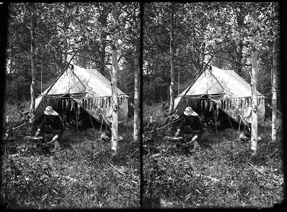
Elliott Barnes and Barnes Family Photographs
https://archives.whyte.org/en/permalink/descriptions15031
- Part Of
- Elliott Barnes fonds
- Scope & Content
- File pertains to Barnes family members and activities at Kootenay Plains, Banff, Jumping Pound and Morley, Alberta. Includes a mix of family portraits, scenic views, wildlife, sports and recreation, Stoney Nakoda, and ranching.
- Date Range
- [ca.1905-ca.1914]
- Reference Code
- V48 / I / B / NG - 1 to 76
- Description Level
- 5 / File
- GMD
- Negative
- Transparency
73 images
- Part Of
- Elliott Barnes fonds
- Description Level
- 5 / File
- Fonds Number
- V48
- Series
- I.B. Negatives : Glass
- Sous-Fonds
- V48
- Accession Number
- .
- Reference Code
- V48 / I / B / NG - 1 to 76
- GMD
- Negative
- Transparency
- Date Range
- [ca.1905-ca.1914]
- Physical Description
- 76 photographs : negatives, glass
- History / Biographical
- See fonds level description
- Scope & Content
- File pertains to Barnes family members and activities at Kootenay Plains, Banff, Jumping Pound and Morley, Alberta. Includes a mix of family portraits, scenic views, wildlife, sports and recreation, Stoney Nakoda, and ranching.
- Notes
- Negatives are related to negatives in sub-series I.A. Negatives : Film
- Identifications provided by Barnes family and Archives LIST OF NEGATIVES :
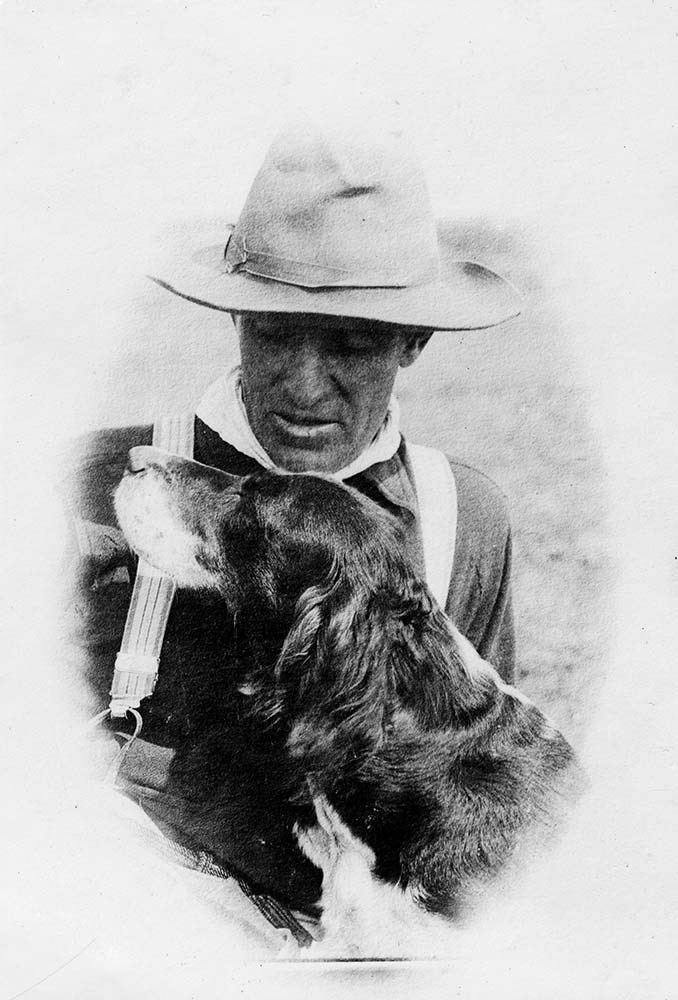
- 1 Elliott Barnes and dog (Gyp)
- 2 Elliott Barnes in front of fireplace at his Kootenay Plains cabin, [1907?]
- 3 Barnes cabin at Kootenay Plains, Elliott Barnes on step, Elliott Peak in background
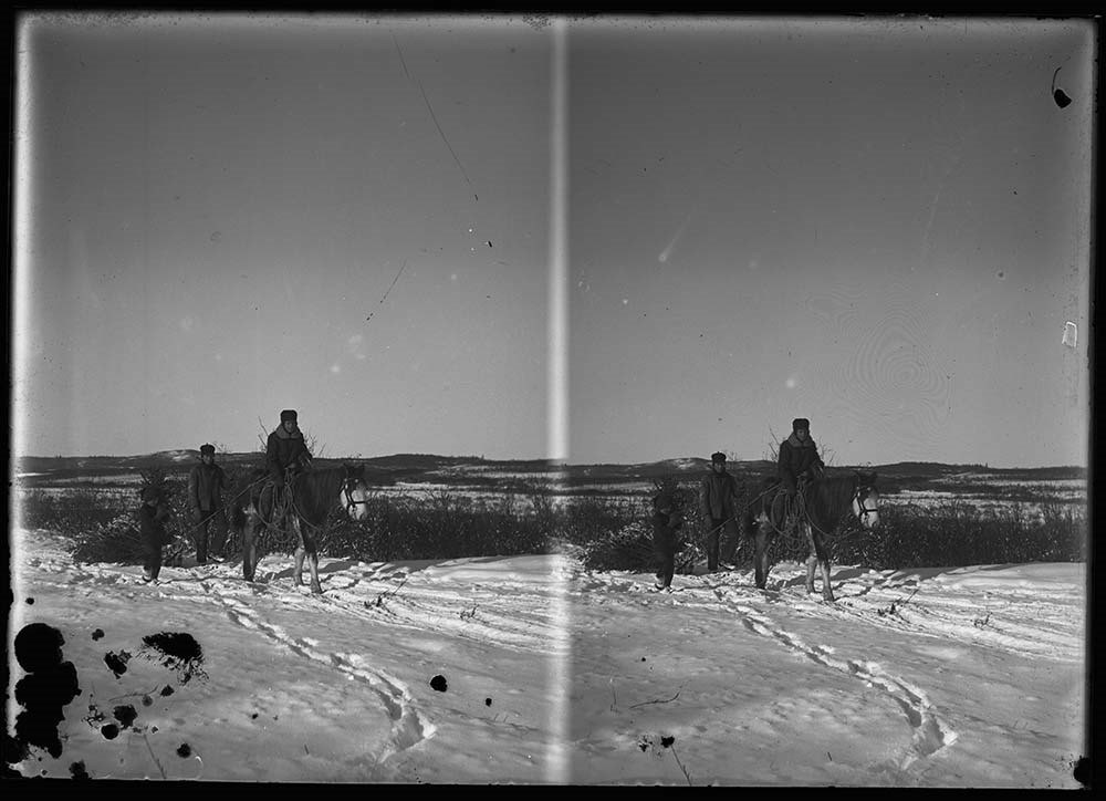
- 4 Horses on Kootenay Plains, Indigenous man and Barnes herding, Elliott Peak in background
- 5 Horses pasturing on Kootenay Plains
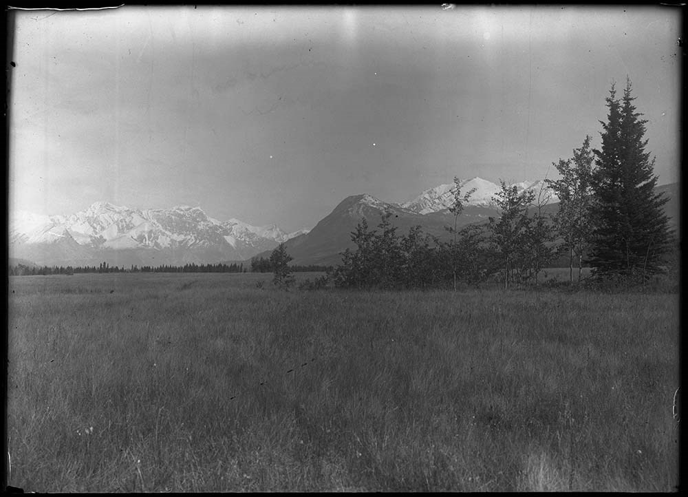
- 6 Kootenay Plains, 1906
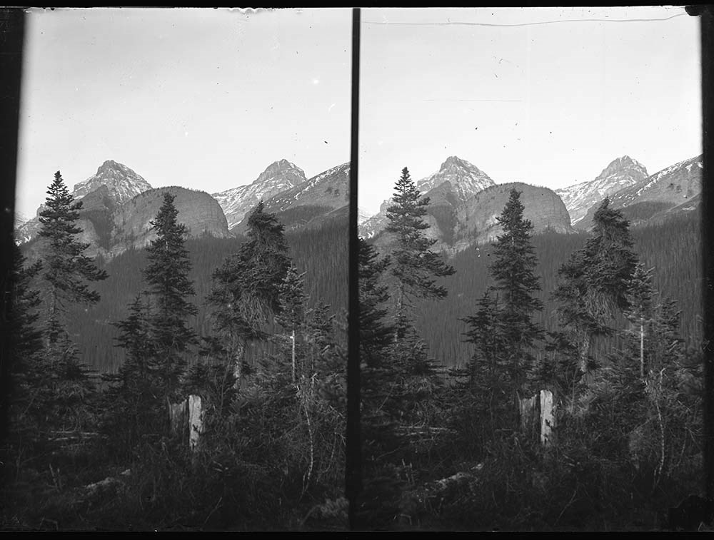
- 7 Kootenay Plains and Mt. Siffleur
- 8 Kootenay Plains and unknown peak
- 9 Indigenous woman and child at Kootenay Plains [Mrs. Paul Beaver]
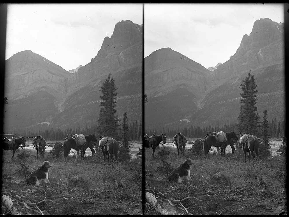
- 10 Barnes pack train on Siffleur River
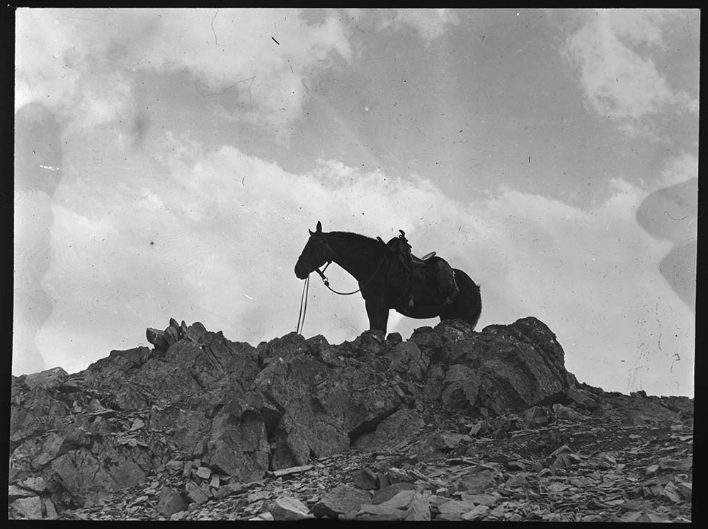
- 11 Horse (Grace) on Badger Pass
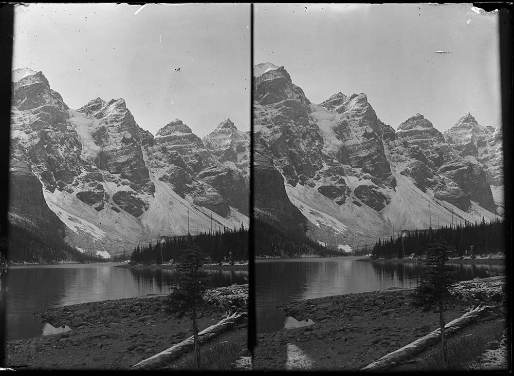
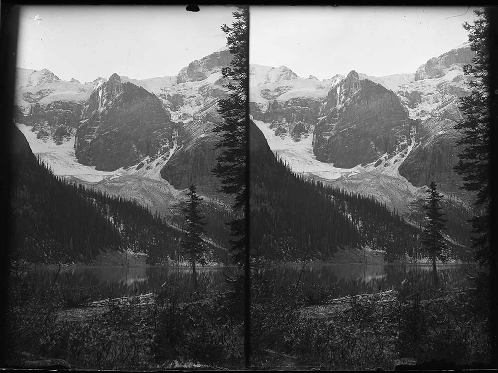
- 12 Valley of the Ten Peaks, 1906
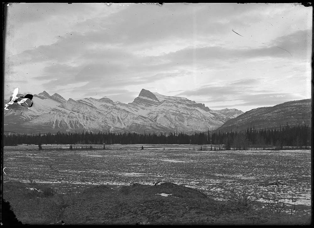
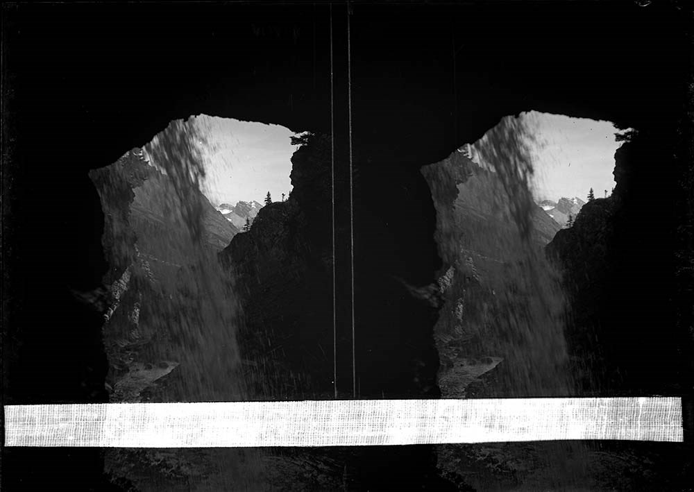
- 13 Glacier
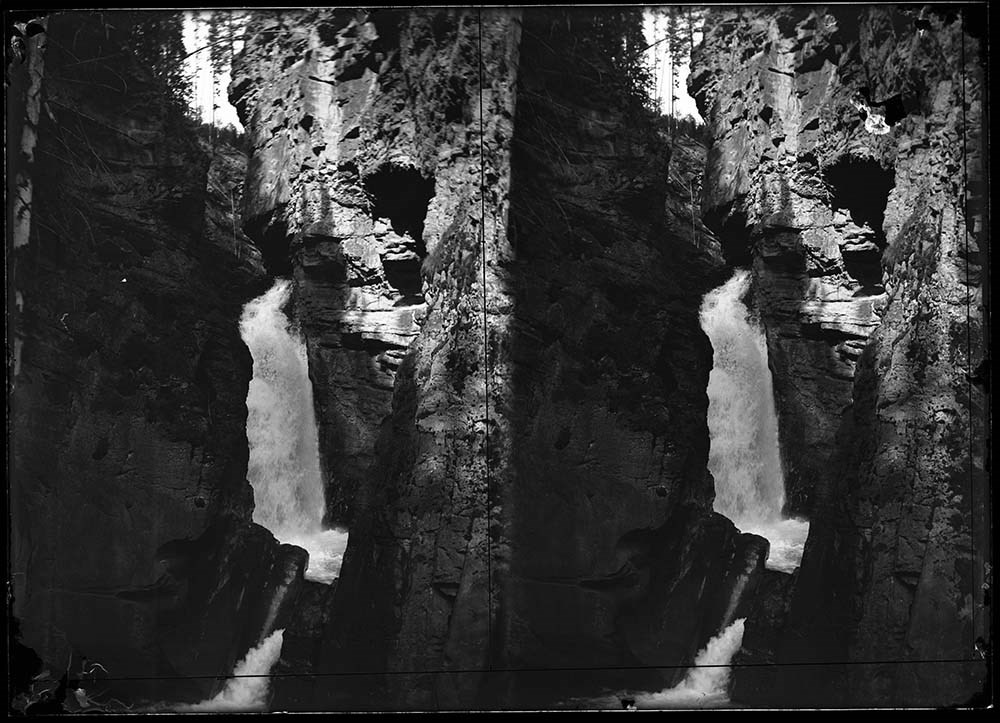
- 14, 18 Waterfall/s
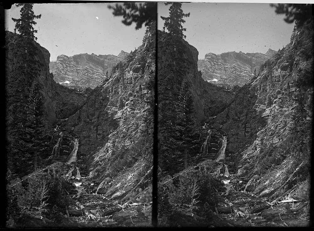
- 15 to 18 Mountain scene/s
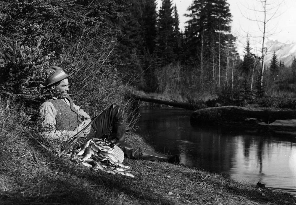
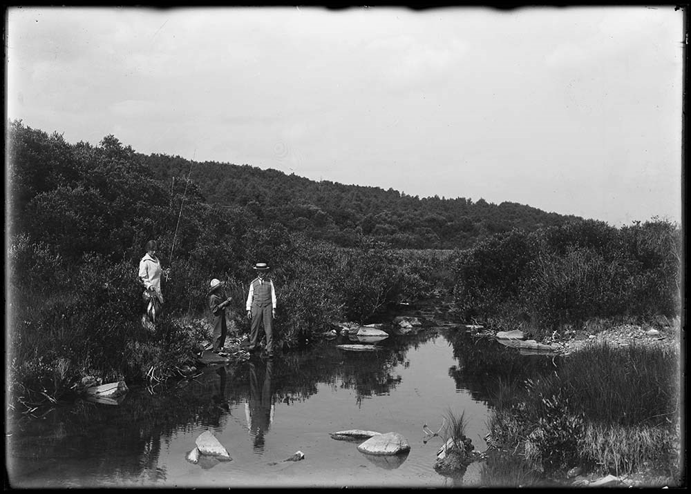
- 19 Elliott Barnes fishing on Forty Mile Creek
- 20 Elliott Barnes and Mr. Jordan fishing on Forty Mile Creek
- 21 Fishing scene
- 22 Elliott Barnes fishing
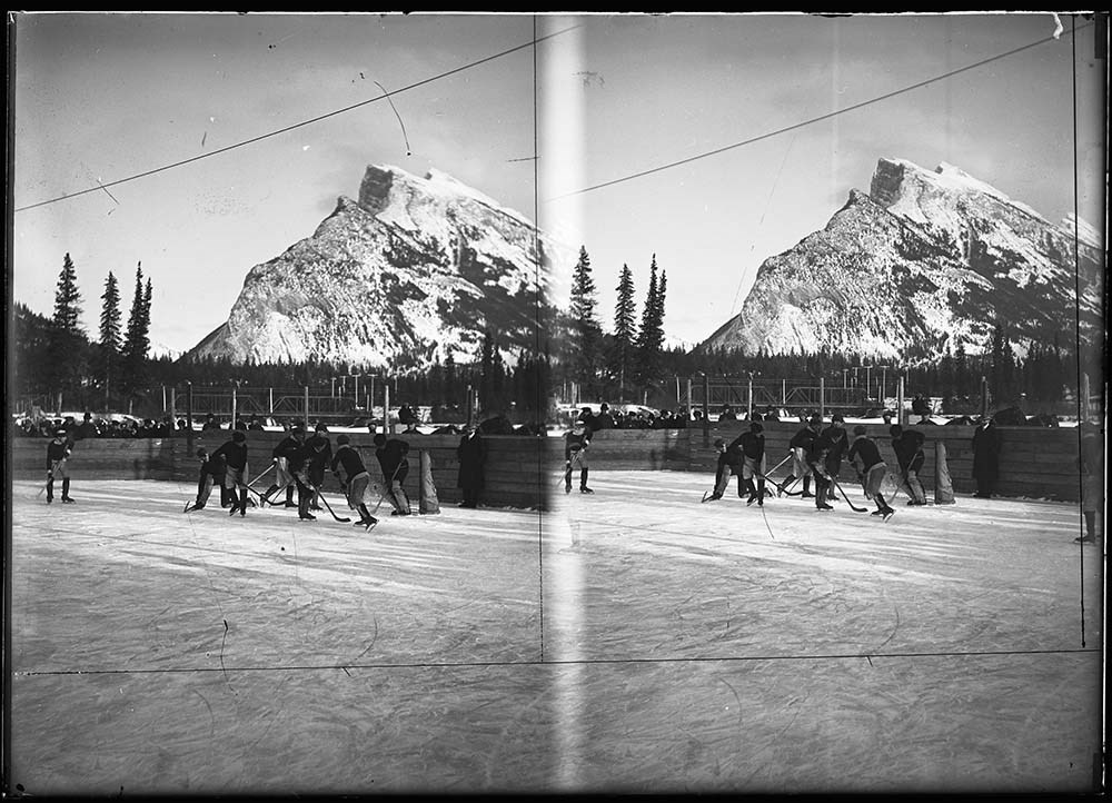
- 23 Hockey on Bow River at Banff, 1905-1906
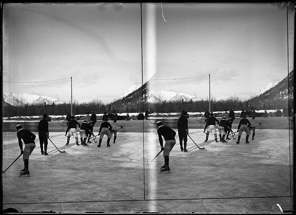
- 24 Hockey on Bow River at Banff, 1906-1907
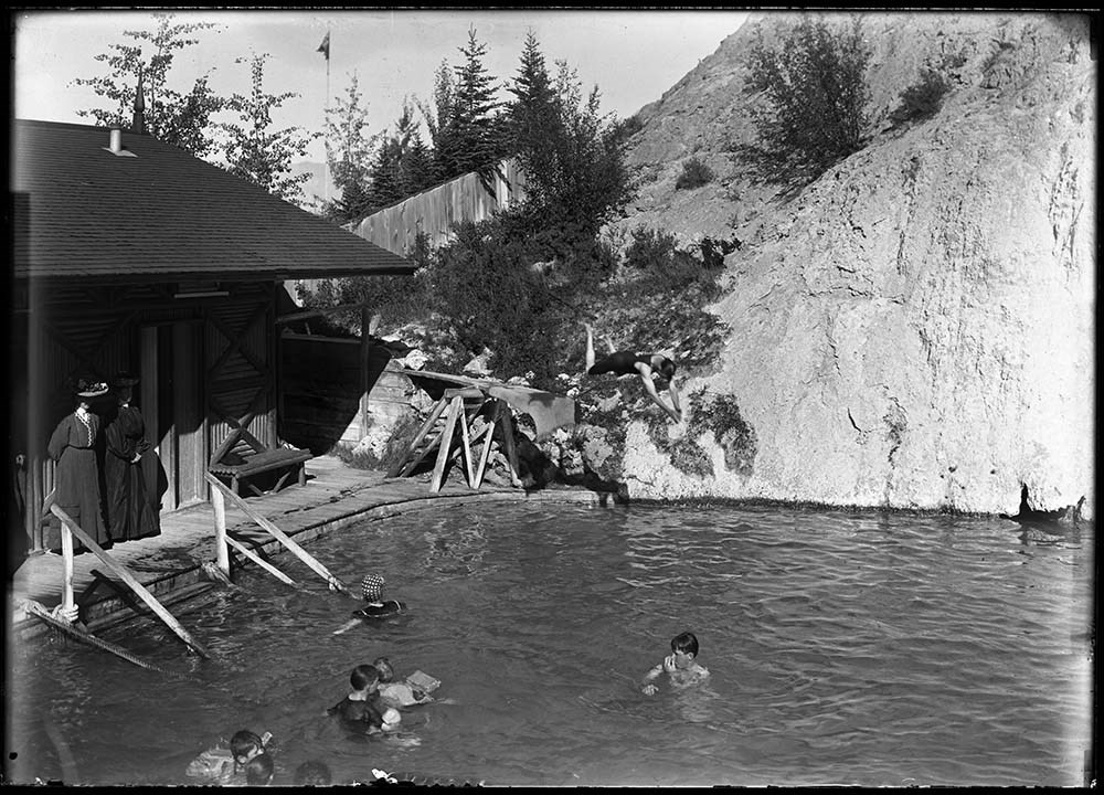
- 25 Cave and Basin bathhouse and pool, 1905 or 1906
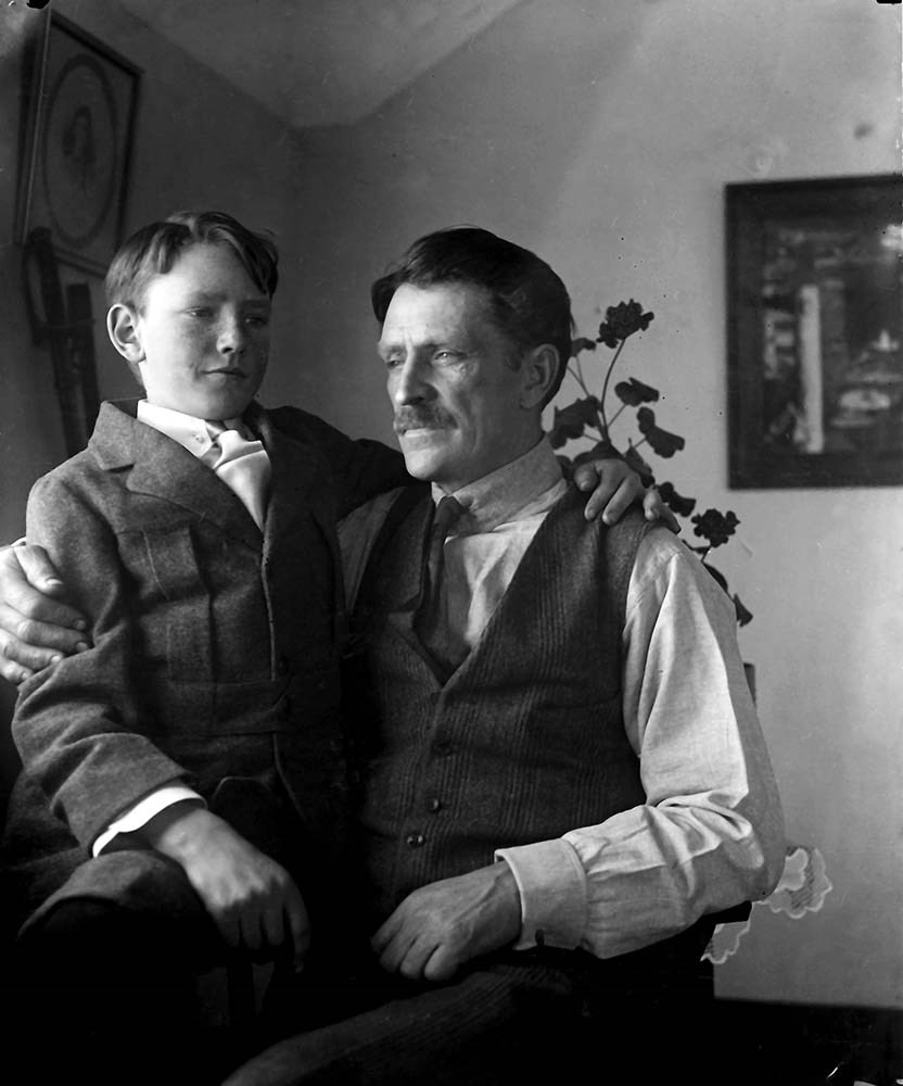
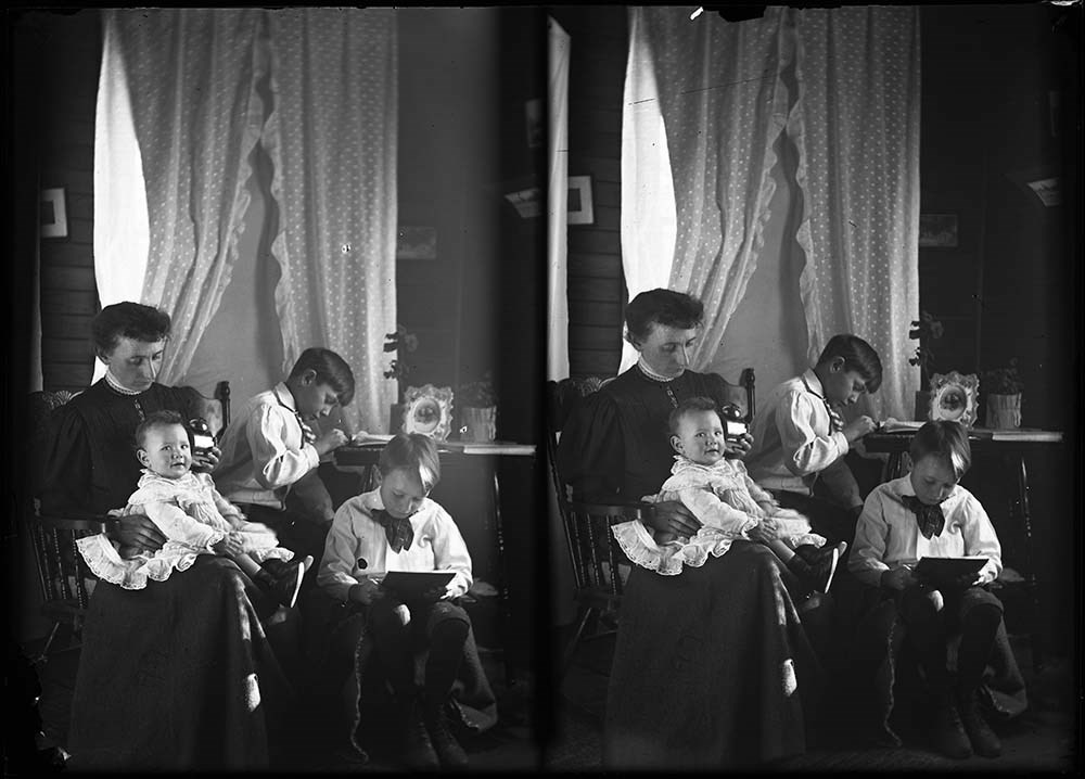
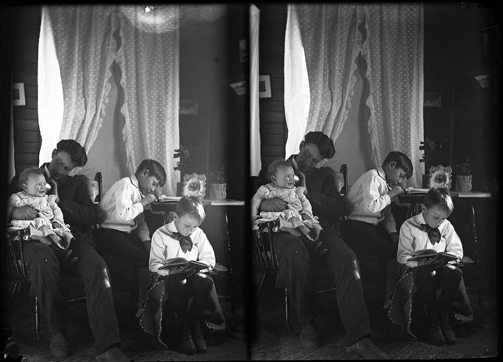
- 26 Elliott Barnes and son Findlay
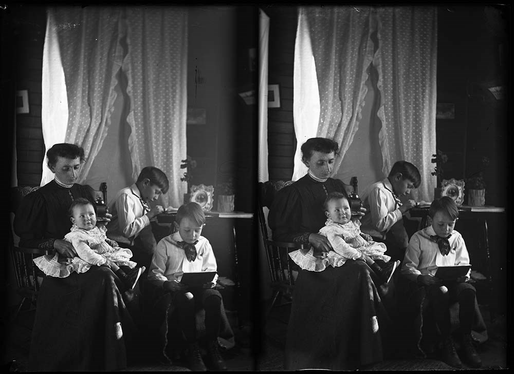
- 27 Mrs. E. Barnes and sons, 1907
- 28 Elliott Jr. and Findlay Barnes, 1907
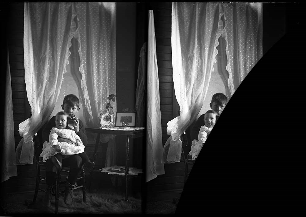
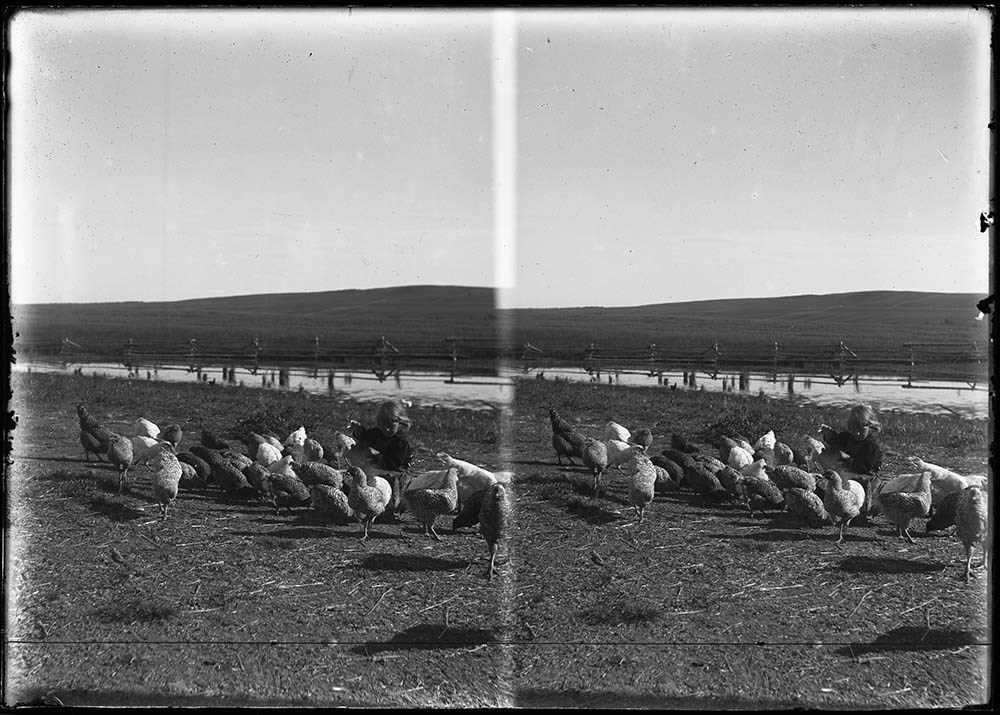
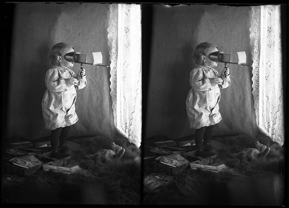
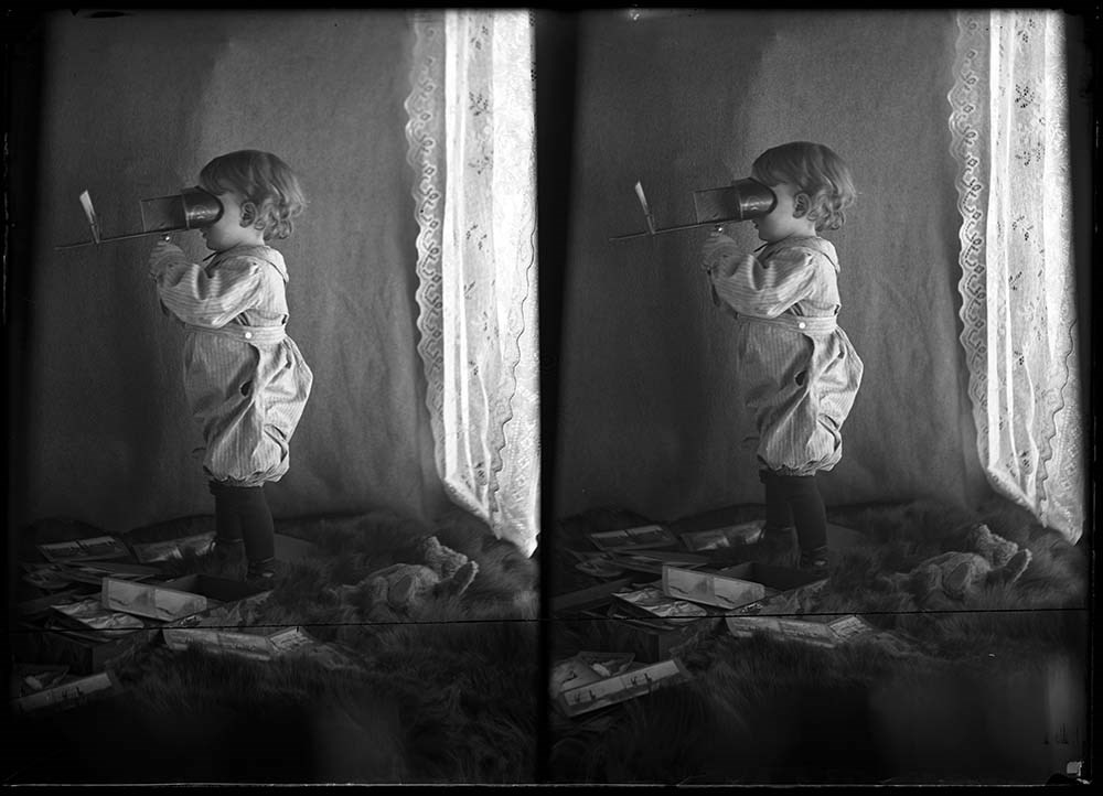
- 29 Findlay Barnes with chickens at S-L Ranch
- 30, 31 Findlay Barnes using stereo viewer, 1909 or 1910
- 32 Stoney Band, 1909
- 33 People fishing on Little Jumping Pound Creek
- 34 Elliott Barnes and Lois fishing on Little Jumping Pound Creek
- 35 Boys fishing on Jumping Pound Creek (Jack Leeson on right)
- 36 Jack Leeson cooking fish
- 37 John Copithorne, [1910?]
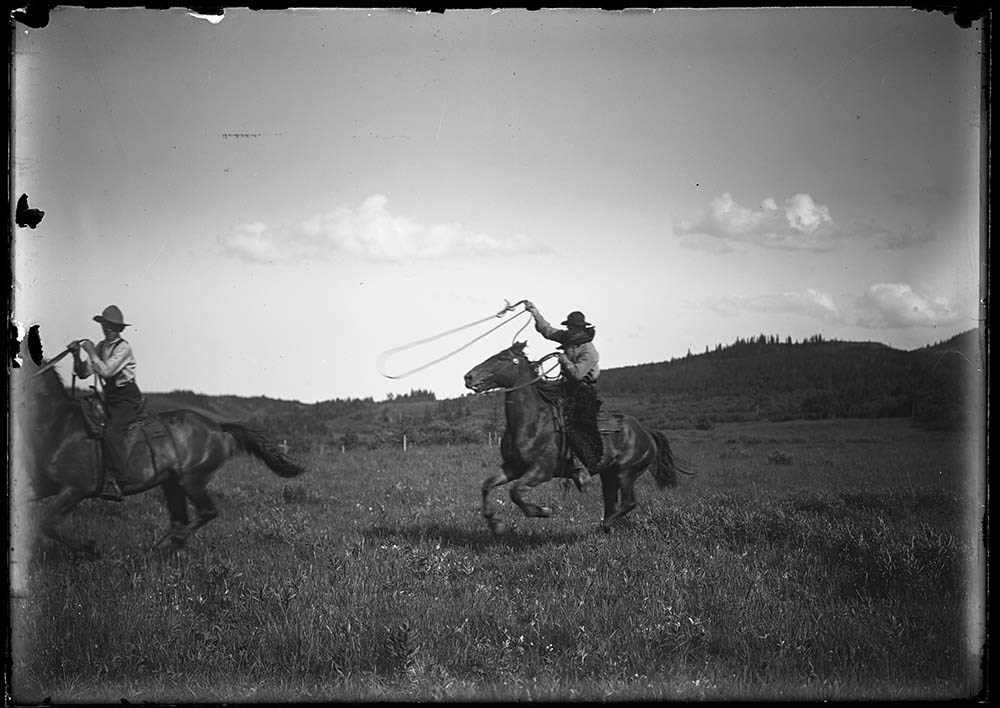
- 38 Elliott and Robert Barnes roping horses at Jumping Pound
- 39 Elliott and Robert Barnes roping horses at Jumping Pound
- 40 to 44 Elliott Jr., Robert and Findlay Barnes at Jumping Pound homestead, [1914], portrait
- 45 Findlay Barnes at Jumping Pound homestead
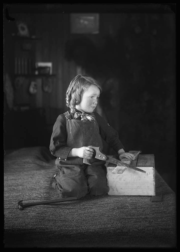
- 46, 47 Findlay Barnes at Jumping Pound homestead (sawing), 1911
- 48 Findlay Barnes with fish
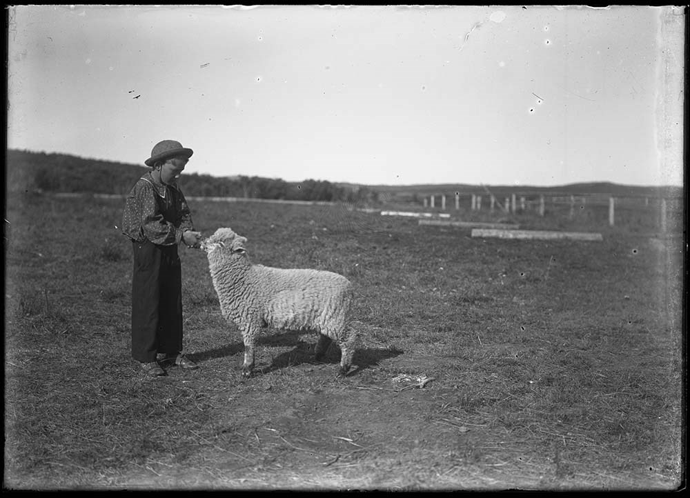
- 49 Findlay Barnes with sheep at Jumping Pound
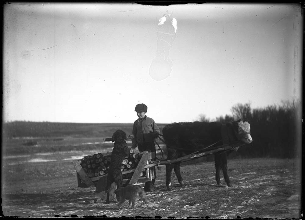
- 50 Findlay Barnes on cart at Jumping Pound
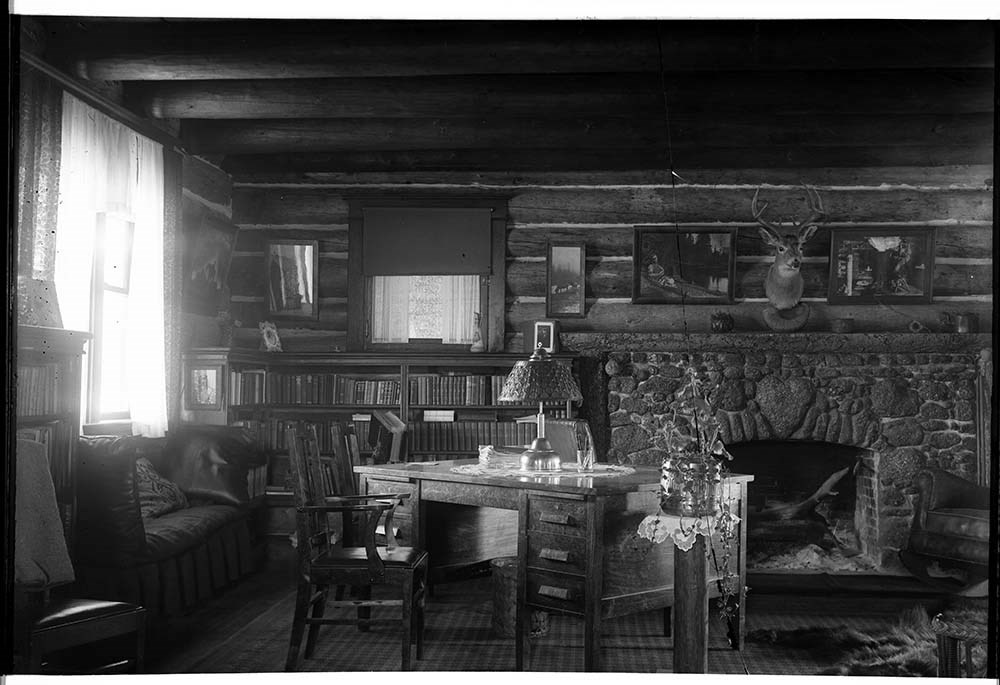
- 51 Main room of homestead at Jumping Pound, [1914]
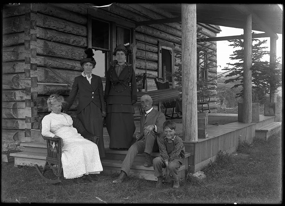
- 52 Family on porch of Jumping Pound homestead, [1914]
- 53, 54 Muriel Barnes at Milo, 1919, portrait
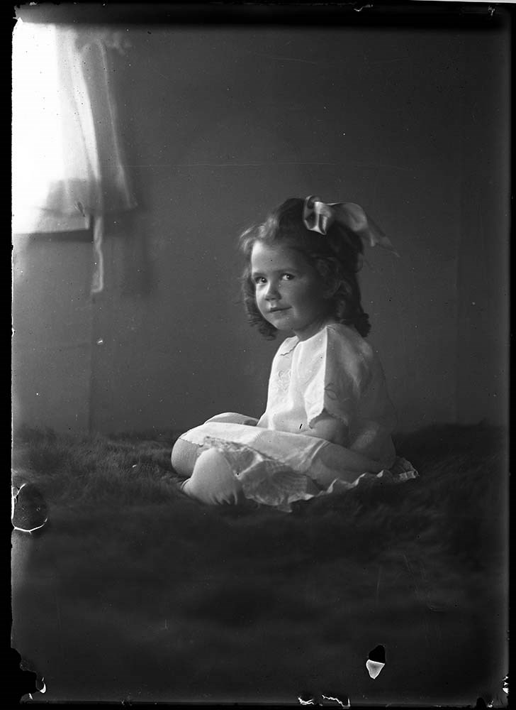
- 55 Baby (Eggley baby?)
- 56 Portrait of woman
- 57 Elliott Barnes' anti-rattler invention
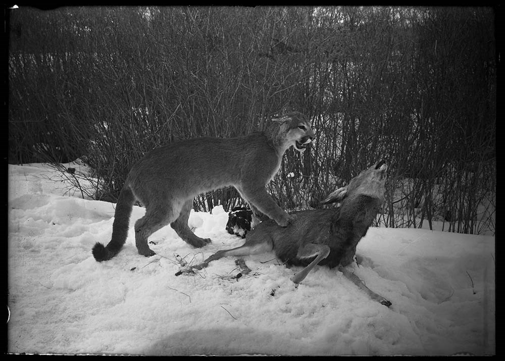
- 58 Mounted specimen of cougar attacking deer from Luxton's
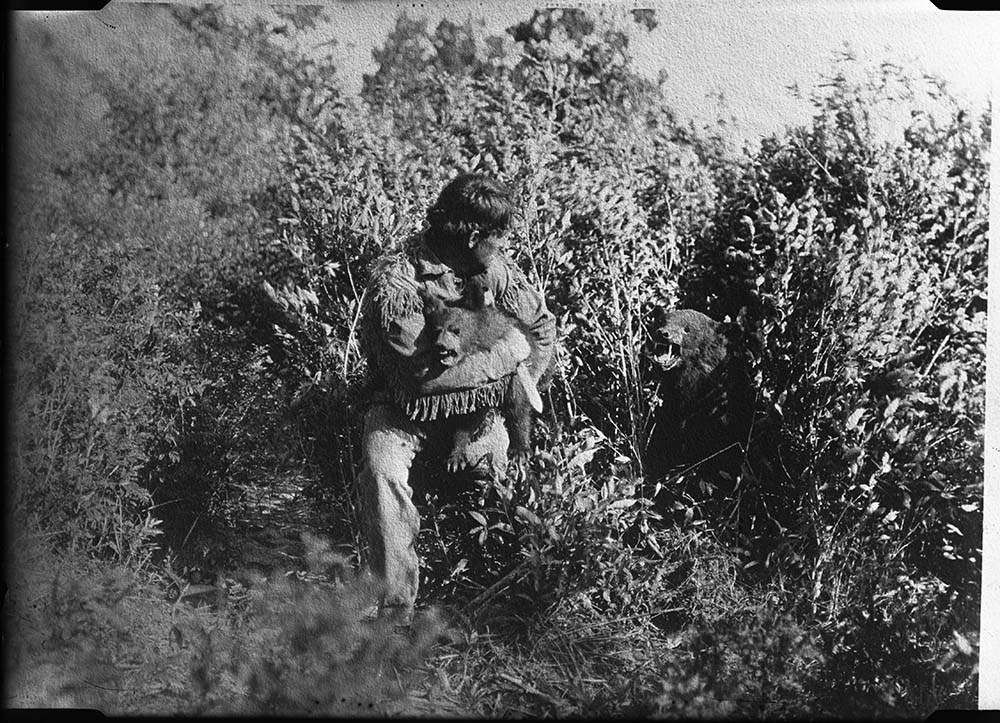
- 59 Bear attacking man
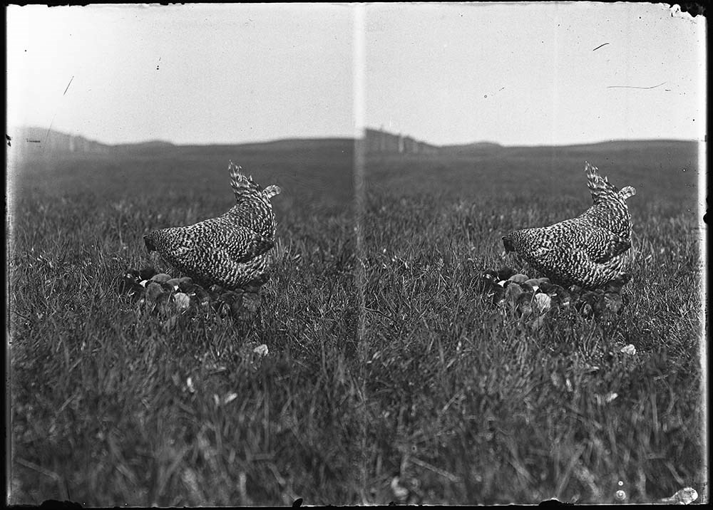
- 60 Hen and chicks at S-L Ranch
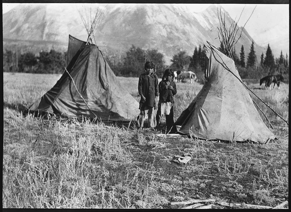
- 61 [Stoney children with playhouse teepee at Kootenay Plains, 1906?]
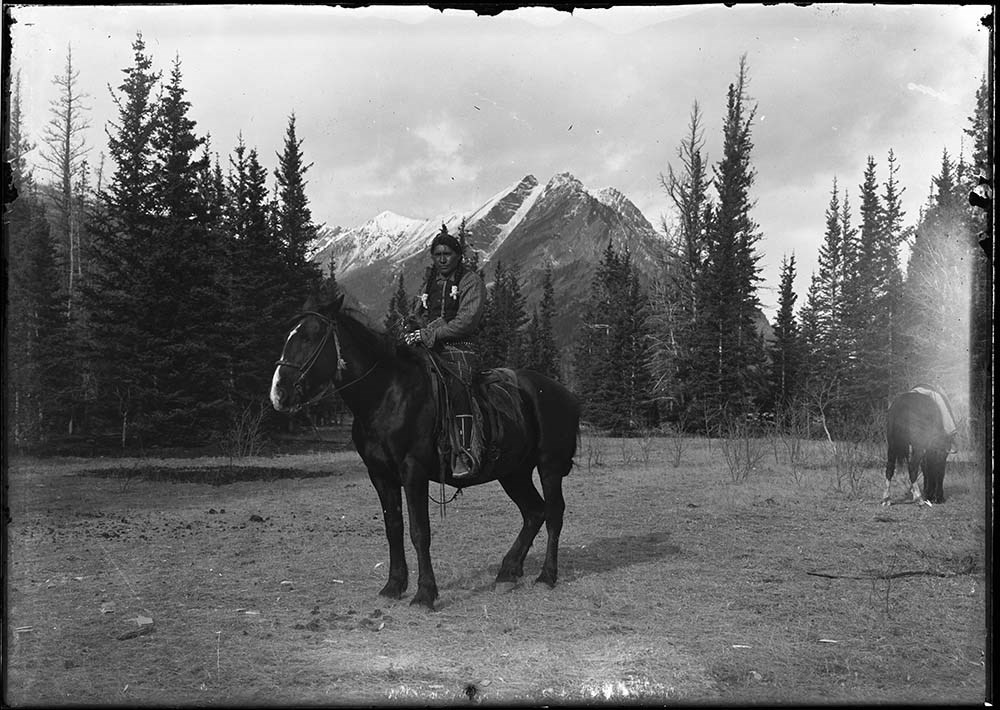
- 62 [Silas Abraham on horseback at Kootenay Plains, 1906?]
- 63 [Silas Abraham, Morley or Issac Beaver, and John House at Kootenay Plains, 1906?]
- 64 [Pack train at Kootenay Plains, 1907?]
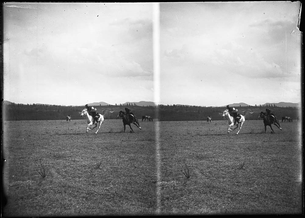
- 65, 66 [Stoney horse racing at Morley, 1910?]
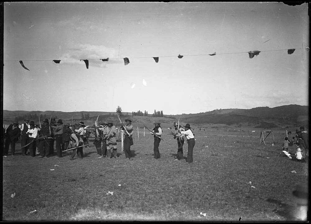
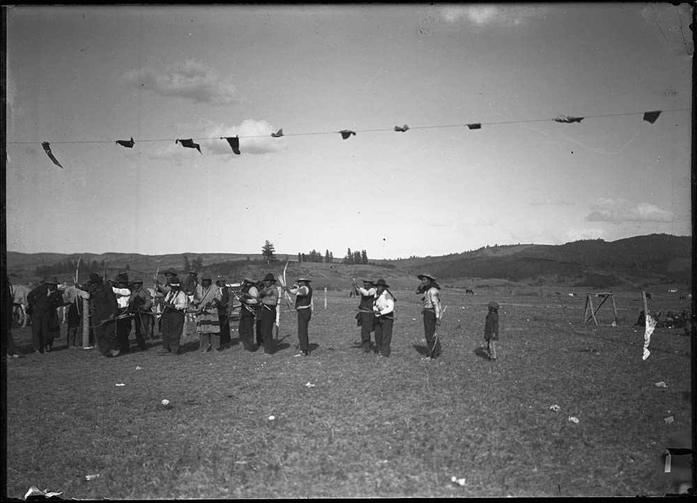
- 67, 68 [Stoney archery competition at Morley, 1910?] NG 69 to 76 added, no independant entry
- Name Access
- Barnes, Elliott
- Abraham, Silas
- House, John
- Beaver, Issac
- Subject Access
- Activities
- Animals
- Children
- Dogs
- Family
- Family and personal life
- Fishing
- Glaciers
- Horses
- Landscapes
- Mountains
- Photography
- Portrait
- Ranching
- Sports and leisure
- Sports and recreation
- Wildlife
- Waterfalls
- Winter
- Geographic Access
- Kootenay Plains
- Forty Mile Creek
- Banff
- Banff National Park
- Alberta
- Canada
- Access Restrictions
- Access by appointment only
- Language
- NA
- Title Source
- Title based on contents of file
- Processing Status
- Processed
Images


This material is presented as originally created; it may contain outdated cultural descriptions and
potentially offensive content.
Read more.
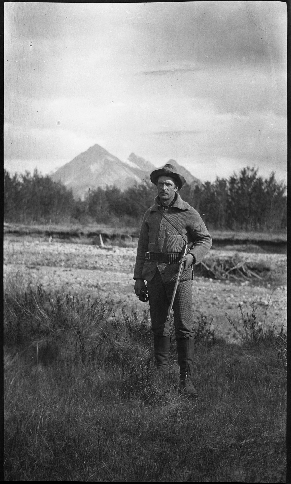
Elliott Barnes hunting
https://archives.whyte.org/en/permalink/descriptions37757
- Part Of
- Elliott Barnes fonds
- Date Range
- 1910 or 1911
- Reference Code
- V48 / NA - 391
- V48 / PA - 11
- Description Level
- 6 / Item
- GMD
- Photograph
1 image
- Part Of
- Elliott Barnes fonds
- Description Level
- 6 / Item
- Series
- I. Negative series
- Reference Code
- V48 / NA - 391
- V48 / PA - 11
- GMD
- Photograph
- Date Range
- 1910 or 1911
- Physical Description
- 1 photograph : negative, 13 x 18 cm or smaller
- Subject Access
- Discovery and Exploration
- Sports and Recreation
- Geographic Access
- Alberta
- Creator
- Elliott Barnes
Images
This material is presented as originally created; it may contain outdated cultural descriptions and
potentially offensive content.
Read more.
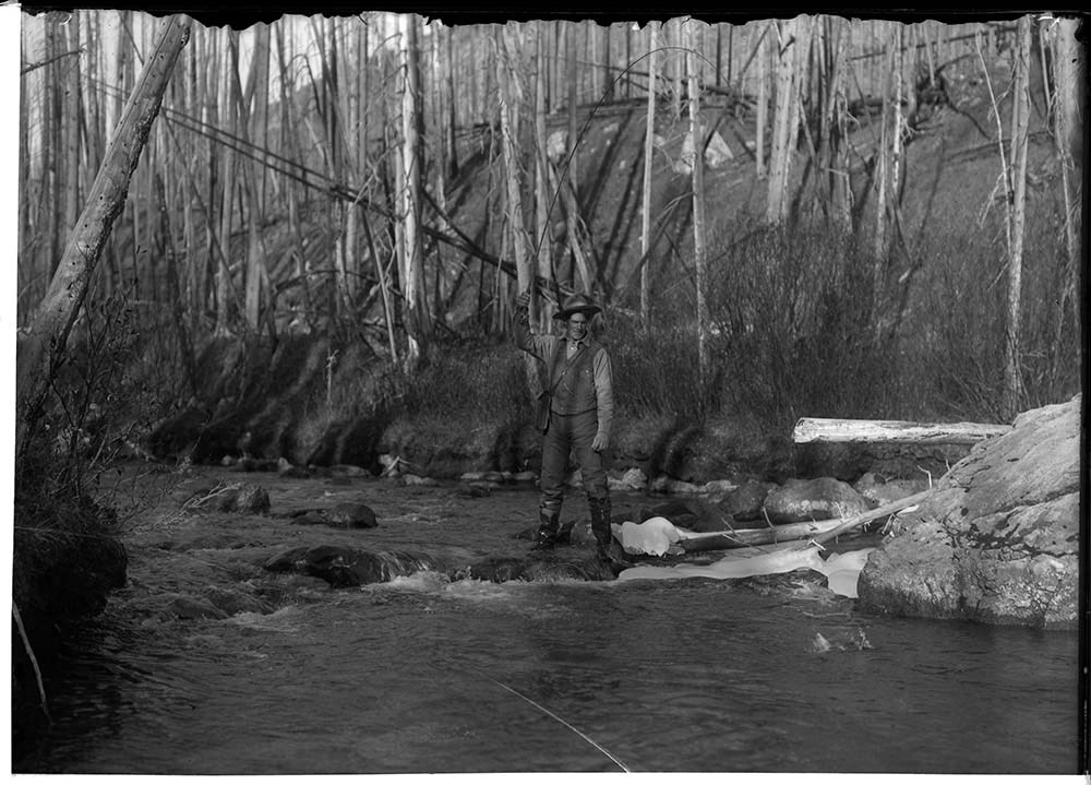
Elliott Barnes fishing on Forty Mile Creek
https://archives.whyte.org/en/permalink/descriptions37899
- Part Of
- Elliott Barnes fonds
- Scope & Content
- Elliott Barnes fishing on Forty Mile Creek, Banff National Park
- Date Range
- [ca.1905-ca.1914]
- Reference Code
- V48 / NG - 19
- Description Level
- 6 / Item
- GMD
- Photograph
1 image
- Part Of
- Elliott Barnes fonds
- Description Level
- 6 / Item
- Series
- I. Negative series
- Reference Code
- V48 / NG - 19
- GMD
- Photograph
- Date Range
- [ca.1905-ca.1914]
- Physical Description
- 1 photograph : negative, glass, 13 x 18 cm or smaller
- Scope & Content
- Elliott Barnes fishing on Forty Mile Creek, Banff National Park
- Subject Access
- Discovery and Exploration
- Sports and Recreation
- Geographic Access
- Alberta
- Creator
- Elliott Barnes
Images

This material is presented as originally created; it may contain outdated cultural descriptions and
potentially offensive content.
Read more.
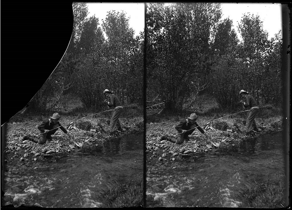
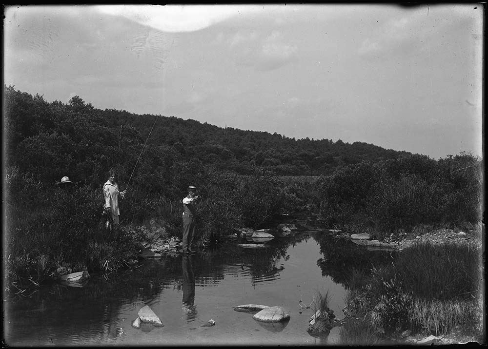
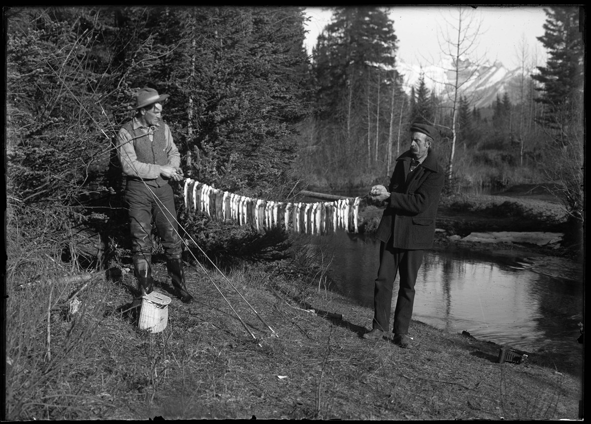
Elliott Barnes and Mr. Jordan fishing on Forty Mile Creek
https://archives.whyte.org/en/permalink/descriptions37900
- Part Of
- Elliott Barnes fonds
- Scope & Content
- Elliott Barnes and Walter Jordan with catch of fish on Forty Mile Creek, Banff National Park
- Date Range
- [ca.1905-ca.1914]
- Reference Code
- V48 / NG - 20
- Description Level
- 6 / Item
- GMD
- Photograph
1 image
- Part Of
- Elliott Barnes fonds
- Description Level
- 6 / Item
- Series
- I. Negative series
- Reference Code
- V48 / NG - 20
- GMD
- Photograph
- Date Range
- [ca.1905-ca.1914]
- Physical Description
- 1 photograph : negative, glass, 13 x 18 cm or smaller
- Scope & Content
- Elliott Barnes and Walter Jordan with catch of fish on Forty Mile Creek, Banff National Park
- Subject Access
- Discovery and Exploration
- Sports and Recreation
- Geographic Access
- Alberta
- Creator
- Elliott Barnes
Images
This material is presented as originally created; it may contain outdated cultural descriptions and
potentially offensive content.
Read more.
- Part Of
- Elliott Barnes fonds
- Scope & Content
- Unidentified man fishing
- Date Range
- [ca.1905-ca.1914]
- Reference Code
- V48 / NG - 21
- Description Level
- 6 / Item
- GMD
- Photograph
1 image
- Part Of
- Elliott Barnes fonds
- Description Level
- 6 / Item
- Series
- I. Negative series
- Reference Code
- V48 / NG - 21
- GMD
- Photograph
- Date Range
- [ca.1905-ca.1914]
- Physical Description
- 1 photograph : negative, glass, stereo, 13 x 18 cm or smaller
- Scope & Content
- Unidentified man fishing
- Subject Access
- Discovery and Exploration
- Sports and Recreation
- Geographic Access
- Alberta
- Creator
- Elliott Barnes
Images

This material is presented as originally created; it may contain outdated cultural descriptions and
potentially offensive content.
Read more.
Elliott Barnes fishing
https://archives.whyte.org/en/permalink/descriptions37902
- Part Of
- Elliott Barnes fonds
- Date Range
- [ca.1905-ca.1914]
- Reference Code
- V48 / NG - 22
- V48 / PA - 6
- Description Level
- 6 / Item
- GMD
- Photograph
1 image
- Part Of
- Elliott Barnes fonds
- Description Level
- 6 / Item
- Series
- I. Negative series
- Reference Code
- V48 / NG - 22
- V48 / PA - 6
- GMD
- Photograph
- Date Range
- [ca.1905-ca.1914]
- Physical Description
- 1 photograph : negative, glass, 13 x 18 cm or smaller
- Subject Access
- Discovery and Exploration
- Sports and Recreation
- Geographic Access
- Alberta
- Creator
- Elliott Barnes
Images

This material is presented as originally created; it may contain outdated cultural descriptions and
potentially offensive content.
Read more.
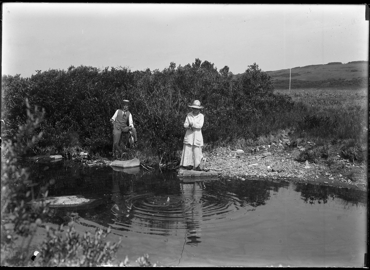
People fishing on Little Jumping Pound Creek
https://archives.whyte.org/en/permalink/descriptions37913
- Part Of
- Elliott Barnes fonds
- Scope & Content
- [Lois, Findlay and Oscar Barnes fishing on Little Jumping Pound Creek, Alberta]
- Date Range
- [ca.1905-ca.1914]
- Reference Code
- V48 / NG - 33
- Description Level
- 6 / Item
- GMD
- Photograph
1 image
- Part Of
- Elliott Barnes fonds
- Description Level
- 6 / Item
- Series
- I. Negative series
- Reference Code
- V48 / NG - 33
- GMD
- Photograph
- Date Range
- [ca.1905-ca.1914]
- Physical Description
- 1 photograph : negative, glass, 13 x 18 cm or smaller
- Scope & Content
- [Lois, Findlay and Oscar Barnes fishing on Little Jumping Pound Creek, Alberta]
- Subject Access
- Family and personal life
- Sports and Recreation
- Geographic Access
- Alberta
- Creator
- Elliott Barnes
Images

This material is presented as originally created; it may contain outdated cultural descriptions and
potentially offensive content.
Read more.
Elliott Barnes and Lois fishing on Little Jumping Pound Creek
https://archives.whyte.org/en/permalink/descriptions37914
- Part Of
- Elliott Barnes fonds
- Scope & Content
- [Oscar Barnes and daughter Lois fishing on Little Jumping Pound Creek, Alberta]
- Date Range
- [ca.1905-ca.1914]
- Reference Code
- V48 / NG - 34
- Description Level
- 6 / Item
- GMD
- Photograph
1 image
- Part Of
- Elliott Barnes fonds
- Description Level
- 6 / Item
- Series
- I. Negative series
- Reference Code
- V48 / NG - 34
- GMD
- Photograph
- Date Range
- [ca.1905-ca.1914]
- Physical Description
- 1 photograph : negative, glass, 13 x 18 cm or smaller
- Scope & Content
- [Oscar Barnes and daughter Lois fishing on Little Jumping Pound Creek, Alberta]
- Subject Access
- Family and personal life
- Sports and Recreation
- Geographic Access
- Alberta
- Creator
- Elliott Barnes
Images
This material is presented as originally created; it may contain outdated cultural descriptions and
potentially offensive content.
Read more.