Narrow Results By
- Alpine Club of Canada fonds 125
- Trail Riders of the Canadian Rockies fonds 50
- Ben Gadd fonds 37
- Lillian Gest fonds 25
- Bruce Hatfield fonds 6
- Chic Scott fonds 4
- Jean A. Hembroff MacDonald fonds 4
- Peter and Catharine Whyte fonds 4
- Bo Holroyd fonds 3
- Dorothy Wardle fonds 3
- Elmer and Grace Charlton fonds 3
- Bert Riggall fonds 2
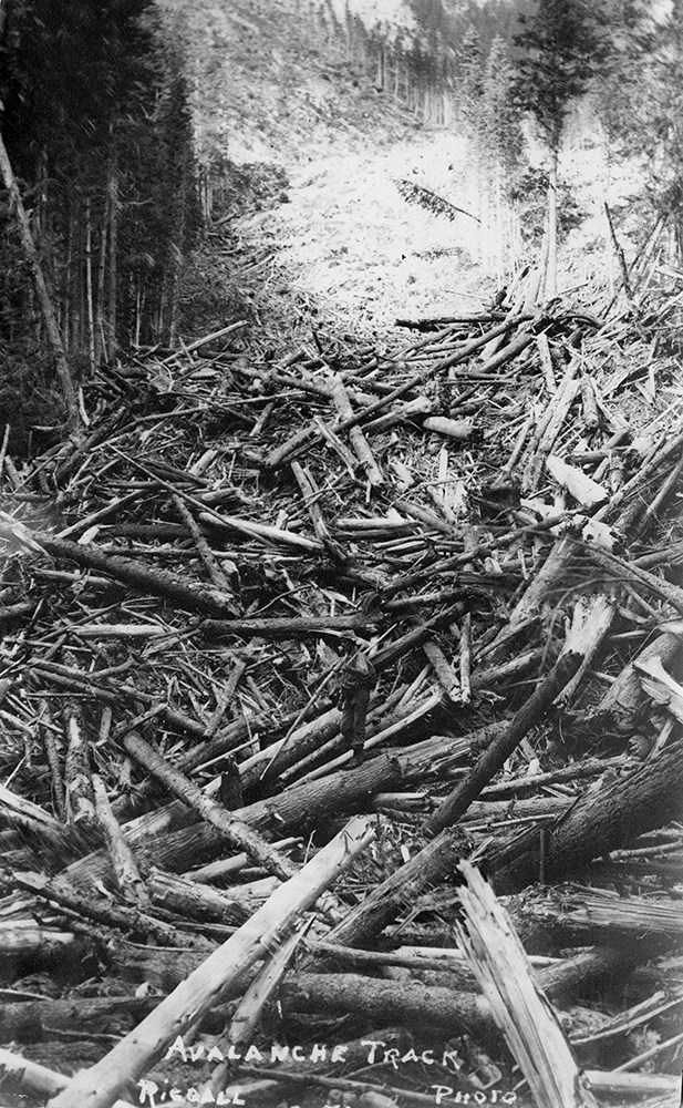
Bert Riggall's 1000 Mile Pack trip
https://archives.whyte.org/en/permalink/descriptions23454
- Part Of
- Bert Riggall fonds
- Scope & Content
- File consists of 43 b&w photographs, some captioned. Photographs pertain to Riggall's 1911 1000 mile pack trip undertaken to seek out areas for hunting and outfitting following the enlargement of Waterton National Park and the reduction of available hunting area for Riggall's clients. The prints do…
- Date Range
- 1911
- Reference Code
- V26 / II / A7 / PA - 119 to 161
- Description Level
- 5 / File
- GMD
- Photograph
- Photograph print
1 image
- Part Of
- Bert Riggall fonds
- Description Level
- 5 / File
- Fonds Number
- M376 / V26
- Series
- II.Business and Financial: Bert Riggall's 1000 Mile Pack trip, 1911
- Sous-Fonds
- V26
- Accession Number
- 7201
- Reference Code
- V26 / II / A7 / PA - 119 to 161
- Date Range
- 1911
- Physical Description
- 43 photographs: b&w prints
- Scope & Content
- File consists of 43 b&w photographs, some captioned. Photographs pertain to Riggall's 1911 1000 mile pack trip undertaken to seek out areas for hunting and outfitting following the enlargement of Waterton National Park and the reduction of available hunting area for Riggall's clients. The prints document this pack trip from stops in Banff, AB and Cranbrook, BC, and the extent of his mountain exploration from Fort Steele to Edson. On this trip, approximately 150 miles of new trail was cut including portions of Roger's Pass.
- Subject Access
- Pack trips
- Exploration
- Trails
- Trail making
- Recreation
- Hunting
- Outfitters, trail guides and packers
- Geographic Access
- Canada
- Alberta
- Banff National Park
- Waterton National Park
- British Columbia
- Cranbrook
- Rogers Pass
- Language
- English
- Title Source
- Title based on contents of file
- Processing Status
- Processed
Images

This material is presented as originally created; it may contain outdated cultural descriptions and
potentially offensive content.
Read more.
Bert Riggall's 1000 Mile Pack trip
https://archives.whyte.org/en/permalink/descriptions23455
- Part Of
- Bert Riggall fonds
- Scope & Content
- File consists of 20 b&w photographs, some captioned. Photographs pertain to Riggall's 1911 1000 mile pack trip undertaken to seek out areas for hunting and outfitting following the enlargement of Waterton National Park and the reduction of available hunting area for Riggall's clients. The prints do…
- Date Range
- 1911
- Reference Code
- V26 / II / A7 / PA - 162 to 181
- Description Level
- 5 / File
- GMD
- Photograph
- Photograph print
1 image
- Part Of
- Bert Riggall fonds
- Description Level
- 5 / File
- Fonds Number
- M376 / V26
- Series
- II.Business and Financial: Bert Riggall's 1000 Mile Pack trip, 1911
- Sous-Fonds
- V26
- Accession Number
- 7201
- Reference Code
- V26 / II / A7 / PA - 162 to 181
- Date Range
- 1911
- Physical Description
- Photographs: 20 prints, b&w
- Scope & Content
- File consists of 20 b&w photographs, some captioned. Photographs pertain to Riggall's 1911 1000 mile pack trip undertaken to seek out areas for hunting and outfitting following the enlargement of Waterton National Park and the reduction of available hunting area for Riggall's clients. The prints document this pack trip from stops in Banff, AB and Cranbrook, BC, and the extent of his mountain exploration from Fort Steele to Edson. On this trip, approximately 150 miles of new trail was cut including portions of Roger's Pass.
- Subject Access
- Pack trips
- Exploration
- Trails
- Trail making
- Recreation
- Hunting
- Outfitters, trail guides and packers
- Geographic Access
- Canada
- Alberta
- Banff National Park
- Waterton National Park
- British Columbia
- Cranbrook
- Rogers Pass
- Language
- English
- Title Source
- Title based on contents of file
- Processing Status
- Processed
Images
This material is presented as originally created; it may contain outdated cultural descriptions and
potentially offensive content.
Read more.
Backcountry user fees
https://archives.whyte.org/en/permalink/catalogue9623
- Physical Description
- p.1
- Medium
- Library - Periodical
- Notes
- In Alpine Club of Canada [known as Gazette], , vol.9, no.2, summer 1994
- Call Number
- P
- Collection
- Archives Library
This material is presented as originally created; it may contain outdated cultural descriptions and
potentially offensive content.
Read more.
Cadets at work
https://archives.whyte.org/en/permalink/catalogue9704
- Physical Description
- p.20
- Medium
- Library - Periodical
- Subjects
- Trails
- Notes
- In Mountain Guide, spring 1990
- Call Number
- P
- Collection
- Archives Library
This material is presented as originally created; it may contain outdated cultural descriptions and
potentially offensive content.
Read more.
Canadian Rockies : they abound in wild animals, glaciers, and luxurious hotels
https://archives.whyte.org/en/permalink/catalogue24918
- Medium
- Library - Book (including soft-cover and pamphlets)
- Published Date
- 1947
- Publisher
- Life
- Call Number
- 02.6 L11c PAM OS
1 website
- Publisher
- Life
- Published Date
- 1947
- Subjects
- Banff National Park
- Travel
- Tourism
- Banff Springs Hotel
- Rundle Mount
- Athabaska River
- Brazeau
- Maligne Lake
- Bow River
- Canadian National Railway
- Canadian Pacific Railway
- Chateau Lake Louise
- Trails
- Mountaineering
- Columbia Icefield
- Abstract
- Pertains to the Canadian Rocky Mountains as a tourist destination in 1947 and features main geographical attractions such as the Mount Rundle, Athabaska River, Maligne Lake, Bow River in addition to the Banff Springs Hotel with map of Banff National Park and Jasper National Park.
- Notes
- In Life, June 9, 1947, pp. 68 - 76
- Accession Number
- 7889
- Call Number
- 02.6 L11c PAM OS
- Collection
- Archives Library
- URL Notes
- Specific volume with article can be viewed online via Google Books
Websites
This material is presented as originally created; it may contain outdated cultural descriptions and
potentially offensive content.
Read more.
Bill Brewster interview
https://archives.whyte.org/en/permalink/descriptions15208
- Date Range
- 1969
- Reference Code
- S1 / 26
- Description Level
- 6 / Item
- Description Level
- 6 / Item
- Fonds Number
- S1
- Series
- I. Interviews
- Sous-Fonds
- S1
- Reference Code
- S1 / 26
- Responsibility
- Interviewer: Maryalice Harvey Stewart
- Date Range
- 1969
- Physical Description
- 1 sound recording
- Subject Access
- Boyd family
- Buildings - Banff
- Douglas, Howard
- Fire wardens
- Potts family
- Ranchers and ranching
- Schools - Banff
- Stewart, George
- Indigenous Peoples
- Trails
- Finding Aid
- Recording summary and reference cassette available
- Title Source
- Title based on contents of recording
- Processing Status
- Processed
This material is presented as originally created; it may contain outdated cultural descriptions and
potentially offensive content.
Read more.
Map of Banff and vicinity showing major highway, other roads, viewpoints, campgrounds, trailer park, picnic areas, lifts, trails
https://archives.whyte.org/en/permalink/catalogue21352
- Medium
- Library - Maps and blueprints (unannotated; published)
- Map
- Published Date
- ca. 1970
- Call Number
- C6-4.3(f)
- Published Date
- ca. 1970
- Notes
- Map B on reverse side of A shows the townsite in a larger scale
- file transfer
- Accession Number
- 5500
- Call Number
- C6-4.3(f)
- Collection
- Archives Library
This material is presented as originally created; it may contain outdated cultural descriptions and
potentially offensive content.
Read more.
Map showing trail outings at Banff, Spray River Valley, Tunnel Mountain area, Summit of Sulphur, Stoney Squaw Mountain, Lower Bow Valley, Sundance Canyon, Rundle Mountain
https://archives.whyte.org/en/permalink/catalogue21353
- Medium
- Library - Maps and blueprints (unannotated; published)
- Map
- Publisher
- Northern Affairs & Natural Resources
- Call Number
- C6-4.3(g)
- Publisher
- Northern Affairs & Natural Resources
- Subjects
- Banff National Park - Roads & Trails
- Notes
- Info on reverse side re: routes etc.
- Accession Number
- 2613
- Call Number
- C6-4.3(g)
- Collection
- Archives Library
This material is presented as originally created; it may contain outdated cultural descriptions and
potentially offensive content.
Read more.
Map showing trail outings at Banff, highways, trails, railway fire trail
https://archives.whyte.org/en/permalink/catalogue21354
- Subjects
- Banff National Park - Rads & Trails
- Notes
- Info on back re: "Trail Outings at Banff, Trails in the Spray River Valley, Tunnel Mtn. area, Sulphur Mtn., Stoney Squaw, Lower Bow Valley, Rundle, Sundance General info.
- Accession Number
- 2613
- Call Number
- C6-4.3(h)
- Collection
- Archives Library
This material is presented as originally created; it may contain outdated cultural descriptions and
potentially offensive content.
Read more.
Sketch map showing the vicinity of Lake Louise, Moraine Lake and Vermilion Pass
https://archives.whyte.org/en/permalink/catalogue21355
- Medium
- Library - Maps and blueprints (unannotated; published)
- Map
- Published Date
- 1905
- Publisher
- Department of the Interior
- Call Number
- C6-4.3(i)
- Publisher
- Department of the Interior
- Published Date
- 1905
- Subjects
- Lake Louise - Roads & Trails
- Notes
- Driving Roads, Pony trails
- From photographic surveys by A.O. Wheeler, Topographer of the Department assisted by M.P. Bridgland D.L.S. and H.G. Wheeler
- Accession Number
- 3120
- Call Number
- C6-4.3(i)
- Collection
- Archives Library
This material is presented as originally created; it may contain outdated cultural descriptions and
potentially offensive content.
Read more.