Narrow Results By
- Alpine Club of Canada fonds 127
- Trail Riders of the Canadian Rockies fonds 50
- Ben Gadd fonds 37
- Lillian Gest fonds 25
- Bruce Hatfield fonds 6
- Chic Scott fonds
- Jean A. Hembroff MacDonald fonds 4
- Peter and Catharine Whyte fonds 4
- Bo Holroyd fonds 3
- Dorothy Wardle fonds 3
- Elmer and Grace Charlton fonds 3
- Bert Riggall fonds
Bert Riggall's 1000 Mile Pack trip
https://archives.whyte.org/en/permalink/descriptions23454
- Part Of
- Bert Riggall fonds
- Scope & Content
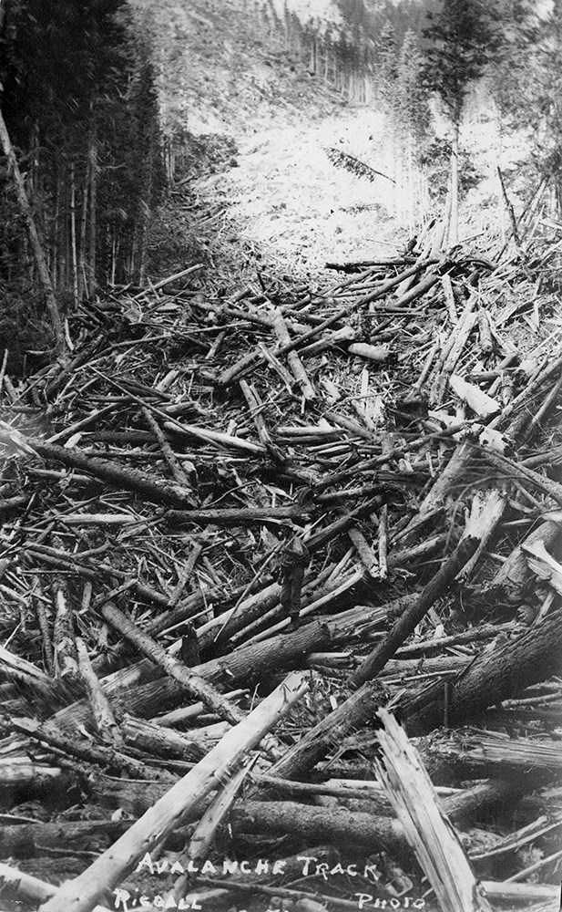
- File consists of 43 b&w photographs, some captioned. Photographs pertain to Riggall's 1911 1000 mile pack trip undertaken to seek out areas for hunting and outfitting following the enlargement of Waterton National Park and the reduction of available hunting area for Riggall's clients. The prints do…
- Date Range
- 1911
- Reference Code
- V26 / II / A7 / PA - 119 to 161
- Description Level
- 5 / File
- GMD
- Photograph
- Photograph print
1 image
- Part Of
- Bert Riggall fonds
- Description Level
- 5 / File
- Fonds Number
- M376 / V26
- Series
- II.Business and Financial: Bert Riggall's 1000 Mile Pack trip, 1911
- Sous-Fonds
- V26
- Accession Number
- 7201
- Reference Code
- V26 / II / A7 / PA - 119 to 161
- Date Range
- 1911
- Physical Description
- 43 photographs: b&w prints
- Scope & Content
- File consists of 43 b&w photographs, some captioned. Photographs pertain to Riggall's 1911 1000 mile pack trip undertaken to seek out areas for hunting and outfitting following the enlargement of Waterton National Park and the reduction of available hunting area for Riggall's clients. The prints document this pack trip from stops in Banff, AB and Cranbrook, BC, and the extent of his mountain exploration from Fort Steele to Edson. On this trip, approximately 150 miles of new trail was cut including portions of Roger's Pass.
- Subject Access
- Pack trips
- Exploration
- Trails
- Trail making
- Recreation
- Hunting
- Outfitters, trail guides and packers
- Geographic Access
- Canada
- Alberta
- Banff National Park
- Waterton National Park
- British Columbia
- Cranbrook
- Rogers Pass
- Language
- English
- Title Source
- Title based on contents of file
- Processing Status
- Processed
Images

This material is presented as originally created; it may contain outdated cultural descriptions and
potentially offensive content.
Read more.
Bert Riggall's 1000 Mile Pack trip
https://archives.whyte.org/en/permalink/descriptions23455
- Part Of
- Bert Riggall fonds
- Scope & Content
- File consists of 20 b&w photographs, some captioned. Photographs pertain to Riggall's 1911 1000 mile pack trip undertaken to seek out areas for hunting and outfitting following the enlargement of Waterton National Park and the reduction of available hunting area for Riggall's clients. The prints do…
- Date Range
- 1911
- Reference Code
- V26 / II / A7 / PA - 162 to 181
- Description Level
- 5 / File
- GMD
- Photograph
- Photograph print
1 image
- Part Of
- Bert Riggall fonds
- Description Level
- 5 / File
- Fonds Number
- M376 / V26
- Series
- II.Business and Financial: Bert Riggall's 1000 Mile Pack trip, 1911
- Sous-Fonds
- V26
- Accession Number
- 7201
- Reference Code
- V26 / II / A7 / PA - 162 to 181
- Date Range
- 1911
- Physical Description
- Photographs: 20 prints, b&w
- Scope & Content
- File consists of 20 b&w photographs, some captioned. Photographs pertain to Riggall's 1911 1000 mile pack trip undertaken to seek out areas for hunting and outfitting following the enlargement of Waterton National Park and the reduction of available hunting area for Riggall's clients. The prints document this pack trip from stops in Banff, AB and Cranbrook, BC, and the extent of his mountain exploration from Fort Steele to Edson. On this trip, approximately 150 miles of new trail was cut including portions of Roger's Pass.
- Subject Access
- Pack trips
- Exploration
- Trails
- Trail making
- Recreation
- Hunting
- Outfitters, trail guides and packers
- Geographic Access
- Canada
- Alberta
- Banff National Park
- Waterton National Park
- British Columbia
- Cranbrook
- Rogers Pass
- Language
- English
- Title Source
- Title based on contents of file
- Processing Status
- Processed
Images
This material is presented as originally created; it may contain outdated cultural descriptions and
potentially offensive content.
Read more.
Lake O'Hara Trails
https://archives.whyte.org/en/permalink/descriptions54776
- Part Of
- Murray Hay fonds
- Scope & Content
- File consists of 0.5 cm of textual records, 60.5 x 48.5 cm. File pertains to a trail map of the Lake O'Hara area created by Murray Hay. File consists of one published poster depicting a reproduced map of the trails at Lake O'Hara in Yoho National Park (British Columbia).
- Date Range
- ca.1970-ca.2015
- Reference Code
- M570 / III / A / iv / 1
- Description Level
- 5 / File
- GMD
- Map
- Poster
- Published record
- Textual record
- Part Of
- Murray Hay fonds
- Description Level
- 5 / File
- Fonds Number
- M570 / V795
- Series
- M570 / III : Murray Hay Portfolio (published material)
- Sous-Fonds
- M570
- Sub-Series
- M570 / III / A : British Columbia / iv : Lake O'Hara
- Accession Number
- 2019.41
- Reference Code
- M570 / III / A / iv / 1
- Date Range
- ca.1970-ca.2015
- Physical Description
- 0.5 cm of textual material (60.5 x 48.5 cm)
- Scope & Content
- File consists of 0.5 cm of textual records, 60.5 x 48.5 cm. File pertains to a trail map of the Lake O'Hara area created by Murray Hay. File consists of one published poster depicting a reproduced map of the trails at Lake O'Hara in Yoho National Park (British Columbia).
- Notes
- M570 / III / A / iv / 1 is oversize.
- Name Access
- Hay, Murray
- Subject Access
- Trails
- Hiking
- Cartography
- Advertising
- Artist
- Sports and recreation
- Travel
- Tourism
- Tourist information
- Geographic Access
- Lake O'Hara
- British Columbia
- Canada
- Canadian Rocky Mountains
- Yoho National Park
- Language
- English
- Title Source
- Title based on contents of file
- Processing Status
- Processed
This material is presented as originally created; it may contain outdated cultural descriptions and
potentially offensive content.
Read more.
Reference Material
https://archives.whyte.org/en/permalink/descriptions54749
- Part Of
- Murray Hay fonds
- Scope & Content
- File consists of 2.5 cm of textual material, 45.5 x 60.5 cm or smaller. File consists of miscellaneous research and reference material related to Murray Hay's work projects. File includes various brochures and tourism booklets about Alaska (one of Hay's projects in the 1990s) and a promotional post…
- Date Range
- 1982- ca.1999
- 1982
- 1993-1994
- ca.1999
- Reference Code
- M570 / II / 1-2
- Description Level
- 5 / File
- GMD
- Published record
- Textual record
- Part Of
- Murray Hay fonds
- Description Level
- 5 / File
- Fonds Number
- M570 / V795
- Series
- M570 / II : Research and Reference Material
- Sous-Fonds
- M570
- Accession Number
- 2019.41
- Reference Code
- M570 / II / 1-2
- Date Range
- 1982- ca.1999
- 1982
- 1993-1994
- ca.1999
- Physical Description
- 2.5 cm of textual records (45.5 x 60.5 cm or smaller)
- Scope & Content
- File consists of 2.5 cm of textual material, 45.5 x 60.5 cm or smaller. File consists of miscellaneous research and reference material related to Murray Hay's work projects. File includes various brochures and tourism booklets about Alaska (one of Hay's projects in the 1990s) and a promotional poster of the Mt. Everest Canadian Expedition (1982).
- Notes
- M570 / II / 2 is oversize.
- Hay produced a map of the route of the Mt. Everest Canadian Expedition that was used for promotional purposes and in books produced by Pat Morrow (a participant of the expedition). This poster also has smaller images of all of the participants.
- One of the booklets in M570 / II / 1 is published in German.
- Name Access
- Hay, Murray
- Subject Access
- Advertising
- Airplane
- Cartography
- Discovery and travel
- Everest '82
- Mountains
- Promo
- Research
- Trails
- Travel
- Landscapes
- Climbing
- Geographic Access
- Alaska
- United States
- United States of America
- Nepal
- Mount Everest
- Language
- English
- German
- Title Source
- Title based on contents of file
- Processing Status
- Processed
This material is presented as originally created; it may contain outdated cultural descriptions and
potentially offensive content.
Read more.
Ski Trails in the Canadian Rockies - textual
https://archives.whyte.org/en/permalink/descriptions55078
- Part Of
- Chic Scott fonds
- Scope & Content
- Series consists of research documents, published materials and maps used during the creation of the book Ski Trails in the Canadian Rockies.
- Date Range
- 1999 - 2015
- Reference Code
- M57 / VI
- Description Level
- 3 / Series
- GMD
- Textual record
- Part Of
- Chic Scott fonds
- Description Level
- 3 / Series
- Fonds Number
- M57 / V40 / S47
- Series
- M57 / VI: Ski Trails in the Canadian Rockies
- Sous-Fonds
- M57
- Sub-Series
- M57 / VI / A: Research Files
- M57 / VI / B: Collected publications
- M57 / VI / C: Maps
- Accession Number
- .
- Reference Code
- M57 / VI
- GMD
- Textual record
- Date Range
- 1999 - 2015
- Physical Description
- 18 cm of textual records
- History / Biographical
- The classic guidebook to cross country ski trails in Waterton, Banff, Kootenay, Yoho and Jasper National Parks as well as Mount Assiniboine and Mount Robson Provincial Parks and Kananaskis Country, now greatly expanded to includes ski trails in the front ranges of the Rockies, in the Crowsnest Pass and in the Columbia Valley. Jointly authored with Darren Farley. This book also covers topics such as accommodation, regulations, weather and snow conditions.
- Scope & Content
- Series consists of research documents, published materials and maps used during the creation of the book Ski Trails in the Canadian Rockies.
- Notes
- Series consists of three sub-series: M57 / VI / A: Research Files
- M57 / VI / B: Collected publications
- M57 / VI / C: Maps
- Name Access
- Scott, Chic
- Subject Access
- Activities
- Environment
- Exploration
- Geography
- Guide
- Map
- Mountaineering
- Mountains
- National parks and reserves
- Publication
- Recreation
- Ski areas
- Ski Maps
- Ski mountaineering
- Ski lodges and cabins
- Skiing
- Sports and recreation
- Sports
- Tourism
- Tourist information
- Trail guides
- Trails
- Travel
- Winter sports
- Geographic Access
- Canada
- Alberta
- British Columbia
- Canadian Rocky Mountains
- Banff National Park
- Yoho National Park
- Jasper National Park
- Waterton
- Kootenay National Park
- Rogers Pass
- Columbia Valley
- Crowsnest Pass
- Language
- English
- Related Material
- S47 / VI
- V40 / VI
- Title Source
- Title based on contents of file
- Processing Status
- Processed
This material is presented as originally created; it may contain outdated cultural descriptions and
potentially offensive content.
Read more.
Ski Trails of the Canadian Rockies - visual
https://archives.whyte.org/en/permalink/descriptions55079
- Part Of
- Chic Scott fonds
- Scope & Content
- Series consists of 3 CD's with photo scans pertaining to the creation of Ski Trails of the Canadian Rockies.
- Date Range
- 1999 - 2015
- Reference Code
- V40 / VI
- Description Level
- 3 / Series
- GMD
- Digital image
- Photograph
- Part Of
- Chic Scott fonds
- Description Level
- 3 / Series
- Fonds Number
- M57 / V40 / S47
- Series
- V40 / VI : Ski Trails of the Canadian Rockies
- Sous-Fonds
- V40
- Accession Number
- .
- Reference Code
- V40 / VI
- Date Range
- 1999 - 2015
- Physical Description
- Digital photo scans on 3 discs
- History / Biographical
- The classic guidebook to cross country ski trails in Waterton, Banff, Kootenay, Yoho and Jasper National Parks as well as Mount Assiniboine and Mount Robson Provincial Parks and Kananaskis Country, now greatly expanded to includes ski trails in the front ranges of the Rockies, in the Crowsnest Pass and in the Columbia Valley. Jointly authored with Darren Farley. This book also covers topics such as accommodation, regulations, weather and snow conditions.
- Scope & Content
- Series consists of 3 CD's with photo scans pertaining to the creation of Ski Trails of the Canadian Rockies.
- Name Access
- Scott, Chic
- Subject Access
- Activities
- Environment
- Exploration
- Geography
- Guide
- Map
- Mountaineering
- Mountains
- National parks and reserves
- Publication
- Recreation
- Ski areas
- Ski Maps
- Ski mountaineering
- Ski lodges and cabins
- Skiing
- Sports and recreation
- Sports
- Tourism
- Tourist information
- Trail guides
- Trails
- Travel
- Winter sports
- Geographic Access
- Canada
- Alberta
- British Columbia
- Canadian Rocky Mountains
- Banff National Park
- Yoho National Park
- Jasper National Park
- Waterton
- Kootenay National Park
- Mount Robson
- Columbia Valley
- Crowsnest Pass
- Access Restrictions
- Reference only
- Reproduction Restrictions
- Restricted: copyright remains with owner
- Language
- English
- Related Material
- M57 / VI
- S47 / VI
- Biographical Source Notes
- http://chicscott.com/books.htm
- Title Source
- Title based on contents of file
- Processing Status
- Processed
This material is presented as originally created; it may contain outdated cultural descriptions and
potentially offensive content.
Read more.
Tommy and Lawrence: The Ways and the Trails of Lake O'Hara - textual
https://archives.whyte.org/en/permalink/descriptions55065
- Part Of
- Chic Scott fonds
- Scope & Content
- Series consists of textual records pertaining to the creation of Tommy and Lawrence [later edition]; includes notes, correspondence and other related materials.
- Date Range
- 2019
- Reference Code
- M57 / X
- Description Level
- 3 / Series
- GMD
- Textual record
- Part Of
- Chic Scott fonds
- Description Level
- 3 / Series
- Fonds Number
- M57 / V40 / S47
- Series
- M57 / X : Tommy and Lawrence: The Ways and the Trails of Lake O'Hara
- Sous-Fonds
- M57
- Sub-Series
- M57 / X / A: Manuscript Draft
- M57 / X / B: Correspondence
- M57 / X / C: Invoices
- M57 / X / D: Notes
- Accession Number
- .
- Reference Code
- M57 / X
- GMD
- Textual record
- Date Range
- 2019
- Physical Description
- 3 cm of textual records
- History / Biographical
- In 2010 Assiniboine Publishing undertook to reissue, on behalf of the Lake O'Hara Trails Club, Tommy and Lawrence, the Ways and the Trails of Lake O'Hara. Published originally in 1983, this book tells the story of George K. K. 'Tommy' Link and Lorenzo 'Lawrence' Grassi, the two colourful individuals who designed and built the majority of the trails at Lake O'Hara. No digital material was available from the first edition so it was necessary to completely rebuild the book adding many new photographs and a map of the Lake O'Hara region.
- Scope & Content
- Series consists of textual records pertaining to the creation of Tommy and Lawrence [later edition]; includes notes, correspondence and other related materials.
- Notes
- Series consists of four sub-series: M57 / X / A: Manuscript Draft M57 / X / B: Correspondence M57 / X / C: Invoices M57 / X / D: Notes
- Name Access
- Scott, Chic
- Link, George K. K. (Tommy)
- Grassi, Lawrence
- Subject Access
- Trails
- Trail making
- Biography
- Environment
- History
- Publication
- Research
- Exploration
- Geographic Access
- Canada
- Alberta
- Banff National Park
- Lake O'Hara
- Language
- English
- Biographical Source Notes
- http://chicscott.com/books.htm
- Title Source
- Title based on contents of file
- Processing Status
- Processed
This material is presented as originally created; it may contain outdated cultural descriptions and
potentially offensive content.
Read more.
Tommy and Lawrence: The Ways and the Trails of Lake O'Hara - visual
https://archives.whyte.org/en/permalink/descriptions55204
- Part Of
- Chic Scott fonds
- Scope & Content
- Series consists of images pertaining to the creation of the book Tommy and Lawrence [later edition].
- Date Range
- 2011 - 2019
- Reference Code
- V40 / X
- Description Level
- 3 / Series
- GMD
- Digital image
- Photograph
- Part Of
- Chic Scott fonds
- Description Level
- 3 / Series
- Fonds Number
- M57 / V40 / S47
- Series
- V40 / X : Tommy and Lawrence: The Ways and the Trails of Lake O'Hara
- Sous-Fonds
- V40
- Accession Number
- .
- Reference Code
- V40 / X
- Date Range
- 2011 - 2019
- Physical Description
- photographs
- History / Biographical
- In 2010 Assiniboine Publishing undertook to reissue, on behalf of the Lake O'Hara Trails Club, Tommy and Lawrence, the Ways and the Trails of Lake O'Hara. Published originally in 1983, this book tells the story of George K. K. 'Tommy' Link and Lorenzo 'Lawrence' Grassi, the two colourful individuals who designed and built the majority of the trails at Lake O'Hara. No digital material was available from the first edition so it was necessary to completely rebuild the book adding many new photographs and a map of the Lake O'Hara region.
- Scope & Content
- Series consists of images pertaining to the creation of the book Tommy and Lawrence [later edition].
- Name Access
- Scott, Chic
- Grassi, Lawrence
- Link, George K. K. (Tommy)
- Subject Access
- Trails
- Trail making
- Biography
- Environment
- History
- Publication
- Research
- Exploration
- Geographic Access
- Canada
- Alberta
- Banff National Park
- Lake O'Hara
- Access Restrictions
- Reference only
- Reproduction Restrictions
- Restricted: copyright remains with owner
- Language
- English
- Biographical Source Notes
- http://chicscott.com/books.htm
- Title Source
- Title based on contents of file
- Processing Status
- Processed
This material is presented as originally created; it may contain outdated cultural descriptions and
potentially offensive content.
Read more.