Narrow Results By
Road Constructions
https://archives.whyte.org/en/permalink/descriptions57427
- Part Of
- Bruno Engler fonds
- Scope & Content
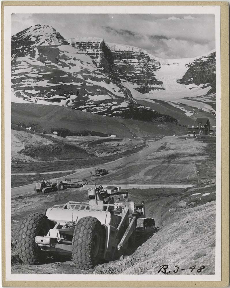
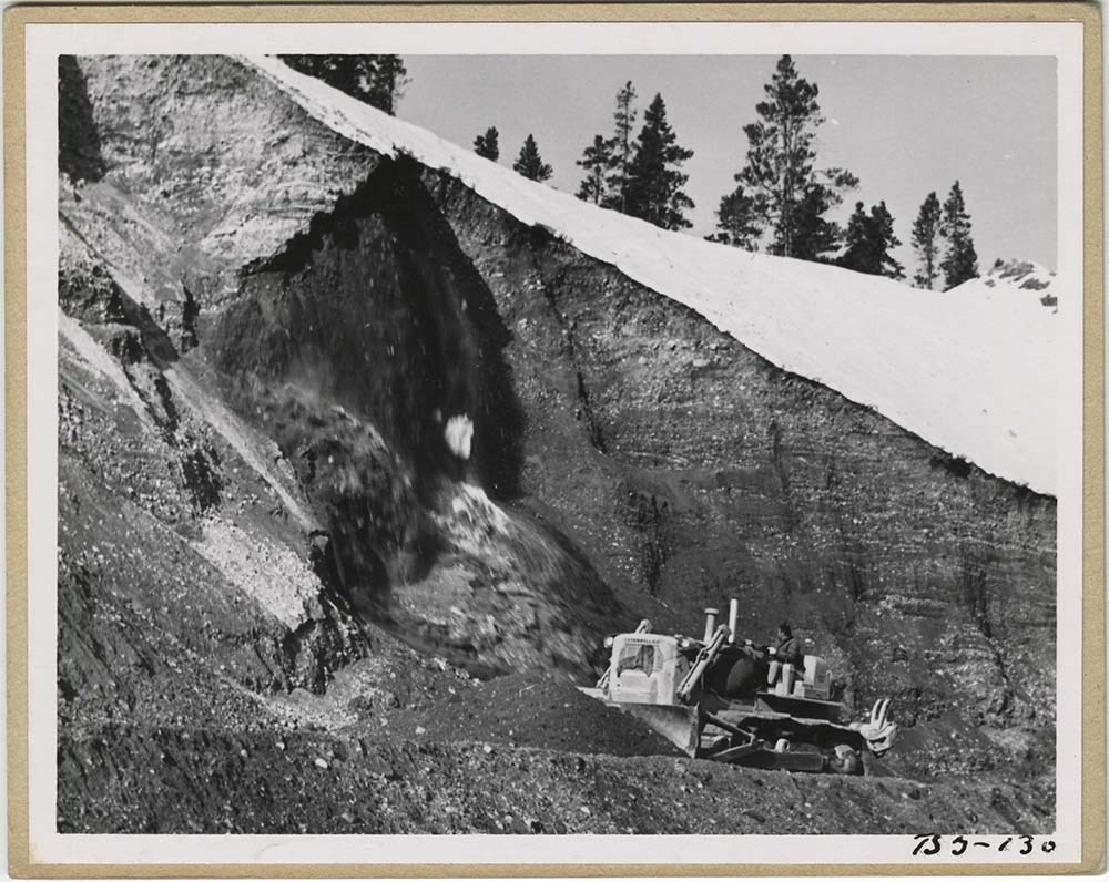
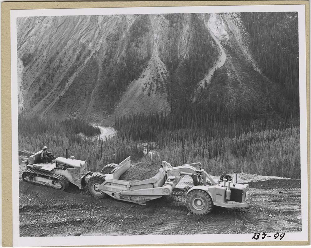
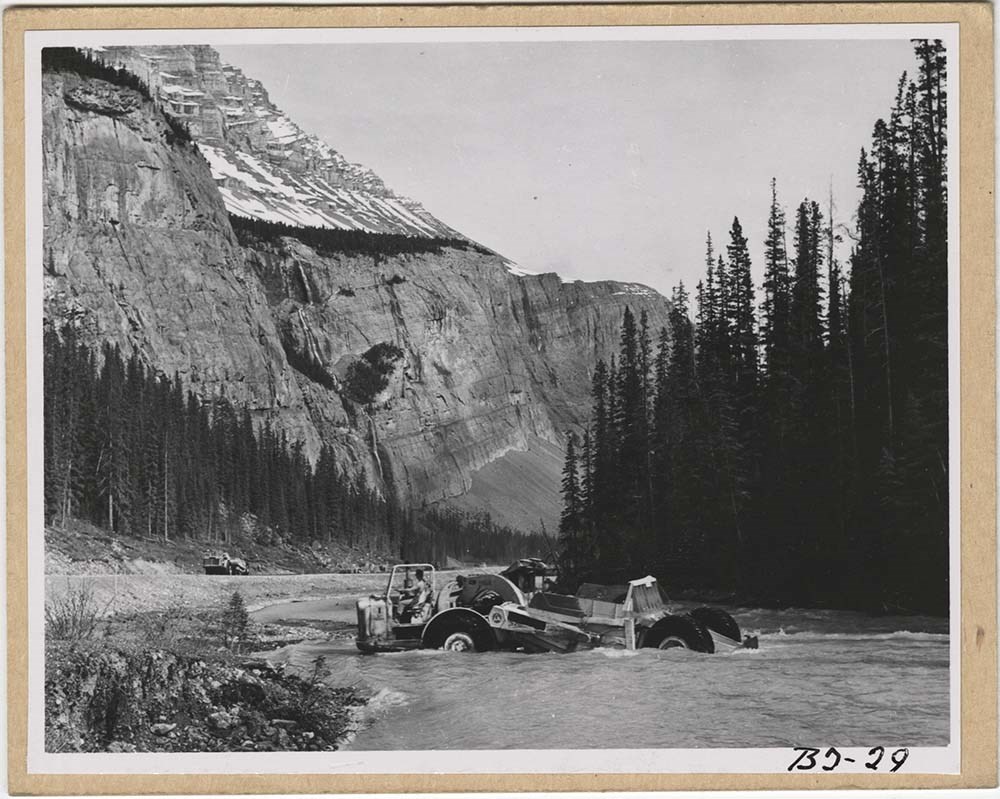
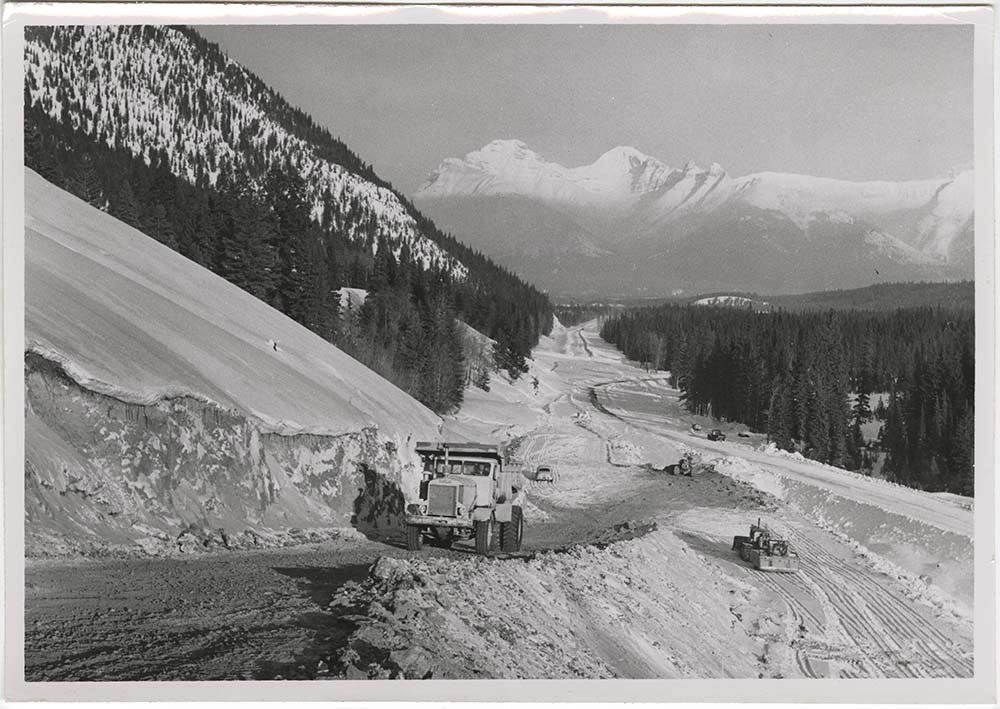
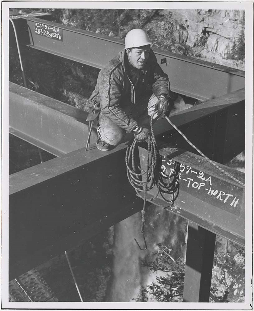
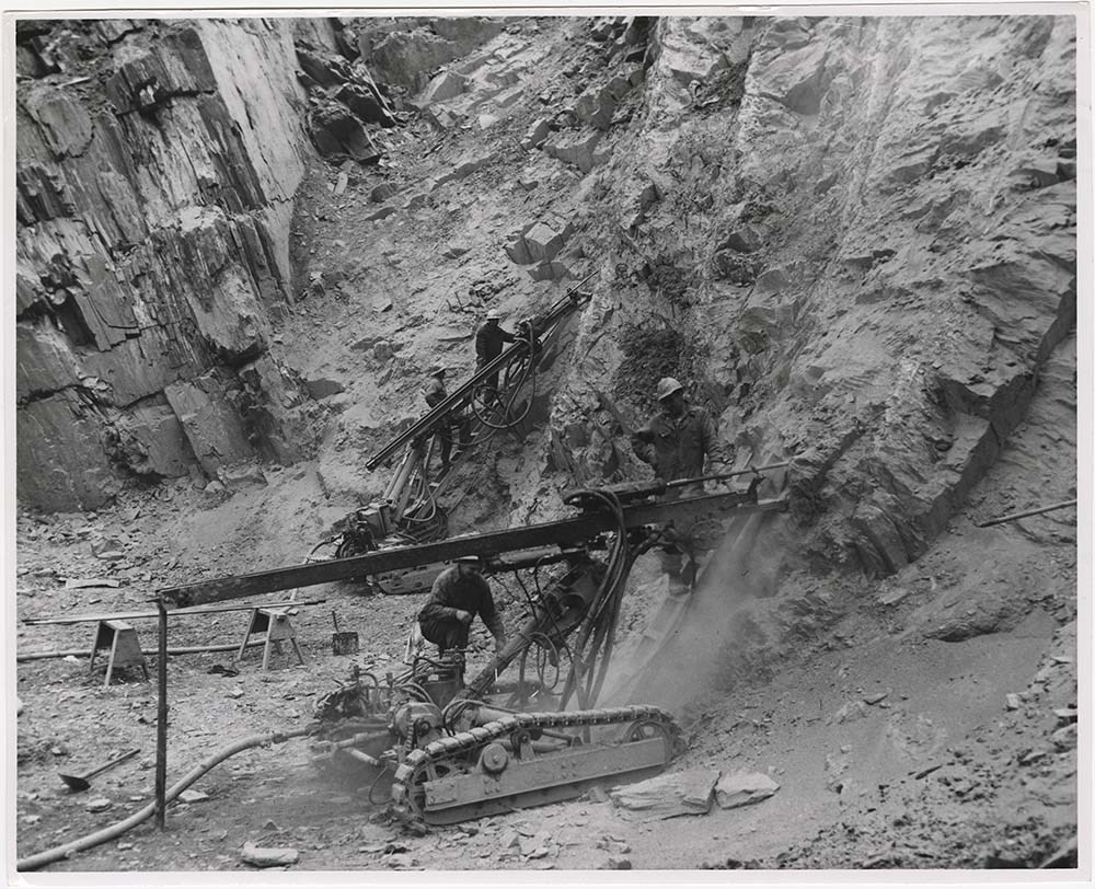
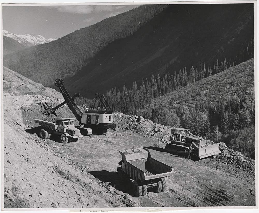
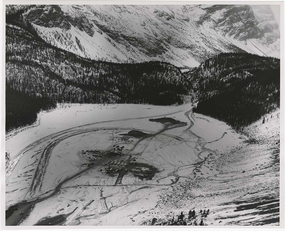
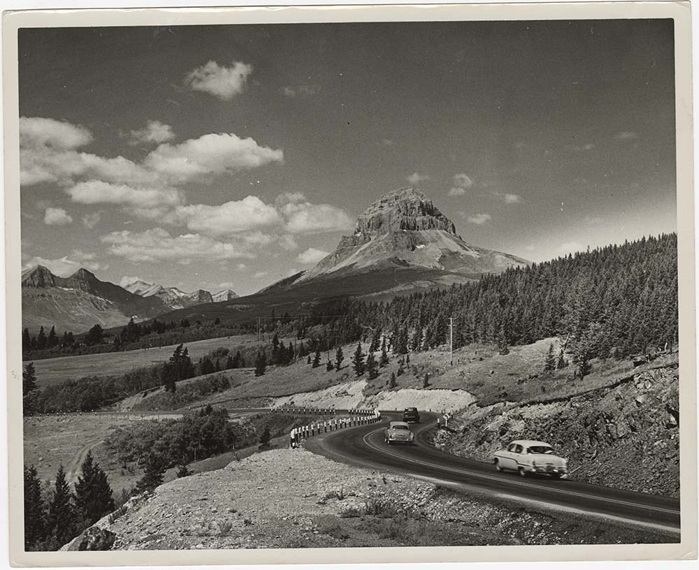
- File pertains to 62 b&w prints of construction of the Banff-Jasper Highway [the Icefield Parkway], as well as a few shots of the Trans-Canada Highway construction just west of the town of Banff.
- Date Range
- 1957-1962
- Reference Code
- V190 / VI / R / ii / b / PA - 01 to PA - 62
- Description Level
- 5 / File
- GMD
- Photograph
14 images
- Part Of
- Bruno Engler fonds
- Description Level
- 5 / File
- Fonds Number
- M323 / S40 / V190
- Series
- VI : Retained file, R : Alphabetical order
- Sous-Fonds
- V190
- Sub-Series
- ii : Roads, b : Construction
- Accession Number
- 7436
- Reference Code
- V190 / VI / R / ii / b / PA - 01 to PA - 62
- GMD
- Photograph
- Date Range
- 1957-1962
- Physical Description
- 62 photographs : b&w ; 25.2 x 20.2 cm or smaller
- History / Biographical
- See fonds level description
- Scope & Content
- File pertains to 62 b&w prints of construction of the Banff-Jasper Highway [the Icefield Parkway], as well as a few shots of the Trans-Canada Highway construction just west of the town of Banff.
- Subject Access
- Athabasca Glacier
- Banff-Jasper Highway
- Bridges
- Construction
- Glaciers
- Mountains
- Trans-Canada Highway
- Roads
- Geographic Access
- Banff
- Banff National Park
- Jasper National Park
- Alberta
- Language
- English
- Creator
- Engler, Bruno
- Title Source
- Original title kept
- Processing Status
- Processed
Images


This material is presented as originally created; it may contain outdated cultural descriptions and
potentially offensive content.
Read more.
- Part Of
- Bruno Engler fonds
- Scope & Content
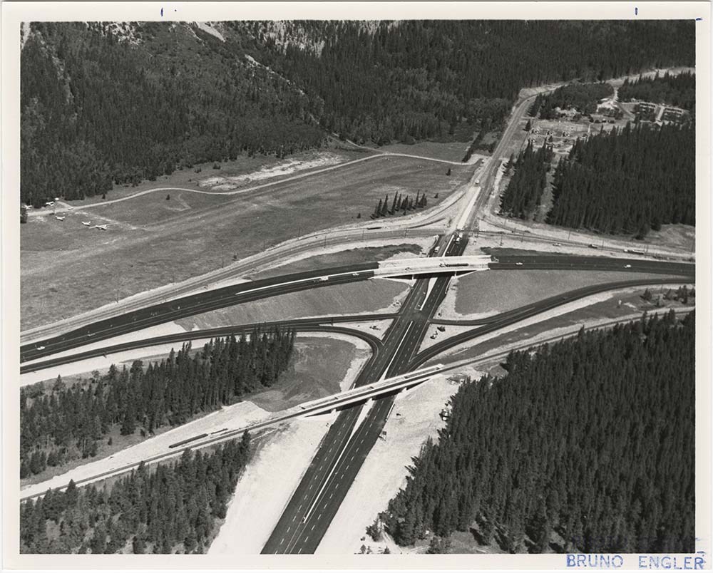
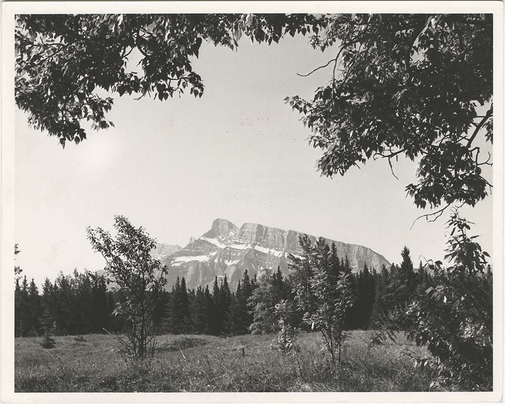
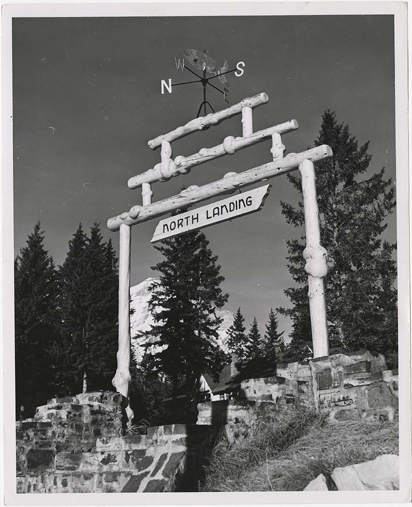
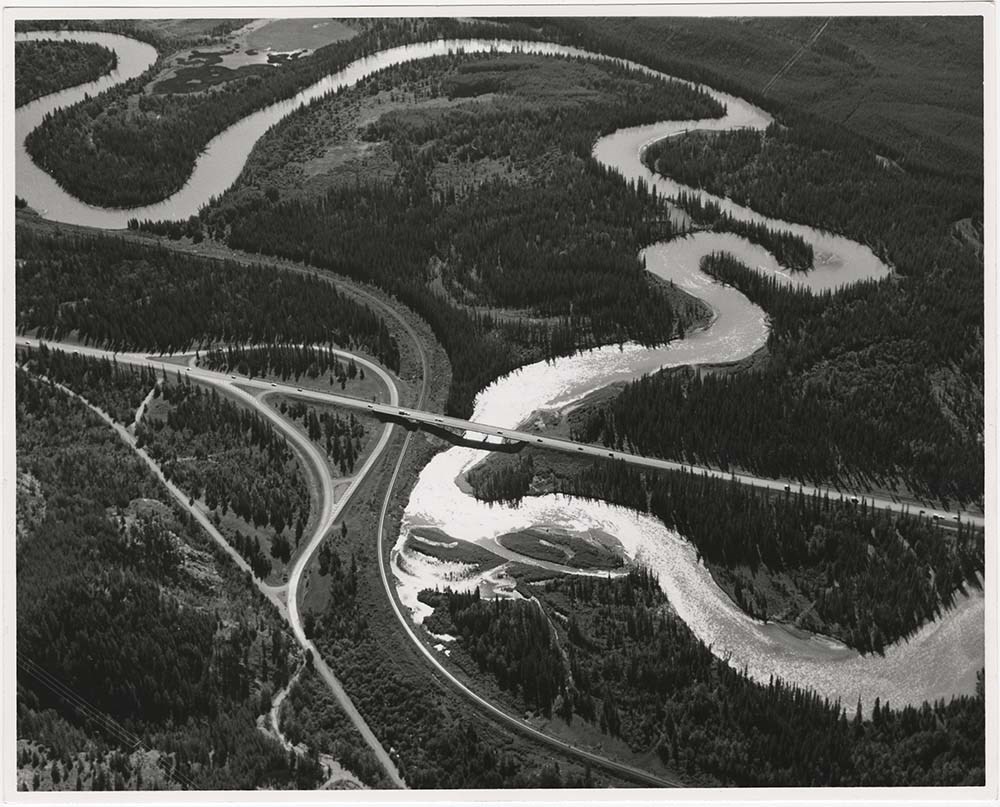
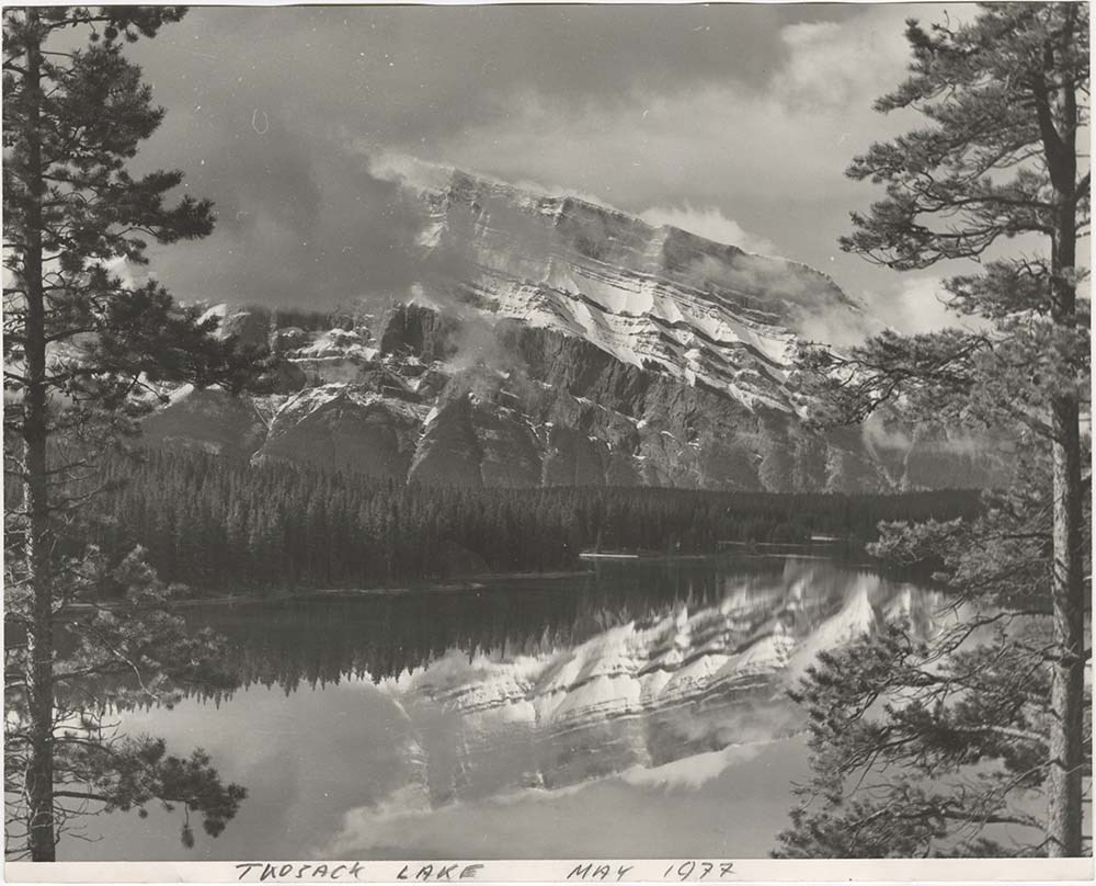
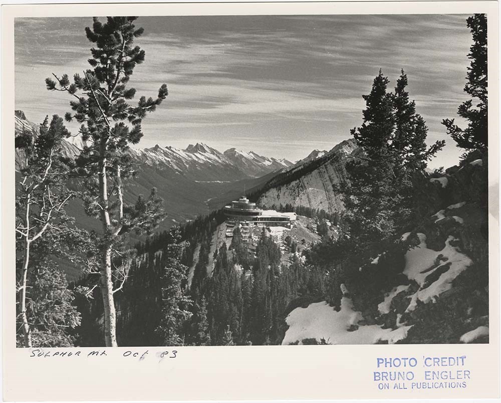
- File pertains to 40 b&w prints of various scenic views from throught the Canadian Rockies. Includes several mountains [including Rundle, Cascade, Mount Lougheed, Ha Ling, Sulphur ], lakes [including Two Jack, Vermillion, Bow, Peyto, and Waterton], and various other views like highways, rivers, hood…
- Date Range
- [ca. 1950-1988]
- Reference Code
- V190 / VI / S / i / PA - 01 to PA - 40
- Description Level
- 5 / File
- GMD
- Photograph
10 images
- Part Of
- Bruno Engler fonds
- Description Level
- 5 / File
- Fonds Number
- M323 / S40 / V190
- Series
- VI : Retained file, S : Alphabetical order
- Sous-Fonds
- V190
- Sub-Series
- i : Scenic Park
- Accession Number
- 7436
- Reference Code
- V190 / VI / S / i / PA - 01 to PA - 40
- GMD
- Photograph
- Date Range
- [ca. 1950-1988]
- Physical Description
- 40 photographs : b&w ; 25.2 x 20.2 cm or smaller
- History / Biographical
- See fonds level description
- Scope & Content
- File pertains to 40 b&w prints of various scenic views from throught the Canadian Rockies. Includes several mountains [including Rundle, Cascade, Mount Lougheed, Ha Ling, Sulphur ], lakes [including Two Jack, Vermillion, Bow, Peyto, and Waterton], and various other views like highways, rivers, hoodoos, tunnels, and valleys.
- Subject Access
- Automobiles
- Banff townsite
- Banff-Jasper Highway
- Bow River
- Bow Valley
- Cascade Mountain
- Cascades of Time Garden
- Fishing
- Glaciers
- Hoodoos
- Icefield Parkway
- Mountains
- North Saskatchewan River
- Rivers
- Roads
- Rundle Mountain
- scenic
- Sulphur Mountain
- Sulphur Mountain Gondola
- Trans-Canada Highway
- Two Jack Lake
- Geographic Access
- Banff
- Bow Lake
- Peyto Lake
- Banff National Park
- Jasper National Park
- Waterton
- Alberta
- Bugaboos
- British Columbia
- Language
- English
- Creator
- Engler, Bruno
- Title Source
- Original title kept
- Processing Status
- Processed
Images


This material is presented as originally created; it may contain outdated cultural descriptions and
potentially offensive content.
Read more.
T.C.H. . -- 1957
https://archives.whyte.org/en/permalink/descriptions1196
- Part Of
- Bruno Engler fonds
- Scope & Content
- Trans Canada Highway through Fortitude, Hermit Creek, Lauria?, Lanack, and Connaught slides. Also avalanche studies in Glacier National Park.
- Reference Code
- V190 / I.D.i. - 3
- Description Level
- 5 / File
- Part Of
- Bruno Engler fonds
- Description Level
- 5 / File
- Series
- I.D. Old file: Government operations and projects
- Reference Code
- V190 / I.D.i. - 3
- Physical Description
- ca.44 negatives: 9.5 x 12 cm. or smaller
- Scope & Content
- Trans Canada Highway through Fortitude, Hermit Creek, Lauria?, Lanack, and Connaught slides. Also avalanche studies in Glacier National Park.
- Subject Access
- Avalanches
- Landslides
- Trans Canada Highway
- Access Restrictions
- Access by appointment only
This material is presented as originally created; it may contain outdated cultural descriptions and
potentially offensive content.
Read more.
T.C.H. . --1957
https://archives.whyte.org/en/permalink/descriptions1197
- Part Of
- Bruno Engler fonds
- Scope & Content
- Construction of Ottertail Bridge for Trans Canada Highway.
- Reference Code
- V190 / I.D.i. - 4
- Description Level
- 5 / File
- Part Of
- Bruno Engler fonds
- Description Level
- 5 / File
- Series
- I.D. Old file: Government operations and projects
- Reference Code
- V190 / I.D.i. - 4
- Physical Description
- ca.24 negatives : 6 x 6 cm.
- Scope & Content
- Construction of Ottertail Bridge for Trans Canada Highway.
- Subject Access
- Trans Canada Highway
- Access Restrictions
- Access by appointment only
This material is presented as originally created; it may contain outdated cultural descriptions and
potentially offensive content.
Read more.
T.C.H. Miscellaneous. -- 1957-1959
https://archives.whyte.org/en/permalink/descriptions1198
- Part Of
- Bruno Engler fonds
- Scope & Content
- Views of Bow River Bridge at Lake Louise, panorama from Mount Norquay, road engineers convention at the Banff School of Fine Arts, guard railings near Canmore.
- Reference Code
- V190 / I.D.i. - 5
- Description Level
- 5 / File
- Part Of
- Bruno Engler fonds
- Description Level
- 5 / File
- Series
- I.D. Old file: Government operations and projects
- Reference Code
- V190 / I.D.i. - 5
- Physical Description
- ca.22 negatives : 9.5 x 12 cm. or smaller
- Scope & Content
- Views of Bow River Bridge at Lake Louise, panorama from Mount Norquay, road engineers convention at the Banff School of Fine Arts, guard railings near Canmore.
- Subject Access
- Trans Canada Highway
- Access Restrictions
- Access by appointment only
This material is presented as originally created; it may contain outdated cultural descriptions and
potentially offensive content.
Read more.
T.C.H. Rogers Pass Lanark Slide and Snow shed. -- 1956-1963
https://archives.whyte.org/en/permalink/descriptions1203
- Part Of
- Bruno Engler fonds
- Scope & Content
- Trans Canada Highway through Rogers Pass, 1956 and the Lanark slide covering snow shed in 1963.
- Reference Code
- V190 / I.D.i. - 2
- Description Level
- 5 / File
- Part Of
- Bruno Engler fonds
- Description Level
- 5 / File
- Series
- I.D. Old file: Government operations and projects
- Reference Code
- V190 / I.D.i. - 2
- Physical Description
- ca.6 negatives: 9.5 x 12 cm. or smaller
- Scope & Content
- Trans Canada Highway through Rogers Pass, 1956 and the Lanark slide covering snow shed in 1963.
- Subject Access
- Landslides
- Rogers Pass
- Trans Canada Highway
- Access Restrictions
- Access by appointment only
This material is presented as originally created; it may contain outdated cultural descriptions and
potentially offensive content.
Read more.
TCH. Surveyors Course B.S.F.A. -- 1957
https://archives.whyte.org/en/permalink/descriptions1195
- Part Of
- Bruno Engler fonds
- Scope & Content
- Surveyors of Trans Canada Highway at the Banff School of Fine Arts for classes and dance, and at University of Alberta.
- Reference Code
- V190 / I.D.i. - 1
- Description Level
- 5 / File
- Part Of
- Bruno Engler fonds
- Description Level
- 5 / File
- Series
- I.D. Old file: Government operations and projects
- Reference Code
- V190 / I.D.i. - 1
- Physical Description
- ca.49 negatives: 9.5 x 12 cm. or smaller
- Scope & Content
- Surveyors of Trans Canada Highway at the Banff School of Fine Arts for classes and dance, and at University of Alberta.
- Subject Access
- Banff Centre
- Trans Canada Highway
- Access Restrictions
- Access by appointment only
This material is presented as originally created; it may contain outdated cultural descriptions and
potentially offensive content.
Read more.
Trans-Canada Hgw. -- 1963
https://archives.whyte.org/en/permalink/descriptions1397
- Part Of
- Bruno Engler fonds
- Scope & Content
- Trans-Canada Highway through the Castle Mountain area and Glacier, B.C.; some aerial photography.
- Reference Code
- V190 / II.A.xix. - 6
- Description Level
- 5 / File
- Part Of
- Bruno Engler fonds
- Description Level
- 5 / File
- Series
- II.A. Main file: Alphabetical files
- Reference Code
- V190 / II.A.xix. - 6
- Physical Description
- ca.21 negatives: 9.5 x 12 cm. or smaller
- Scope & Content
- Trans-Canada Highway through the Castle Mountain area and Glacier, B.C.; some aerial photography.
- Subject Access
- Aerial photography
- Castle Mountain
- Glacier, B.C.
- Trans-Canada Highway
- Access Restrictions
- Access by appointment only
This material is presented as originally created; it may contain outdated cultural descriptions and
potentially offensive content.
Read more.