Narrow Results By
Mt. Wheeler 1984
https://archives.whyte.org/en/permalink/descriptions57767
- Part Of
- Alpine Club of Canada fonds
- Scope & Content
- File consists of a summit record from Mount Wheeler produced by the Alpine Club of Canada in 1984. Summit record includes entries from visitors to the various summits which pertain to individuals' hiking and climbing trips; details of specific events which occurred while at the summit, wildlife sig…
- Date Range
- 1984
- Reference Code
- M200 / V / A / 181
- Description Level
- 5 / File
- GMD
- Textual record
- Organization record
- Part Of
- Alpine Club of Canada fonds
- Description Level
- 5 / File
- Fonds Number
- M200
- V14
- S6
- Series
- M200 / V: Summit Records
- Sous-Fonds
- M200
- Sub-Series
- M200 / V / A: Identified Summit Records
- Accession Number
- accn. 2023.20
- Reference Code
- M200 / V / A / 181
- Responsibility
- Summit Registers and Notes produced by Alpine Club of Canada
- Date Range
- 1984
- Physical Description
- 1 volume 0.5 cm of textual record
- History / Biographical
- Mount Wheeler is located in Glacier National Park, British Columbia. Arthur Wheeler made the first ascent of the mountain in 1902; the mountain was named in his honour.
- Scope & Content
- File consists of a summit record from Mount Wheeler produced by the Alpine Club of Canada in 1984. Summit record includes entries from visitors to the various summits which pertain to individuals' hiking and climbing trips; details of specific events which occurred while at the summit, wildlife sightings, trail updates, and related topics. File: M200 / V / A / 181: Mt. Wheeler 1984
- Name Access
- Alpine Club of Canada
- Subject Access
- Alpine Club of Canada
- Backpacking
- British Columbia
- Climbing
- Club
- Description and travel
- Environment
- Environment and Nature
- Hiking
- Mountain
- Mountaineering
- Mountaineers
- Mountains
- National parks and reserves
- Record keeping
- Sports and leisure
- Sports and recreation
- Summit
- Geographic Access
- Canada
- Canadian Rocky Mountains
- Rocky Mountains
- British Columbia
- Selkirks
- Glacier National Park
- Revelstoke
- Golden
- Golden, BC
- Mount Selwyn
- Deville Glacier
- Black Glacier
- Thor Glacier
- Mount Wheeler
- Access Restrictions
- Restrictions may apply
- Language
- English
- Conservation
- Register placed in mylar due to water damage and mold.
- Related Material
- M235
- Title Source
- Original title
- Processing Status
- Processed
This material is presented as originally created; it may contain outdated cultural descriptions and
potentially offensive content.
Read more.
Mount Deltaform Summit Note
https://archives.whyte.org/en/permalink/descriptions57779
- Part Of
- Alpine Club of Canada fonds
- Scope & Content
- File consists of a summit record from Mount Deltaform produced by the Alpine Club of Canada in 1983. Summit note by Hans Fuhrer and David Wilkinson depicting their route to the summit.
- Date Range
- 1983
- Reference Code
- M200 / V / A / 193
- Description Level
- 5 / File
- GMD
- Textual record
- Organization record
- Part Of
- Alpine Club of Canada fonds
- Description Level
- 5 / File
- Fonds Number
- M200
- V14
- S6
- Series
- M200 / V: Summit Records
- Sous-Fonds
- M200
- Sub-Series
- M200 / V / A: Identified Summit Records
- Accession Number
- accn. 8119
- Reference Code
- M200 / V / A / 193
- Responsibility
- Summit Registers and Notes produced by Alpine Club of Canada
- Date Range
- 1983
- Physical Description
- 0.5 cm of textual record 1 summit note
- History / Biographical
- Mount Deltaform is located in the Valley of the Ten Peaks, along the Continental Divide/Great Divide of the Canadian Rockies. Mount Deltaform is also on the border of Kootenay National Park, BC and Banff National Park, AB. Nearby are Hungabee Mountain, Mount Tuzo, and Mount Whymper.
- Scope & Content
- File consists of a summit record from Mount Deltaform produced by the Alpine Club of Canada in 1983. Summit note by Hans Fuhrer and David Wilkinson depicting their route to the summit.
- Name Access
- Alpine Club of Canada
- Subject Access
- Alberta
- Banff National Park
- British Columbia
- Climbing
- Description and travel
- Environment
- Environment and Nature
- Great Divide
- Hiking
- Mountain
- Mountaineering
- Mountaineers
- Mountains
- National parks and reserves
- Record keeping
- Sports and leisure
- Sports and recreation
- Summit
- Geographic Access
- Canada
- Canadian Rocky Mountains
- Rocky Mountains
- Continental Divide
- Great Divide
- Alberta
- British Columbia
- Banff National Park
- Kootenay National Park
- Valley of the Ten Peaks
- Hungabee Mountain
- Mount Whymper
- Mount Tuzo
- Mount Deltaform
- Access Restrictions
- Restrictions may apply
- Language
- English
- Related Material
- M235
- Biographical Source Notes
- Peak Finder: Deltaform Mountain, Canadian Rockies Database: https://cdnrockiesdatabases.ca/peaks/365
- Title Source
- Original title
- Processing Status
- Processed
This material is presented as originally created; it may contain outdated cultural descriptions and
potentially offensive content.
Read more.
Summit Notes - MT. Hooker, 1978
https://archives.whyte.org/en/permalink/descriptions57716
- Part Of
- Alpine Club of Canada fonds
- Scope & Content
- File consists of summit notes from Mount Hooker, produced by the Alpine Club of Canada in 1978. Summit record includes entries from visitors to the various summits which pertain to individuals' hiking and climbing trips; details of specific events which occurred while at the summit, wildlife sighti…
- Date Range
- 1978
- Reference Code
- M200 / V / A / 126
- Description Level
- 5 / File
- GMD
- Textual record
- Organization record
- Part Of
- Alpine Club of Canada fonds
- Description Level
- 5 / File
- Fonds Number
- M200
- V14
- S6
- Series
- M200 / V: Summit Records
- Sous-Fonds
- M200
- Sub-Series
- M200 / V / A: Identified Summit Records
- Accession Number
- accn. 8002
- Reference Code
- M200 / V / A / 126
- Responsibility
- Summit Registers and Notes produced by Alpine Club of Canada
- Date Range
- 1978
- Physical Description
- 1 cm of textual records 5 summit notes
- History / Biographical
- Mount Hooker is part of the Canadian Rockies, along the Continental Divide/Great Divide separating Alberta and British Columbia. Mount Hooker lies above the Hooker Icefield and the Athabasca Pass. The mountain was named after accomplished botanist, Sir William Jackson Hooker, in 1827.
- Scope & Content
- File consists of summit notes from Mount Hooker, produced by the Alpine Club of Canada in 1978. Summit record includes entries from visitors to the various summits which pertain to individuals' hiking and climbing trips; details of specific events which occurred while at the summit, wildlife sightings, trail updates, and related topics. File: M200 / V / A / 126: Summit Notes - MT. Hooker, 1978
- Name Access
- Alpine Club of Canada
- Subject Access
- Alberta
- Alpine Club of Canada
- Backcountry skiing
- Backpacking
- British Columbia
- Climbing
- Club
- Cross-country skiing
- Description and travel
- Environment
- Environment and Nature
- Great Divide
- Hiking
- Mountain
- Mountaineering
- Mountaineers
- Mountains
- Parks
- Record keeping
- Ski areas
- Ski area
- Ski mountaineering
- Sports and leisure
- Sports and recreation
- Summit
- Trails
- Winter sports
- Geographic Access
- Canada
- Canadian Rocky Mountains
- Continental Divide
- Great Divide
- Alberta
- British Columbia
- Athabasca Pass
- Hooker Icefield
- Mount Clemenceau
- Mount Hooker
- Access Restrictions
- Restrictions may apply
- Language
- English
- Conservation
- Summit notes placed in individual mylar sleeves due to fragile state of paper. Water damage and mold on every summit note.
- Related Material
- M235
- Biographical Source Notes
- Peak Finder: Mount Hooker, Canadian Rockies Database: https://cdnrockiesdatabases.ca/peaks/647#undefined3
- Title Source
- Original title
- Processing Status
- Processed
This material is presented as originally created; it may contain outdated cultural descriptions and
potentially offensive content.
Read more.
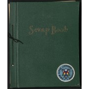
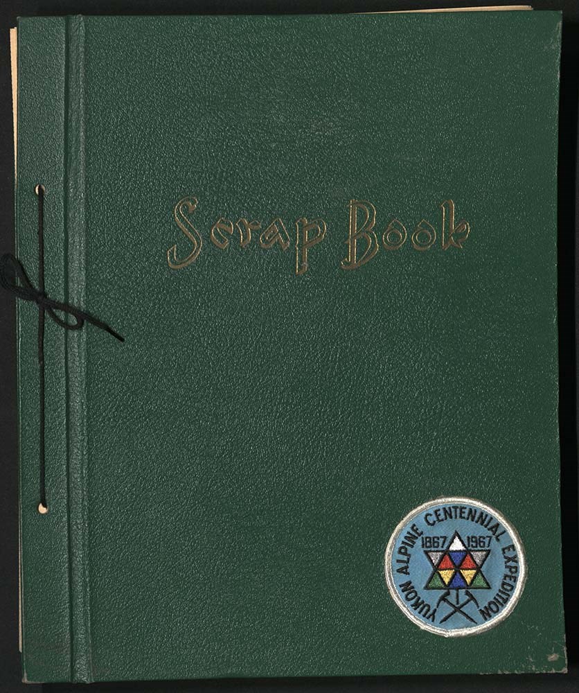
Yukon Alpine Centennial Expedition scrapbook
https://archives.whyte.org/en/permalink/descriptions6290
- Part Of
- Alpine Club of Canada fonds
- Scope & Content
- File consists of a scrapbook containing newspaper clippings and other publications about the Yukon Alpine Centennial Expedition from 19 June to 13 August, 1967. Inserts refer to fold-out newspaper clippings and occasionally entire articles and pages throughout the scrapbook.
- Date Range
- 1967
- Reference Code
- M200 / AC 004M / 4
- Description Level
- 5 / File
- GMD
- Scrapbook
1 image
1 Electronic Resource
- Part Of
- Alpine Club of Canada fonds
- Description Level
- 5 / File
- Fonds Number
- M200 / S6 / V14
- Series
- I.A.2.d.ii. Administration: expeditions - Yukon Alpine Centennial Expedition
- Sous-Fonds
- AC 004M
- Accession Number
- .
- Reference Code
- M200 / AC 004M / 4
- GMD
- Scrapbook
- Date Range
- 1967
- Physical Description
- 4.5 cm of textual records (108 pages ; 30 x 36.5 cm)
- History / Biographical
- The Alpine Club of Canada was founded in 1906 as a national organization dedicated to climbing, mountaineering, mountain safety, and environmental preservation. It continues to operate throughout Canada and has a headquarters located in Canmore, Alberta.
- Scope & Content
- File consists of a scrapbook containing newspaper clippings and other publications about the Yukon Alpine Centennial Expedition from 19 June to 13 August, 1967. Inserts refer to fold-out newspaper clippings and occasionally entire articles and pages throughout the scrapbook.
- Name Access
- Alpine Club of Canada
- Subject Access
- Anniversary
- Backpacking
- Centennial
- Climbing
- Exploration
- History
- Hiking
- Mountaineering
- Mountaineers
- Travel
- Geographic Access
- Alberta
- British Columbia
- Yukon
- Ontario
- Canada
- Language
- English
- French
- Title Source
- Title based on contents of file
- Processing Status
- Unprocessed
Electronic Resources
Images
This material is presented as originally created; it may contain outdated cultural descriptions and
potentially offensive content.
Read more.
[Summit note, Phyllis & Don Munday Sockeye Peak, 1931]
https://archives.whyte.org/en/permalink/descriptions57717
- Part Of
- Alpine Club of Canada fonds
- Scope & Content
- File consists of one summit note from Sockeye Peak produced by the Alpine Club of Canada in 1931. Summit note describes weather, elevation of the peak, and the visitors' hiking/climbing trip. File: M200 / V / A / 127: [Summit note, Phyllis & Don Munday Sockeye Peak, 1931]
- Date Range
- 1931
- Reference Code
- M200 / V / A / 127
- Description Level
- 5 / File
- GMD
- Textual record
- Organization record
- Part Of
- Alpine Club of Canada fonds
- Description Level
- 5 / File
- Fonds Number
- M200
- V14
- S6
- Series
- M200 / V: Summit Records
- Sous-Fonds
- M200
- Sub-Series
- M200 / V / A: Identified Summit Records
- Accession Number
- accn. 6465
- Reference Code
- M200 / V / A / 127
- Responsibility
- Summit Registers and Notes produced by Alpine Club of Canada
- Date Range
- 1931
- Physical Description
- 1 summit note 0.5 cm of textual record
- History / Biographical
- Sockeye Peak is located in British Columbia, along the Coast Mountains/Coast Range. Nearby are Mount Munday, Mount Agur, and Agur Glacier.
- Scope & Content
- File consists of one summit note from Sockeye Peak produced by the Alpine Club of Canada in 1931. Summit note describes weather, elevation of the peak, and the visitors' hiking/climbing trip. File: M200 / V / A / 127: [Summit note, Phyllis & Don Munday Sockeye Peak, 1931]
- Name Access
- Alpine Club of Canada
- Subject Access
- Alpine Club of Canada
- British Columbia
- Climbing
- Club
- Description and travel
- Environment
- Environment and Nature
- Hiking
- Mountain
- Mountaineering
- Mountaineers
- Mountains
- Record keeping
- Sports and leisure
- Sports and recreation
- Summit
- Trails
- Geographic Access
- Canada
- British Columbia
- Coast Range
- Coast Mountains
- Mount Munday
- Mount Agur
- Sockeye Peak
- Access Restrictions
- Restrictions may apply
- Language
- English
- Conservation
- Summit note placed in mylar.
- Related Material
- M235
- Title Source
- Title based on contents of file
- Processing Status
- Processed
This material is presented as originally created; it may contain outdated cultural descriptions and
potentially offensive content.
Read more.
Metal engraving plates
https://archives.whyte.org/en/permalink/descriptions55782
- Part Of
- Alpine Club of Canada fonds
- Scope & Content
- File pertains to four copper engraved negative printing plates and one metal engraved map, all mounted on wooden blocks. The copper printing plates depict various unidentified people hiking and climbing, mountains, and camps with mountain peaks in the background - the engraved map shows the Lynx Cr…
- Date Range
- [ca. 1920-1950]
- Reference Code
- V14 / AC 104 / NC - 01 to NC - 05
- Description Level
- 5 / File
- GMD
- Negative
- Negative printing plate
- Part Of
- Alpine Club of Canada fonds
- Description Level
- 5 / File
- Fonds Number
- M200 / S6 / V14
- Sous-Fonds
- V14
- Accession Number
- AC104
- Reference Code
- V14 / AC 104 / NC - 01 to NC - 05
- Date Range
- [ca. 1920-1950]
- Physical Description
- 5 photograph : b&w printing plates ; 15.8 x 11.7 x 2.8 cm or smaller
- Scope & Content
- File pertains to four copper engraved negative printing plates and one metal engraved map, all mounted on wooden blocks. The copper printing plates depict various unidentified people hiking and climbing, mountains, and camps with mountain peaks in the background - the engraved map shows the Lynx Creek Valley near Mt. Alberta.
- Subject Access
- Alpine Club of Canada
- Camps
- Climbing
- Glaciers
- Hiking
- Mountains
- Mountaineering
- Mountaineers
- Geographic Access
- Alberta
- British Columbia
- Canada
- Language
- English
- Title Source
- Title based on contents of file
- Processing Status
- Processed
This material is presented as originally created; it may contain outdated cultural descriptions and
potentially offensive content.
Read more.
Metal engraving plates
https://archives.whyte.org/en/permalink/descriptions55783
- Part Of
- Alpine Club of Canada fonds
- Scope & Content
- File pertains to two copper engraved negative printing plates mounted on wooden blocks. One printing plate is made up of attached three images depicting an unidentifed person with their back to the camera looking at a glacier, an open valley and river with mountains in the distance, and a number of…
- Date Range
- [ca. 1920-1950]
- Reference Code
- V14 / AC 98 / NC - 01 to NC - 02
- Description Level
- 5 / File
- GMD
- Negative
- Negative printing plate
- Part Of
- Alpine Club of Canada fonds
- Description Level
- 5 / File
- Fonds Number
- M200 / S6 / V14
- Sous-Fonds
- V14
- Accession Number
- AC98
- Reference Code
- V14 / AC 98 / NC - 01 to NC - 02
- Date Range
- [ca. 1920-1950]
- Physical Description
- 2 photograph : b&w printing plates ; 16.1 x 23.8 x 2.3 cm or smaller
- Scope & Content
- File pertains to two copper engraved negative printing plates mounted on wooden blocks. One printing plate is made up of attached three images depicting an unidentifed person with their back to the camera looking at a glacier, an open valley and river with mountains in the distance, and a number of pack horses and unidentified people standing beside a river with mountains in the background. The other plate has two attached images depicting a close up of an unidentified person climbing [taken from below], and a man [possibly Conrad Kain] standing beside a tent with mountains in the background.
- Subject Access
- Alpine Club of Canada
- Camps
- Climbing
- Glaciers
- Hiking
- Horses
- Mountains
- Mountaineering
- Mountaineers
- Geographic Access
- Alberta
- British Columbia
- Canada
- Language
- English
- Title Source
- Title based on contents of file
- Processing Status
- Processed
This material is presented as originally created; it may contain outdated cultural descriptions and
potentially offensive content.
Read more.
Storm Mountain Summit Records
https://archives.whyte.org/en/permalink/descriptions57676
- Part Of
- Alpine Club of Canada fonds
- Scope & Content
- Files consist of summit notes and summit registers from Storm Mountain produced by the Alpine Club of Canada between 1993 and 2009. Summit records include entries from visitors to the various summits which pertain to individuals' hiking and climbing trips; details of specific events which occurred …
- Date Range
- 1993 - 2009
- Reference Code
- M200 / V / A / 57 to 60
- Description Level
- 5 / File
- GMD
- Textual record
- Organization record
- Part Of
- Alpine Club of Canada fonds
- Description Level
- 5 / File
- Fonds Number
- M200
- V14
- S6
- Series
- M200 / V: Summit Records
- Sous-Fonds
- M200
- Sub-Series
- M200 / V / A: Identified Summit Records
- Accession Number
- accn. 8002 accn. 7779 accn. 2014.8315
- Reference Code
- M200 / V / A / 57 to 60
- Responsibility
- Summit Registers and Notes produced by Alpine Club of Canada
- Date Range
- 1993 - 2009
- Physical Description
- 4 cm of textual records 4 volumes
- History / Biographical
- Storm Mountain is located on the Continental Divide between Alberta and British Columbia, and is also on the boundary between Kootenay National Park and Banff National Park. Nearby are Castle Mountain, Vermilion Pass and Stanley Peak.
- Scope & Content
- Files consist of summit notes and summit registers from Storm Mountain produced by the Alpine Club of Canada between 1993 and 2009. Summit records include entries from visitors to the various summits which pertain to individuals' hiking and climbing trips; details of specific events which occurred while at the summit, wildlife sightings, trail updates, and related topics. Files include: M200 / V / A / 57: Summit Register - Storm Mtn., 1993 - 2009 M200 / V / A / 58: Storm Mountain July 1994 - August 2004 M200 / V / A / 59: Summit Register - MT. Storm (Banff), 2005 M200 / V / A / 60: Mt. Storm Summit Register [2005-2009]
- Name Access
- Alpine Club of Canada
- Subject Access
- Alpine Club of Canada
- Alberta
- Backcountry skiing
- Backpacking
- Banff National Park
- British Columbia
- Castle Mountain
- Climbing
- Environment
- Environment and Nature
- Hiking
- Mountain
- Mountaineering
- Mountaineers
- Mountains
- National parks and reserves
- Ski mountaineering
- Skiing
- Sports and leisure
- Sports and recreation
- Summit
- Trails
- Winter sports
- Geographic Access
- Canada
- Alberta
- British Columbia
- Banff National Park
- Kootenay National Park
- Castle Mountain
- Vermilion Pass
- Stanley Peak
- Access Restrictions
- Restrictions may apply
- Language
- English
- French
- Conservation
- Some registers contain water damage. Some registers are loose pages and have been placed in mylar.
- Related Material
- M235
- Biographical Source Notes
- Storm Mountain, North East Face, 1988, In Alpinism no.1, p.60-61, Archives Library, Call Number P
- Title Source
- Title based on contents of file
- Processing Status
- Processed
This material is presented as originally created; it may contain outdated cultural descriptions and
potentially offensive content.
Read more.
Mt. Ward Summit Records
https://archives.whyte.org/en/permalink/descriptions57680
- Part Of
- Alpine Club of Canada fonds
- Scope & Content
- Files consist of summit notes and summit registers from Mt. Ward produced by the Alpine Club of Canada between 1996 and around 2018. Summit records include entries from visitors to the various summits which pertain to individuals' hiking and climbing trips; details of specific events which occurred…
- Date Range
- 1996 - ca. 2018
- Reference Code
- M200 / V / A / 68 to 69
- Description Level
- 5 / File
- GMD
- Textual record
- Organization record
- Part Of
- Alpine Club of Canada fonds
- Description Level
- 5 / File
- Fonds Number
- M200
- V14
- S6
- Series
- M200 / V: Summit Records
- Sous-Fonds
- M200
- Sub-Series
- M200 / V / A: Identified Summit Records
- Accession Number
- accn. 8119
- accn. 2020.05
- Reference Code
- M200 / V / A / 68 to 69
- Responsibility
- Summit Registers and Notes produced by Alpine Club of Canada
- Date Range
- 1996 - ca. 2018
- Physical Description
- 2 volumes 2 cm
- History / Biographical
- Mount Ward is located in southwestern Alberta, near Crowsnest Pass. Surrounding Mt. Ward is Crowsnest Mountain, the Seven Sisters, and Window Mountain. Mt. Ward is along the Continental Divide, between Alberta and British Columbia. Allison Peak is also close by.
- Scope & Content
- Files consist of summit notes and summit registers from Mt. Ward produced by the Alpine Club of Canada between 1996 and around 2018. Summit records include entries from visitors to the various summits which pertain to individuals' hiking and climbing trips; details of specific events which occurred while at the summit, wildlife sightings, trail updates, and related topics. Files include: M200 / V / A / 68: Mt. Ward 1996 - 2010 M200 / V / A / 69: Mt. Ward Summit Log Book [ca. 2011-2018]
- Name Access
- Alpine Club of Canada
- Subject Access
- Alberta
- Alpine Club of Canada
- Backcountry skiing
- Backpacking
- British Columbia
- Climbing
- Environment
- Environment and Nature
- Hiking
- Mountain
- Mountaineering
- Mountaineers
- Mountains
- Record keeping
- Ski mountaineering
- Skiing
- Sports and recreation
- Sports and leisure
- Summit
- Trails
- Winter sports
- Geographic Access
- Canada
- Alberta
- British Columbia
- Crowsnest Pass
- Canadian Rocky Mountains
- Rocky Mountains
- Seven Sister Mountains
- Access Restrictions
- Restrictions may apply
- Language
- English
- Japanese
- Conservation
- Some registers contain chew marks and tears, some registers contain water damage.
- Related Material
- M235
- Title Source
- Title based on contents of file
- Processing Status
- Processed
This material is presented as originally created; it may contain outdated cultural descriptions and
potentially offensive content.
Read more.
Mt. Yukness Summit Records
https://archives.whyte.org/en/permalink/descriptions57687
- Part Of
- Alpine Club of Canada fonds
- Scope & Content
- Files consist of summit notes and summit registers from Mt. Yukness produced by the Alpine Club of Canada between ca. 1962 and 2003. Summit records include entries from visitors to the various summits which pertain to individuals' hiking and climbing trips; details of specific events which occurred…
- Date Range
- ca. 1962-1985
- 1994-2003
- Reference Code
- M200 / V / A / 79 to 80
- Description Level
- 5 / File
- GMD
- Textual record
- Organization record
- Part Of
- Alpine Club of Canada fonds
- Description Level
- 5 / File
- Fonds Number
- M200
- V14
- S6
- Series
- M200 / V: Summit Records
- Sous-Fonds
- M200
- Sub-Series
- M200 / V / A: Identified Summit Records
- Accession Number
- accn. 2023.32
- accn. 8002
- Reference Code
- M200 / V / A / 79 to 80
- Responsibility
- Summit Registers and Notes produced by Alpine Club of Canada
- Date Range
- ca. 1962-1985
- 1994-2003
- Physical Description
- 2 cm of textual records 2 volumes
- History / Biographical
- Mt. Yukness is located near Lake O'Hara in Yoho National Park, B.C. Nearby is Ringrose Peak, Mount Huber, Mount Lefroy, Glacier Peak, and Mount Biddle.
- Scope & Content
- Files consist of summit notes and summit registers from Mt. Yukness produced by the Alpine Club of Canada between ca. 1962 and 2003. Summit records include entries from visitors to the various summits which pertain to individuals' hiking and climbing trips; details of specific events which occurred while at the summit, wildlife sightings, trail updates, and related topics. Files include: M200 / V / A / 79: Mt. Yukness [ca. 1962 - 1985] M200 / V / A / 80: Summit Register - MT. Yukness, 1994 - 2003
- Name Access
- Alpine Club of Canada
- Subject Access
- Alpine Club of Canada
- Backcountry skiing
- Backpacking
- British Columbia
- Climbing
- Cross-country skiing
- Description and travel
- Environment
- Environment and Nature
- Hiking
- Lake O'hara
- Mountain
- Mountaineering
- Mountaineers
- Mountains
- National parks and reserves
- Parks
- Record keeping
- Ski area
- Ski areas
- Ski mountaineering
- Ski touring
- Skiers
- Skiing
- Snowshoes and snowshoeing
- Sports and leisure
- Sports and recreation
- Summit
- Trails
- Winter sports
- Geographic Access
- Canada
- British Columbia
- Canadian Rocky Mountains
- Rocky Mountains
- Yoho National Park
- Lake O'Hara
- Mount Huber
- Mount Lefroy
- Ringrose Peak
- Access Restrictions
- Restrictions may apply
- Language
- English
- Conservation
- M200 / V / A / 80: Summit Register - MT. Yukness, 1994 - 2003 register is placed in mylar due to evidence of mold. This register also contains water damage.
- Related Material
- M235
- Biographical Source Notes
- Mount Yukness, Peak Finder, Canadian Rockies Database: https://cdnrockiesdatabases.ca/peaks/1559
- Title Source
- Title based on contents of file
- Processing Status
- Processed
This material is presented as originally created; it may contain outdated cultural descriptions and
potentially offensive content.
Read more.