Narrow Results By
Rocky Mountain fishing and hiking maps : Banff Park area
https://archives.whyte.org/en/permalink/catalogue24355
- Medium
- Library - Maps and blueprints (unannotated; published)
- Map
- Published Date
- c1983
- Publisher
- Calgary : Brock Hassell
- Call Number
- C6-.8.1c
- Publisher
- Calgary : Brock Hassell
- Published Date
- c1983
- Physical Description
- 1 map : col
- Scale
- 1 inch = 5 km
- Subjects
- Fishing
- Banff National Park
- Accession Number
- 17,000
- Call Number
- C6-.8.1c
- Collection
- Archives Library
This material is presented as originally created; it may contain outdated cultural descriptions and
potentially offensive content.
Read more.
Rocky Mountain fishing and hiking maps : Kananaskis-Windermere
https://archives.whyte.org/en/permalink/catalogue24357
- Medium
- Library - Maps and blueprints (unannotated; published)
- Map
- Published Date
- c1983
- Publisher
- Calgary : Brock Hassell
- Call Number
- C6-8.2b
- Publisher
- Calgary : Brock Hassell
- Published Date
- c1983
- Physical Description
- 1 map : col
- Scale
- 1 inch = 5 km
- Subjects
- Fishing
- Kananaskis Country
- Windermere region
- Accession Number
- 17,000
- Call Number
- C6-8.2b
- Collection
- Archives Library
This material is presented as originally created; it may contain outdated cultural descriptions and
potentially offensive content.
Read more.
Rocky Mountain fishing and hiking maps : Rocky Mountain House-Nordegg
https://archives.whyte.org/en/permalink/catalogue24358
- Medium
- Library - Maps and blueprints (unannotated; published)
- Map
- Published Date
- c1983
- Publisher
- Calgary : Brock Hassell
- Call Number
- C6-8.3
- Publisher
- Calgary : Brock Hassell
- Published Date
- c1983
- Physical Description
- 1 map : col
- Scale
- 1 inch = 5 km
- Subjects
- Fishing
- Nordegg Region
- Accession Number
- 17,000
- Call Number
- C6-8.3
- Collection
- Archives Library
This material is presented as originally created; it may contain outdated cultural descriptions and
potentially offensive content.
Read more.
- Date
- 1987 – 1988
- Material
- metal
- Catalogue Number
- 103.09.1178 a-g
- Description
- 7 Parks Canada guide badges. Rectangular shape, white background with blue lettering. All badges read: “Environment Canada. Parks. GUIDE.” with date “1987-88” at bottom. Under “GUIDE” each badge is identified with the type of guide: a) “FISH”; b) “SKI INSTRUCTOR”; c) “TRAIL & BOATING TRIP”; d) “TR…
1 image
- Title
- Guide Pin
- Date
- 1987 – 1988
- Material
- metal
- Dimensions
- 4.0 x 7.0 cm
- Description
- 7 Parks Canada guide badges. Rectangular shape, white background with blue lettering. All badges read: “Environment Canada. Parks. GUIDE.” with date “1987-88” at bottom. Under “GUIDE” each badge is identified with the type of guide: a) “FISH”; b) “SKI INSTRUCTOR”; c) “TRAIL & BOATING TRIP”; d) “TRAIL ‘C’”; e) “SKI”; f) “MOUNTAIN”; g) “TRAIL ‘A’”.
- Credit
- Gift of Wendy Bush, Banff, 2000
- Catalogue Number
- 103.09.1178 a-g
Images

This material is presented as originally created; it may contain outdated cultural descriptions and
potentially offensive content.
Read more.
Rocky Mountain fishing and hiking maps : Banff Park area
https://archives.whyte.org/en/permalink/catalogue23422
- Medium
- Library - Maps and blueprints (unannotated; published)
- Map
- Published Date
- c1983
- Publisher
- Calgary : Brock Hassell
- Call Number
- C6-.8.1c
- Publisher
- Calgary : Brock Hassell
- Published Date
- c1983
- Physical Description
- 1 map : col
- Scale
- 1 inch = 5 km
- Subjects
- Fishing
- Banff National Park
- Accession Number
- 17,000
- Call Number
- C6-.8.1c
- Collection
- Archives Library
This material is presented as originally created; it may contain outdated cultural descriptions and
potentially offensive content.
Read more.
Rocky Mountain fishing and hiking maps : Kananaskis-Windermere
https://archives.whyte.org/en/permalink/catalogue23424
- Medium
- Library - Maps and blueprints (unannotated; published)
- Map
- Published Date
- c1983
- Publisher
- Calgary : Brock Hassell
- Call Number
- C6-8.2b
- Publisher
- Calgary : Brock Hassell
- Published Date
- c1983
- Physical Description
- 1 map : col
- Scale
- 1 inch = 5 km
- Subjects
- Fishing
- Kananaskis Country
- Windermere region
- Accession Number
- 17,000
- Call Number
- C6-8.2b
- Collection
- Archives Library
This material is presented as originally created; it may contain outdated cultural descriptions and
potentially offensive content.
Read more.
Rocky Mountain fishing and hiking maps : Rocky Mountain House-Nordegg
https://archives.whyte.org/en/permalink/catalogue23425
- Medium
- Library - Maps and blueprints (unannotated; published)
- Map
- Published Date
- c1983
- Publisher
- Calgary : Brock Hassell
- Call Number
- C6-8.3
- Publisher
- Calgary : Brock Hassell
- Published Date
- c1983
- Physical Description
- 1 map : col
- Scale
- 1 inch = 5 km
- Subjects
- Fishing
- Nordegg Region
- Accession Number
- 17,000
- Call Number
- C6-8.3
- Collection
- Archives Library
This material is presented as originally created; it may contain outdated cultural descriptions and
potentially offensive content.
Read more.
Four Mountain Parks Planning Program
https://archives.whyte.org/en/permalink/descriptions54919
- Scope & Content
- File consists of a planning scenario draft, response form and information sheet, draft of possible implications, meeting notes and comments, and correspondence between Parks Canada and the Trail Riders of the Canadian Rockies. Content pertains to the Four Mountain Parks Program implemented by Parks…
- Date Range
- 1984-1985
- Reference Code
- M545 / V / 24
- Description Level
- 5 / File
- GMD
- Textual record
- Government record
- Description Level
- 5 / File
- Fonds Number
- M545 / V635
- Series
- M545 / V : Administrative records
- Sous-Fonds
- M545
- Accession Number
- 5939
- Reference Code
- M545 / V / 24
- Date Range
- 1984-1985
- Physical Description
- 2 cm of textual records
- Scope & Content
- File consists of a planning scenario draft, response form and information sheet, draft of possible implications, meeting notes and comments, and correspondence between Parks Canada and the Trail Riders of the Canadian Rockies. Content pertains to the Four Mountain Parks Program implemented by Parks Canada between 1984 and 1985, and related changes adapted by the Trail Riders. Topics include wildlife and resource management, trail use and maintenance, townsite development, hunting and fishing, and other related subjects within Banff, Jasper, Yoho and Kootenay National Parks.
- Notes
- Planning scenario draft has annotations on front cover, annotations and illustrations on second interior page
- Subject Access
- Government
- Environment
- Natural resources
- Townsite development
- Wildlife
- Wildfire
- Conservation
- Ecology
- Fishing
- Forestry
- Hunting
- Land use
- Laws and legislation
- National parks and reserves
- Parks Canada
- Park policy
- Geographic Access
- Canada
- Alberta
- British Columbia
- Banff National Park
- Jasper National Park
- Kootenay National Park
- Yoho National Park
- Language
- English
- Conservation
- Plastic binding removed from planning scenario draft
- Category
- Environment
- Government
- Land, settlement and immigration
- Natural resources
- Sports, recreation and leisure
- Title Source
- Title copied from contents in file
- Processing Status
- Processed
This material is presented as originally created; it may contain outdated cultural descriptions and
potentially offensive content.
Read more.
People Fishing
https://archives.whyte.org/en/permalink/descriptions56419
- Part Of
- Douglas Leighton fonds
- Scope & Content
- Files consist of photographs of people fishing, could be from a photoshoot for commercial purposes. Children and adults fishing, holding rods, and holding up caught fish.
- Date Range
- 1981
- 1983 - 1985
- 1987
- Reference Code
- V222 / III / C / 1 / NS - 1 to 74
- Description Level
- 5 / File
- GMD
- Transparency
- Photograph
- Part Of
- Douglas Leighton fonds
- Description Level
- 5 / File
- Fonds Number
- M133
- V222
- Series
- V222 / III : Trips, Topics or Events
- Sous-Fonds
- V222
- Sub-Series
- V222 / III / C : Fishing
- Accession Number
- 2020.24
- Reference Code
- V222 / III / C / 1 / NS - 1 to 74
- Date Range
- 1981
- 1983 - 1985
- 1987
- Physical Description
- 74 photographs : col. slides ; 35 mm
- Scope & Content
- Files consist of photographs of people fishing, could be from a photoshoot for commercial purposes. Children and adults fishing, holding rods, and holding up caught fish.
- Name Access
- Leighton, Douglas
- Geographic Access
- Banff National Park
- Chase, BC
- Top of the World Provincial Park
- Cranbrook, BC
- Adams River, BC
- Vancouver, BC
- Kimberely, BC
- Cawston, BC
- Creston, BC
- Language
- English
- Creator
- Douglas Leighton
- Title Source
- Title based on contents of file
- Processing Status
- Processed
This material is presented as originally created; it may contain outdated cultural descriptions and
potentially offensive content.
Read more.
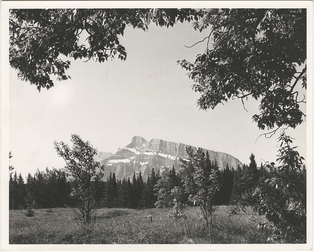
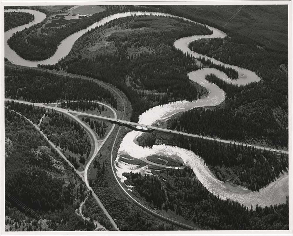
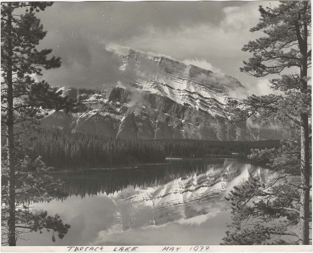
- Part Of
- Bruno Engler fonds
- Scope & Content
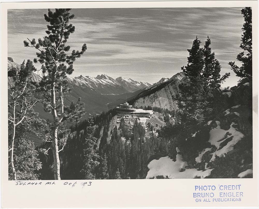
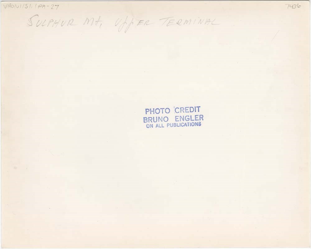
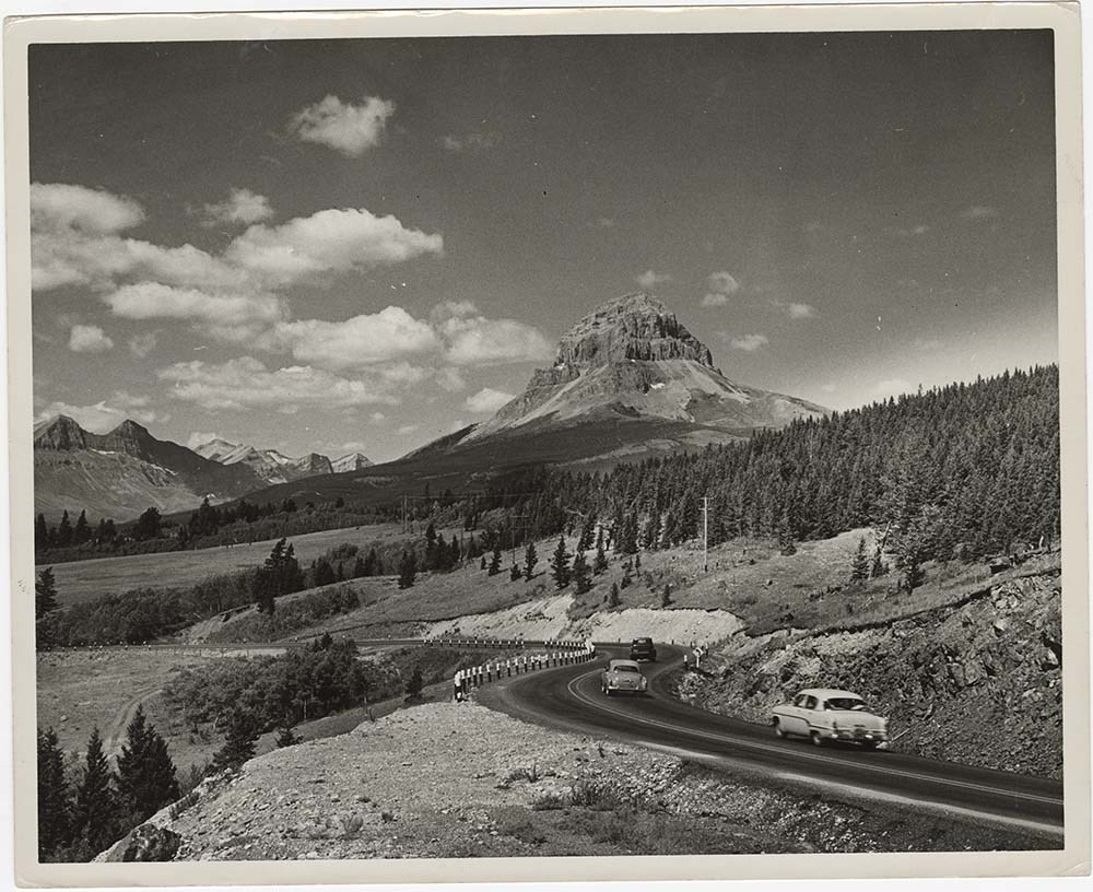
- File pertains to 40 b&w prints of various scenic views from throught the Canadian Rockies. Includes several mountains [including Rundle, Cascade, Mount Lougheed, Ha Ling, Sulphur ], lakes [including Two Jack, Vermillion, Bow, Peyto, and Waterton], and various other views like highways, rivers, hood…
- Date Range
- [ca. 1950-1988]
- Reference Code
- V190 / VI / S / i / PA - 01 to PA - 40
- Description Level
- 5 / File
- GMD
- Photograph
10 images
- Part Of
- Bruno Engler fonds
- Description Level
- 5 / File
- Fonds Number
- M323 / S40 / V190
- Series
- VI : Retained file, S : Alphabetical order
- Sous-Fonds
- V190
- Sub-Series
- i : Scenic Park
- Accession Number
- 7436
- Reference Code
- V190 / VI / S / i / PA - 01 to PA - 40
- GMD
- Photograph
- Date Range
- [ca. 1950-1988]
- Physical Description
- 40 photographs : b&w ; 25.2 x 20.2 cm or smaller
- History / Biographical
- See fonds level description
- Scope & Content
- File pertains to 40 b&w prints of various scenic views from throught the Canadian Rockies. Includes several mountains [including Rundle, Cascade, Mount Lougheed, Ha Ling, Sulphur ], lakes [including Two Jack, Vermillion, Bow, Peyto, and Waterton], and various other views like highways, rivers, hoodoos, tunnels, and valleys.
- Subject Access
- Automobiles
- Banff townsite
- Banff-Jasper Highway
- Bow River
- Bow Valley
- Cascade Mountain
- Cascades of Time Garden
- Fishing
- Glaciers
- Hoodoos
- Icefield Parkway
- Mountains
- North Saskatchewan River
- Rivers
- Roads
- Rundle Mountain
- scenic
- Sulphur Mountain
- Sulphur Mountain Gondola
- Trans-Canada Highway
- Two Jack Lake
- Geographic Access
- Banff
- Bow Lake
- Peyto Lake
- Banff National Park
- Jasper National Park
- Waterton
- Alberta
- Bugaboos
- British Columbia
- Language
- English
- Creator
- Engler, Bruno
- Title Source
- Original title kept
- Processing Status
- Processed
Images


This material is presented as originally created; it may contain outdated cultural descriptions and
potentially offensive content.
Read more.