Narrow Results By
Bruce Hatfield fonds
https://archives.whyte.org/en/permalink/descriptions57499
- Part Of
- Bruce Hatfield fonds
- Scope & Content
- Fonds consists of materials pertaining to Dr. Bruce Hatfield's excursions with the Trail Riders between 1963-1995 and his role as Trail Doctor. Fonds includes ca.441 transparency slides with images primarily taken by Bruce during trail rides, 1963-1994, depicting fellow ride participants, camp life…
- Date Range
- 1963-1995
- Reference Code
- M597 / V819
- Description Level
- 1 / Fonds
- GMD
- Photograph
- Transparency
- Textual record
- Negative
- Private record
- Organization record
- Part Of
- Bruce Hatfield fonds
- Description Level
- 1 / Fonds
- Fonds Number
- M597
- V819
- Sous-Fonds
- M597
- V819
- Accession Number
- 2023.29
- Reference Code
- M597 / V819
- Responsibility
- Photographs mostly produced by Bruce Hatfield
- Date Range
- 1963-1995
- Physical Description
- ca.441 col. transparency slides : 35 mm -- 14 col. neg. film strips (49 images) : 35 mm -- ca.1.5 cm textual records
- History / Biographical
- Clinton Bruce Hatfield (1926-2009) was born in Calgary, Alberta. After graduating from Western Canada High School in 1945, Bruce attended the University of Alberta, where he completed a Bachelor of Science degree in 1948, a Master of Science degree in 1951, and a Medical Degree in 1953. Bruce interned at the University of Alberta Hospital before moving to Minneapolis in 1957, where he worked as an Instructor in Medicine at the University of Minnesota Hospital (1958-1959). Bruce moved back to Calgary and opened a private medical practice with his brother, Bob Hatfield. While operating his private practice, Bruce also served on several committees at the Calgary Hospital, including the Intern Committee, Library Committee, Medical Education Committee, Pharmacy Committee (of which he was Chair in 1966), and the Department of Medicine Committee. Bruce was hired as an Assistant Professor at the University of Calgary in 1970, and was Clinical Professor of Medicine when he retired in 1994. Bruce was active as an educator and volunteer in his community, and supported numerous charitable initiatives through the United Church of Canada. He gave public presentations on the topics of Family Life and Sex Education throughout the 1960s and 1970s. Bruce also served as a Trail Doctor for the Trail Riders of the Canadian Rockies on numerous trips between 1963 and 1995. Bruce was also a talented photographer; his photographs were featured in multiple publications including Macleans magazine, Canadian Doctor, and Canadian Medical Association Journal. Bruce was the recipient of many awards including Calgary’s Citizen of the Year (1970), the Premier’s Cup (1983), an Honorary Doctorate of Laws from the University of Calgary (1995) and most recently was chosen as one of Alberta’s 100 Physicians of the Century (2005). Bruce and his brother, Bob, were co-recipients of the Alberta Achievement Award and the Premier's Cup for Excellence in Medicine and the Community. Bruce was married to his wife, Kathleen, for 55 years and the couple raised four daughters together: Linda, Barbara, Sue and Kate.
- Scope & Content
- Fonds consists of materials pertaining to Dr. Bruce Hatfield's excursions with the Trail Riders between 1963-1995 and his role as Trail Doctor. Fonds includes ca.441 transparency slides with images primarily taken by Bruce during trail rides, 1963-1994, depicting fellow ride participants, camp life, wildlife, and landscapes; 14 colour negative film strips (49 images) depicting scenes from a trail ride in 1995; collected correspondence pertaining to trail rides and administrative work; medical reports from trail rides; and collected riders' lists and related material.
- Name Access
- Hatfield, Bruce
- Subject Access
- Trails
- Trail Riders of the Canadian Rockies
- Travel
- Administration
- Animals
- Bighorn Sheep
- Buildings and facilities
- Businesses
- Camping
- Correspondence
- Dancing
- Deer
- Dogs
- Elk
- Entertainment
- Environment
- Fishing
- Glaciers
- Guides
- Horse packing
- Horseback riding
- Horses
- Health services
- Landscapes
- Membership
- Mountain Goats
- Music
- Musicians
- Organizations
- Outfitters, trail guides and packers
- Pack trips
- Recreation
- Sports and recreation
- Swimming
- Tourism
- Trail guides
- Geographic Access
- Canada
- Alberta
- British Columbia
- Access Restrictions
- Some restrictions apply- contains personal information
- Reproduction Restrictions
- Some restrictions apply- contains personal information
- Related Material
- Trail Riders of the Canadian Rockies fonds (M545/V635)
- Biographical Source Notes
- https://searcharchives.ucalgary.ca/dr-c-bruce-hatfield-fonds
- https://mhfh.com/tribute/details/15163/Clinton-Hatfield/obituary.html
- Title Source
- Title based on contents of fonds
- Processing Status
- Processed
This material is presented as originally created; it may contain outdated cultural descriptions and
potentially offensive content.
Read more.
Rocky Mountain fishing and hiking maps : Banff Park area
https://archives.whyte.org/en/permalink/catalogue24355
- Medium
- Library - Maps and blueprints (unannotated; published)
- Map
- Published Date
- c1983
- Publisher
- Calgary : Brock Hassell
- Call Number
- C6-.8.1c
- Publisher
- Calgary : Brock Hassell
- Published Date
- c1983
- Physical Description
- 1 map : col
- Scale
- 1 inch = 5 km
- Subjects
- Fishing
- Banff National Park
- Accession Number
- 17,000
- Call Number
- C6-.8.1c
- Collection
- Archives Library
This material is presented as originally created; it may contain outdated cultural descriptions and
potentially offensive content.
Read more.
Rocky Mountain fishing and hiking maps : Kananaskis-Windermere
https://archives.whyte.org/en/permalink/catalogue24357
- Medium
- Library - Maps and blueprints (unannotated; published)
- Map
- Published Date
- c1983
- Publisher
- Calgary : Brock Hassell
- Call Number
- C6-8.2b
- Publisher
- Calgary : Brock Hassell
- Published Date
- c1983
- Physical Description
- 1 map : col
- Scale
- 1 inch = 5 km
- Subjects
- Fishing
- Kananaskis Country
- Windermere region
- Accession Number
- 17,000
- Call Number
- C6-8.2b
- Collection
- Archives Library
This material is presented as originally created; it may contain outdated cultural descriptions and
potentially offensive content.
Read more.
Rocky Mountain fishing and hiking maps : Rocky Mountain House-Nordegg
https://archives.whyte.org/en/permalink/catalogue24358
- Medium
- Library - Maps and blueprints (unannotated; published)
- Map
- Published Date
- c1983
- Publisher
- Calgary : Brock Hassell
- Call Number
- C6-8.3
- Publisher
- Calgary : Brock Hassell
- Published Date
- c1983
- Physical Description
- 1 map : col
- Scale
- 1 inch = 5 km
- Subjects
- Fishing
- Nordegg Region
- Accession Number
- 17,000
- Call Number
- C6-8.3
- Collection
- Archives Library
This material is presented as originally created; it may contain outdated cultural descriptions and
potentially offensive content.
Read more.
Blue ribbon Bow
https://archives.whyte.org/en/permalink/catalogue6851
- Medium
- Library - Book (including soft-cover and pamphlets)
- Published Date
- 1987
- Author
- McLennan, Jim
- Publisher
- Edmonton : Lone Pine
- Call Number
- 04.2 M22
- Author
- McLennan, Jim
- Responsibility
- photos: Jim and Lynda McLennan
- illustrations: Jack Cowin
- line drawings: Yuet C. Chan
- Publisher
- Edmonton : Lone Pine
- Published Date
- 1987
- Physical Description
- 156p. : ill., maps
- Subjects
- Fishing
- Notes
- Bibliography
- ISBN
- 0-919433-21-9
- Accession Number
- 20500
- Call Number
- 04.2 M22
- Collection
- Archives Library
This material is presented as originally created; it may contain outdated cultural descriptions and
potentially offensive content.
Read more.
Rocky Mountain fishing and hiking maps : Banff Park area
https://archives.whyte.org/en/permalink/catalogue23422
- Medium
- Library - Maps and blueprints (unannotated; published)
- Map
- Published Date
- c1983
- Publisher
- Calgary : Brock Hassell
- Call Number
- C6-.8.1c
- Publisher
- Calgary : Brock Hassell
- Published Date
- c1983
- Physical Description
- 1 map : col
- Scale
- 1 inch = 5 km
- Subjects
- Fishing
- Banff National Park
- Accession Number
- 17,000
- Call Number
- C6-.8.1c
- Collection
- Archives Library
This material is presented as originally created; it may contain outdated cultural descriptions and
potentially offensive content.
Read more.
Rocky Mountain fishing and hiking maps : Kananaskis-Windermere
https://archives.whyte.org/en/permalink/catalogue23424
- Medium
- Library - Maps and blueprints (unannotated; published)
- Map
- Published Date
- c1983
- Publisher
- Calgary : Brock Hassell
- Call Number
- C6-8.2b
- Publisher
- Calgary : Brock Hassell
- Published Date
- c1983
- Physical Description
- 1 map : col
- Scale
- 1 inch = 5 km
- Subjects
- Fishing
- Kananaskis Country
- Windermere region
- Accession Number
- 17,000
- Call Number
- C6-8.2b
- Collection
- Archives Library
This material is presented as originally created; it may contain outdated cultural descriptions and
potentially offensive content.
Read more.
Rocky Mountain fishing and hiking maps : Rocky Mountain House-Nordegg
https://archives.whyte.org/en/permalink/catalogue23425
- Medium
- Library - Maps and blueprints (unannotated; published)
- Map
- Published Date
- c1983
- Publisher
- Calgary : Brock Hassell
- Call Number
- C6-8.3
- Publisher
- Calgary : Brock Hassell
- Published Date
- c1983
- Physical Description
- 1 map : col
- Scale
- 1 inch = 5 km
- Subjects
- Fishing
- Nordegg Region
- Accession Number
- 17,000
- Call Number
- C6-8.3
- Collection
- Archives Library
This material is presented as originally created; it may contain outdated cultural descriptions and
potentially offensive content.
Read more.
People Fishing
https://archives.whyte.org/en/permalink/descriptions56419
- Part Of
- Douglas Leighton fonds
- Scope & Content
- Files consist of photographs of people fishing, could be from a photoshoot for commercial purposes. Children and adults fishing, holding rods, and holding up caught fish.
- Date Range
- 1981
- 1983 - 1985
- 1987
- Reference Code
- V222 / III / C / 1 / NS - 1 to 74
- Description Level
- 5 / File
- GMD
- Transparency
- Photograph
- Part Of
- Douglas Leighton fonds
- Description Level
- 5 / File
- Fonds Number
- M133
- V222
- Series
- V222 / III : Trips, Topics or Events
- Sous-Fonds
- V222
- Sub-Series
- V222 / III / C : Fishing
- Accession Number
- 2020.24
- Reference Code
- V222 / III / C / 1 / NS - 1 to 74
- Date Range
- 1981
- 1983 - 1985
- 1987
- Physical Description
- 74 photographs : col. slides ; 35 mm
- Scope & Content
- Files consist of photographs of people fishing, could be from a photoshoot for commercial purposes. Children and adults fishing, holding rods, and holding up caught fish.
- Name Access
- Leighton, Douglas
- Geographic Access
- Banff National Park
- Chase, BC
- Top of the World Provincial Park
- Cranbrook, BC
- Adams River, BC
- Vancouver, BC
- Kimberely, BC
- Cawston, BC
- Creston, BC
- Language
- English
- Creator
- Douglas Leighton
- Title Source
- Title based on contents of file
- Processing Status
- Processed
This material is presented as originally created; it may contain outdated cultural descriptions and
potentially offensive content.
Read more.
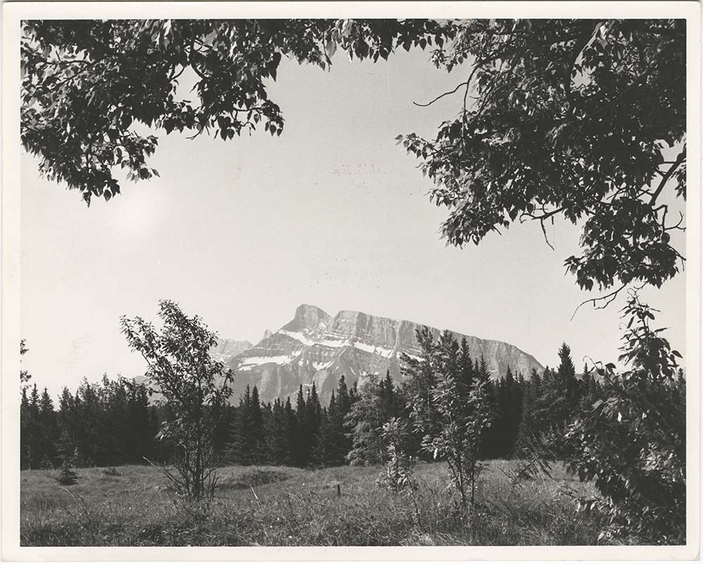
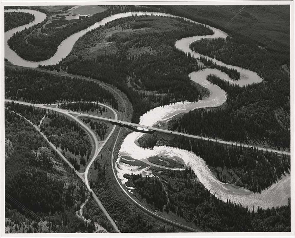
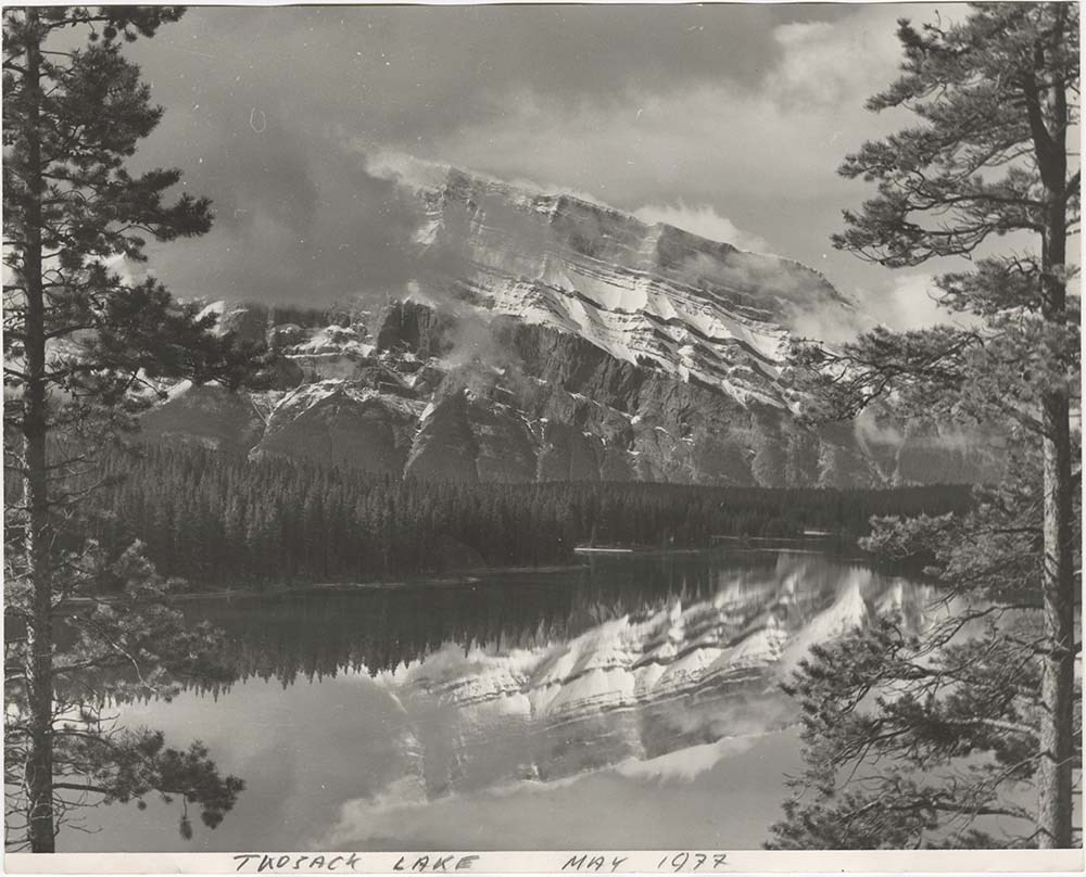
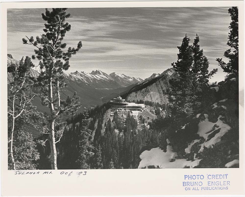
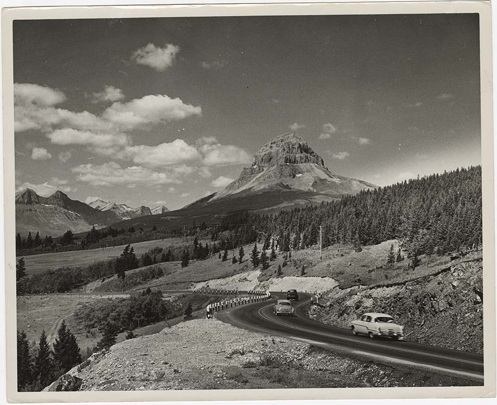
- Part Of
- Bruno Engler fonds
- Scope & Content
- File pertains to 40 b&w prints of various scenic views from throught the Canadian Rockies. Includes several mountains [including Rundle, Cascade, Mount Lougheed, Ha Ling, Sulphur ], lakes [including Two Jack, Vermillion, Bow, Peyto, and Waterton], and various other views like highways, rivers, hood…
- Date Range
- [ca. 1950-1988]
- Reference Code
- V190 / VI / S / i / PA - 01 to PA - 40
- Description Level
- 5 / File
- GMD
- Photograph
10 images
- Part Of
- Bruno Engler fonds
- Description Level
- 5 / File
- Fonds Number
- M323 / S40 / V190
- Series
- VI : Retained file, S : Alphabetical order
- Sous-Fonds
- V190
- Sub-Series
- i : Scenic Park
- Accession Number
- 7436
- Reference Code
- V190 / VI / S / i / PA - 01 to PA - 40
- GMD
- Photograph
- Date Range
- [ca. 1950-1988]
- Physical Description
- 40 photographs : b&w ; 25.2 x 20.2 cm or smaller
- History / Biographical
- See fonds level description
- Scope & Content
- File pertains to 40 b&w prints of various scenic views from throught the Canadian Rockies. Includes several mountains [including Rundle, Cascade, Mount Lougheed, Ha Ling, Sulphur ], lakes [including Two Jack, Vermillion, Bow, Peyto, and Waterton], and various other views like highways, rivers, hoodoos, tunnels, and valleys.
- Subject Access
- Automobiles
- Banff townsite
- Banff-Jasper Highway
- Bow River
- Bow Valley
- Cascade Mountain
- Cascades of Time Garden
- Fishing
- Glaciers
- Hoodoos
- Icefield Parkway
- Mountains
- North Saskatchewan River
- Rivers
- Roads
- Rundle Mountain
- scenic
- Sulphur Mountain
- Sulphur Mountain Gondola
- Trans-Canada Highway
- Two Jack Lake
- Geographic Access
- Banff
- Bow Lake
- Peyto Lake
- Banff National Park
- Jasper National Park
- Waterton
- Alberta
- Bugaboos
- British Columbia
- Language
- English
- Creator
- Engler, Bruno
- Title Source
- Original title kept
- Processing Status
- Processed
Images


This material is presented as originally created; it may contain outdated cultural descriptions and
potentially offensive content.
Read more.