Narrow Results By
- Chromogenic Colour Print Photograph 49
- Oil Painting 27
- Library - Periodical 23
- Painting 19
- Library - Book (including soft-cover and pamphlets) 13
- Library - Maps and blueprints (unannotated; published) 13
- Map
- Watercolour Painting 11
- Photograph 7
- Graphite Drawing 4
- Lithograph Print 4
- Chromogenic Colour Print Photograph 3
- Crowsnest Forest 3
- Rocky Mountains Forest Reserve 2
- Al Azhar Temple 1
- Alberta-Forest Protection Areas 1
- Bow River Forest Reserve 1
- Clearwater Forest, Rocky Mountains Forest Reserve 1
- Crowsnest Forest and Waterton Lakes Park 1
- Crowsnest Forest Reserve 1
- Cypress Hills Forest Reserve 1
- Forest Kidney 1
- Pop Kidney 1
- Rocky Mountains Forest Reserve Area 1
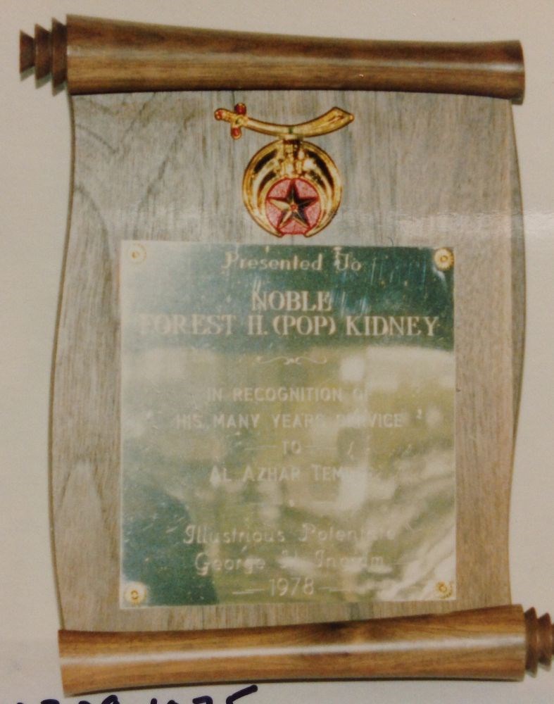
Achievement Plaque
https://archives.whyte.org/en/permalink/artifact103.09.1075
- Date
- 1978
- Material
- wood; metal
- Catalogue Number
- 103.09.1075
- Description
- Light coloured wooden plaque with simulated paper scrolls top and bottom. Centered near top is the Al Azhar Temple crest in gold, red and green coloured metals. Copper coloured plate, 16.0x15.2, is on the face and inscribed "Presented to Noble Forest H. (Pop) Kidney In recognition of his many yea…
1 image
- Title
- Achievement Plaque
- Date
- 1978
- Material
- wood; metal
- Dimensions
- 29.0 x 20.5 cm
- Description
- Light coloured wooden plaque with simulated paper scrolls top and bottom. Centered near top is the Al Azhar Temple crest in gold, red and green coloured metals. Copper coloured plate, 16.0x15.2, is on the face and inscribed "Presented to Noble Forest H. (Pop) Kidney In recognition of his many years service to Al Azhar Temple Illustrious Potentate George H. Ingram 1978.
- Subject
- Forest Kidney
- Pop Kidney
- Al Azhar Temple
- Credit
- Gift of Karin MacAulay, Banff, 1979
- Catalogue Number
- 103.09.1075
Images
This material is presented as originally created; it may contain outdated cultural descriptions and
potentially offensive content.
Read more.
[Alberta-Forest Protection Areas]
https://archives.whyte.org/en/permalink/catalogue23246
- Medium
- Library - Maps and blueprints (unannotated; published)
- Map
- Published Date
- April 1st, 1974
- Publisher
- Surveys Branch, Department of Highways and Transport
- Call Number
- C2-11.6
- Publisher
- Surveys Branch, Department of Highways and Transport
- Published Date
- April 1st, 1974
- Scale
- Scale: 1":50 miles
- Subjects
- Alberta-Forest Protection Areas
- Notes
- Legend in Green
- Accession Number
- SG7500
- Call Number
- C2-11.6
- Collection
- Archives Library
This material is presented as originally created; it may contain outdated cultural descriptions and
potentially offensive content.
Read more.
Athabaska Forest
https://archives.whyte.org/en/permalink/catalogue23248
- Medium
- Library - Maps and blueprints (unannotated; published)
- Map
- Published Date
- 1920 (signed Dec. 1919. Calgary/R.D.M)
- Publisher
- 1920 Forestry Branch
- Call Number
- C2-11.8
- Responsibility
- R.H. Campbell
- Publisher
- 1920 Forestry Branch
- Published Date
- 1920 (signed Dec. 1919. Calgary/R.D.M)
- Scale
- Scale: 3 miles to an inch
- Subjects
- Rocky Mountains Forest Reserve
- Notes
- Prepared under direction of R.H. Campbell Director of Forestry
- Call Number
- C2-11.8
- Collection
- Archives Library
This material is presented as originally created; it may contain outdated cultural descriptions and
potentially offensive content.
Read more.
[Bow River Forest Reserve]
https://archives.whyte.org/en/permalink/catalogue23240
- Medium
- Library - Maps and blueprints (unannotated; published)
- Map
- Published Date
- 1965
- Publisher
- Dept. of Lands, Forests
- Call Number
- C2-11.2a
- Publisher
- Dept. of Lands, Forests
- Published Date
- 1965
- Physical Description
- 1 map : col
- Scale
- Scale: 1 inch : 3 miles
- Altitude tints
- Subjects
- Bow River Forest Reserve
- Notes
- C2-11.2b - 1970 reprint - Accn. 3000
- Accession Number
- 718
- Call Number
- C2-11.2a
- Collection
- Archives Library
This material is presented as originally created; it may contain outdated cultural descriptions and
potentially offensive content.
Read more.
[Clearwater Forest, Rocky Mountains Forest Reserve]
https://archives.whyte.org/en/permalink/catalogue23243
- Medium
- Library - Maps and blueprints (unannotated; published)
- Map
- Published Date
- 1971
- Publisher
- Dept. of Lands and Forests
- Call Number
- C2-11.4
- Publisher
- Dept. of Lands and Forests
- Published Date
- 1971
- Physical Description
- 1 map : col
- Scale
- Scale: 1" : 3 miles
- Altitude tints
- Accession Number
- 3000
- Call Number
- C2-11.4
- Collection
- Archives Library
This material is presented as originally created; it may contain outdated cultural descriptions and
potentially offensive content.
Read more.
[Crowsnest Forest Reserve]
https://archives.whyte.org/en/permalink/catalogue23241
- Medium
- Library - Maps and blueprints (unannotated; published)
- Map
- Published Date
- 1962 (Revised 1968)
- Publisher
- Dept. of Lands and Forests
- Call Number
- C2-11.3
- Publisher
- Dept. of Lands and Forests
- Published Date
- 1962 (Revised 1968)
- Physical Description
- 1 map : col
- Scale
- Scale: 1 inch : 3 miles
- Altitude tints
- Subjects
- Crowsnest Forest Reserve
- Accession Number
- 3000
- Call Number
- C2-11.3
- Collection
- Archives Library
This material is presented as originally created; it may contain outdated cultural descriptions and
potentially offensive content.
Read more.
[Cypress Hills Forest Reserve]
https://archives.whyte.org/en/permalink/catalogue23238
- Medium
- Library - Maps and blueprints (unannotated; published)
- Map
- Published Date
- 1927
- Publisher
- Dept. of The Interior
- Call Number
- C2-11.1
- Publisher
- Dept. of The Interior
- Published Date
- 1927
- Physical Description
- 1 map : col
- Scale
- Scale: 1 inch : 1 mile
- Contour Interval 20 feet
- Subjects
- Cypress Hills Forest Reserve
- Accession Number
- 718
- Call Number
- C2-11.1
- Collection
- Archives Library
This material is presented as originally created; it may contain outdated cultural descriptions and
potentially offensive content.
Read more.
Plan of Control Survey
https://archives.whyte.org/en/permalink/catalogue23244
- Medium
- Library - Maps and blueprints (unannotated; published)
- Map
- Published Date
- May 31, 1961
- Publisher
- Dept. of Highways
- Call Number
- C2-11.5(a)
- Publisher
- Dept. of Highways
- Published Date
- May 31, 1961
- Scale
- Scale: 1:250,000
- Subjects
- Rocky Mountains Forest Reserve Area
- Notes
- Legend in Colour
- Accession Number
- SG7500
- Call Number
- C2-11.5(a)
- Collection
- Archives Library
This material is presented as originally created; it may contain outdated cultural descriptions and
potentially offensive content.
Read more.
Plan of S.W. 1/4 Township 26, Range 15, West of the Fifth Meridian showing Yoho Forest Reserve
https://archives.whyte.org/en/permalink/catalogue23247
- Medium
- Library - Maps and blueprints (unannotated; published)
- Map
- Publisher
- Dept. of the Interior
- Call Number
- C2-11.7
- Publisher
- Dept. of the Interior
- Scale
- Scale: 20 chains to the inch
- Series
- Mar. 12, 1917
- Subjects
- Yoho Forest Reserve
- Accession Number
- SG7500
- Call Number
- C2-11.7
- Collection
- Archives Library
This material is presented as originally created; it may contain outdated cultural descriptions and
potentially offensive content.
Read more.
Rocky Mountain Forest Reserve
https://archives.whyte.org/en/permalink/catalogue23249
- Medium
- Library - Maps and blueprints (unannotated; published)
- Map
- Published Date
- 1913-14
- Publisher
- Department of the Interior
- Call Number
- C2-11.9
- Publisher
- Department of the Interior
- Published Date
- 1913-14
- Scale
- Scale: 1".014 = 1 mile
- Accession Number
- 2781
- Call Number
- C2-11.9
- Collection
- Archives Library
This material is presented as originally created; it may contain outdated cultural descriptions and
potentially offensive content.
Read more.