Narrow Results By
- District of Franklin, Northwest Territories 6
- Baffin Island, Barnes Ice Cap 4
- Baffin Island, Bieler Lake West, Barnes Ice Cap 2
- Banff Winter Carnival 2
- Camping 2
- Fairmont Banff Springs Hotel 2
- Family and personal life 2
- Hiking 2
- Ice sculpture 2
- Swimming 2
- Athabasca Ice Cave - Jasper N.P. 1
- Baffin Island, Lewis Glacier, Barnes Ice Cap 1
[Athabasca Ice Caves - Jasper N.P.]
https://archives.whyte.org/en/permalink/catalogue21548
- Medium
- Library - Maps and blueprints (unannotated; published)
- Map
- Call Number
- C16-1.1(b)
- Responsibility
- Surveyed November 1969 by M.C. Brown, S. Brown, and R. McGimm.
- Compiled by P.L. Smart, drawn at University of Alberta for Canadian Karst Research Group
- Subjects
- Athabasca Ice Cave - Jasper N.P.
- Notes
- Total length 1059 feet. Entrance elevation 6,500 feet. The cave is excavated entirely in ice at the snout of the Athabasca Glacier. Most of it has now collapsed and is dangerous to enter."
- Accession Number
- 1461
- Call Number
- C16-1.1(b)
- Collection
- Archives Library
This material is presented as originally created; it may contain outdated cultural descriptions and
potentially offensive content.
Read more.
[Baffin Island, Barnes Ice Cap 27E/2W] District of Franklin, Northwest Territories
https://archives.whyte.org/en/permalink/catalogue23464
- Medium
- Library - Maps and blueprints (unannotated; published)
- Map
- Published Date
- 1964
- Publisher
- Department of Mines and Technical Surveys
- Call Number
- NTS
- 37E/2W
- Publisher
- Department of Mines and Technical Surveys
- Published Date
- 1964
- Physical Description
- 1 map : black and white
- Scale
- Scale: 1:50,000
- Relief: Contour intervals
- Notes
- National Topographic System
- Arctic provisional map
- Accession Number
- 7000
- Call Number
- NTS
- 37E/2W
- Collection
- Archives Library
This material is presented as originally created; it may contain outdated cultural descriptions and
potentially offensive content.
Read more.
[Baffin Island, Barnes Ice Cap 37E/2E] District of Franklin, Northwest Territories
https://archives.whyte.org/en/permalink/catalogue23462
- Medium
- Library - Maps and blueprints (unannotated; published)
- Map
- Published Date
- 1964
- Publisher
- Department of Mines and Technical Surveys
- Call Number
- NTS
- 37E/2E
- Publisher
- Department of Mines and Technical Surveys
- Published Date
- 1964
- Physical Description
- 1 map : black and white
- Scale
- Scale: 1:50,000
- Contour intervals
- Notes
- National Topographic System
- Arctic provisional map
- Accession Number
- 7000
- Call Number
- NTS
- 37E/2E
- Collection
- Archives Library
This material is presented as originally created; it may contain outdated cultural descriptions and
potentially offensive content.
Read more.
[Baffin Island, Barnes Ice Cap 37E/2W] District of Franklin, Northwest Territories
https://archives.whyte.org/en/permalink/catalogue23463
- Medium
- Library - Maps and blueprints (unannotated; published)
- Map
- Published Date
- 1964
- Publisher
- Department of Mines and Technical Surveys
- Call Number
- NTS
- 37E/2W
- Publisher
- Department of Mines and Technical Surveys
- Published Date
- 1964
- Physical Description
- 1 map : black and white
- Scale
- Scale: 1:50,000
- Relief: Contour intervals
- Notes
- National Topographic System
- Arctic Provisional map
- Accession Number
- 7000
- Call Number
- NTS
- 37E/2W
- Collection
- Archives Library
This material is presented as originally created; it may contain outdated cultural descriptions and
potentially offensive content.
Read more.
[Baffin Island, Barnes Ice Cap 37E/3E] District of Franklin, Northwest Territories
https://archives.whyte.org/en/permalink/catalogue23465
- Medium
- Library - Maps and blueprints (unannotated; published)
- Map
- Published Date
- 1964
- Publisher
- Department of Mines and Technical Surveys
- Call Number
- NTS
- 37E/3E
- Publisher
- Department of Mines and Technical Surveys
- Published Date
- 1964
- Physical Description
- 1 map : black and white
- Scale
- Scale: 1:50,000
- Relief: Contour intervals
- Notes
- National Topographic System
- Accession Number
- 7000
- Call Number
- NTS
- 37E/3E
- Collection
- Archives Library
This material is presented as originally created; it may contain outdated cultural descriptions and
potentially offensive content.
Read more.
[Baffin Island, Bieler Lake West, Barnes Ice Cap 37E/7E] District of Franklin, Northwest Territories
https://archives.whyte.org/en/permalink/catalogue23469
- Medium
- Library - Maps and blueprints (unannotated; published)
- Map
- Published Date
- 1964
- Publisher
- Department of Mines and Technical Surveys
- Call Number
- NTS
- 37E/7E
- Publisher
- Department of Mines and Technical Surveys
- Published Date
- 1964
- Physical Description
- 1 map : black and white
- Scale
- Scale: 1:50,000
- Relief: Contour intervals
- Subjects
- Baffin Island, Bieler Lake West, Barnes Ice Cap
- District of Franklin, Northwest Territories
- Notes
- National Topographic System
- Accession Number
- 7000
- Call Number
- NTS
- 37E/7E
- Collection
- Archives Library
This material is presented as originally created; it may contain outdated cultural descriptions and
potentially offensive content.
Read more.
[Baffin Island, Bieler Lake West, Barnes Ice Cap 37E/7W] District of Franklin, Northwest Territories
https://archives.whyte.org/en/permalink/catalogue23470
- Medium
- Library - Maps and blueprints (unannotated; published)
- Map
- Published Date
- 1964
- Publisher
- Department of Mines and Technical Surveys
- Call Number
- NTS
- 37E/7W
- Publisher
- Department of Mines and Technical Surveys
- Published Date
- 1964
- Physical Description
- 1 map : black and white
- Scale
- Scale: 1:50,000
- Relief: Contour intervals
- Subjects
- Baffin Island, Bieler Lake West, Barnes Ice Cap
- District of Franklin, Northwest Territories
- Notes
- National Topographic System
- Arctic provisional map
- Accession Number
- 7000
- Call Number
- NTS
- 37E/7W
- Collection
- Archives Library
This material is presented as originally created; it may contain outdated cultural descriptions and
potentially offensive content.
Read more.
[Baffin Island, Lewis Glacier, Barnes Ice Cap 37E/6E] District of Franklin, Northwest Territories
https://archives.whyte.org/en/permalink/catalogue23467
- Medium
- Library - Maps and blueprints (unannotated; published)
- Map
- Published Date
- 1964
- Publisher
- Department of Mines and Technical Surveys
- Call Number
- NTS
- 37E/6E
- Publisher
- Department of Mines and Technical Surveys
- Published Date
- 1964
- Physical Description
- 1 map : black and white
- Scale
- Scale: 1:50,000
- Relief: Contour intervals
- Notes
- National Topographic System
- Arctic provisional map
- Accession Number
- 7000
- Call Number
- NTS
- 37E/6E
- Collection
- Archives Library
This material is presented as originally created; it may contain outdated cultural descriptions and
potentially offensive content.
Read more.
Maud Woodworth album, 1916
https://archives.whyte.org/en/permalink/descriptions54416
- Part Of
- Kidney family fonds
- Scope & Content
- File consists of one photograph album containing 224 black and white photograph prints, one newspaper clipping and one pressed plant. Many photographs are annotated in white lettering or on reverse sides. Content pertains to family members and friends of Maud Woodworth and depicts people posing in …
- Date Range
- 1916
- Reference Code
- V324 / I / A / PD - 2
- Description Level
- 5 / File
- GMD
- Album
- Photograph
- Photograph print
- Textual record
- Published record
- Part Of
- Kidney family fonds
- Description Level
- 5 / File
- Fonds Number
- M74 / V324
- Series
- V324 / I : Maud (Woodworth) Kidney records
- Sous-Fonds
- V324
- Sub-Series
- V324 / I / A : 1894 - 1920
- Accession Number
- 2016.8581
- Reference Code
- V324 / I / A / PD - 2
- Responsibility
- Produced by Maud Woodworth
- Date Range
- 1916
- Physical Description
- 1 album (224 photographs : b&w) dimensions TBD - see "Admin Notes"
- Scope & Content
- File consists of one photograph album containing 224 black and white photograph prints, one newspaper clipping and one pressed plant. Many photographs are annotated in white lettering or on reverse sides. Content pertains to family members and friends of Maud Woodworth and depicts people posing in military uniforms, horseback riding/packing trips in the Canadian Rockies, portraits of various family members, Maud Woodworth at the Banff Winter Carnival ice palace, numerous babies and young children, skiing, children playing, horseback riding and ranching, camping, hiking, swimming, the Bankhead monument, and boating. Locations include Bear Creek, Brazeau Lake, Nigel Pass, Banff Springs Hotel, the Woodworth home in Banff, Cave and Basin, "The Great Divide" [Alberta/British Columbia border], and Vancouver. Individuals include Joe Woodworth, Annie and Maud Woodworth, Mary and Margaret Simpson [later known as the "Simpson Sisters"], "Billie" and numerous others who are mostly unnamed. Newspaper clipping pertains to Will Rogers memorial ice sculpture, n.d.
- Notes
- Some photographs annotated on reverse side with information re: individuals in photograph, location, etc.
- Negatives have been removed from album [see "Conservation" notes]; newspaper clipping and pressed plant kept in album
- Name Access
- Woodworth, Maude
- Woodworth, Joe
- Simpson, Margaret
- Simpson, Mary (Hallock)
- Woodworth, Annie
- Subject Access
- Hiking
- Skiing
- Boating
- Horses
- Packing
- Camping
- Family
- Monument
- Banff Winter Carnival
- Ice sculpture
- World War I
- Travel
- Swimming
- Fairmont Banff Springs Hotel
- Geographic Access
- Canada
- Alberta
- Banff
- British Columbia
- Victoria
- Cave and Basin
- Banff National Park
- Bear Creek
- Brazeau Lake
- Nigel Pass
- Language
- English
- Conservation
- Condition report completed by Karol Hancik in July 2017.
- Pressed plant in album has been encapsulated to prevent damage to other album materials
- 5 black and white negatives have been removed from album and will be stored with other V324 negatives in separate file box in downstairs vault, processed under V324 / I / A / NA
- Album has been interleaved with acid-free tissue paper
- Creator
- Maud Woodworth
- Category
- Family and personal life
- Title Source
- Title based on contents of file
- Processing Status
- Processed
This material is presented as originally created; it may contain outdated cultural descriptions and
potentially offensive content.
Read more.
Photograph Album
https://archives.whyte.org/en/permalink/descriptions54497
- Part Of
- Charles Reid fonds
- Scope & Content
- File consists of one photograph album, comprising 183 photographs, H12 x W17.5 cm or smaller. Photographs pertain to Charlie Reid and his family and friends during, predominantly, the 1920's. The first photograph is of a child and man; the child looks like it could be Charlie Reid at around 4 to 5 …
- Date Range
- ca.1909 - ca.1929
- 1922
- 1923
- 1924
- 1925
- 1926
- 1927
- Reference Code
- V487 / I / PD - 1
- Description Level
- 5 / File
- GMD
- Album
- Photograph
- Photograph print
- Private record
1 image
1 Electronic Resource
- Part Of
- Charles Reid fonds
- Description Level
- 5 / File
- Fonds Number
- M413 / V487
- Series
- V487 / I : Albums
- Sous-Fonds
- V487
- Accession Number
- 5248
- Reference Code
- V487 / I / PD - 1
- Date Range
- ca.1909 - ca.1929
- 1922
- 1923
- 1924
- 1925
- 1926
- 1927
- Physical Description
- 1 album (183 photographs : b&w ; 17.5 x 12 cm or smaller)
- Scope & Content
- File consists of one photograph album, comprising 183 photographs, H12 x W17.5 cm or smaller.
- Photographs pertain to Charlie Reid and his family and friends during, predominantly, the 1920's. The first photograph is of a child and man; the child looks like it could be Charlie Reid at around 4 to 5 years old.
- Photographs document sports and recreation (races, sledding, skiing, snowshoeing, track, canoeing, golf, camping, horseback riding, fishing), events at the Banff Springs Hotel, Banff Indian Days, Banff Winter Carnival (Festival), Highland gathering, Herald road race, and various activities in and around Banff.
- Locations include: Banff, Medicine Hat, University of Alberta (Edmonton), and Lake Louise.
- Notes
- One of the photographs is a cut-out quote, "a canoo in foolish hands is probably the nation's greatest tipping well"
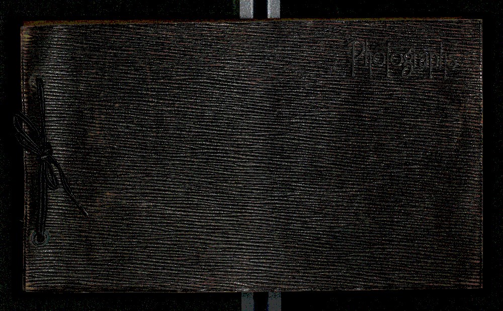
- Album is bound in brown leather with "photographs" written on the cover. Some of the photographs have captions. Not every page is filled.
- Name Access
- Reid, Charles
- Subject Access
- Banff
- Banff Indian Days
- Banff National Park
- Banff Winter Carnival
- Banff Winter Festival
- Bow River Bridge
- Camping
- Canoes and canoeing
- Children
- Cross-country skiing
- Dogs
- Fairmont Banff Springs Hotel
- Fishing
- Golfing
- Hiking
- Hockey
- Horseback riding
- Ice sculpture
- Indigenous Peoples
- Leisure
- Personal and Family Life
- Photography
- Public events
- Recreation
- Skating
- Snowshoes and snowshoeing
- Sports and recreation
- Sulphur Mountain lookout
- Swimming
- Winter sports
- Wildlife
- Geographic Access
- Alberta
- Banff
- Banff National Park
- Canada
- Lake Louise
- Medicine Hat
- Language
- English
- Title Source
- Title based on contents of file
- Processing Status
- Processed
Electronic Resources
Images
This material is presented as originally created; it may contain outdated cultural descriptions and
potentially offensive content.
Read more.