Narrow Results By
- Bruno Engler fonds 32
- Lillian Gest fonds 10
- Nicholas Morant fonds 8
- Peter and Catharine Whyte fonds 7
- Alpine Club of Canada fonds 3
- Ron Duke fonds 3
- Lawrence Grassi fonds 2
- Murray Hay fonds 2
- Trail Riders of the Canadian Rockies fonds 2
- Whyte Museum Oral History Programme collection 2
- Banff Lake Louise Chamber of Commerce fonds 1
- Bob Smith fonds 1
Hector Lake, Alberta-British Columbia
https://archives.whyte.org/en/permalink/catalogue23654
- Medium
- Library - Maps and blueprints (unannotated; published)
- Map
- Published Date
- 1979
- Publisher
- [Ottawa] : Surveys and Mapping Branch, Dept. of Energy, Mines and Resources
- Edition
- 2d ed.
- Call Number
- NTS
- 82N/9
- Edition
- 2d ed.
- Publisher
- [Ottawa] : Surveys and Mapping Branch, Dept. of Energy, Mines and Resources
- Published Date
- 1979
- Physical Description
- 1 map : col
- Scale
- 1:50,000
- Subjects
- Hector Lake (Alta./B.C.)
- Accession Number
- 27,000
- Call Number
- NTS
- 82N/9
- Collection
- Archives Library
This material is presented as originally created; it may contain outdated cultural descriptions and
potentially offensive content.
Read more.
- Date
- 1979
- Medium
- cibachrome on paper
- Catalogue Number
- HrD.18.02
- Description
- A colour photographic positive, the mountain range in the background is reflected in the lake lower centre of picture, the mountains have snow on them, the area around the lake does not, the sky is blue with some white clouds
1 image
- Title
- Moraine Lake
- Date
- 1979
- Medium
- cibachrome on paper
- Dimensions
- 37.5 x 48.0 cm
- Description
- A colour photographic positive, the mountain range in the background is reflected in the lake lower centre of picture, the mountains have snow on them, the area around the lake does not, the sky is blue with some white clouds
- Credit
- Purchased from Don Harmon, Banff, 1985
- Catalogue Number
- HrD.18.02
Images

This material is presented as originally created; it may contain outdated cultural descriptions and
potentially offensive content.
Read more.
Involvement and environment : proceedings of the Canadian Conference on Public Participation, Banff, Alberta, October 4-7, 1977 : volume 2: working papers and case studies
https://archives.whyte.org/en/permalink/catalogue6446
- Medium
- Library - Book (including soft-cover and pamphlets)
- Published Date
- 1979
- Publisher
- Edmonton : Environment Council of Alberta
- Call Number
- 04 C16inv v.2
- Responsibility
- edited by Barry Sadler
- contributions by Stephen Herrero, Raymond W. Sloan, Rodney Touche, Cliff J. White
- Publisher
- Edmonton : Environment Council of Alberta
- Published Date
- 1979
- Physical Description
- xi, 413p. : maps
- Notes
- Bibliography
- Accession Number
- NC11500
- Call Number
- 04 C16inv v.2
- Collection
- Archives Library
This material is presented as originally created; it may contain outdated cultural descriptions and
potentially offensive content.
Read more.
The Docks, Summerland, BC
https://archives.whyte.org/en/permalink/artifactwbg.04.079
- Date
- 1979
- Medium
- ink on paper
- Catalogue Number
- WbG.04.079
- Description
- Hills surrounding docks on Okanagan Lake.
- Title
- The Docks, Summerland, BC
- Date
- 1979
- Medium
- ink on paper
- Dimensions
- 30.5 x 40.7 cm
- Description
- Hills surrounding docks on Okanagan Lake.
- Subject
- landscape
- BC
- Okanagan Lake
- Summerland
- Credit
- Gift of Donna Tingley, Edmonton, 2004
- Catalogue Number
- WbG.04.079
This material is presented as originally created; it may contain outdated cultural descriptions and
potentially offensive content.
Read more.
[Hector Lake]
https://archives.whyte.org/en/permalink/catalogue21455
- Medium
- Library - Book (including soft-cover and pamphlets)
- Map
- Published Date
- 1978
- Publisher
- Geological Survey of Canada
- Call Number
- C7-1.12(a)
- Publisher
- Geological Survey of Canada
- Published Date
- 1978
- Subjects
- Hector Lake
- B.N.P.
- Notes
- Diagrammatic structure of geological maps of the Hector Lake area, east half (Map 1463A) and west half (Map 1464A)
- Accession Number
- 11,000
- Call Number
- C7-1.12(a)
- Collection
- Archives Library
This material is presented as originally created; it may contain outdated cultural descriptions and
potentially offensive content.
Read more.
Topographic map of Blackstone Kale area in the Ogilvie Mountains, Yukon Territory. Blackstone River.
https://archives.whyte.org/en/permalink/catalogue23496
- Medium
- Library - Maps and blueprints (unannotated; published)
- Map
- Published Date
- 1978
- Publisher
- D.E.M.R.
- Call Number
- NTS
- 116H/4
- Publisher
- D.E.M.R.
- Published Date
- 1978
- Scale
- 1: 50,000
- Subjects
- Blackstone Lake
- Yukon Territory
- Accession Number
- 11.500
- Call Number
- NTS
- 116H/4
- Collection
- Archives Library
This material is presented as originally created; it may contain outdated cultural descriptions and
potentially offensive content.
Read more.
Exploring glaciers and mountains
https://archives.whyte.org/en/permalink/catalogue15135
- Medium
- Library - Book (including soft-cover and pamphlets)
- Published Date
- 1978
- Author
- Kucera, Richard E
- Call Number
- QE576 K83 Pam
- Author
- Kucera, Richard E
- Published Date
- 1978
- Physical Description
- 61p. : ill., maps
- Subjects
- Louise, Lake
- Moraine Lake
- Accession Number
- AC629
- Call Number
- QE576 K83 Pam
- Collection
- Alpine Club of Canada Library
This material is presented as originally created; it may contain outdated cultural descriptions and
potentially offensive content.
Read more.
Geological map of Hector Lake area, east half
https://archives.whyte.org/en/permalink/catalogue24702
- Medium
- Library - Book (including soft-cover and pamphlets)
- Map
- Published Date
- 1978
- Publisher
- Geological Survey of Canada
- Call Number
- C7-1.12(b)
- Publisher
- Geological Survey of Canada
- Published Date
- 1978
- Scale
- 1:50,000
- Subjects
- Hector Lake
- B.N.P.
- Notes
- Map 1463A
- Accession Number
- 11,000
- Call Number
- C7-1.12(b)
- Collection
- Archives Library
This material is presented as originally created; it may contain outdated cultural descriptions and
potentially offensive content.
Read more.
Geological map of Hector Lake area, west half
https://archives.whyte.org/en/permalink/catalogue24703
- Medium
- Library - Book (including soft-cover and pamphlets)
- Map
- Published Date
- 1978
- Publisher
- Geological Survey of Canada
- Call Number
- C7-1.12(c)
- Publisher
- Geological Survey of Canada
- Published Date
- 1978
- Scale
- 1:50,000
- Subjects
- Hector Lake
- B.N.P.
- Notes
- Map 1464A
- Accession Number
- 11,000
- Call Number
- C7-1.12(c)
- Collection
- Archives Library
This material is presented as originally created; it may contain outdated cultural descriptions and
potentially offensive content.
Read more.
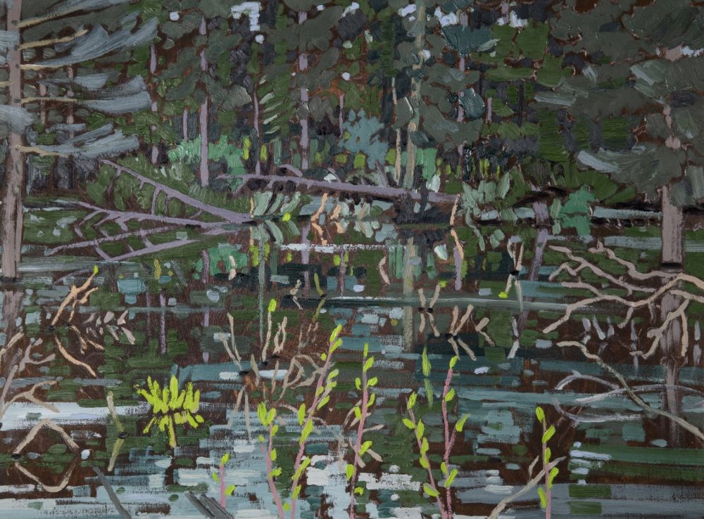
Beaver Pond, Banff Area
https://archives.whyte.org/en/permalink/artifactgot.02.01
- Date
- 1978
- Medium
- oil on canvas
- Catalogue Number
- GoT.02.01
- Description
- The painting of the water and foliage covers the picture from frame to frame.
1 image
- Title
- Beaver Pond, Banff Area
- Date
- 1978
- Medium
- oil on canvas
- Dimensions
- 43.7 x 59.5 cm
- Description
- The painting of the water and foliage covers the picture from frame to frame.
- Credit
- Purchased from Canadian Art Gallery, Canmore, 1978
- Catalogue Number
- GoT.02.01
Images
This material is presented as originally created; it may contain outdated cultural descriptions and
potentially offensive content.
Read more.