Narrow Results By
Sketch map of the Canadian Rocky Mountains
https://archives.whyte.org/en/permalink/catalogue24640
- Medium
- Library - Maps and blueprints (unannotated; published)
- Map
- Published Date
- 189-?
- Publisher
- London : Royal Geographical Society
- Call Number
- C3-7.3a
- Publisher
- London : Royal Geographical Society
- Published Date
- 189-?
- Physical Description
- 1 map : partly col.
- Scale
- 3/4 inches = 5 miles
- Notes
- source of information: maps of J. Norman Collie, W.D. Wilcox and J. Habel
- Fragile, in bits and pieces
- From Ted's office
- Call Number
- C3-7.3a
- Collection
- Archives Library
This material is presented as originally created; it may contain outdated cultural descriptions and
potentially offensive content.
Read more.
Map of a portion of the watershed of the Rocky Mountains / from survey by S.E.S. Allen
https://archives.whyte.org/en/permalink/catalogue24798
- Medium
- Library - Maps and blueprints (unannotated; published)
- Map
- Published Date
- 189-?
- Publisher
- Philadelphia : J.L. Smith
- Call Number
- C12-1.29a
- Publisher
- Philadelphia : J.L. Smith
- Published Date
- 189-?
- Physical Description
- 1 map : black and white
- Scale
- 1 statute mile = 1 inch
- Notes
- Boundaries colored in
- Copy 2 mounted on cardboard
- Accession Number
- 576
- Call Number
- C12-1.29a
- Collection
- Archives Library
This material is presented as originally created; it may contain outdated cultural descriptions and
potentially offensive content.
Read more.
Rocky Mountains between Lat. 51 degrees and 53 degrees 10 minutes
https://archives.whyte.org/en/permalink/catalogue24636
- Medium
- Library - Maps and blueprints (unannotated; published)
- Map
- Published Date
- 191-?
- Publisher
- [Montreal] : Canadian Pacific Railway
- Call Number
- C3-6.6
- Responsibility
- Canadian Pacific Railway
- Publisher
- [Montreal] : Canadian Pacific Railway
- Published Date
- 191-?
- Physical Description
- 1 map : col
- Scale
- Scale: 1:253,440
- Relief: Contour interval 500 feet
- Notes
- Shows main line of C.P.R. from Kananaskis to Moberly
- Mounted on linen
- Accession Number
- 2933
- Call Number
- C3-6.6
- Collection
- Archives Library
This material is presented as originally created; it may contain outdated cultural descriptions and
potentially offensive content.
Read more.
[Rocky Mountains Park]
https://archives.whyte.org/en/permalink/catalogue23187
- Medium
- Library - Maps and blueprints (unannotated; published)
- Map
- Published Date
- 1890
- Publisher
- Dept. of the Interior
- Call Number
- C2-3.1a
- C2-3.1b
- C2-3.1c
- C2-3.1d
- Publisher
- Dept. of the Interior
- Published Date
- 1890
- Scale
- Scale: 1 mile to 1 inch
- Relief: Spot heights
- Subjects
- Rocky Mountains Park
- Notes
- Two duplicates in map room - Accn. 440 and 938, Two photostatic duplicates in map room - Accn. 400, One photostatic duplicate - C2-3.1b
- Accession Number
- 400
- 938
- Call Number
- C2-3.1a
- C2-3.1b
- C2-3.1c
- C2-3.1d
- Collection
- Archives Library
This material is presented as originally created; it may contain outdated cultural descriptions and
potentially offensive content.
Read more.
- Medium
- Library - Maps and blueprints (unannotated; published)
- Map
- Published Date
- 1892
- Call Number
- C3-8.23
- Published Date
- 1892
- Subjects
- Rocky and Selkirk Mountains - B.C.
- Notes
- Photostatic copy from Public Archives
- Accession Number
- 675
- Call Number
- C3-8.23
- Collection
- Archives Library
This material is presented as originally created; it may contain outdated cultural descriptions and
potentially offensive content.
Read more.
[Index to Top. Sheets of Rocky Mountains]
https://archives.whyte.org/en/permalink/catalogue24641
- Medium
- Library - Maps and blueprints (unannotated; published)
- Map
- Published Date
- 1900
- Publisher
- Dept. of the Interior
- Call Number
- C3-8.1 (a)
- C3-8.1 (b)
- Publisher
- Dept. of the Interior
- Published Date
- 1900
- Scale
- (a): 25,000' to 1 inch; 1:300,000
- (b): 20,000' to 1 inch; 1:240,000
- Notes
- Photostatic copy from Public Archives
- Accession Number
- 675
- 1192
- Call Number
- C3-8.1 (a)
- C3-8.1 (b)
- Collection
- Archives Library
This material is presented as originally created; it may contain outdated cultural descriptions and
potentially offensive content.
Read more.
Showing rivers and Indian trails
https://archives.whyte.org/en/permalink/catalogue21450
- Medium
- Library - Maps and blueprints (unannotated; published)
- Map
- Published Date
- 1900
- Call Number
- C3-8.22
- Published Date
- 1900
- Subjects
- Rocky Mountains (2 Sections)
- Notes
- Photostatic copy from Public Archives
- Accession Number
- 675
- Call Number
- C3-8.22
- Collection
- Archives Library
This material is presented as originally created; it may contain outdated cultural descriptions and
potentially offensive content.
Read more.
Drainage Patterns
https://archives.whyte.org/en/permalink/catalogue21492
- Medium
- Library - Maps and blueprints (unannotated; published)
- Map
- Published Date
- 1900
- Call Number
- C12-1.17
- Published Date
- 1900
- Subjects
- Rocky Mountains
- Notes
- 2 sections
- Photostatic copy from Public Archives
- Accession Number
- 675
- Call Number
- C12-1.17
- Collection
- Archives Library
This material is presented as originally created; it may contain outdated cultural descriptions and
potentially offensive content.
Read more.
Topographical map
https://archives.whyte.org/en/permalink/catalogue24609
- Medium
- Library - Maps and blueprints (unannotated; published)
- Map
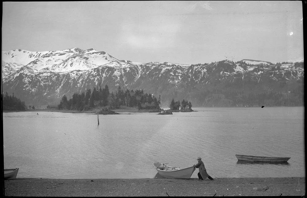
- Published Date
- 1902
- Publisher
- Dept. of the Interior
- Call Number
- C3-1.1
- Publisher
- Dept. of the Interior
- Published Date
- 1902
- Physical Description
- Colour
- Scale
- Scale: 2 miles to 1 inch
- Relief: Contour interval 250 ft.
- Subjects
- Banff and Vicinity
- Rocky Mountains
- Notes
- Dup. in map room
- Accession Number
- 400
- 718
- Call Number
- C3-1.1
- Collection
- Archives Library
This material is presented as originally created; it may contain outdated cultural descriptions and
potentially offensive content.
Read more.
Bear Hunting Trip
https://archives.whyte.org/en/permalink/descriptions15023
- Part Of
- Elliott Barnes fonds
- Scope & Content
- File pertains to a bear hunting trip on the Columbia River, B. C.
- Date Range
- 1906
- Reference Code
- V48 / I / A / NA - 235 to 259
- Description Level
- 5 / File
- GMD
- Film
- Negative
- Transparency
25 images
- Part Of
- Elliott Barnes fonds
- Description Level
- 5 / File
- Fonds Number
- V48
- Series
- I.A. Negatives : Film
- Sous-Fonds
- V48
- Accession Number
- .
- Reference Code
- V48 / I / A / NA - 235 to 259
- GMD
- Film
- Negative
- Transparency
- Date Range
- 1906
- Physical Description
- 25 photographs : negatives, film
- History / Biographical
- See fonds level description
- Scope & Content
- File pertains to a bear hunting trip on the Columbia River, B. C.
- Notes
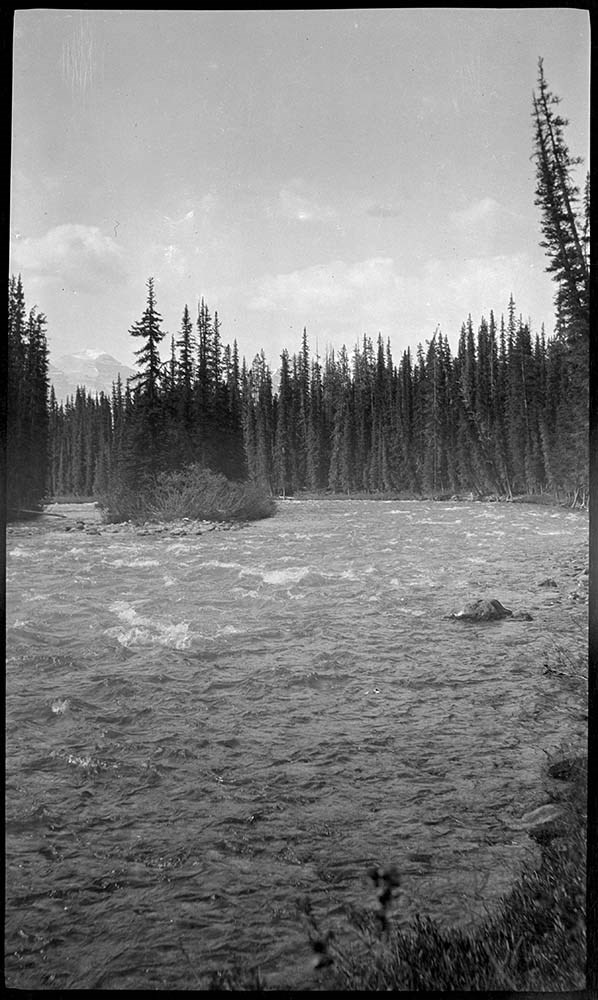
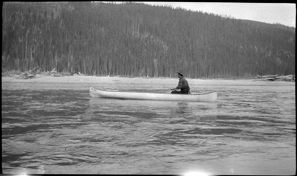
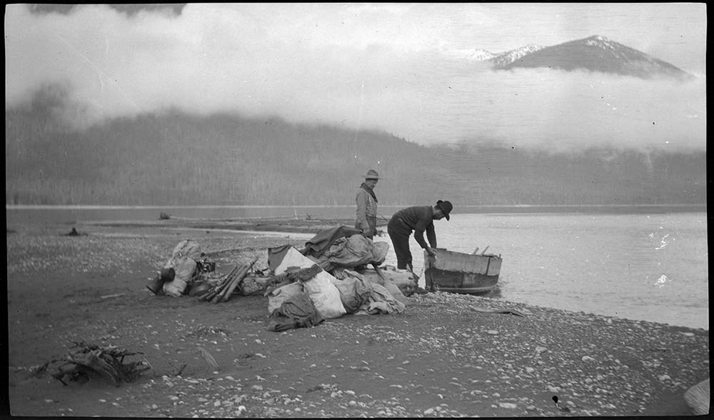
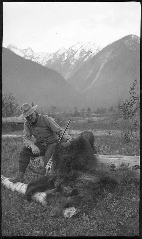
- Identifications provided by Barnes family and Archives LIST OF NEGATIVES :
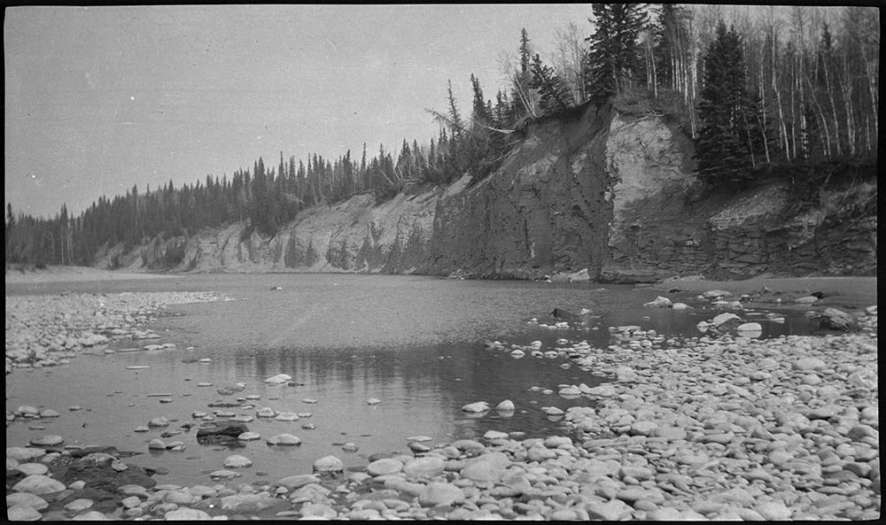
- 235 Man looking at Columbia River during spring bear hunt
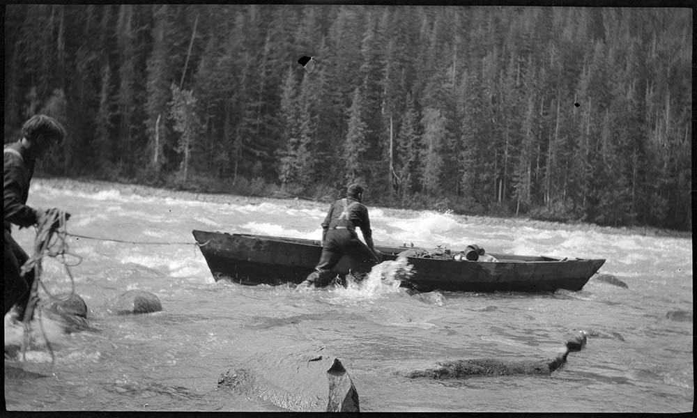
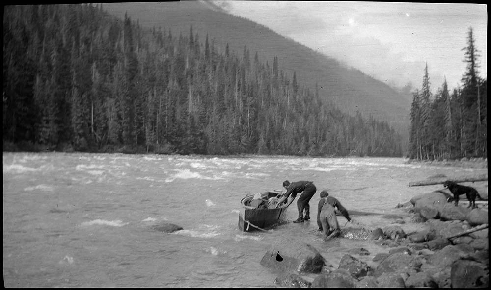
- 236, 237 Men lining boat on river
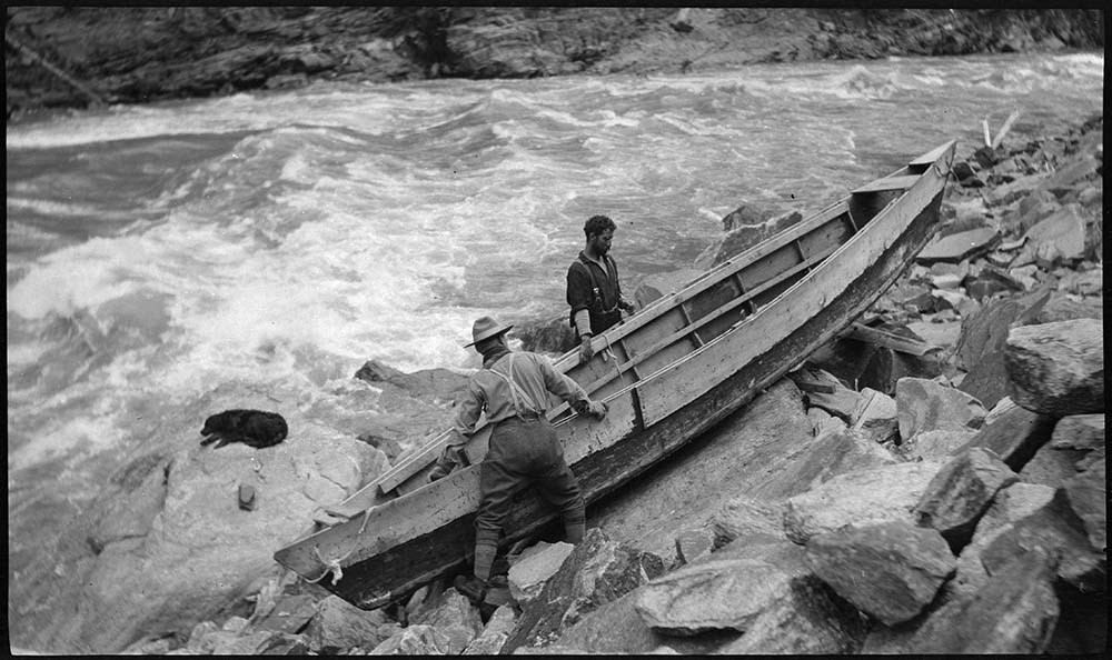
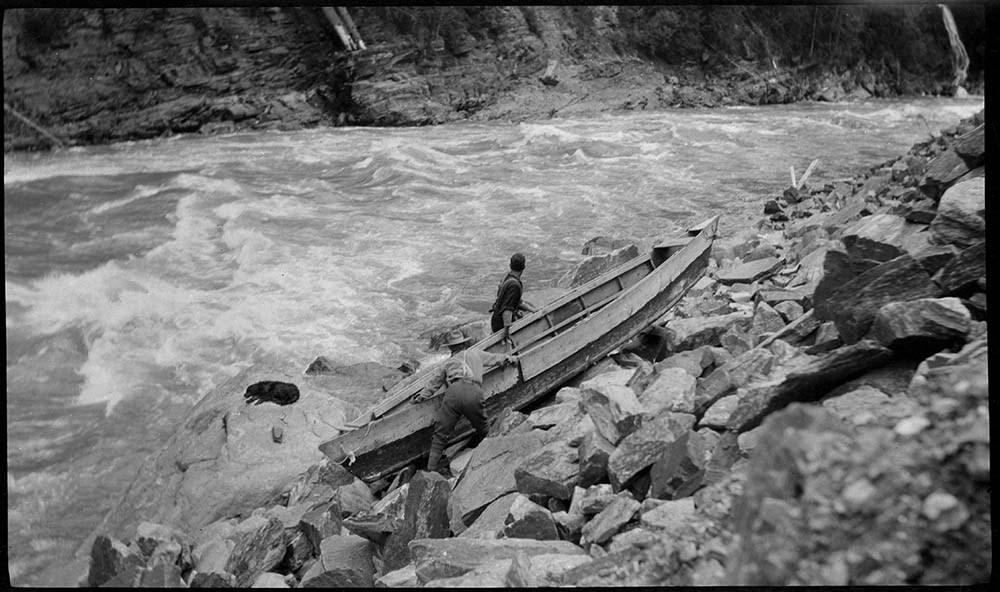
- 238 to 240 Men portaging boat
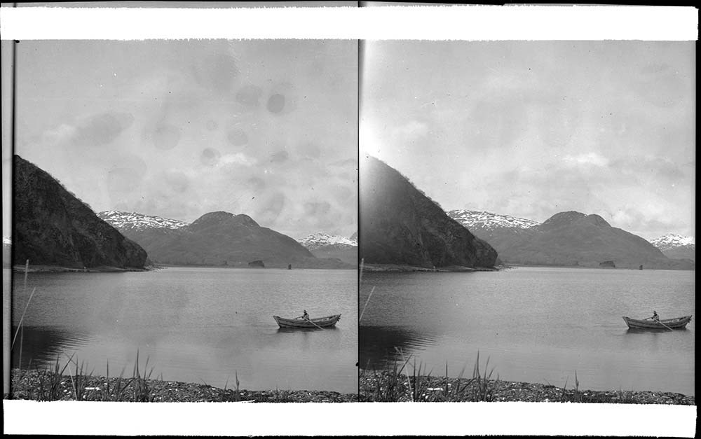
- 241 Boating on unidentified lake
- 242 Man launching boat on unidentified lake
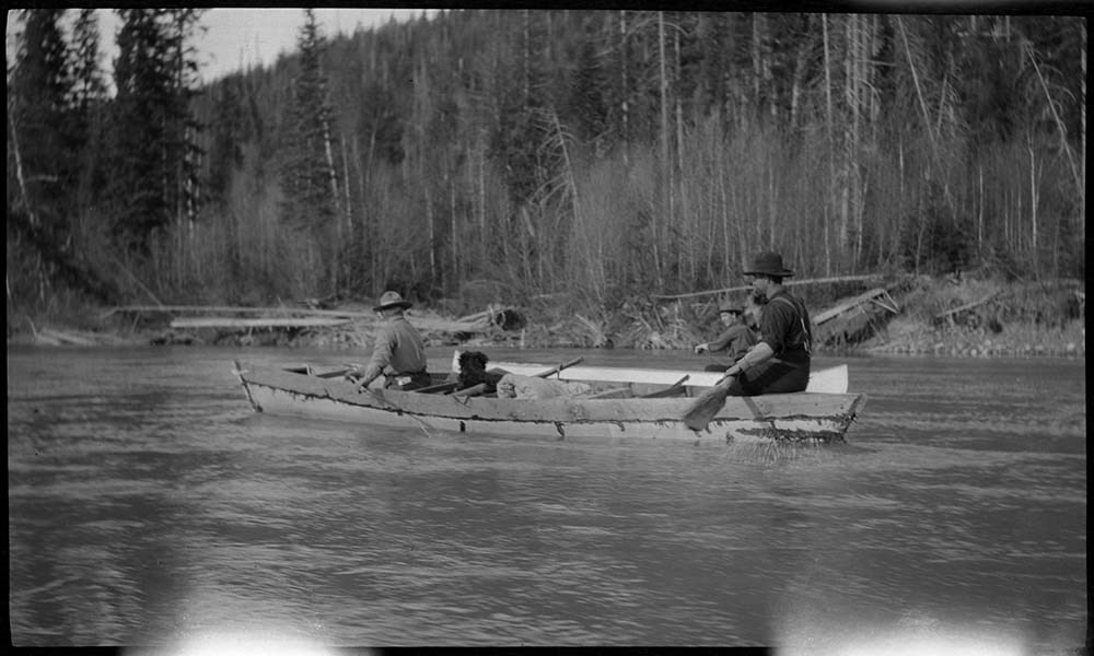
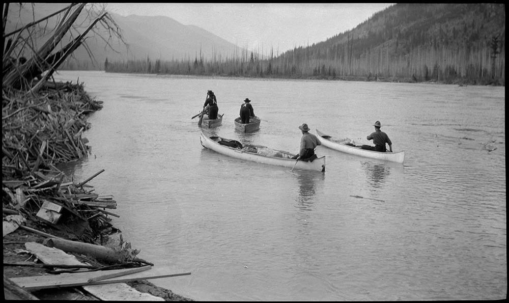
- 243 Men in boats on Columbia River
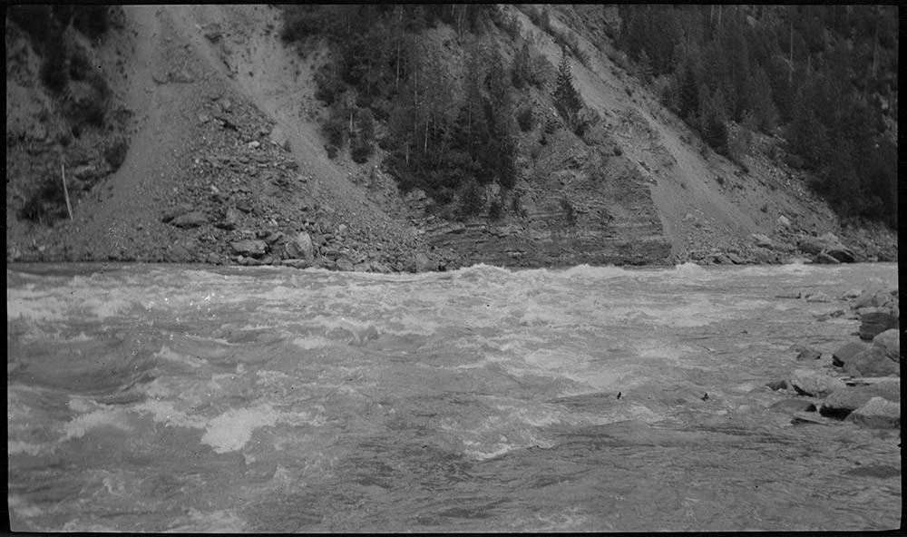
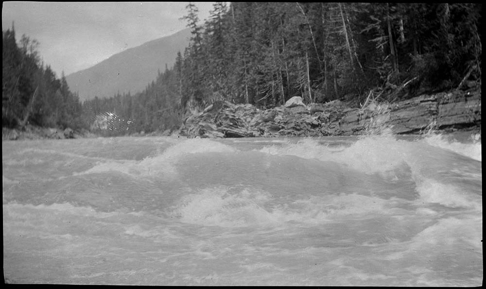
- 244 Rapids on Columbia River
- 245 River scene
- 246 Rapids on Columbia River
- 247 Men in boats on Columbia River
- 248 Men loading boats
- 249 Men launching boat
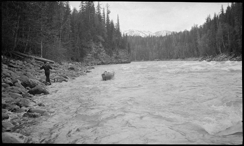
- 250 Man lining boat through rapids
- 251 Lake
- 252 Rapids on the Columbia River
- 253 Man in canoe on Columbia River
- 254 Men unloading boat on Columbia River
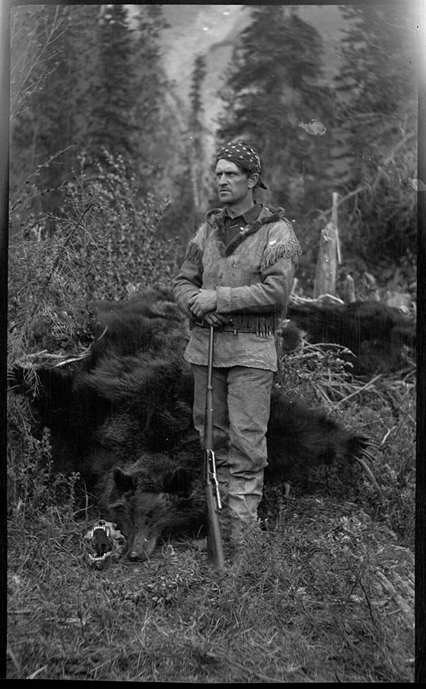
- 255 Emerson Hough posing with bear skin
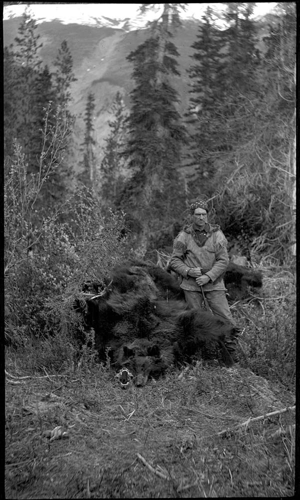
- 256 to 259 Elliott Barnes with bear skins
- 259 Hunter fording river
- Name Access
- Barnes, Elliott
- Geographic Access
- Columbia River
- Revelstoke
- British Columbia
- Canada
- Access Restrictions
- Access by appointment only
- Language
- NA
- Title Source
- Title based on contents of file
- Processing Status
- Processed
Images


This material is presented as originally created; it may contain outdated cultural descriptions and
potentially offensive content.
Read more.