Narrow Results By
- Alpine Club of Canada fonds 124
- Chic Scott fonds 25
- Murray Hay fonds
- Ben Gadd fonds 7
- Jean A. Hembroff MacDonald fonds 7
- Dorothy Wardle fonds 6
- Luxton family fonds 5
- Trail Riders of the Canadian Rockies fonds 5
- Bert Riggall fonds
- Malcolm Geddes fonds 3
- Mary (Molly) Wright Adams fonds 3
- Douglas Leighton fonds 2
Banff National Park (general)
https://archives.whyte.org/en/permalink/descriptions55338
- Part Of
- Murray Hay fonds
- Scope & Content
- File consists of 4 prings : col. 35.1 x 24.8 cm or smaller and 4 maps (2 paper, 2 overlays) : col., on mylar ; 60.4 x 30. cm or smaller. File pertains to aerial views of Banff National Park, showing the towns of Banff and Lake Louise, ski hills (Norqay Ski Hill, Sunshine Village, and Lake Louise Sk…
- Date Range
- ca.1976-ca.2000
- Reference Code
- V795 / II / B / v / 1-2
- Description Level
- 5 / File
- GMD
- Map
- Private record
- Part Of
- Murray Hay fonds
- Description Level
- 5 / File
- Fonds Number
- M570 / V795
- Series
- V795 / II : Unpublished Material
- Sous-Fonds
- V795
- Sub-Series
- V795 / II / B : Alberta / v : Banff National Park
- Accession Number
- 2019.41
- Reference Code
- V795 / II / B / v / 1-2
- GMD
- Map
- Private record
- Date Range
- ca.1976-ca.2000
- Physical Description
- 4 prints : col. 35.1 x 24.8 cm or smaller
- 4 maps (2 paper, 2 overlays) : col., annotations, on mylar ; 60.4 x 30. cm or smaller
- Scope & Content
- File consists of 4 prings : col. 35.1 x 24.8 cm or smaller and 4 maps (2 paper, 2 overlays) : col., on mylar ; 60.4 x 30. cm or smaller. File pertains to aerial views of Banff National Park, showing the towns of Banff and Lake Louise, ski hills (Norqay Ski Hill, Sunshine Village, and Lake Louise Ski Resort), as well as other georgraphic features. The mylar overlays contain various amounts of detail and annotations - one consists of a dark red sheet overlayed with place names in negative.
- Notes
- Items not in oversize stored in downstairs vault.
- Name Access
- Hay, Murray
- Subject Access
- Advertising
- Artist
- Ski Maps
- Map
- Cartography
- Sports and recreation
- Tourism
- Tourist information
- Winter
- Winter sports
- Ski area
- Sunshine Village
- Norquay Ski Hill
- Lake Louise Ski Area
- Geographic Access
- Banff
- Lake Louise
- Banff National Park
- Alberta
- Canada
- Canadian Rocky Mountains
- Language
- English
- Creator
- Hay, Murray
- Title Source
- Title based on contents of file
- Processing Status
- Processed
This material is presented as originally created; it may contain outdated cultural descriptions and
potentially offensive content.
Read more.
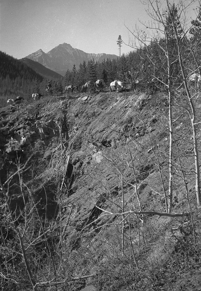
Bennett Trips 1931 to 1936
https://archives.whyte.org/en/permalink/descriptions23415
- Part Of
- Bert Riggall fonds
- Scope & Content
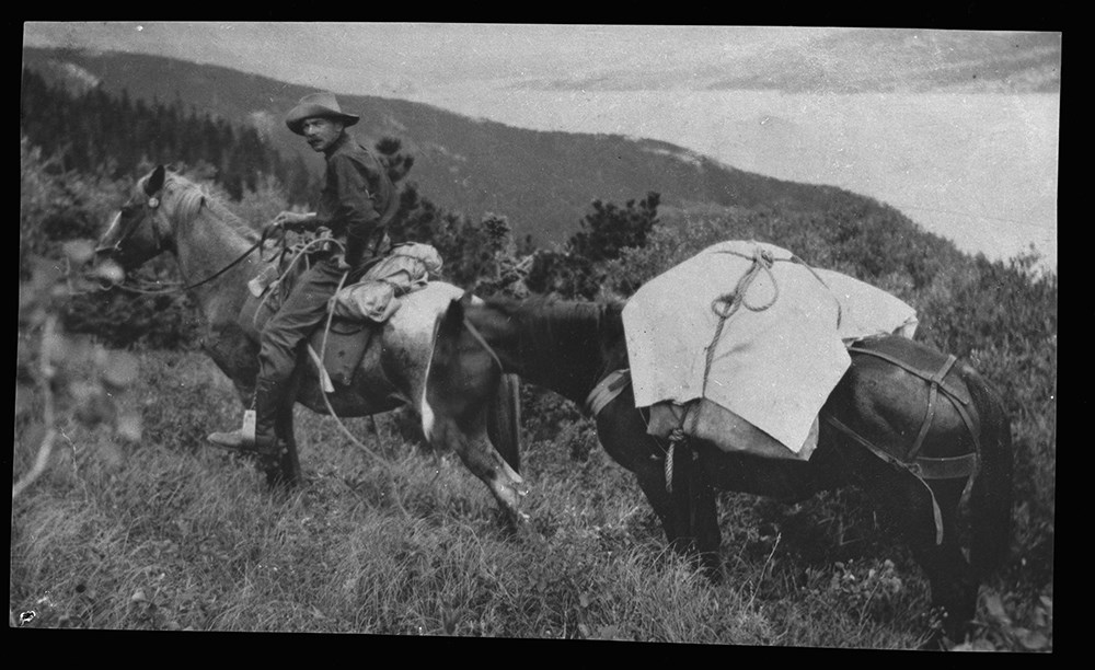
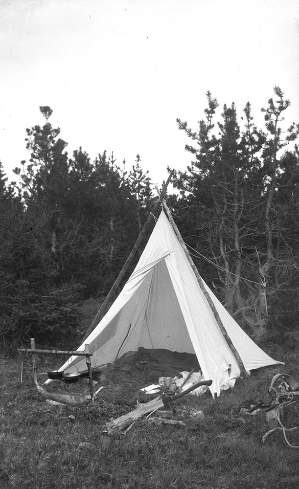
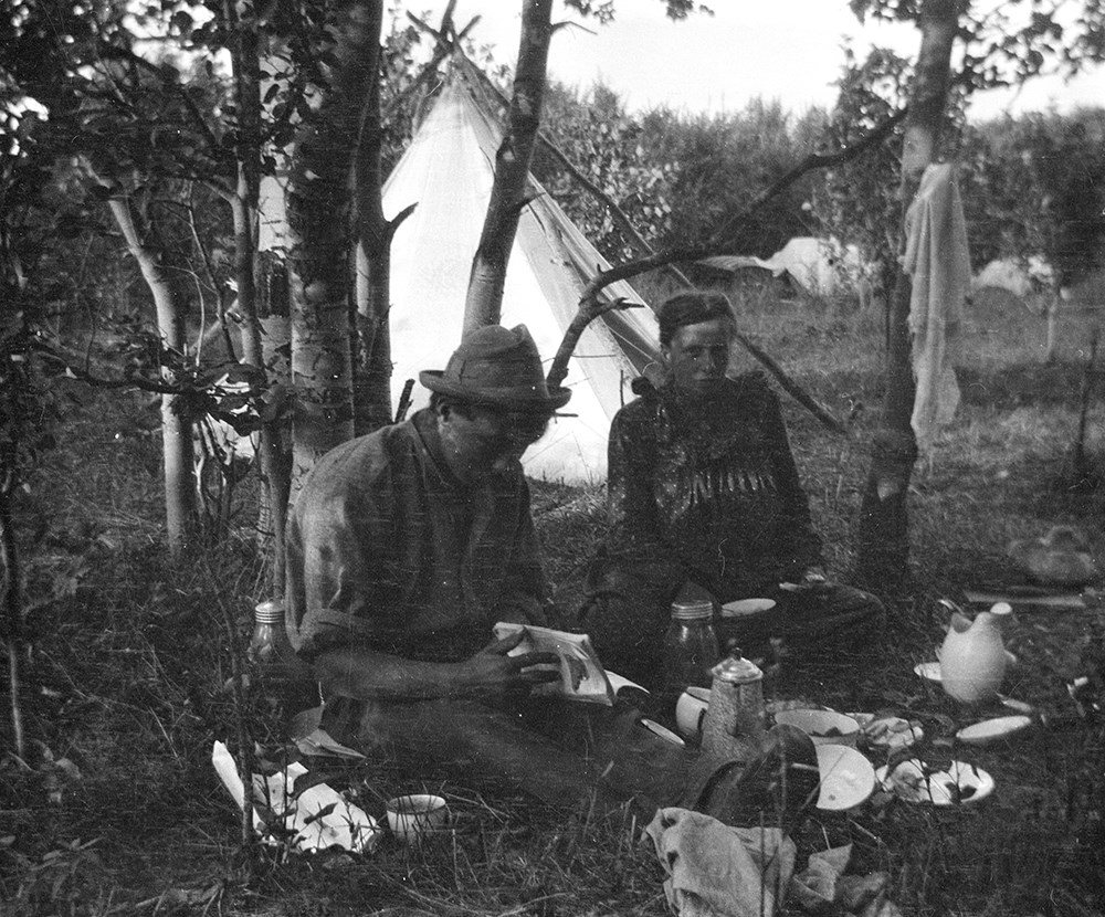
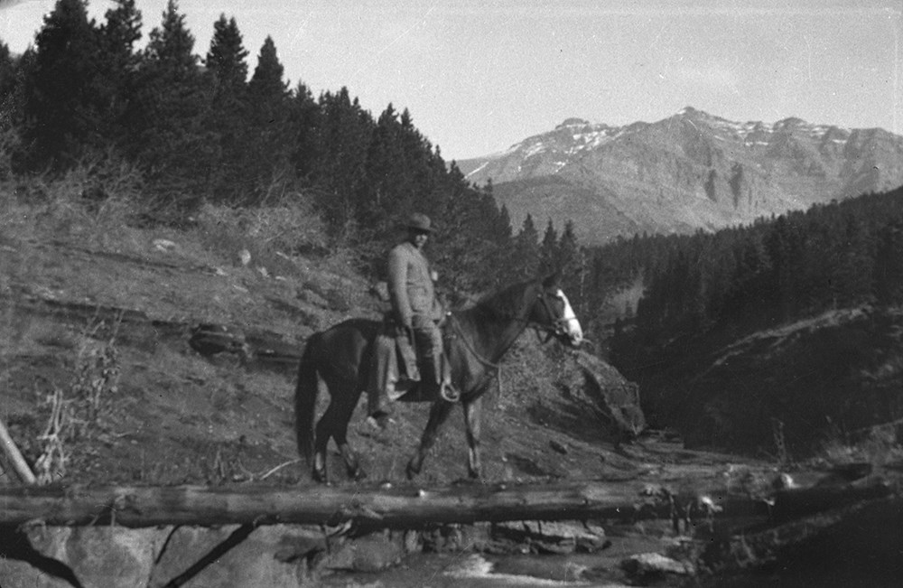
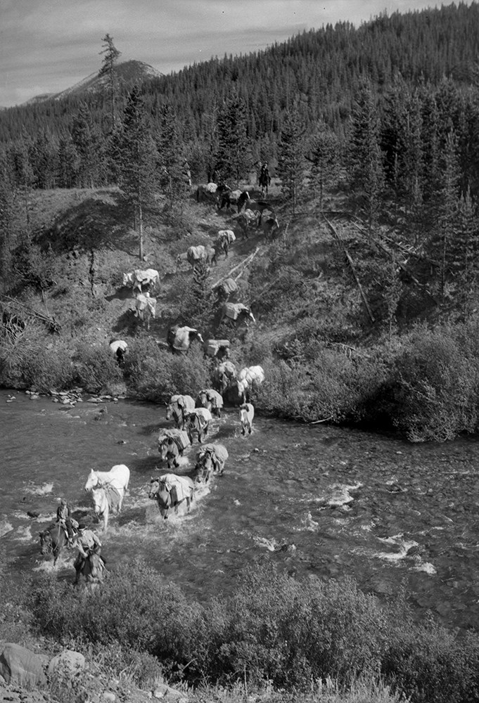
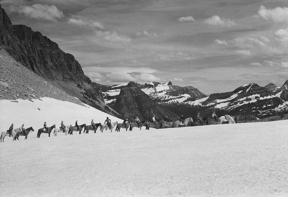
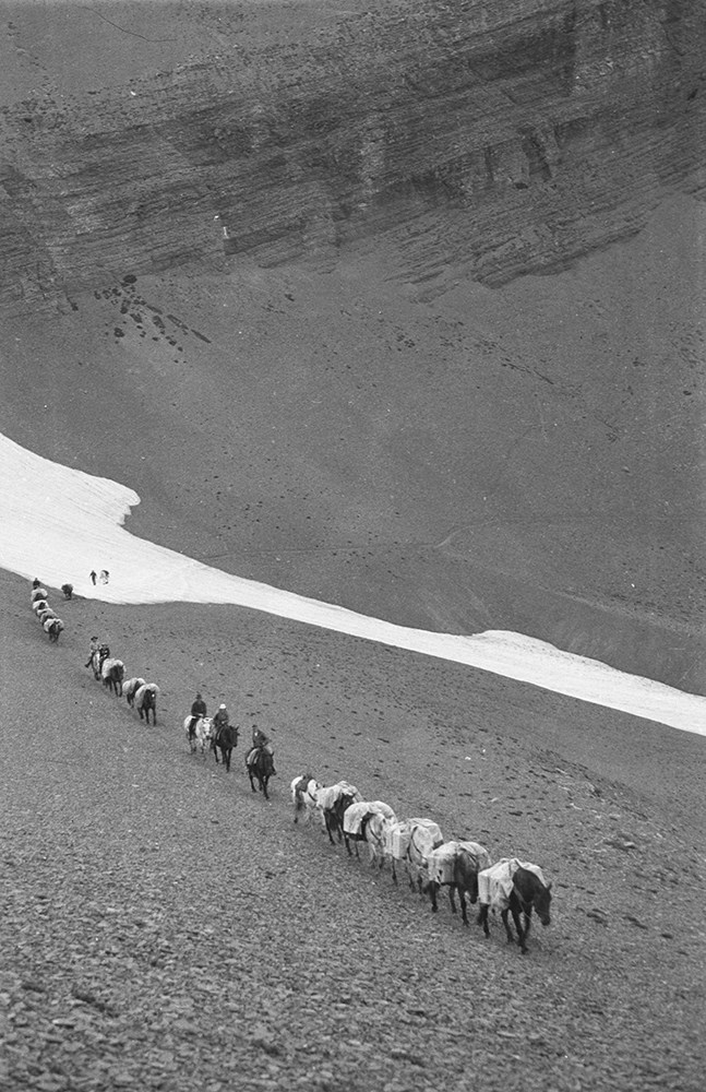
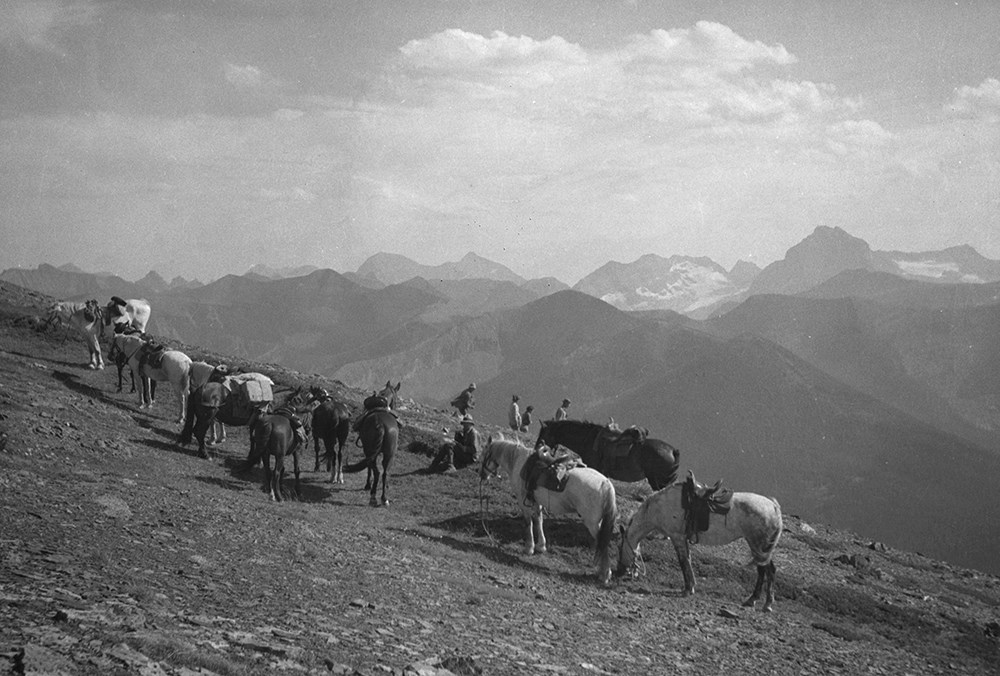
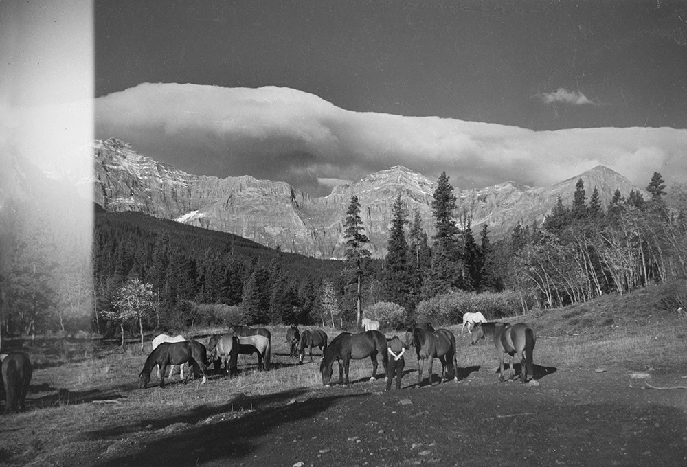
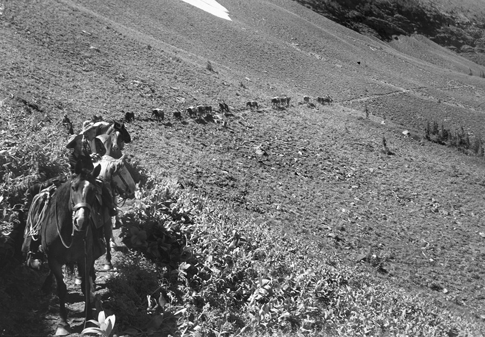
- File consists of 22 b&w photographs, some captioned. Photographs pertain to the Bennett trips guided and outfitted by Riggall of 1931, 1933, 1934, 1935, and 1936. The photographs document packtrains, camp life, hiking, Herbst glacier, and fishing. Locations of photographs include: Wall Lake, Mount …
- Date Range
- 1931
- 1933-1936
- Reference Code
- V26 / II / A4 / PA - 130 to 152
- Description Level
- 5 / File
- GMD
- Photograph
- Photograph print
- Part Of
- Bert Riggall fonds
- Description Level
- 5 / File
- Fonds Number
- M376 / V26
- Series
- II.Business and Financial: Client Papers and Photographs
- Sous-Fonds
- V26
- Accession Number
- 7201
- Reference Code
- V26 / II / A4 / PA - 130 to 152
- Date Range
- 1931
- 1933-1936
- Physical Description
- Photographs: 22 b&w prints
- Scope & Content
- File consists of 22 b&w photographs, some captioned. Photographs pertain to the Bennett trips guided and outfitted by Riggall of 1931, 1933, 1934, 1935, and 1936. The photographs document packtrains, camp life, hiking, Herbst glacier, and fishing. Locations of photographs include: Wall Lake, Mount Festubert, Great Divide at South Kootenay Pass.
- Subject Access
- Guiding, Camping, Packtrains
- Hiking
- Camping
- Recreation
- Sports
- Fishing
- Geographic Access
- Canada
- Canadian Rocky Mountains
- British Columbia
- Kootenay National Park
- Great Divide
- Language
- N/A
- Title Source
- Title based on contents of file
- Processing Status
- Processed
This material is presented as originally created; it may contain outdated cultural descriptions and
potentially offensive content.
Read more.
Calgary Olympic Bid 1988
https://archives.whyte.org/en/permalink/descriptions54946
- Part Of
- Murray Hay fonds
- Scope & Content
- File consists of 10 prints : col. ; 64 x 61 cm or smaller. File pertains to Murray Hay's participation in Calgary's Olympic Bid in the early 1980s. File includes a variety of different reproduced draft maps depciting Calgary and Canada Olympic Park, Banff National Park, Kananaskis, Spray Valley, et…
- Date Range
- ca.1980-ca.1981
- Reference Code
- V795 / II / B / iv / 1-2
- Description Level
- 5 / File
- GMD
- Map
- Private record
- Part Of
- Murray Hay fonds
- Description Level
- 5 / File
- Fonds Number
- M570 / V795
- Series
- V795 / II : Unpublished Material
- Sous-Fonds
- V795
- Sub-Series
- V795 / II / B : Alberta / iv : Olympic Bid
- Accession Number
- 2019.41
- Reference Code
- V795 / II / B / iv / 1-2
- GMD
- Map
- Private record
- Date Range
- ca.1980-ca.1981
- Physical Description
- 10 prints : col. ; 64 x 61 cm or smaller
- Scope & Content
- File consists of 10 prints : col. ; 64 x 61 cm or smaller. File pertains to Murray Hay's participation in Calgary's Olympic Bid in the early 1980s. File includes a variety of different reproduced draft maps depciting Calgary and Canada Olympic Park, Banff National Park, Kananaskis, Spray Valley, etc.
- Notes
- Date range is approximate. The Olympic Bid was selected in 1981.
- One print depicting the City of Calgary with the Canadian Rockies in the background has a note taped to it that reads: "A view from Calgary to Banff showing Olympic sites for 1988 winter games (proximity exaggerated."
- Name Access
- Hay, Murray
- Subject Access
- Artist
- Ski Maps
- Map
- Cartography
- Sports and recreation
- Tourism
- Winter
- Winter sports
- Olympic Games (Winter)
- Geographic Access
- Calgary
- Banff National Park
- Alberta
- Canada
- Canadian Rocky Mountains
- Canada Olympic Park
- Spray Lakes
- Spray Valley
- Bow Valley
- Kananaskis
- Bragg Creek
- Canmore
- Language
- English
- Conservation
- V795 / II / B / iv / 2 : Masking tape should be removed and alternative preservation methods should be considered at a reasonable time to do so.
- Related Material
- M570 / III / C / i / 1
- Creator
- Hay, Murray
- Title Source
- Title based on contents of file
- Processing Status
- Processed
This material is presented as originally created; it may contain outdated cultural descriptions and
potentially offensive content.
Read more.
Fernie Alpine Resort
https://archives.whyte.org/en/permalink/descriptions54883
- Part Of
- Murray Hay fonds
- Scope & Content
- File consists of 2 maps (1 base, 4 overlays) : col., annotations, on mylar ; 32 x 27 cm and 30 x 22 cm, and 2 prints : col. ; 35 x 28 cm. File pertains to Murray Hay's rendering of the ski hill at Fernie, British Columbia. File includes two reproduced drafts with mylar overlays (one held together b…
- Date Range
- ca.1977-ca.1997
- Reference Code
- V795 / II / A / vi / 1-2
- Description Level
- 5 / File
- GMD
- Map
- Private record
- Part Of
- Murray Hay fonds
- Description Level
- 5 / File
- Fonds Number
- M570 / V795
- Series
- V795 / II : Unpublished Material
- Sous-Fonds
- V795
- Sub-Series
- V795 / II / A : British Columbia / vi : Fernie
- Accession Number
- 2019.41
- Reference Code
- V795 / II / A / vi / 1-2
- GMD
- Map
- Private record
- Date Range
- ca.1977-ca.1997
- Physical Description
- 2 maps (1 base, 4 overlays) : col., annotations, on mylar ; 32 x 27 cm and 30 x 22 cm
- 2 prints : col. ; 35 x 28 cm
- Scope & Content
- File consists of 2 maps (1 base, 4 overlays) : col., annotations, on mylar ; 32 x 27 cm and 30 x 22 cm, and 2 prints : col. ; 35 x 28 cm. File pertains to Murray Hay's rendering of the ski hill at Fernie, British Columbia. File includes two reproduced drafts with mylar overlays (one held together by tape or glue, the other by masking tape), and two reproduced draft prints of the ski area.
- Notes
- Date range is approximate. The Timberland sub-division was developed between 1981-1991. The resort was known as Fernie Snow Valley until 1997.
- Name Access
- Hay, Murray
- Subject Access
- Advertising
- Art
- Artist
- Ski Maps
- Cartography
- Sports and recreation
- Tourism
- Tourist information
- Winter
- Winter sports
- Ski area
- Geographic Access
- Fernie
- British Columbia
- Canada
- Canadian Rocky Mountains
- Language
- English
- Conservation
- Masking tape should be removed and alternative preservation methods should be considered at a reasonable time to do so.
- Creator
- Hay, Murray
- Title Source
- Title based on contents of file
- Processing Status
- Processed
This material is presented as originally created; it may contain outdated cultural descriptions and
potentially offensive content.
Read more.
Jasper Marmot Basin
https://archives.whyte.org/en/permalink/descriptions54813
- Part Of
- Murray Hay fonds
- Scope & Content
- File consists of 1 cm of textual records, 10 x 23.5 cm or smaller. File pertains to ski trail maps of Jasper Marmot Basin and ski area created by Murray Hay. File includes three brochures promoting the ski runs at Marmot Basin that each include a reproduced map by Hay.
- Date Range
- 2001-2003
- 2001
- 2003
- Reference Code
- M570 / III / B / iii / 1
- Description Level
- 5 / File
- GMD
- Map
- Textual record
- Published record
- Part Of
- Murray Hay fonds
- Description Level
- 5 / File
- Fonds Number
- M570 / V795
- Series
- M570 / III : Murray Hay portfolio (published material)
- Sous-Fonds
- M570
- Sub-Series
- M570 / III / B : Alberta / iii : Jasper
- Accession Number
- 2019.41
- Reference Code
- M570 / III / B / iii / 1
- Date Range
- 2001-2003
- 2001
- 2003
- Physical Description
- 1 cm of textual records (10 x 23.5 cm or smaller)
- Scope & Content
- File consists of 1 cm of textual records, 10 x 23.5 cm or smaller. File pertains to ski trail maps of Jasper Marmot Basin and ski area created by Murray Hay. File includes three brochures promoting the ski runs at Marmot Basin that each include a reproduced map by Hay.
- Name Access
- Hay, Murray
- Subject Access
- Ski Maps
- Skiing
- Ski areas
- Map
- Marmot Basin Ski Area
- Cartography
- Sports and recreation
- Tourism
- Tourist information
- Travel
- Winter
- Winter sports
- Advertising
- Artist
- Geographic Access
- Jasper
- Jasper Marmot Basin
- Jasper National Park
- Alberta
- Canada
- Canadian Rocky Mountains
- Language
- English
- Related Material
- V795 / II / B / i / 1
- Title Source
- Title based on contents of file
- Processing Status
- Processed
This material is presented as originally created; it may contain outdated cultural descriptions and
potentially offensive content.
Read more.
- Part Of
- Murray Hay fonds
- Scope & Content
- File consists of 1.5 cm of textual records, 53 x 80.5 cm and 10 x 23.5 cm. File pertains to ski trail maps of Lake Louise ski area created by Murray Hay. File includes two published reproductions of three original trail maps in a fold-out brochure (1992/1993) and in poster format. The three maps de…
- Date Range
- ca.1980 - ca. 1995
- 1992-1993
- Reference Code
- M570 / III / B / ii / 1-2
- Description Level
- 5 / File
- GMD
- Textual record
- Published record
- Map
- Poster
- Part Of
- Murray Hay fonds
- Description Level
- 5 / File
- Fonds Number
- M570 / V795
- Series
- M570 / III : Murray Hay portfolio (published material)
- Sous-Fonds
- M570
- Sub-Series
- M570 / III / B : Alberta / ii : Lake Louise
- Accession Number
- 2019.41
- Reference Code
- M570 / III / B / ii / 1-2
- Date Range
- ca.1980 - ca. 1995
- 1992-1993
- Physical Description
- 1.5 cm of textual records (53 x 80.5 cm and 10 x 23.5 cm)
- Scope & Content
- File consists of 1.5 cm of textual records, 53 x 80.5 cm and 10 x 23.5 cm. File pertains to ski trail maps of Lake Louise ski area created by Murray Hay. File includes two published reproductions of three original trail maps in a fold-out brochure (1992/1993) and in poster format. The three maps depict South Face, Back Bowls, and Larch Area.
- Name Access
- Hay, Murray
- Subject Access
- Ski area
- Ski Maps
- Skiing
- Tourism
- Cartography
- Map
- Winter
- Winter sports
- Sports and recreation
- Travel
- Lake Louise Ski Area
- Lake Louise
- Artist
- Advertising
- Geographic Access
- Lake Louise
- Alberta
- Canada
- Canadian Rocky Mountains
- Language
- English
- Related Material
- V795 / II / B / ii / 1
- Title Source
- Title based on contents of file
- Processing Status
- Processed
This material is presented as originally created; it may contain outdated cultural descriptions and
potentially offensive content.
Read more.
Lake Louise Area
https://archives.whyte.org/en/permalink/descriptions54925
- Part Of
- Murray Hay fonds
- Scope & Content
- File consists of 6 prints : col. ; 25.5 x 20 cm or smaller. File pertains to Murray Hay's renderings of the Lake Louise ski area. File includes six reproduced draft prints of original paintings of the Lake Louise ski area created by Murray Hay (different iterations).
- Date Range
- ca.1976-ca.2000
- Reference Code
- V795 / II / B / ii / 1
- Description Level
- 5 / File
- GMD
- Map
- Private record
- Part Of
- Murray Hay fonds
- Description Level
- 5 / File
- Fonds Number
- M570 / V795
- Series
- V795 / I : Unpublished Material
- Sous-Fonds
- V795
- Sub-Series
- V795 / I / B : Alberta / ii : Lake Louise
- Accession Number
- 2019.41
- Reference Code
- V795 / II / B / ii / 1
- GMD
- Map
- Private record
- Date Range
- ca.1976-ca.2000
- Physical Description
- 6 prints : col. ; 25.5 x 20 cm or smaller
- Scope & Content
- File consists of 6 prints : col. ; 25.5 x 20 cm or smaller. File pertains to Murray Hay's renderings of the Lake Louise ski area. File includes six reproduced draft prints of original paintings of the Lake Louise ski area created by Murray Hay (different iterations).
- Name Access
- Hay, Murray
- Subject Access
- Advertising
- Artist
- Ski Maps
- Map
- Cartography
- Sports and recreation
- Tourism
- Tourist information
- Winter
- Winter sports
- Ski area
- Lake Louise Ski Area
- Geographic Access
- Lake Louise
- Alberta
- Canada
- Canadian Rocky Mountains
- Language
- English
- Related Material
- M570 / III / B / ii / 1-2
- Creator
- Hay, Murray
- Title Source
- Title based on contents of file
- Processing Status
- Processed
This material is presented as originally created; it may contain outdated cultural descriptions and
potentially offensive content.
Read more.
Lake O'Hara Trails
https://archives.whyte.org/en/permalink/descriptions54776
- Part Of
- Murray Hay fonds
- Scope & Content
- File consists of 0.5 cm of textual records, 60.5 x 48.5 cm. File pertains to a trail map of the Lake O'Hara area created by Murray Hay. File consists of one published poster depicting a reproduced map of the trails at Lake O'Hara in Yoho National Park (British Columbia).
- Date Range
- ca.1970-ca.2015
- Reference Code
- M570 / III / A / iv / 1
- Description Level
- 5 / File
- GMD
- Map
- Poster
- Published record
- Textual record
- Part Of
- Murray Hay fonds
- Description Level
- 5 / File
- Fonds Number
- M570 / V795
- Series
- M570 / III : Murray Hay Portfolio (published material)
- Sous-Fonds
- M570
- Sub-Series
- M570 / III / A : British Columbia / iv : Lake O'Hara
- Accession Number
- 2019.41
- Reference Code
- M570 / III / A / iv / 1
- Date Range
- ca.1970-ca.2015
- Physical Description
- 0.5 cm of textual material (60.5 x 48.5 cm)
- Scope & Content
- File consists of 0.5 cm of textual records, 60.5 x 48.5 cm. File pertains to a trail map of the Lake O'Hara area created by Murray Hay. File consists of one published poster depicting a reproduced map of the trails at Lake O'Hara in Yoho National Park (British Columbia).
- Notes
- M570 / III / A / iv / 1 is oversize.
- Name Access
- Hay, Murray
- Subject Access
- Trails
- Hiking
- Cartography
- Advertising
- Artist
- Sports and recreation
- Travel
- Tourism
- Tourist information
- Geographic Access
- Lake O'Hara
- British Columbia
- Canada
- Canadian Rocky Mountains
- Yoho National Park
- Language
- English
- Title Source
- Title based on contents of file
- Processing Status
- Processed
This material is presented as originally created; it may contain outdated cultural descriptions and
potentially offensive content.
Read more.
- Part Of
- Murray Hay fonds
- Scope & Content
- File consists of 2 prints : col. ; 35 x 28 cm. File pertains to Murray Hay's rendering of Marmot Basin ski area in Jasper National Park. File includes two iterations of reproduction draft prints of Hay's map of Marmot Basin.
- Date Range
- ca.1976-ca.2000
- Reference Code
- V795 / II / B / i / 1
- Description Level
- 5 / File
- GMD
- Map
- Private record
- Part Of
- Murray Hay fonds
- Description Level
- 5 / File
- Fonds Number
- M570 / V795
- Series
- V795 / II : Unpublished Material
- Sous-Fonds
- V795
- Sub-Series
- V795 / II / B : Alberta / i : Jasper National Park
- Accession Number
- 2019.41
- Reference Code
- V795 / II / B / i / 1
- GMD
- Map
- Private record
- Date Range
- ca.1976-ca.2000
- Physical Description
- 2 prints : col. ; 35 x 28 cm
- Scope & Content
- File consists of 2 prints : col. ; 35 x 28 cm. File pertains to Murray Hay's rendering of Marmot Basin ski area in Jasper National Park. File includes two iterations of reproduction draft prints of Hay's map of Marmot Basin.
- Name Access
- Hay, Murray
- Subject Access
- Advertising
- Artist
- Ski Maps
- Ski area
- Map
- Cartography
- Sports and recreation
- Tourism
- Tourist information
- Winter
- Winter sports
- Geographic Access
- Jasper Marmot Basin
- Jasper National Park
- Alberta
- Canada
- Canadian Rocky Mountains
- Language
- English
- Related Material
- M570 / III / B / iii / 1
- Creator
- Hay, Murray
- Title Source
- Title based on contents of file
- Processing Status
- Processed
This material is presented as originally created; it may contain outdated cultural descriptions and
potentially offensive content.
Read more.
- Part Of
- Bert Riggall fonds
- Scope & Content
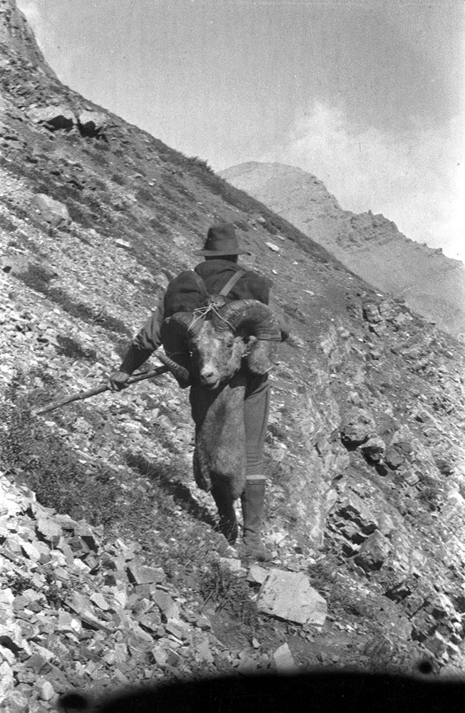
- File consists of 440 b&w negatives. The negatives pertain to Riggall pack trains and camps, hunting trophies, Riggall's ram trophies, various birds, bison, Ed Burton, Doris "Babe" Burton (nee Riggall), Bob Burton, Kay Riggall, and Dora Riggall posing in front of the Burton's home, and interior view…
- Date Range
- [ca.1904 to ca.1959]
- Reference Code
- V26 / IX / D / NA (D1 to D 23)
- Description Level
- 5 / File
- GMD
- Photograph
- Negative
15 images
- Part Of
- Bert Riggall fonds
- Description Level
- 5 / File
- Fonds Number
- M376 / V26
- Series
- IX. Riggall Negatives Scanned and Described
- Sous-Fonds
- V26
- Accession Number
- 7102
- Reference Code
- V26 / IX / D / NA (D1 to D 23)
- GMD
- Photograph
- Negative
- Date Range
- [ca.1904 to ca.1959]
- Physical Description
- 440 photographs : b&w negatives
- Scope & Content
- File consists of 440 b&w negatives. The negatives pertain to Riggall pack trains and camps, hunting trophies, Riggall's ram trophies, various birds, bison, Ed Burton, Doris "Babe" Burton (nee Riggall), Bob Burton, Kay Riggall, and Dora Riggall posing in front of the Burton's home, and interior views of Riggall's gunsmithing shop.
- Name Access
- Burton, Doris
- Burton, Bob
- Riggall, Kay
- Riggall, Dora
- Burton, Ed
- Subject Access
- Packing
- Pack trips
- Hunting
- Sports
- Recreation
- Family and personal life
- Animals
- Buffalo
- Birds
- Environment and Nature
- Natural resources
- Gunsmithing
- Geographic Access
- Canada
- Canadian Rocky Mountains
- Language
- N/A
- Category
- Environment
- Exploration, discovery and travel
- Family and personal life
- Sports, recreation and leisure
- Title Source
- Title based on contents of file
- Content Details
- Reference scans available: V26 / IX / D / NA (D1 to D 23)
- Processing Status
- Processed
Images


This material is presented as originally created; it may contain outdated cultural descriptions and
potentially offensive content.
Read more.