Narrow Results By
- Part Of
- Ben Gadd fonds
- Scope & Content
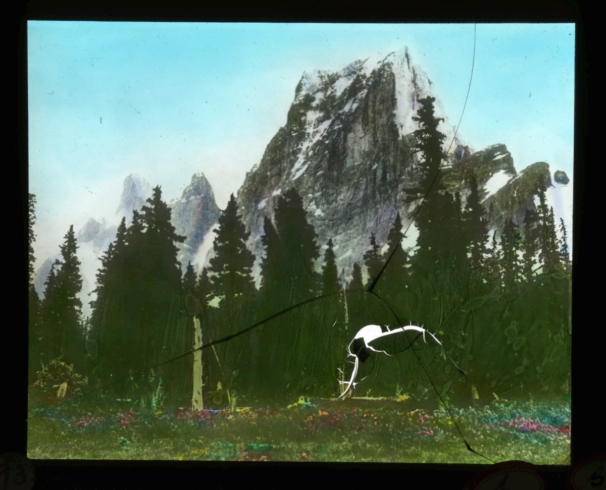
- File consists of photographs taken by Ben Gadd during a trip to Jackman Flats Provincial Park in 1997. Images depict unidentified individuals posing next to interpretive signs; hiking trails; a truck driving through sand; and measurements of a geological artifact.
- Date Range
- 1997
- Reference Code
- V810 / III / D / PA - 128 to 172
- Description Level
- 5 / File
- GMD
- Photograph
- Part Of
- Ben Gadd fonds
- Description Level
- 5 / File
- Fonds Number
- M590
- V810
- S61
- Series
- V810 / III : Professional records
- Sous-Fonds
- V810
- Sub-Series
- V810 / III / D : Other contracts and projects
- Accession Number
- 2021.20
- Reference Code
- V810 / III / D / PA - 128 to 172
- GMD
- Photograph
- Responsibility
- Produced by Ben Gadd
- Date Range
- 1997
- Physical Description
- 45 photographs : col. prints ; 10 x 15 cm
- Scope & Content
- File consists of photographs taken by Ben Gadd during a trip to Jackman Flats Provincial Park in 1997. Images depict unidentified individuals posing next to interpretive signs; hiking trails; a truck driving through sand; and measurements of a geological artifact.
- Name Access
- Gadd, Ben
- Subject Access
- Tourism
- Tourist information
- Hiking
- Recreation
- Trails
- Provincial parks and reserves
- Family and personal life
- Geology
- Research
- Geographic Access
- Canada
- British Columbia
- Jackman Flats Provincial Park
- Language
- N/A
- Related Material
- V810/III/D/NA-52 to 53
- Title Source
- Original title used
- Processing Status
- Processed
This material is presented as originally created; it may contain outdated cultural descriptions and
potentially offensive content.
Read more.
Pembina River Provincial Park
https://archives.whyte.org/en/permalink/descriptions56397
- Part Of
- Ben Gadd fonds
- Scope & Content
- File consists of photographs taken by Ben Gadd during a trip to Pembina River Provincial Park, including winter views of hiking trails and forested areas.
- Date Range
- 1997
- Reference Code
- V810 / III / D / PA - 173 to 180
- Description Level
- 5 / File
- GMD
- Photograph
- Part Of
- Ben Gadd fonds
- Description Level
- 5 / File
- Fonds Number
- M590
- V810
- S61
- Series
- V810 / III : Professional records
- Sous-Fonds
- V810
- Sub-Series
- V810 / III / D : Other contracts and projects
- Accession Number
- 2021.20
- Reference Code
- V810 / III / D / PA - 173 to 180
- GMD
- Photograph
- Responsibility
- Produced by Ben Gadd
- Date Range
- 1997
- Physical Description
- 8 photographs : col. prints ; 10 x 15 cm
- Scope & Content
- File consists of photographs taken by Ben Gadd during a trip to Pembina River Provincial Park, including winter views of hiking trails and forested areas.
- Name Access
- Gadd, Ben
- Subject Access
- Tourism
- Tourist information
- Hiking
- Recreation
- Trails
- Provincial parks and reserves
- Geographic Access
- Canada
- British Columbia
- Pembina River Provincial Park
- Language
- N/A
- Category
- Tourism
- Sports, recreation and leisure
- Title Source
- Original title used
- Processing Status
- Processed
This material is presented as originally created; it may contain outdated cultural descriptions and
potentially offensive content.
Read more.
Summit Notes - MT. Hooker, 1978
https://archives.whyte.org/en/permalink/descriptions57716
- Part Of
- Alpine Club of Canada fonds
- Scope & Content
- File consists of summit notes from Mount Hooker, produced by the Alpine Club of Canada in 1978. Summit record includes entries from visitors to the various summits which pertain to individuals' hiking and climbing trips; details of specific events which occurred while at the summit, wildlife sighti…
- Date Range
- 1978
- Reference Code
- M200 / V / A / 126
- Description Level
- 5 / File
- GMD
- Textual record
- Organization record
- Part Of
- Alpine Club of Canada fonds
- Description Level
- 5 / File
- Fonds Number
- M200
- V14
- S6
- Series
- M200 / V: Summit Records
- Sous-Fonds
- M200
- Sub-Series
- M200 / V / A: Identified Summit Records
- Accession Number
- accn. 8002
- Reference Code
- M200 / V / A / 126
- Responsibility
- Summit Registers and Notes produced by Alpine Club of Canada
- Date Range
- 1978
- Physical Description
- 1 cm of textual records 5 summit notes
- History / Biographical
- Mount Hooker is part of the Canadian Rockies, along the Continental Divide/Great Divide separating Alberta and British Columbia. Mount Hooker lies above the Hooker Icefield and the Athabasca Pass. The mountain was named after accomplished botanist, Sir William Jackson Hooker, in 1827.
- Scope & Content
- File consists of summit notes from Mount Hooker, produced by the Alpine Club of Canada in 1978. Summit record includes entries from visitors to the various summits which pertain to individuals' hiking and climbing trips; details of specific events which occurred while at the summit, wildlife sightings, trail updates, and related topics. File: M200 / V / A / 126: Summit Notes - MT. Hooker, 1978
- Name Access
- Alpine Club of Canada
- Subject Access
- Alberta
- Alpine Club of Canada
- Backcountry skiing
- Backpacking
- British Columbia
- Climbing
- Club
- Cross-country skiing
- Description and travel
- Environment
- Environment and Nature
- Great Divide
- Hiking
- Mountain
- Mountaineering
- Mountaineers
- Mountains
- Parks
- Record keeping
- Ski areas
- Ski area
- Ski mountaineering
- Sports and leisure
- Sports and recreation
- Summit
- Trails
- Winter sports
- Geographic Access
- Canada
- Canadian Rocky Mountains
- Continental Divide
- Great Divide
- Alberta
- British Columbia
- Athabasca Pass
- Hooker Icefield
- Mount Clemenceau
- Mount Hooker
- Access Restrictions
- Restrictions may apply
- Language
- English
- Conservation
- Summit notes placed in individual mylar sleeves due to fragile state of paper. Water damage and mold on every summit note.
- Related Material
- M235
- Biographical Source Notes
- Peak Finder: Mount Hooker, Canadian Rockies Database: https://cdnrockiesdatabases.ca/peaks/647#undefined3
- Title Source
- Original title
- Processing Status
- Processed
This material is presented as originally created; it may contain outdated cultural descriptions and
potentially offensive content.
Read more.
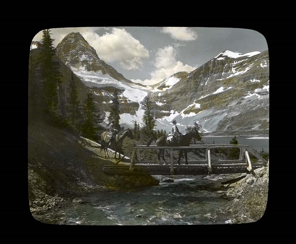
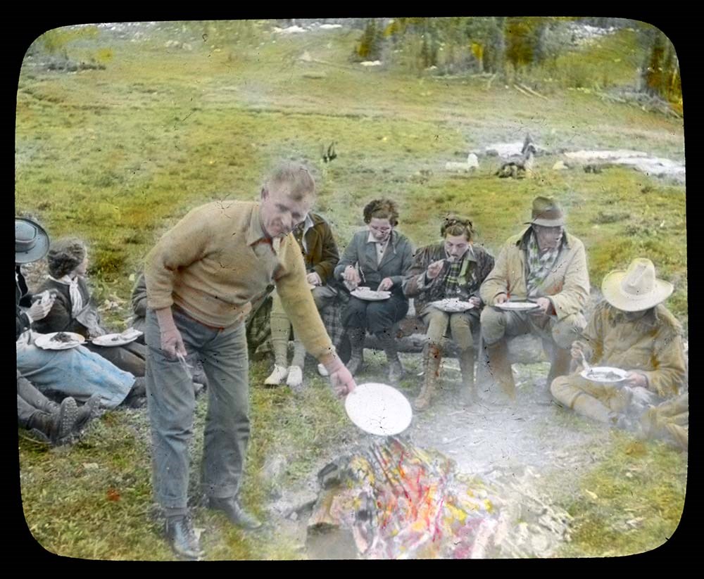
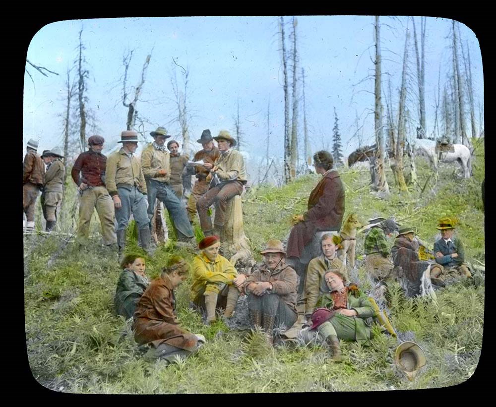
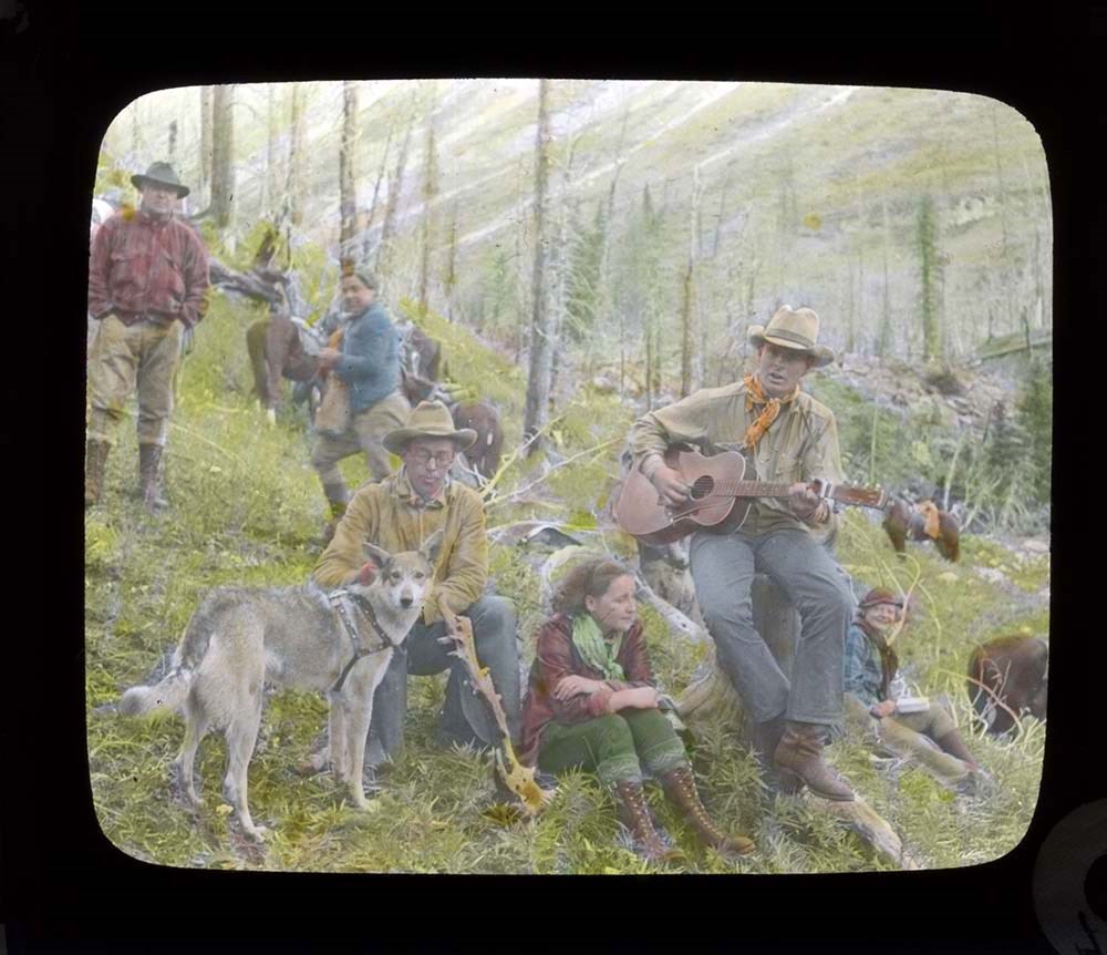
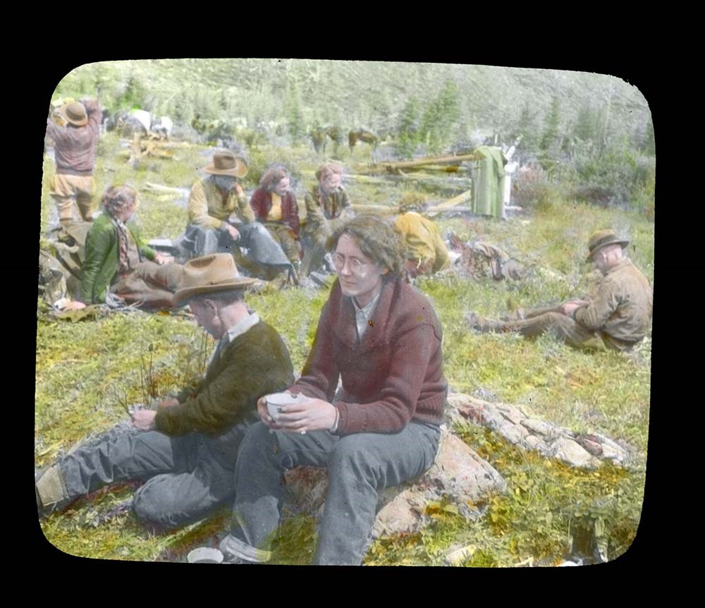
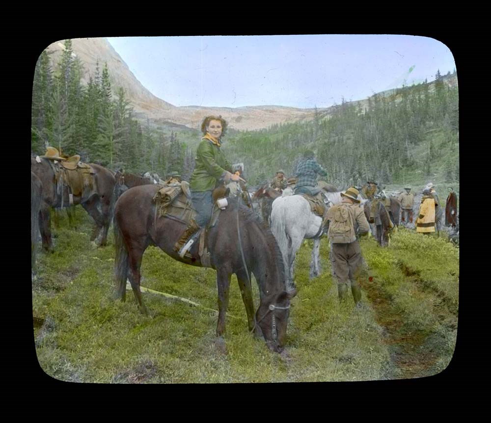
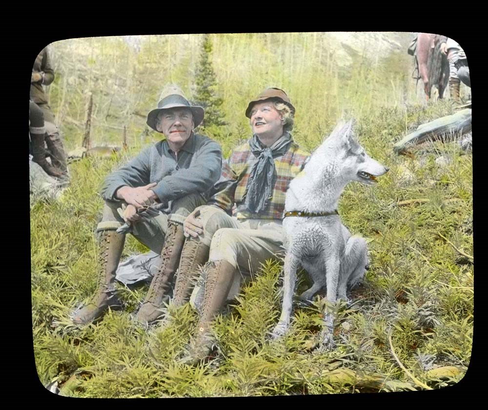
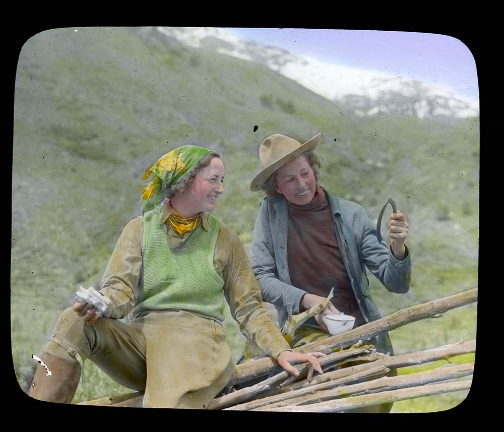
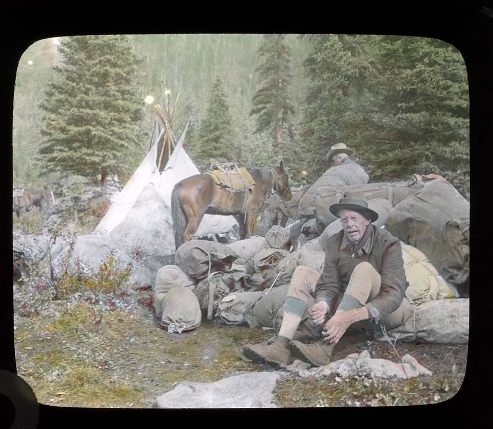
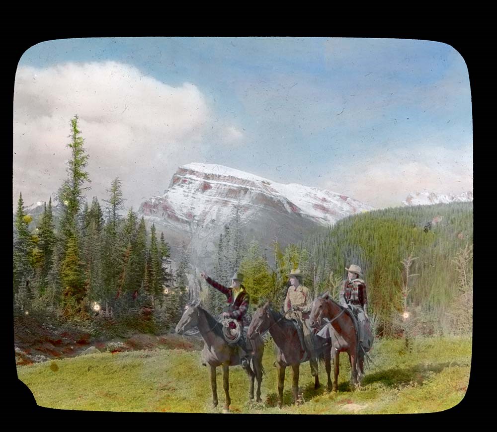
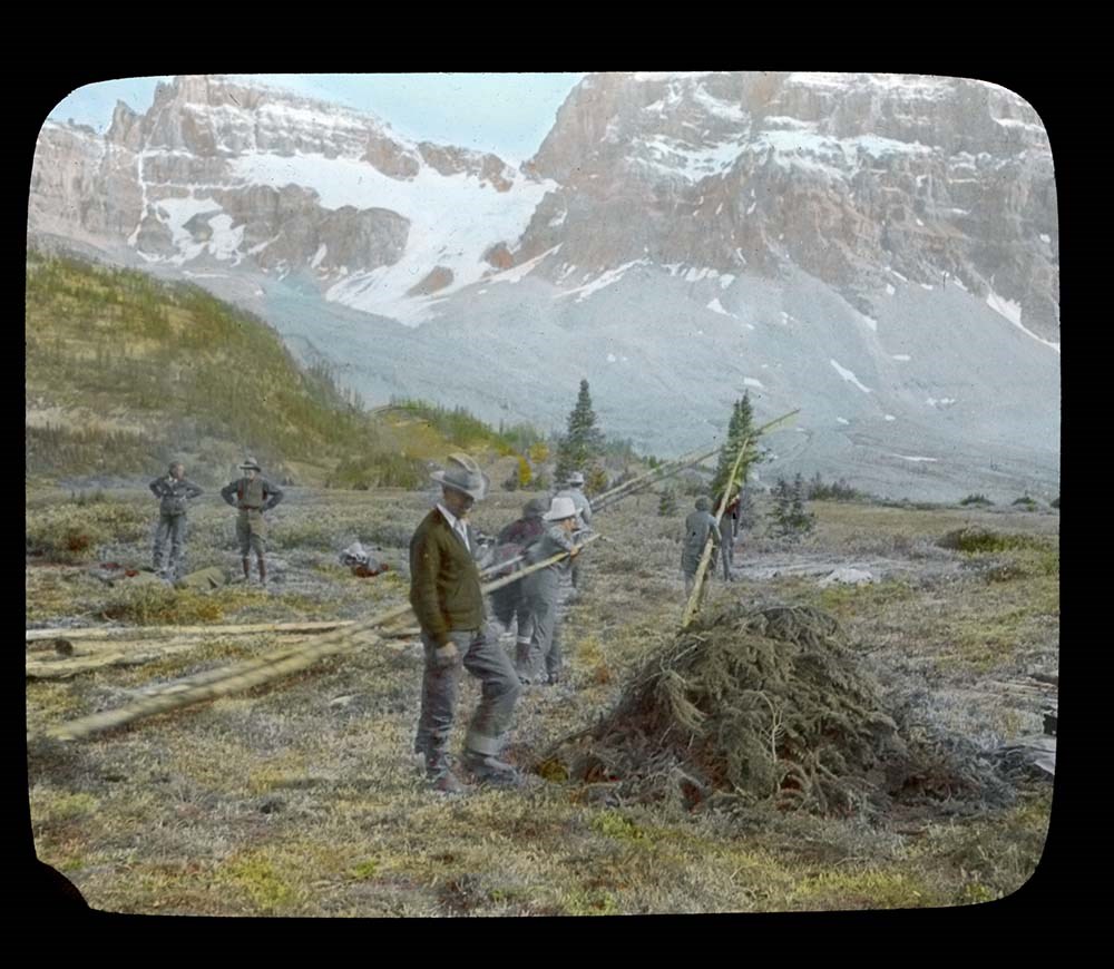
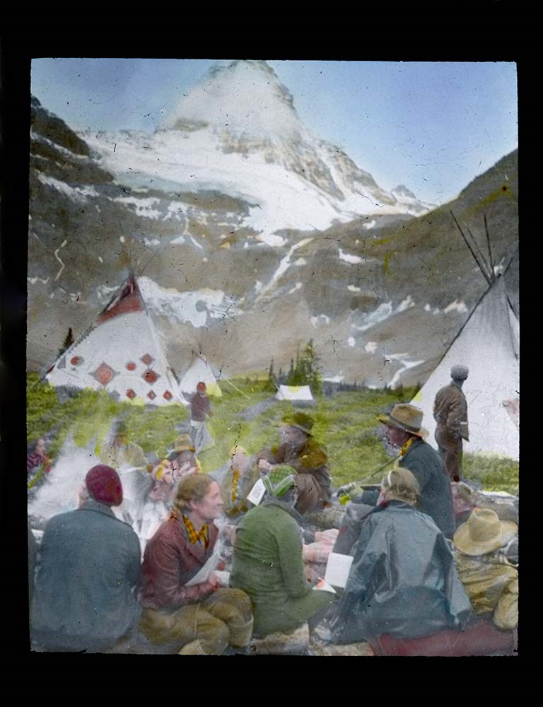
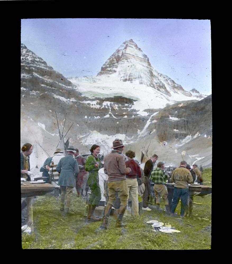
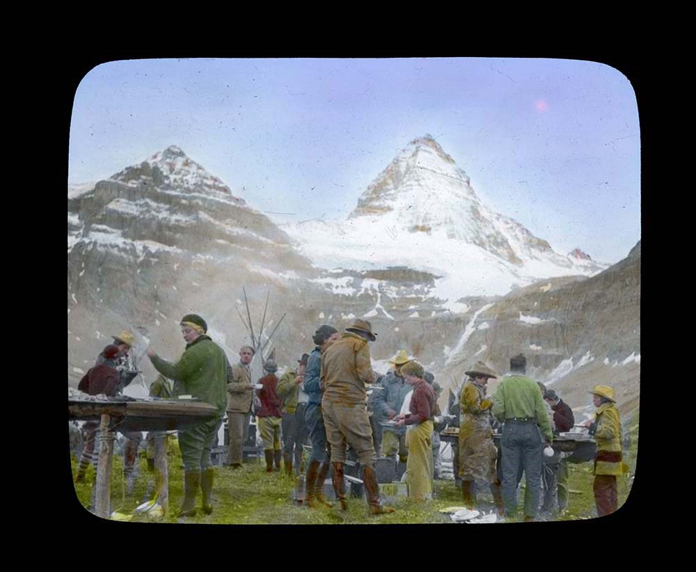
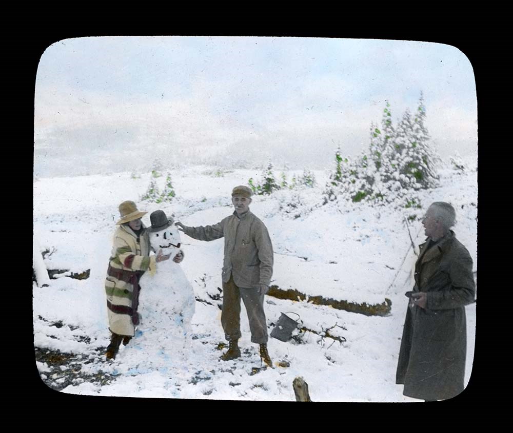
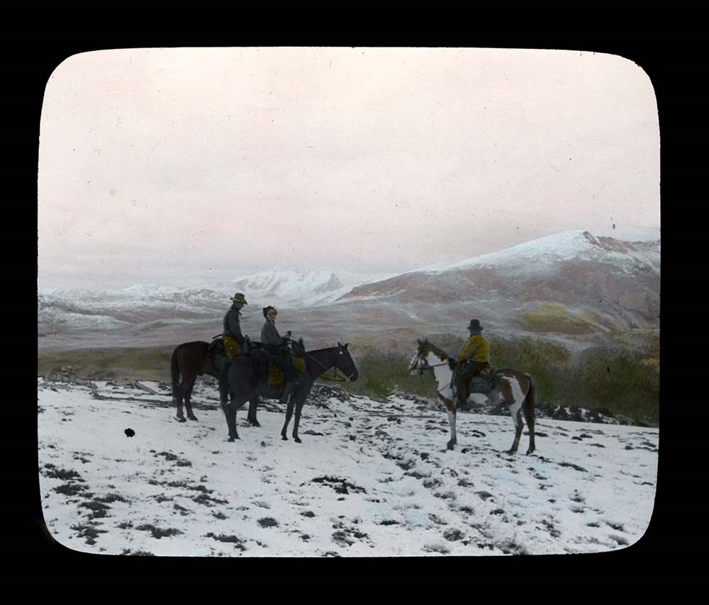
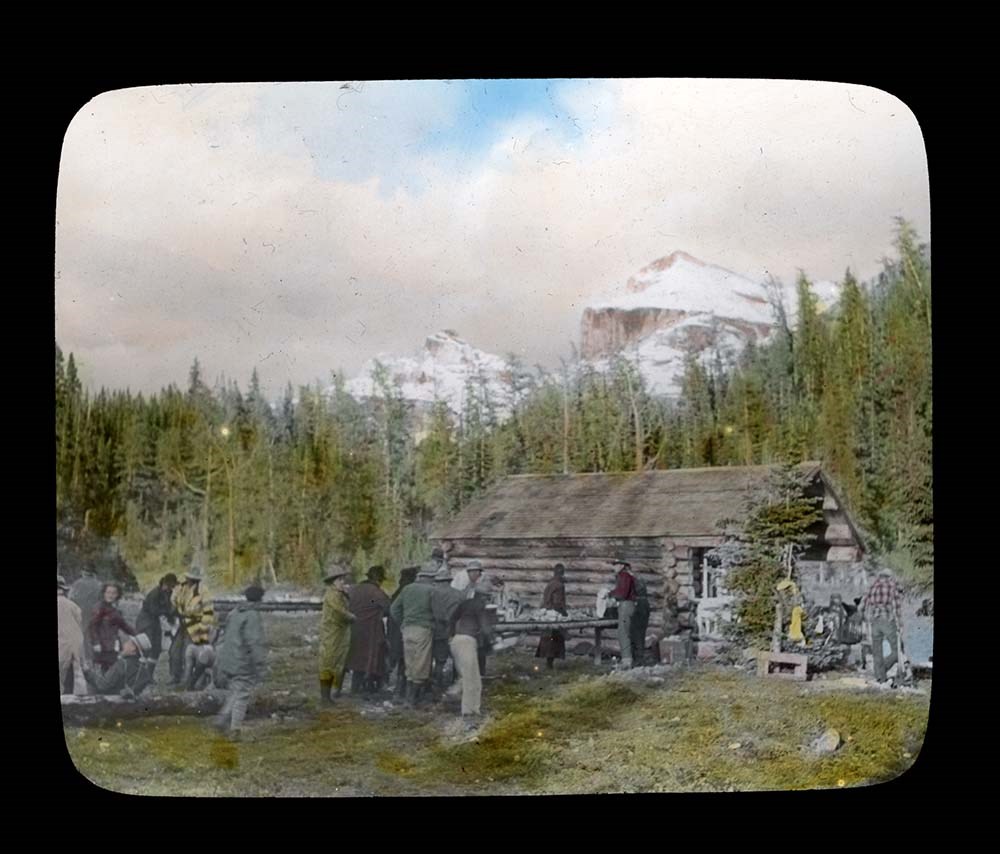
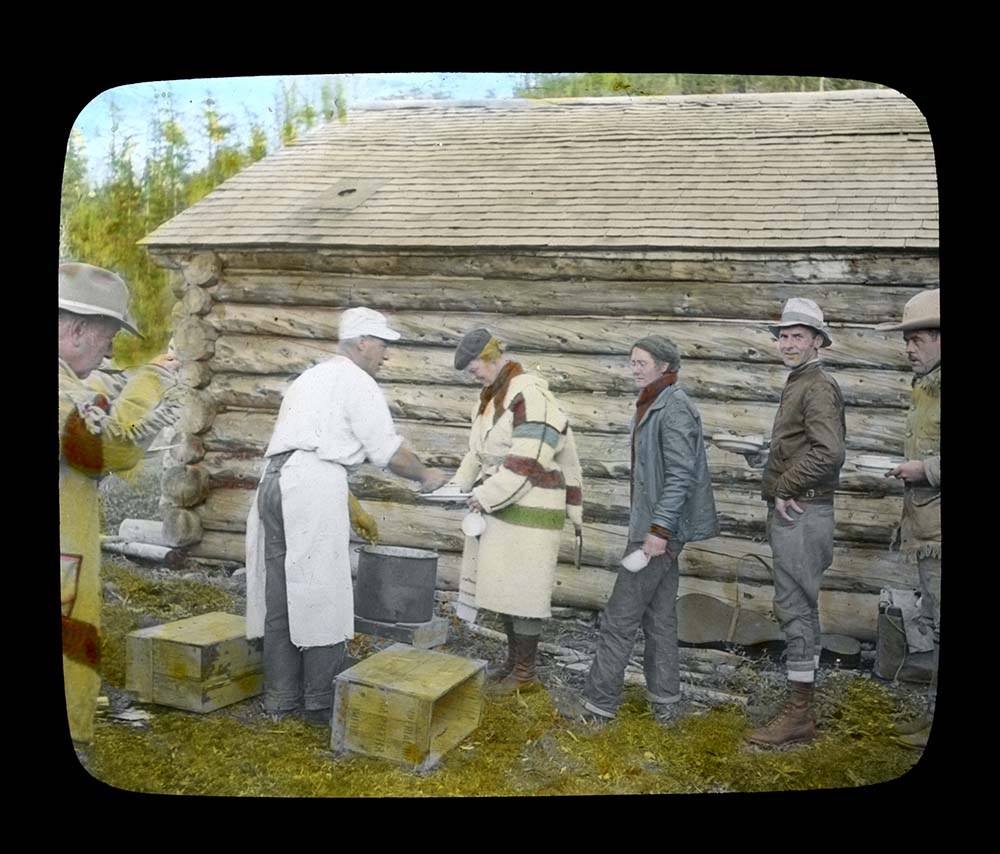
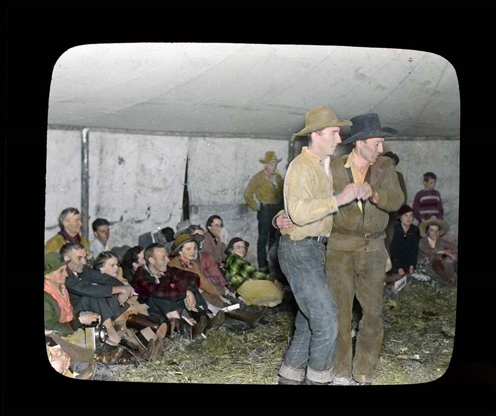
Trail Ride of 1937
https://archives.whyte.org/en/permalink/descriptions54697
- Part Of
- Jean A. Hembroff MacDonald fonds
- Scope & Content
- File consists of 27 colour photograph transparencies (lantern slides). File pertains to the Official Trail Ride of 1937 organized by the Trail Riders of the Canadian Rockies, which Jean Hembroff MacDonald participated in. File documents the trail ride to Mount Assiniboine and the camp at Mount Assi…
- Date Range
- 1937
- Reference Code
- V797 / II / PS - 1 to 27
- Description Level
- 5 / File
- GMD
- Lantern slide
- Photograph
- Transparency
27 images
- Part Of
- Jean A. Hembroff MacDonald fonds
- Description Level
- 5 / File
- Fonds Number
- M573 / V797 / S60
- Series
- V797 / II : Lantern Slides
- Sous-Fonds
- V797
- Accession Number
- 2019.111
- Reference Code
- V797 / II / PS - 1 to 27
- Date Range
- 1937
- Physical Description
- 27 photographs : col. slides
- Scope & Content
- File consists of 27 colour photograph transparencies (lantern slides). File pertains to the Official Trail Ride of 1937 organized by the Trail Riders of the Canadian Rockies, which Jean Hembroff MacDonald participated in. File documents the trail ride to Mount Assiniboine and the camp at Mount Assiniboine, with several landscape photographs but mostly of the hikers.
- Notes
- Jean wrote an article about her experience in the form of an article and a poem [see related material], and used this experience for future lectures.
- Slides are numbered on the back. Some are missing, the new number and order was imposed by Archive and Library Assistant for clarity.
- Slides were stored with a note stating: "Slides taken by the C.P.R. of Trail Ride, 1936-1937."
- Name Access
- Hembroff MacDonald, Jean
- Rungius, Carl
- Fisher, George
- Subject Access
- Trail Riders of the Canadian Rockies
- Hiking
- Mount Assiniboine
- Travel
- Tourism
- Trail guides
- Trails
- Horse packing
- Horseback riding
- Horses
- Geographic Access
- British Columbia
- Alberta
- Great Divide
- Mount Assiniboine
- Mount Assiniboine Park
- Canada
- Canadian Rocky Mountains
- Language
- English
- Related Material
- M573 / I / 18
- Trail Riders of the Canadian Rockies, Bulletin No. 48 (October 1937)
- Title Source
- Title based on contents of file
- Processing Status
- Processed
Images


This material is presented as originally created; it may contain outdated cultural descriptions and
potentially offensive content.
Read more.
[Summit note, Phyllis & Don Munday Sockeye Peak, 1931]
https://archives.whyte.org/en/permalink/descriptions57717
- Part Of
- Alpine Club of Canada fonds
- Scope & Content
- File consists of one summit note from Sockeye Peak produced by the Alpine Club of Canada in 1931. Summit note describes weather, elevation of the peak, and the visitors' hiking/climbing trip. File: M200 / V / A / 127: [Summit note, Phyllis & Don Munday Sockeye Peak, 1931]
- Date Range
- 1931
- Reference Code
- M200 / V / A / 127
- Description Level
- 5 / File
- GMD
- Textual record
- Organization record
- Part Of
- Alpine Club of Canada fonds
- Description Level
- 5 / File
- Fonds Number
- M200
- V14
- S6
- Series
- M200 / V: Summit Records
- Sous-Fonds
- M200
- Sub-Series
- M200 / V / A: Identified Summit Records
- Accession Number
- accn. 6465
- Reference Code
- M200 / V / A / 127
- Responsibility
- Summit Registers and Notes produced by Alpine Club of Canada
- Date Range
- 1931
- Physical Description
- 1 summit note 0.5 cm of textual record
- History / Biographical
- Sockeye Peak is located in British Columbia, along the Coast Mountains/Coast Range. Nearby are Mount Munday, Mount Agur, and Agur Glacier.
- Scope & Content
- File consists of one summit note from Sockeye Peak produced by the Alpine Club of Canada in 1931. Summit note describes weather, elevation of the peak, and the visitors' hiking/climbing trip. File: M200 / V / A / 127: [Summit note, Phyllis & Don Munday Sockeye Peak, 1931]
- Name Access
- Alpine Club of Canada
- Subject Access
- Alpine Club of Canada
- British Columbia
- Climbing
- Club
- Description and travel
- Environment
- Environment and Nature
- Hiking
- Mountain
- Mountaineering
- Mountaineers
- Mountains
- Record keeping
- Sports and leisure
- Sports and recreation
- Summit
- Trails
- Geographic Access
- Canada
- British Columbia
- Coast Range
- Coast Mountains
- Mount Munday
- Mount Agur
- Sockeye Peak
- Access Restrictions
- Restrictions may apply
- Language
- English
- Conservation
- Summit note placed in mylar.
- Related Material
- M235
- Title Source
- Title based on contents of file
- Processing Status
- Processed
This material is presented as originally created; it may contain outdated cultural descriptions and
potentially offensive content.
Read more.
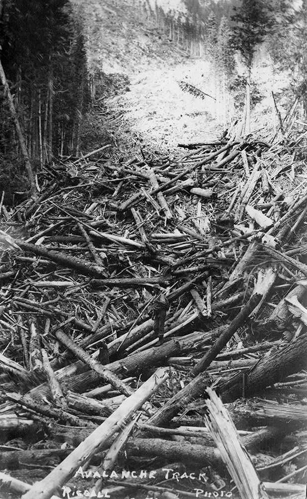
Bert Riggall's 1000 Mile Pack trip
https://archives.whyte.org/en/permalink/descriptions23454
- Part Of
- Bert Riggall fonds
- Scope & Content
- File consists of 43 b&w photographs, some captioned. Photographs pertain to Riggall's 1911 1000 mile pack trip undertaken to seek out areas for hunting and outfitting following the enlargement of Waterton National Park and the reduction of available hunting area for Riggall's clients. The prints do…
- Date Range
- 1911
- Reference Code
- V26 / II / A7 / PA - 119 to 161
- Description Level
- 5 / File
- GMD
- Photograph
- Photograph print
1 image
- Part Of
- Bert Riggall fonds
- Description Level
- 5 / File
- Fonds Number
- M376 / V26
- Series
- II.Business and Financial: Bert Riggall's 1000 Mile Pack trip, 1911
- Sous-Fonds
- V26
- Accession Number
- 7201
- Reference Code
- V26 / II / A7 / PA - 119 to 161
- Date Range
- 1911
- Physical Description
- 43 photographs: b&w prints
- Scope & Content
- File consists of 43 b&w photographs, some captioned. Photographs pertain to Riggall's 1911 1000 mile pack trip undertaken to seek out areas for hunting and outfitting following the enlargement of Waterton National Park and the reduction of available hunting area for Riggall's clients. The prints document this pack trip from stops in Banff, AB and Cranbrook, BC, and the extent of his mountain exploration from Fort Steele to Edson. On this trip, approximately 150 miles of new trail was cut including portions of Roger's Pass.
- Subject Access
- Pack trips
- Exploration
- Trails
- Trail making
- Recreation
- Hunting
- Outfitters, trail guides and packers
- Geographic Access
- Canada
- Alberta
- Banff National Park
- Waterton National Park
- British Columbia
- Cranbrook
- Rogers Pass
- Language
- English
- Title Source
- Title based on contents of file
- Processing Status
- Processed
Images

This material is presented as originally created; it may contain outdated cultural descriptions and
potentially offensive content.
Read more.
Bert Riggall's 1000 Mile Pack trip
https://archives.whyte.org/en/permalink/descriptions23455
- Part Of
- Bert Riggall fonds
- Scope & Content
- File consists of 20 b&w photographs, some captioned. Photographs pertain to Riggall's 1911 1000 mile pack trip undertaken to seek out areas for hunting and outfitting following the enlargement of Waterton National Park and the reduction of available hunting area for Riggall's clients. The prints do…
- Date Range
- 1911
- Reference Code
- V26 / II / A7 / PA - 162 to 181
- Description Level
- 5 / File
- GMD
- Photograph
- Photograph print
1 image
- Part Of
- Bert Riggall fonds
- Description Level
- 5 / File
- Fonds Number
- M376 / V26
- Series
- II.Business and Financial: Bert Riggall's 1000 Mile Pack trip, 1911
- Sous-Fonds
- V26
- Accession Number
- 7201
- Reference Code
- V26 / II / A7 / PA - 162 to 181
- Date Range
- 1911
- Physical Description
- Photographs: 20 prints, b&w
- Scope & Content
- File consists of 20 b&w photographs, some captioned. Photographs pertain to Riggall's 1911 1000 mile pack trip undertaken to seek out areas for hunting and outfitting following the enlargement of Waterton National Park and the reduction of available hunting area for Riggall's clients. The prints document this pack trip from stops in Banff, AB and Cranbrook, BC, and the extent of his mountain exploration from Fort Steele to Edson. On this trip, approximately 150 miles of new trail was cut including portions of Roger's Pass.
- Subject Access
- Pack trips
- Exploration
- Trails
- Trail making
- Recreation
- Hunting
- Outfitters, trail guides and packers
- Geographic Access
- Canada
- Alberta
- Banff National Park
- Waterton National Park
- British Columbia
- Cranbrook
- Rogers Pass
- Language
- English
- Title Source
- Title based on contents of file
- Processing Status
- Processed
Images
This material is presented as originally created; it may contain outdated cultural descriptions and
potentially offensive content.
Read more.
Margaret Oliver fonds
https://archives.whyte.org/en/permalink/descriptions55186
- Part Of
- Margaret Oliver fonds
- Scope & Content
- Fonds consists of transparency slides, maps, handwritten notes and club records, song books, and scrapbooks pertaining to Margaret Ruth Oliver and the Tuesday Hikers club.
- Date Range
- 1971-2010
- Reference Code
- M569 / V793
- Description Level
- 1 / Fonds
- GMD
- Textual record
- Photograph
- Transparency
- Published record
- Private record
- Scrapbook
- Map
- Organization record
- Part Of
- Margaret Oliver fonds
- Description Level
- 1 / Fonds
- Fonds Number
- M569 / V793
- Sous-Fonds
- M569
- V793
- Accession Number
- 2017.8656
- Reference Code
- M569 / V793
- GMD
- Textual record
- Photograph
- Transparency
- Published record
- Private record
- Scrapbook
- Map
- Organization record
- Date Range
- 1971-2010
- Physical Description
- 28 photographs : col. slides -- 1.5 m of textual records (3 binders -- 1 record book -- 10 song books -- maps, annotated -- 11 scrapbooks)
- History / Biographical
- Margaret Ruth Oliver was born on December 19, 1927 to parents Edgar and Gladys (Brazier) Hammett in Winnipeg, Manitoba. Margaret's siblings include Dorothy (1922), Muriel "Miv" (1923), John (1929), and Jean (1933). Margaret graduated from United College (Winnipeg) in 1949 with a B.Sc. degree, and worked as an Assistant Librarian at the University of Manitoba afterwards. Margaret later enrolled in a Laboratory Technician program at the University of Manitoba Medical College. Margaret married Thomas Albert Oliver, a fellow University of Manitoba alumnus, on September 25, 1954. The couple moved to Calgary for work (Thomas taught at the University of Calgary, and Margaret worked for a geophysical company). Margaret travelled extensively following the death of her husband in 1997, visiting places such as Nepal, Cambodia, Russia, Egypt and Greenland. In 1971, Margaret formed a hiking group within the University Faculty Women's Club (F.W.C.) through the University of Calgary. In 1976, this group became a private club called the Tuesday Hikers, which no longer held any affiliation to the F.W.C. Trips included weekly hikes and/or ski trips, as well as longer backpacking excursions.The club is still active as of 2022.
- Scope & Content
- Fonds consists of transparency slides, maps, handwritten notes and club records, song books, and scrapbooks pertaining to Margaret Ruth Oliver and the Tuesday Hikers club.
- Notes
- Materials are unprocessed and stored in three boxes: Box 1: 1 envelope "T. Hikers' Slides" - 28 film transparencies and printed notes; various maps with handwritten notes Box 2: 1 record book "T.H. Record Book" - handwritten lists and statistics of trips, attendance, miles; 2 binders with handwritten notes, titled "National Parks - Banff and Assiniboine" and "Nat'l Parks - Glacier + Jasper" Box 3: 1 binder titled "Tues. Hikers- Past Members and Guests"; 10 song books; trail, park and road maps; 11 scrapbooks, 1971-2010
- Name Access
- Oliver, Margaret
- Subject Access
- Hiking
- Travel
- Recreation
- Club
- Map
- Trails
- Music
- Entertainment
- Geography
- Geographic Access
- Canada
- Alberta
- Banff National Park
- Jasper National Park
- Assiniboine
- British Columbia
- Glacier National Park
- Language
- English
- Biographical Source Notes
- https://biblio.uottawa.ca/en/node/16056
- Title Source
- Title based on content in fonds
- Processing Status
- Unprocessed
This material is presented as originally created; it may contain outdated cultural descriptions and
potentially offensive content.
Read more.
Canadian Rockies mountaineering trips, Alpine Club of Canada expeditions
https://archives.whyte.org/en/permalink/descriptions55242
- Part Of
- Malcolm Geddes fonds
- Scope & Content
- File consists of 129 lantern slides pertaining to mountaineering expeditions and scenic views in the Canadian Rockies. Includes images of pack trips, ice climbing, hiking, and Alpine Club of Canada camps. Locations include Emperor Falls; Berg Lake; ascent of Resplendent Mountain; Mount Edith Cavell…
- Date Range
- [1913-1925]
- Reference Code
- V756 / III / A / PS - 1 to 129
- Description Level
- 5 / File
- GMD
- Photograph
- Lantern slide
1 image
- Part Of
- Malcolm Geddes fonds
- Description Level
- 5 / File
- Fonds Number
- M39
- V756
- Series
- V756 / III : Personal and family records
- Sous-Fonds
- V756
- Sub-Series
- V756 / III / A : Travel and mountain expeditions
- Accession Number
- 6504
- Reference Code
- V756 / III / A / PS - 1 to 129
- Responsibility
- Some items produced by Charles Potter and James Mahon
- Date Range
- [1913-1925]
- Physical Description
- 129 photographs : lantern slides
- Scope & Content
- File consists of 129 lantern slides pertaining to mountaineering expeditions and scenic views in the Canadian Rockies. Includes images of pack trips, ice climbing, hiking, and Alpine Club of Canada camps. Locations include Emperor Falls; Berg Lake; ascent of Resplendent Mountain; Mount Edith Cavell; Mount Maud; Mount Commander; Mount Marpole; Mount Habel; Mount Robson; Mount Temple; Mount Huber; Castle Mountain; and Wilcox Pass.
- Notes
- Some items are numbered on outer edges or otherwise labelled
- Material Details
- Some items hand-coloured
- Name Access
- Gibbon, John Murray
- Wheeler, A. O. (Arthur Oliver)
- Geddes, Malcolm
- Alpine Club of Canada
- Subject Access
- Travel
- Exploration
- Hiking
- Ice climbing
- Summit
- Mountains
- Landscapes
- Recreation
- Alpine Club of Canada
- Glaciers
- Trails
- Pack trips
- Camping
- Geographic Access
- Canada
- Alberta
- British Columbia
- Canadian Rocky Mountains
- Mount Robson
- Mount Temple
- Mount Habel
- Mount Geikie
- Mount Huber
- Castle Mountain
- Wilcox Pass
- Mount Edith Cavell
- Mount Maud
- Mount Commander
- Mount Marpole
- Access Restrictions
- Fragile - restrictions may apply
- Reproduction Restrictions
- Fragile- restrictions may apply
- Language
- N/A
- Title Source
- Title based on contents of file
- Processing Status
- Processed
Images
This material is presented as originally created; it may contain outdated cultural descriptions and
potentially offensive content.
Read more.
- Scope & Content
- File consists of seven discs containing a slideshow and photographs pertaining to trail rides led by the Trail Riders of the Canadian Rockies between 2005 and 2007. Includes ca.1,214 photograph files depicting trail ride participants trail ride views and the winning Townsend Trophy photograph by Jo…
- Date Range
- 2005-2008
- Reference Code
- V635 / I / DF - 1 to 7
- Description Level
- 5 / File
- GMD
- Video
- Sound recording
- Digital born
- Description Level
- 5 / File
- Fonds Number
- M545
- V635
- Series
- V635 / I : Events and Activities
- Sous-Fonds
- V635
- Accession Number
- 8235
- Reference Code
- V635 / I / DF - 1 to 7
- Date Range
- 2005-2008
- Physical Description
- 7 compact discs with digital files -- 1,214 digital images, 1 slideshow
- Scope & Content
- File consists of seven discs containing a slideshow and photographs pertaining to trail rides led by the Trail Riders of the Canadian Rockies between 2005 and 2007. Includes ca.1,214 photograph files depicting trail ride participants trail ride views and the winning Townsend Trophy photograph by Joe Madaro in 2005; and a slideshow of a 2007 trail ride to Clearwater, British Columbia with accompanying music.
- Notes
- List of contents in file: V635 / I / DF - 1 : "TRCR 2005" (160 image files) V635 / I / DF - 2 : [no title], contains two files with images of winnjing Townsend Trophy photogaph by Joe Madaro, 2005 V635 / I / DF - 3 : "Lodge Ride", 2005 trail ride (36 image files) V635 / I / DF - 4 and 5 : "TRCR 2006 Debbie Sonberg", CD #1 (513 image files) and CD #2 (503 image files) V635 / I / DF - 6 : TRCR 2007 Clearwater Area (slideshow) V635 / I / DF - 7 : "March 21, 2008 TRCR of the Rockies Al Owchar", "Come Ride With Me" [edited excerpt]
- Subject Access
- Trails
- Organizations
- Travel
- Tourism
- Recreation
- Photography
- Geographic Access
- Canada
- British Columbia
- Clearwater
- Reproduction Restrictions
- Copyright restrictions may apply
- Language
- English
- Title Source
- Title based on contents of file
- Processing Status
- Processed
This material is presented as originally created; it may contain outdated cultural descriptions and
potentially offensive content.
Read more.