Narrow Results By
Bow Valley Camera Club
https://archives.whyte.org/en/permalink/descriptions8330
- Part Of
- Peter and Catharine Whyte fonds
- Date Range
- 1968-1971
- Reference Code
- M36 / I / A / 4 / b / i / 1205
- Description Level
- 5 / File
- Part Of
- Peter and Catharine Whyte fonds
- Description Level
- 5 / File
- Fonds Number
- M36 / V683 / S37
- Series
- I.A.4. Catharine Robb Whyte papers / photographs
- Reference Code
- M36 / I / A / 4 / b / i / 1205
- Date Range
- 1968-1971
- Physical Description
- 1 file of textual records
- Subject Access
- Bow Valley Camera Club
This material is presented as originally created; it may contain outdated cultural descriptions and
potentially offensive content.
Read more.
Bow Valley Naturalists
https://archives.whyte.org/en/permalink/descriptions8476
- Part Of
- Peter and Catharine Whyte fonds
- Scope & Content
- Catharine was a member of this organization.
- Date Range
- 1967-1976
- Reference Code
- M36 / I / A / 4 / b / iii / 1361
- Description Level
- 5 / File
- Part Of
- Peter and Catharine Whyte fonds
- Description Level
- 5 / File
- Fonds Number
- M36 / V683 / S37
- Series
- I.A.4. Catharine Robb Whyte papers / photographs
- Reference Code
- M36 / I / A / 4 / b / iii / 1361
- Date Range
- 1967-1976
- Physical Description
- 1 file of textual records
- Scope & Content
- Catharine was a member of this organization.
- Subject Access
- Bow Valley Naturalists
This material is presented as originally created; it may contain outdated cultural descriptions and
potentially offensive content.
Read more.
- Part Of
- Alpine Club of Canada fonds
- Scope & Content
- File consists of a summit record from Haddo Peak produced by the Alpine Club of Canada between 1968 and 2001. Summit record includes entries from visitors to the various summits which pertain to individuals' hiking and climbing trips; details of specific events which occurred while at the summit, w…
- Date Range
- 1968-2001
- Reference Code
- M200 / V / A / 212
- Description Level
- 5 / File
- GMD
- Textual record
- Organization record
- Part Of
- Alpine Club of Canada fonds
- Description Level
- 5 / File
- Fonds Number
- M200
- V14
- S6
- Series
- M200 / V: Summit Records
- Sous-Fonds
- M200
- Sub-Series
- M200 / V / A: Identified Summit Records
- Accession Number
- accn. 2023.10
- Reference Code
- M200 / V / A / 212
- Responsibility
- Summit Registers and Notes produced by Alpine Club of Canada
- Date Range
- 1968-2001
- Physical Description
- 1 volume 1 cm of textual record
- History / Biographical
- Haddo Peak is located in the Lake Louise area of Banff National Park, Alberta. Haddo Peak is attached to Mount Aberdeen. Nearby is the Plain of the Six Glaciers Tea House, Lake Louise, Mount Victoria, Mount Lefroy and Mount Temple.
- Scope & Content
- File consists of a summit record from Haddo Peak produced by the Alpine Club of Canada between 1968 and 2001. Summit record includes entries from visitors to the various summits which pertain to individuals' hiking and climbing trips; details of specific events which occurred while at the summit, wildlife sightings, trail updates, and related topics. File: M200 / V / A / 212: Haddo [Peak]
- Name Access
- Alpine Club of Canada
- Subject Access
- Alberta
- Alpine Club of Canada
- Backpacking
- Banff
- Banff National Park
- Bow Valley
- Climbing
- Club
- Description and travel
- Environment
- Environment and Nature
- Hiking
- Lake Louise
- Mountain
- Mountaineering
- Mountaineers
- Mountains
- National parks and reserves
- Plain of Six Glacier Teahouse
- Record keeping
- Sports and leisure
- Sports and recreation
- Summit
- Temple Mountain
- Trails
- Geographic Access
- Canada
- Canadian Rocky Mountains
- Rocky Mountains
- Alberta
- Banff National Park
- Lake Louise
- Lake Louise, AB
- Plain of Six Glaciers
- Mount Victoria
- Mount Lefroy
- Mount Temple
- Mount Aberdeen
- Haddo Peak
- Access Restrictions
- Restrictions may apply
- Language
- English
- Related Material
- M235
- Title Source
- Title based on contents of file
- Processing Status
- Processed
This material is presented as originally created; it may contain outdated cultural descriptions and
potentially offensive content.
Read more.
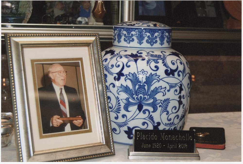
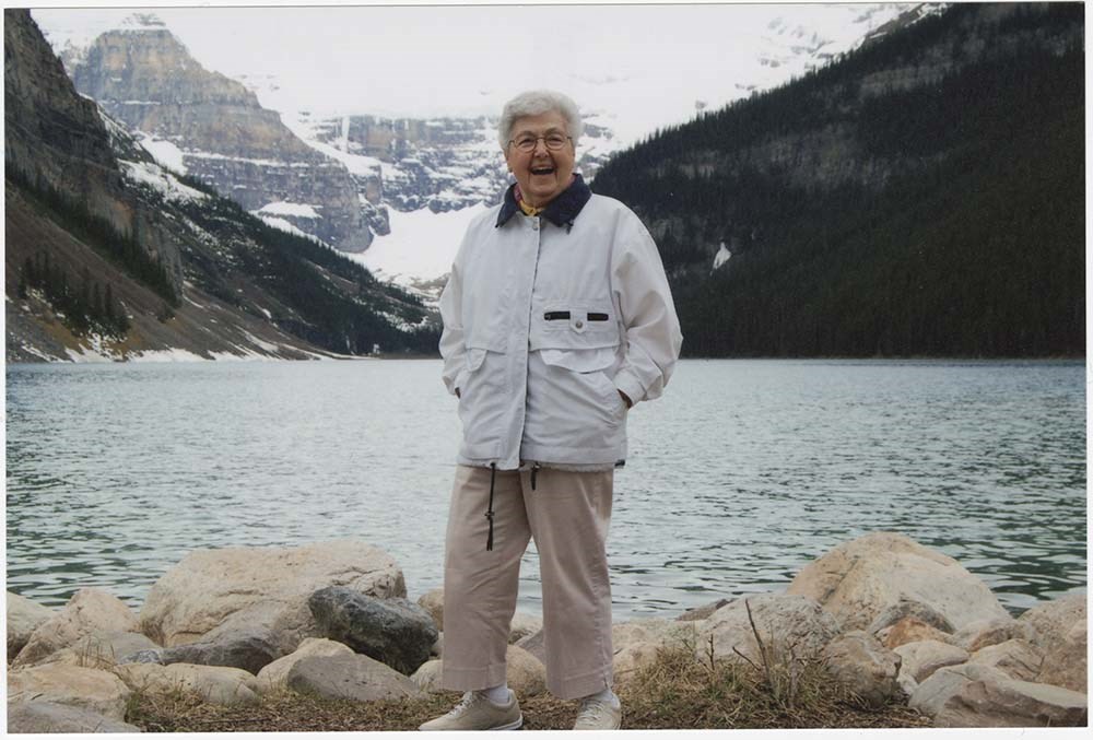
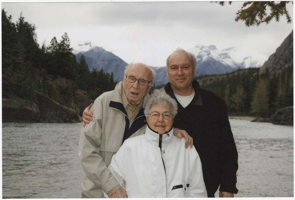
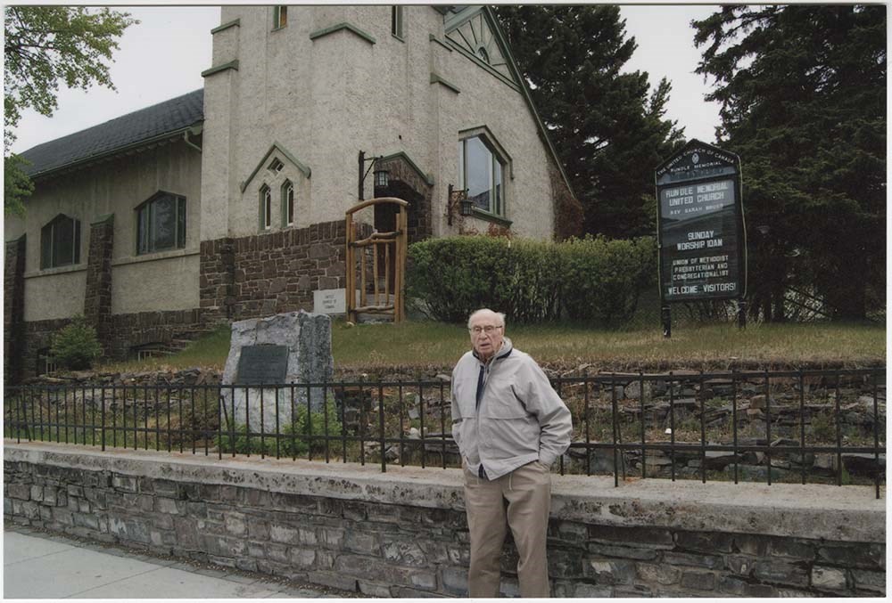
Miscellaneous photographs
https://archives.whyte.org/en/permalink/descriptions55718
- Part Of
- Placido Monachello fonds
- Scope & Content
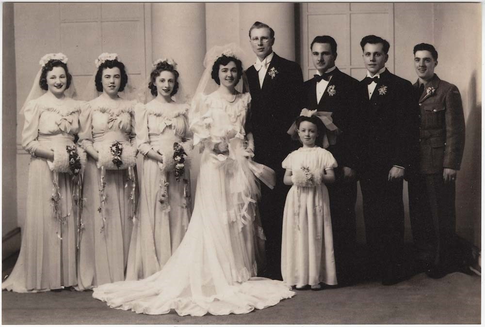
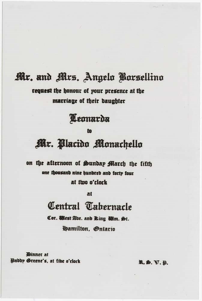
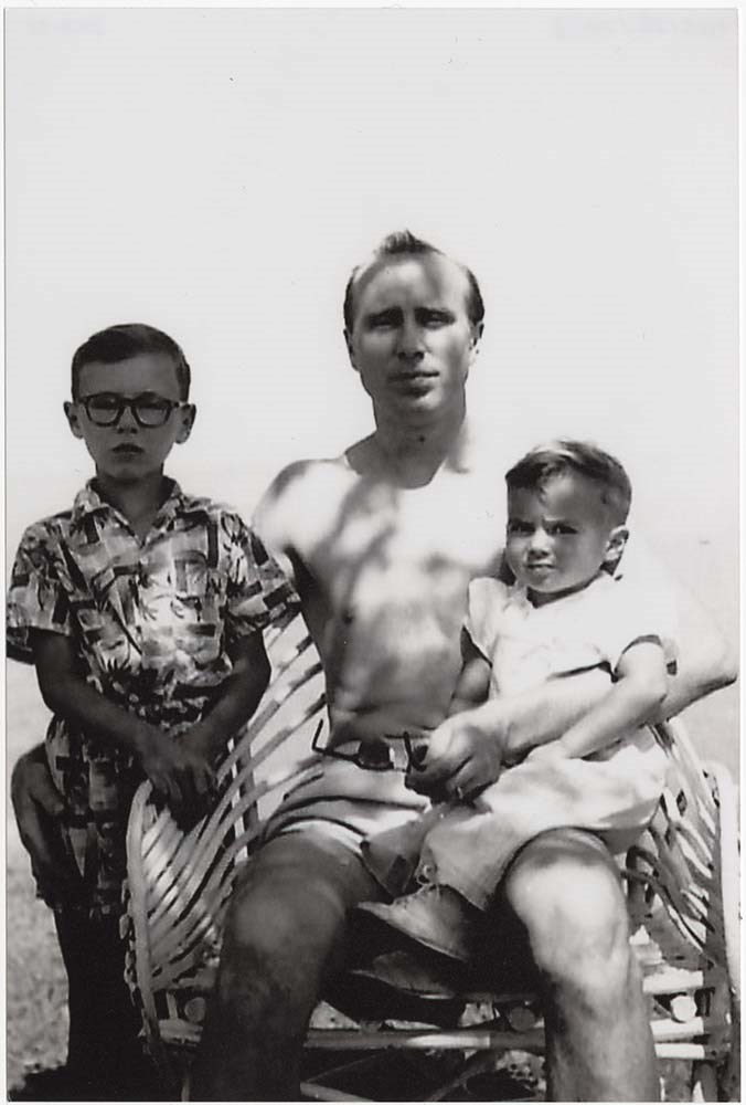
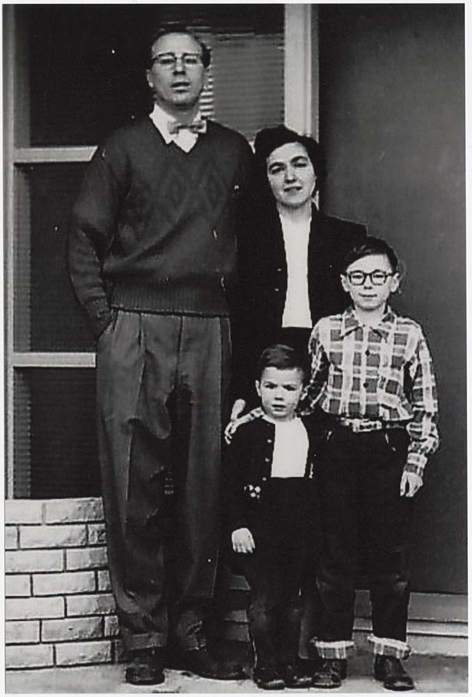
- File pertains to 21 black and white and colour photographs of Placido and Leona's wedding in 1944, family photographs from the 1950s and 1960s, and photographs taken during a 2010 trip Placido and Leona took to Banff and Lake Louise.
- Date Range
- 1944-2010
- Reference Code
- V803 / VII / PA - 1 to PA - 21
- Description Level
- 5 / File
- GMD
- Photograph
21 images
- Part Of
- Placido Monachello fonds
- Description Level
- 5 / File
- Fonds Number
- V803
- Series
- VII : Misc.
- Sous-Fonds
- M582 / V803
- Accession Number
- 2020.25
- Reference Code
- V803 / VII / PA - 1 to PA - 21
- GMD
- Photograph
- Date Range
- 1944-2010
- Physical Description
- 21 photographs : b&w ; 15.1x 10.1 cm or smaller
- History / Biographical
- See fonds level description
- Scope & Content
- File pertains to 21 black and white and colour photographs of Placido and Leona's wedding in 1944, family photographs from the 1950s and 1960s, and photographs taken during a 2010 trip Placido and Leona took to Banff and Lake Louise.
- Name Access
- Monachello, Placido
- Subject Access
- Family and personal life
- Bankhead
- Bow Falls
- Bow River
- Bow Valley
- Mountains
- Travel
- Geographic Access
- Banff
- Lake Louise
- Banff National Park
- Language
- English
- Title Source
- Title based on contents of file
- Processing Status
- Processed
Images


This material is presented as originally created; it may contain outdated cultural descriptions and
potentially offensive content.
Read more.
Mt. Assiniboine Summit Records
https://archives.whyte.org/en/permalink/descriptions57697
- Part Of
- Alpine Club of Canada fonds
- Scope & Content
- Files consist of summit notes and summit registers from Mount Assiniboine produced by the Alpine Club of Canada between 1977 and 1998. Summit records include entries from visitors to the various summits which pertain to individuals' hiking and climbing trips; details of specific events which occurr…
- Date Range
- 1977-1998
- Reference Code
- M200 / V / A / 107 to 108
- Description Level
- 5 / File
- GMD
- Textual record
- Organization record
- Part Of
- Alpine Club of Canada fonds
- Description Level
- 5 / File
- Fonds Number
- M200
- V14
- S6
- Series
- M200 / V: Summit Records
- Sous-Fonds
- M200
- Sub-Series
- M200 / V / A: Identified Summit Records
- Accession Number
- accn. 5396
- accn. 7779
- Reference Code
- M200 / V / A / 107 to 108
- Responsibility
- Summit Registers and Notes produced by Alpine Club of Canada
- Date Range
- 1977-1998
- Physical Description
- 2 volumes 2 cm of textual records
- History / Biographical
- Mount Assiniboine is located along the Continental Divide, in the Rocky Mountains, in British Columbia. It was named in 1885, and it sits on the border of Mount Assiniboine Provincial Park, B. C. and Banff National Park, AB. In 1925, Lawrence Grassi became the first person to make a solo attempt of the mountain. Mount Assiniboine was first climbed in 1901 by James Outram, Christian Bohren and Christian Hasler.
- Scope & Content
- Files consist of summit notes and summit registers from Mount Assiniboine produced by the Alpine Club of Canada between 1977 and 1998. Summit records include entries from visitors to the various summits which pertain to individuals' hiking and climbing trips; details of specific events which occurred while at the summit, wildlife sightings, trail updates, and related topics. Files include: M200 / V / A / 107: [Mt. Assiniboine log book 1977-1987] M200 / V / A / 108: [Mt. Assiniboine Aug. 1978 - Aug. 1998]
- Notes
- File M200 / V / A / 108: [Mt. Assiniboine Aug. 1978 - Aug. 1998] contains a piece of engraved metal.
- Name Access
- Alpine Club of Canada
- Subject Access
- Alpine Club of Canada
- Backcountry skiing
- Backpacking
- Alberta
- Banff National Park
- Banff
- Bow Valley
- British Columbia
- Climbing
- Club
- Cross-country skiing
- Description and travel
- Environment
- Environment and Nature
- Hiking
- Mount Assiniboine
- Mountain
- Mountaineering
- Mountaineers
- Mountains
- National parks and reserves
- Parks Canada
- Parks
- Provincial parks and reserves
- Record keeping
- Ski area
- Ski areas
- Ski mountaineering
- Skiing
- Skis
- Sports and leisure
- Sports and recreation
- Summit
- Trails
- Winter sports
- Geographic Access
- Canada
- Canadian Rocky Mountains
- Rocky Mountains
- Continental Divide
- Alberta
- British Columbia
- Banff National Park
- Assiniboine Provincial Park
- Mount Assiniboine Park
- Bow Valley
- Mount Assiniboine
- Access Restrictions
- Restrictions may apply
- Reproduction Restrictions
- Contains personal information
- Language
- English
- Conservation
- Some materials have been placed in mylar. Some materials have water damage. File M200 / V / A / 108: [Mt. Assiniboine Aug. 1978 - Aug. 1998] contains a piece of engraved metal that has been placed in a conservation bag within the file.
- Related Material
- M235
- Biographical Source Notes
- Peak Finder: Mount Assiniboine, Canadian Rockies Database: https://cdnrockiesdatabases.ca/peaks/57#undefined1
- Title Source
- Title based on contents of file
- Processing Status
- Processed
This material is presented as originally created; it may contain outdated cultural descriptions and
potentially offensive content.
Read more.
Mt. Buller [1971-2000]
https://archives.whyte.org/en/permalink/descriptions57796
- Part Of
- Alpine Club of Canada fonds
- Scope & Content
- File consists of a summit record from Mount Buller produced by the Alpine Club of Canada between 1971 and 2000. Summit record includes entries from visitors to the various summits which pertain to individuals' hiking and climbing trips; details of specific events which occurred while at the summit,…
- Date Range
- 1971-2000
- Reference Code
- M200 / V / A / 113
- Description Level
- 5 / File
- GMD
- Textual record
- Organization record
- Part Of
- Alpine Club of Canada fonds
- Description Level
- 5 / File
- Fonds Number
- M200
- V14
- S6
- Series
- M200 / V: Summit Records
- Sous-Fonds
- M200
- Sub-Series
- M200 / V / A: Identified Summit Records
- Accession Number
- accn. 2023.10
- Reference Code
- M200 / V / A / 113
- Responsibility
- Summit Registers and Notes produced by Alpine Club of Canada
- Date Range
- 1971-2000
- Physical Description
- 1 volume 1 cm of textual record
- History / Biographical
- Mount Buller is located in the Spray Valley Provincial Park, Alberta. Nearby are the Spray Lakes Reservoir, Cone Mountain, Canmore, and Kananaskis Village.
- Scope & Content
- File consists of a summit record from Mount Buller produced by the Alpine Club of Canada between 1971 and 2000. Summit record includes entries from visitors to the various summits which pertain to individuals' hiking and climbing trips; details of specific events which occurred while at the summit, wildlife sightings, trail updates, and related topics. File: M200 / V / A / 113: Mt. Buller [1971-2000]
- Name Access
- Alpine Club of Canada
- Subject Access
- Alberta
- Alpine Club of Canada
- Backpacking
- Banff National Park
- Bow Valley
- Climbing
- Club
- Description and travel
- Environment
- Environment and Nature
- Hiking
- Kananaskis Country
- Mountain
- Mountaineering
- Mountaineers
- Mountains
- Provincial parks and reserves
- Record keeping
- Sports and leisure
- Sports and recreation
- Summit
- Trails
- Geographic Access
- Canada
- Canadian Rocky Mountains
- Rocky Mountains
- Alberta
- Spray Valley Provincial Park
- Spray Valley
- Kananaskis
- Kananaskis Country
- Spray Lakes Reservoir
- Cone Mountain
- Canmore
- Mount Buller
- Access Restrictions
- Restrictions may apply
- Language
- English
- Related Material
- M235
- Title Source
- Title based on contents of file
- Processing Status
- Processed
This material is presented as originally created; it may contain outdated cultural descriptions and
potentially offensive content.
Read more.
Mt. Hood, 1953 - 2009
https://archives.whyte.org/en/permalink/descriptions57774
- Part Of
- Alpine Club of Canada fonds
- Scope & Content
- File consists of a summit record from Mount Hood produced by the Alpine Club of Canada between 1953 and 2009. Summit record includes entries from visitors to the various summits which pertain to individuals' hiking and climbing trips; details of specific events which occurred while at the summit, w…
- Date Range
- 1953-2009
- Reference Code
- M200 / V / A / 188
- Description Level
- 5 / File
- GMD
- Textual record
- Organization record
- Part Of
- Alpine Club of Canada fonds
- Description Level
- 5 / File
- Fonds Number
- M200
- V14
- S6
- Series
- M200 / V: Summit Records
- Sous-Fonds
- M200
- Sub-Series
- M200 / V / A: Identified Summit Records
- Accession Number
- accn. 8119
- Reference Code
- M200 / V / A / 188
- Responsibility
- Summit Registers and Notes produced by Alpine Club of Canada
- Date Range
- 1953-2009
- Physical Description
- 1 Summit record 1 cm of textual record
- History / Biographical
- Mount Hood is located in Kananaskis, and is part of the Opal Range of the Canadian Rockies, Alberta.
- Scope & Content
- File consists of a summit record from Mount Hood produced by the Alpine Club of Canada between 1953 and 2009. Summit record includes entries from visitors to the various summits which pertain to individuals' hiking and climbing trips; details of specific events which occurred while at the summit, wildlife sightings, trail updates, and related topics. File: M200 / V / A / 188: Mt. Hood, 1953 - 2009
- Name Access
- Alpine Club of Canada
- Subject Access
- Alberta
- Alpine Club of Canada
- Bow Valley
- Climbing
- Club
- Description and travel
- Environment
- Environment and Nature
- Hiking
- Kananaskis Country
- Mountain
- Mountaineering
- Mountaineers
- Mountains
- Record keeping
- Sports and leisure
- Sports and recreation
- Summit
- Trails
- Geographic Access
- Canada
- Canadian Rocky Mountains
- Rocky Mountains
- Opal Range
- Alberta
- Kananaskis
- Kananaskis Country
- Kananaskis Country Golf Course
- Exshaw
- Exshaw, AB
- Mount Hood
- Access Restrictions
- Restrictions may apply
- Language
- English
- Related Material
- M235
- Biographical Source Notes
- Peak Finder: Mount Hood, Canadian Rockies Database: https://cdnrockiesdatabases.ca/peaks/645
- Title Source
- Original title
- Processing Status
- Processed
This material is presented as originally created; it may contain outdated cultural descriptions and
potentially offensive content.
Read more.
Mt. Sarbach summit register, 1968-2011
https://archives.whyte.org/en/permalink/descriptions57780
- Part Of
- Alpine Club of Canada fonds
- Scope & Content
- File consists of a summit register from Mount Sarbach between 1968 and 2011, produced by the Alpine Club of Canada. Summit record includes entries from visitors to the various summits which pertain to individuals' hiking and climbing trips; details of specific events which occurred while at the sum…
- Date Range
- 1968-2011
- Reference Code
- M200 / V / A / 194
- Description Level
- 5 / File
- GMD
- Textual record
- Organization record
- Part Of
- Alpine Club of Canada fonds
- Description Level
- 5 / File
- Fonds Number
- M200
- V14
- S6
- Series
- M200 / V: Summit Records
- Sous-Fonds
- M200
- Sub-Series
- M200 / V / A: Identified Summit Records
- Accession Number
- accn. 8119
- Reference Code
- M200 / V / A / 194
- Responsibility
- Summit Registers and Notes produced by Alpine Club of Canada
- Date Range
- 1968-2011
- Physical Description
- 1 volume 1 cm of textual record
- History / Biographical
- Mount Sarbach is located in Banff National Park, Alberta. Nearby are Mount Forbes, Mount Freshfield and Howse Peak.
- Scope & Content
- File consists of a summit register from Mount Sarbach between 1968 and 2011, produced by the Alpine Club of Canada. Summit record includes entries from visitors to the various summits which pertain to individuals' hiking and climbing trips; details of specific events which occurred while at the summit, wildlife sightings, trail updates, and related topics. File: M200 / V / A / 194: Mt. Sarbach summit register, 1968-2011
- Name Access
- Alpine Club of Canada
- Subject Access
- Alberta
- Alpine Club of Canada
- Backpacking
- Banff National Park
- Bow Valley
- Climbing
- Club
- Description and travel
- Environment
- Environment and Nature
- Hiking
- Mountain
- Mountaineering
- Mountaineers
- Mountains
- National parks and reserves
- Record keeping
- Sports and leisure
- Sports and recreation
- Summit
- Trails
- Geographic Access
- Canada
- Canadian Rocky Mountains
- Rocky Mountains
- Alberta
- Banff National Park
- Mount Forbes
- Mount Freshfield
- Howse Peak
- Mount Sarbach
- Access Restrictions
- Restrictions may apply
- Language
- English
- Conservation
- Register has water damage and rust damage. Binding has come loose on register, pages are loose.
- Related Material
- M235
- Biographical Source Notes
- Peak Finder: Mount Sarbach, Canadian Rockies Database: https://cdnrockiesdatabases.ca/peaks/1212
- Title Source
- Original title
- Processing Status
- Processed
This material is presented as originally created; it may contain outdated cultural descriptions and
potentially offensive content.
Read more.
Published booklets
https://archives.whyte.org/en/permalink/descriptions55761
- Part Of
- William Royle fonds
- Scope & Content
- File consists of two published booklets - one is about the St. Mary's Of the Assumption Catholic church in Banff and the other is about Vermilion Lakes. Both were printed by the Craig & Canyon.
- Date Range
- 1962-1978
- Reference Code
- M587 / 01 - 02
- Description Level
- 5 / File
- GMD
- Published record
- Textual record
- Part Of
- William Royle fonds
- Description Level
- 5 / File
- Fonds Number
- M587 / V808
- Sous-Fonds
- M587
- Accession Number
- 2021.29
- Reference Code
- M587 / 01 - 02
- Date Range
- 1962-1978
- Physical Description
- 0.7 cm of textual records (2 volumes ; 16.4 x 25 cm)
- History / Biographical
- See fonds level description
- Scope & Content
- File consists of two published booklets - one is about the St. Mary's Of the Assumption Catholic church in Banff and the other is about Vermilion Lakes. Both were printed by the Craig & Canyon.
- Subject Access
- Bow Valley
- Buildings
- Churches
- Conservation
- Ecology
- Environment and Nature
- Land use
- Landscapes
- Religions
- St. Mary's of the Assumption Catholic Church
- Geographic Access
- Banff
- Banff National Park
- Alberta
- Canada
- Language
- English
- Title Source
- Title based on contents of file
- Processing Status
- Processed
This material is presented as originally created; it may contain outdated cultural descriptions and
potentially offensive content.
Read more.
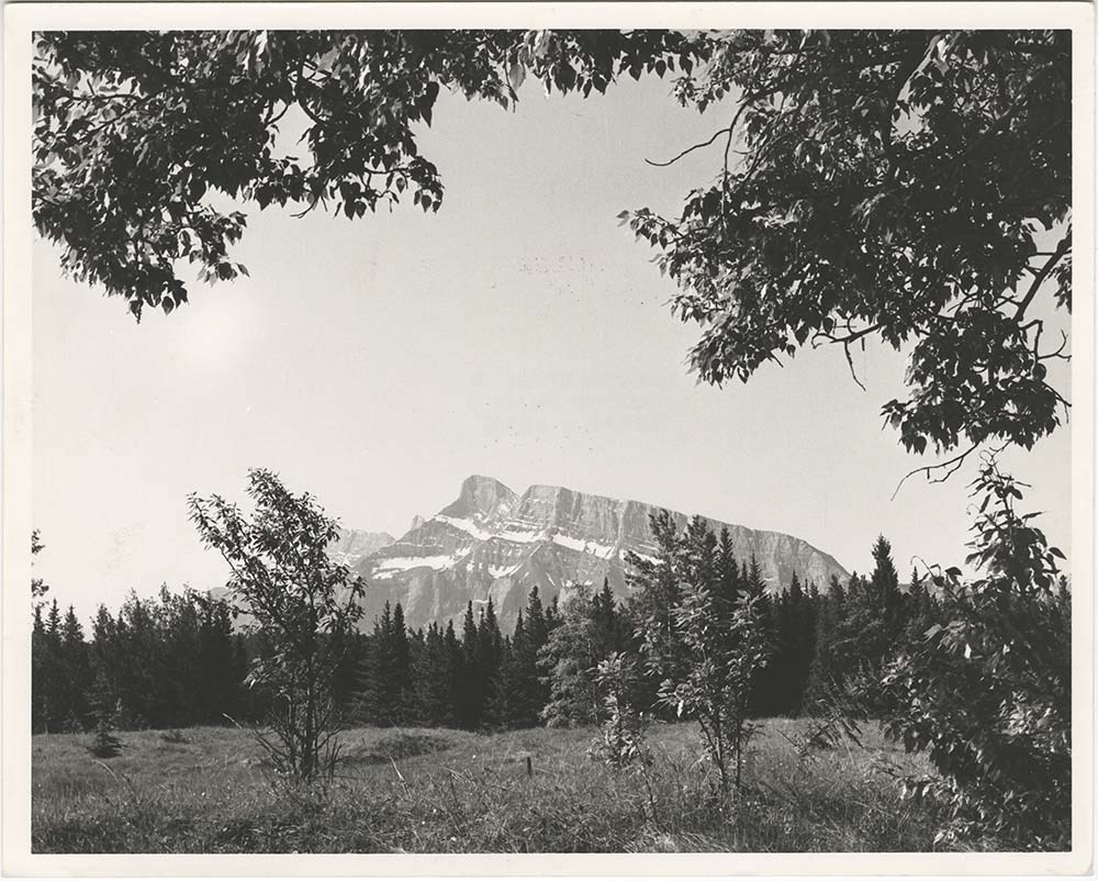
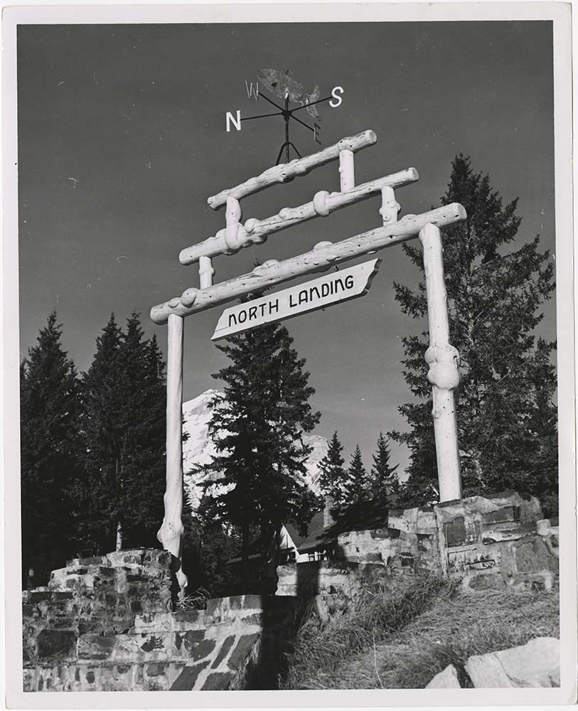
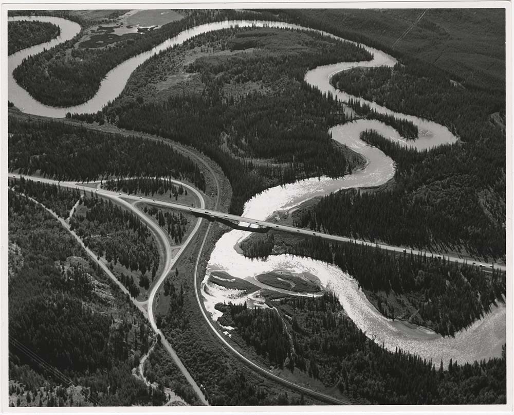
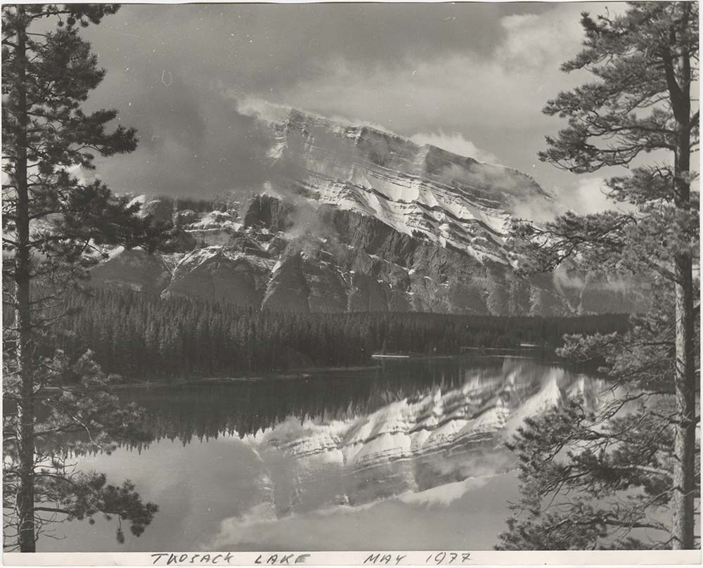
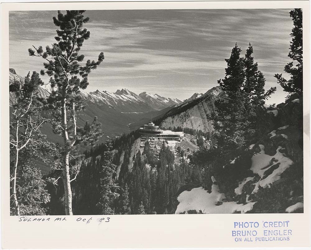
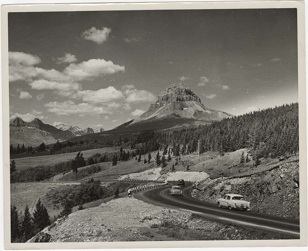
- Part Of
- Bruno Engler fonds
- Scope & Content
- File pertains to 40 b&w prints of various scenic views from throught the Canadian Rockies. Includes several mountains [including Rundle, Cascade, Mount Lougheed, Ha Ling, Sulphur ], lakes [including Two Jack, Vermillion, Bow, Peyto, and Waterton], and various other views like highways, rivers, hood…
- Date Range
- [ca. 1950-1988]
- Reference Code
- V190 / VI / S / i / PA - 01 to PA - 40
- Description Level
- 5 / File
- GMD
- Photograph
10 images
- Part Of
- Bruno Engler fonds
- Description Level
- 5 / File
- Fonds Number
- M323 / S40 / V190
- Series
- VI : Retained file, S : Alphabetical order
- Sous-Fonds
- V190
- Sub-Series
- i : Scenic Park
- Accession Number
- 7436
- Reference Code
- V190 / VI / S / i / PA - 01 to PA - 40
- GMD
- Photograph
- Date Range
- [ca. 1950-1988]
- Physical Description
- 40 photographs : b&w ; 25.2 x 20.2 cm or smaller
- History / Biographical
- See fonds level description
- Scope & Content
- File pertains to 40 b&w prints of various scenic views from throught the Canadian Rockies. Includes several mountains [including Rundle, Cascade, Mount Lougheed, Ha Ling, Sulphur ], lakes [including Two Jack, Vermillion, Bow, Peyto, and Waterton], and various other views like highways, rivers, hoodoos, tunnels, and valleys.
- Subject Access
- Automobiles
- Banff townsite
- Banff-Jasper Highway
- Bow River
- Bow Valley
- Cascade Mountain
- Cascades of Time Garden
- Fishing
- Glaciers
- Hoodoos
- Icefield Parkway
- Mountains
- North Saskatchewan River
- Rivers
- Roads
- Rundle Mountain
- scenic
- Sulphur Mountain
- Sulphur Mountain Gondola
- Trans-Canada Highway
- Two Jack Lake
- Geographic Access
- Banff
- Bow Lake
- Peyto Lake
- Banff National Park
- Jasper National Park
- Waterton
- Alberta
- Bugaboos
- British Columbia
- Language
- English
- Creator
- Engler, Bruno
- Title Source
- Original title kept
- Processing Status
- Processed
Images


This material is presented as originally created; it may contain outdated cultural descriptions and
potentially offensive content.
Read more.