Narrow Results By
- Part Of
- Luxton family fonds
- Scope & Content
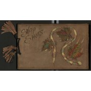
- File consists of Eleanor Luxton's personal album which contains 195 black and white prints pasted in, most spreads are captioned. Content pertains to family and school photographs, events and travels between 1921 and 1925, in addition to potentional childhood photographs as well. Locations include …
- Date Range
- 1921 - 1925
- Reference Code
- LUX / II / E / PD / 1
- Description Level
- 5 / File
- GMD
- Photograph
- Album
1 Electronic Resource
- Part Of
- Luxton family fonds
- Description Level
- 5 / File
- Fonds Number
- LUX
- Series
- LUX / II / E : Travel and home records
- Sous-Fonds
- LUX / II : Eleanor Luxton sous-fonds
- Accession Number
- LUX
- Reference Code
- LUX / II / E / PD / 1
- GMD
- Photograph
- Album
- Date Range
- 1921 - 1925
- Physical Description
- Photograph Album: 1 image from album (195 b&w prints)
- Scope & Content
- File consists of Eleanor Luxton's personal album which contains 195 black and white prints pasted in, most spreads are captioned. Content pertains to family and school photographs, events and travels between 1921 and 1925, in addition to potentional childhood photographs as well. Locations include Banff, Lake Louise, Yoho, Marble Canyon, Takakkaw Falls, Lake Minnewanka, Summit Lake, Victoria, Vancouver, Yoho Valley Bungalow Camp and Radium Hot Springs. Events include the opening of the Banff-Wintermere Highway at Kootenay Crossing in 1921, a dog derby on frozen Lake Minnewanka, Banff Indian Days, Banff Winter Carnival. Subjects include unidentified and identified people including Norman Luxton, Georgina Luxton, Enos Hunter, Ben Kaquitts, Hector Crawler, John Englishman, Mrs. Wood, Edmée, Mrs Mitt and Miss Maemillan. Album cover is leather with burned annotation "Snap Shots" with paint and cloth leaf detailing. The album i sbound by a cord with leather tassels.
- Notes
- File consists of several loose photographs. Some photographs are detaching from the paper.
- Name Access
- Luxton, Eleanor
- Luxton, Norman
- Luxton, Georgina
- Englishman, John
- Kaquitts, Tom
- Crawler, Hector
- Hunter, Enos
- Subject Access
- Chateau Lake Louise
- Banff Indian Days
- Banff Winter Carnival
- Banff
- Banff Gun Club
- Banff National Park
- Bighorn Sheep
- Cave and Basin
- Community events
- Dogs
- Family and personal life
- Indigenous Peoples
- Parades
- Takakkaw Falls
- Twin Falls Chalet
- Winter Carnival
- Yoho Valley Bungalow Camp
- Geographic Access
- Banff
- Banff National Park
- Alberta
- British Columbia
- Victoria
- Victoria Glacier
- Vancouver
- Butchart Gardens
- Lake Louise
- Lake Minnewanka
- Radium
- Yoho National Park
- Marble Canyon
- Language
- English
- Creator
- Luxton, Eleanor
- Title Source
- Title given by Archivist based on contents of album
- Processing Status
- Processed
Electronic Resources
This material is presented as originally created; it may contain outdated cultural descriptions and
potentially offensive content.
Read more.
Dolomite Peak July 30, 1998 - Sept. 6, 2004
https://archives.whyte.org/en/permalink/descriptions57788
- Part Of
- Alpine Club of Canada fonds
- Scope & Content
- File consists of a summit record from Dolomite Peak produced by the Alpine Club of Canada between 1998 and 2004. Summit record includes entries from visitors to the various summits which pertain to individuals' hiking and climbing trips; details of specific events which occurred while at the summit…
- Date Range
- 1998-2004
- Reference Code
- M200 / V / A / 205
- Description Level
- 5 / File
- GMD
- Textual record
- Organization record
- Part Of
- Alpine Club of Canada fonds
- Description Level
- 5 / File
- Fonds Number
- M200
- V14
- S6
- Series
- M200 / V: Summit Records
- Sous-Fonds
- M200
- Sub-Series
- M200 / V / A: Identified Summit Records
- Accession Number
- accn. 7779
- Reference Code
- M200 / V / A / 205
- Responsibility
- Summit Registers and Notes produced by Alpine Club of Canada
- Date Range
- 1998-2004
- Physical Description
- 1 volume 1 cm of textual record
- History / Biographical
- Dolomite Peak is located in the Bow Valley of Banff National Park, Alberta. It is near the Continental Divide/Great Divide, and is part of the Canadian Rockies. Nearby are Cirque Peak, Observation Peak, Peyto Lake, and Bow Lake.
- Scope & Content
- File consists of a summit record from Dolomite Peak produced by the Alpine Club of Canada between 1998 and 2004. Summit record includes entries from visitors to the various summits which pertain to individuals' hiking and climbing trips; details of specific events which occurred while at the summit, wildlife sightings, trail updates, and related topics. File: M200 / V / A / 205: Dolomite Peak July 30, 1998 - Sept. 6, 2004
- Name Access
- Alpine Club of Canada
- Subject Access
- Alberta
- Alpine Club of Canada
- Backpacking
- Banff
- Banff National Park
- Bow Valley
- British Columbia
- Climbing
- Club
- Description and travel
- Environment
- Environment and Nature
- Great Divide
- Hiking
- Mountain
- Mountaineering
- Mountaineers
- Mountains
- Record keeping
- Sports and leisure
- Sports and recreation
- Summit
- Trails
- Geographic Access
- Canada
- Canadian Rocky Mountains
- Rocky Mountains
- Continental Divide
- Great Divide
- Alberta
- British Columbia
- Banff National Park
- Bow Valley
- Peyto Lake
- Bow Lake
- Cirque Peak
- Observation Peak
- Dolomite Peak
- Access Restrictions
- Restrictions may apply
- Language
- English
- Related Material
- M235
- Title Source
- Original title
- Processing Status
- Processed
This material is presented as originally created; it may contain outdated cultural descriptions and
potentially offensive content.
Read more.
- Part Of
- Wing Family fonds
- Scope & Content
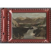
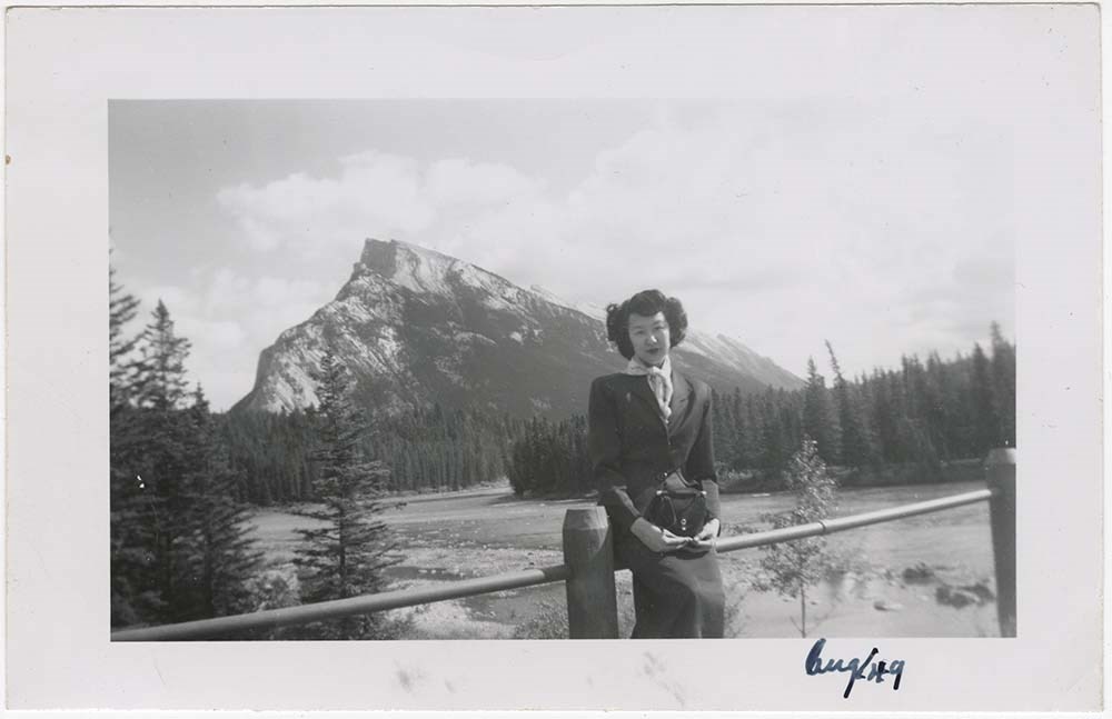
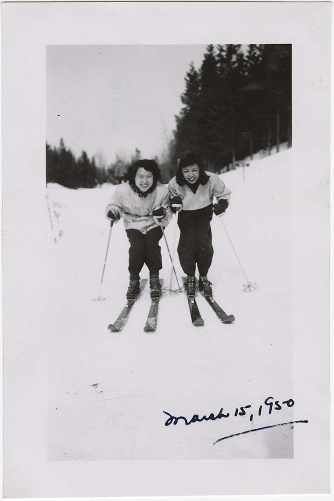
- File consists of 1 album with 226 b&w photographs and 9 colour photographs depicting everyday scenes of the Wing family around Banff. Includes photographs of the two eldest Wing children (Carole and Paul) as babies and young children. Album has 1 colour print of the Bow valley on front and is bound…
- Date Range
- 1949 - 1953
- Reference Code
- V781 / A / PD – 1
- Description Level
- 5 / File
- GMD
- Album
- Photograph
3 images
1 Electronic Resource
- Part Of
- Wing Family fonds
- Description Level
- 5 / File
- Fonds Number
- M558 / V781
- Series
- V781 / A: Wing Family: Photographs
- Sous-Fonds
- V781
- Accession Number
- 2015.8408
- Reference Code
- V781 / A / PD – 1
- GMD
- Album
- Photograph
- Date Range
- 1949 - 1953
- Physical Description
- Photograph Album : 1 photograph album (235 photographs; b&w and col.).
- Scope & Content
- File consists of 1 album with 226 b&w photographs and 9 colour photographs depicting everyday scenes of the Wing family around Banff. Includes photographs of the two eldest Wing children (Carole and Paul) as babies and young children. Album has 1 colour print of the Bow valley on front and is bound with black cord. Plastic lacing around edges of album is broken in some parts. Images mostly adhered with photo corners.
- Name Access
- Wing, Edith
- Wing, Carole
- Wing, Paul
- Wing, Fred
- Subject Access
- Activities
- Animals
- Asian
- Banff townsite
- Banff Winter Carnival
- Banff Winter Festival
- Bow Falls
- Bow River
- Bow Valley
- Buildings
- Businesses
- Cascades of Time Garden
- Castle Mountain
- Chateau Lake Louise
- Children
- Christmas
- Clothing and dress
- Columbia Icefield
- Dogs
- Dominion Cafe
- Family
- Family and personal life
- Glaciers
- Holidays
- Home
- Horses
- Horseback riding
- Lake Louise
- Marriage
- Personal and Family Life
- Personal and Professional Life
- Photography
- Picnics and picnicking
- Portrait
- Swimming
- Takakkaw Falls
- Winter Carnival
- Geographic Access
- Banff
- Lake Louise
- Banff National Park
- Vancouver
- Yoho National Park
- Alberta
- British Columbia
- Title Source
- Title based on contents of file.
- Processing Status
- Processed
Electronic Resources
Images

This material is presented as originally created; it may contain outdated cultural descriptions and
potentially offensive content.
Read more.
Mount Victoria Summit Record
https://archives.whyte.org/en/permalink/descriptions57688
- Part Of
- Alpine Club of Canada fonds
- Scope & Content
- File consists of one summit register from Mount Victoria produced by the Alpine Club of Canada between 1998 and 2004. Summit record include entries from visitors to the various summits which pertain to individuals' hiking and climbing trips; details of specific events which occurred while at the su…
- Date Range
- September 1998 - August 2004
- Reference Code
- M200 / V / A / 81
- Description Level
- 5 / File
- GMD
- Textual record
- Organization record
- Part Of
- Alpine Club of Canada fonds
- Description Level
- 5 / File
- Fonds Number
- M200
- V14
- S6
- Series
- M200 / V: Summit Records
- Sous-Fonds
- M200
- Sub-Series
- M200 / V / A: Identified Summit Records
- Accession Number
- accn. 8002
- Reference Code
- M200 / V / A / 81
- Responsibility
- Summit Registers and Notes produced by Alpine Club of Canada
- Date Range
- September 1998 - August 2004
- Physical Description
- 1 cm of textual records 1 volume
- History / Biographical
- Mount Victoria is located in both Yoho National Park, B. C. and Banff National Park, AB in the Canadian Rockies. The mountain is part of the mountain range along the Continental Divide, between Alberta and B.C. Nearby are Lake O'Hara, Lake Louise, Abbot Pass and Mount Lefroy. Mount Victoria was named for Queen Victoria.
- Scope & Content
- File consists of one summit register from Mount Victoria produced by the Alpine Club of Canada between 1998 and 2004. Summit record include entries from visitors to the various summits which pertain to individuals' hiking and climbing trips; details of specific events which occurred while at the summit, wildlife sightings, trail updates, and related topics. File: M200 / V / A / 81: Summit - MT. Victoria, Sept. 1998 - Aug. 2004
- Name Access
- Alpine Club of Canada
- Subject Access
- Alberta
- Abbot Pass
- Alpine Club of Canada
- Backcountry skiing
- Backpacking
- Banff National Park
- Bow Valley
- British Columbia
- Climbing
- Club
- Cross-country skiing
- Description and travel
- Environment
- Environment and Nature
- Hiking
- Lake Louise
- Lake O'hara
- Mountain
- Mountaineering
- Mountaineers
- Mountains
- Parks Canada
- Record keeping
- Ski area
- Ski areas
- Ski mountaineering
- Ski touring
- Skiers
- Skiing
- Snowshoes and snowshoeing
- Sports and leisure
- Sports and recreation
- Summit
- Trails
- Winter sports
- Geographic Access
- Canada
- Alberta
- British Columbia
- Banff National Park
- Yoho National Park
- Lake O'Hara
- Lake Louise
- Lake Louise, AB
- Abbot Pass
- Abbott Pass
- Mount Lefroy
- Mount Victoria
- Access Restrictions
- Restrictions may apply
- Language
- English
- French
- German
- Japanese
- Related Material
- M235
- Biographical Source Notes
- Peak Finder: Mount Victoria, Canadian Rockies Database: https://cdnrockiesdatabases.ca/peaks/1459
- Title Source
- Title based on contents of file
- Processing Status
- Processed
This material is presented as originally created; it may contain outdated cultural descriptions and
potentially offensive content.
Read more.
Mt. Assiniboine Summit Records
https://archives.whyte.org/en/permalink/descriptions57697
- Part Of
- Alpine Club of Canada fonds
- Scope & Content
- Files consist of summit notes and summit registers from Mount Assiniboine produced by the Alpine Club of Canada between 1977 and 1998. Summit records include entries from visitors to the various summits which pertain to individuals' hiking and climbing trips; details of specific events which occurr…
- Date Range
- 1977-1998
- Reference Code
- M200 / V / A / 107 to 108
- Description Level
- 5 / File
- GMD
- Textual record
- Organization record
- Part Of
- Alpine Club of Canada fonds
- Description Level
- 5 / File
- Fonds Number
- M200
- V14
- S6
- Series
- M200 / V: Summit Records
- Sous-Fonds
- M200
- Sub-Series
- M200 / V / A: Identified Summit Records
- Accession Number
- accn. 5396
- accn. 7779
- Reference Code
- M200 / V / A / 107 to 108
- Responsibility
- Summit Registers and Notes produced by Alpine Club of Canada
- Date Range
- 1977-1998
- Physical Description
- 2 volumes 2 cm of textual records
- History / Biographical
- Mount Assiniboine is located along the Continental Divide, in the Rocky Mountains, in British Columbia. It was named in 1885, and it sits on the border of Mount Assiniboine Provincial Park, B. C. and Banff National Park, AB. In 1925, Lawrence Grassi became the first person to make a solo attempt of the mountain. Mount Assiniboine was first climbed in 1901 by James Outram, Christian Bohren and Christian Hasler.
- Scope & Content
- Files consist of summit notes and summit registers from Mount Assiniboine produced by the Alpine Club of Canada between 1977 and 1998. Summit records include entries from visitors to the various summits which pertain to individuals' hiking and climbing trips; details of specific events which occurred while at the summit, wildlife sightings, trail updates, and related topics. Files include: M200 / V / A / 107: [Mt. Assiniboine log book 1977-1987] M200 / V / A / 108: [Mt. Assiniboine Aug. 1978 - Aug. 1998]
- Notes
- File M200 / V / A / 108: [Mt. Assiniboine Aug. 1978 - Aug. 1998] contains a piece of engraved metal.
- Name Access
- Alpine Club of Canada
- Subject Access
- Alpine Club of Canada
- Backcountry skiing
- Backpacking
- Alberta
- Banff National Park
- Banff
- Bow Valley
- British Columbia
- Climbing
- Club
- Cross-country skiing
- Description and travel
- Environment
- Environment and Nature
- Hiking
- Mount Assiniboine
- Mountain
- Mountaineering
- Mountaineers
- Mountains
- National parks and reserves
- Parks Canada
- Parks
- Provincial parks and reserves
- Record keeping
- Ski area
- Ski areas
- Ski mountaineering
- Skiing
- Skis
- Sports and leisure
- Sports and recreation
- Summit
- Trails
- Winter sports
- Geographic Access
- Canada
- Canadian Rocky Mountains
- Rocky Mountains
- Continental Divide
- Alberta
- British Columbia
- Banff National Park
- Assiniboine Provincial Park
- Mount Assiniboine Park
- Bow Valley
- Mount Assiniboine
- Access Restrictions
- Restrictions may apply
- Reproduction Restrictions
- Contains personal information
- Language
- English
- Conservation
- Some materials have been placed in mylar. Some materials have water damage. File M200 / V / A / 108: [Mt. Assiniboine Aug. 1978 - Aug. 1998] contains a piece of engraved metal that has been placed in a conservation bag within the file.
- Related Material
- M235
- Biographical Source Notes
- Peak Finder: Mount Assiniboine, Canadian Rockies Database: https://cdnrockiesdatabases.ca/peaks/57#undefined1
- Title Source
- Title based on contents of file
- Processing Status
- Processed
This material is presented as originally created; it may contain outdated cultural descriptions and
potentially offensive content.
Read more.
- Part Of
- Alpine Club of Canada fonds
- Scope & Content
- File consists of a summit record from Mount Baker produced by the Alpine Club of Canada around 1988. Summit record includes entries from visitors to the various summits which pertain to individuals' hiking and climbing trips; details of specific events which occurred while at the summit, wildlife s…
- Date Range
- ca. 1988
- Reference Code
- M200 / V / A / 120
- Description Level
- 5 / File
- GMD
- Textual record
- Organization record
- Part Of
- Alpine Club of Canada fonds
- Description Level
- 5 / File
- Fonds Number
- M200
- V14
- S6
- Series
- M200 / V: Summit Records
- Sous-Fonds
- M200
- Sub-Series
- M200 / V / A: Identified Summit Records
- Accession Number
- accn. 2023.10
- Reference Code
- M200 / V / A / 120
- Responsibility
- Summit Registers and Notes produced by Alpine Club of Canada
- Date Range
- ca. 1988
- Physical Description
- 1 volume 1 cm of textual record
- History / Biographical
- Mount Baker is located on the Continental Divide of Alberta and British Columbia. It is part of the Waputik Mountains of the Canadian Rockies. Nearby are Yoho Provincial Park, Banff National Park, Mount Freshfield, Mount Forbes, Lake Louise, AB, and Field, B.C.
- Scope & Content
- File consists of a summit record from Mount Baker produced by the Alpine Club of Canada around 1988. Summit record includes entries from visitors to the various summits which pertain to individuals' hiking and climbing trips; details of specific events which occurred while at the summit, wildlife sightings, trail updates, and related topics. File: M200 / V / A / 120: Mt. Baker
- Name Access
- Alpine Club of Canada
- Subject Access
- Alberta
- Alpine Club of Canada
- Backcountry skiing
- Backpacking
- Banff
- Banff National Park
- Bow Valley
- British Columbia
- Climbing
- Club
- Cross-country skiing
- Description and travel
- Environment
- Environment and Nature
- Hiking
- Mountain
- Mountaineering
- Mountaineers
- Mountains
- National parks and reserves
- Record keeping
- Ski area
- Ski areas
- Ski mountaineering
- Skiers
- Skiing
- Skis
- Sports and leisure
- Sports and recreation
- Summit
- Trails
- Winter sports
- Geographic Access
- Canada
- Canadian Rocky Mountains
- Rocky Mountains
- Continental Divide
- Alberta
- British Columbia
- Banff National Park
- Yoho National Park
- Mount Freshfield
- Mount Forbes
- Lake Louise
- Lake Louise, AB
- Mount Baker
- Access Restrictions
- Restrictions may apply
- Language
- English
- Conservation
- Register placed in mylar due to evidence of mold. Evidence of water damage.
- Related Material
- M235
- Title Source
- Original title used
- Processing Status
- Processed
This material is presented as originally created; it may contain outdated cultural descriptions and
potentially offensive content.
Read more.
Mt. McPhail Summit Register
https://archives.whyte.org/en/permalink/descriptions57711
- Part Of
- Alpine Club of Canada fonds
- Scope & Content
- File consists of a summit record from Mount McPhail produced by the Alpine Club of Canada around 1994. Summit record includes entries from visitors to the various summits which pertain to individuals' hiking and climbing trips; details of specific events which occurred while at the summit, wildlife…
- Date Range
- ca. 1994
- Reference Code
- M200 / V / A / 121
- Description Level
- 5 / File
- GMD
- Textual record
- Organization record
- Part Of
- Alpine Club of Canada fonds
- Description Level
- 5 / File
- Fonds Number
- M200
- V14
- S6
- Series
- M200 / V: Summit Records
- Sous-Fonds
- M200
- Sub-Series
- M200 / V / A: Identified Summit Records
- Accession Number
- accn. 2014.8293
- Reference Code
- M200 / V / A / 121
- Responsibility
- Summit Registers and Notes produced by Alpine Club of Canada
- Date Range
- ca. 1994
- Physical Description
- 1 volume 1 cm of textual record
- History / Biographical
- Mount McPhail is located in the Elk Range of the Park Ranges of the Canadian Rockies and is along the Continental Divide, between the Alberta and British Columbia border. It is within the Kananaskis Country Provincial Park boundary, Mount McPhail is also known as "The Pyramid" for its shape. The mountain was named for Corporal Norman RR. McPhail, a member of the Surveyor General staff, who fought and was killed in action in WWI.
- Scope & Content
- File consists of a summit record from Mount McPhail produced by the Alpine Club of Canada around 1994. Summit record includes entries from visitors to the various summits which pertain to individuals' hiking and climbing trips; details of specific events which occurred while at the summit, wildlife sightings, trail updates, and related topics. File: M200 / V / A / 121: Mt. McPhail Summit Register
- Name Access
- Alpine Club of Canada
- Subject Access
- Alberta
- Alpine Club of Canada
- Backcountry skiing
- Backpacking
- Banff
- Banff National Park
- Bow Valley
- British Columbia
- Climbing
- Club
- Cross-country skiing
- Description and travel
- Environment
- Environment and Nature
- Hiking
- Kananaskis Country
- Mountain
- Mountaineering
- Mountaineers
- Mountains
- National parks and reserves
- Provincial parks and reserves
- Record keeping
- Ski area
- Ski areas
- Ski mountaineering
- Skiing
- Skiers
- Sports and leisure
- Sports and recreation
- Summit
- Winter sports
- Geographic Access
- Canada
- Canadian Rocky Mountains
- Alberta
- British Columbia
- Banff National Park
- Yoho National Park
- Continental Divide
- Elk Range Mountains
- Mount McPhail
- Access Restrictions
- Restrictions may apply
- Language
- English
- Conservation
- Register contains black mold, water damage. Register is placed in mylar.
- Related Material
- M235
- Biographical Source Notes
- Peak Finder: Mount McPhail, Canadian Rockies Database: https://cdnrockiesdatabases.ca/peaks/889
- Title Source
- Original title used
- Processing Status
- Processed
This material is presented as originally created; it may contain outdated cultural descriptions and
potentially offensive content.
Read more.
Mt. Rhondda Summit Records
https://archives.whyte.org/en/permalink/descriptions57783
- Part Of
- Alpine Club of Canada fonds
- Scope & Content
- Files consist of summit notes and summit registers from Mount Rhondda produced by the Alpine Club of Canada between 1988 and 1998. Summit records include entries from visitors to the various summits which pertain to individuals' hiking and climbing trips; details of specific events which occurred w…
- Date Range
- 1988-1998
- Reference Code
- M200 / V / A / 197 to 198
- Description Level
- 5 / File
- GMD
- Textual record
- Organization record
- Part Of
- Alpine Club of Canada fonds
- Description Level
- 5 / File
- Fonds Number
- M200
- V14
- S6
- Series
- M200 / V: Summit Records
- Sous-Fonds
- M200
- Sub-Series
- M200 / V / A: Identified Summit Records
- Accession Number
- accn. 6396
- accn. 7779
- Reference Code
- M200 / V / A / 197 to 198
- Responsibility
- Summit Registers and Notes produced by Alpine Club of Canada
- Date Range
- 1988-1998
- Physical Description
- 2 volumes 2 cm of textual records
- History / Biographical
- Mount Rhondda is located along the Continental Divide/Great Divide, along the Canadian Rockies. It is in the centre of the Wapta Icefield. It also lies along the border of Banff National Park, Alberta and Yoho National Park, British Columbia.
- Scope & Content
- Files consist of summit notes and summit registers from Mount Rhondda produced by the Alpine Club of Canada between 1988 and 1998. Summit records include entries from visitors to the various summits which pertain to individuals' hiking and climbing trips; details of specific events which occurred while at the summit, wildlife sightings, trail updates, and related topics. Files include: M200 / V / A / 197: [Mt. Rhondda South register, 1988-1991] M200 / V / A / 198: [Mt. Rhondda summit register March 11, 1988 - July 6, 1998]
- Name Access
- Alpine Club of Canada
- Subject Access
- Alberta
- Alpine Club of Canada
- Banff
- Banff National Park
- Bow Valley
- British Columbia
- Climbing
- Club
- Description and travel
- Environment
- Environment and Nature
- Great Divide
- Hiking
- Mountain
- Mountaineering
- Mountaineers
- Mountains
- National parks and reserves
- Record keeping
- Sports and leisure
- Sports and recreation
- Summit
- Trails
- Geographic Access
- Canada
- Canadian Rocky Mountains
- Rocky Mountains
- Great Divide
- Continental Divide
- Alberta
- British Columbia
- Banff National Park
- Yoho National Park
- Wapta Icefield
- Mont des Pollus
- Arete Peak
- Mount Gordon
- Mount Rhondda
- Access Restrictions
- Restrictions may apply
- Reproduction Restrictions
- Both registers contain black mold
- Language
- English
- Conservation
- Both registers have been placed in mylar due to black mold.
- Related Material
- M235
- Biographical Source Notes
- Peak Finder: Mount Rhondda, Canadian Rockies Database: https://cdnrockiesdatabases.ca/peaks/1164
- Title Source
- Title based on contents of file
- Processing Status
- Processed
This material is presented as originally created; it may contain outdated cultural descriptions and
potentially offensive content.
Read more.
Mt. Tyrwhitt summit register Nov. 7, 1987 - July 31, 1996
https://archives.whyte.org/en/permalink/descriptions57787
- Part Of
- Alpine Club of Canada fonds
- Scope & Content
- File consists of a summit record from Mount Tyrwhitt produced by the Alpine Club of Canada between 1987 and 1996. Summit record includes entries from visitors to the various summits which pertain to individuals' hiking and climbing trips; details of specific events which occurred while at the summi…
- Date Range
- 1987-2001
- Reference Code
- M200 / V / A / 215 to 216
- Description Level
- 5 / File
- GMD
- Textual record
- Organization record
- Part Of
- Alpine Club of Canada fonds
- Description Level
- 5 / File
- Fonds Number
- M200
- V14
- S6
- Series
- M200 / V: Summit Records
- Sous-Fonds
- M200
- Sub-Series
- M200 / V / A: Identified Summit Records
- Accession Number
- accn. 2023.10
- Reference Code
- M200 / V / A / 215 to 216
- Responsibility
- Summit Registers and Notes produced by Alpine Club of Canada
- Date Range
- 1987-2001
- Physical Description
- 2 volumes 2 cm of textual record
- History / Biographical
- Mount Tyrwhitt is located in Kananaskis, and is on the Continental Divide/Great Divide, along the Canadian Rockies. Nearby are Mount Joffre, Peter Lougheed Provincial Park and Mount Pocaterra.
- Scope & Content
- File consists of a summit record from Mount Tyrwhitt produced by the Alpine Club of Canada between 1987 and 1996. Summit record includes entries from visitors to the various summits which pertain to individuals' hiking and climbing trips; details of specific events which occurred while at the summit, wildlife sightings, trail updates, and related topics. File: M200 / V / A / 215: Mt. Tyrwhitt summit register Nov. 7, 1987 - July 31, 1996 M200 / V / A / 216: Mt. Tyrwhitt [1996-2001]
- Name Access
- Alpine Club of Canada
- Subject Access
- Alberta
- Alpine Club of Canada
- Backpacking
- Backcountry skiing
- Bow Valley
- British Columbia
- Climbing
- Club
- Description and travel
- Environment
- Environment and Nature
- Great Divide
- Hiking
- Kananaskis Country
- Mountain
- Mountaineering
- Mountaineers
- Mountains
- Provincial parks and reserves
- Record keeping
- Ski mountaineering
- Sports and leisure
- Sports and recreation
- Summit
- Trails
- Geographic Access
- Canada
- Canadian Rocky Mountains
- Rocky Mountains
- Continental Divide
- Great Divide
- Alberta
- British Columbia
- Elk Range
- Kananaskis
- Kananaskis Country
- Peter Lougheed Provincial Park
- Mount Joffre
- Mount Pocaterra
- Mount Tyrwhitt
- Mt. Tyrwhitt
- Access Restrictions
- Restrictions may apply
- Language
- English
- Conservation
- Spiral metal binding on register is rusting. Register contains water damage, resulting in some pages being stuck together and some entries are difficult to read due to ink bleeding on M200 / V / A / 215. M200 / V / A / 216 may have some water damage, but is in mostly fair condition.
- Related Material
- M235
- Biographical Source Notes
- Peak Finder: Mount Tyrwhitt, Canadian Rockies Database: https://cdnrockiesdatabases.ca/peaks/1440
- Title Source
- Original title
- Processing Status
- Processed
This material is presented as originally created; it may contain outdated cultural descriptions and
potentially offensive content.
Read more.
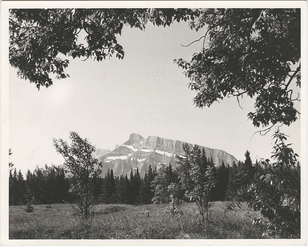
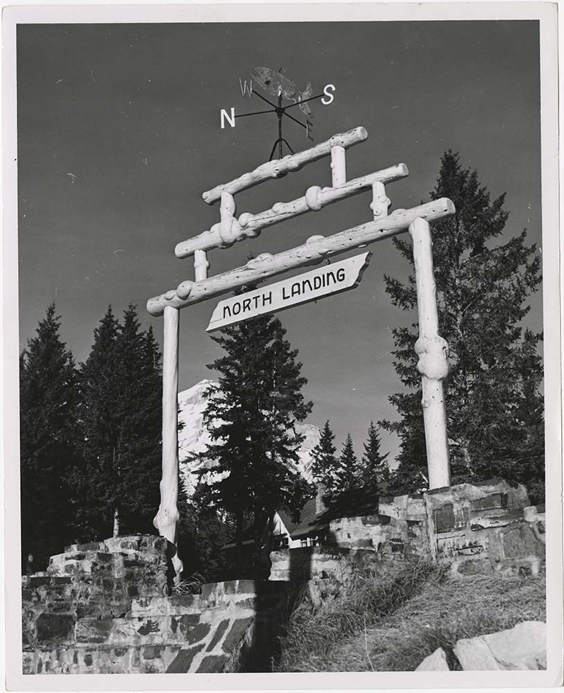
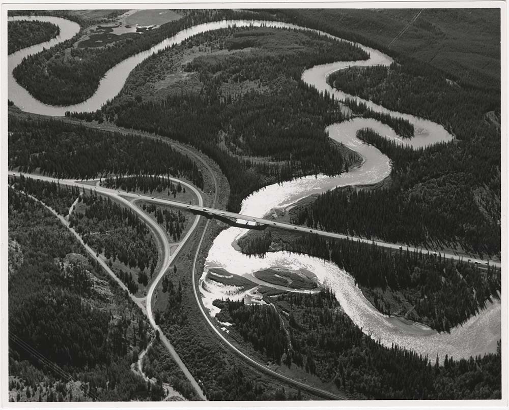
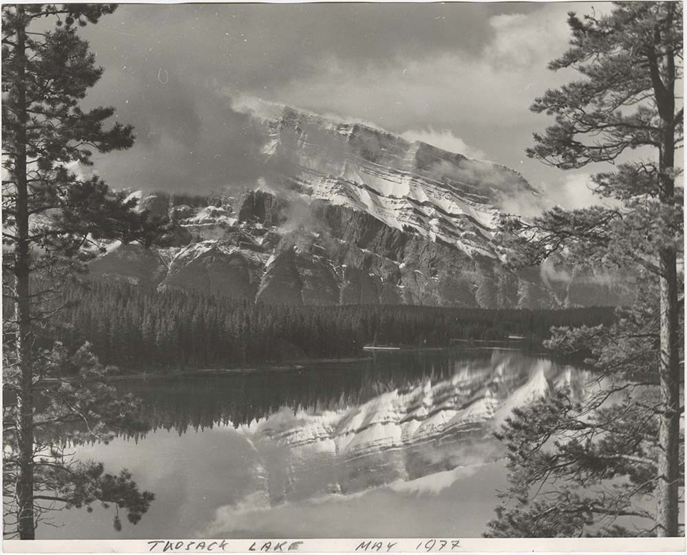
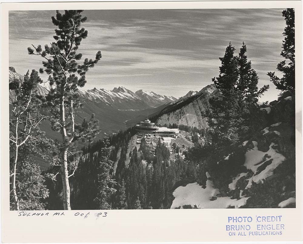
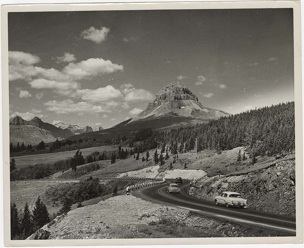
- Part Of
- Bruno Engler fonds
- Scope & Content
- File pertains to 40 b&w prints of various scenic views from throught the Canadian Rockies. Includes several mountains [including Rundle, Cascade, Mount Lougheed, Ha Ling, Sulphur ], lakes [including Two Jack, Vermillion, Bow, Peyto, and Waterton], and various other views like highways, rivers, hood…
- Date Range
- [ca. 1950-1988]
- Reference Code
- V190 / VI / S / i / PA - 01 to PA - 40
- Description Level
- 5 / File
- GMD
- Photograph
10 images
- Part Of
- Bruno Engler fonds
- Description Level
- 5 / File
- Fonds Number
- M323 / S40 / V190
- Series
- VI : Retained file, S : Alphabetical order
- Sous-Fonds
- V190
- Sub-Series
- i : Scenic Park
- Accession Number
- 7436
- Reference Code
- V190 / VI / S / i / PA - 01 to PA - 40
- GMD
- Photograph
- Date Range
- [ca. 1950-1988]
- Physical Description
- 40 photographs : b&w ; 25.2 x 20.2 cm or smaller
- History / Biographical
- See fonds level description
- Scope & Content
- File pertains to 40 b&w prints of various scenic views from throught the Canadian Rockies. Includes several mountains [including Rundle, Cascade, Mount Lougheed, Ha Ling, Sulphur ], lakes [including Two Jack, Vermillion, Bow, Peyto, and Waterton], and various other views like highways, rivers, hoodoos, tunnels, and valleys.
- Subject Access
- Automobiles
- Banff townsite
- Banff-Jasper Highway
- Bow River
- Bow Valley
- Cascade Mountain
- Cascades of Time Garden
- Fishing
- Glaciers
- Hoodoos
- Icefield Parkway
- Mountains
- North Saskatchewan River
- Rivers
- Roads
- Rundle Mountain
- scenic
- Sulphur Mountain
- Sulphur Mountain Gondola
- Trans-Canada Highway
- Two Jack Lake
- Geographic Access
- Banff
- Bow Lake
- Peyto Lake
- Banff National Park
- Jasper National Park
- Waterton
- Alberta
- Bugaboos
- British Columbia
- Language
- English
- Creator
- Engler, Bruno
- Title Source
- Original title kept
- Processing Status
- Processed
Images


This material is presented as originally created; it may contain outdated cultural descriptions and
potentially offensive content.
Read more.