Narrow Results By
Avalanche Control [1/2]
https://archives.whyte.org/en/permalink/descriptions56748
- Part Of
- Bruno Engler fonds
- Scope & Content
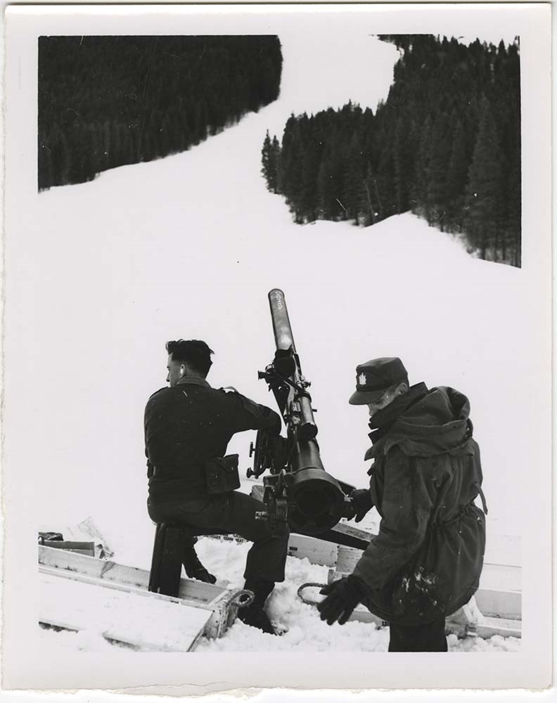
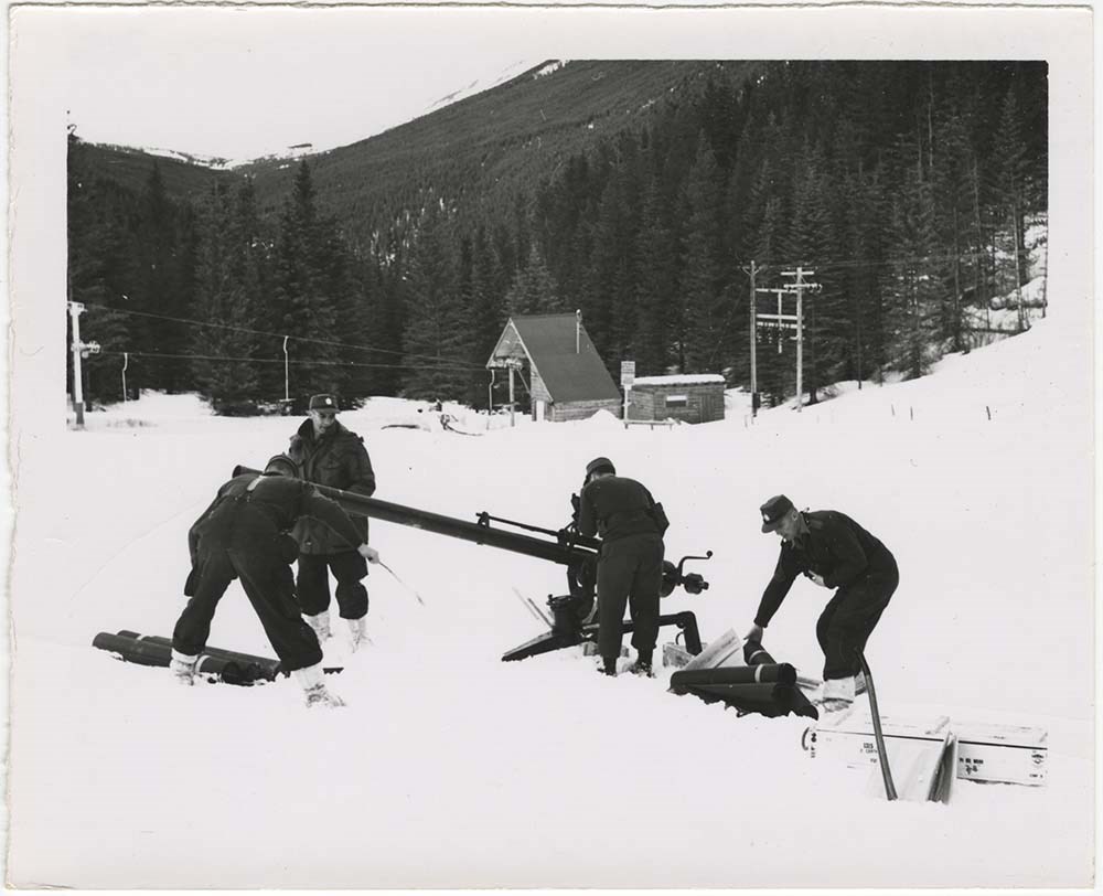
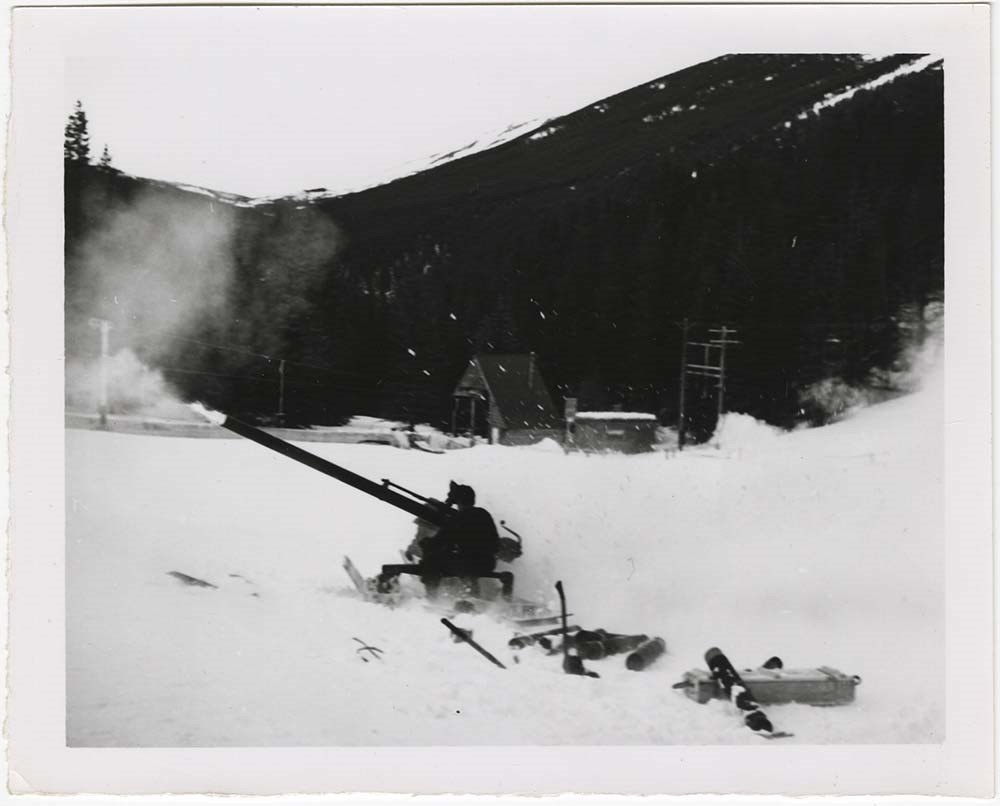
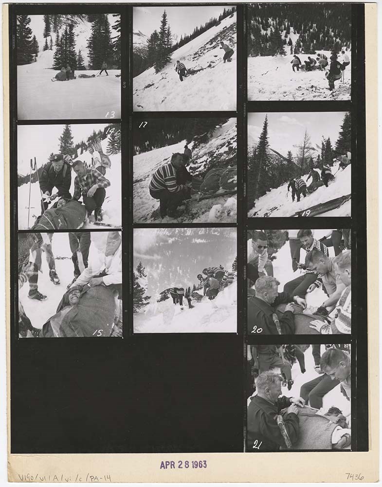
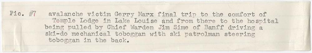
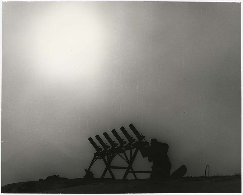
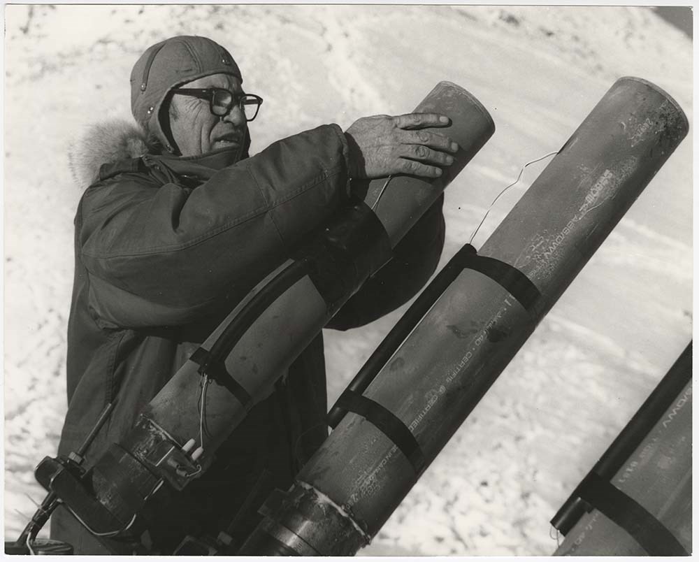
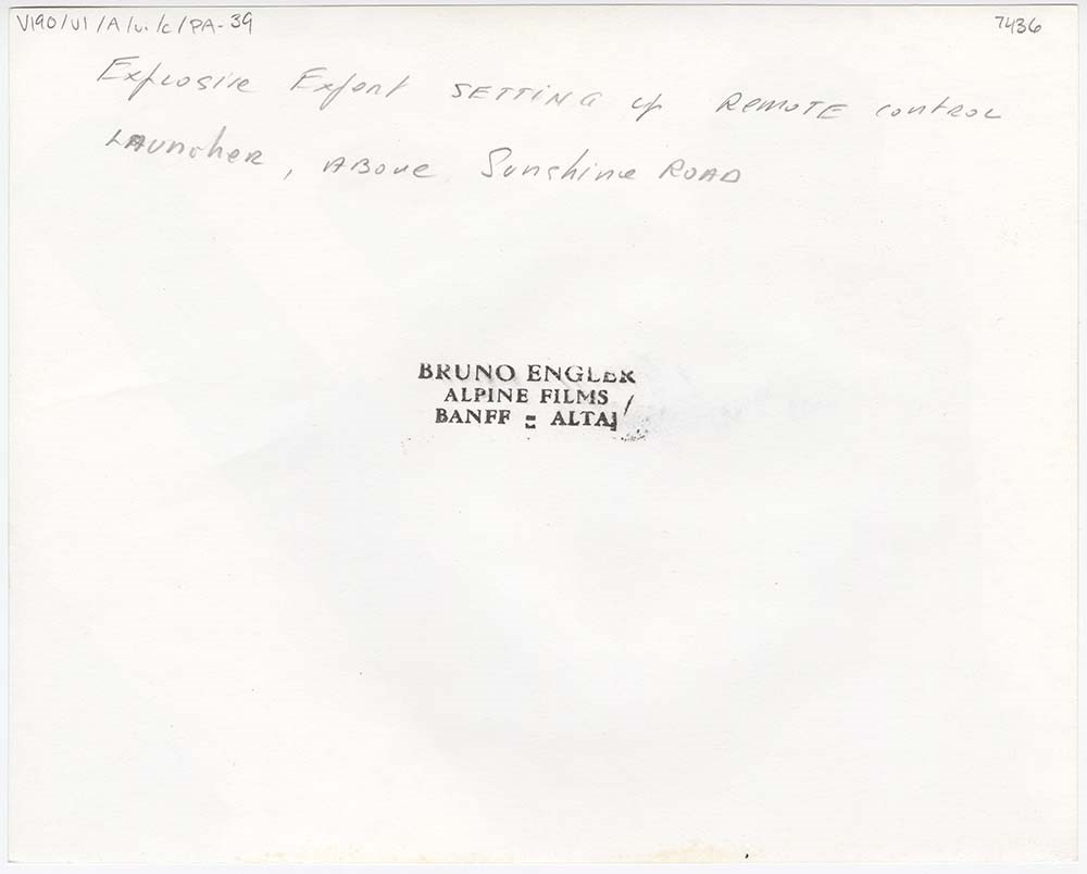
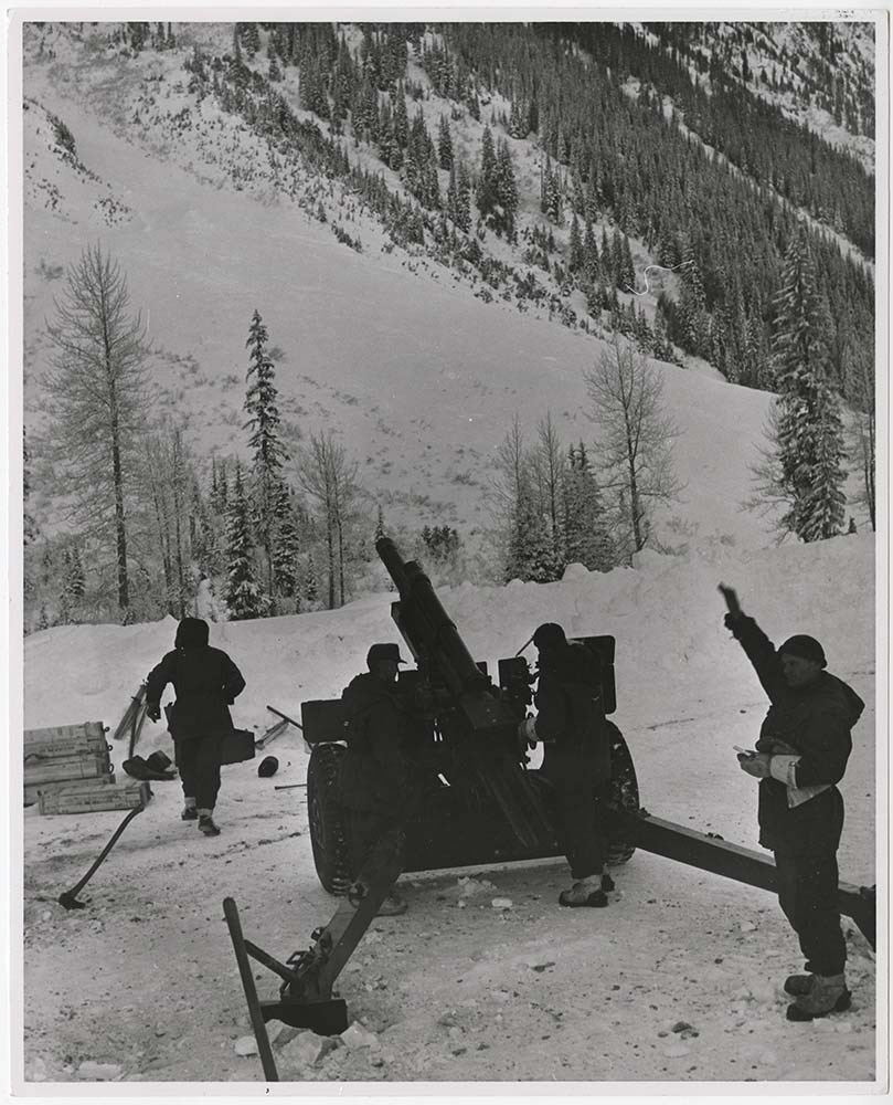
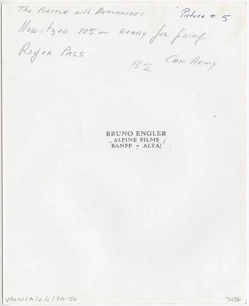
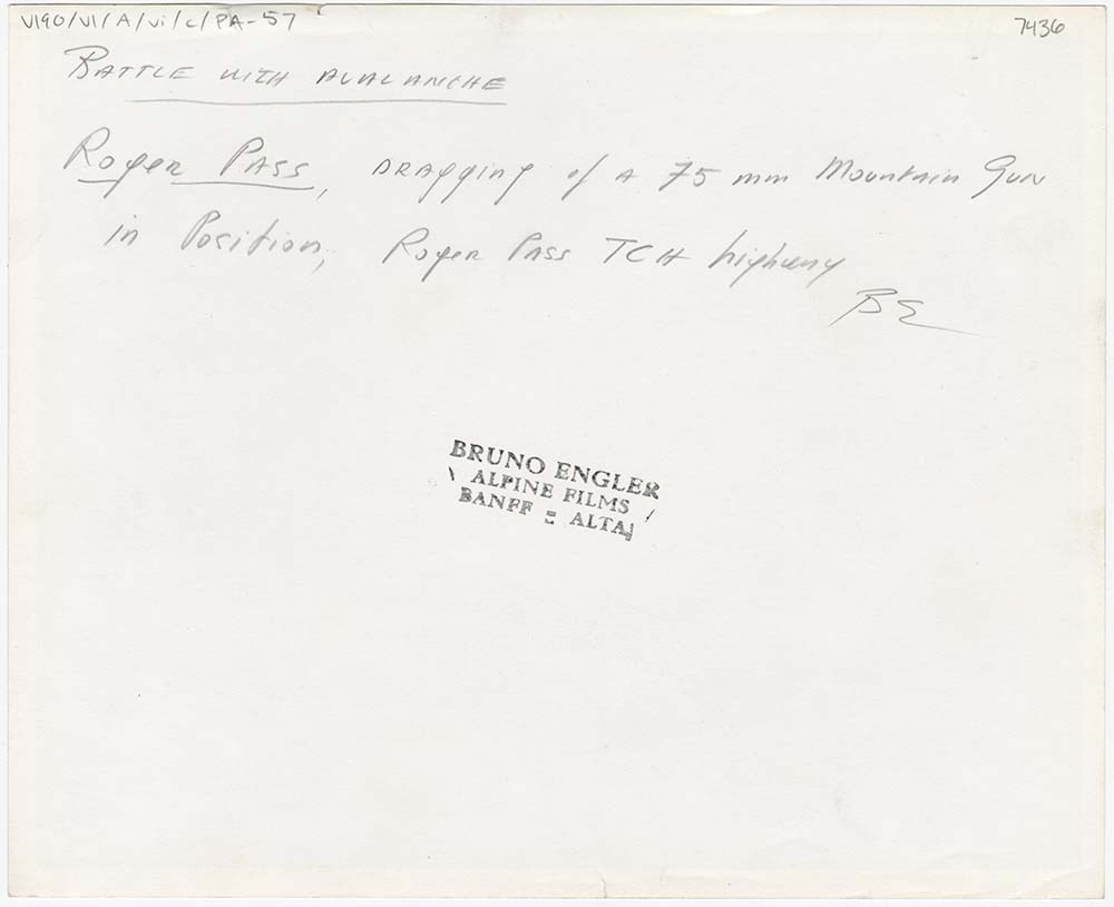
- File pertains to 62 b&w prints of various avalanche control operations around Banff National Park, usually along highways and around ski hills. Also includes photographs from a rescue operation and accompanying news clippings pertaining to that rescue.
- Date Range
- 1956-1979
- Reference Code
- V190 / VI / A / vi / c / PA - 01 to PA - 62
- Description Level
- 5 / File
- GMD
- Photograph
17 images
- Part Of
- Bruno Engler fonds
- Description Level
- 5 / File
- Fonds Number
- M323 / S40 / V190
- Series
- VI : Retained file, A : Alphabetical order
- Sous-Fonds
- V190
- Sub-Series
- vi : Avalanches, c : Control
- Accession Number
- 7436
- Reference Code
- V190 / VI / A / vi / c / PA - 01 to PA - 62
- GMD
- Photograph
- Date Range
- 1956-1979
- Physical Description
- 62 photographs : b&w ; 20.3 x 25.4 cm or smaller
- History / Biographical
- See fonds level description
- Scope & Content
- File pertains to 62 b&w prints of various avalanche control operations around Banff National Park, usually along highways and around ski hills. Also includes photographs from a rescue operation and accompanying news clippings pertaining to that rescue.
- Notes
- Photographs included in this entry were originally housed in a photo paper box identified by Bruno Engler prior to accessioning.
- Subject Access
- Aerial photography
- Avalanches
- Banff-Jasper Highway
- Lake Louise Ski Area
- Mountains
- Rescue
- Rogers Pass
- Ski areas
- Sunshine Ski Resort
- Winter
- Geographic Access
- Banff National Park
- Jasper National Park
- Alberta
- Language
- English
- Conservation
- PA - 25 has two overlapping pieces of masking tape on the back, holding the two torn pieces of the print together
- Creator
- Engler, Bruno
- Title Source
- Original title kept
- Processing Status
- Processed
Images


This material is presented as originally created; it may contain outdated cultural descriptions and
potentially offensive content.
Read more.
Avalanche Control [2/2]
https://archives.whyte.org/en/permalink/descriptions57495
- Part Of
- Bruno Engler fonds
- Scope & Content
- File pertains to 6 boards with b&w negative contact sheets adhered to them depicting various areas prone to avalanches taken from a plane or helicopter. Includes views of ski areas and roads.
- Date Range
- 1956-1979
- Reference Code
- V190 / VI / A / vi / c / PA - 63 to PA - 68
- Description Level
- 5 / File
- GMD
- Photograph
- Part Of
- Bruno Engler fonds
- Description Level
- 5 / File
- Fonds Number
- M323 / S40 / V190
- Series
- VI : Retained file, A : Alphabetical order
- Sous-Fonds
- V190
- Sub-Series
- vi : Avalanches, c : Control
- Accession Number
- 7436
- Reference Code
- V190 / VI / A / vi / c / PA - 63 to PA - 68
- GMD
- Photograph
- Date Range
- 1956-1979
- Physical Description
- 6 photographs : b&w ; 23.4 x 34.2 cm or smaller
- History / Biographical
- See fonds level description
- Scope & Content
- File pertains to 6 boards with b&w negative contact sheets adhered to them depicting various areas prone to avalanches taken from a plane or helicopter. Includes views of ski areas and roads.
- Notes
- File came from box XVI, separate from alphabetised boxes
- Subject Access
- Aerial photography
- Avalanches
- Banff-Jasper Highway
- Lake Louise Ski Area
- Mountains
- Rescue
- Rogers Pass
- Ski areas
- Sunshine Ski Resort
- Winter
- Geographic Access
- Banff National Park
- Jasper National Park
- Alberta
- Language
- English
- Creator
- Engler, Bruno
- Title Source
- Original title kept
- Processing Status
- Processed
This material is presented as originally created; it may contain outdated cultural descriptions and
potentially offensive content.
Read more.
- Part Of
- Murray Hay fonds
- Scope & Content
- File consists of 2 prints : col. ; 35 x 28 cm. File pertains to Murray Hay's rendering of Marmot Basin ski area in Jasper National Park. File includes two iterations of reproduction draft prints of Hay's map of Marmot Basin.
- Date Range
- ca.1976-ca.2000
- Reference Code
- V795 / II / B / i / 1
- Description Level
- 5 / File
- GMD
- Map
- Private record
- Part Of
- Murray Hay fonds
- Description Level
- 5 / File
- Fonds Number
- M570 / V795
- Series
- V795 / II : Unpublished Material
- Sous-Fonds
- V795
- Sub-Series
- V795 / II / B : Alberta / i : Jasper National Park
- Accession Number
- 2019.41
- Reference Code
- V795 / II / B / i / 1
- GMD
- Map
- Private record
- Date Range
- ca.1976-ca.2000
- Physical Description
- 2 prints : col. ; 35 x 28 cm
- Scope & Content
- File consists of 2 prints : col. ; 35 x 28 cm. File pertains to Murray Hay's rendering of Marmot Basin ski area in Jasper National Park. File includes two iterations of reproduction draft prints of Hay's map of Marmot Basin.
- Name Access
- Hay, Murray
- Subject Access
- Advertising
- Artist
- Ski Maps
- Ski area
- Map
- Cartography
- Sports and recreation
- Tourism
- Tourist information
- Winter
- Winter sports
- Geographic Access
- Jasper Marmot Basin
- Jasper National Park
- Alberta
- Canada
- Canadian Rocky Mountains
- Language
- English
- Related Material
- M570 / III / B / iii / 1
- Creator
- Hay, Murray
- Title Source
- Title based on contents of file
- Processing Status
- Processed
This material is presented as originally created; it may contain outdated cultural descriptions and
potentially offensive content.
Read more.