Fonds consists of materials personally collected by Margaret Gmoser. Fonds includes photographs and textual records pertaining to Hans Gmoser, Robson Gmoser, and traverse trip with Chic Scott. Fonds also includes an original letter from Orville Wright regarding early helicopters.
4 cm textual records -- ca. 42 photographs -- 1 oversized poster
Scope & Content
Fonds consists of materials personally collected by Margaret Gmoser. Fonds includes photographs and textual records pertaining to Hans Gmoser, Robson Gmoser, and traverse trip with Chic Scott. Fonds also includes an original letter from Orville Wright regarding early helicopters.
File consists of photographs pertaining to Hans Gmoser skiing with friends. Most photographs are from a 1964 ski trip between Toby Creek and the Bugaboos mountain range in British Columbia.
24 photographs : b&w and col. prints; 25 x 20 cm or smaller
Scope & Content
File consists of photographs pertaining to Hans Gmoser skiing with friends. Most photographs are from a 1964 ski trip between Toby Creek and the Bugaboos mountain range in British Columbia.
Notes
Photographs in file are accompanied by one page of handwritten notes pertaining to details of images from 1964 ski trip [PA - 1 to 21] and one copy of an Eaton's newspaper ad featuring an illustration of a ski jumper
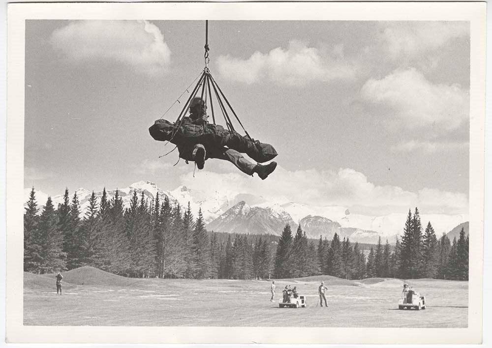
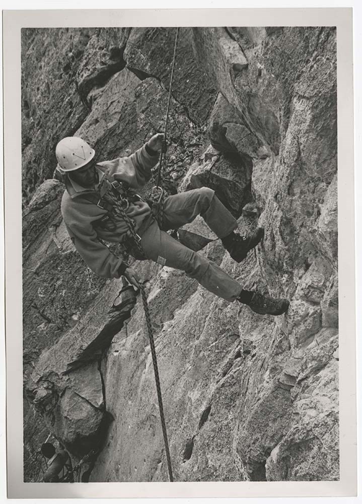
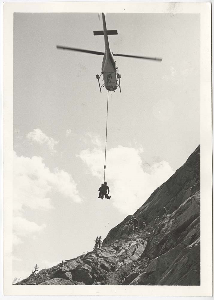
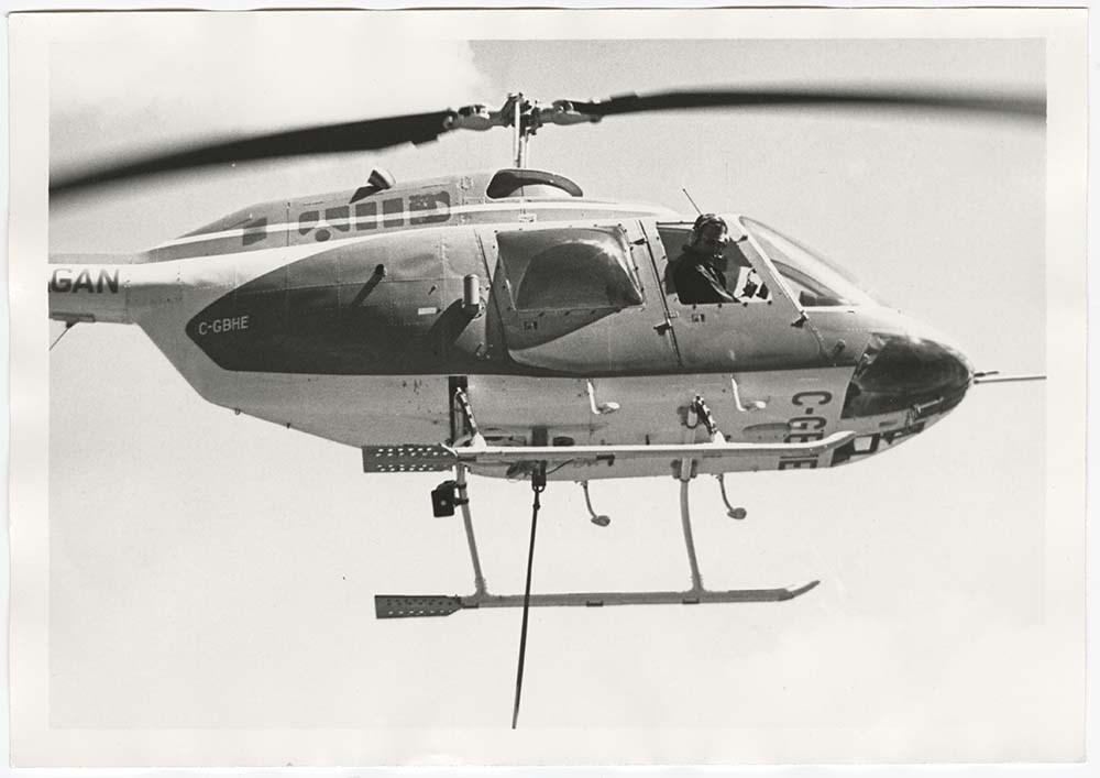
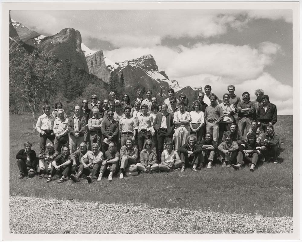
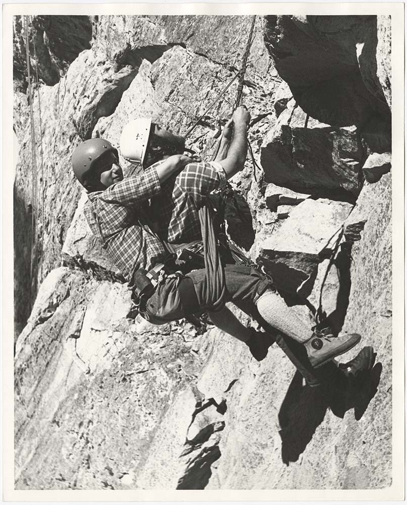
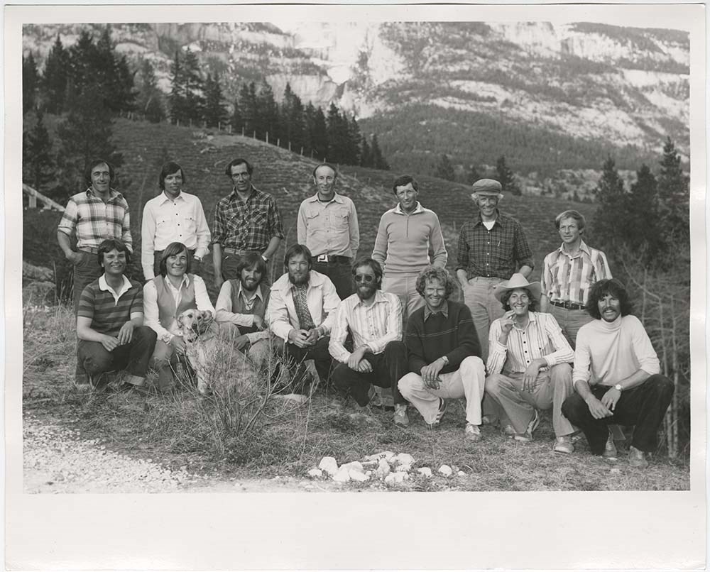
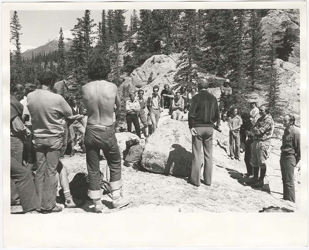
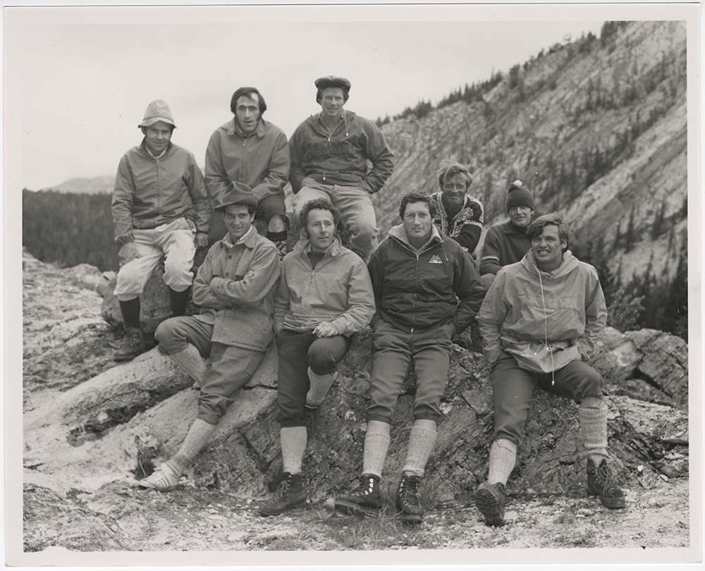
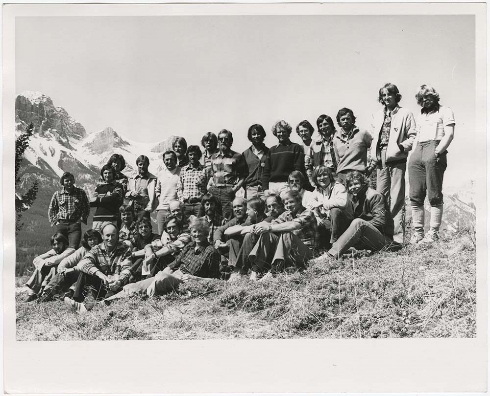
File pertains to 34 b&w prints of the Association of Canadian Mountain Guides training courses and members. Includes shots of potential members participating in training courses [usually on Tunnel Mountain] as well as posed group shots of ACMG members.
34 photographs : col. & b&w ; 25.5 x 20.5 cm or smaller
History / Biographical
See fonds level description
Scope & Content
File pertains to 34 b&w prints of the Association of Canadian Mountain Guides training courses and members. Includes shots of potential members participating in training courses [usually on Tunnel Mountain] as well as posed group shots of ACMG members.
Notes
Identities of people in PA - 27 from left to right [back row]: Rüdi Geitsch, Tim Auger, Peter Schlunegger, Bernie Schiesser, Hans Gmoser, [unidentified], Lloyd "Kiwi" Gallagher ; [front row]: [unidentified], [unidentified], Scott Flavelle, Clair Israelson, Dave Cochrane?, [unidentified], Phil Heim, Dan Griffith.
Identities of people in PA - 29, from left to right [back row]: Frank Stark, Rüdi Geitsch, Lloyd "Kiwi" Gallagher ; [front row]: Leo Gullmair, [unidentified], Hans Gmoser, [unidentified], Pierre Lentire?, Sepp Renner.
Identifications provided by Chic Scott
File pertains to 33 b&w negatives of the Association of Canadian Mountain Guides training courses and members. Includes shots of potential members participating in training courses [usually on Tunnel Mountain] as well as posed group shots of ACMG members.
33 photographs : b&w negatives ; 15.2 x 5.8 cm or smaller
History / Biographical
See fonds level description
Scope & Content
File pertains to 33 b&w negatives of the Association of Canadian Mountain Guides training courses and members. Includes shots of potential members participating in training courses [usually on Tunnel Mountain] as well as posed group shots of ACMG members.
File consists of 144 photographs : col. negatives ; 35 m
m; 12 prints : col. ; 42 x 35 cm or smaller ; 1 cm of visual material. File pertains to various projects Murray Hay was involved with related to Alaska, USA, particularly in the mid-1990s. File includes: aerial photographs of the landscape (A…
File consists of 144 photographs : col. negatives ; 35 m
m; 12 prints : col. ; 42 x 35 cm or smaller ; 1 cm of visual material. File pertains to various projects Murray Hay was involved with related to Alaska, USA, particularly in the mid-1990s. File includes: aerial photographs of the landscape (Anchorage area, Homer, Prince William Sound, Valdez); hand-drawn draft maps of the Prince William Sound region (created for a cruise line); a variety of printed maps with annotations demonstrating comments (including a fax with an attached map from Dana at Adventure Media International); and a variety of printed reproductions of draft maps (Alyeska Ski Resort, City of Anchorage for the 1992 Olympic Bid, and Glacier Bay and the Tongass National Forest).
Notes
Items not in oversize (negatives) stored in downstairs vault.
File consists of 2 cm of textual records, 43 x 28 cm, or smaller. File pertains to Murray Hay's work on various projects in Alaska, USA, specifically the Mount Roberts Tramway in Juneau and Anchorage's Olympic Bid for the 1992 Winter Olympics. File includes a map and/or illustration of the Mount Ro…
File consists of 2 cm of textual records, 43 x 28 cm, or smaller. File pertains to Murray Hay's work on various projects in Alaska, USA, specifically the Mount Roberts Tramway in Juneau and Anchorage's Olympic Bid for the 1992 Winter Olympics. File includes a map and/or illustration of the Mount Roberts Tramway in Juneau, Alaska; handwritten correspondence between Hay and "Ms. Hunter" and the mailing slip (1997); a rough sketch of Hay's illustrations; tourism information related to the Mount Roberts Tramway; and correspondence and a draft example of the map for the Olympic Bid.
Notes
The Mount Roberts Tramway has been in operation since 1996.
M570 / IV / A / 3 : date based on the potential connection between the records and the Olympic bid process for the 1992 Winter Olympics, for which Anchorage (Alyeska) submitted a bid using maps created by Murray Hay. The selection was determined in 1986.
Records were originally filed in two envelopes, labelled: "Mt. Roberts Trmw." and "Prince William Sound - Valdez." File titles reflect this.
File consists of 4 prints : col. ; 22 x 15.5 cm or smaller on sheet 35 x 30 cm. FIle pertains to Murray Hay's work for Alts Golf and Ski Resort in Japan. File includes multiple prints glued/taped to a sheet of paper depicting different areas of the ski area, and is titled "Alts Golf and Ski Resort …
4 prints : col. ; 22 x 15.5 cm or smaller on sheet 35 x 30 cm
Scope & Content
File consists of 4 prints : col. ; 22 x 15.5 cm or smaller on sheet 35 x 30 cm. FIle pertains to Murray Hay's work for Alts Golf and Ski Resort in Japan. File includes multiple prints glued/taped to a sheet of paper depicting different areas of the ski area, and is titled "Alts Golf and Ski Resort in the Bandai Area of Japan."
Prints are taped or otherwise glued to the sheet of paper. Adhesives should be removed and alternative preservation methods used at a reasonable time to do so.
File consists of 1 map (1 base, 4 overlays) : col., annotations, on mylar ; 83 x 61.5 cm, and 1 print : b&w ; 25.5 x 20.5 cm. File pertains to ski maps Murray Hay created for Apex Mountain Ski Resort in Penticton, British Columbia. File includes one oversize map with four overlays (held together wi…
1 map (1 base, 4 overlays) : col., annotations, on mylar ; 83 x 61.5 cm
1 print : b&w ; 25.5 x 20.5 cm
Scope & Content
File consists of 1 map (1 base, 4 overlays) : col., annotations, on mylar ; 83 x 61.5 cm, and 1 print : b&w ; 25.5 x 20.5 cm. File pertains to ski maps Murray Hay created for Apex Mountain Ski Resort in Penticton, British Columbia. File includes one oversize map with four overlays (held together with masking tape), and one print of the general ski area.
Notes
V795 / II / A / iv / 4 : has "16488" and "Hold" written in pencil on the masking tape.
File consists of 1 map : col., annotations, 96.5 x 69 cm. File pertains to an original unfinished hand-drawn map of interior Arizona in red, blue, black, and purple ink. Includes geographic features and labeled cities (including Yuma, Nogales, Bisbee, and Flagstaff).
File consists of 1 map : col., annotations, 96.5 x 69 cm. File pertains to an original unfinished hand-drawn map of interior Arizona in red, blue, black, and purple ink. Includes geographic features and labeled cities (including Yuma, Nogales, Bisbee, and Flagstaff).
File consists of 4 prings : col. 35.1 x 24.8 cm or smaller and 4 maps (2 paper, 2 overlays) : col., on mylar ; 60.4 x 30. cm or smaller. File pertains to aerial views of Banff National Park, showing the towns of Banff and Lake Louise, ski hills (Norqay Ski Hill, Sunshine Village, and Lake Louise Sk…
4 maps (2 paper, 2 overlays) : col., annotations, on mylar ; 60.4 x 30. cm or smaller
Scope & Content
File consists of 4 prings : col. 35.1 x 24.8 cm or smaller and 4 maps (2 paper, 2 overlays) : col., on mylar ; 60.4 x 30. cm or smaller. File pertains to aerial views of Banff National Park, showing the towns of Banff and Lake Louise, ski hills (Norqay Ski Hill, Sunshine Village, and Lake Louise Ski Resort), as well as other georgraphic features. The mylar overlays contain various amounts of detail and annotations - one consists of a dark red sheet overlayed with place names in negative.
File consists of 2 prints : col ; 35 x 28 cm. File pertains to Murray Hay's rendering of the ski area at Big White Ski Resort in Kelowna, British Columbia. File includes two unlabelled, draft print reproductions of original paintings.
File consists of 2 prints : col ; 35 x 28 cm. File pertains to Murray Hay's rendering of the ski area at Big White Ski Resort in Kelowna, British Columbia. File includes two unlabelled, draft print reproductions of original paintings.
File consists of 0.5 cm of textual records, 90 x 60.5 cm. File pertains to ski trail maps of Big White Ski Village and Area created by Murray Hay. File includes one oversized published reproduction of a Big White trail map in poster format.
File consists of 0.5 cm of textual records, 90 x 60.5 cm. File pertains to ski trail maps of Big White Ski Village and Area created by Murray Hay. File includes one oversized published reproduction of a Big White trail map in poster format.
File consists of 1 cm of textual records, 21.5 x 35 cm. File pertains to development of The Fairways (a golf community) in Calgary, Alberta. File includes a reproduced published map of the development and surrounding area created by Murray Hay.
File consists of 1 cm of textual records, 21.5 x 35 cm. File pertains to development of The Fairways (a golf community) in Calgary, Alberta. File includes a reproduced published map of the development and surrounding area created by Murray Hay.
Notes
Date approximate based on the development of The Fairways, 1985-1991 (https://anthemunited.com/properties/the-fairways/).
File consists of 1 cm of textual records, 10 x 22 cm. File pertains to tourist maps of the Canadian Rocky Mountains created by Murray Hay. File includes a brochure of titled "Canadian Rockies Access Maps" that, when unfolded, includes several maps of the various areas that make up the Canadian Rock…
File consists of 1 cm of textual records, 10 x 22 cm. File pertains to tourist maps of the Canadian Rocky Mountains created by Murray Hay. File includes a brochure of titled "Canadian Rockies Access Maps" that, when unfolded, includes several maps of the various areas that make up the Canadian Rocky Mountains, like Kananaskis Country, Canmore, Banff National Park, Jasper National Park, Yoho National Park, etc.
53 discs with image files -- 6 cm of scanned photograph copies -- 62 reference slides : col. ; 35mm -- 27 reference photographs : col. prints
History / Biographical
Hans Gmoser played a major role in creating Canada’s vibrant mountain community. Although known internationally as the father of heli-skiing, he was much more than that: a talented rock climber, tireless expedition leader, a mountain guide, film maker and organizer.
Deep Powder and Steep Rock presents an intimate portrait of this charismatic man. Much of the story is told in Gmoser’s own words, gleaned from his diaries, expedition journals, film commentaries and personal correspondence. It is a unique tale of adventure, hard work, perseverance and ultimate success.
Scope & Content
Photograph series consists of discs with reference scans of photographs pertaining to the research and creation of Deep Powder and Steep Rock.
File consists of 2 maps (1 base, 4 overlays) : col., annotations, on mylar ; 32 x 27 cm and 30 x 22 cm, and 2 prints : col. ; 35 x 28 cm. File pertains to Murray Hay's rendering of the ski hill at Fernie, British Columbia. File includes two reproduced drafts with mylar overlays (one held together b…
2 maps (1 base, 4 overlays) : col., annotations, on mylar ; 32 x 27 cm and 30 x 22 cm
2 prints : col. ; 35 x 28 cm
Scope & Content
File consists of 2 maps (1 base, 4 overlays) : col., annotations, on mylar ; 32 x 27 cm and 30 x 22 cm, and 2 prints : col. ; 35 x 28 cm. File pertains to Murray Hay's rendering of the ski hill at Fernie, British Columbia. File includes two reproduced drafts with mylar overlays (one held together by tape or glue, the other by masking tape), and two reproduced draft prints of the ski area.
Notes
Date range is approximate. The Timberland sub-division was developed between 1981-1991. The resort was known as Fernie Snow Valley until 1997.
File consists of 1 cm of textual records, 21 x 29.5 cm. File pertains to the Alts Ski Area in Japan for which Murray Hay created a trail map. File includes one tourist booklet that includes Hay's trail map.
File consists of 1 cm of textual records, 21 x 29.5 cm. File pertains to the Alts Ski Area in Japan for which Murray Hay created a trail map. File includes one tourist booklet that includes Hay's trail map.
File consists of 2 original paintings : landscape (2 base, 2 overlays) ; 100 x 71.2 cm or smaller (one unfinished) - the complete painting has tracing paper overlay with annotations written in pencil (second overlay also tracing paper with annotations in ink, stored seperately). Also includes 1 map…
2 paintings : landscape (2 base, 2 overlays) ; 100 x 71.2 cm or smaller
1 map (1 base, 1 overlay) : col., annotations, on mylar ; 101 x 70.1 cm
2 prints : col., annotations ; 35.5 x 27.8 cm
Scope & Content
File consists of 2 original paintings : landscape (2 base, 2 overlays) ; 100 x 71.2 cm or smaller (one unfinished) - the complete painting has tracing paper overlay with annotations written in pencil (second overlay also tracing paper with annotations in ink, stored seperately). Also includes 1 map (1 base, 1 overlay) : col., annotations, on mylar ; 101 x 70.1 cm of the Kananaskis/Canmore area and 2 prints : col., annotations ; 35.5 x 27.8 cm of the same area.
Notes
Prints have two different titles associated with them: "Portion of Kananaskis, Bow Valley, Spray Lake Area (cloudy portion is for story area)" and "Kanasakis Park, Mount Allen (Nakiska) Ski Area, Fortress Mtn Ski Area & Banff East Entrance (cloudy area for story line)." Prints are connected to the map.
File consists of 8 colour prints, 28 x 35 cm or smaller. File pertains to Murray Hay's work for the City of Kimberley, British Columbia. File includes prints of original paintings done by Hay relating to a proposed real estate development in the city and the Kimberley ski hill.
File consists of 8 colour prints, 28 x 35 cm or smaller. File pertains to Murray Hay's work for the City of Kimberley, British Columbia. File includes prints of original paintings done by Hay relating to a proposed real estate development in the city and the Kimberley ski hill.
Notes
The ski hill at Kimberley was developed in 1979.
Most of the prints are annotated in ink by Hay (his own notes and comments by clients).
There is masking tape holding some of the prints together on a piece of paper, which should be removed and alternative preservation methods should be considered at a reasonable time to do so.
File consists of 1.5 cm of textual records, 53 x 80.5 cm and 10 x 23.5 cm. File pertains to ski trail maps of Lake Louise ski area created by Murray Hay. File includes two published reproductions of three original trail maps in a fold-out brochure (1992/1993) and in poster format. The three maps de…
1.5 cm of textual records (53 x 80.5 cm and 10 x 23.5 cm)
Scope & Content
File consists of 1.5 cm of textual records, 53 x 80.5 cm and 10 x 23.5 cm. File pertains to ski trail maps of Lake Louise ski area created by Murray Hay. File includes two published reproductions of three original trail maps in a fold-out brochure (1992/1993) and in poster format. The three maps depict South Face, Back Bowls, and Larch Area.